
North Hitchcock Mountain
The White Mountains received a jumble of weather, wind with mixed precipitation Sunday morning; close to home, rain fell most of the morning with a minor slushy mess on any exposed lawn, while higher elevations received snow - big flakes from what I saw during a morning run.
I had heard rumors of the soft snowpack having been refrozen, since becoming weight-bearing in many locations. Unsure of what to believe, I figured I’d gamble with a continuation of a climb from last week, the 5-Hitchcock peaks located just east of Lincoln, NH.

Start of the East Side Trail
Knowing that the lower areas of this mini-range had been logged and was now growing back as a very open, primarily hardwood forest; mostly beech, birch and spruce dotted the mountainside along the west-facing slope of my ascent today.
For those who missed the loop of Hitchcock’s (find it right here), there are five main peaks; four of which emanate from Mount Hitchcock (3,620’): North, West, South and East Peaks. Last week I paid a lovely visit with some mixed bushwhacking (easy going hardwood down low with patches of beautifully open conifer areas and no doubt a few excruciatingly thick, stabby spruce entanglements up higher) to South, West and the main - Mount Hitchcock, or Middle Hitchcock peaks.

Early morning brook crossing on the East Side Trail
Hoping to use this adventure as a recon mission to check how the snowpack was fairing following the weekend weather, I was prepared for anything but hopeful for a supportive and quick-traveling, crusty snow layer.
This time I parked at the Lincoln Woods Trailhead and tossed my National Parks Pass in the Subaru’s front window, this card covers any WMNF parking fees. Despite the balmy 26° air temperature, I loaded the 28-liter pack with all the standard cold-weather gear and dressed to be prepared to shed falling snow from overhead conifer boughs.

Off-trail and heading east
At 7:09AM I began trekking down the Pemi East Side Trail, an old truck road which was once used to haul timber out of the surrounding hillsides. Today, the old road was packed solid (but not icy) by skiers and had a few bare boot prints, but thankfully, no post holes in the snowy surface, making for a very enjoyable trek into the wilderness as the East Branch Pemigewasset River babbled slightly to my west - it seemed to be flowing well with the recent freeze/thaw cycles but none too threatening from my vantage point.
The East Side Trail crosses several tributaries along its early miles by way of bridges, wide enough for National Forest vehicles, should the need arise. Reaching 1.0-mile, the pathway tracks alongside another tributary to the East Branch, which was a shallow, ~8’ width by the time I needed to cross.

Weaving around young conifer bands
Reaching ~1.6-miles down the East Side Trail I stepped into snowshoes and departed packed trail, heading due east for my objective I crossed the tributary which I had been following and began a gradual ascent through open beech woods.
The sight of a slide-streaked Whaleback Mountain (3,586’) began to show through the trees off to my west and occasionally hints of Franconia Ridge flickered into view - shining as bright as the full moon with the snowy ridgeside reflecting the morning sunrays, such a beautiful sight and knowing the views were only getting better kept me pushing upward.
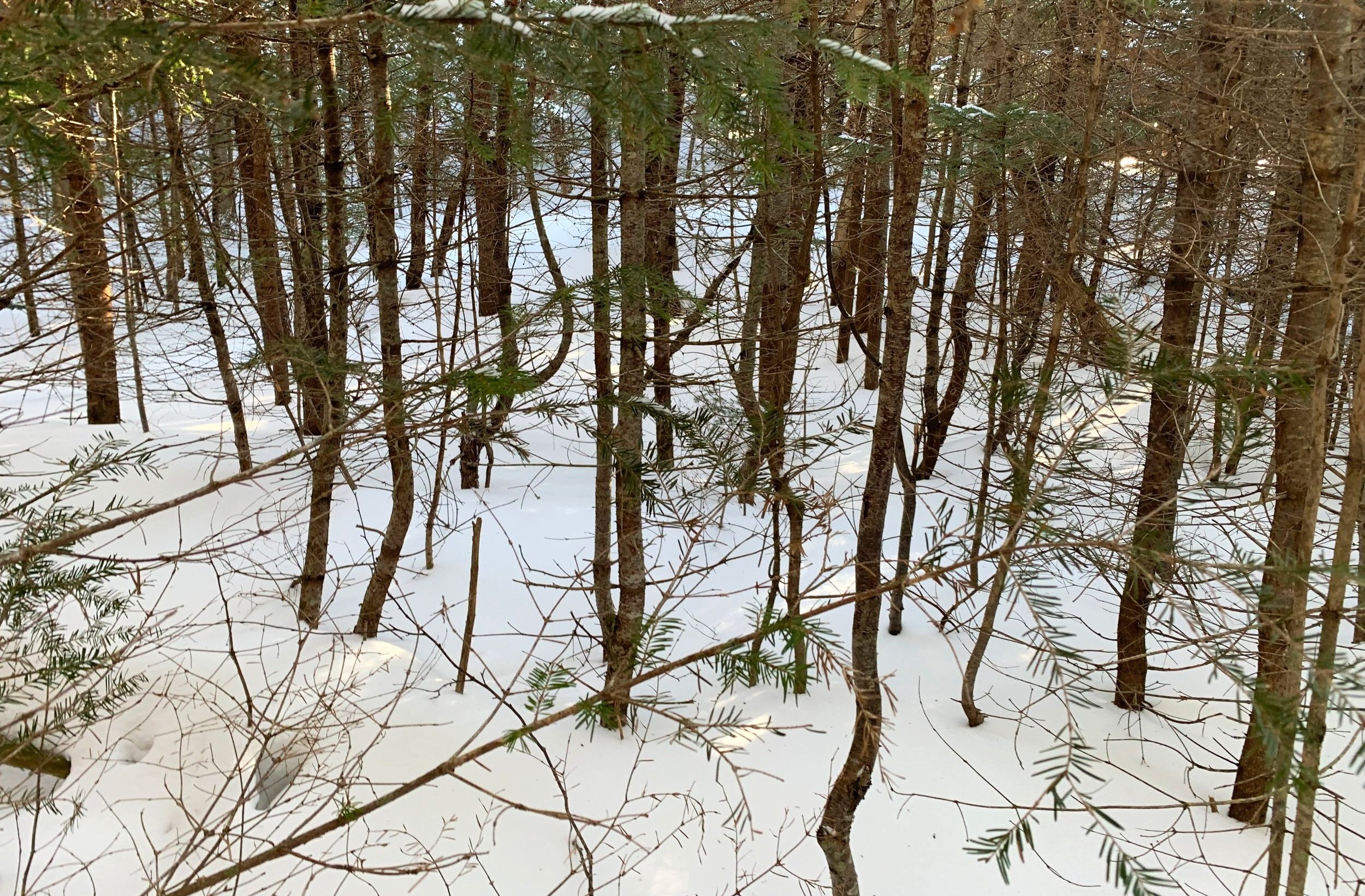
Entering the thickness
So far, off-trail, the snow was fantastic; remaining frozen from the low overnight temperatures - the Tubbs snowshoe crampon points barely made a dent in the crust layer - floatation and grip were spot on this morning allowing for a fast-paced cruise along the hillside.
With the sight of a bump in the distance I aimed directly at it; reaching the conifer-covered knob at ~2.4-miles and upon taking one good look at the evergreen and boulder-lined amphitheater ahead, I skirted the elevation contour edge while remaining in mostly hardwood.

3,620’ Mount Hitchcock (Middle peak)
At one point I assumed this was the initial band of spruce and fir that simply needed to be breached - so I pushed into the tight canopy. Sunlight lit the mountainside shortly beyond my shaded evergreen patch. Upon reaching the bright forest ahead, it was brought to my attention I had pushed through that mess for no reason, completely unnecessary if I had only followed the hardwood further south - now I know for next time!
Once back out in a more favorable beech-filled canopy, navigation was simplified as the shoulder of North Hitchcock rose tall just ahead. Passing 2,500’, spruce and fir became the more prominent species and not far beyond I could see my nemesis waiting patiently for my arrival: the northeastern spruce trap.

Franconia Ridge from the helipad area
Luckily I was able to steer around a majority of the bright green, young fir growth; several short sections were pushed through, and in those instances did find the deep voids hidden alongside short, young spruce and fir, such is inevitable, I suppose - how would a hiker know they enjoy a nice, mature spruce grove if they never get to experience all the other variabilities with bushwhacking?
I ended up summiting by hooking from the southwest; I’ve heard of a northerly approach being easier to traverse but cannot speak on this as I have never been there (yet). What began with a nice, open conifer stand surrounded by short, snow-covered balsam boughs, quickly morphed into dense, spindly spruce twigs, to which I essentially “swam” through, as to do no harm to my wooded forest friends.
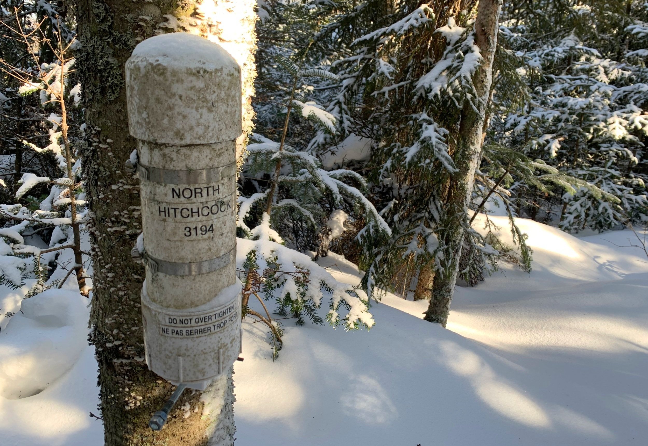
North Hitchcock summit
Skirting counter-clockwise around several rocky bands nearing the summit, several of which offered a restricted but stunning view to the neighboring, 3,600’ Mount Hitchcock with Scar Ridge just beyond.
A push through one final scrappy section of forest brought me to the solar panel-topped radio repeater tower, which I had completely forgotten I had read about, with all the exciting forested goodness right before me; reports also described a wooden helicopter landing pad, used if the tower required maintenance - this wooden platform must have been under mounds of snow, for there was not a flat surface in sight up there.
Returning to the woods for a short, pleasant jaunt, brought me to the high point - actually, I walked right past the tree on which the canister was hung and upon circling back, found it and signed its guestbook, logging my ascent of North Hitchcock and its 3,194’ summit dome.

The summit ridge finally opens up a bit
Retracing my steps was rather easy going; with a brief tea break once back in the sunshine at what would be the helipad site, I gazed at the beautifully brilliant eastern slopes of the white-capped Franconia Ridge and Garfield Mountains while the low slung hump of Owls Head occupied the foreground of my scenic rest-stop panorama.
Fortunately, the powder layer still hid anything to snag snowshoes on as I glissaded down-slope through parts of the open spruce forest, possibly the closest I will ever come to making jump-turns on New England powder in the backcountry.

West Osceola + Scar Ridge
Once back down to ~2,400’ I recalled the conifer knob just ahead to the west and the open hardwood forest which surrounded; in an attempt to see if I could cut the right-angle of which my ascending route had made, I veered southwesterly. While managing to remove ~0.5-mile of East Side Trail walk out, I descended through rather nice, easy going forest until being walled-up against a massive drainage cut.
To avoid further unnecessary climbing, I simply followed this northern edge back to cross the first brook of the bushwhack, guiding me back to the packed East Side Trail.

Back through the young conifer + spruce traps
As the time neared 10:30AM on the final mile, I met a nice fellow coming off the Pine Island Trail, with whom I remarked the beauty of the blue-sky morning, both of us agreeing how lucky we were to find ourselves out in the forest as the springtime air brought scents of soil and life; birds were coming back and sharing their song as well, it was a marvelous hike through Lincoln Woods.
The view which I had overlooked on the hike in, as it was to my back, I could now see and fully appreciate - the massive slides on Scar Ridge stood out magnificently against its wooded slopes and a deep-blue sky.

Trekking out with a quality view to Scar Ridge
Despite a short day of backcountry trekking, North Hitchcock contained everything I desired: an all-around beautiful forest in which to roam, desolate but always within sight of such other famous hiking destinations; while the Hitchcock’s offer a twisted game of navigation - constantly trying to pick the route with least spruce branch entanglement, each mountain, so far, has offered something unique - North Hitchcock featured a premium tea-break location in the sunshine.
I wonder if all the Hitchcock’s are as enjoyable - if so, I cannot wait to see what East Hitchcock has in store for me.
Overall stats for the day:
7.08mi
3hr 46 minutes
2,339’ elevation gain
Mount Hitchcock, North Peak - 3,194’