
South, Middle & West Hitchcock Mountains
Supposedly, it must be true that there would be no way to know a “good bushwhack” if we had never experienced what we perceived to be a “bad bushwhack”. Of course, this is entirely open to personal interpretation and how many sharp, pointy spruce branches one can endure in a given timeframe.
This adventure into many depths of forested adventure takes place on the southern cusp of the Pemigewasset Wilderness; several miles east of Lincoln, NH, along the northern side of the Kancamagus Highway, west of the Hancock Mountains.

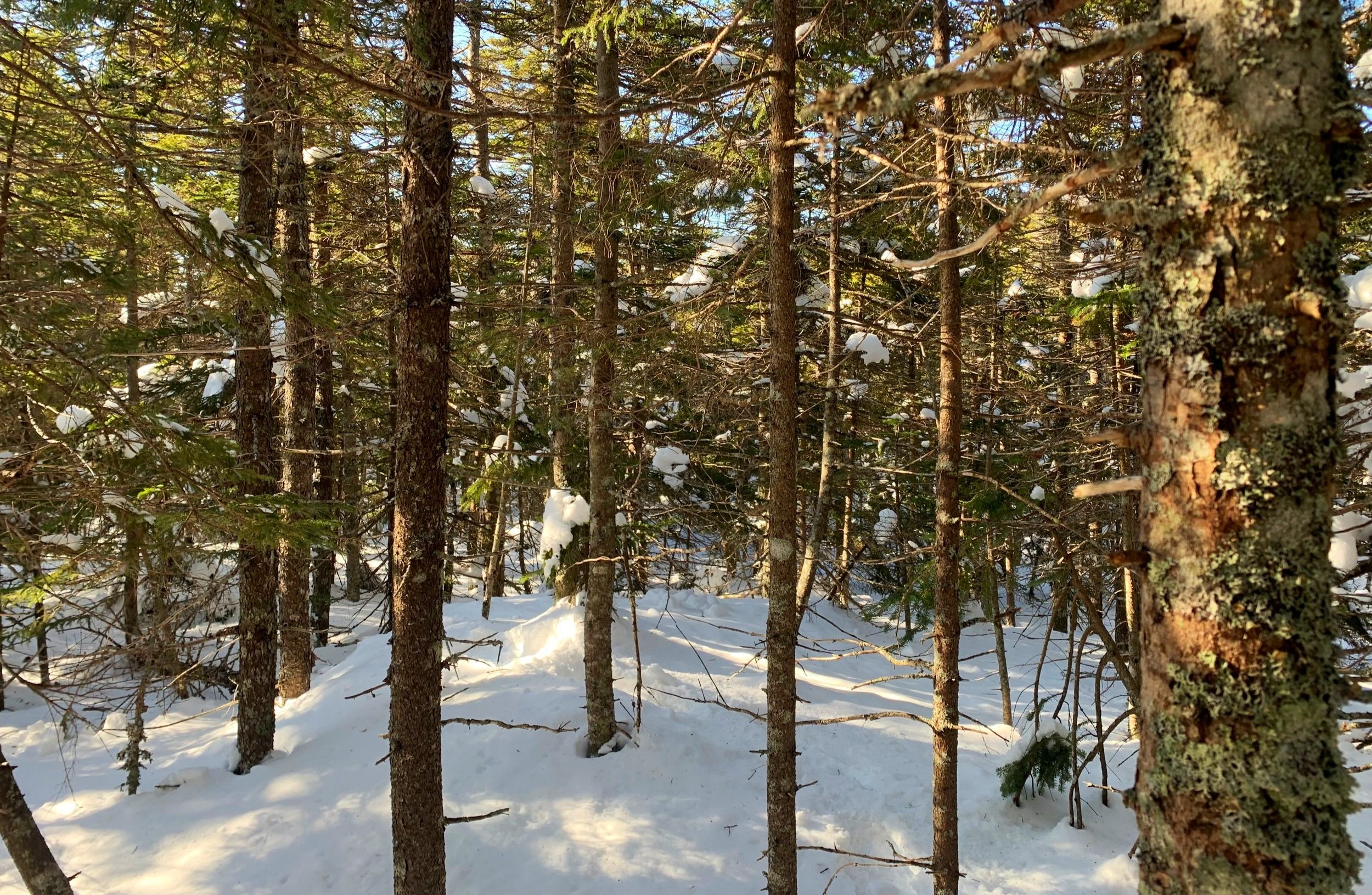
Hemlock grove along the low ridge
While there are a number of approaches to reach the 5-peaked landmass of Mount Hitchcock, I began by parking at the Discovery Trail Visitor Center which is plowed in winter and complete with vault toilets and an information kiosk (I used neither on this trip).
The main high point of Mount Hitchcock reaches 3,620’ (elevation varies depending on source), while the lesser sub-peaks range from 3,064’ at the West peak up to 3,500’ of its South peak.
The height of North and East peaks land within this range and were not on my radar for today’s trek; I had plotted a course of ascending the South Peak and following that ridge up to the main peak, descending westerly toward the West Hitchcock nub before finally dropping back south/southeast, crossing the Hancock Branch tributaries and bushwhacking through hopefully easy lower hardwood back to my car.

Ascending the southern ridge of Mt Hitchcock South Peak
Beginning at 7:29am, I stepped out of the car to the crisp 16° mountain air and into snowshoes, which would remain on my feet for the remainder of the hike. The snow was perhaps the best I had bushwhacked in all winter, I could not believe the Tubbs Flex spikes barely left a mark in the crusty top snow layer. I had grown accustomed to breaking trail in 16+ inches during the previous few bushwhacks but today was just what I had been waiting for - full floatation on a recent freeze/thaw crust.
Originally, I had planned on ascending by way of an old logging road which still appears on some maps. I cut straight from the Discovery Trail to FR 397 and began following old, frozen snowshoe tracks for a brief period but those ended abruptly. With surface conditions as favorable as I was finding, I cut nearly straight up-slope to gain the first ridge landing at ~2,730’.

Easy going through open hardwood atop the initial ridge
The beech forest of down low was easy to weave through and soon spruce, balsam fir and birch trees made their way into the landscape. I even passed through a small grove of hemlock, their bark always seemingly aglow in the low-angle, early morning sunlight.
Occasionally, there were small patches of half-buried blowdown scattered on the southern ridge-face, much of this was easy to avoid, veering into surrounding open forest before regaining the upward direction.
Once the initial climb topped out I found myself walking through a forest of which I secretly hoped would continue all day - a terrifically open and easily navigable hardwood forest along the low grade ascent, reminiscent of a tucked away, hidden meadow.

When bushwhacking gets steep
Reaching ~3,000, the forest tightened right in, spruce twigs were barely several inches apart and with no open path to either side I made my way through as carefully as one could. A steep band which I thought could likely house a bear den was ascended by kicking steps into the deep-snow hillside, here I received momentary reprieve from the oppressively thick, prickly spruce.
Upon reaching the top of this climb I looked ahead with disbelief at the sight. somehow an even tighter-knit scrappy conifer forest await my arrival. Deciding that there was no way this brutal entanglement could go on forever, I pushed through, weaving and meandering my way while trying to leave the fragile branches intact.
When bushwhacking gets dense
While hiking the southern trio of Hitchcock’s today, I developed a kind of rhythm for gliding as gracefully as one could through pencil-thin spruce branches; I dubbed it: The-Turnstile-Method. This replicates a sort of swimming through forest, shoving branches behind ones body while advancing through the next weave of spruce boughs. Once perfected it is quite effective for forward progress!
Between me and the final ridge climb stood a low hump which topped out ~3,217’. This broad mound consisted of a more mature spruce blend with thicker branches which proved to be somewhat easier to navigate - it was a scene straight out of a winter greeting card, simply stunning to find in the backcountry.
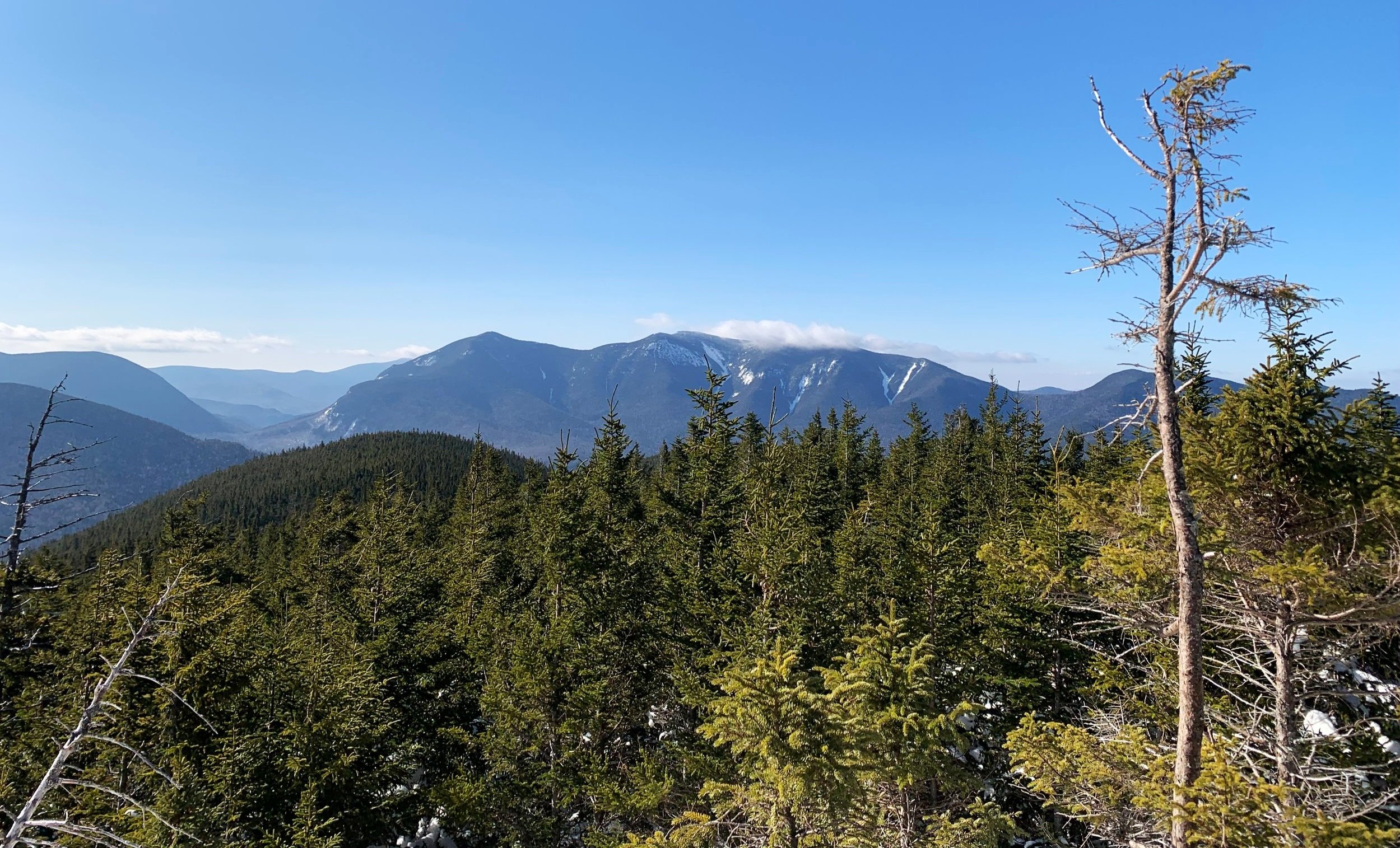
Osceola Mountains
While slowly traversing the longer ridge at about 3,350’ I began to see sunshine glistening off the snow; in past days this would have meant spruce-trap-city but today, as the crust remained relatively stable and solid I trekked into the clearing for a gorgeous (and very unique) panorama of the nearby Hancock’s, Osceola’s and many others.
The blue skies were helping create a marvelous day in the mountains but the sound of wind in the higher trees reminded me to be thankful for these lower elevation mountainous, wooded places.

Old glass jar summit register south of true summit
While making the final climb up to the high point of Mount Hitchcock’s South Peak my attention was captured by a shiny glass jar hanging just above the snowpack. Knowing this wasn’t the true high spot nor the PVC canister that I was looking for - I was intrigued!
Inside, dated August 28, 1980, it appeared that the jar had been placed by Dr Claud Sharps, acknowledging that he knew this was not located at the high point of the mountain but wanted a canister out in the open. Interestingly a response was written 9-years later. After thumbing through several pages of the secondary canister I sealed it back up and continued in a northwesterly direction, arcing counterclockwise to gain the final elevation of the high point.

South Hitchcock summit
This PVC canister proved to be the most elusive of today’s three summits, I went briefly in a circle before finding the smaller canister hanging along the backside (as I interpreted from my approach to be the back) of a spruce tree.
Very happy to have located the summit register, I read a few recent entries and logged my own ascent before hurrying off toward today’s highest - Mount Hitchcock itself, or Middle Hitchcock as the canister names it.

Between South - Middle Hitchcock Mtns
This next stretch of forest was absolutely blissful to trek through, just what I mentally needed after the previous half-mile of soul-crushing bushwhacking. Open to the extent that the sun could shine down through the canopy but not so much as to warm the snow crust, just the right combination to stay comfortable in base layers, saving dry mid-layers incase the winds picked up on the other side of the mountains.
While I could have hung out in the quiet utopia, I had time to make up from the slow slog of earlier. Bobbing, weaving and dodging tree trunks of the boreal forest - all the while I awaited another onslaught of thick bushwhack, but reaching the low point I kept on moving through rather enjoyable forest, at times could even see a narrow corridor through the canopy created by previous ‘whackers.

Middle Hitchcock summit
With one glance around what appeared to be the high point, I found through the balsam boughs, the handmade summit sign with summit register hanging just below - a perfect place at 3,620’ to break for tea and once again log my ascent in its notebook.
If I knew the forest would remain as open as I just traversed through, I thought of going out-and-back to North Hitchcock, but with the west peak still lingering on my minds to-do list, I was okay with a less-than-long day out.

Descending into a wall of conifer needles
Not long after dropping off the summit through more open forest toward the west side I ran right into a wall of thick balsam evergreens. With eye protection on and arms ready to push, shove and block, the descent was really not entirely as treacherous as the darkened canopy eluded to from a distance. Then, the western slope got steep - real steep, so much so that if we still had the heavy, deep powder from several days prior I’d be having serious reservations about avalanching. Thankfully with the freeze/thaw crust, the hillside was totally stable and locked in place around the network of tree trunks.
Occasionally, through breaks in the canopy I could sneak glimpses of West peak’s the low mound, the next objective. While trying to nail the col perfectly as to not drop off either side too far, I only had to backtrack slightly once before passing through; a single step forward delineated the thick conifer cover and suddenly entered into a lovely meadow-style forestscape.

Ascending West Hitchcock
It was a low-angle, gradual ascent while picking a path of least resistance through the understory, West Hitchcock was really pleasant and easy to navigate. Within minutes of ascending out of the col the summit canister was located, last of the day to write in. With such a beautiful day unfolding all around, I had to take several moments to listen to the springtime chickadee calls; snow rhythmically dripped from the surrounding trees as the morning continued warming the mountainside.

West Hitchcock summit
When it was time to depart the final summit, I decided to trek along the southern ridge before losing elevation, hoping to skirt around some of the dense conifer and find a more pleasant, open hardwood carpet.
Eventually, I did enter a forest of yellow birch which appeared to radiate - glowing even without its canopy of fiery autumnal leaves. In hindsight, I followed the stream too far, I think if I cut back east to cross the waterway sooner I may not have had to ascend quite as steeply, through unconsolidated deep powder to gain and cross over a minor ridge shoulder.

Entering a sea of yellow birch
Once that slight inconvenience was out of the way I entered a sea of mixed-age beech, the location of which an old logging road was said to have ran; further down the old road became visible but from ~1,800’ and above it was so overgrown, it was nearly unrecognizable from the encroaching young beech growth.
Knowing that both the lower logging road and Discovery Trails could be used to exit the forest, I opted to continue bushwhacking straight through; the Discovery Trail was a mess of ice and post holes, much easier just picking my way through spindly beech cover with a bearing locked on the trailhead.
While stashing gear in the backseat I recalled the good and the bad of today’s hike, recognizing that a dense forest doesn’t make the heart race as it would have years ago - its just a place we find ourselves, a place to navigate and meander through; while romping through an open boreal-type forest like that of today atop Middle Hitchcock can make life feel so simple, extraneous cares and worries simply fade momentarily and we are living a more simple life - in the moment, as if we are able view the world through those of a child once again - it is truly a beautiful world to live in sometimes.
Overall stats of the day:
6.96-mi
4hr 59 minutes
3,186’ elevation gain
Mt Hitchcock South Peak - 3,500’
Mt Hitchcock (Middle) - 3,620’
Mt Hitchcock West Peak - 3,064’