
Mahoosuc Arm
Traversing narrow, soft, and loamy trails at water’s edge, through brilliantly viridescent hardwood and lichen blanketed conifers; meandering pathways snake their way up a rugged hillside in an area of the White Mountains immortalized for its boulder-jumbled notches; the Mahoosuc Range seems to contain a glimpse of all which is beautiful about the northeastern mountains.
Ever since climbing along the rugged mountainside of Mount Carlo and Goose Eye Mountain, the thought of traipsing the trails beckoned me back. With snow long gone from the west-facing hillside, there was a good probability springtime snow remained, deeply buried under the jumbled mass of boulders which comprise the Mahoosuc Notch toward the south, thus making for a good reason to adventure along the Speck Pond Trail up to the 3,765’ Mahoosuc Arm.
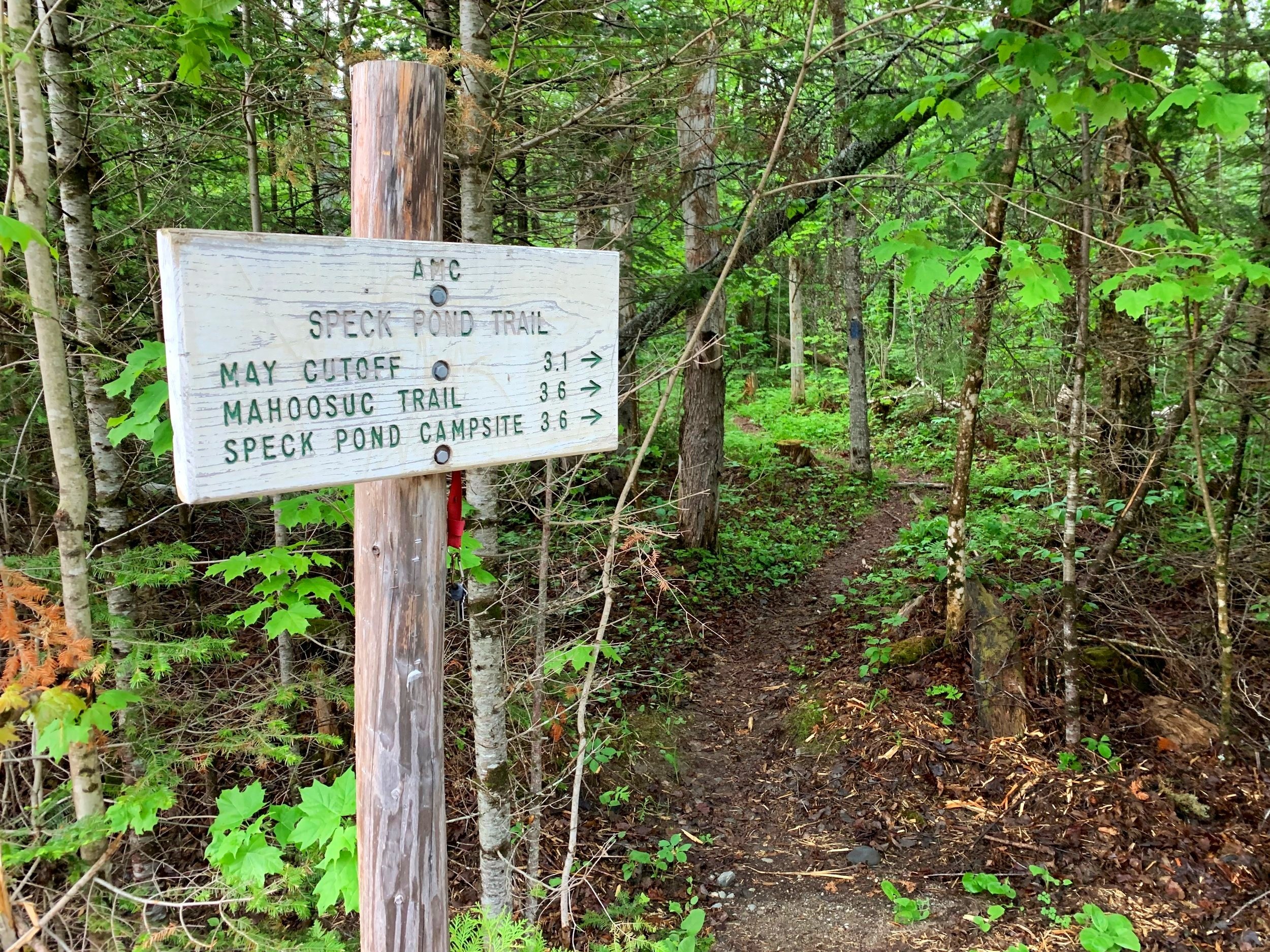
Beginning along Speck Pond Trail
The trailhead for Mahoosuc Arm can be found along what was once proclaimed to be “perhaps the most difficult road in the White Mnts. for a person unfamiliar with the area to find”, by the 25th edition AMC White Mountain Guide book. The entrance to Success Pond Road did prove incredibly elusive the first time I tried to locate it at 3am while enroute to another hike, my best suggestion is to not trust Google Maps entirely as it may lead into gated logging mills and various other roads of questionable drivability.
Located on Hutchins Road, the entrance to Success Pond Road is labeled with faded trail signs and for OHRV Parking; the old logging railroad bed is consistently a mellow grade but begins atop a rough roadway, best suited for trucks with high clearance, although my Subaru sedan has successfully navigated the road in all seasons at this point. Large potholes and decent sized rocks emerge from the dirt roadway, various other logging and access roads diverge along the route.
Along Sucker Brook
Not far into the agonizingly slow commute along the old road, a sense of incredible remoteness takes over; today, we even saw a moose romping down the road before diving into a murky northbound hillside. At 11.4-miles from Hutchins Road, veer right at a junction to proceed briefly along North Pond Road - there is a painted boulder with an arrow signaling the diversion for Speck Pond Trail and Route 26.
The dirt and gravel roadbed soon became impassable, having been washed out due to culvert damage 0.4-miles from the junction. At which point I parked along the east side of North Pond Road, tucked far off the main road in an old logging landing which appeared to be no longer used. With high clearance or OHRV the road may be navigable further, not for a sedan, however. Upon returning, other vehicles began lining the western side of the North Pond Road.

Along lower Speck Pond Trail
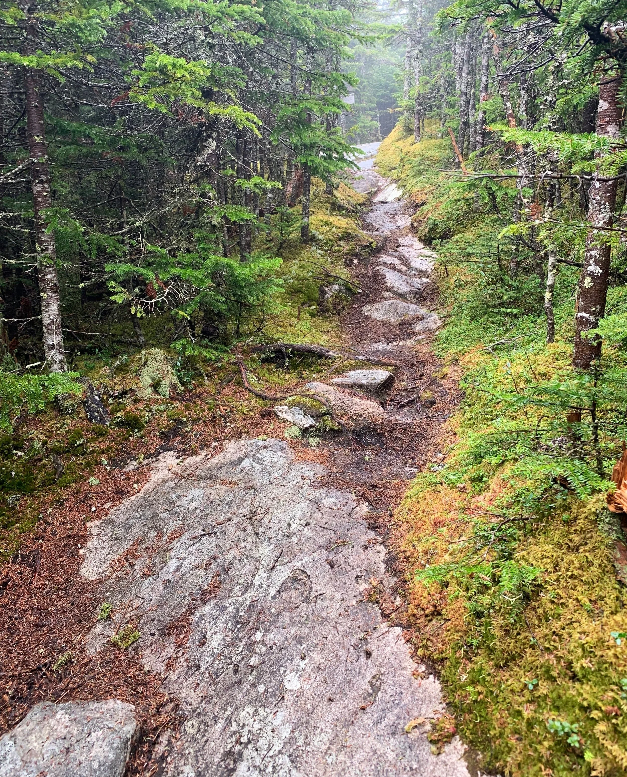
An easy road walk of 0.3-miles would guide the remaining distance in which to reach the signed entrance to the Speck Pond Trail. Immediately, the trail becomes one of the most picturesque: a narrow, rich, and loamy footway lined with a verdant understory - ferns, grasses and a plethora of hobblebush burst through a forest floor blanket of fallen orange and tan hardwood leaves. The late-spring canopy was aglow with lighter hardwood leaves contrasting darker evergreen needles, whose trunks were blackened as they retained the moisture of recent rainstorms.
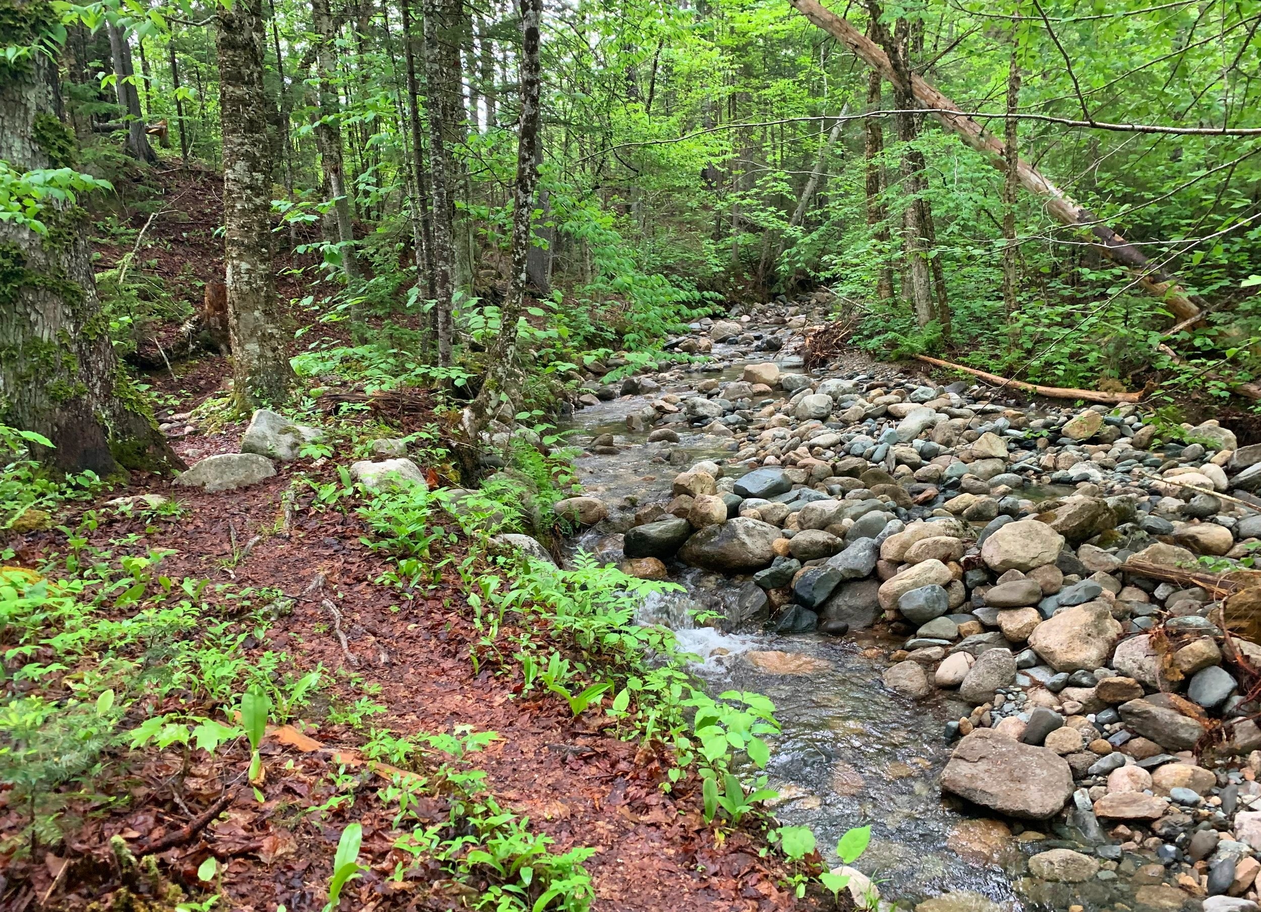
Soon along the forested trek, Sucker Brook is encountered and crossed at a highly washed-out section, this morning water levels remained low and crossing was made easy atop boulders. However, this could prove treacherous in times of higher water or spring thaw - the AMC White Mountain Guide actually recommends bushwhacking to the north, around the two crossings of Sucker Brook in such times of high water.
Speck Pond Trail; ~2,600’
Following along the northern edge of the brook, evidence of high water is all around; a narrow trail sidehills along the bouldery brook bed as water-levels had clearly risen nearly to trail-height not long ago. At several instances, as the grade remains low, several faint herd paths can be found diverging northward, perhaps to meet the old logging road which is shown on most maps just to the north.
Several areas had received recent trail maintenance as intrusive hobblebush which had begun encroaching into the pathway had been lopped off, now laying trailside. A large fir tree had toppled, remaining atop the trail long enough for a side path to have been formed around the blowdown.
Traipsing through boreal forest
A very soft footway comprises much of the trail early on as stone staircases can be found in several instances, aiding in preventing erosion and helping hikers ascend steeper pitches. Near the tree-mounted sign denoting the Grafton Forest Wilderness Preserve/Northeast Wilderness Trust, evidence of an old camp can be found alongside the babbling brook, here an old herd path also leads northbound into the thick forest, appearing to have not been used in ages.
As the grade increases, Sucker Brook now falls in a series of cascades, the lowest of which shooting out from between several boulders with great velocity into a wide basin which appears to be wildly inviting on a summer hike - luckily today, neither biting bugs nor heat were an issue to contend with, making for a much more pleasant springtime stroll through Maine trails than expected.

A small ladder section aids in ascending
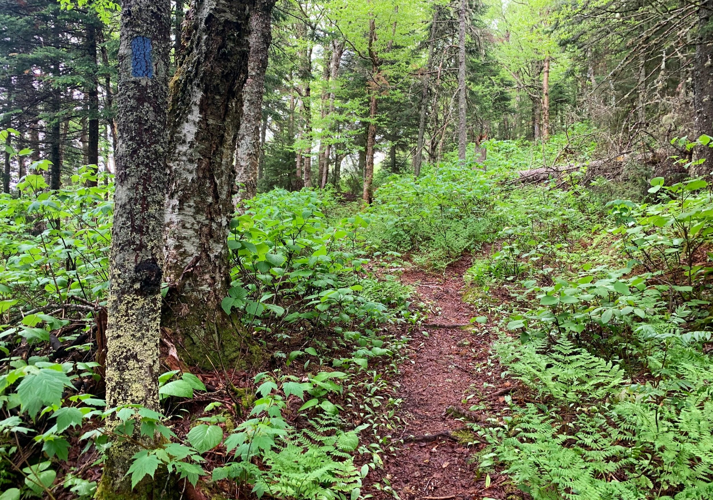
At 1.3-miles from the trailhead, the Speck Pond Trail makes a sharp northward swing away from the brook, the forest quickly becomes deafeningly silent with each step away from the fast-flowing waterfalls. Swinging around the western contour of the mountain, the 1926-cut Speck Pond Trail has no doubt seen its share of reroutes and diverges around mountainside logging; the trail is now near level with gentle dips and rises as it passes through sections of newer growth, evidence of relatively recent logging in the area. Several old skid roads remain faintly visible as mature tree trunks edge the grown-in logging path.

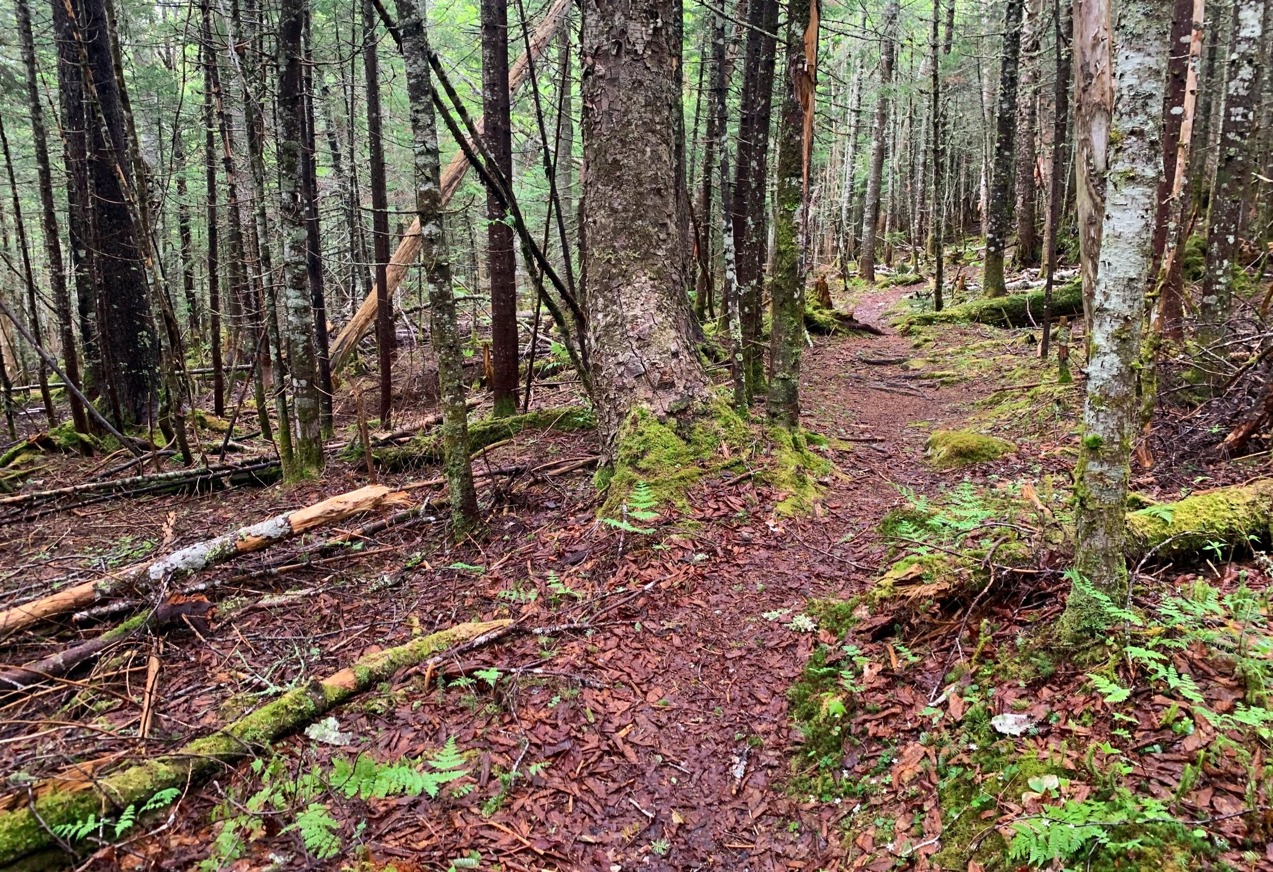
Speck Pond Trail becomes rugged
Swinging now easterly and surpassing 2,500’, mature spruce and fir now become the dominant species as massive white birch also dot the hillside; the path gradually becomes increasingly eroded and rocky underfoot as a fine northeastern boreal forest is encountered, the dense hobblebush-choked understory quickly fades to a vast sea of umber with occasional green of an unfurling fern. Old fallen branches and logs trailside slowly become overtaken by a blanket of shaggy mosses; here, the trail becomes soft once again as it treks atop a thick blanket of decaying birch leaves and conifer needles. Occasional roots and rocks show through the cushioned footpath creating a stunningly welcoming White Mountain pathway.
Speck Pond Trail; ~3,650’
As elevation is gained and the pitch steepens, the path grows wetter and more eroded, in places appearing as a dry stream bed, in others a ledgy sidewalk guides hikers up-slope. Swinging hither and thither, the path meanders, gaining elevation rapidly with the aid of several shorter ladder sections and one longer ladder, these all appear to be a relatively recent addition to the mountainside - a very welcome bit of trail maintenance!
While hiking in a low-hanging cloud today, the mossy slabs were slick but nothing too concerning, traversing simply required thoughtful foot placement and greater care in ascending, even more so while descending. As the grade begins to mellow and taper, the rugged and rocky pathway fades into more rock slab; conifers grow low and dense as they knit themselves to brace for higher winds nearing the mountaintop. A dense carpet of moss stretches trailside into the forest, covering boulders and fallen trees alike.

Reaching the May Cutoff
At 2.8-miles from the trailhead, the May Cutoff junction is encountered. Veering toward the left, the Speck Pond Trail diverges, avoiding the mountain’s high point and descending to the namesake pond and campsite. As the objective of the day was the high point of Mahoosuc Arm, we continued past the advisory signs for the alpine zone and along the May Cutoff.
What is a mountaintop of several bumps of near-equal height, we emerged following a beautiful stroll along the rolling mountaintop at the suggested high point, from which views of Old Speck Mountain (4,160’) could be had if one were not socked in a dense cloud layer. Enjoying the mountain and surrounding scrappy conifers, we delicately traipsed to several trailside “could be” high points just to see what the humps had to offer.

Summit views
As the low cloud began to shed its water droplets we began the descent, wanting to get off the exposed slabs and mossy boulders before they became even more slick - after all, while it was a balmy 47° upon departing the trailhead at 1,735’. With the elevation gain, the mercury was likely hovering around 37° and any wind could have formed a bit of surface ice.
Conveniently, as the rain slowly picked up, we found ourselves re-entering the hardwood canopy, its larger, dinner plate-sized striped maple and dense birch shielding from the falling water. Reaching the trailhead, we pleasantly found no precipitation but a group of 15+ hikers whom we had passed earlier. As one from the group had stated they were enroute to the Full Goose shelter but were now performing a dreaded road walk - being now 13-miles from Hutchins Road with no guide service vans in sight, we wondered if they had wandered off the wrong side of the mountain. As they appeared still in good spirits and not in distress, we parted ways and concluded a very enjoyable roam along the Mahoosuc mountains of Maine.
Overall stats for the day:
7.01-miles
4hr 30 minutes
2,257’ elevation gain
Mahoosuc Arm - 3,765’