
Eastern Belknap Mountains
Whether a single-day traverse of all twelve recognized summits or a more leisurely day-hike encompassing a peak or two. The Belknap mountains are sure to bestow a pleasant stroll; soft pine needle paths interspersed by bare rock, ledgy sidewalks; vast mountainous vistas to the not-so-distant White Mountains and neighboring Ossipee’s; meandering through a rolling mountainside of sweet-scented conifer and crunchy hardwood leaves, this minor range provides handsomely to the mountain traveler.
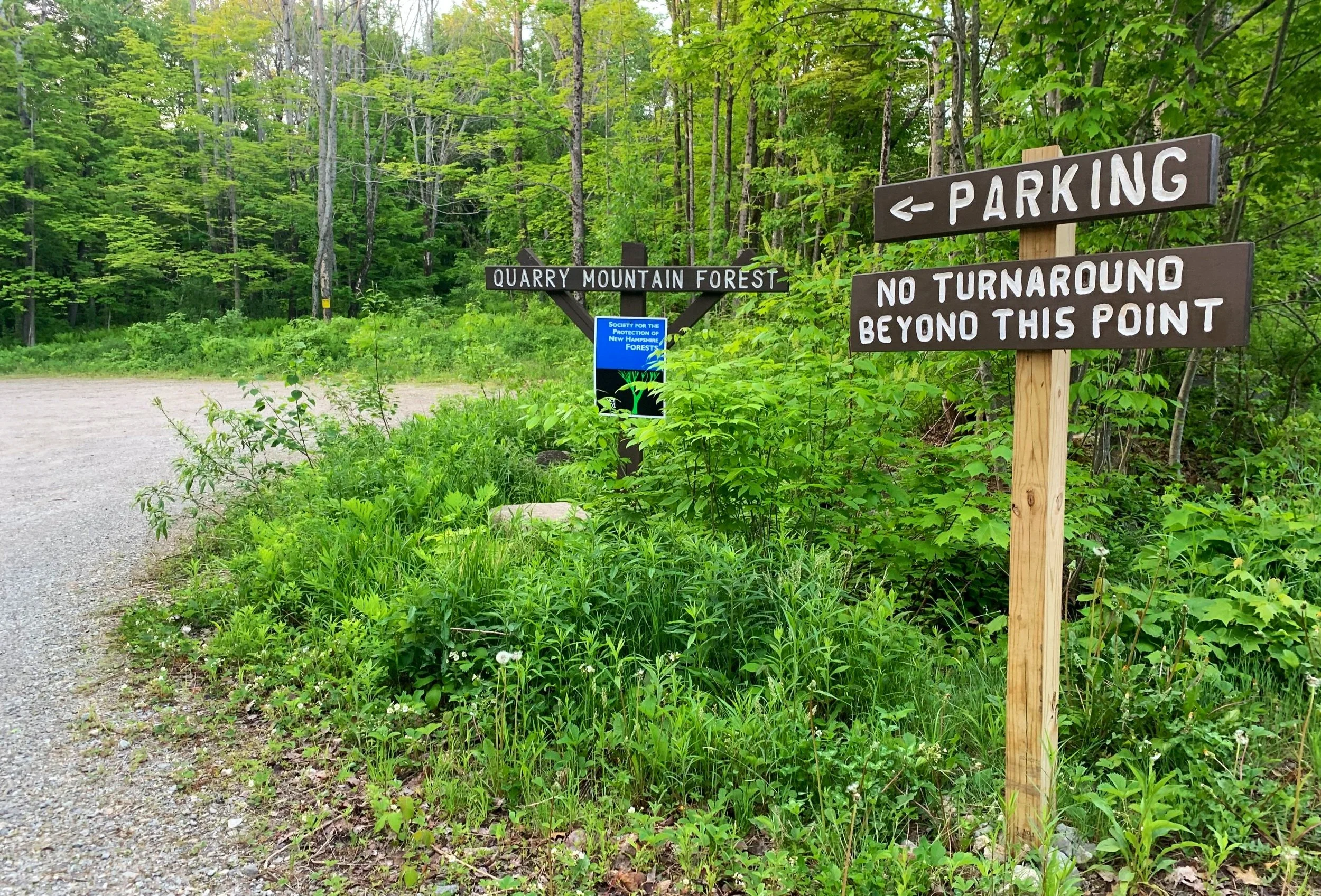
Steinwach’s Trailhead for the Reed Road Trail
While an end-to-end traverse of the small mountain range (still 19+ miles) might generally begin from Mount Major toward the east or Gunstock ski resort of the westward peaks, I decided to mix it up and begin hiking from a mid-point, looping over several forested favorites.

Early morning glow on Reed Road
The Steinwach’s Trailhead in Alton, NH begins on Reed Road at a small dirt and gravel parking lot 0.75-miles from US Route 11A. Beyond a short southward trek along the remaining 0.1-mile road walk, along which several residential properties are passed; reaching the road’s end, the Reed Road Trail veers left while an old forest road (Glidden Road) departs on the right (southwesterly). Soon passing a gate, the hiking path proceeds along a highly eroded and rocky, old logging road through the Society for the Protection of New Hampshire Forest’s (simply known as: The Forest Society), Quarry Mountain Forest tract of 507-acre protected land.

Reed Road Trail
Innumerable, short white pine grow thick, revegetating an old, logged clearing; tiny four-petalled bluets formed a low, white and purple blanket trailside. Entering a dense canopy beyond the clearing, the hiking path continues southeasterly until veering off the main roadbed, signs and arrows indicate the way as the trail enters the forest atop a small stone staircase. Before departing the old road, a glance over one’s shoulder will afford views toward Gunstock Mountain and Mount Rowe.

Along the switchbacks of Reed Road Trail
Footing now becomes soft and agreeable as the trail ascends several small, tight switchbacks; an old, grown-in logging road is often visible cutting straight upslope. Swinging southward to follow atop a northern ridge of East Quarry Mountain, the fern-lined trail becomes a narrow, moderately eroded pathway before reaching the intersection with the Dave Roberts Quarry Trail.

Ascending East Quarry Mountain
Just beyond the junction, the path quickly grows rugged and steep as it climbs the rocky mountainside of East Quarry; several gently worn herd paths can be found radiating south as the white-blazed path cuts nearly straight upslope atop exposed rocks and roots. Leveling off, the signed summit at 1,880’ is reached before gradually tapering down the eastern hillside with a southward swing. Along the descent a faint herd path can be discerned cutting through the trees on the left which guides hikers to a series of caves which were created by fallen boulders, we did not venture down this path today but simply continued following the Quarry Trail.

Lake Winnipesauki from East Quarry
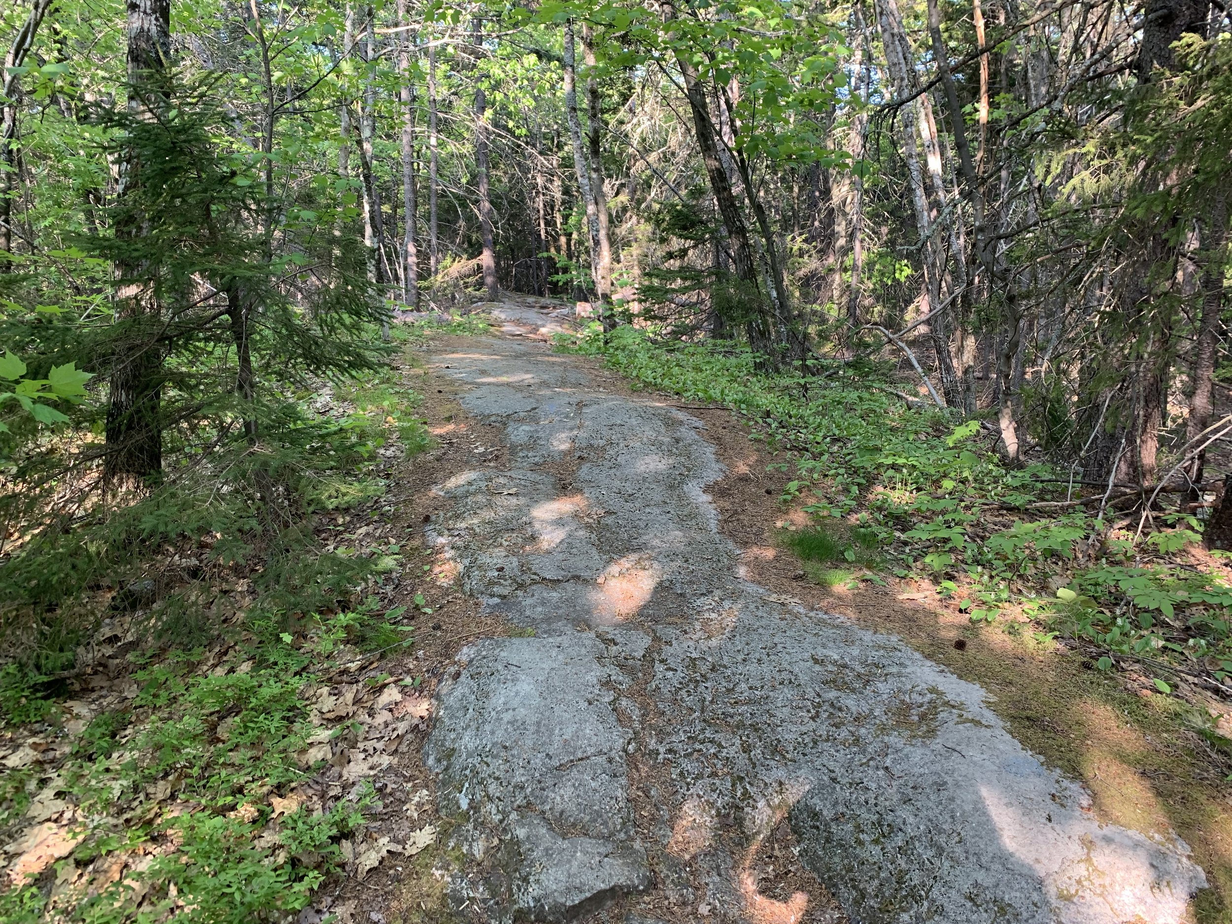
Soon the soft path of fallen conifer needles transitions to one of bare rock, as if following a ledgy sidewalk the path traverses atop a narrow band which soon grows steep yet again before reaching the next domed summit. Ascending atop cracked and jagged boulders, usually necessitating the aid of handholds, the trail climbs its way up the northwestern slope of North Straightback Mountain.

North Straightback Mountain summit
Arriving at the signed, 1,910’ summit of North Straightback Mountain, we followed the Quarry Trail as it tracked due south for 200’ until diverging onto the orange-blazed Quarry Spur Trail. Descending steeply atop a slick bed of fallen hardwood leaves and exposed roots, the trail crosses a small tributary to Minge Brook atop small, mossy boulders before a slight climb to a wooded knob. Rolling along a beautiful Belknappian hillside, the path merges with the Belknap Ridge Trail while proceeding toward our most eastbound mountain of the day.
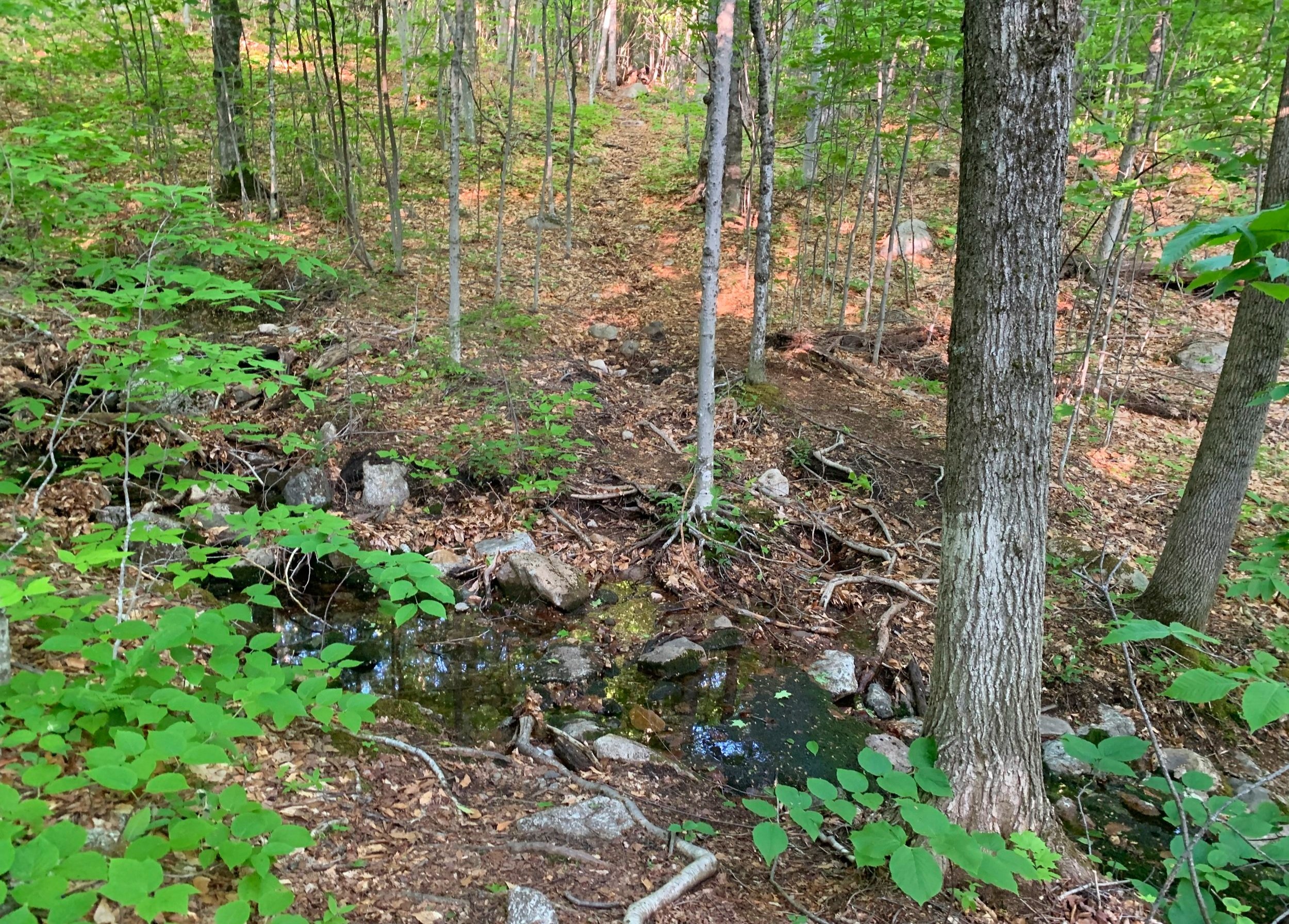
Drainage on the Quarry Spur Trail
Beyond the Brook Trail (which departs northbound) junction at 1,600’, the pathway once again becomes steep as it ascends atop bare ledges. Rock cairns as well as yellow/blue paint swatches mark the path enroute to the summit; while the cairns are helpful in times of limited visibility, the wide ledgy path is nearly unmistakable although several rocky routes diverge, leading toward various vistas and lookouts along the climb along the western ridge of Mount Major.

Approaching Mount Major
Before reaching the 1,786’ summit of Mount Major, Lake Winnipesauki becomes visible northeasterly, beyond an opening in the trees. Various scrapes and gouges in the bedrock imply a glaciatic past, while wide, intrusive black igneous dikes are sandwiched between lighter grey bands of conglomeratic rock demonstrating years of tortuous upheaval; morphing, cracking and bending of bedrock. The Belknaps as well as the Ossipee’s being ancient calderas, a feature which is clear when viewed on topographical maps.

Northeasterly views from Mount Major
The foundation of a 1925-built stone shelter still adorns the bald summit of Mount Major, its second roof having been blown from the structure in a 1928 springtime windstorm; evidenced by the recent campfires inside the structure walls, it is still serving its original purpose. Just outside the walls of the old hut, a tattered US Geological Survey bench mark can be found embedded in the bedrock, it’s etched lettering now far from legible due to hiker’s abuse.

Towers of Belknap Mtn between N Straightback and E Quarry
Retracing steps westward off the open summit of Mount Major, along rocky ledges which cut through the sprucy forest, the Jesus Valley/Beaver Pond Trail exits on the left. Continuing still along the Belknap Range Trail, this soon diverges southward as well at a junction with the Quarry Spur Trail, which was hiked earlier in the loop. While remaining an unmistakable pathway through the coniferous hilltop, the path becomes relatively rougher, some blowdown is encountered which facilitated a step over. However, perhaps due to the slower pace, we were able to spot several trailside Lady Slipper flowers.
A rocky sidewalk through the Belknaps
Along a gently ascending hillside, the trail merges with the Straightback Mountain trail atop its namesake mountaintop, at 1,890’. Low trees cover the range as we continued hiking, now toward the west; breaks in the trees offered distant views south/southwesterly. Scrappy red pine can be found trailside as the path passes purple-topped rock cairns which denote the Precipice Trail (East). The Belknap Range Trail is now emblazoned with the BRT arrowhead logo; 115 of these trail markers had been placed along the ridgeline by the BRATTS (Belknap Range Trail Tenders) trail crew.

Trailside boulders
The Belknap Range Trail becomes soft underfoot once again as it traverses a rolling, forested hillside atop a fine bed of fallen conifer needles with low blueberry bushes lining the trailside. Today, in late-May, unripe blueberry bushes can be found all throughout the Belknaps, soon to be a tasty treat to hikers and wildlife alike.

Rocky ascent up Mt Anna
A steep and rocky descent off the western hump of Straightback Mountain brings hikers to a tranquil conifer needle-rich col where several massive boulders lay trailside. Passing the western branch of the purple-marked Precipice Trail, the Belknap Range Trail makes a southerly swing while enroute to summit Mount Anna. A short, steep scramble atop strewn boulders brings hikers to a more mellow grade nearing the 1,670’ summit; a small boulder-garden lays off-trail to the north, just prior to reaching the colorfully signed summit.

Mount Anna summit
From here, a slightly longer route could be made which would encompass Mount Mack (1,945’) before swinging northward to Mount Klem (2,001’), then eastward to summit Mount Rand (1,833’), and finally West Quarry Mountain to close the loop. Being content with an 8-mile loop, we simply retraced our steps back down the craggy hillside off the east flank of Mount Anna, 0.4-miles back to the yellow-blazed Marsh Crossing Trail.

Trailside marshland crossing
True to its name, the Marsh Crossing Trail hooked around a low, boggy area to the north of the trail - we searched through the trees for grazing moose but figured they had all found somewhere quiet to bed in the early morning sun at 9am. At 0.2-miles along the northbound trail we encountered a wall of mosquitoes, which hitherto had not been problematic along the trails.

Rock slabs ascending West Quarry
With many trees now sporting a low ring of absent tree material resulting from beaver activity, we trekked atop a small drainage flowing into the westward marsh. A gradual ascent through brightly illuminated hardwood tapered into a steep scramble as the path departs the loamy soil and climbs atop rocky slabs; rounded divots in the bedrock comprise much of the upper footpath to reach the summit of West Quarry Mountain, at 1,894’.
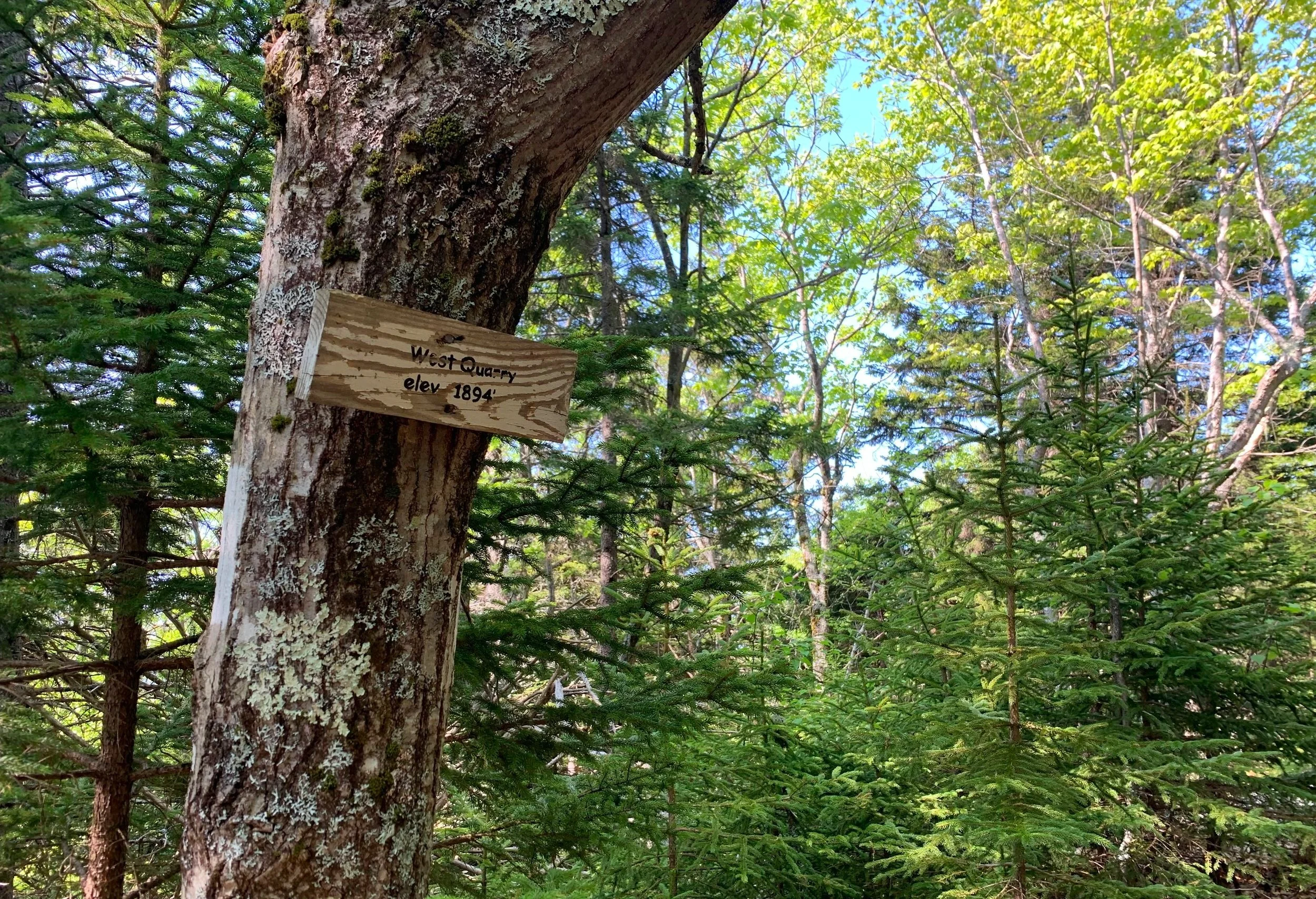
West Quarry summit
As elevation was gained, mosquitoes were traded for black flies which hung thick around the summit of West Quarry, with several quick photos of the small summit sign we dashed off, now back along the white-blazed Quarry Trail eastward. Passing an old stone wall, we remarked how massive the stones were which comprised the old stone wall, such a feat to move and stack boulders of that girth at this elevation.

Dave Roberts Quarry Trail
Passing a highly restricted southeasterly lookout, the path swings north then northeastward to follow an elevation contour. Young spruce and blueberries edge a soft path as ferns continue to unfurl in the morning sun. A final descent off a 1,840’ ridge brings hikers back to the Reed Road Trail. While descending the Reed Road Trail, great views periodically arrive through the trees which help entice planning the next inevitable visit to the Belknap Range.
Overall stats for the day:
7.83-miles
4hr 30 minutes
2,392’ elevation gain
East Quarry Mountain - 1,890’
West Quarry Mountain - 1,894’
North Straightback - 1,910’
Straightback Mountain - 1,890’
Mount Major - 1,786’
Mount Anna - 1,670’