
Knox + East Knox Mountains
Being on the search for a good snowpack to bushwhack upon, it seemed as if chronic warm temperatures over the weekend were effectively transitioning most remaining snowpacks to a consistency akin to soggy, sloppy, mashed potatoes; with the supportive crust I had found on the southern aspect of Butterfield Mountain toward the end of last week, I thought: why not keep working southward down the range.
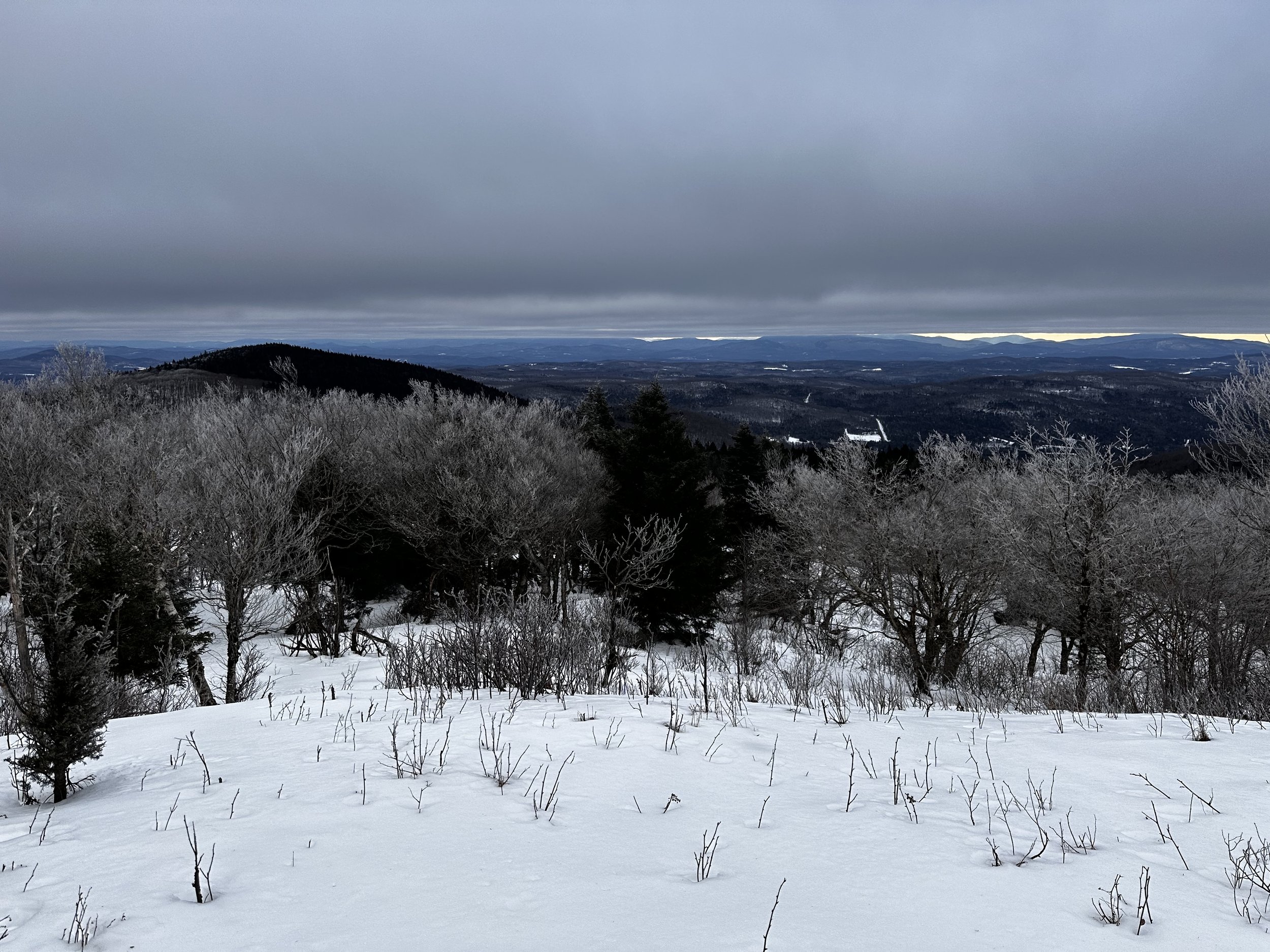
With Signal, and Butterfield Mountains ascended, naturally, my focus was placed on the next significant peak along the ridgeway - Knox Mountain. Along with several lower sub-peaks, Knox Mountain rises from a 2,390’ boggy col, which separates it from its northerly neighbor, Butterfield Mountain (3,167’). In glancing at the V.A.S.T. snowmobile club trail map (found: here), it was reassuring to find groomed Corridor 302 slicing directly through the Butterfield-Knox col; unfortunately, for the riders, the trail network was reduced to a hazard-red color: CLOSED.

Entering the Knox-Butterfield col on Corridor 302
Apparently, the groomed snowmobile trail network had not fared well either; warm, sunny days with unseasonably mild overnight temperatures kept their roadbed a formidable layer of icy slush. This was precisely what was encountered upon stepping out of the Subaru at 6:57AM. With mountaineering boots on the feet to preserve warmth while shedding any wet, springtime snow, I began out of the large V.A.S.T. trail system parking lot, off US Route 302, back to Gore Road, which becomes Corridor 302B.
The parking lot was icy, as were the trails - refrozen, muddy slush - if a snowmobile can leave a posthole, I certainly encountered several of such instances anytime a sled had ventured off the groomed route and into any open clearing. Travel was made efficient by trekking within the un-churned snowpack at either extreme edge of the groomed route; this narrow band had been solidified by the weight of the grooming machine, without being kicked up by sled skis or belts.

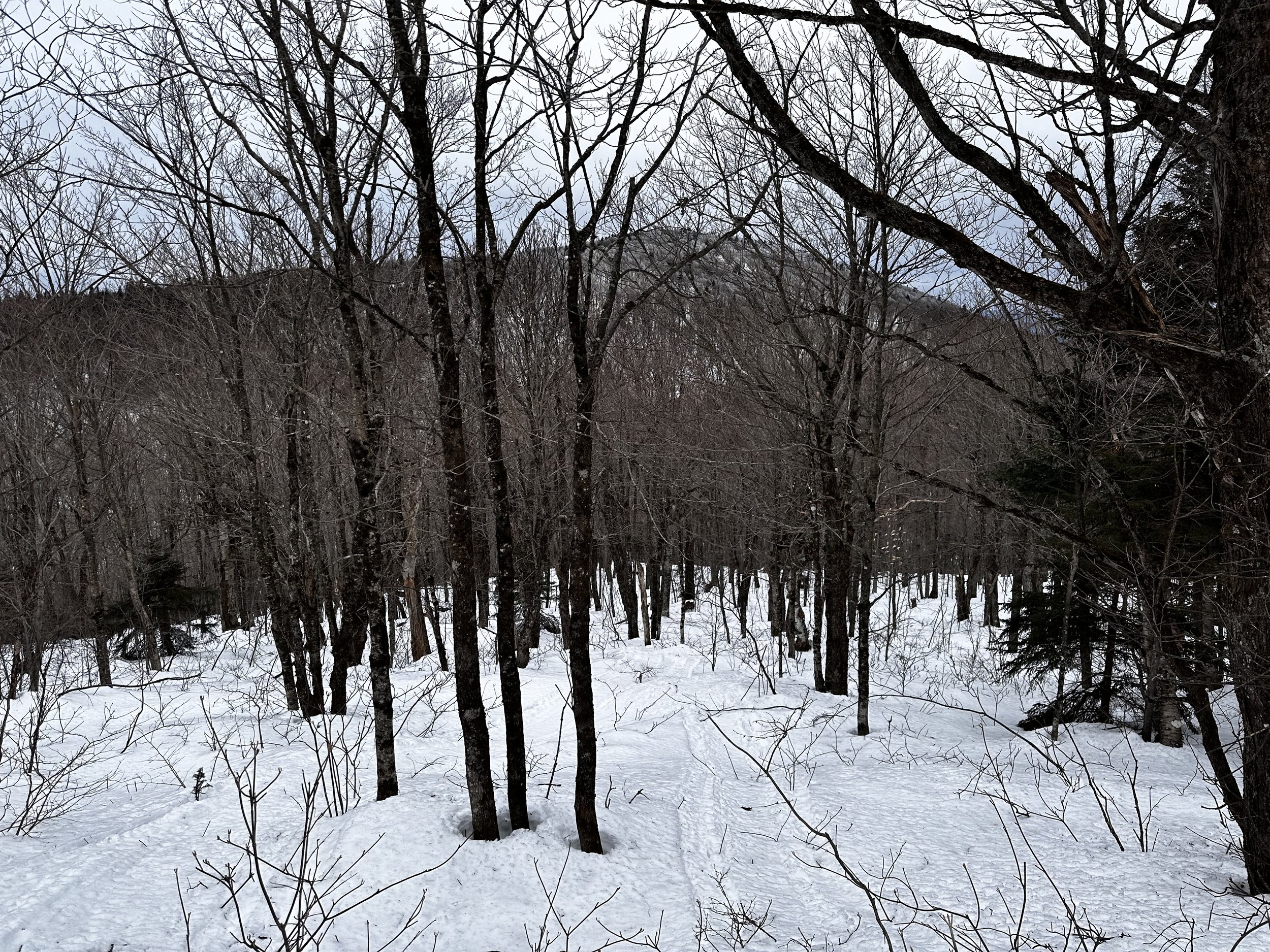
Entering very birchy woods of East Knox Mtn
Similar to my Butterfield bushwhack route, I continued straight on Corridor 302, in a westerly direction to start. Crossing a bridged tributary of Waits River, it was not hard to observe that water levels had come up slightly following days of warmer temperatures - I hoped for good conditions but had my reservations when I put a trekking pole into the trailside snowbank and found the consistency of a slushie at 1,750’.
Corridor 302C, which makes a large loop at the eastern base of Butterfield Mountain, was marked in yellow, indicating this stretch of trail warranted Caution be taken by riders. In most corners, where riders had carried any speed, the soft, slushy snow had been completely thrashed aside, leaving massive divots right down to rock and dirt. Proceeding 0.5-miles further, I came to the next junction - this one actually had me pondering my currently location as I had already passed the ravine which drains thenceforth to the Waits River, from the Butterfield-Knox col.

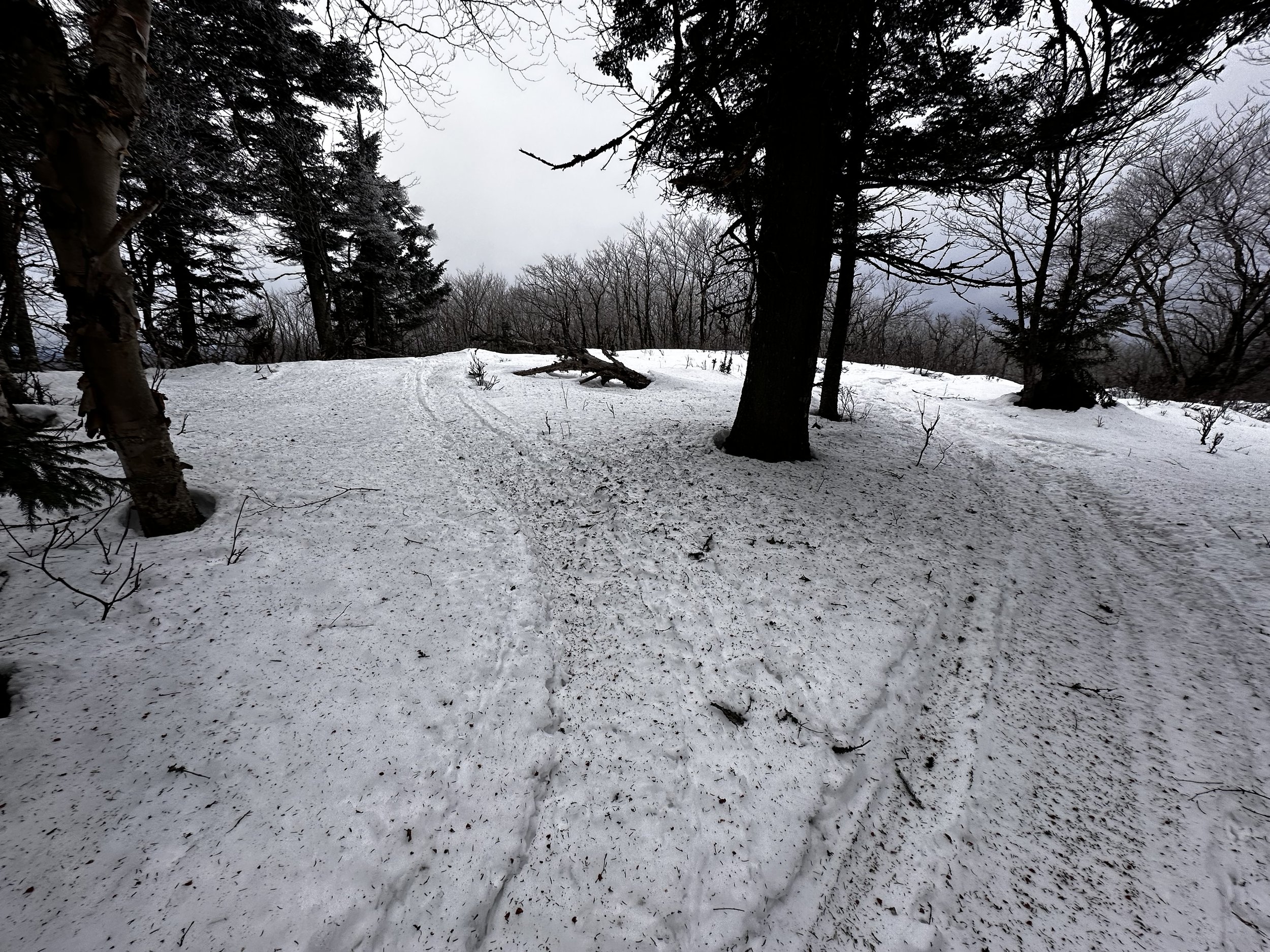
Reaching the summit crest of East Knox - is that a trail corridor?
Certain that this uphill sled trail must be the route I had intended to take, a sense of ease abounded when I could discern myself entering the open woods of the high col. Just as I had traced on the snowmobile maps the night prior, I clambered up a somewhat steep grade (steep for a snowmobile, perhaps) until completely trekking around a horseshoe shaped arc, which makes a large southward swing before turning northbound once again, then entering the col by side-hilling the East Knox side of the gully.
Continuing to follow the groomed snowmobile trail a bit further, I had planned to utilize the packed trails until reaching the height of land in the col, and venturing southwestward to Knox Mountain; the only downfall to this planned route was the need to sidehill the lower slope of East Knox, thus avoiding the beaver pond areas of 2,385’.

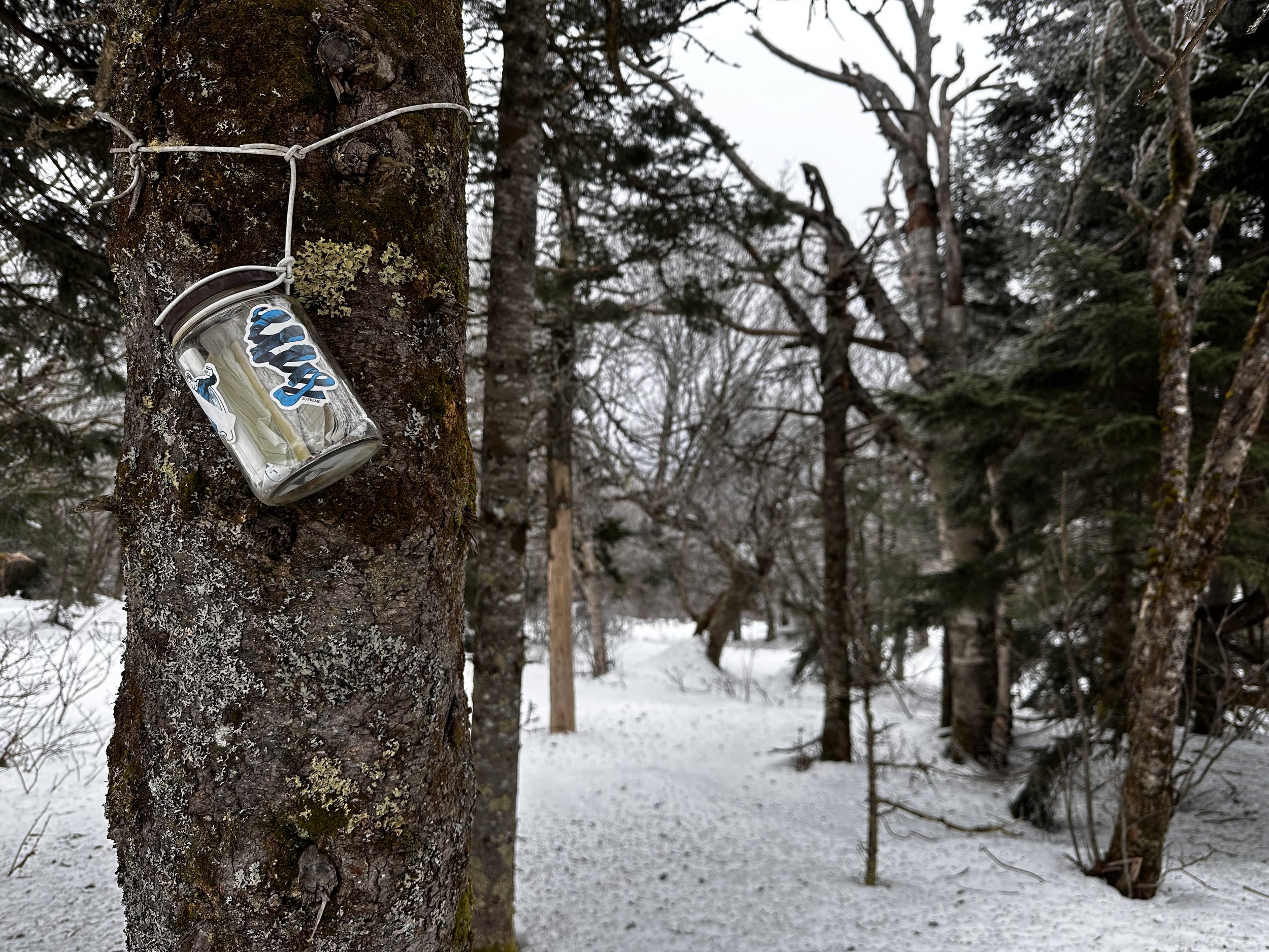
East Knox summit canister (sticker blurred out to keep website PG)
With snowshoes now affixed to the boots, I stepped off trail around 2,380’ and immediately found myself in a remote new world of full-floatation. Able to pick out an old, brushy logging/skidder road, I chose to follow this but absolutely lost any sign of it within only several rods - had I even been following an old corridor to begin with. Looking directly up the steep mountainside while trying to coax myself into side-hilling the low terrain of the East Peak, I could sense that the summit crest was really not all that far upslope.
Taking a quick reprieve from breaking trail, I had begun to sink around any patches of young conifer, or in areas where low hobblebush poked through the snowpack, it was becoming completely unsupportive. Unsure of whether I wanted to struggle all the way out to the highest of the Knox Mountains, I shared some choice words with my forest friends, and reluctantly began steeply up the mountainside on the primary crampon points of the Flex Alp snowshoes.
Reaching the open glade shoulder of East Knox Mtn
With each step placed upslope, the surrounding forest was not only becoming tidier as the understory was dropping away, the snowpack was incrementally becoming more supportive as elevation was gained. With a fine glance back toward Butterfield Mountain through the canopy of East Knox, I could almost see my exact ascent route from last week, when I had bushwhacked through beautifully open hardwoods, which eventually opened up to reveal stunning higher elevation birch glades.
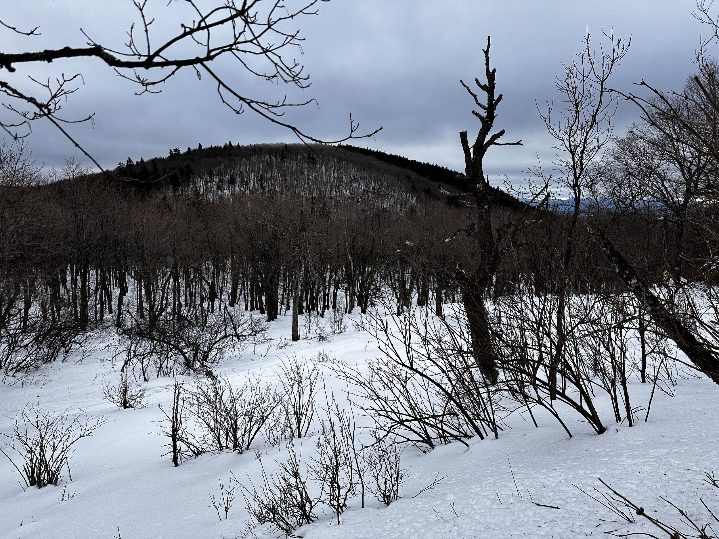
Knox Mountain from low on East Knox Mtn
Approaching East Knox from a due south position, the snow was finally encouraging a quickened pace, and the mature conifers ensured travel would not be impeded by their boughs. As it was obvious to note: around the base of each evergreen could be found a ring as big around as its widest branches - all the caked and frozen treetop snow had cascaded down and formed a berm around each tree - some of this snow shed was compact and supportive, other patches preferred to swallow a leg and snowshoe completely.
Reaching the summit crest, I turned to trek the final elevation in mature, open softwoods, finding not the recognized summit of East Knox, but a trail corridor cut into the ridgecrest instead. Full of intrigue as to where the old route may lead, I secretly hoped this rough path would streamline some of the travel over to Knox Mountain - although, at this point in the bushwhack, I had yet to officially “add back in” the main peak of Knox Mountain to my morning itinerary, as it had been temporarily scrapped upon encountering a sub-par, completely unsupportive snowpack along the base of East Knox.

Ascending Knox Mountain
Following the rough, ridge trail, I soon encountered a white-capped, plastic pill jar, I opened the lid long enough to see a wad of mangled paper bits stuffed into a plastic bag. With no interest in tackling that mess this morning, I bade farewell to a beautiful, wooded summit. Choosing to follow this rough trail, I was now snowshoeing directly atop a packed snowmobile track, which had shredded directly up the western ridge of East Knox Mountain.
East Knox Mountain from Knox Mountain
One track soon became two sled prints as elevation was casually relinquished; thoughts and prayers went out to the poor understory vegetation which had been ripped clean out of soil upon getting snagged in sled drive belts, such an unnecessary scene of devastation right up the mountainside. Following sled tracks, I was dumbfounded upon exiting the brushy evergreen canopy when I strolled onto a broad shoulder consisting of elegantly frosted birch. From my current perch, the main peak of Knox Mountain was completely visible - my proposed route looked incredible: open, frosty glades all the way up the east/northeastern face, with several dark evergreens providing all the contrast needed to make this trek visually alluring.
With one glance at such a mountainous sight, I could also peer into the immediate forest to find packed snowmobile track persisting into the Knox-East Knox col. At times of not following the packed sled track, I found myself romping down a completely enjoyable and crusty snowpack - even the crampon points hardly left a scratch while romping steeply downslope. Reaching the 2,670’ col, I glanced up the precipitous grade for a “path of least resistance” upslope; making several turns around stately, old birches, I ascended in a southwesterly fashion toward the broad summit of Knox Mountain.
Summit of Knox Mountain
Throughout the ascent, I could glance through various openings in the lofty glade, to other Vermont peaks; before long, the White Mountain’s also became visible from around the dark mound of evergreen-capped East Knox Mountain. The most interesting feature found while gazing back to East Knox was the hardwood ridge of the most immediate descent preceding the darker, coniferous summit cap.
Around the wind-snarled, birch grove, the rock-solid snowpack continued entirely up to the 3,086’ mountaintop; this was the only location of the morning adventure where I encountered any moose tracks whatsoever - and they were fresh, as were their accompanying beds. Without any struggle, I located the glass jar which protects the summit register log - into this notebook I did sign.
Looking east: East Knox left, then into the White Mountains of NH
Ever since departing the summit of East Knox Mountain, I had been trekking completely outside of the Groton State Forest boundary; while I had never encountered any Posted signs while hiking on the actual Knox Mountains, I had spotted a yellow Posted sign at the entrance of an old woods road, back along the groomed snomo trail. This was, however, the primary reason for approaching the Knox Mountains from the east - I have encountered many reports of Posted property when approaching from the west.
After sealing up the summit register jar, I swung a wide, counterclockwise loop, mostly following day-old moose tracks around patches of scrubby spruce and fir. A return to this mountaintop will certainly be made in warm weather, as I could have remained in the lofty glade all day - just watching the low cloud ceiling scrape along craggy summits of White Mountain peaks. For the descent, I attempted to follow my uphill snowshoe tracks but soon lost any sight of them in times of solid, crusty snowpack.

One dilapidated old cabin
Back at the East Knox-Knox col, I wanted to see how far I could follow the rugged snowmobile track as it chewed through the loose snow; without sinking, I was thankful to be following a formidable sidewalk of packed snow. At one time, I thought the sled was veering back toward my descending tracks of East Knox Mountain; I diverged, finding myself atop more crusty and solid snow, I thought of crossing a few drainage gullies while beginning to side-hill back toward the groomed snowmobile corridor.
Finding thick woods beyond the first water crossing, I recrossed, following my original route which soon picked up the packed snowmobile track once again. Once settled on following this track for a distance, it soon led me into the soggy, beaver pond area which I could spot from high atop Knox Mountain. With the initial crossing of wetland area clearly frozen, I carefully stepped in the sled track, assuming if the ice held the weight of a steel machine, it could certainly hold my gear and body weight. The wider, more northern side of the pond showed signs of melting; the sleds somehow remained afloat through slushy tracks - I traipsed carefully around the outskirts of the pond, around young spruce and fir.
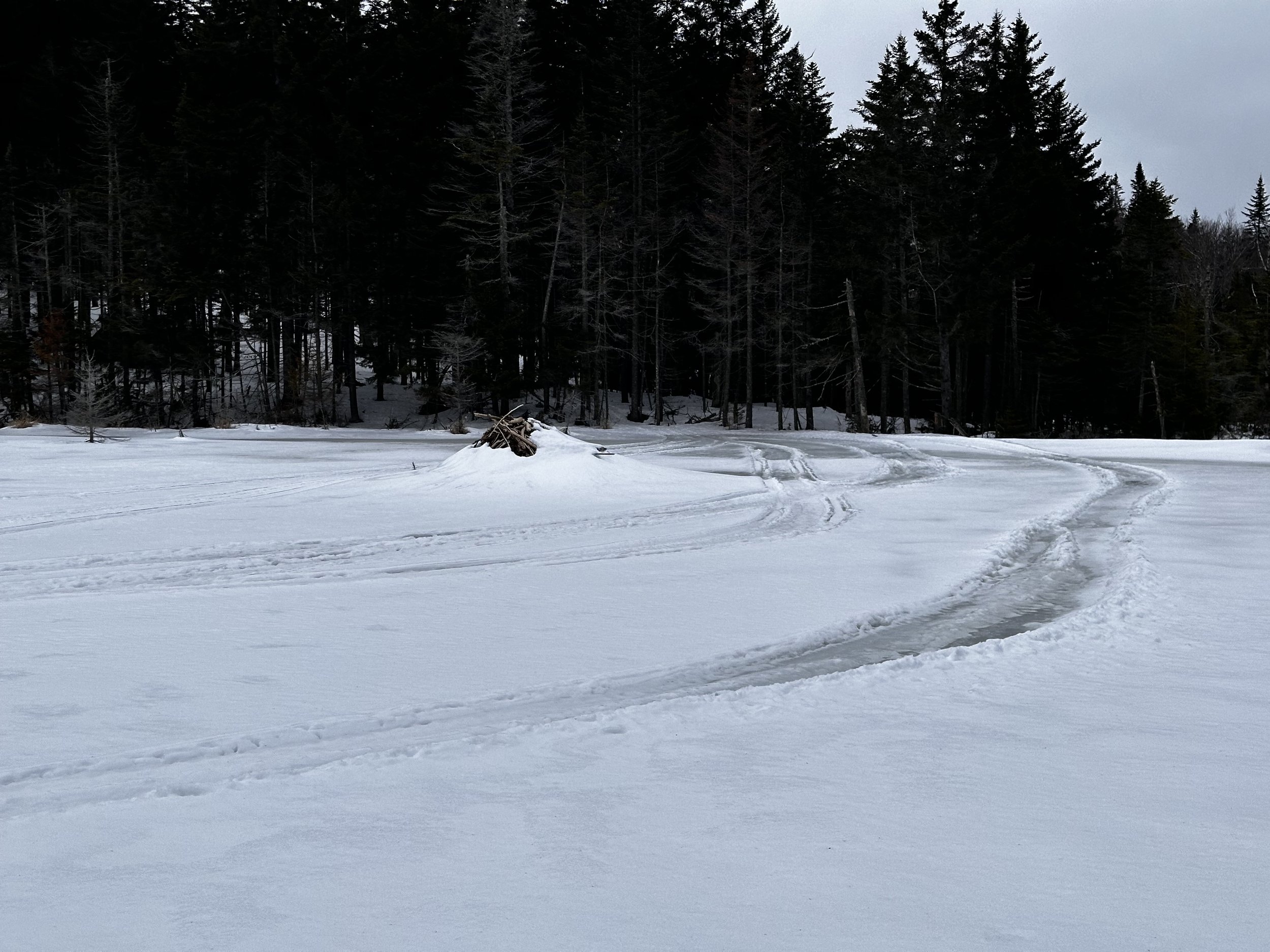
Sledders, living life on the edge a bit
After a crusty snow crossing of the beaver dam, I rejoined the sled track once again and entered a wooded area which contains a small log cabin; the second of its kind which I had now encountered this morning - the first cabin was found (with the roof collapsed) on the far side of the beaver pond, a name inscribed in a birch log claimed it to be from 1970. Now, without the aid of packed snowmobile track, I began steering my trajectory northeastward, as I could sense myself approaching the side of the Butterfield-Knox col which I did not want to descend into.
A brief stint of side-hilling through decent, mixed woods, brought me to a stretch of glorious, northern hardwoods, although several scrappy beech saplings had arms and legs flailing like a windmill. As I thought I could see a boggy pond area through the open woods, it was reassuring to know I had navigated to the northern side of the tarn; soon, I should be spotting dirty snow of the groomed trails through the forest.

Side-hilling East Knox Mountain - in search of groomed snomo trail
Once back on groomed trails, I opted to follow this expeditious route back downslope until reaching a point when the corridor swings south - I proceeded eastbound into the open woods, descending rather steeply atop a grippy, solid crust, to a tributary of the Waits River. Meandering along a marshmallow plume of frozen snow, footing was just fine atop the freeze-thaw cycled snowpack until reaching the main network of Corridor 302C and 302 proper.

Opting for a final off trail ramble to avoid closed snowmobile trails
Once back on the groomed trails for the final occurrence of the day, I could glance back toward Butterfield and Knox Mountains, the col from which I had just descended seemed already too far away - such is life of a snowshoe trail runner when they find themselves atop a primo crust which encourages a hasteful, downslope ramble - even the crust which was snagging snowshoe noses last week had seemingly taken a bit of a hiatus. While it would be nice to state this is the final 3000-foot bushwhack of this short mountain range, it is not - this remaining bushwhack will either wait patiently until springtime, or tomorrow - whichever comes first.
Overall stats for the day:
7.97-miles
3hr 12 minutes
2,195’ elevation gain
Knox Mountain - 3,086’
Knox Mountain, East Peak - 2,980’