
Signal Mountain
Oftentimes, living on the western border of New Hampshire state, it is possible to look out over the Connecticut River and see frosted tips of several 3,000-Footers of Vermont. While gazing westward, a ridge of saw teeth emerge from the surrounding farmland; Knox (3,086’), Butterfield (3,167’), and my primary objective for the day: Signal Mountain, rising higher than any other peak along the ridgeline at 3,360’. Naturally, there are a plethora of minor sub-peaks adorning the ridgeway to keep any peakbagger content for a good long while.

Parking to the left, Gore Road straight ahead, taken from Corridor 302
The summits of Butterfield and Signal Mountains are located within the Groton State Forest of Vermont and have been told to contain a bushwhackers paradise of open woods, offering pleasurable strolls anytime of the year - this, I had to see! I suppose, however, this should not come as a surprise, after roaming through lovely State Forest hardwoods to the north, near its namesake lake.
With all prior trip reports that I found having taken place in warmer months, parking and trail access were somewhat up in the air until my arrival on the scene: in winter, the network of old logging railroads and forest roads are repurposed into groomed snowmobile trails for V.A.S.T. - or, Vermont Association of Snow Travelers (a map for the network can be found: here). Located on the west side of US Route 302 (also on maps as Scott Highway), my heart skipped a beat momentarily as I saw Gore Road (my assumed access to the State Forest) was unplowed, and not even packed down from sleds.
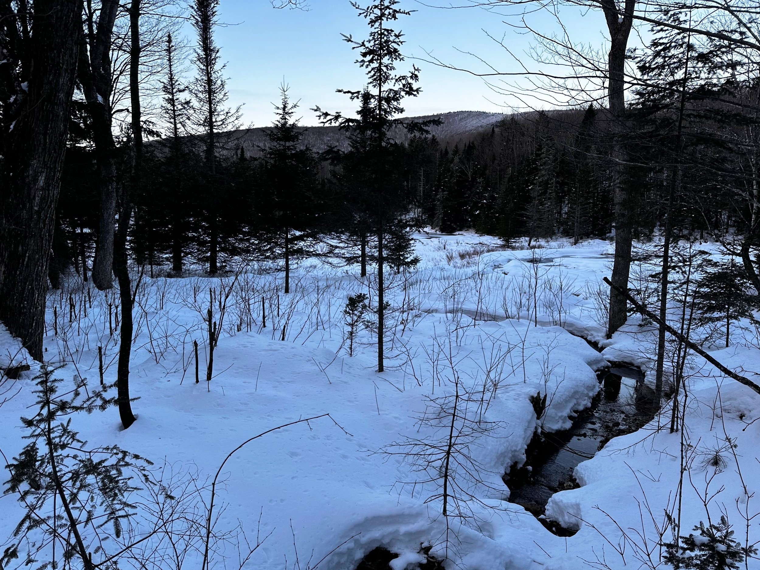
Butterfield Mountain beyond the boggy tarn
Conveniently, just up the road is a massive parking lot for trucks with sled trailers, with no traffic in the lot to contend with at 6:30AM, I casually backed into one of the lot’s snow banked corners - well out of the way should the trails get busy from this side. From where I parked, both Butterfield and Signal Mountains were clearly visible through the airy hardwood canopy, they appeared miles away from my current location.
Trekking down the groomed corridor, mountaineering boot tread hardly broke the compacted, snowy surface. Only a handful of miles from New Hampshire and even the groomed snow was completely variable from that of New Hampshire snowmobile trails. Vermont definitely had more of a “compacted freezing rain pellet” feel to its surface. From the parking lot, I veered onto Gore Road (Corridor 302B), which, at this point (several rods from the highway), was back to a groomed route.

Exposed band of rock around 2,700’ stretched either direction
Following a gentle, yet steady decline, I watched my objectives seemingly inching closer. I turned right (northbound) at the first junction, onto Corridor 302, and continued an efficient pace as the landscape began to rise in earnest. To the east, the sun was just beginning to illuminate the underside of clouds a dull shade of pink and purple.
At a T-junction, I paused briefly to watch the orb of sun burst over Fuller Hill (2,346’) to the east; a formidable hill at the base of Corridor 302C stood before me. Finding only one way to scale the low rise, I began chugging up the hardpacked surface in all-wheel drive. Aside from the occasional chunk of ice releasing from overhead branches, as the sun slowly crept up the mountainside, the forest was overall very calm. No internal combustion engines of the sleds yet this morning - aside from the glaringly obvious logged hillside and built roadbed underfoot, it was hard to spot anything touched by the human hand.

Past the rock bands and into boreal goodness
As the groomed trail made several sharp bends around a small boggy tarn which drains the shoulder of Signal Mountain, and thenceforth the Waits River after cascading through several accumulating tributaries. Knowing that most hikers begin their bushwhack near 2,300’, I saw beautiful, open hardwoods and stepped off the groomed corridor onto a rather surprisingly supportive snowpack.
From the northern side of the tarn, I directed my trajectory first toward its long stretched, southeastern ridge. After an exhaustive ascent of kicking front crampon points into the crusty layer, and finding anything but purchase, I managed to find several loose spots where I plunged knee deep. Today, my ice axe was in tow after reading about several minor cliff bands along the southern face of Signal Mountain - all during this climb I was craving trekking poles, as the technical tool was simply too short, I made it work out of necessity.
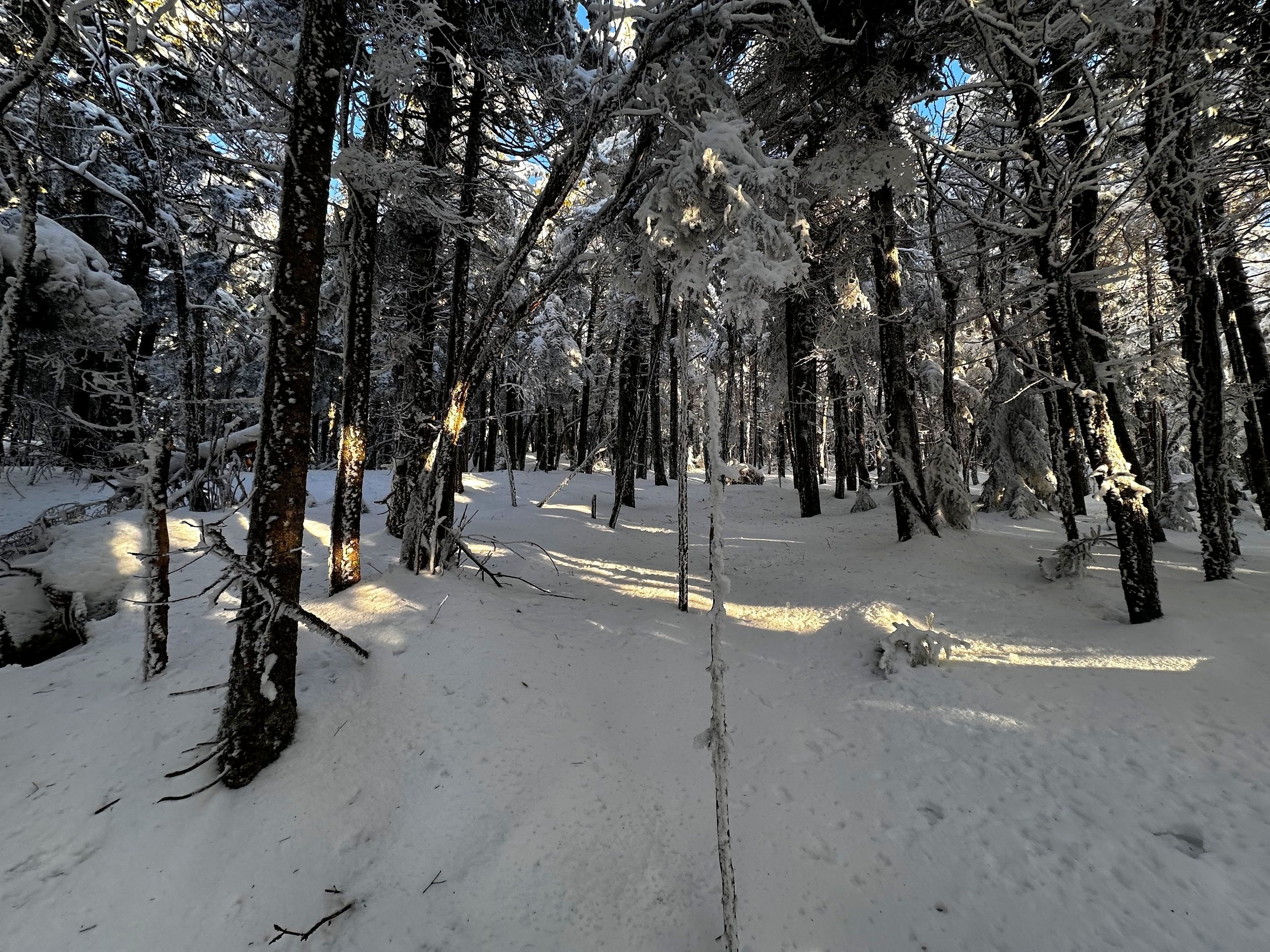
Even the thicker woods were gloriously open
Even with a hefty snowpack layer, it was not difficult to discern many old logging or skidder roads meandering up the hillside, some of these were put to use for my climb, others just passed over. It might be accurate to say: the only vegetation that I used even an arm to brush past were young beech saplings and small, localized patches of hobblebush early into the ‘whack, other than that the woods remained favorable all morning. While I could spot grotesquely dense areas of darker evergreen boughs, I continuously found open birch glades or other relatively easy routes for passing.
Momentarily, I had wanted to stroll directly atop the 2,740’ ridge, before then ascending directly up the remaining summit cone. As I could spot an open route directly through the forest, I struck a direction straight at the snow-capped mountain, knowing my destination would be contained within those frosted conifers. Looking at a topographic map of Signal Mountain, it was right around the 2,800’ point where I had been employing my ice axe to provide an anchor in the crusty mayhem which was becoming the snowpack beneath my snowshoes.

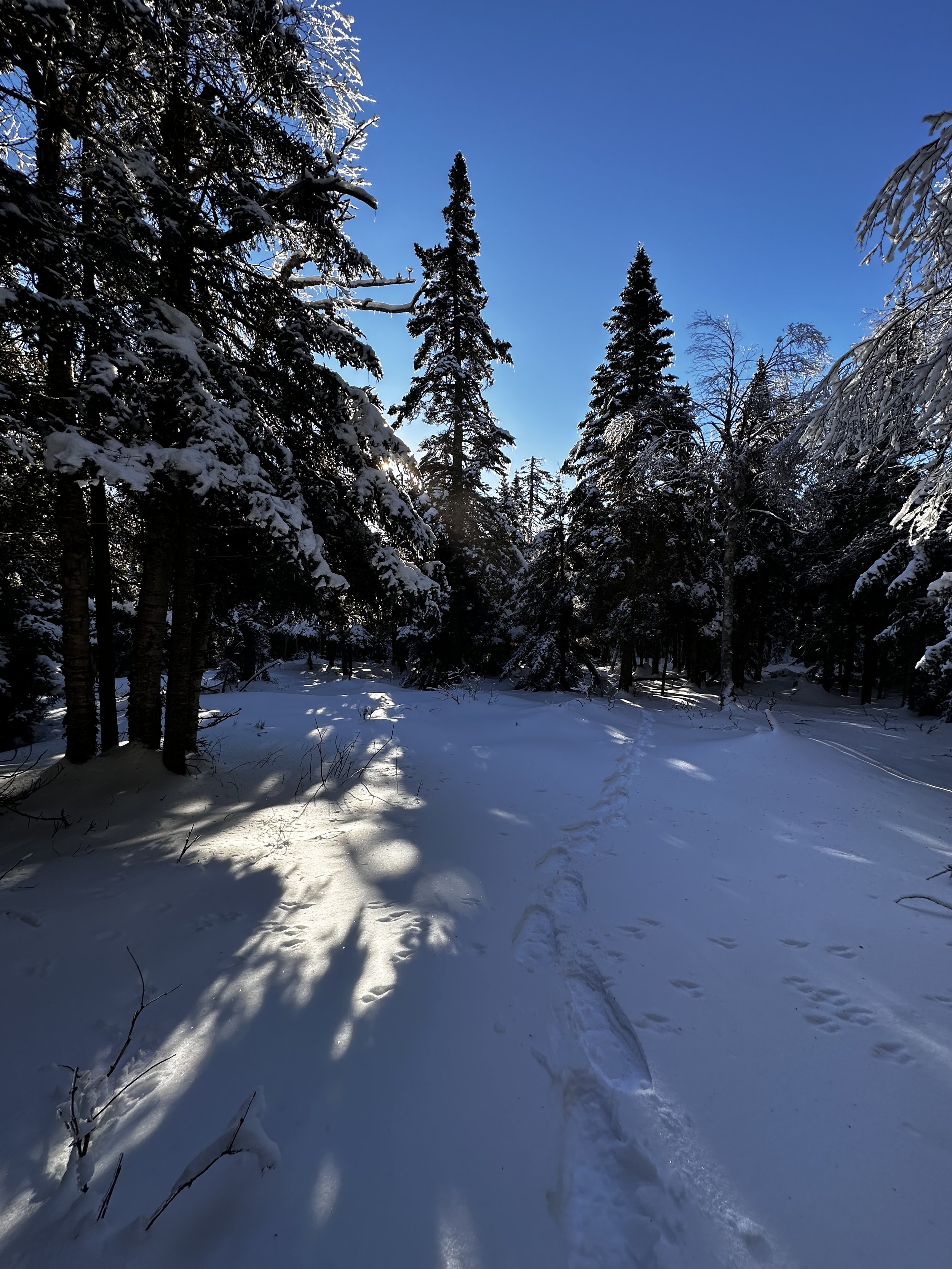
Caked trees of the final summit ridge (with moose tracks)
As I began encountering open birch glades, I could observe chunks of ice raining down from the canopy, as the morning sun illuminated the hillside. To the best of my observations, it seemed as if the entire hillside was blanketed with 5-6” of extremely loose ice cylinders, most of which had been blown loose from the overhead canopy; the warm, sunny days prior had melted the mass and later froze overnight into a harrowingly treacherous, completely unsupportive, and bewilderingly airy snowpack. Many snowshoe steps around the exposed bands of rock had plunged deep into spruce traps - I feared I would find a void between the rocks; luckily, I chose a route very carefully up a narrow chute of rock and conifer.
After several minutes of perfecting my rendition of The Running Man, I topped out onto a minor plateau area, which was really just a brief breath-catching spot while admiring the shimmering canopy overhead while the sunlight flickered through. Here, I began spotting, and following on occasion, old moose tracks - these had been through several freeze-thaw cycles as well and were partially filled with drifted snow; several bedding depressions were even noticeable.

Summit of Signal Mountain
With the open hardwoods long gone behind, I found myself strolling through a stunning sight of mature conifer and birch. In this area of the ascent (climbing the southern slope), I found a rotten snowpack, completely full of air pockets - many treetops lay scattered around, nearly splintered as they snapped from their trunks following a magnificent gust. I found lots of old blowdown, but no blowdown patches - if conditions offered a more solid snowpack, I might not have even known so many trees had toppled - most were well under snow by the time of my passing.
Slowly huffing my way up the abrupt mountainside, the steepness was then exacerbated by constant sinking, or catching the nose of a snowshoe on a downed tree, or that crusty layer - the conditions apparently wanted to shred all of my collateral and cruciate ligaments before I was done. Popping onto the eastern side of the stunning summit cap, it was no issue to note and follow the open mountainscape toward the recognized high point of Signal Mountain.

Signal Mountain summit register
From afar I could spot the notoriously leaky Nalgene bottle; a previous hiking reporter had noted that the contents of the summit register were sopping wet - but in hindsight, that may have been the 2014 review I had uncovered. Today, I did not even try to break the solid ice which encased the plastic bottle. With a good look around the summit area, I was pleased to have found a place akin to some of my local favorites: Jeffers and Clough mountains back home in the Benton Range - nowhere else in the world have I found such glorious glades, generally offering a lookout as well.
The snowpack was decent in places of open sky
While there is no debate that the summit of Signal Mountain offers no views from its pinnacle, anyone who makes such a claim has evidently never strolled the picturesque birch glades which I encountered today. As I turned to leave, I wanted to try a more direct descent to the groomed corridor below; a tentative plan was set to proceed onward to Butterfield Mountain following Signal Mountain, but the snow conditions encouraged me to save that beautifully open bushwhack for better snow conditions.
All during the descent of Signal Mountain, I could peer over and see directly through hardwoods to its snowy surface; a miniscule cap of dark conifer could be discerned as well - as if a dark green frisbee had drifted, coming to rest atop the broad mountain. I had to remind myself of the conditions which I was leaving behind - as elevation was lost, the snowpack became much more solid underfoot. I could still recall the chronic postholing in snowshoes higher up and wanted nothing to do with that again today.

Back in open hardwoods, descending toward Butterfield Mtn
Back on the groomed trail, I could hear riders out enjoying the morning sunshine. Their engines echoing violently off the surrounding mountain ridges, making it easy to hear them approaching. While waiting for a few to pass, I entertained myself by tossing fallen sticks off their groomed trails - it was the least I could do for being allowed to snowshoe their winter routes.
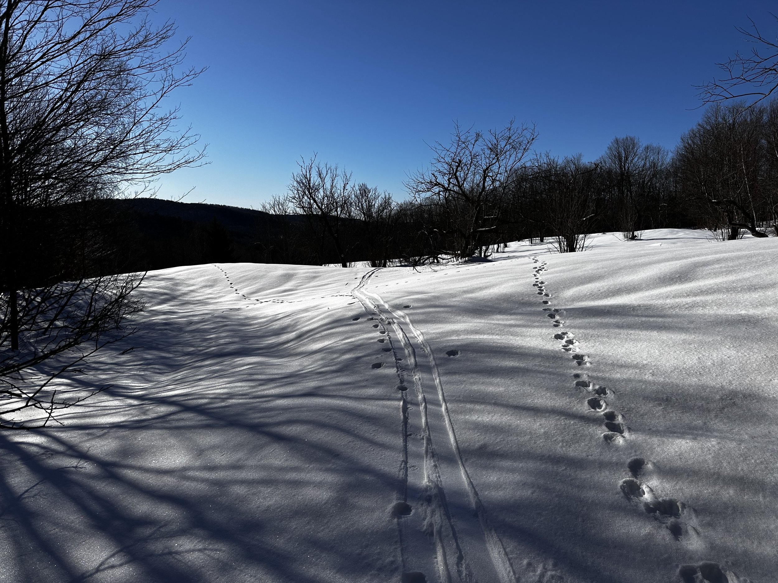
Before long, I grew tired of waiting for oncoming sleds to pass; I took off into open hardwoods for one final thrash about the woods - which is precisely what took place over several drainages, a low hobblebush patch, and many pesky spruce traps - this was far from the easy stroll I had been hoping for. Before heading back to the V.A.S.T. parking lot, I followed ski tracks into a clearing which I had spied on the ascent, at about the time I saw the sun pop up; the sun felt amazing on bare skin after so many days of drab, overcast skies.
Entering the apple tree clearing
The clearing had rows of cultivated apple trees - some with frosty apples still clinging to upper branches. I wondered if this was an old logging camp, or perhaps a private residence in the woods at one time or another. Tracking alongside Corridor 302, I found more open hardwoods without much junky understory vegetation to contend with, apparently the skier had favored this route as well, taking to the woods all the way, as opposed to the groomed sled trail.
For so long, I had peered at this ridge of three predominant humps while sitting atop the ledgy summit of Wrights Mountain, daydreaming of what their slopes might contain, now I knew: A Bushwhacker’s Paradise.
Overall stats for the day:
6.04 miles
2hr 42 minutes
1,982’ elevation gain
Signal Mountain - 3,360’