
Whitewall Mountain
“How had I not thought of this until just now?!”, as if standing atop a lofty summit when the final remnants of cloudy veil floats by, revealing a stunning image of majestic scenery to blow the viewers mind; a sort of epiphany had overcome the logistical planning side of my brain - suddenly, I knew I could access this 3,405’ mountain without necessitating a menacing, winter ascent of its scar-streaked, west-facing rockslide.

Early morning ascent of the Tom-Field col
Last year, during appropriate conditions, I found that I could ascend the A-Z trail to the Field-Tom col, then continue down the western side of the ridgecrest toward Zealand Notch, before diverging into trailless woods. This approach worked flawlessly to access and summit West Field Mountain (3,691’) last winter, I thought, why not continue further into the vast Pemigewasset wilderness, connect with the snowmobile corridor I had heard about, and use that corridor for a relatively easy approach to Whitewall Mountain - how had I never thought of that before?
Beginning roadside at the Crawford Notch Depot, the Avalon trail was well-packed from prior snowshoe traffic; every couple of paces, a rogue posthole would appear - from when daytime temperatures were warm and full sun shone overhead, catching unprepared hikers off guard. Exchanging morning greetings with several other day hikers, I soon reached the Tom-Field col at ~3,700’, following an 1,800’ ascent over 2.1-miles.

Brief plateau of the Tom-Field col
With snowshoes on mountaineering boots, I encountered a grotesque scene of countless postholes; initially, it was easy to assume a moose had unwittingly ventured steeply down this stretch of the A-Z trail, but it quickly became apparent that the frozen holes were placed by boots, with no equipment whatsoever to disperse the hiker’s weight. I found descending this length of Swiss cheese trail much easier by bushwhacking entirely off trail, through enjoyable, mature spruce and fir, while keeping the obliterated footpath in sight all the while.
The descent was disheartening, and honestly downright frustrating to be subject to these abysmal conditions when I chose to actually carry and use appropriate winter hiking gear. While continuing to “hike my own hike”, well off the maintained treadway, Forest Road 192A was soon encountered, after descending well off the Tom-Field col.

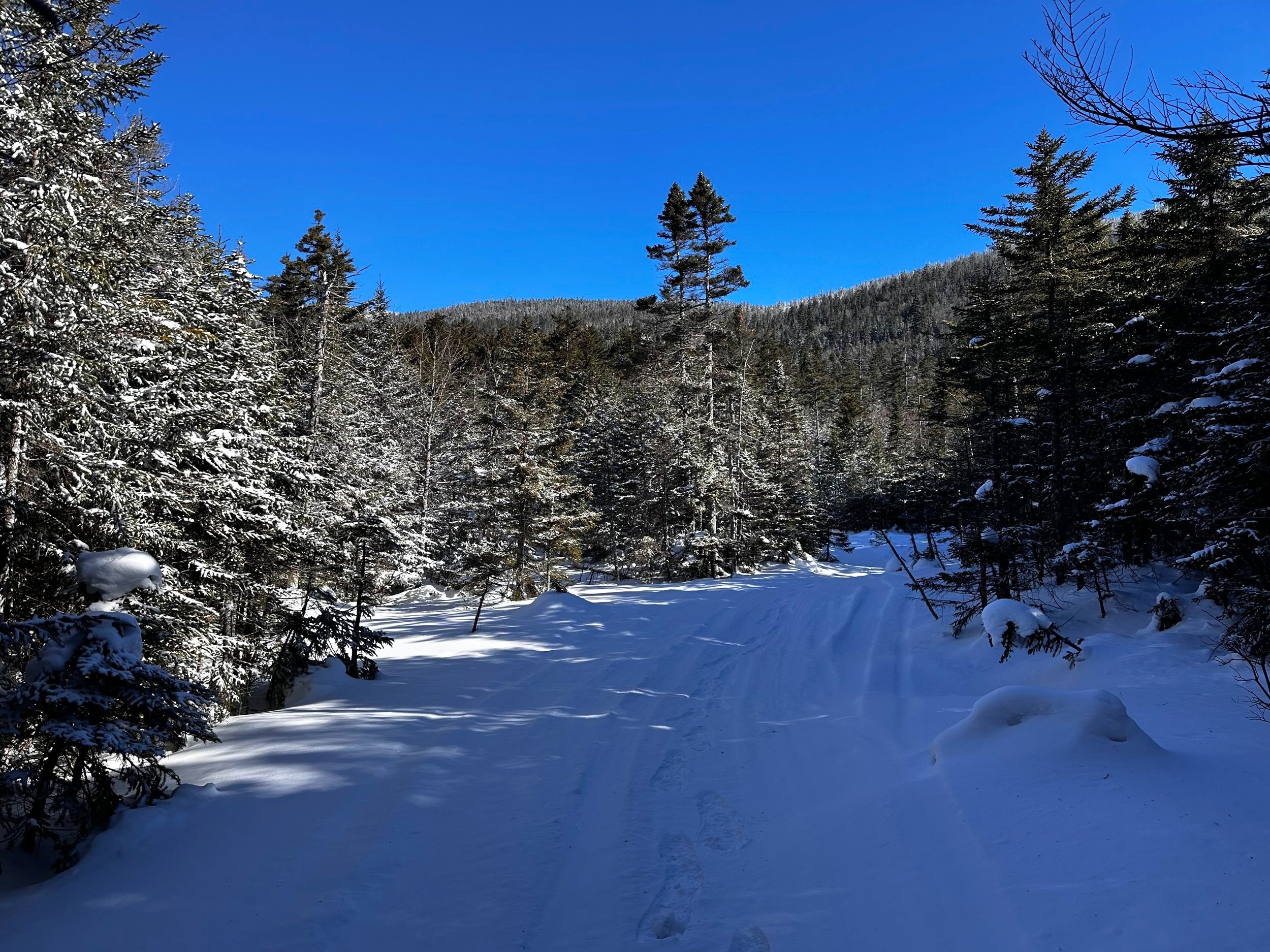
FR 192A: a proper snowmobile trail in winter
Swinging southwardly onto the narrow roadway, it was obvious that this old corridor had grown in considerably since its days of a typical forest access road. Today, the path was just wide enough for the one sled track which I began to follow. With solid footing, the packed treadway was as smooth and efficient as any sidewalk I had trekked. Before long, the narrow corridor spilled into an open, cleared area where I could then gaze back over my shoulder, for the first glimpse of the wooded Tom-Field col - it appeared as a sleeping giant, its freshly frosted spine gently arcing toward either bookending mountaintop.
The snowmobile corridor led me through a magnificent forest of matchstick-straight spruce and fir, even showcasing a sun-drenched birch glade to my south, which blanketed the far lower slope of West Field Mountain. Given the sight of morning sun spilling through the open canopy, I grew eager to depart the packed snowmobile trail and enter the beautiful woods. Just beyond what appeared to be a rather boggy patch - had there not been a recent deep freeze to render the deep snowpack solid - I located what appeared to be an obvious corridor leading into the wilderness.
Looking back to the Tom-Field col
Into the glowing forest I trekked, with overall ease; the snow was highly wind-drifted, leaving several inches of considerably loose, powdery snow atop old crusty layers, which all provided efficient floatation through the woods. Before long, I could actually see through the canopy - to Whitewall Mountain; I was not on my objective at all. I had entered the forest too soon and invariably began climbing along the extreme western shoulder of West Field Mountain. This would simply not do - as I recalled from studying topographic maps, that these mounds of topography do not connect!

An open area between West Field and Whitewall Mountains
West Field and Whitewall Mountain are separated by a deep, 3,100’ col, and if one were to venture far enough southward into the col, they may find a small, mountain tarn at 3,050’. Knowing I did not want to trek across a frozen pond this morning, I began working a route from my current position to the col. The descent was tricky and steep, but at least I had pleasant woods and mature conifer to meander through.
Approaching the col, I found nice, open woods persisting until completely opening up skyward at what could have been mistaken as another frozen tarn. Expecting to startle a resting moose in the boggy col, I carried a jingling bear bell; however, the crackling and scraping of hardpacked snow underfoot was enough to alert any forest dweller to my approach from a considerable distance. From the col I could glance upslope through a sea of twisted birch branches - I had found the onset of the notorious Whitewall Mountain birch glade.

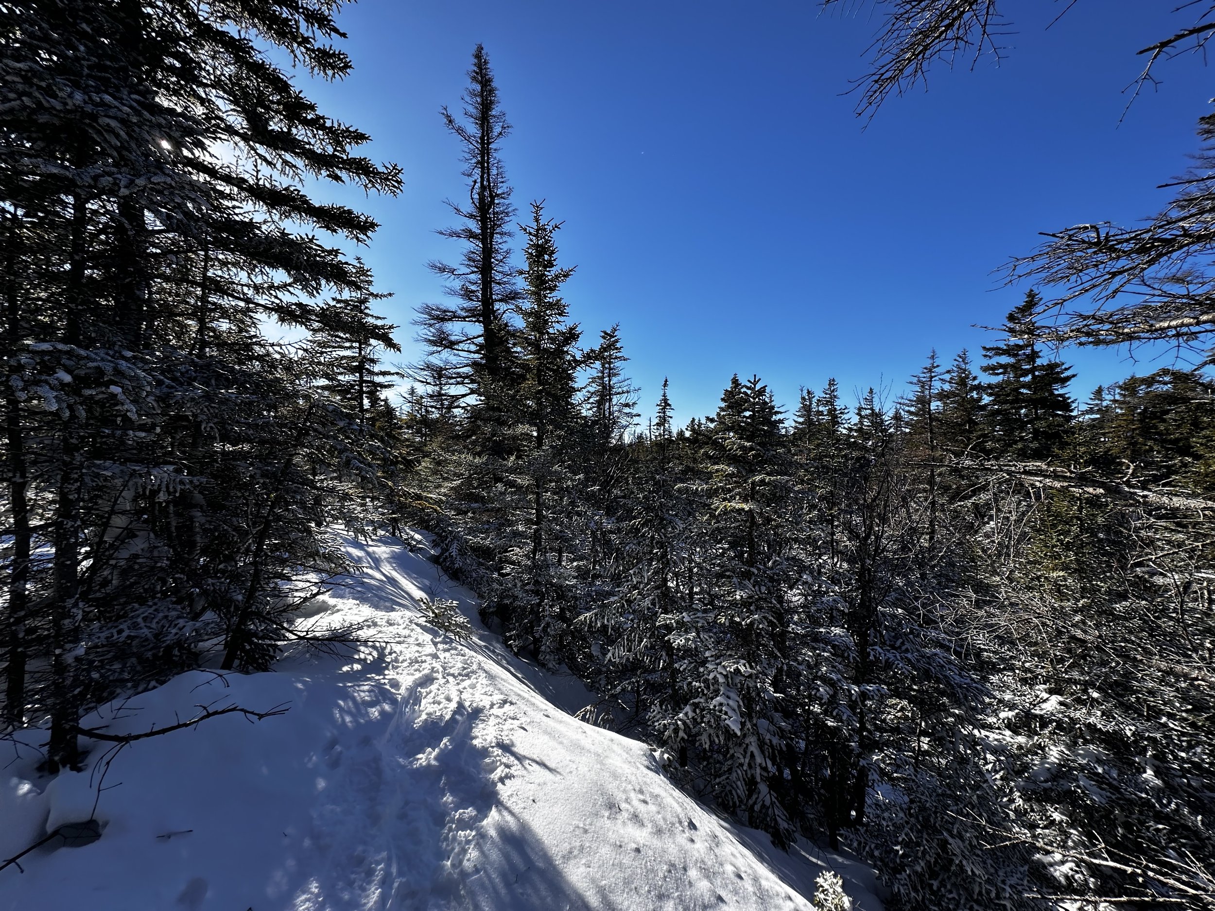
Ascending through open birch glades
Navigating along this stretch was managed without compass or any GPS devices as it was impossible to not observe a steadily rising hillside that must continuously be gained - at the sight of any incline leading toward the summit, I climbed in that direction. Through open glades, I swung around wide birch trunks, occasionally reaching ominously dark patches of forest comprised of bushy evergreen boughs. Into that patch of forest, I could make out a thick entanglement of spruce twigs and various younger coniferous growth that I wanted nothing to do with at that moment.
Navigating a narrow ledge enroute to the summit
At one point, it was obvious to discern the birch glade continuing along the eastern slope of the mountaintop area, seeing no easy way to continue ascending the mountain in open woods, I pulled a Gore-Tex hood up and prepared to shed any of the recent snowfall which had gathered in overhead boughs. Only a handful of brief, dense patches were sprinkled into the otherwise completely enjoyable ascent of Whitewall Mountain. As I continued climbing, now in a south/southeasterly direction, I grew further from the abrupt ledges of its western aspect and closer to the recognized summit toward the east of the summit cone.

Summit views: North Twin on right
Before long, stunning views began to appear as the summit ridge tapered; the slide-streaked face of North Twin was obvious to locate, South Twin was merely a sliver of white poking above the long mountain mass of Zeacliff, along which the Twinway can be found; the bald, wind-scraped shoulders of the Bonds were visible as part of a wide panorama, while Mount Carrigain was framed elegantly by frosted conifers. To the climbers left (eastward), the slide-streaked, precipitously steep slope of Mount Willey was framed equally as beautifully.
The final stroll to the 3,405’ mountaintop of Whitewall Mountain was absolutely marvelous; aside from the occasional propeller plane cruising overhead, the only distractions from absorbing my stunning surroundings was a steady wind overhead - except for the ultimate high point of the mountain, I remained well sheltered from the arctic gusts (windchill was somewhere around -11° this morning).

Gazing toward Zeacliff + South Twin (rear, right of center)
Thankful for an overall rock-solid snowpack, I could discern the tops of young balsam or spruce, which would likely be working to snag a snowshoe, had the snowpack been any softer, or unsupportive. Along several narrow bands of what appeared to be exposed rock, now covered in a hefty, crusty snowpack, I meandered around scrappy conifers, giving them a solid berth as I preferred to return home with weather-proof layers intact.
At several instances along the final approach, it would be easy to confuse the high point of the broad summit, but with any semblance of care, it is not too difficult to observe and follow a slight rise in the mountainous terrain. Expansive views in about six directions welcomed me to the highest point of Whitewall Mountain; I located the PVC canister fairly easily. Initially, I was going to forego logging my ascent into the register notebooks, due to strong gusting winds - I did not want to remove gloves and risk losing precious finger dexterity. Reluctantly, I signed in while creating a small, sheltered area with my body to do the writing, before wrapping the notebook back up and returning the care package back to its container for the next mountain climber.
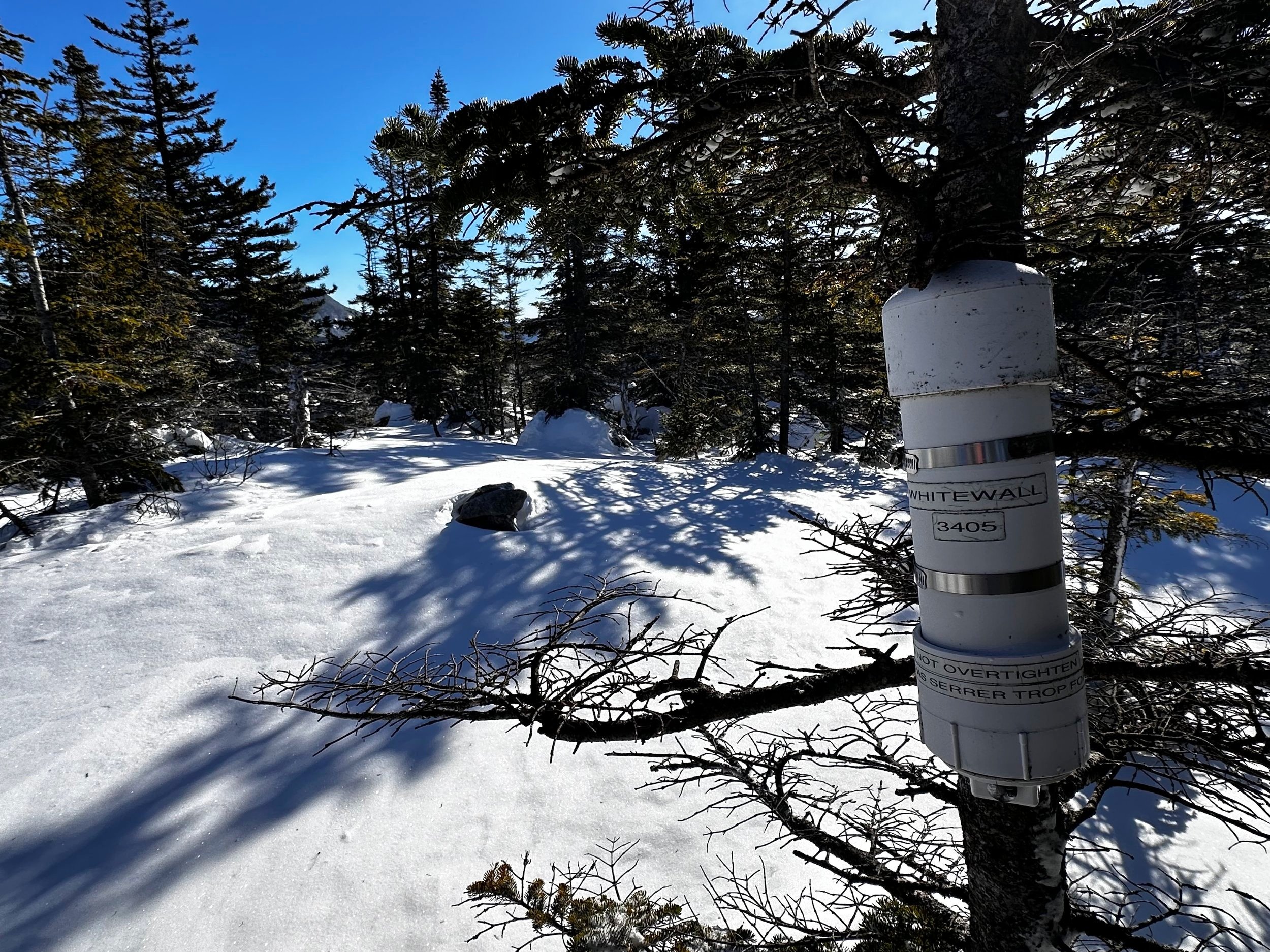
Summit of Whitewall Mountain
The full-sun overhead worked to negate the chilling effects of the strong winds, once sheltered I could let the glorious rays instill life back to my ice-crusted face, this was one beautiful summit that I just did not want to depart from. Eventually, though, I had to turn to follow my ascending foot steps back to the birch glades. With all navigational work essentially complete, I could step back into a meditative state within my mind, simply following my uphill snowshoe tracks back out to the snowmobile corridor.
Not wanting the birch glade stroll to end, I soon reached the 3,100’ boggy col, where I knew I would ditch the wacky route which partially ascended the shoulder of West Field, I wanted to follow a short-sweet path, directly through the forest to snomo trail. Picking a route by meandering left and right, through a grove of thick conifer trunks, I soon found a mess of bewilderingly thick balsam boughs as I neared the open cut of old Forest Road.

Overall, most of the woods trekked were not too thick
After a brief struggle navigating around spruce traps, and dense, snow-laden evergreen boughs (which wanted nothing more than to poke at eyes), I found myself inhaling a deep breath of relief upon exiting the trailless forest and standing atop the hard-packed snowmobile track. Through bushy boughs, I wiggled and danced in a manner as to avoid knocking overhead snow onto myself, or down my back. This route led me through more sun-soaked forest, as straight and tidy as if the trees had been cultivated or planted.

Left the woods here to rejoin the snowmobile trail
Once on packed trail, the going was very smooth and efficient - aside from now ascending the mess which had become the A-Z trail back to the Tom-Field col. Alternating between off trail travel and ascending on the front points of the Tubbs snowshoes, I picked a route up the frozen trail while sharing my true opinions of the hikers who had created such an abomination out of an otherwise lovely trail segment.
Back at the Mt Tom-Avalon junction, the time was now 11AM when I met an older gentleman in mid-morning, full-sun who was eager to share that he had attempted to scale the Avalon Trail but was quickly forced to retreat as he carried no traction what-so-ever to contend with the smoothed over, butt-slid surface of the foot path. The hiker ended our brief encounter by asking if he thought summiting Mount Tom was any more likely - without spikes or snowshoes.

The #1 reason why I roam off trail
After informing the hiker that I was not sure what the conditions were on the Mount Tom Spur, we parted ways - leaving me in a befuddled mindspace for the remainder of the trek back to Crawford Notch - what the hell is going on in the White Mountains where hikers assume it is okay to enter the mountains in mid-February without appropriate gear? This goes well beyond any “hike your own hike” mantra, fully entering the realm of questionable hiker reasoning and safety.
What happened to the hikers with winter packs so big that I envied their sheer ability to even move with such a weight on their shoulders: mountaineering preparedness. It does not seem this mindset is found much in the mountains anymore (prove me wrong) - as if general preparedness had gone out the window. I’ll just continue to haul my big packs into the wilderness, knowing I have enough to establish a small community in the backwoods for several days.
Happy climbing!
Overall stats for the day:
10.01-miles
4hr 11 minutes
3,862’ elevation gain
Whitewall Mountain - 3,405’