
Butterfield Mountain
“If you don’t like the snow, check back tomorrow”, should be the common catchphrase, here, in the northeast. At least this proved to be the case while snowshoe bushwhacking several Vermont 3000-Footers recently. Yesterday, I found tolerable conditions at best: overall unsupportive snow above 2,300’, with a choppy ice crust covering sugary, loose snow. Today, while I could glance northward and view the broad summit ridge of Signal Mountain; however, if I shut my eyes and simply focus on the snow - it was a night and day difference.
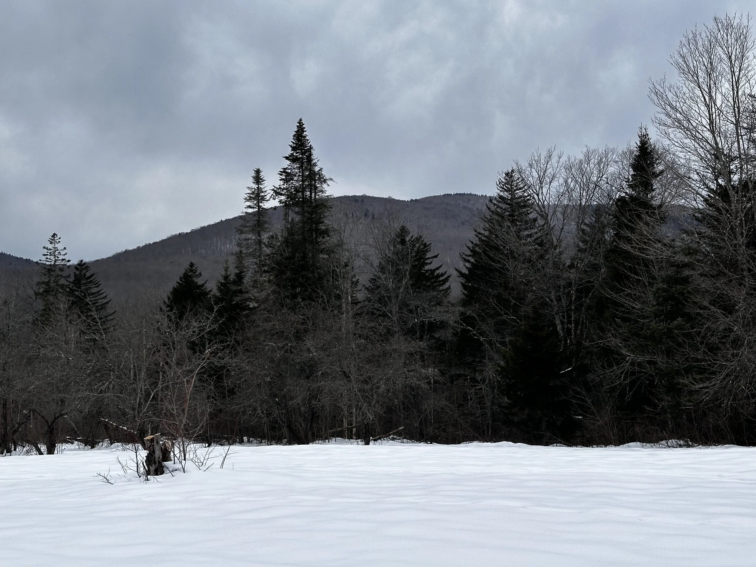
Butterfield Mountain, summit is nearing just right of center
Anyone who has read some other posts on here (two-day, heavy snow breaking to Mount Bemis) may observe how difficult I find setting incomplete projects aside; once begun there is a nagging within to see a task or idea to completion. Well, such was the case after summiting neighboring Signal Mountain yesterday. Warm, sunny skies made for adverse snow conditions, with chunks of ice dropping from the overhead canopy. At the time, I was content with my choice - but as the evening progressed, the open hardwood slopes of Butterfield Mountain lingered in my thoughts.
With a sliver of sub-freezing temperatures to begin the early hours of daylight, I was also intrigued to find the cloud ceiling forecasted to reside at 15,000’ - that is certainly high enough to catch some views, but also to protect my fragile snowpack from melting underfoot. Departing slightly later than preferred, I dragged gear back to the Subaru as the underside of clouds were aglow with orange and pink - as if the eastern skies were burning bright.

Continued on Corridor 302 (left branch) toward Butterfield Mtn
Back at the V.A.S.T. snowmobile parking lot on US Route 302, I was alone again this morning as I readied boots, snowshoes, and other winter gear. Once barreling down the snowmobile corridor on foot, it was obvious that yesterday’s full sun had taken a toll on the groomed surface - today, I trekked atop dirty, refrozen slush - basically ice, early along Corridor 302.

Continued upslope on Corridor 302C
Reaching the first junction at 0.4-miles, I kept straight this time, as yesterday I had veered right here, toward Signal Mountain. During most of the initial hike of groomed snomo trail, I could peer ahead: above the nearby canopy the double-hump of Butterfield Mountain was framed exquisitely. What appeared as a sub-peak of Butterfield is really just a brief reprieve in the steep ridgecrest, then the terrain picks back up to obtain the high elevation glades of the mountain.
At 0.8-miles, I took a right to follow Corridor 302C, which formed a 3.3-mile loop through the stunning open hardwood forest; several bridged tributaries trickle beneath the snowy roadway, as well as several brushy tarns to adore - this is a side of Groton State Forest which I had hitherto not known to exist, at least not for the public to freely roam. During certain times of the year, the State Forest is open to hunting; if planning a visit, be sure to check the schedule and wear bright colors.

A solid snowpack welcomed me off trail
Once I had reached a point at about 1,930’, I found evidence of an old logging or skidder road veering northwardly into the forest; a stunning, snow-blanketed, old corridor which now had a set of ski tracks. Assuming I would find no place better to enter the woods ahead, the hardwood forest leading up the SE ridge of my objective was as open a forest as I had ever found - clear sailing far up the mountain slope!
It seems most prior bushwhackers begin their trailless ascent from the north/northeast, after descending off Signal Mountain - well, I thought about that, or even to ascend from that direction and then descend the southeast ridge; at least with the latter option, I could see more of this stunning, open hardwood shoulder.
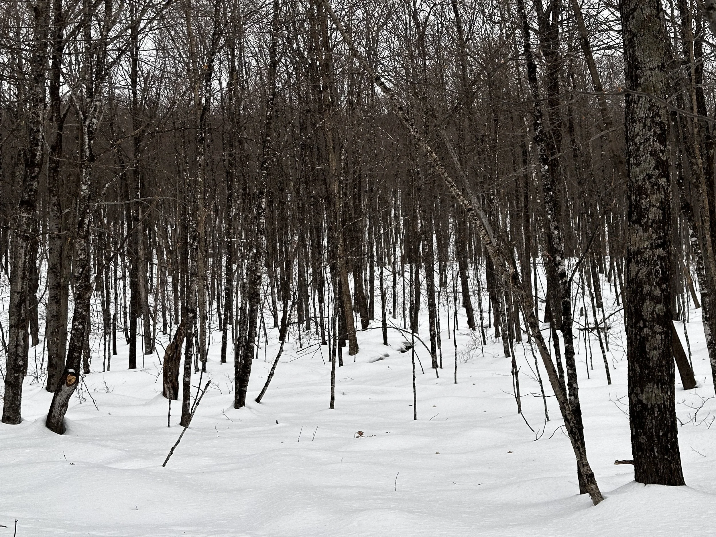
Overall easy travel through the woods
The woods in this section of Groton State Forest are simply littered with old skidder roads, or perhaps ATV trails - none of them currently being utilized in winter; their wide swaths devoid of any mature trees are typically readily discernable to the trained eye. Occasionally, I followed the upslope ski tracks, but overall I found better snow by blazing my own trail adjacent - it seemed we were both headed to the same destination. Aside from several patches of hardly dense hobblebush and young beech growth, the woods remained completely open, never needing to brush a branch aside even once while enroute to this 3,167’ high place.

Patches of softwood dot the shoulder - open hardwoods beyond!
With a net gain of 1000’-per-mile between my current location and the summit, instantaneously, I could appreciate the completely different snow quality from the trash I had been snowshoeing through the day prior (zero floatation); what I found underfoot hardly cracked half an inch beneath the crampon spikes of the Flex Alp snowshoes. Happy to have brought trekking poles today, I leaned onto front points to scale the rock-solid snowpack, perhaps this was the result of yesterday’s freeze-thaw cycle; without becoming too excited, too early, I knew I favored what I found, and wished hard for it to persist upslope.
On one hand alone, I think I could count the few instances where a snowshoe hit a soft drainage gully, or air pocket surrounding a toppled tree - if Signal Mountain was a bushwhacker’s paradise, I had now found myself deep within a beautiful, bushwhacker’s dream. While rhythmically laying snowshoe tracks on the hardpacked mountainside, I could glance back over either shoulder, toward the east, and see lights from nearby towns beginning to twinkle to life.

A surprise view of Franconia Ridge from 3,080’
After some time of slowly picking a steep route up the southeastern ridge, I landed atop a plateau area; to the south, I could spot the start of intimidatingly dense coniferous growth. Opting to press my path into more open woods, I could not believe my luck as I passed by a small band of evergreen (which, I fit beneath - still no struggle with the forest), and emerged on the northern side - with a hillside of even more well-spaced hardwoods; by now, the surrounding woods were primarily beech, birch, maple, with a few scrappy hobblebush branches poking through the snowpack.
As the summit grew near, I traipsed into a wildly open glade area with lots of moose-chewed understory vegetation; any trees grew in the most bizarre formations from being exposed at such an elevation to any ferocious winter winds. Glancing yet again over either shoulder rewarded the hiker with a gorgeous view of Franconia Ridge in its winter finest. Even the glades on Signal Mountain were beautiful to feast upon from here, and recall the pleasant strolling through those woods just yesterday - even though the snowpack was subjectively sub-par.

Signal Mountain with snowy, birch glades
Now, ascending the open-air glade, I found the snowpack here to be nearly as hard as solid water ice, likely a combination of all the ice dumping out of the overhead boughs, as well as the past week of freeze-thaw cycles; snowshoes were floating right atop the crust, and I had no complaints. Throughout the final ascent, I meandered along with the mountain skier around stunted patches of moose food; before long, deep moose prints were found in the crusty snow - they must have had a tough time. I noticed a few tracks terminate at a point where the moose was easily (their knee) knee deep, just to start off another direction - evidently, I was not the only creature out searching for better snow lately!

A trio of summit registers atop Butterfield Mtn
It was interesting checking aerial imagery during the planning of this off trail ramble, the soft-hardwood delineation being highly visible on Butterfield Mountain - this coniferous cap occupies just the uppermost height of summit, when approached from the east. If approaching this peak from the west, expect softwoods for much more of the climb, with perhaps some ledgy steepness adorning the south/southwest face of this mountain - at about 2,800’; not dissimilar to those found on Signal Mountain. Glacial plucking in action - which was also evidenced by snowy, pillow-topped boulders found deposited along the southeastern base of the broad mountain range.

Moose bed (and obviously tracks) directly beneath the registers
Finally, entering the conifer cap, picking a route toward the highest point of the mountain was hardly difficult - the summit is somewhat broad at the peak, but if one simply continues to walk uphill, the trio of summit registers is certain to be found. Beneath the high point marker, moose had made a formidable bed directly beneath. All seemed quiet up there this morning, but those tracks were alarmingly fresh - without any sign of freeze-thaw cycles rounding over the edges of any hoof prints. Needless to say, I introduced myself loudly to any other creatures occupying the summitland; even signing into the Tostitos salsa jar register as this book had a last entry of November 2023.

A great place to roam in winter
Returning all contents to the glass jar, a small, red Nalgene bottle was also hanging (similar to what was found atop Signal Mountain) from the massive fir tree - but also, a jar of “pot”; with a hand rolled joint contained in the jar - which was probably just oregano rolled up to play a joke on someone looking for a quick high.
After roaming the summit area for a bit, searching for secret windows of lookout, I turned east to follow my ascending tracks back downslope. It is hard to believe I was thinking of deferring this bushwhack until the next snowstorm. Given the conditions yesterday - what a complete switch from the atrocious snowshoe postholing I had been performing on Signal Mountain. With trekking poles for balance, today’s descent was basically a game of glissading on snowshoe tails until reaching the groomed snowmobile roads once again.

White-capped Washington just left of center, Franconia also rising tall
Turning to glance down the snomo corridor, I continued straight ahead; into more open hardwoods, primarily thin beech regrowing in, akin to the far southern slope of Mount Hitchcock of the White Mountains - evidence of past, massive logging operations in the vicinity. Any minor drainage gullies were crossed rather easily, thanks to the rock-solid crust atop the snowpack. With no need for trail, I bounced down a series of pillow-topped rocks while enroute to a larger drainage gully, as if ripping down a set of moguls (I have never skied, so I will simply imagine the sensation is similar).
On the wide roadbed walk out, I stopped to admire Waits River briefly, then poked around several other old clearing areas - here, I found a great look back toward my objective from this morning. Many old cellar holes can be found dotting the roadside; generally, I have found apple trees adjacent to these old homestead sites - looks like a warm weather ramble is in store for this part of Groton State Forest!
Overall stats for the day:
4.73-miles
2hr 10 minutes
1,696’ elevation gain
Butterfield Mountain - 3,167’

Ya don’t find that on a summit often, leave it to VT