
Fort Mountain
Located 324-miles away, or at the end of a cool 6-hour 42-minute drive, Fort Mountain remained an unclimbed peak in a remote, northern stretch of Maine wilderness that I’d ponder over for several years. Back in 2019, when I summited several other high places of Baxter State Park, I had yet to really begin keeping track of any New England Hundred Highest peaks - that is, until finishing the NE67 and NE115 list of 4000-footers.
Aimed to promote backwoods travel to new places without trail, this list of 100 mountains contains the familiar NE67 peaks as well as 33 others - 13 of which feature either no trail or faint herd paths to follow.

Marston Trailhead
Fort Mountain falls into the latter category; described in many early editions of the AMC Maine Mountain Guide as a, “rough, unmarked, and obliterated in sections by blown-down trees”, the description still holds true; however, the blowdown has been replaced with ultra-dense, young, balsam fir boughs which requires the bushwhacker to “swim” through, pushing their way through the scrappy, wind-stiffened, needle-covered branches.

Crossing Slide Brook along the Marston Trail
With the notion of visiting Baxter State Park ruminating throughout the household, I worked to clean up my tally of remaining peaks on the AMC Northeast Hundred Highest list. First, I knocked out the Rangeley six-pack of peaks during a pleasant overnight stay in the back of my Subaru, followed by a solo trek to ascend Elephant Mountain, where I met and shared the trailless mountainside with several brilliant hikers. This ecstatic push to summit remote peaks of Maine left me with one peak remaining - the most distant of the bunch - Fort Mountain.
Beginning a gradual ascent away from the Baxter State Park Tote Road, I departed the Marston Trailhead at 6:30am with the soft crunch of freshly fallen foliage underfoot. To my delight, many hardwood leaves were already changing, illuminating the understory with a brilliant yellow-orange hue while leaves back home in western New Hampshire had yet to begin its autumnal transformation.

Mt Coe Trail junction
Passing over Slide Brook, the blue blazed pathway is a glorious trail - a minor trench of dirt foot path meanders gently through the mixed understory; brilliant flecks of yellow, orange, and red contrast beautifully as leaves tumble and finally come to a rest, nestled in a network of fir and spruce boughs - autumn in Maine should never be missed!
Following a 925’ climb, a junction is reached at 1.2-miles which leads to Mount Coe by veering right, onto the aptly named Mount Coe Trail; today’s destination would be found by taking a left at this junction and continuing along the Marston Trail. Now officially trekking the 1987 re-route, this newer stretch of trail reaches the North-South Brother col instead of beelining up to the summit of South Brother by way of rugged rock slide.

Teardrop Pond from the Marston Trail
After traversing the western shore of Teardrop Pond, the trail crosses its’ outlet and begins a rugged and steep ascent up exposed rock slabs, boulders, and several short sections of rock staircases. Leading up to the North-South Brother col, the Marston Trail begins trekking atop seemingly endless stretches of wooden boardwalk as the surrounding mountainside grows soggy and rich with spongy, green moss and fallen plant debris.

Approaching North Brother
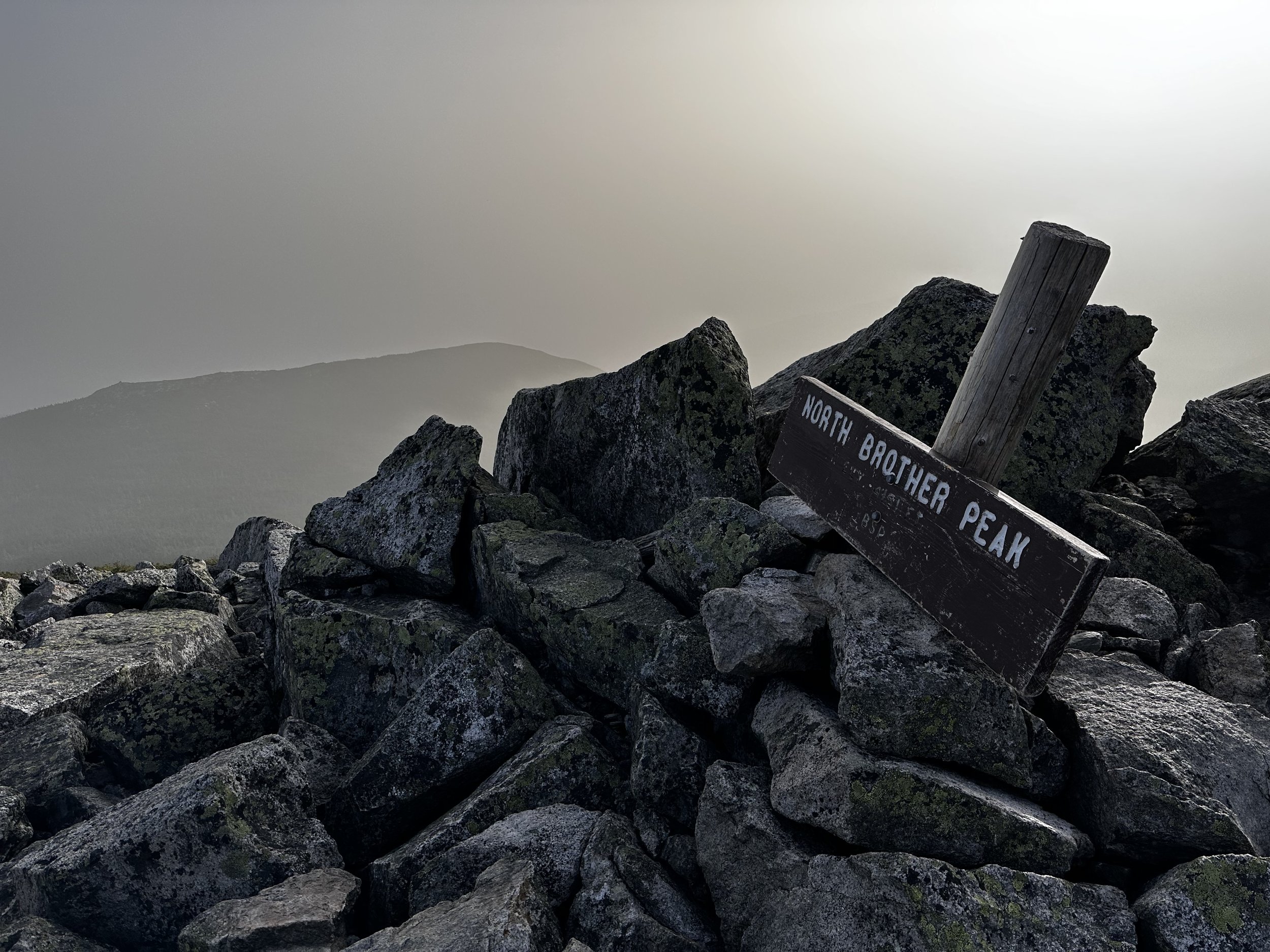
North Brother comes in and out of view after passing through the final junction, several sandy, wet patches direct hikers toward the next steady incline. Gaining just over 700’ to reach the high point of North Brother, the pathway soon grows impressively steep and rugged as it passes atop loose, mossy slabs and boulders. Before long, tree line comes into view and the final ascent is made atop a fine earthen footway as the surrounding mountaintop transitions to boulder field - reminiscent of trails found in the Presidential Range of the White Mountains.
From the summit of North Brother, the 0.5-mile long ridge crest of Fort Mountain comes into the northeasterly vista; just behind, South Brother and Coe can be found. Often times, Katahdin and its surrounding peaks can be located southeastwardly; today, any peak beyond several miles remained hidden in a blanket of wildfire smoke.
North Brother summit with Fort Mountain beyond
Once searching for a pathway in the direction of Fort Mountain, it, along with several short rock cairns can be located leading off the summit of North Brother. Initially swinging due north from the summit of North Brother, the herd path begins winding northeasterly, down the mountainside; several older paths can be found diverging while the primary route is relatively easy to navigate. Only several short sections have become encroached upon by scrappy trailside conifers - here, the footpath is plain to see, once the brushy conifer boughs are pushed aside.

Pleasant herd path to Fort Mountain
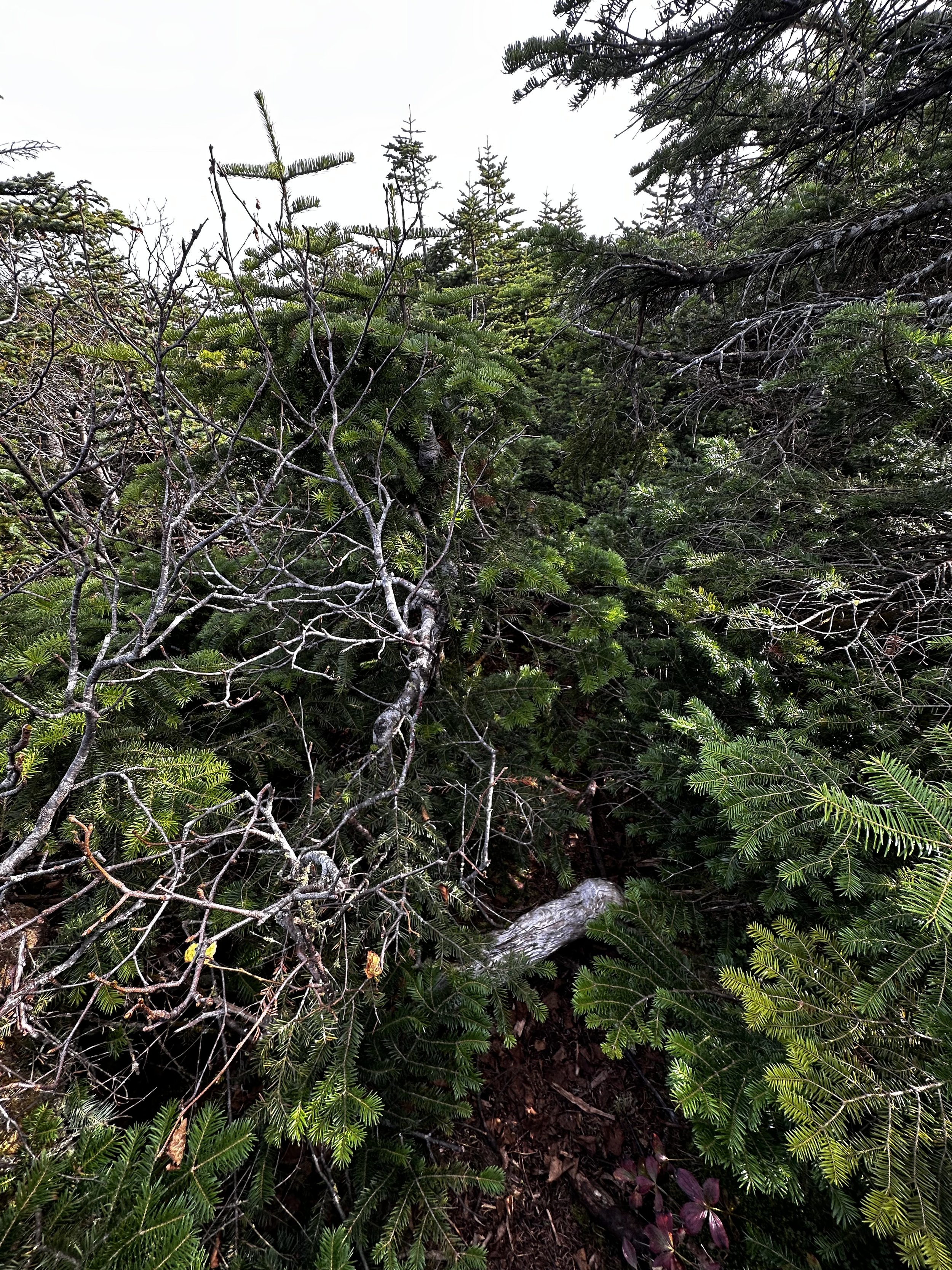
Back in the tree line, distance is seemingly covered rather rapidly; reaching the high saddle between North Brother and Fort Mountain, the pathway I found was simply a treat, an easy to follow pathway just narrow enough to accommodate hiking through in single file. A brief section of blowdown (perhaps the “blown-down trees” referenced in the old guide books) is reached but has been either rerouted or debris moved just enough to allow passage.
The Fort Mountain herd path slices through a lovely section of spruce forest, which would no doubt be a tough ‘whack if not for the discernable stretch of pathway from North Brother. In prior editions of the AMC Maine Mountain Guide, mention had been made of a second route up the mountain from the north, beginning near Russell Pond and Annis Brook, although I am completely unsure of its state today.
Overgrown herd path to Fort Mountain
The 3,867’ ridge crest of Fort Mountain approaches quickly as the narrow path emerges from dense forest pockets to open islands of rock and boulder. Standing atop any of these fine lookouts, North Brother appears eons away, as do many of the surrounding peaks as one stands in a sea of scrappy, wind-bent conifers. Rock cairns occasionally denote the path as it continues up the mountainside. Care must be taken as several deep crevasses are passed, necessitating a quick step over; exposed roots, rocks and moss dangle into the void as one searches for solid footing on the far side.

Eastwardly along the ridgecrest of Fort Mountain
A large rock cairn marks the furthest westerly hump, while a narrow footpath meanders around lichen and sub-alpine vegetation. The ridge appears to be much higher as one peers down the mountaintop toward the east, but sources all report that the high point of Fort Mountain can be found at a subsequent rock cairn which has the addition of an old radio receiver.
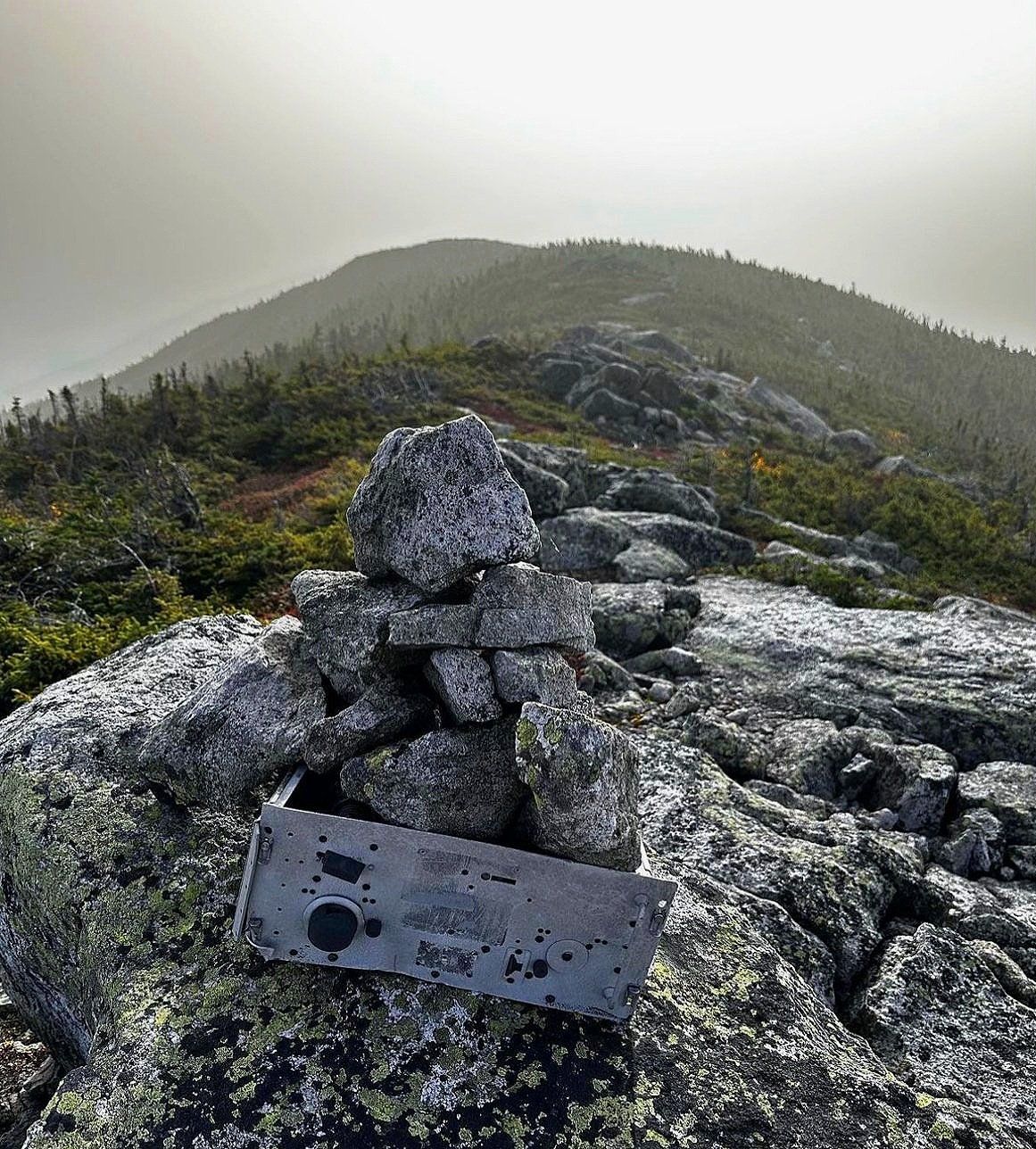
Fort Mountain high point atop the southwest summit
In all of my route-finding research, I had neglected to note that this is one of the trailless peaks to not offer a PVC summit canister at its peak - signing in for my final Hundred Highest peak would have made for a wonderful finish; but as the Canadian wildfire smoke hung low on the mountains this morning, I poked around, bade the beautiful mountain crest a peaceful goodbye and began retracing my steps and passing familiar cairns as I once again slipped into the blanket of conifers.
The route was even easier to follow on the return trek as I had made mental notes of blocked off spur paths and routes which did not interest me. Before long, I crested at the low of the col and began to climb, a low grade initially, which never became steep per se, but offered a heart-pumping incline, stepping back up minor ledges and small boulders before reaching the exposed summit of North Brother.

Looking back to North Brother from Fort Mountain
The remaining miles trekking back downslope, along the Marston Trail, I watched leaves drift lazily from high in the canopy, hitting branches on the way down like a pinball machine, until coming to a rest on the lush, green forest floor. I thought of the prior 99-peaks; the adventures embarked upon; the folks and friends met along the way; the many seasons visited; the snacks devoured; the beautiful herd paths; the wildlife encountered whom all (thankfully) allowed me to continue on my mountain climbing endeavors - what a journey the New England Hundred Highest had been - Fort Mountain was a delightful spot for a finish.
Overall stats for the day:
9.93-miles
4hr 52 minutes
4,010’ elevation gain
North Brother - 4,151’
Fort Mountain (Southwest Peak) - 3,867’
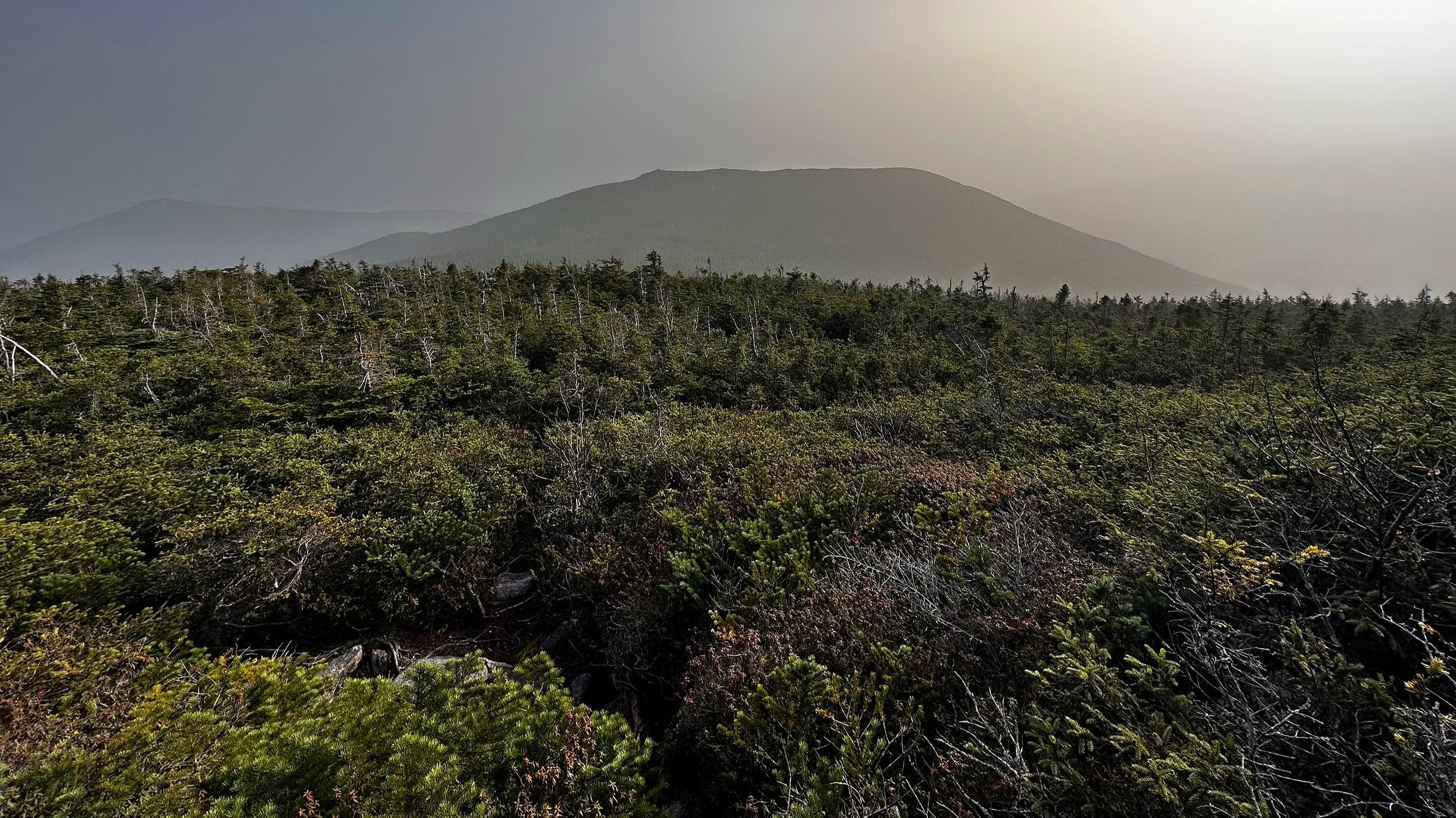
Smokey glimpse of Fort Mountain from North Brother