
White Cap, Kennebago Divide + Boundary Peaks
For several years I had studied topographic maps of a certain remote tract of land which can be found just north of Rangeley, Maine. Summiting and checking off peaks for the New England Hundred Highest list was made easier and more efficient by remaining close to home, eagerly visiting the trailless peaks of New Hampshire, while these six bumps in Maine lingered, unclimbed. Despite countless hours of route planning and difficult logistics worked out, these six-peaks of Maine would remain on the backburner for several years.

Trekking Porter Brook Road in search of bushwhack
Finally, all elements which are needed for a successful, long-trek into the backcountry were beginning to stack up; a multi-day weather window appeared just as reprieve from other daily tasks presented itself. With gear and food stowed for a two-day trek to Maine, I left home in the western White Mountains, amidst the dark of night, for a 3+ hour commute to Rangeley, Maine, to embark into the (mostly) unknown.
Turning off a beloved asphalt roadway, I began down an unfamiliar, remote network of dirt and gravel logging and tote roads. Atop the rough forest access roads, I would find myself for the coming forty nerve-wracking miles as I traversed the dirt and gravel road, which was showing its age with dips and potholes of varying degrees. Occasionally, jagged boulders emerged from the old logging roadway as I tried to direct my oil pan over the lowest, and most forgiving surface.
Bushwhacking up White Cap Mtn
After an hour of navigating the logging road network, Porter Brook Road was around the next corner; beginning rather roughly, beyond a small bridged brook crossing, the road eventually mellows into a smooth surface as it crests a small rise. Finding a fine parking area about 1.5-miles from the end of Porter Brook Road, I stashed the Subaru before getting further along a forest road of unknown integrity. In hindsight, a similar sedan could have easily navigated further toward the terminal end of Porter Brook Road and even would have been gifted several instances to pull over and park. The road receives no thru-traffic.
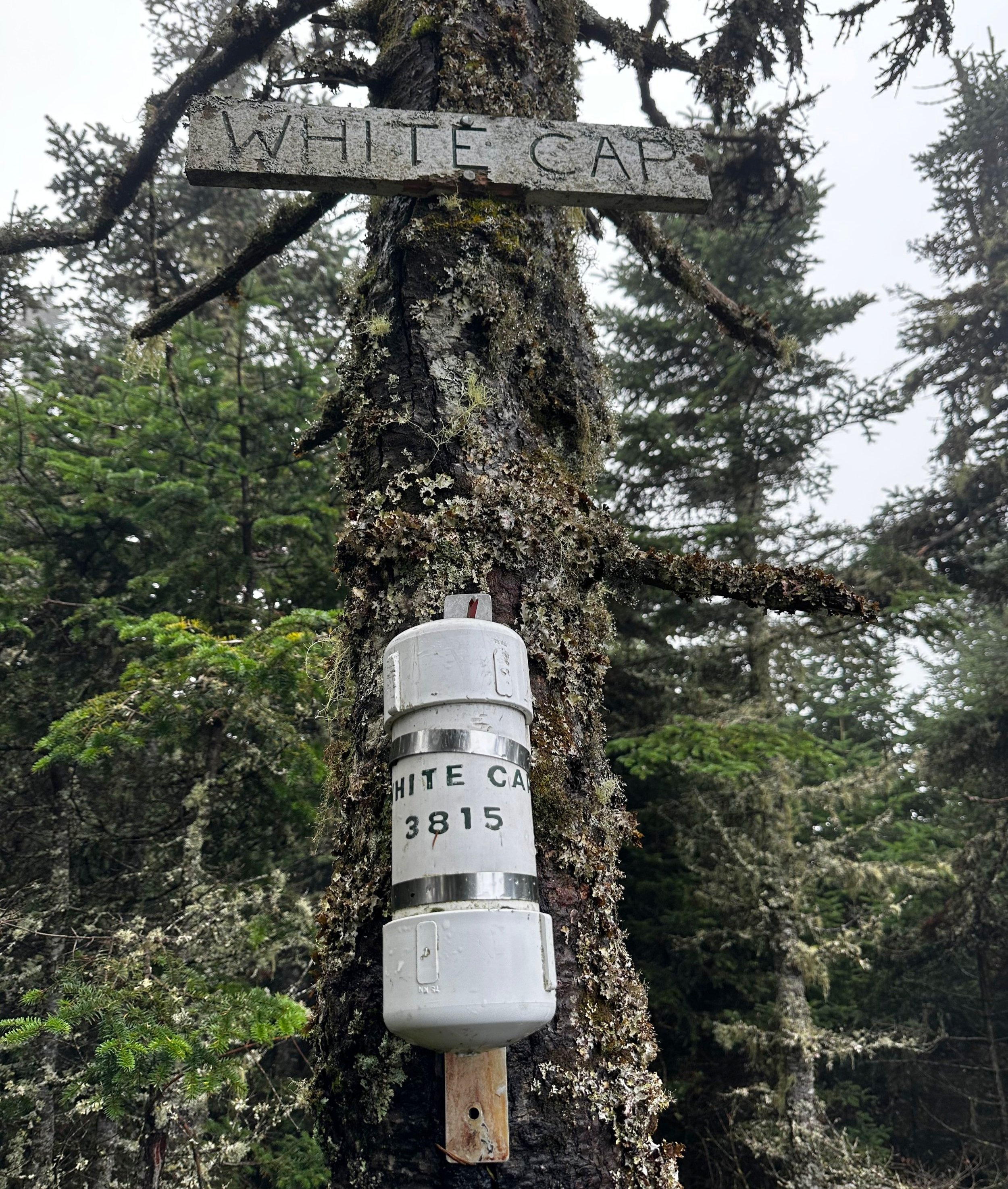
Summit of White Cap Mountain
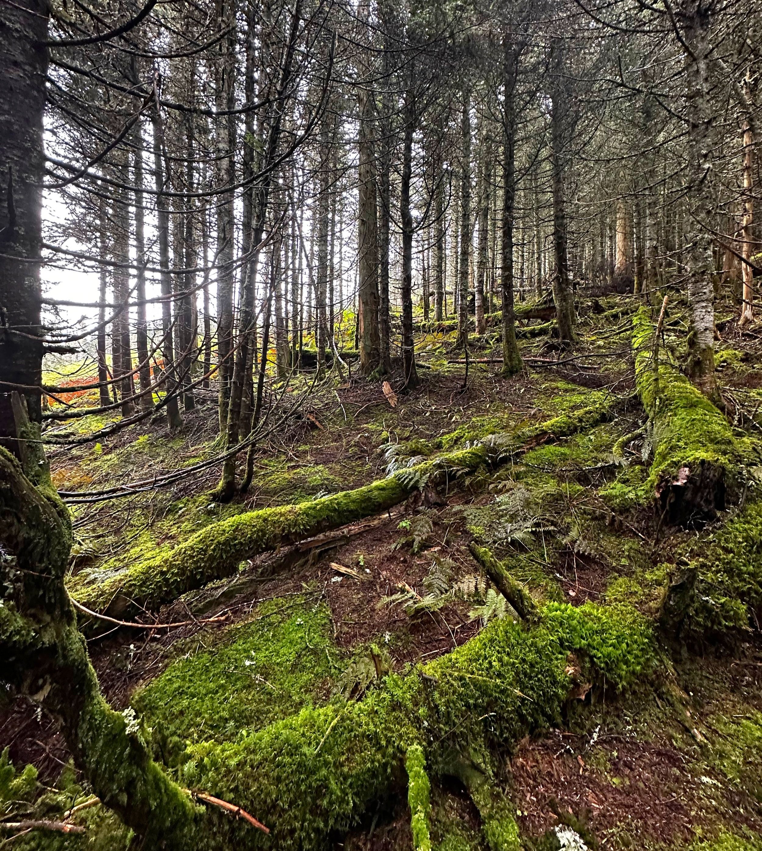
Logging slash and old clear cuts line the remaining portion of Porter Brook Road before terminating at a brushy landing. Throughout the remaining trek along the old logging road, the forested mound of Kennebago Divide can be seen just up ahead, dominating a narrow vista down the walkway, framed by evergreens. Porter Brook Road can easily be followed as it enters the forest, but will be found intensely overgrown in many places. As the sound of trickling water grows near, I exited the encroachingly narrow herd path and entered a very agreeable, open forest with spongy, lush moss blanketing the forest floor.
Descending White Cap enroute to Kennebago Divide
Initially, bushwhacking due east, I soon began following the southern boundary of an older clear cut along the mountainside. Attempting to follow the contour of the domed ridgeline, the summit’s direction is nearly unmistakable but becomes even more obvious as various herd paths begin to merge, forming more pronounced paths along the slope. Between the moss blanket and decomposing tree layer, footing is very soft and cushioned while ascending; occasionally, one becomes enveloped by twiggy, young fir and must push a few low-hanging branches aside to continue the upslope progress.
In a eastward direction, I encountered small sheets of thick, blue foam board (a crude shelter of sorts?) near the summit area, beyond which an obvious herd path was found with the White Cap Mountain summit canister hanging just above eye-level several rods further. From the summit of White Cap, the old path, which can be found labelled “Bear Brook Road” on some maps, is easily traceable through a sea of ferns and low hobblebush. Footing is affably solid while descending, however, soon the path emerges onto a 4-5’ wide cut through the forest which traverses atop a narrow drainage of swiftly flowing run off.
Ascending Kennebago Divide
Swinging overall southwardly to drop off the summit ridge, the old path soon proceeds eastward as it drops out of the mountains. Here, I began a bushwhack to cut directly southward, to pick up the other branch of southbound trail. On the trek to Kennebago Divide, I managed to pick up a random old herd path which veered too far west/southwestwardly for my taste, at which point I left that path to bushwhack with the intention of intersecting the southern branch, which would thenceforth guide toward the second peak of the day - North Kennebago, or Kennebago Divide, depending on the source.
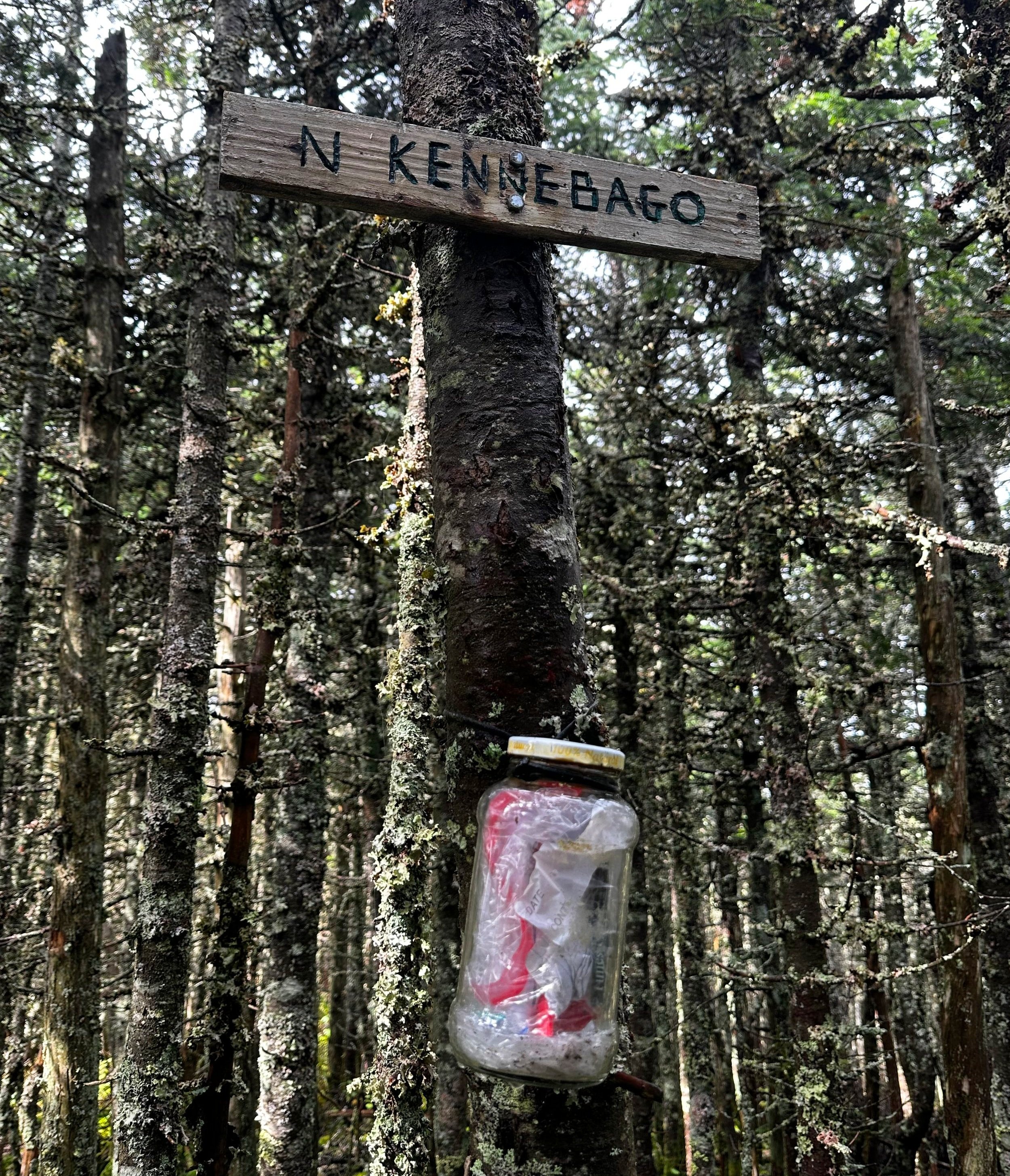
Summit of North Kennebago, or Kennebago Divide
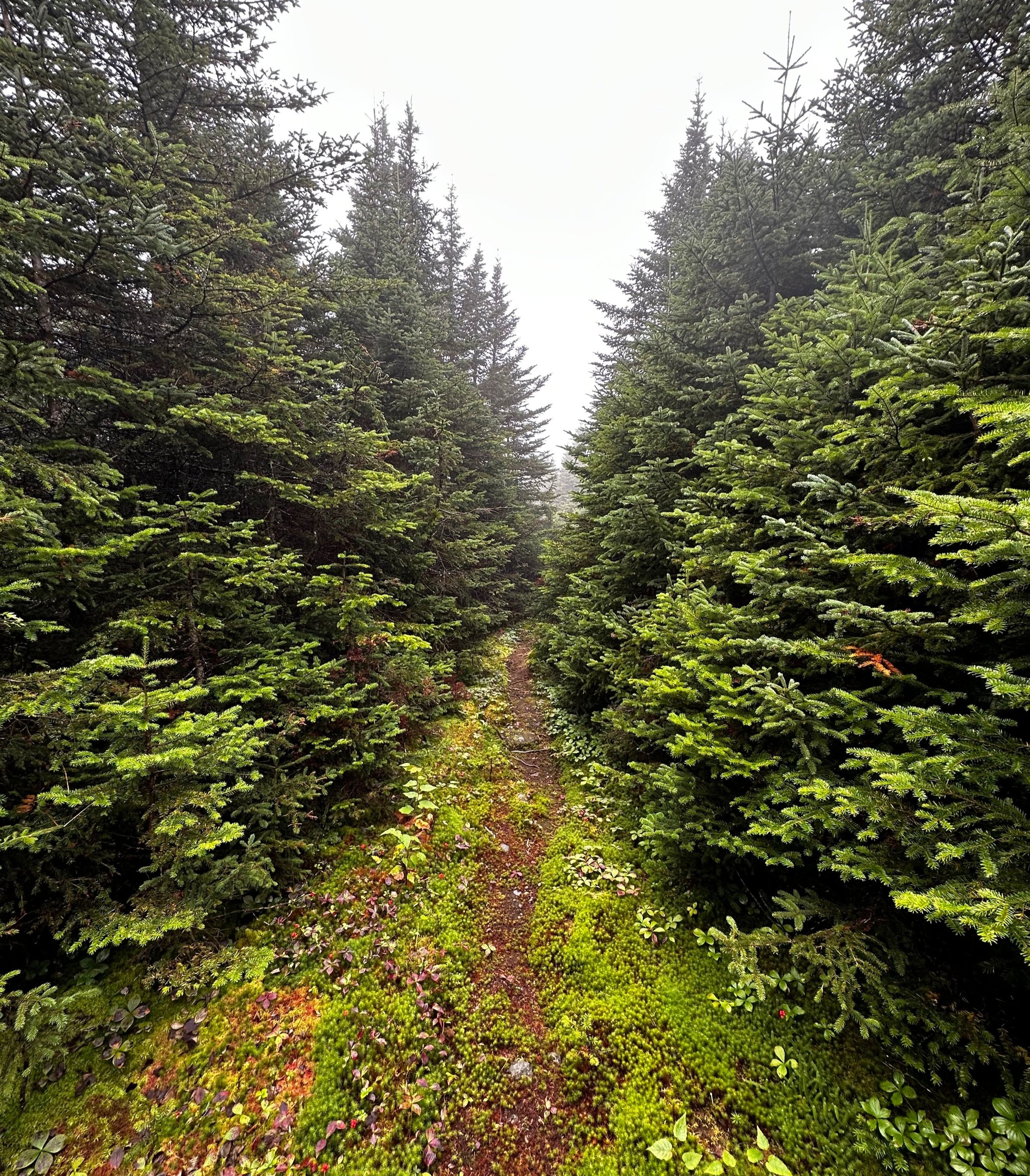
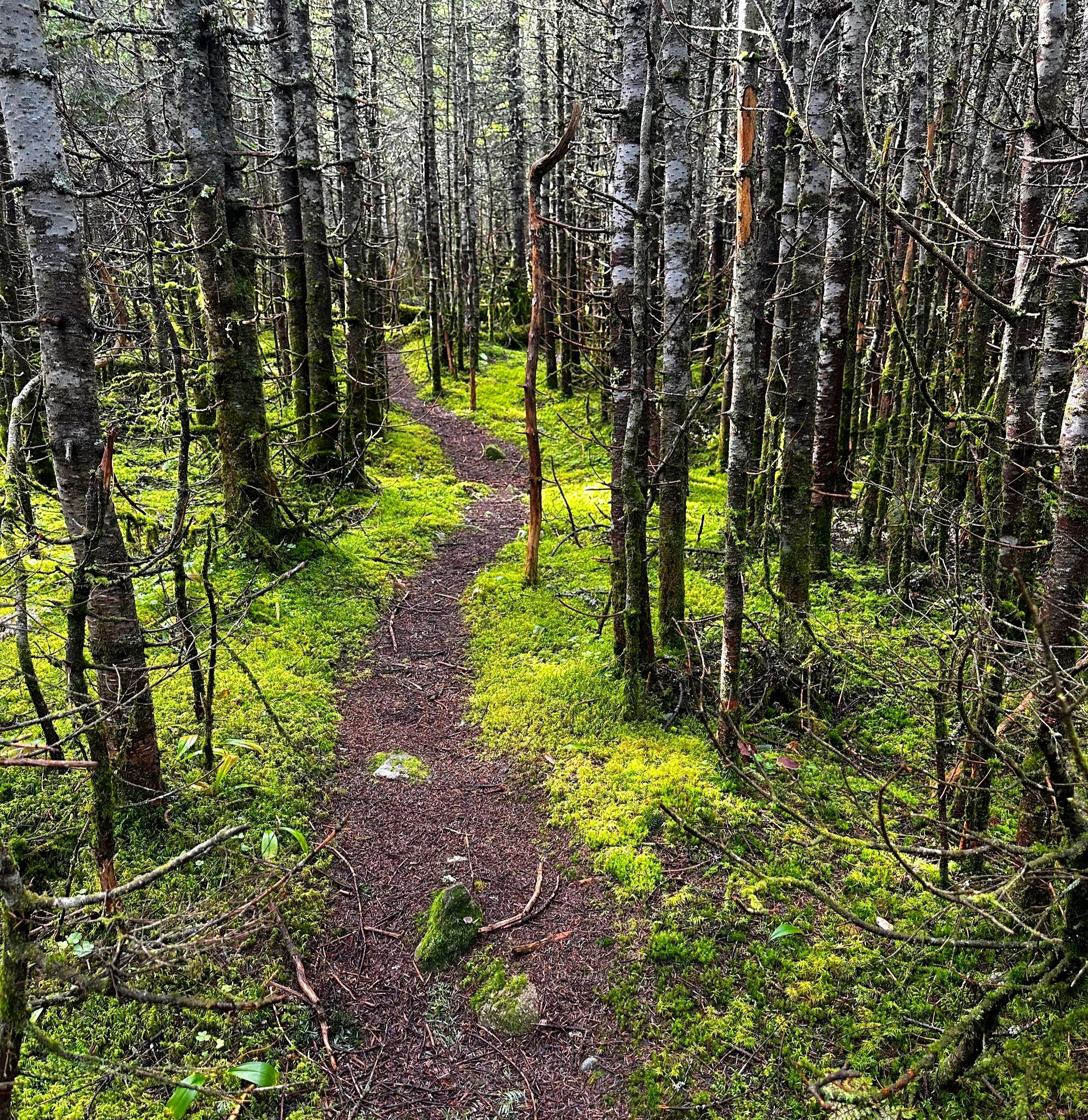
The path remains narrow but highly discernable as it meanders through the lush forest, beginning to ascend once again and passing over several fallen logs and small patches of localized blowdown. Trekking atop one of the finest, most picturesque stretches of moss-lined footpath I had ever encountered. Eventually, the grade tapers and the small summit area is reached. After a quick break to sign into the summit register log book and send a note back home to advise of progress, the phone went back into airplane-mode and I retraced steps back to White Cap Mountain.

Looking back to White Cap from Monument 450 Peak
As the morning mist was beginning to rise, a stunning blue sky was displayed and outer layers of clothing began to dry from a soaking earlier while trekking through the dense understory. Back up and over White Cap Mountain, initially following my ascending steps until reaching a point near 3,250’, I then diverged as to follow the contour of the land as it thence connects to the eastern ridge of Monument 450 Peak.
Employing a network of moose and herd paths, I crossed a low, boggy area and soon began a gradual ascent, aiming with a more westwardly trajectory as to avoid unnecessarily summiting a small sub-peak off Monument 450. Appearing as to be following in the footsteps of others, the path soon departed the shaded forest and entered a patch of dense berry bushes, whose brambles worked to prevent forward progress of any kind.

Summit of Monument 450 Peak
Working my way, I high stepped over and through the thorned bushes to top out at a small PVC canister marking the high point of Monument 450 Peak. From this 3,530’ mountaintop, the US/Canada border cut can then be located and followed. For nearly 2.5-miles, the route follows the international border between Maine and Quebec, atop a rugged, rolling and often rough footpath, which also sees ATV traffic in sections nearing the elevated hunting blinds.

Views from the international border swath
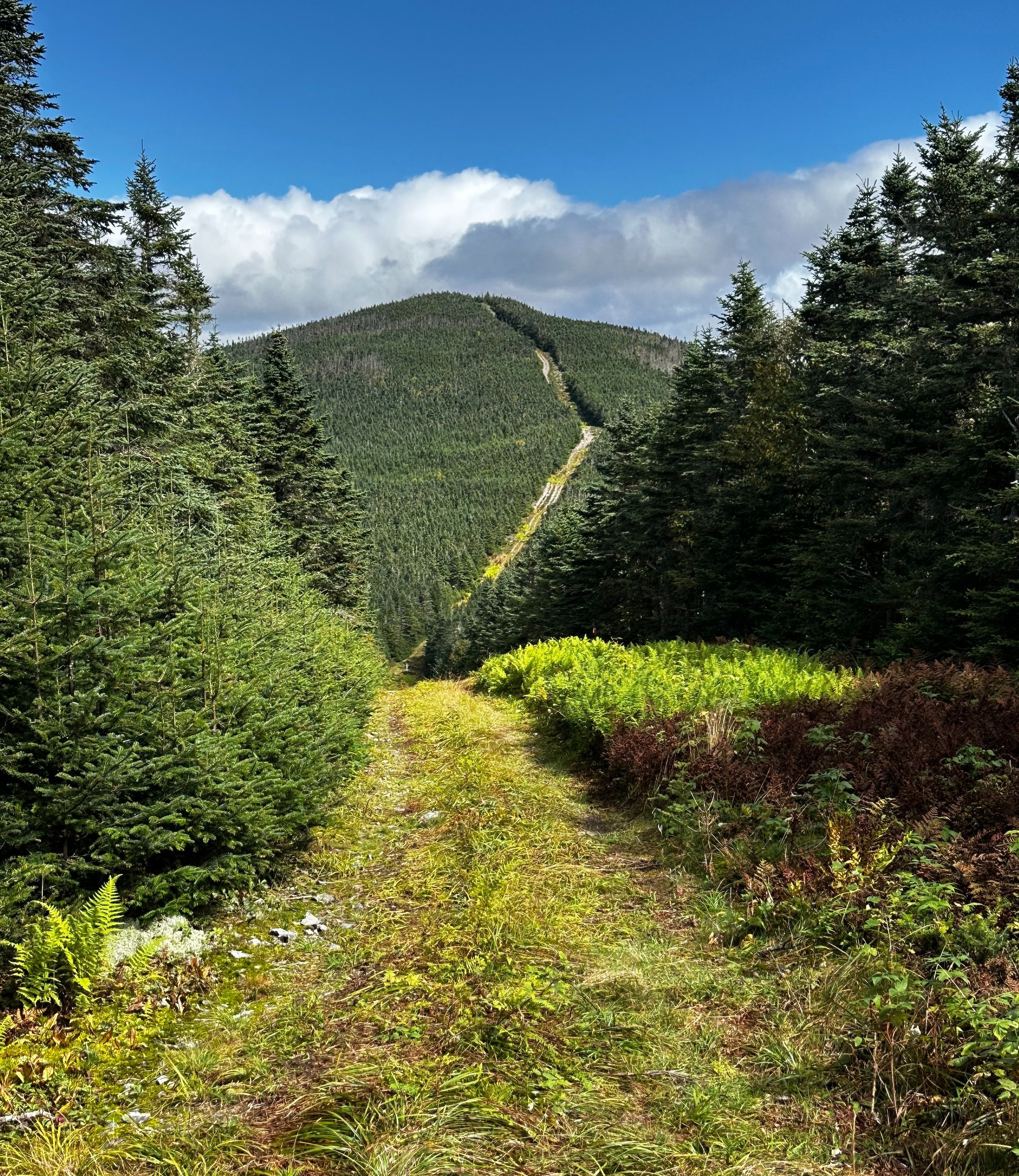
Following a steep, rocky descent off Monument 450 Peak, the international border swath treks through the western edge of Dennison Bog for about 0.25-miles - this stretch was incredibly soggy with deep, shoe-sucking mud, at the time of my passing. Before long, the journey’s penultimate destination comes into view, appearing too far away, beyond several successive bumps in the hillside. The border cut is a near-straight swath through the otherwise forested mountainside, allowing minimal consideration for topography, the cut winds straight up or straight down any land in its path.

Ascending Boundary Peak
A steep and rugged ascent up Boundary Peak’s southwest summit now brings the hulking mass of Boundary Peak itself into plain sight; just beyond a small sag followed by a steep, rocky ascent, the high point of Panther Peak, also known as Boundary Peak, can be found. As one tops out along the Boundary Peak climb, a short 10’ spur path can be found leading toward Maine. Amidst the highest tree can be found a shiny, relatively new PVC canister which contains several summit register log books, taller visitors can also find a fine southeastern lookout vista from here as well.
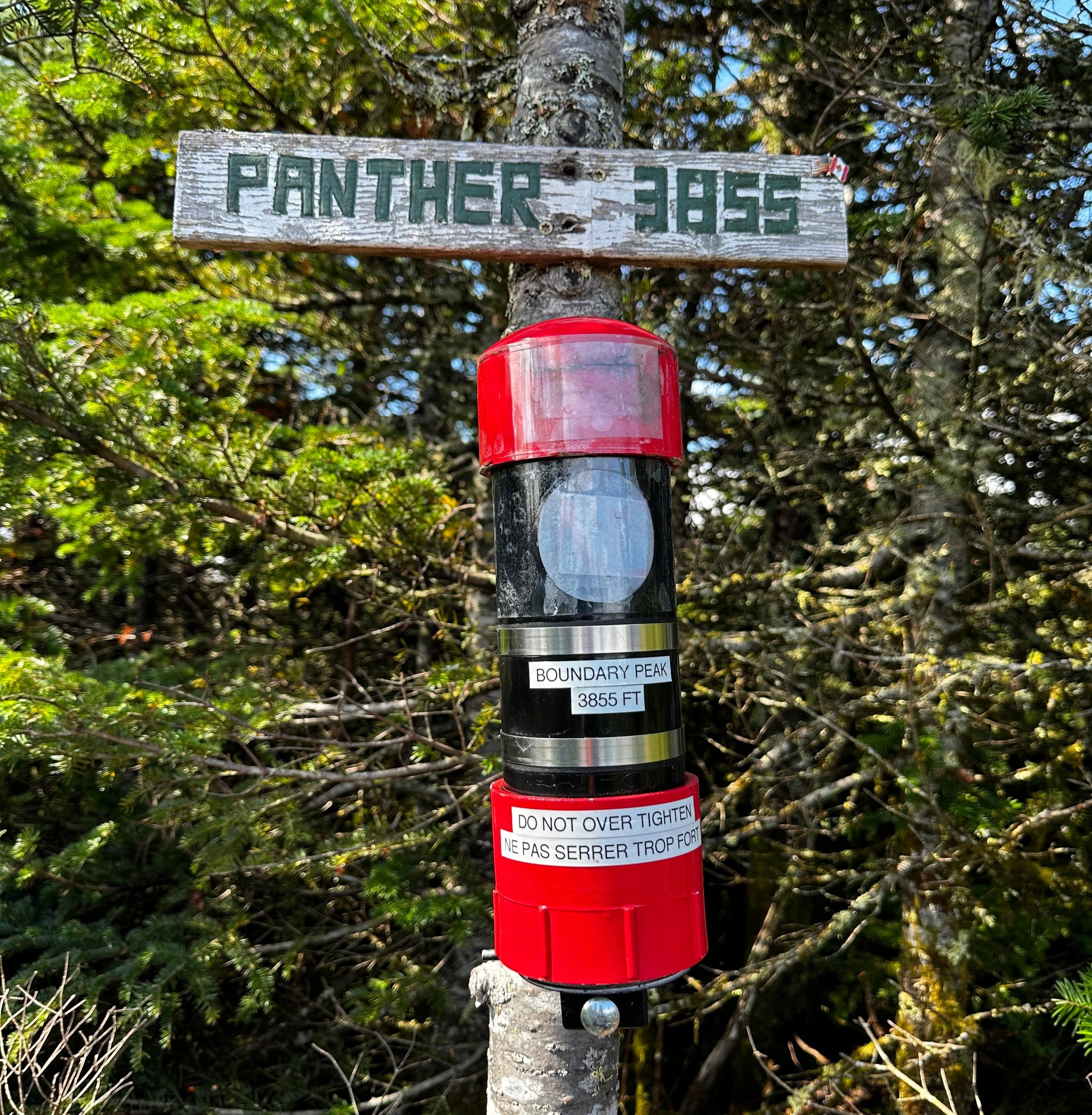
Summit of Boundary Peak
Trekking back along the international border cut, the forward view is now cast toward the beautiful White Mountains of New Hampshire, while the nearby humps of White Cap and Kennebago Divide are also visible just to the left of Monument 450 Peak.
Once atop Monument 450 Peak for the second round, the international border cut is departed as I rejoined the herd path once again; this would first guide back through the raspberry bush bramble patch and thenceforth into the open forest beyond. Following a southeasterly trajectory off Monument 450 Peak, I inevitably began noticing older paths from other hikers as well as newer moose tracks. The sun cast a glow through the canopy as the sound of trickling water became audible yet again; I knew the now familiar herd path to Porter Brook Road lay just ahead.
Looking back toward Boundary Peak
After placing deep tracks in the Dennison Bog several miles prior, the dirt and gravel roadway of Porter Brook Road was a heavenly surface on which to trod. With a slight jog to the pace, the 1.5-miles of logging/forest access road was passed which would lead back to my awaiting car. Apples and amaranth would serve as a refuel while I made the harrowing drive several miles away to an undisclosed location where I could begin my afternoon bushwhack in the brambles.
Next up: Snow Mountain (Cupsuptic)
Overall stats for the day:
14.65-miles
5hr 50 minutes
4,600’ elevation gain
White Cap Mountain - 3,815’
North Kennebago (Kennebago Divide) - 3,775’
Boundary Peak (Panther Peak) - 3,855’
Monument 450 Peak - 3,530’