
Duck Pond Mountain
Even prior to receiving a notice from The Teal Goat that my intended route of travel had been thoroughly broken out by a horde of snowshoers, I was excited to pay a visit to this little-known peak. Residing only several hundred feet above the surface of nearby Nancy Pond, Duck Pond itself can be found at about 3,030’, due east of the Lowell-Anderson col, from whence the Whiteface Brook flows.

A snowshoe trench comprises the Nancy Pond Trail
Last winter, while snowshoe bushwhacking a route from Nancy Pond to both Lowell and Anderson Mountains, I had considered adding on the brief ascent of this 3,340’ peak, but had opted to orphan Duck Pond Mountain, saving it for another jaunt to the Nancy Brook Research Natural Area. For me, this region of the White Mountains has become synonymous with peace and tranquility - with its all-embracing sense of remoteness, stunning forest offerings, and picturesque, panoramic vistas.
Generally, the trailhead parking area for the Nancy Pond Trail is plowed in winter, as was the case upon arriving this morning; having never had fellow vehicles to share the lot with in winter, I backed cautiously alongside two other SUVs. From the parking lot, a packed snowshoe trench could be seen side-hilling the old railroad grade - this was a much more welcome sight than the unbroken snow which took two full days of breaking, to reach the 3,725’ summit of Mount Bemis a year prior.

Great winter conditions abound!
With snowshoes on mountaineering boots, a grin the size of Manhattan overtook my face upon stepping onto the styrofoam-like snowpack. The hardpacked path encouraged efficient travel, however, the 10° ambient air temperature also made me hesitant to work up much of a sweat too early into this climb. Several rocks emerged from the otherwise smoothed over, snowy path - even most of the minor water crossings had been properly bridged by hardpacked, crusty snow.
Knowing the course of the Nancy Pond Trail, it was interesting to observe slight nuances where the prior team of ascensionists had streamlined an otherwise meandering footpath. After crossing Nancy Brook at 1.6-miles, I was surprised to see no subsequent foot traffic diverging upslope, where the old Mount Bemis Trail corridor had been lain. Finally, the morning sun was high enough to crest over the neighboring forest and hillsides; this was a blue sky the likes of which had not been seen for nearly two weeks!

Side-hilling steeply beyond the Nancy Cascades
Several tiers of old brick emerged from the blanketed hillside, remains of the old Lucy Mill; how I would enjoy seeing this area operating in its heyday - although I do quite enjoy the current state of forested hillsides. Departing the old logging road corridor, I followed a low, wooden arrow which directs hikers steeply up tight switchbacks, thus avoiding the Hurricane Irene (2011) washouts. Personally, I enjoy trekking through the spruce along this sharply switch-backed section. Leg muscles always anticipate the steep descent to round out any jaunt to the ponds beyond.
Hardly stopping for a breath before beginning the next steep climb, the Nancy Cascades were almost completely encased in snow and ice - only the penultimate base of the falls remained open, displaying a hazy rainbow of frozen water droplets. Last year, when visiting other trailless peaks around the Nancy Pond area, my ice axe had been integral for proper ascent and descent, as nearly the entire headwall of the mountainous feature had slipped. What I thought was simply the visual result of a skier trying to navigate the slope was actually piled up mounds of wet snow which had slabbed - thankfully not with me on it! Henceforth, I bring an ice axe during most later-season, winter bushwhack adventures.

Mount Anderson rising from across Nancy Pond
The well-packed snowshoe trench persisted all the way up the steep face, switch-backing several times enroute as the normal summer route also would. This snowpack had apparently refrozen overnight as the traction and floatation it provided was phenomenal; even the steep uphill travel was efficient, thanks to the previous snowshoe traffic. As the Nancy Pond Trail began to crest, I took in a glorious sight of snowy spruce - their boughs highly snow-loaded, thoughts then went to the Gore-Tex shell stowed in my bag, which would later provide shelter from the overhead onslaught.
Reaching Nancy Pond in shorter order than was expected, the proposed snowshoe track ventured directly out onto the frozen, wind-scoured surface of the pond; I saw the track arc around the water’s edge and disappear in the direction of the Norcross Ponds. The mound of Mount Anderson rose from the far edge of the pond, its upper elevation cloaked in frosty precipitation. Walking away from the packed path, my snowshoes sunk only several inches into the wind-drifted, fine grain snowpack.

I see no mountain through those woods!
Turning to observe my own tracks as I began toward the final objective, Mount Nancy also rose tall, its coniferous contours seemingly smothered in frosting - similarly to Mt Anderson, and very reminiscent of Frosted Mini Wheat cereal, a most wonderful winter wardrobe!
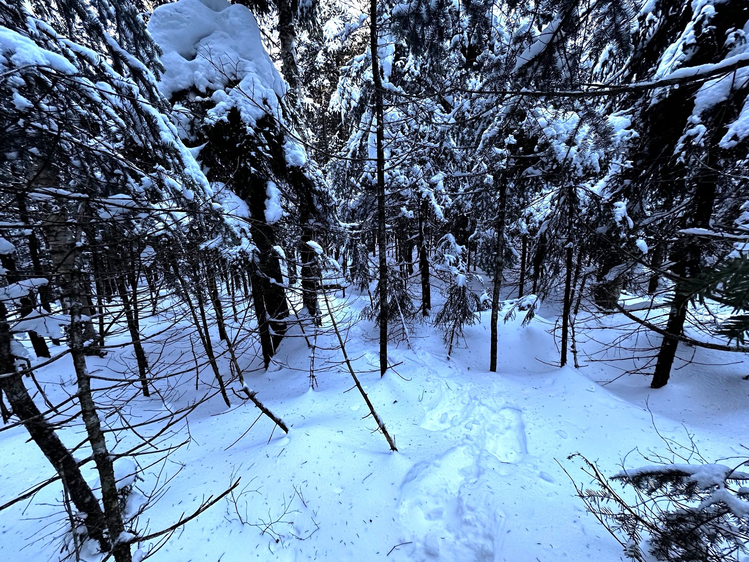
Into the pathless forest I began, armed with several prior climbing reports, I was prepared to expect a dense, tight bit of forest to begin the bushwhack up Duck Pond Mountain. Before being fully submerged into snow-loaded conifers, I donned the Gore-Tex shell, hoping this would sluff snow bombs as they release from overhead boughs. While the woods were certainly thick, they were never anything I would categorize as haunting, treacherous, or mind-numbing - just a plethora of pokey spruce.
Glancing back at the initial thick bit of evergreen
As the peak is a recognized 3000-footer, 200-Highest, and whatever other list hikers want to assign this low summit to, I had alternatively wanted to pay a visit as this mountain mass is contained within the Nancy Brook Research Natural Area, and more specifically, this particular area of the Natural Area was said to contain the largest stand of virgin spruce in the state of New Hampshire - sign me up!
Several rods into the forested bushwhack, thankfully the canopy did transition to one of increased maturity; I found myself trekking through a matchstick forest of spruce, completely devoid of any lower branches. At several instances, I could discern vague routes, or rough herd paths where prior traffic had pushed through the trees, although the deep snowpack completely concealed any semblance of footpath worn into the hillside.

Decent woods before becoming tight again at the high point
Following slightly east of the true ridgecrest, I tried to remain in what I determined to be “thick as hell, but could be worse” sort-of woods. Here, tiny, spindly branches created a haze anytime the vision was cast further along the mountainside; while spotting the constant rise in the mountain was no issue, it was navigating through the seemingly impenetrable net of woven, young growth branches. Travel was slow and meticulous while trying to navigate the final paces to reach the tightly wooded summit, but thankfully, it was short lived.
At the summit, I found hardly enough room to turn my body around - a bushy evergreen ensured I recalled what standing in a phone booth was like. While the shaft of my ice axe knocked nearly every flake of refrozen snow from the conifer at my back, I signed into the spiral bound notebook register, as it appeared this register saw more recent logins than the several pieces of loose paper someone had also stuffed in the Ziplock bags.

One very enthused author and bushwhacker
After thumbing through the notebooks, and looking for familiar names, I returned all the paper goods and writing utensils to the double-layer Ziplock bags, and gently returned this rolled package to the summit register cylinder. Following my ascending tracks back out, I now vacillated between following a broken snowshoe track, or begin a new descending track by following other minor herd paths through the virgin spruce stand.
In what felt like half the duration, I found myself standing atop Nancy Pond once again; with the sun re-warming rosy cheeks, I took a final glance at Mt Nancy, content with no inclination of summiting that additionally peak today, I began back down the Nancy Pond Trail. Given the hardpacked surface, the descent was just as efficient as the ascent - even hitting and maintaining a 14-minute/mile pace once beyond Nancy Brook.

Admiring massive birch which dotted the mountainside
To say that the surface of the trail was hardpacked may be misconceived as saying the trail is ready for bare-boot traffic, this could not be further from the case: the snow is loose and granular, which is minimally supportive without the widened footprint of a snowshoe. Henceforth, the trail is a beautiful route for snowshoe traffic; I feel incredibly lucky to have traversed this route while it was in such good, winter condition. Snowshoes will likely remain the equipment of choice for the foreseeable future, here in the White Mountains, whether on trail or off.
Overall stats for the day:
7.92-miles
3hr 25 minutes
2,867’ elevation gain
Duck Pond Mountain - 3,340’

Enjoying the sight of Mt Nancy, while reading about Mt Nancy (in my new book!)