
Nancy Brook Scenic Area
All was silent, muted by the 16” of powdery snow with a crust atop making the river rocks appear like marshmallow-shaped pillows. Today I was lucky enough - or unlucky enough - to be breaking trail through all this snow and with the freezing rain of last week, the going was beautiful but tough - footing occasionally supportive, other times a snowshoe would crunch through into the depths below.
Nancy Cascades; 2,400’
Finding myself on the Nancy Brook Trail, occasionally I’ve found this path broken out in winter as the backpacking and camping just up ahead at any of the 3,100’ ponds is some of the most remote in the White Mountain National Forest.
Departing the 1972 parking lot from the west side of US Rt 302 just south of Crawford Notch State Park, the trail follows old logging roads with nice footing and an overall gentle grade.

Wintery Halfway Brook
Today, I could hear the windchimes clanging on the porch of a private residence shortly after leaving the 5-7 car trailhead, most of these residences have private trails stretching to meet up with the Nancy Brook Trail but arrows help guide hikers along the designated hiking path.
At 0.3-miles I reached the first water crossing of the trek, a slight depression in the land leads to Halfway Brook where it is breathtaking to see the scoured sides of where the river rose to great heights during past hurricanes.
Continuing along by way of old logging roads, I passed a private trail leading to the Notchland Inn (sign reads simply: To Inn), as well as a pile of painted rocks of which were entirely covered by snow, yet recalled from previous summertime jaunts. Trees are also blazed with red which denotes the WMNF boundary.

Nancy Brook Trail in winter
Gaining elevation ever so gradually, the path slopes down on the right side as Nancy Brook becomes audible through the trees. At 1.1-miles the trail crosses a minor tributary then at 1.6-miles Nancy Brook is also crossed. Shortly after the main water crossing is the location where the Bemis Ranger Trail diverged right (northeasterly) to gain the southeast ridge onward to its summit - more on that later.
Beyond the Mount Bemis cut-off a foot path connects to Nancy and Norcross Ponds, opening just prior to the massive September 1938 hurricane, the trail was thenceforth devastated. Noted in the 1955 AMC Mountain Guide, the trail received “preliminary work summer 1954, hoping to make further progress 1955”, but unfortunately remained closed until 1960 when the Pasquaney Boys Camp of Newfound Lake (under direction and supervision of WMNF) provided the trail rehab work, staying onboard for regular maintenance.
While following the northern side of Nancy Brook, the boundary to Nancy Brook Research Natural Area is reached, a sign is posted on a nearby tree regarding backcountry camping regulations.

The Land of Many Boulders
I’ve always wondered what the story was with the old brick foundation and various other relics which are passed around the 1.8-mile mark, these are left over from the old Lucy Mill which was used to reclaim fallen timber following the devastating 1938 hurricane.
Just up ahead a small arrow can be found slightly off ground level directing hikers to a series of switchbacks, a reroute which was put in place to detour around 2011 Hurricane Irene damage.
Passing through beautiful spruce stands the newer section of trail also meanders through a garden of large glacial erratics, making the landscape immersive and giving a true larger-than-life feel to the area.
Losing some elevation, the path grows closer to Nancy Brook once again and, depending on the season, Nancy Cascades comes into view, giving a preview of the large falls shortly up ahead.

Nancy Cascades; Autumn/Winter
Beyond the final crossing of Nancy Brook the trail reaches the site of an old camp and just ahead a beautiful view of the largest of four cascades. The trail switchbacks three times ascending the headwall, each time returning back for a different view of the falls - from here hikers are also rewarded with a fantastic profile view out to Giant Stairs and Resolution off in the easterly distance.
Passing through lovely moss-carpeted forest, careful footwork is needed once atop the switchbacks - roots are exposed which become slick like ice amidst the nearby spray from the cascades. The old boardwalk planks helping hikers avoid boggy areas become just as slick when wet.
In an effort to protect one of the last remaining virgin spruce stands in the state, the Forest Service established the 460-acre Nancy Brook Scenic Area in 1964. This was enlarged in 1991 to 1,385-acres and now listed as the Nancy Brook Research Natural Area.
Shortly after passing into the Pemigewasset Wilderness, Nancy Pond is reached first with views across the pond to Mount Anderson (3,720’), just beyond is Mt Lowell (3,720’) soon coming into view is Vose Spur (3,862’) with Mount Carrigain (4,680’) towering behind.
Nancy Pond drains into Nancy Brook which downstream flows into the Saco River, while slightly northwest, Norcross Pond becomes a source of the Norcross Branch of the East Pemigewasset River. Interesting that two neighboring water sources drain in near-opposite directions.

Norcross Pond + Mt Anderson in Autumn
Traversing the eastern side of the ponds, Little Norcross Pond is reached next which was cleared in 1963 at the request of the WMNF to provide necessary area for emergency helicopter landings.
This section of the Nancy Pond Trail has seen several reroutes, while there are still glimpses of original trail running low to the pond, much of it was flooded by beaver activity requiring reroutes higher into tree line.
The path reaches the far end of Norcross Pond at a natural ledgy dam which can be carefully scaled providing unique views of the pond; glancing north/northwest is perhaps the best lookout of the entire hike thus far, featuring a “commanding view” of the vast Pemi wilderness.
Mount Nancy; 3,926’
This area of Norcross Pond is the furthest that I have been down the Nancy Brook Trail, often the destination is Mount Nancy which rises on the east of the ponds and is #74 on the list of New England Hundred Highest. While this was not my destination today (in winter), I have made several warm season ascents in prior years.
Originally known as Mount Amorisgelu (combination of 2-latin words meaning, “The Frost of Love”), Mount Nancy and the surrounding area is named for a young woman who set out alone one chilly morning in 1788, from Jefferson to meet up with her true love, with whom she was supposed to marry. Travelling 30+ miles through virgin snow, she grew weary and was later found frozen in the ravine.
Listed on All Trails or most other mapping apps these days as the 0.6-mile Mount Nancy Herd Path, one can find the trail initiating from the clearing just prior to the end of Norcross Pond.

View from Mt Nancy: Giant Stairs + Mt Resolution is visible
Beginning at a low grade by way of old logging roads the path is easy to discern, however, there are other old paths which fade away into various directions.
Shortly into the ascent a narrow slide is reached with rather loose footing, the path resumes on the right side and proceeds as a cut through beautiful fir and spruce. I often thought this path to be an old abandoned trail up Mount Nancy but never found it to be listed as maintained, simply old logging roads, I suppose.
Not high into the climb, Vose Spur and Mt Carrigain come into view and provide some reference to upward progress as one climbs steeply along the western slope of Mount Nancy.
Exposed roots are occasionally needed to gain elevation through steeper sections but before long the path mellows out and traverses the summit ridge to a fine outlook toward Crawford Notch and the Presidential’s rising high.

Mount Bemis; 3,725’
Mount Bemis; 3,725’
While certainly not a destination for most, this peak is considered a “bushwhack”, similar to neighboring Mount Nancy to the west. While perhaps not completely a true bushwhack in the sense that there are no trails, Mount Bemis does feature an old Ranger Trail which can be followed with care.
The mountain was once home to a 29’ wooden fire tower; listed as “new” in 1940, it quickly fell into disuse before being dismantled in 1968 - its wooden structure and artifacts from days past can still be found near the summit of Mount Bemis as it is illegal to remove any artifacts from the National Forest.
The old Ranger Trail was listed in 1966 as being “not a maintained trail”, but can certainly be followed fairly easily for the first mile along the initial ridge. Once finding the old trail I couldn’t see how anyone would want to properly bushwhack straight up this mountain, while I found inviting and easily navigable open hardwood forest down low on Mt Bemis, the entangled spruce and new-growth fir nearing 3,000’ is a rough time indeed.

Old Rangers Trail through spruce
Following the initial ridge northwesterly, the Ranger Trail swings around the knob to the north, maintaining ~3,000’ elevation before proceeding generally southwest. Meeting the oncoming mountain face, the Ranger Trail makes a turn proceeding once again northwest toward the summit of Mount Bemis.
Once reaching an open meadow area where a unique view looking into Crawford Notch can be had, as well as the mighty Mt Washington standing tallest of all - perhaps hundreds, if not thousands of mountains can be picked out from the near open panorama - the only instance of blocked view comes from the wide mass of nearby Mt Bemis itself.
The hiking alternates from obscenely thick spruce and fir swatches to pleasantly open mature spruce stands, unfortunately being February and snowy I was able to find just about every spruce trap leading up the slope, plunging one or both legs waist-deep, swimming through powder to extricate myself from the snowshoe post hole.

Fire tower remnants
Nearing the summit I chose a method of crouched-snowshoeing while elevated arms worked to block twiggy spruce and fir while boring through the thickest of the conifers, periodically reaching open stretches to glance back at my progress.
I somewhat lost track of time, just putting one snowshoe in front of the other until I could see old lumber bearing a grey hue leaning in various directions - the old fire tower remnants - made it!
Not much of a view was to be had from down at the base of the tower. The true high-point can be found on a nearby hump about 200’ to the west. I had read about a herd path leading toward the real summit but the initial 20’ was thicker than thick; upon breaking through this conifer wall, progress was simply picking lines and weaving ones body through the thin trees while guarding eyes from poking branches.
At the summit I found the famed canteen hanging at about hip height but unfortunately the glass canister that once held the summit register had shattered, all that remained was the string tied around the glass rim.
With a change of clothes and a swig of hot tea and I was back following my tracks, meandering through the trees. At one point I thought I found the old Ranger Trail but opted to continue following my own tracks - at least I knew they would get me home.
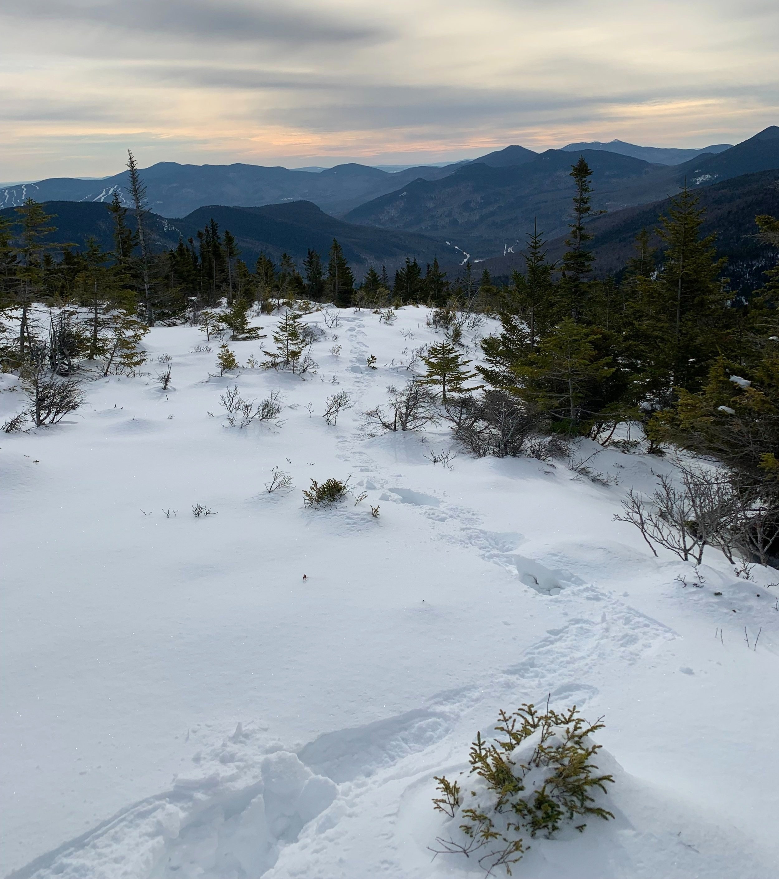
Meandering in the open; 3,080’
Twice on the return trek I found fresh moose tracks, the owner had briefly followed my snowshoe prints, the heavy creature post holed several feet at each step with its narrow hoof. I knew I was not alone out there after all.
It was very nice to get back onto the ridge trail and heading back down, this snow had solidified over night and took my weight nicely. Swinging back onto the Nancy Pond Trail I was in autopilot-mode and homeward bound. A good several days roaming the Nancy Brook Scenic Area.
Overall stats for the day:
Mount Nancy - 3,926’
10.62-miles
3hr 31minutes (no snow)
3,976’ elevation gainMount Bemis - 3,725’
7.57-miles
5hr 25minutes (lots of snow)
~2,900’ elevation gain

Summit canteen + broken register jar