
Scar Ridge, Middle Peak
With prior visits paid to both the West, and East Peaks of the Scar Ridge, I cannot help but imagine checking off my final peak of this oscillating ridgeline is not dissimilar to a Redliner trekking the final trail of a section, or perhaps a Gridder checking off a peak during all 12 calendar months - while not quite an end-to-end traverse, this was the final bump to be scaled along the 2-mile ridgecrest.

Plowed parking at the Discovery trailhead
Most research on this sharply pointed peak was initially focused along the southern face of the ridge; ideally, had Tripoli Road been open, I would have embarked on an ascent of this trailless peak from the East Pond Trail. From that trailhead, the Little East Pond Trail would have likely been utilized to easily gain elevation while enroute to Little East Pond. From the pond, a steep, 800’ bushwhack exists between the hiker and the high point of the 3,480’ mountain. Newer maps (31st edition AMC White Mountain Guide) note this peak as 3,478’, while others claim a broad, 3,500’ - which would place it on the New Hampshire 3500-Footer list, as well as it being a close runner-up on the New Hampshire 100-Highest list.
Call this adventure simply another snowshoe bushwhack to a mountaintop, or due diligence while working on several hiking and climbing lists, or perhaps this was recon for a tale to be told another day. For several days leading up to this climb, I began watching weather patterns closely, making mental notes of daytime highs, and nighttime lows - with a string of blue-sky days, I wanted to pay a visit before the snow became too soft and treacherous.

First of two Hancock Branch crossings
Most who have been hiking for any amount of time in the White Mountains are aware Tripoli Road is not open to vehicular traffic in winter; being currently winter, this forced all of my attention toward the northern side of Scar Ridge. Having climbed East Scar from the Otter Rocks day-use parking lot last winter, I had an image of what to expect for the forest quality and ease of upslope locomotion - down low, I found beautifully open, mixed woods, while adorning the summit cone of East was a sea of snow-loaded young fir, making for a truly tumultuous, and wet ascent.

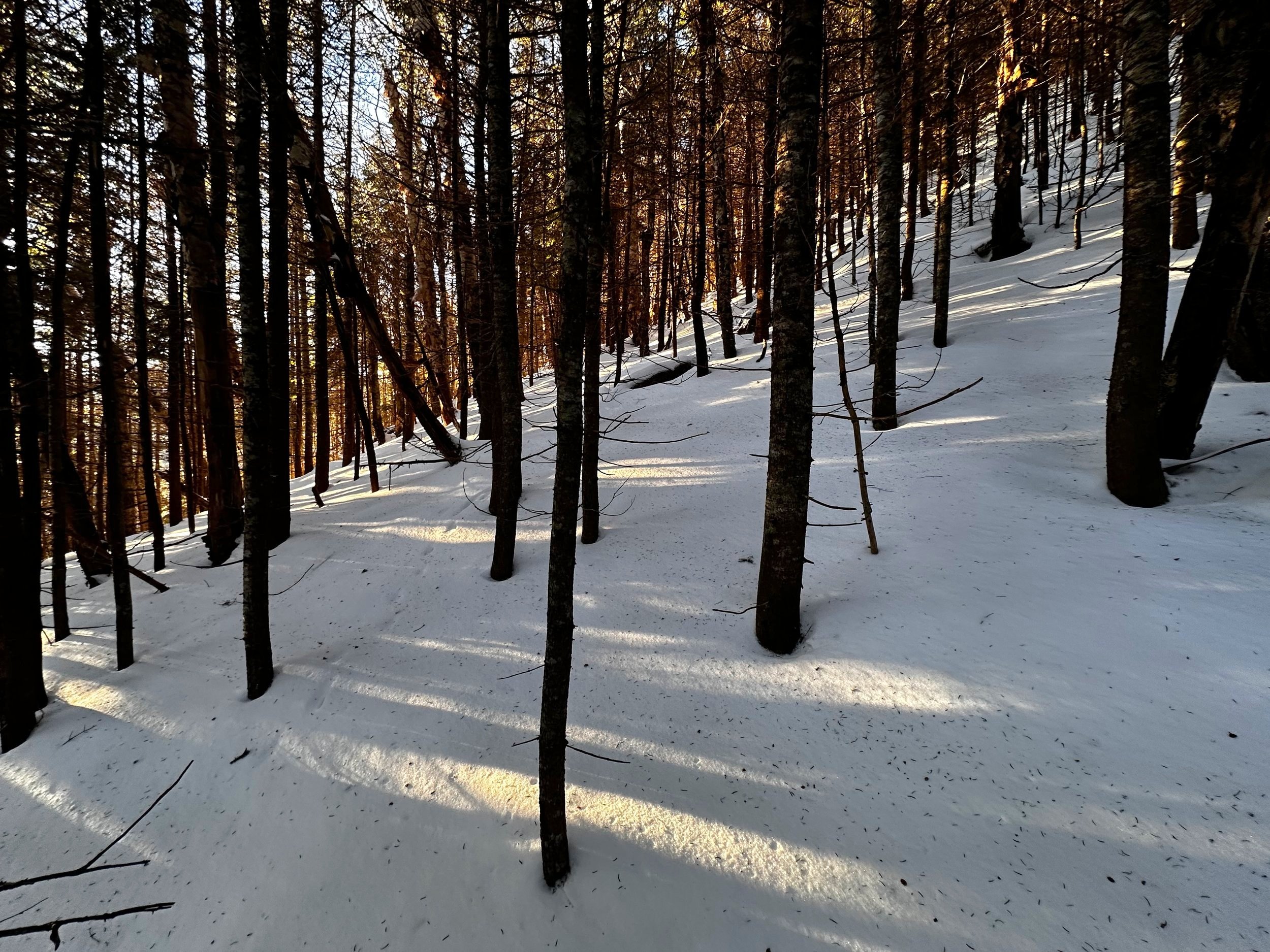
Never too thick, just junky with understory brush early on
Departing the Discovery Center trailhead lot, the trail report on NETC was still on my mind; in the post, the hiker (Cole) had mentioned a wet notebook in the register atop West Scar (main Scar Ridge peak). With a fresh notebook stashed in my bag, I geared up, reserving the option to continue onward to the main peak of Scar Ridge, to replenish the book, then dry out, and store the old book in the 4000-Footer Committee archives.
Reaching the edge of the Kancamagus Highway (US Rt 112) at 6:33AM, I glanced west for a fraction of a second before donning snowshoes. Momentarily, I had considered crossing the Hancock Branch by the same route as the hiker yesterday. Apparently, across from the campground a path guides toward the water; but, quickly realized I wanted nothing to do with unnecessary added mileage. With snowshoes on mountaineering boots, I scaled a small embankment and found easy strolling early on, even an old logging corridor while making my way toward the Hancock Branch of the Pemigewasset River.

Quite a few glacial erratics before terrain gets steep
My compass remained stowed as I navigated the short stretch by the sound of cascading water alone. Reaching a steep embankment, I traversed westward several rods until finding an appropriate place to descend safely to the water’s edge. With minimal difficulty, I picked a meandering route across the water; nearest the highway was bridged under a deep, supportive snowpack - complete with a tacky crust to aid in placing steps. Each step was tested with hiking poles before fully loading with my pack and body weight - all snow I used to cross held just fine.
Once across the Hancock Branch, I was whisked away to memories and scenes of the expansive north ridge of the East Peak, where I strolled beautifully open hemlock, spruce, balsam, and birch groves; here, approaching the Middle Peak directly, I was surprised to find myself in rather dense spruce and fir, most of the younger, peskier variety - thankfully, these evergreen boughs had already sloughed their snowy loads prior to my arrival.

Woods becoming more friendly as elevation is gained
Encountering all the standard familiarities of a northern hardwood forest (a few trees still displayed blue spray paint hashes from the logging days), this side of Route 112 contained much more softwood than what can be found along the lower slopes of the Mount Hitchcock massif. But that is not to say the forest was unenjoyable - it was simply something to deal with. Before long, I could discern the drainage gully to the southeast and began climbing steadily; all the while ensuring that ravine remained far to my left - after all, there would be another drainage gully to my west, as well. The name of the game was to ascend the ridge between these two drainages.

A bushwhackers paradise
Eventually, the hobblebush fell away; tan beech leaves were also left behind as I entered a blanketed forest of mature spruce, fir, with several obscenely large examples of old birch trees - absolutely glorious specimens to find myself surrounded by. Perhaps the snowpack was less than when I had climbed the East Peak, I could not recall hitting so many spruce traps and downed debris last year - most blowdown offered air pockets to sink into while trying to pass, eventually I began trekking well around any toppled trees.
The Middle Peak of Scar Ridge is visible from the Kancamagus highway as a rather sharp peak with a quasi-ridge emanating northeastward from the mountaintop. Despite a somewhat cumbersome forest density, the travel remained overall efficient, most snowshoe steps only sunk about 5” into the snowpack - I was hitting the hardpacked ice crust from several months prior.
Getting steep approaching the 3,030’ ridge
There came a point in the climb when I could gaze ahead, through open conifers, toward the hillside rising exquisitely steep before me - I had reached the end of the very narrow ridgelet. With every intent of scaling it head on, I was thankful for any traction the crusty snow provided, but soon discovered this peak was going to fight back.
While trekking at lower elevation, and at a much lesser pitch, I was thrilled to have finally remembered to bring trekking poles; now that I was climbing steep atop this shifty ice layer, I was kicking myself for taking the ice axe off my pack - I would have happily used it during these several steep pitches. As the top eight inches of snow fell off the mountainside, revealing that old icy layer, I found a mix of easy maneuvers bookended by some relatively tricky scrambles. There were several exposed bands of rock and ledge nearing the crest of this narrow ridge, none of which needed to be scaled, I simply picked a route to the west. There were nice, open woods to either side of my proposed route, but the side-hilling would have surely broken both my ankles and heart simultaneously - this was tough, and steep, but at least footsteps were not off-camber or too wonky, thanks to the route I chose.

Ascending the snow-capped summit cone
For the final clamber up to the crest of the 3,030’ mountainous connector, I reluctantly did a quick bit of side-hilling, but upon reaching the area beyond the open ledge bands, I found a stunning forest of mature timber - from here, even a sliver of the West Peak could be noticed through the canopy. At one point along this 3,000’ ridgeline, I was able to pick a small, restricted window of a lookout toward all peaks of the Franconia Ridge - I spent most of this time tracing slides and various features of Whaleback Mountain (3,586’), but what an interesting back-side view of Mount Flume from atop this high perch!

Final summit stroll
As I had climbed directly up the 3,030’ sub-peak, I then had to descend slightly into a col separating me from the sharp, pyramidal shaped peak. This patch of woods on the southern side of the sub-peak offered the thickest section yet of spindly spruce twigs - this was also the section where a twiggy spruce branch found its way beneath the corner of safety glasses and into the underside of my orbit on the descent (a few pink tinged tears, nothing more to do than continue cautiously trekking out).
While entangled in pokey spruce twigs, I could see the morning sun shining through the coniferous canopy, all the while it seemed just out of reach. Once finally through the thickness, the woods opened up beautifully; ahead, I could see the final summit cone shroud in a beautiful cloak of white. Beside an exposed band of rock, I climbed steeply up its eastern side, through an apparent “herd path” of snapped conifer twigs.
High point, Middle Scar Peak
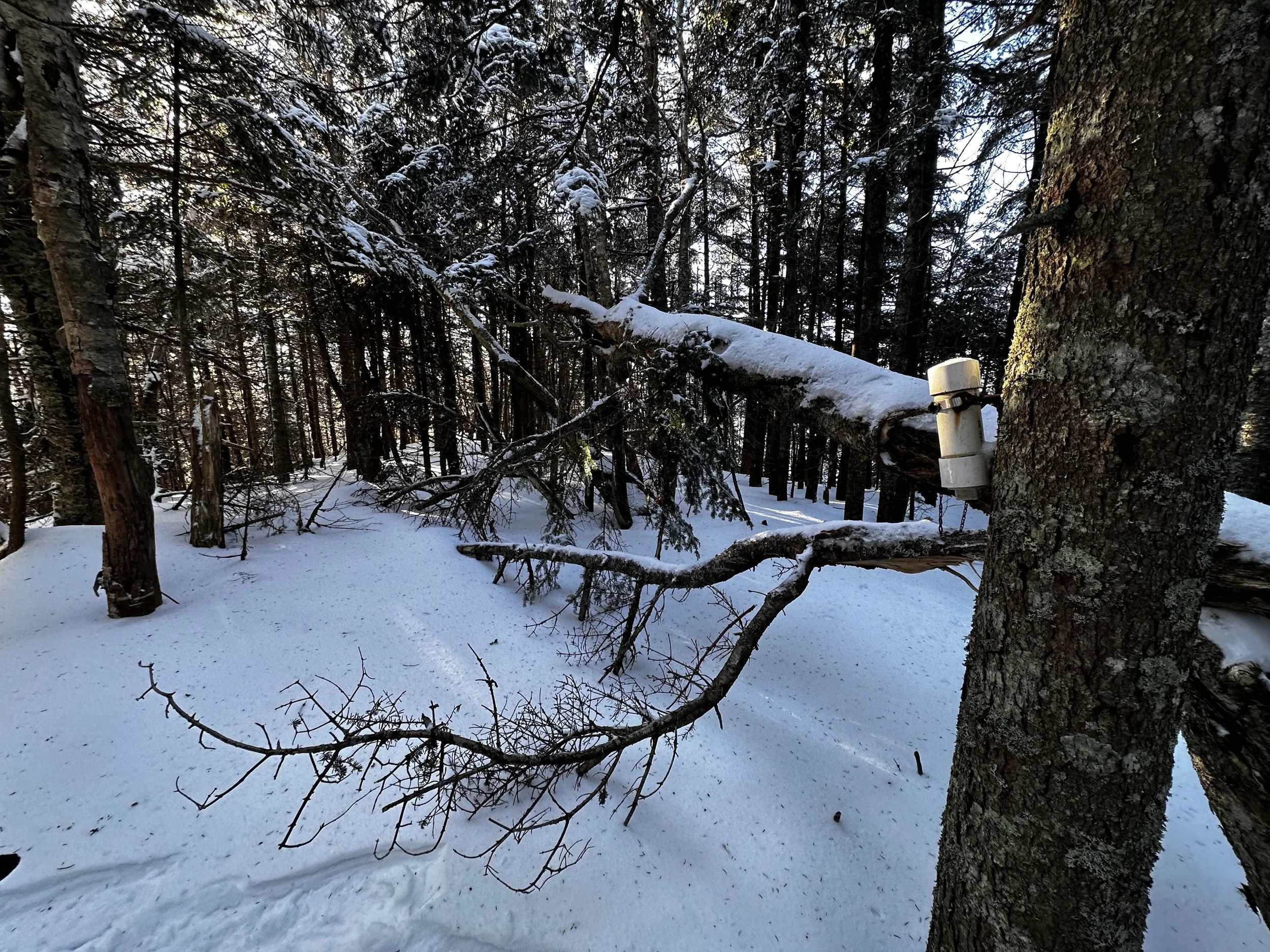
Once crested atop the steep ascent, the woods were some of the finest I had hitherto strolled; a spacious quality with an unbroken blanket of snow, which had transitioned yet again during the final pitch to several inches of loose hoar frost, which had evidently been knocked from overhead conifer boughs. Toward the southern side of the dome, I found a small summit register bolted to a tree - nearby, a massive spruce had toppled, luckily not taking out the recognized tree in the process.
After registering my ascent into the booklet, I sealed all contents back up and returned them to the tube. With no interest in continuing my route over the West Peak, I turned to follow my ascending steps back down, making several minor pit stops at locations I had spied on the uphill - other than a wooded view toward the East Peak, most did not result in any expansive vistas, unfortunately.

Minor lookout toward Franconia Ridge on the descent
All during the relatively flat trek toward the Hancock Branch, thoughts rolled over in my mind of water levels rising, as I had found buckets of melt water raining from treetops at a 3,000’ lookout. The river certainly sounded louder on my return approach, but thankfully, my snowshoe tracks remained untouched - although, during the crossing it was easy to see how much the water had risen, now filling the voids of open water. One final steep pitch up the riverbank, and before long I was standing roadside, removing snowshoes.
Walking across the highway, I glanced back momentarily at the white-capped cone of Middle Scar Peak and its odd-shaped ridgelet: Today was a good day.
Overall stats for the day:
4.31-miles
3hr 18 minutes
2,306’ elevation gain
Scar Ridge, Middle Peak - somewhere around 3,500’, depending on source

Summit register book