
Provo Peak
Still riding a runners high and basking in the morning sun, I sunk deep into my drivers seat, armed with a big bowl of apples, a bag of raw oats and a broken backpacking spoon I commenced my drive on Interstate-80, a road I would not diverge from for the next 360-miles.
While out on the trails I was overtaken with the urge for some childhood music - Guns N Roses to the rescue. I had nothing but time and miles so the tunes were turned up and immediately I was taken back to the 6-year old me, however, now grown up and surrounded by all my memories which had led me to this moment in time; a man driving alone in search of mountains to climb and a place to sleep soundly in the backseat of his sedan.
The Sonoma mountain massif disappeared into the cluster of other hills in my rearview mirror and before long I was breaking my neck trying to get better glimpses of the Ruby mountains; Carlin, Grindstone, Elko, Sherman, Peko Peaks all smashed out of the surrounding plateau - I had an unsettled feeling passing by all these beautiful sights, surely I should be pulling over to make memories on their hillsides.
Entering Salt Lake City, Utah
But, when the 10,000-footers began towering on the horizon I knew the best was yet to come! Bright white and jaggedly reaching toward the skyline, this was a young mountaineers delight right here, my version of heaven amidst a 6-hour car ride.
Grey’s and Humboldt Peaks bookended the East Humboldt wilderness on my right while the Jarbidge wilderness rose high on my left. I-80 contoured and catered its direction to the mountains that burst up out of the earth’s crust, dodging around Bluebell wilderness, Cedar Mountain Wilderness and the Deseret Peaks, one range after another welcomed me to Utah.
That may be only partially true - what had really welcomed me into the fine state of Utah was quite the opposite - for a distance of nearly 50-miles all was flat. I had reached the Bonneville Salt Flats where the old Great Salt Lake used to inhabit. During the entire drive across the flats, my destination lingered far into the distance. I cringed at the sight of deep tire ruts along the highway where unfortunate vehicles tried to navigate the wet salt crust.
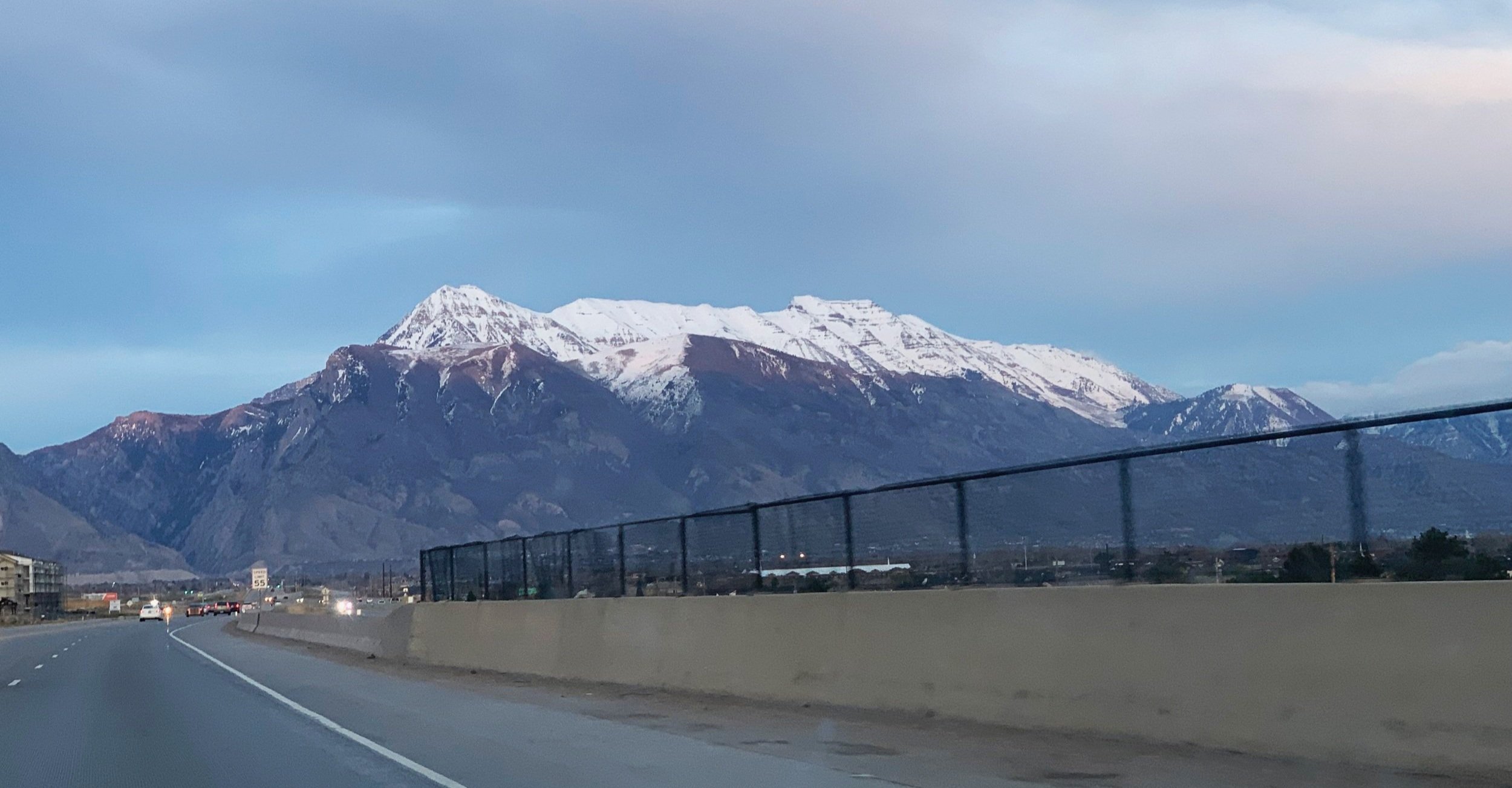
The day was getting late and I knew a parking spot somewhere on the edges of Salt Lake City would accommodate this backseat resident. Driving into a wall of 9, 10, and 11,000-foot summits, I knew I was in the right place - but which white-capped summit was the one I wanted? I was here for one reason, to visit the 11,749’ high point of Mount Timponogos.
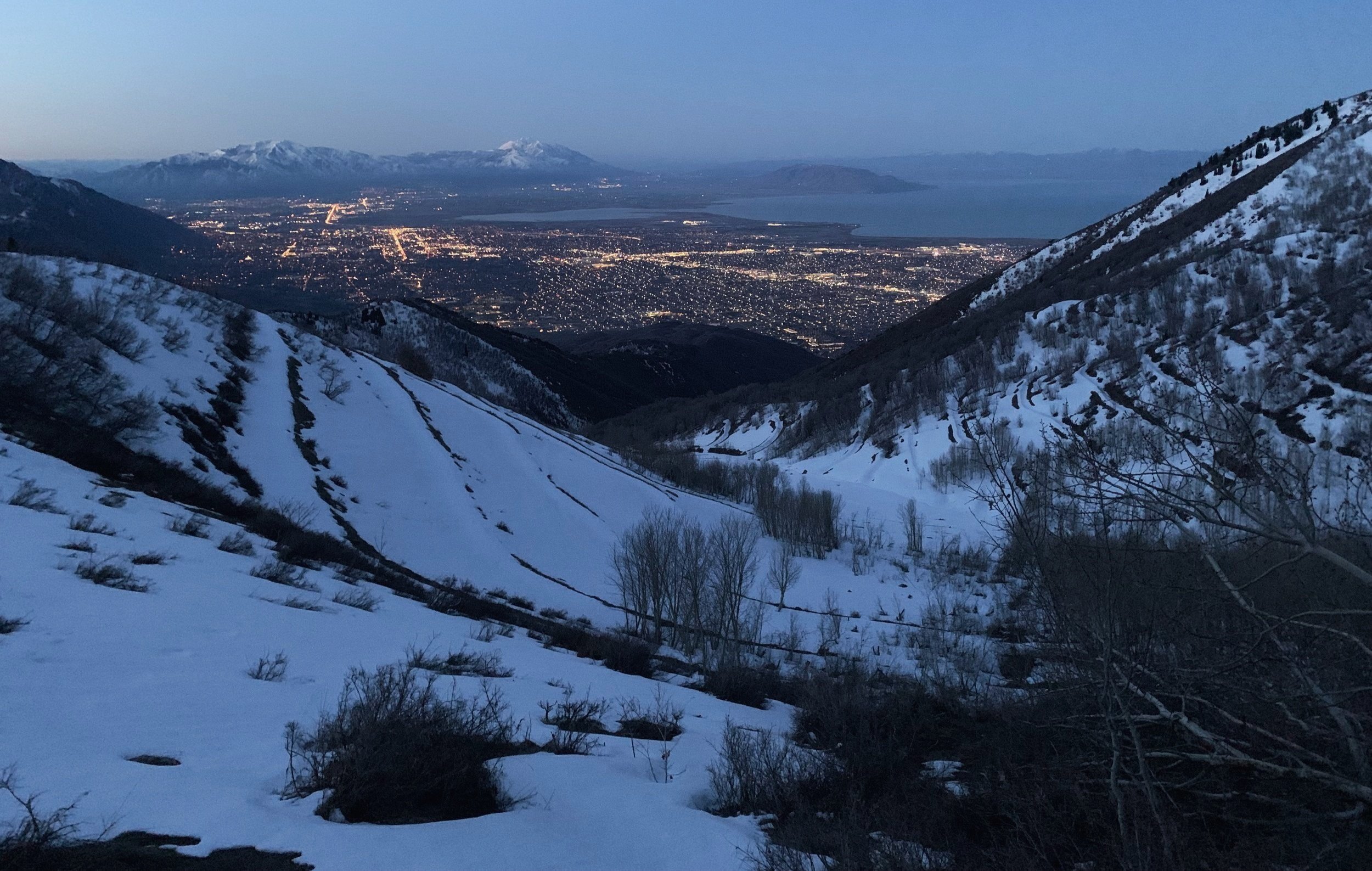
Salt Lake City, 7:06am; base of Mt Timpanogos
After being rerouted several times by snowy road-closures, I reluctantly pulled into the Dry Canyon Trailhead. The view was amazing - like stars in the sky, I gazed at a sea of lights which made up Salt Lake City far down below. In the comfort of my Subaru all was calm; outside, cars came and went while blaring music, screaming voices contaminated my quiet panorama, it seems I had found the town party spot.
I’m not sure when the last car trickled out to the city below but I awoke to the usual 4am alarm; the routine was just that by now. From the onset, the Dry Canyon Trail was just bizarre - vents sticking up out of bedrock exhaling heavy-breaths alongside my ankles as hoards of green eyes darted through the undergrowth. I simply trekked along, trail alit by a single beam of headlamp.
This attempt to ascend the Everest Ridge of Timpanogos was cut short around 8,500’ when I stood at the base of a very recent wet avalanche, so new in fact that no subsequent snow had yet covered the frozen mush - the mess of frozen snow and ice clumps demonstrated just how hot and unstable the mountainsides were becoming in the April afternoons.
Base of Timp, westerly views; ~8,500’
I knew an ascent of this steep face was out of the question if I wanted to return home alive, I wasn’t even disappointed at the decision to bail - the view was like nothing I had ever seen before, a spine of rock rising 3,200’ nearly vertical with peculiar horizontal lines etched across the entire mountain range as if the Wasatch were a Machu Picchu that never came to fruition.
Tracing my tracks back I quickly found the intersection where only moments earlier I stood amused by the name Big Baldy. There is also a nearby Little Baldy but I did not visit that 7,689’ peak today. The AllTrails map showed that I could follow the trail west, cresting over the 8,756’ mound and descend, joining up with the Dry Canyon Trail and back to my car.
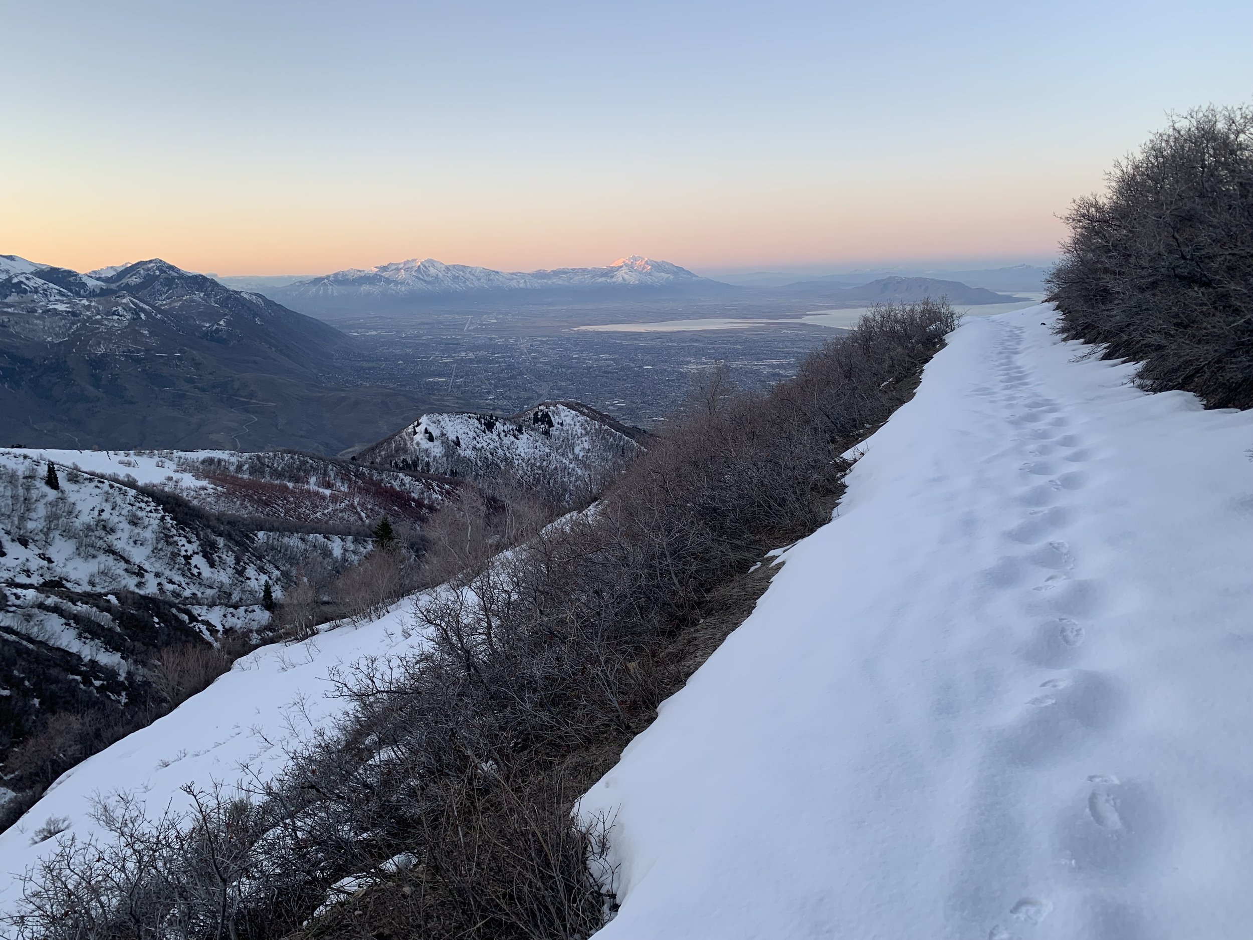
As if the universe was rewarding me for not risking a solo climb up Timpanogos - on a trail I had not originally researched and planned for - I ended up catching sunrise perfectly from atop Big Baldy. The glowing orb crept above the sleeping giants back over my shoulder as I gazed down at Utah Lake and an awakening Salt Lake City, 4,000’ below.
After a pit stop at Harold’s grocery store to re-up on produce (if in town, this is a must-stop, fantastic produce selection all cleanly laid out like a work of art!), I meandered and parked at the Y-Mountain Trailhead. With plenty of day remaining, the Subaru received some much needed cleaning and organizing, I did some reading in the sun and FaceTimed with Alanna back home - I craved a familiar face.

Mount Timpanogos; west face, 11,749’
While refilling my bottles with free water the trailhead graciously offered I was approached by an 80-year old gentleman who admired the many stickers adorning the back of the Subaru, many of them from other cross-country travels. He was excited to talk travel and let me know I was missing out on a very sweaty day of hiking. We discussed Timpanogos where I learned of his joy for the mountain but utter fear of the final 20’ climb - again I was reassured the correct decision was made this morning.
To prepare for a roam the next morning I finished off a relaxing day with apples, oats, unsalted peanuts and almonds, hemp hearts, goji berries and finally five plump organic California dates - all in that order.
2:01am; rise and shine at the Y-Trailhead, 5,147’
Again, I tried to sleep amidst a college party in the dead-end parking lot, which had tapered to a whisper by 2am. I “awoke” at 3am to warm coffee in my mug - I could not possibly think of a better way to begin an alpine start!
I always love a trailhead that comes with a bathroom but the facilities at Timpanogos the day prior had no toilet paper but kindly offered spray painted walls and PBR cans which overflowed the toilet. While today’s offerings were more spacious, there was a veneer of fresh vomit spackling the stall wall; I stuffed my nose into a sweaty hiking shirt and made quick work to return to the fresh Utah air outside.

Salt Lake City at night; from 5,147’
This mornings’ hike began at 4:06am, ascending exactly 14 switchbacks and gradually rising even higher above the city lights. During the swings I could watch my car get smaller until at the 1-mile point and last turn it was out of view. The snow was frozen solid at 6,700’ and I had a path of knee-deep post holes to guide my way, I simply walked through the open forest to the side of the swiss cheese trail, making quick work of the Y-Trail and continuing onto the Slide Canyon Trail.
Ideally, I would have liked to have continued on this path which traverses the side of the 9,001’ Lions Head Peak at about 8,500’ but while breaking trail in absolute darkness, I kept losing the path and ended up bushwhacking a brutally off-camber path along the side of the domed mountain. Each time I angled back toward known trail I wildly overshot and found any sign of trail completely unrecognizable.
Eventually, reaching the eastern slope of the mountain I put on spikes, a helmet and gripped my ice axe for what looked like could be a ride of my life down into the black abyss of ravine. The current objective was rather simple - knowing I had to descend the eastern face and cross Squaw Peak Road (summer access only) down in the valley, I side-hilled my way until reaching the floor, 350’ below.

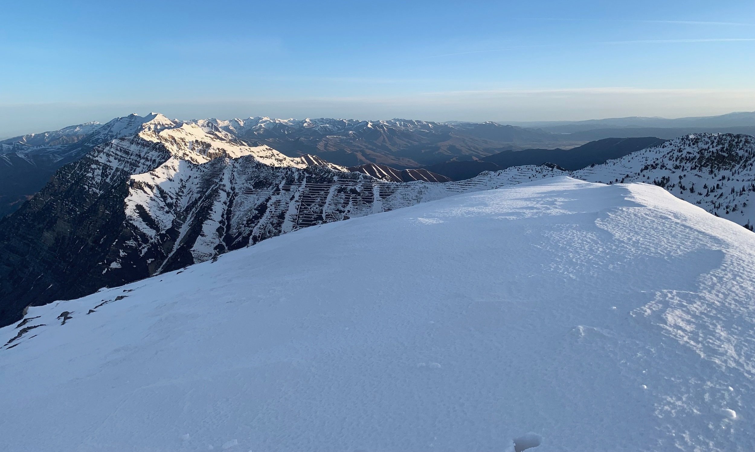
Ascending Provo Peak, westerly views
While still “breaking trail”, more-or-less walking through 4” of fluff atop a hard crust, I was able to follow the Provo Peak Trail easily as it sliced right through a grove of young birches. Swinging slightly right (easterly) I now stared directly up the western shoulder of Provo Peak.
From here, the hiker cannot see the true summit of Provo, all the while one aims far up ahead, bent over swinging ice tools and kicking steps into the frozen hillside with spiked shoes, huffing breaths and taking methodical steps, creeping ones body higher and closer to the ultimate peak.
Scrubby, scraggly trees grew angled and sporadically in patches across the windswept west face of the pyramid-shaped mountain, each one becoming the next resting place to briefly escape lateral winds and blowing snow chunks.
My burning glutes did not believe there would be a summit to this torture but my mind reassured otherwise, while the climb burned legs and lungs there was a part of me that never wanted this adventure to end. In fact, while waiting for the next hump to arrive over the crest I watched the surrounding peaks get lower until in front, I had no terrain left to ascend.
Summit of Provo Peak, northern view
7:39am; summit Provo Peak, 11,068’
Another climb done, and this may be one of the finest of the trip thus far!
I hunkered down low while atop the 11,068’ Provo Peak as to deflect the violently whipping northwesterly winds and nearly as soon as I took my final steps, the freight train roar simply disappeared; I had my moment of Zen as the universe rewarded with a moment of calm, tears froze to my cheeks as quickly as they formed.
I did not want this summit time to end but knew such elevation was not sustainable, after basking in the morning sunrise and saying good morning to my neighbor Timpanogos and bidding a return to that peak another time, I turned to descend, the winds were once again whipping and tearing at GoreTex layers.

Western ridge of Provo Peak
With sharp spikes on my feet and ice axe in hand I (safely?) began a full-on trail run down the frozen face, only once taking an icy slide necessitating a self-rescue with my axe. Within minutes I stood 2,600’ lower and could look back at my tracks completely satisfied with my day thus far.
Now in the daylight I could see and feel the once frozen snow was turning to mashed potatoes by the minute, in an effort to minimize my time spent on this snow I bee-lined straight up the hill before me and to the summit ridge of Lions Head Peak at just over 9,000’. From here I had a fine view of Provo’s entire western spine which was a bright white, encrusted in hard snow and ice.
This time, instead of following a trail or attempting lost traverses, I simply cut across the ridge top and directed my path west, toward the mouth of the canyon. While unsure if the woods would be kind and allow pass without being walled up on a ledge, I turned a corner and saw my tracks down in the snow from before sunrise, 600’ below - what a welcome sight!
The straight lined “bushwhack” was steep in places but managed to avoid any warm weather post holes, I got back to the Apache Flat junction to stash my helmet back onto the pack just as two young trail runners came by with no gear. They asked about my morning and I wished them a good run as we continued in opposite directions.

Descending Lions Head Peak; ~9,000’
Back on the Y-Trail I was in an otherworldly state of bliss recalling the high summit in which I stood just moments prior; with gear clinking on my back and clutching a blue technical ice axe I ran down the switchbacks as dozens of morning walkers roamed - most leapt in surprise off to either side at the sight of someone running with sharp gear in hand (I had pick covers on the axe at this point). I simply wished them a great day and good walking.
Reaching my car at 9:40am, I turned a bag of mandarin oranges into breakfast while draping wet hiking clothes from every inch of the Subaru, what a sight I must have been to the locals arriving in Lexus’s and Mercedes SUVs, getting on the dusty trail with pristine white sneakers.
After a quick “shower” in the restroom sink I let home know that I survived the climb and quickly researched my next destination.
Driving between the giant rocks, I gave both my new pals, Provo and Timp a nod as they faded into the distance. With the help of GoogleMaps I began north toward Wyoming; I had two things on my mind, a real bed and a real hot shower… Country Cabin Inn, here I come!
Overall stats for the day:
12-miles
5hr 41minutes
7,346’ elevation gain
Provo Peak - 11,068’
Lions Head Peak - 9,001’