
Kings Peak
For a couple of hours, I lived the good life. With the keys to a private, one-room log cabin, mountain running gear was laundered in the sink and hung to dry. I had a mini-fridge, a table, several chairs, a bed, hot shower and WiFi, just the reset button I craved between big days.
Originally, I was hoping to pay another visit to the towering Teton’s, 215-miles further north in Wyoming but the prospects of 60-70mph wind and snow kept a more easterly trajectory to my navigating. Perhaps another state high point? Afterall, Utah’s was laying directly in my path, but a 28-mile out-and-back? I knew this was only possible if trail running the distance was an option.
With the rock-solid spring snow in mind, an all-green avalanche report, low winds and full-sun forecast for the coming day I had my sights and maps set to the 13,528’ Kings Peak just an hour drive south, back across the state border into the Uinta-Wasatch-Cache National Forest. I half-laughed at the confirmation from the local avalanche forecast: “go get your winter high elevation while the spring snow is solid!”, enough said then.
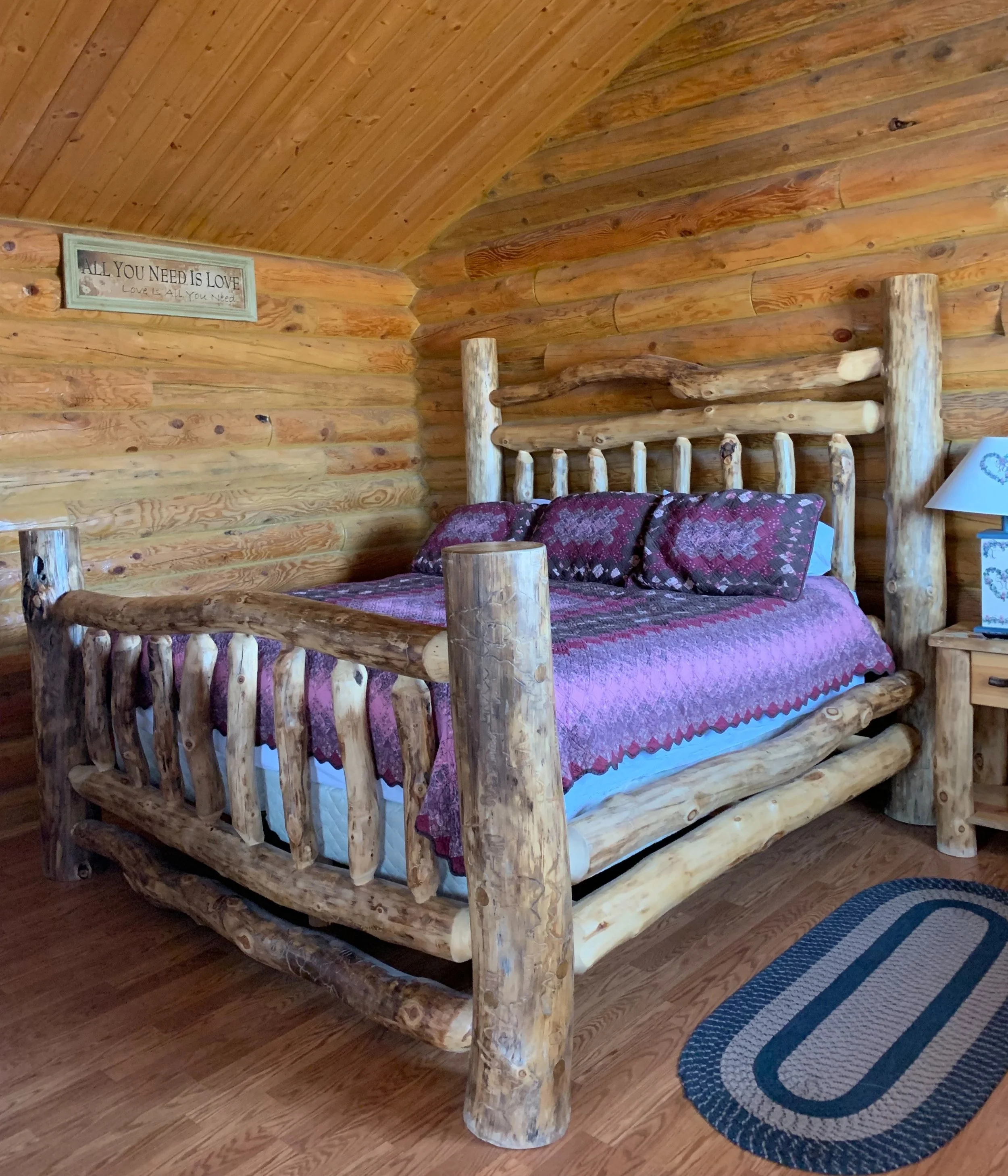
Trading out my backseat bed for a night
4:01am, The Love Cabin; ~6,800’
Beginning a slow morning with coffee (still warmed indoors on the MSR stove), a deep-muscle stretch session, gear was organized and packed back up. Once it was determined weather, maps and trail reports could be consulted no more I loaded up the car and began the quiet drive to Lonetree, WY.
From Lonetree it was a turn onto a dirt farm/oil rig road that I was unsure my Subaru would survive; sharp, jagged rocks made up the road - I thought for sure my tire sidewalls would be slashed to bits before even reaching the trailhead. Now I saw why Google Maps told me it was a 38-minute drive to travel 15-miles, this was treacherous terrain - a game of dodging and weaving around the largest rock daggers in my path.
Feeling as if I could not become any further remote, eventually I arrived at the Henrys Fork Trailhead, where tomorrow I would begin my run out and back to Utah’s highest.
As the parking lot itself was not plowed I parked along the side of North Slope Road or Hole In The Rock-Henrys Fork Road or simply, FS 80082, depending on the source. The dirt road was beginning to soften like cake batter so, before settling in I checked to ensure my tires were not sinking too deep in the muck, all four looked good.
Upon arriving at my new parking spot home I was still assuming that the following day would be my attempt at Kings Peak while today’s bluebird day would remain low key; a read and rest and refuel in the back seat sort of day. This all quickly changed when I took a short walk to feel the sun on my face, I was quickly overtaken by the notion that these warming rays would be decimating my frozen skin trail of a running path. As if a light switch had been flipped I was now convinced - although a very late start - today was the day.

Headed straight to Kings Peak; 10,350’
With a pack full of gear on my back I began down the remainder of Henrys Fork Road enroute to the actual trail which would guide me deep into the High Uintas Wilderness. If only it was that easy.
I was thrilled to see the first few miles drifting by at a 17-minute per mile pace, the trail meandered fairly level through a huge hydro cut from a once flooded Henrys Fork; fallen trees stacked like matchsticks in the nearby forest, the red and black bedrock rose high on my right making the path seem like a subway tunnel through the deepest wilderness, I was loving my decision, so far.
At the beginning, it was obvious where the trail was, I had not only recently packed ski tracks but was also trekking through a tight corridor - there was no where else it could have been. Reaching the 6-mile mark, my skier friends had switched from a side-to-side technique of navigating the river to one of skiing directly on top of. Guessing we also deviated from the hiker/snowshoer path, I plunged at the first step up to my waist in large-grain dagger-like springtime snow. In a panic I tried to swim through to the other side, desperately trying to gain traction and float atop the snowpack. For what seemed like an hour I floundered in the 4’-deep mashed potato snow, the far side of the waterway had no tracks to be found so inevitably I followed my whole-body post holes back to the last place I could call “trail”.
What a wake-up that ordeal was! Shaking off the snow and taking stock of several minor cuts and scrapes from the ice I looked around and found the remnants of faint, snowed-over snowshoe tracks - this would prove hard to follow but afford the floatation needed to proceed. At this point I glanced back toward my car - it was long gone, miles away - I thought of turning back, I pressed on further for now.

Crossing Henrys Fork Basin; ~10,700’
Water was easy to come by during the slog in, having several liters of water stashed on my back, I also carried a Sawyer filter and simply refilled the bag at open water and drank when thirsty.
Reaching the most iconic intersection of the hike I stopped to snack and snap a few photos. There were no tracks leading to Bear Lake, it appeared all who continued did so with my similar goal in mind - toward Dollar Lake and hopefully onward to Gunsight Pass and henceforth Kings Peak. Clouds rose off the distant high peaks which loomed like gigantic ships on the horizon - each one of the behemoths appearing as if they could be a state high point.
Continuing along the skin tracks once again, happily they deviated from atop the brook and onto solid ground of what, to me, could have been the worlds largest snow-covered golf course, very gradually rolling along the hillside, it seemed to stretch near-flat for miles.
I was out of the trees and baking like a potato out there in the full sun, cheeks and hands slowly become warm and red from the sun glistening off the surrounding snow sheet. I weighed the option of dipping into tree line to rest at Dollar Lake but declined adding the out-and-back mileage to my already hefty day.

Ascending Gunsight Pass; ~11,800’
With heavy legs I began the trudge up Gunsight Pass; hitting 12-miles, I was now the distance of a typical hike into my day and had not even reached my objective - and still had to return all this distance!
Knowing from researching, reading and drooling over maps that I would have the option of dropping far down and following Gunsight Cutoff to a lower elevation contour or simply strike a straight path following the contour line across the Dome Peak Cutoff Trail. At this point neither had visible tracks but the snow was topped with a decent crust - not hefty enough to stand upon but enough to make tracks and not slide laterally on soft slush. Kicking a path of my own steps, I side-hilled off camber around Dome Peak at ~12,000’.
All the while kicking steps into the Painter Basin headwall I watched bits of the ice crust tumble and roll, gaining velocity until reaching the valley floor, 500’ below. At the sight of this I leaned harder uphill onto trekking poles, determined to not follow their lead.
Leveling out with still no path to be found, I began trekking across more of a boulder-strewn alpine lawn at 12,400’. With my phone in airplane-mode to conserve precious battery life, I consulted AllTrails to ensure I remained somewhat on course, the summit looked so close on the phone screen but so far in reality.
While there was no real need to follow a beaten path out here I was able to spot my ridge stretching up from Anderson Pass, while Dome Peak remained on my right; my next objective was gaining the ridge which would become Kings Peak Trail.

Ascending the final ridge to King’s Peak; ~13,200’
This ridgeline gained ~900’ from the vertex of Anderson Pass to summit and appeared as if to be the shoulder of a great pyramid. Snow encrusted the eastern face while the ridge itself was exposed red rock, easy to place hands and feet, traction was reassuring. Possibly the most exciting sight of the entire 28-mile trek was peering down the sheer cliff on Kings western side into Upper Yellowstone Creek Basin, 2,000’ below.
The rocks stacked up as I climbed on, racing a haze of incoming snow which was now engulfing the 13,505’ South Kings Peak next door. When it seemed as if the ultimate peak was just over the next pile of red boulders, I’d climb atop to find the ridge went on and on; determined, I also climbed on and on.

One happy hiker atop Kings Peak; 13,528’
6:10pm; Kings Peak summit, 13,528’
Finding the wooden summit sign completely overjoyed me to tears, but I just couldn’t shake the thought of being in such a remote location, alone and with sunset sneaking in very soon. I quickly shut my eyes briefly to feel the aura of surrounding mountain-scape before snatching up gear and safely retracing my steps, bounding back down the rocky shoulder. I raced not only the incoming snowflakes but also the fading light - if I could make it off the ridge by sundown I thought I’d be home-free.
While my feet were wet and cold (I had a few sets of spare wool socks and plastic bags packed) I was happy to be quick and nimble in the Salomon trail runners, bouncing from one red rock boulder to the next, retracing my steps without thought, but at the same time I never had such a clear mind.
While I had reserve water on my back I was rationing rather strictly at this point - until reaching Henrys Fork once again - then I’d drink more leisurely, I found peanuts and dates both completely unpalatable, my mouth so dry I could not swallow either.
Shooting straight for Gunsight Pass, I tried to follow my tracks from several hours earlier but lost them anytime I had opted to walk directly on rock tops, I had not left a trace of passing. Glancing across the pass, about a mile away I could see the 4’ rock cairn marking the descent toward Henrys Fork and hooked around the contour line and followed my chiseled steps straight at it, making good time on the return.

Snow overtaking 13,505’ South King’s Peak
I had checked off another mini-goal and obtained the pass just as the sun set behind me, it was 8:15pm - time to get out the headlamp for some flat-landing across Henrys Fork Basin.
As the sun faded and all slipped into absolute darkness, the top crust of snow refroze and would periodically snap, sending echoes like sharp lightening bolt crackles radiating in all directions of the pitch black landscape. This resettling of the snow as I walked was enough to send chills up my spine, occasionally I’d remember to check the shadows for any large game venturing out to catch a nighttime snack - surprisingly, I did not see any: no moose, no elk or bear during my entire retreat - perhaps, however, they saw me.
The miles slipped by as I tried to step into my frozen post holes, this was difficult as my gait now was stretched out and footsteps did not match up, when they did I’d step and catch shin skin on the refrozen crust encircling the tops of old tracks. Needless to say, my legs looked as if I got into a scratch-fight with a pack of feral cats by the end of this hike!
What had been a 17-minute mile hike earlier in the morning was now a string of 22 to 26-minute per mile slogs; it felt quick enough, just moving legs in auto-pilot-mode to cover terrain.

Red rocks atop King’s Peak; 13,528’
I began passing junctions and familiar places but knew only the safety of shelter awaited for me at the trailhead; while my Subaru was awaiting my return, I’d be without cell phone service and still miles away from any town.
With the excitement of about a mile remaining I crossed Henrys Fork as I had a dozen times throughout the day. Like earlier in the day, the snow gave away and both feet plunged straight down. Immediately I took inventory of the situation: I did not impact any rocks during the fall, rendering me still mobile and in good condition to continue the trek out; I may have hit water - yes, definitely hit water as I could see it rushing underfoot, lit up by headlamp after extricating myself from the waist-deep hole by planting both poles at the snow edge and dragging my bottom-half up and out. I saw the same technique practiced when a victim falls through thin ice and into frigid water below - who knew I’d be in the Utah wilderness putting this skill to use!
While my feet really were not cold (thanks to maintaining a good shuffle), however, my running shoes quickly became a frozen block of ice by the time I reached for my keys and could see my Subaru reflect off headlamp beam.

Shadows fall on Gunsight Pass; ~12,100’
The time was 12:41am and I was tired and cold.
With a change of clothes and several fluffy fleece jackets I slithered into my backseat sleeping bag to preserve any bit of warmth. Here, I ate half of my honey dew melon and put my head down for 2 hours and 51 minutes of sleep (or so my watch had reported).
I awoke to 17° outside (as well as inside my car), frosted windows and all forms of hydration had froze solid; thankfully, I had not become a similar block of ice.
By 4:43am I had just about enough of this situation; reluctantly crawling from my warm cocoon up to my cold driver’s seat I turned the key and awaited the blast of warm air, seat heat also got cranked way up!
The sun had not yet begun to rise as I pulled out of my frozen parking spot and headed back toward civilization. With a brief, “oh shit” moment while in a haze of dehydration, hunger and lack of sleep, I was unsure of which dirt roads I drove in on, there was no service here to consult Google Maps and road signs are rather sparce out on FS 80077.
With white knuckles I gripped my steering wheel, jerking back and forth, once again dodging those pesky sharp rocks sticking up out of the roadway. I cannot put into words the relief I felt when all four tires landed back on pavement; the satisfaction of knowing that trek out to Kings Peak was completo; there was no going back; no one could take that experience away - the chapter had been written.

Descending Gunsight Pass as the daylight dwindles; ~11,600’
With a pit stop in Manila, Utah to scarf down the second half of honey dew melon (breakfast rehydration) I watched the sunrise on another glorious day. Several deer scrounged a nearby lawn for breakfast just outside of my car window, I thanked them for allowing me to be apart of their morning routine.
With a message sent forward three hours to the east coast, I think I surprised Alanna when I told her my climb was successful, a day early.
Departing Manila I crept with no urgency through a real-life painting: Flaming Gorge canyon, several other mountain passes and laughed to myself at the plethora of dinosaur and fossil propaganda of Vernal, UT and Dinosaur, CO.

Backseat view in Tabernash, CO
What I really craved was to stretch out and have a good night of sleep. After driving for several hours I found my refuge off the side of a dirt road alongside a frozen brook in the forest in Tabernash, Colorado. The sleep was glorious but concern grew when I awoke to a freight train of wind blowing through the tree canopy - pine trees nearly being tied into knots. I was on a dead-end forest access road with no other way out.
Overall stats for the day:
28.16-miles
14hr 13minutes
7,428’ elevation gain