
Snow Mountain - Cupsuptic
Parked alongside Wiggle Brook Road, I had a stellar view of my next objective as the first dry, wool sock was coerced into sopping wet trail running shoe, followed by the next. This upcoming climb, Snow Mountain, appeared as a mediocrely forested bump on the horizon while the jagged, mesmerizingly steep, rocky summits of Colorado still flooded my memory, as I had found myself ascending their craggy slopes only days earlier.

A glimpse of Snow Mountain from the trailhead
While there is a slightly higher Snow Mountain (also on the New England Hundred Highest list, and hopefully being climbed in the morning) located several miles distant, this peak is in the Cupsuptic lake and river region while the similarly named Snow Mountain found to the northeast is in the Chain of Ponds region; hence, these two alternate placenames are used to differentiate the Snow Mountain duo.
Despite the sporadic logging traffic witnessed thus far on this windy Thursday afternoon, I thoughtfully pulled several extra inches further off the main road as to not risk getting sideswiped or hit by kicked up rocks. Conveniently, the area in which I chose to park is directly across from the logging and forest access road which begins the trek to the summit of this Snow Mountain.

Welcome to the bushwhack
Brimming with excitement, I was happy to be traveling at a good pace while atop the old forest roads. After hiking up a small incline for about 0.5-miles, the roadway became engulfed with standing water and boggy mud, For a brief moment I contemplated the option of following the saturated road, but with no end to the flood water in sight, I bailed into an opening in the forest boundary. By the looks of it, I was not alone in this decision, with tracks and logging debris strewn about, I initially assumed I was in for a relatively straight-forward bushwhack up the 3,784’ mountain.
Heading southeastwardly, off any semblance of trail, the once open forest soon became tightly clogged with a blanket of hobblebush and patches of berry bush brambles. While the entangled mass of vegetation slowed progress more than I would have preferred for such a late-afternoon commencement; I pushed my track more southward, as if to work my way toward the known herd path.

Maybe a trail, maybe not a trail
With about a quarter-mile of thick understory between bushwhacker and primary herd path, I looked ahead to spot the head of a bull moose - inquisitively bee-lining in my direction! While I tried to keep an open line of conversation going with the colossal creature, to let it know that I was simply trying to give it space and let it be on its merry way, so I could then navigate my way across the contour. I worked harder than ever to push through the berry brambles to relative safety of the fabled footpath. Regardless of its condition, I looked forward to having anything to speed up my travel around the path of such a moose.
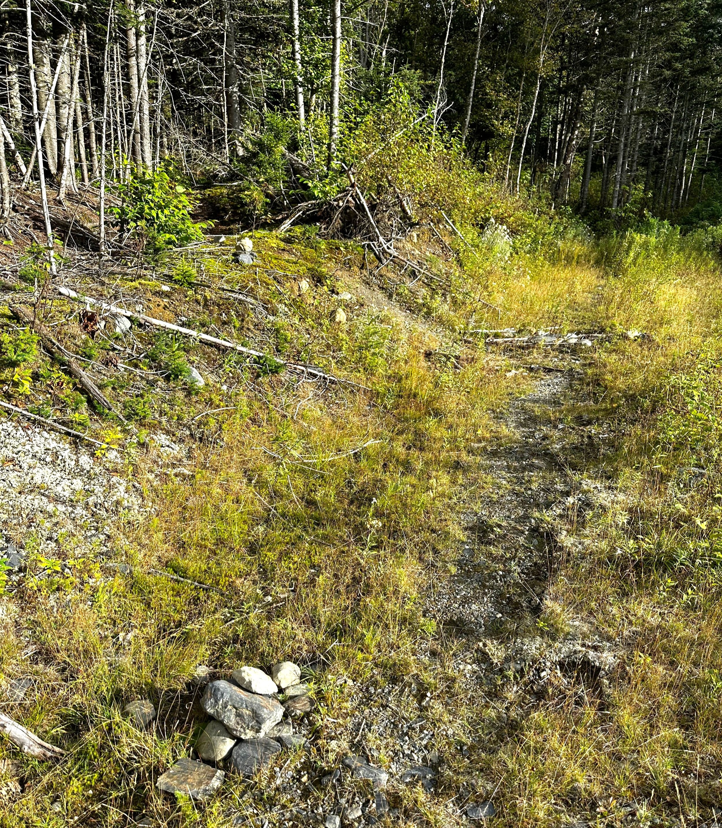
As I popped out of the dense understory into a grassy, overgrown log landing, I ruminated over several possible routes in which to tackle the coming ascent. A small cairn was just visible amidst the high grass blades, excitement grew as I assumed I had made my way to the herd path. The elation was short-lived when I stepped into the woods to find no sign of path anywhere in sight. Knowing I would need to climb this mountain with or without a faint trail, I reluctantly pushed off into an upslope bushwhack.

A proper herd path on Snow Mountain
About a quarter-mile later, while sweating heavily and creeping up the soft, earthen mountainside, I popped out onto flat ground; a flat path which stretched delightfully in either direction, both to the left and the right - I had finally tracked down the coveted herd path of Snow Mountain!
While momentarily allowing myself to mindlessly follow the well-trodden track, I meandered over several fallen trees, shimmied between narrow boulders and spied several large moose ribs and leg bones trailside. The wind grew with intensity all around but I remained well sheltered under the dense, coniferous canopy. With each step I gazed into my forested surroundings for watchful eyes, but never saw or heard anything but wind rustling through the autumn leaves.
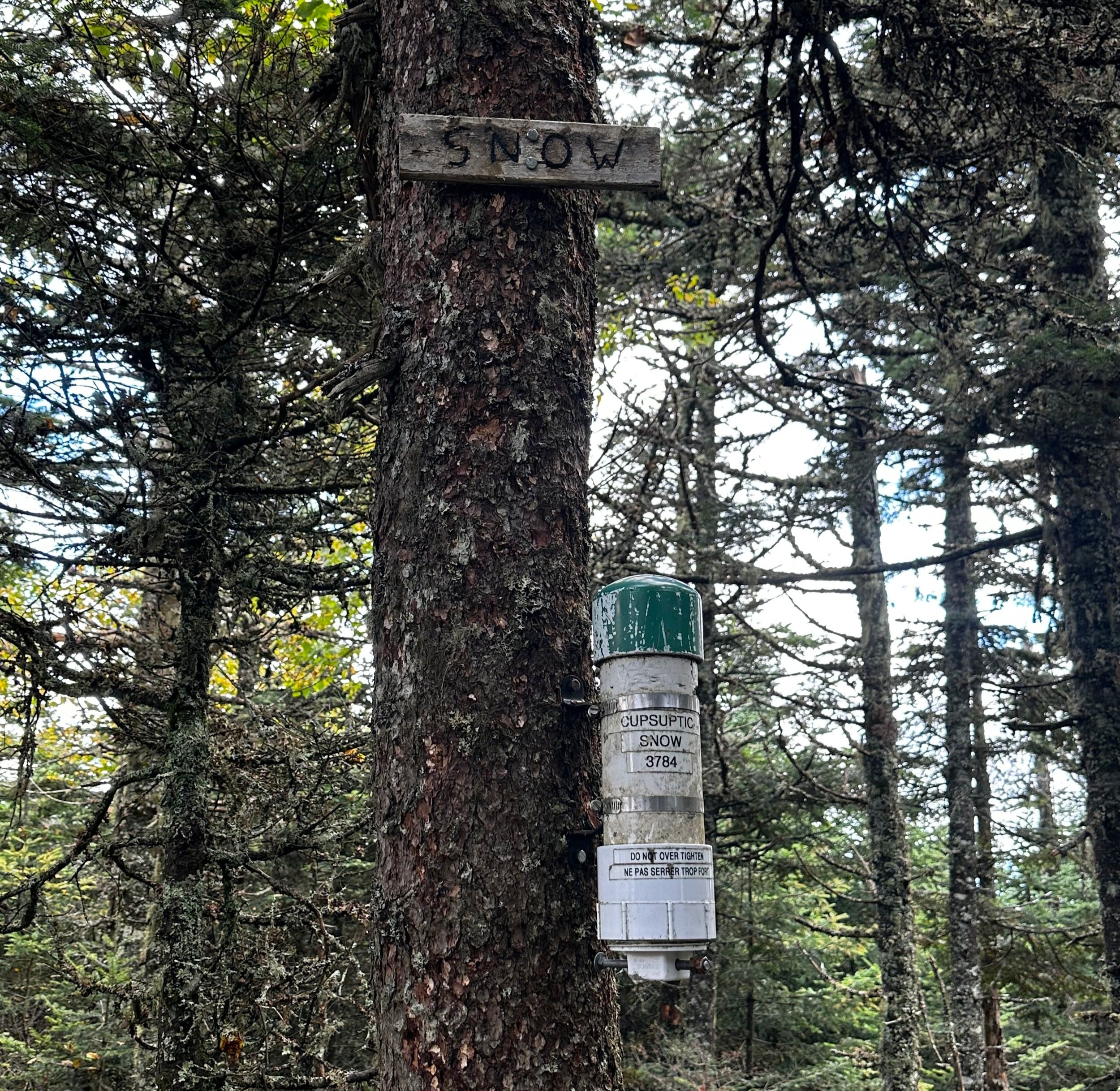
Summit of Snow Mountain
As the higher reaches of the mountain began to noticeably coalesce into a point and the sky became visible beyond, I traipsed into the meager summit area, where I located the PVC canister and searched its contents for the register book and a functioning writing implement.
After logging my ascent and returning the notebook and pencil back to and sealing up the Ziplock bag, I bade the mountaintop a heartfelt goodbye and followed my ascending tracks back downslope. Now determined to trek this faint herd path in its entirety, I simply wanted an easy descent and to return to my awaiting car for dinner, warmth and dry clothing.
Where landing meets forest
Noticing where I had emerged from the trailless woods, I blew past the location now with a slight jog to my pace while descending the beautifully dry and solid footpath. Upon nearing the logging landing once again, I could see exactly how I had missed the faint path on the ascent, for, it was obscenely overgrown for its onset and perhaps rerouted at least once during its course. However, beyond the initial 25-30’ of brushy path, the route was extremely easy to follow to the recognized summit and back.
With more surprise at the overgrown pathway, I continued to follow the old road out of the landing. Evidently, a secondary herd path is now forming in the tall grass alongside what is likely the original route, now appears to be nothing more than a washed out and eroded drainage.
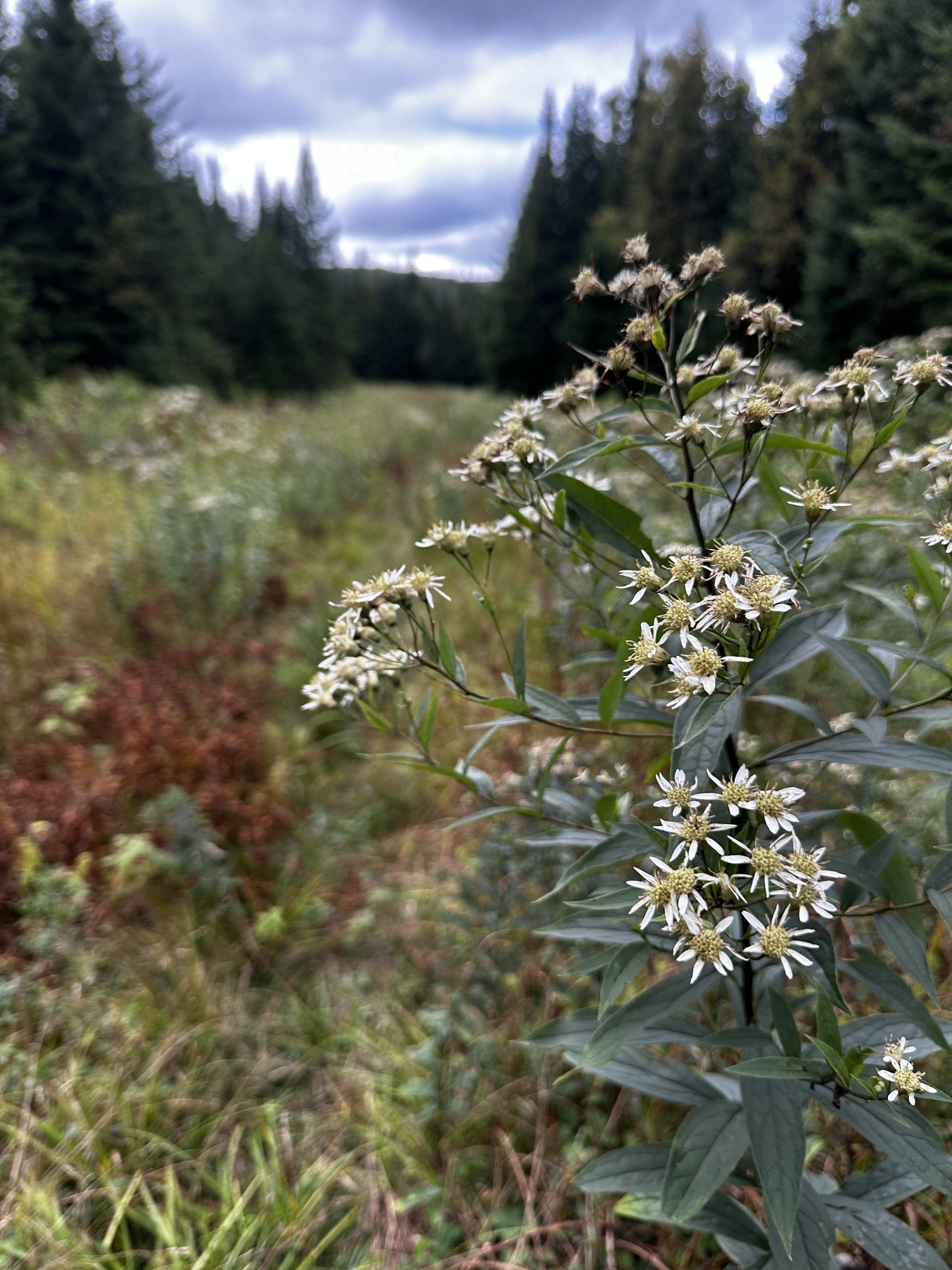
Trekking out through gorgeous groves of wildflowers
Despite the wildflowers now having grown to chest-height, the travel through the lower herd path/logging road section was extremely quick and easy going with an obvious path to follow. Footing remains soft and agreeable until reaching the next set of rock cairns, these leading from the initial road which had become flooded.
In hindsight, I should have remained on the old logging road as I was now finding the standing water and mud completely avoidable. I likely would have summited Snow Mountain much sooner, but no doubt would have given up a run-in with a moose in the wilds of Maine.
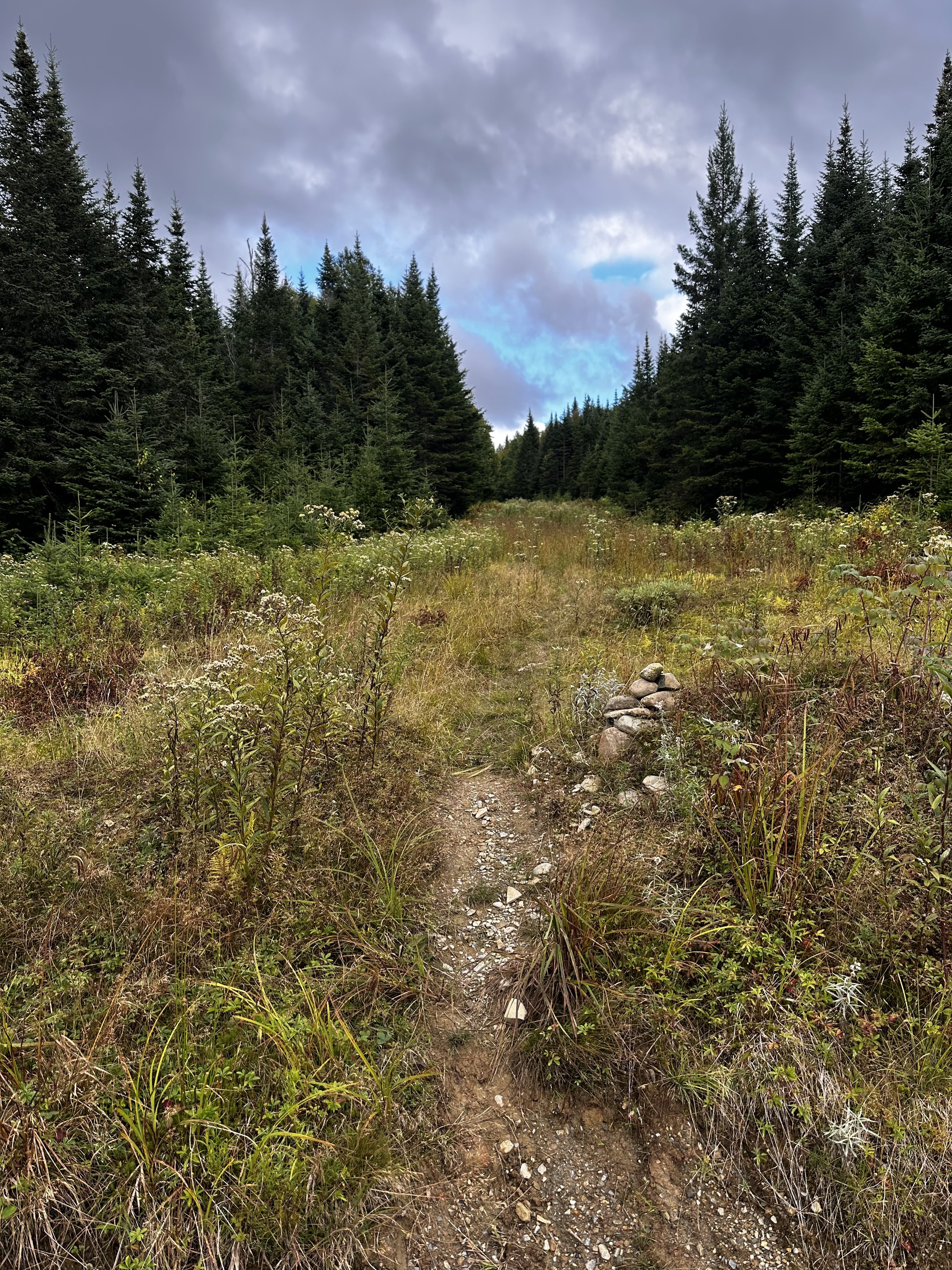
A grassy trek to Snow Mountain
Excitement ran high as I trekked the final descent where I would find my awaiting Subaru. Muddy shoes and socks were pried off, fresh, dry clothes were put on and snacks were obtained for the coming drive - I now had to navigate myself and Subaru to the next trailhead where I would hopefully find a safe and desolate area to park and shut my eyes; for tomorrow, I have much more hiking and exploring on the agenda!
Next up: Snow Mountain (Chain of Ponds)
Overall stats for the day:
4.16-miles
2hr
1,339’ elevation gain
Snow Mountain (Cupsuptic) - 3,784’