
Mount Field - West Peak
As I trekked the trailless mountainside, I tried to strain my gaze deeper into the forest canopy, searching for whence I’d meet the impenetrable wall of spruce; on and on I roamed ever higher up the 3,691’ summit cone, but all I found was a quiet, heavenly ancient-appearing coniferous landscape - heck, even the late-season snowpack was on my side today.
Most are familiar with this mountain’s taller neighbor, Mount Field, who holds the title as a coveted 4000-footer peak, often hiked as part of the “Tom, Field, Willey Loop”.

Moody skies in Crawford
For a while I had been scouting routes to ascend West Field by way of Ethan Pond Trail, which begins in Crawford Notch State Park and would provide a hefty ascent from 2,750’, crossing the North Fork East Branch Pemigewasset River along the way.
This project had been on the back-burner while waiting for snow to melt, allowing for a snowshoe-free approach. Then I saw several reports of hikers bushwhacking from the A-Z Trail which begins at the heart of Crawford Notch, near the AMC Highland Center.

Looking east, down the Avalon Trail
None of the reports I read were particularly favorable, some referring to “moss-traps” and atrociously thick woods in areas; some made mention of agreeable woods, but not for great stretches of distance; most of whom had ascended from ~3,050’, at the old FR 192A snowmobile path. All the while reading these reports I wondered how the woods would be if one were able to hold the 3,400’ contour line and meet up with the Field-West Field col, and ascend from there. Expecting minimal easy trekking once off-trail, I thought perhaps today I’d give it a shot.
Taking a parking spot along the shoulder of US Rt 302, I was surprised to be the only hiker in an otherwise usually busy network of trails. There looked to be a dense cloud layer blanketing the majority of the Presidential Range across the street, but for my western peaks, the cloud ceiling appeared high enough - not as if I was expecting any views on West Field’s forested summit anyhow.

Tom-Field col
Armed with recent reports of packed and well-travelled trails along the Tom, Field and Willey loop, I was ready for a quick, steep ascent up to the Field-Tom col. With snowshoes on my feet I departed the Crawford railway station, adjacent to where I was parked and immediately into a beautiful grove of white birch; I have always enjoyed the initial trek along the Avalon Trail for this very reason.
The Avalon Trail begins rather gradual but was a snowshoe trench super highway; rock solid footing made the ascent brisk and efficient, just as I had hoped. Passing over several snow-bridged waterways, the Avalon Trail gains ~840’ in the first 1.3-mile stretch before breaking off westerly, toward the Willey Range Trail.
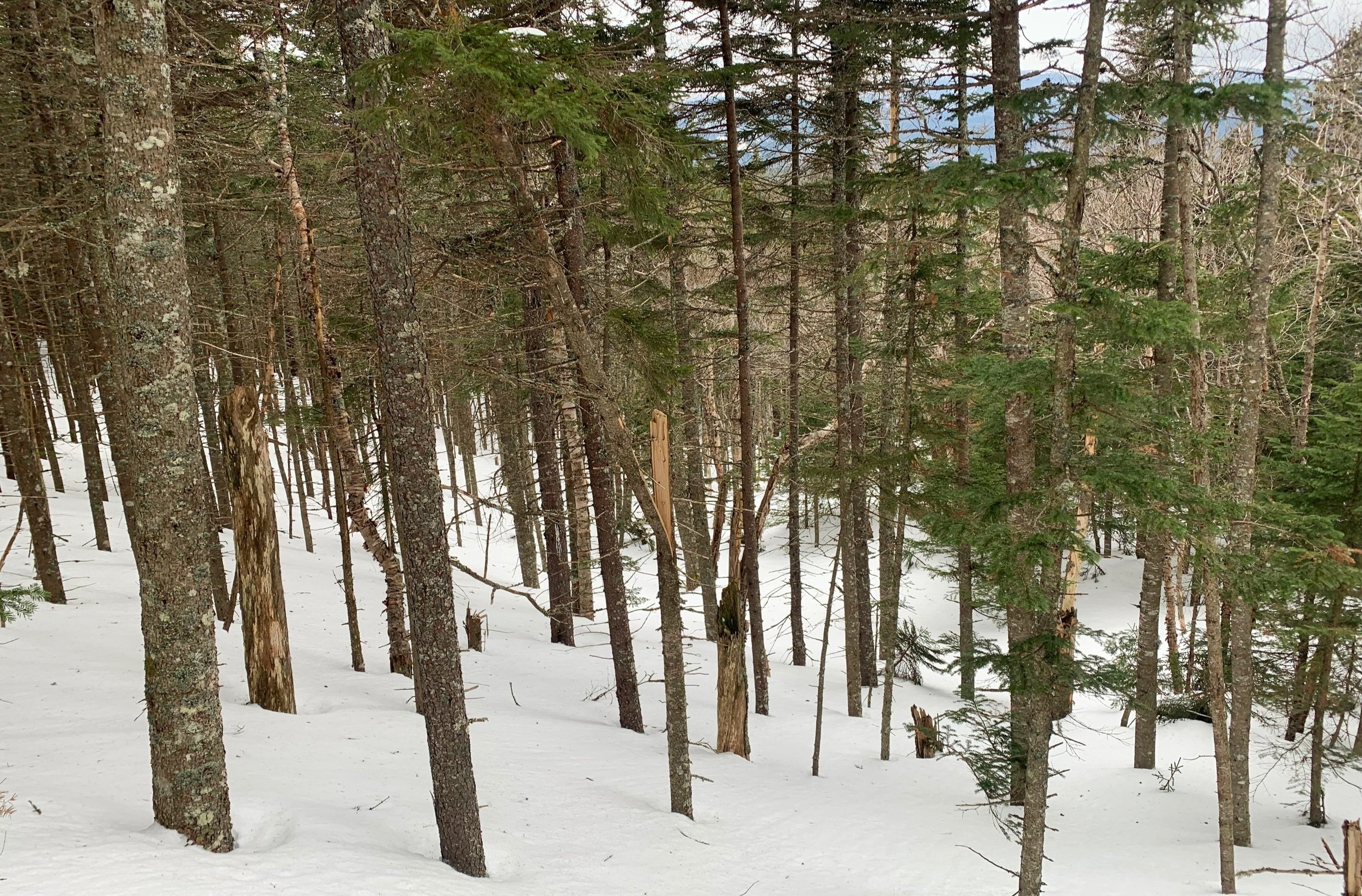
Bushwhacking the southwestern slope of Mt Field
Once on the A-Z Trail I began meandering past old birch and conifer trees, passing over several snow-bridged drainages while enroute to 3,700’. The trail remained solid and was made easier by basically “front pointing” my way up the grade.
As the steep hillside tapers off, the Mt Tom Spur sign comes into view - always a relief to see that tiny white and green USFS/AMC sign. Nearby the similarly colored A-Z Trail sign is found, today it was only several inches above the deep snowpack.

Low dome of West Field through the trees
Wasting no time I pressed on as the path began its westerly descent. Soon, the Willey Range Trail departed on my left, taking all signs of a packed snowshoe path along with it; I’d be breaking trail from here to West Field and back to this spot.
Once off the packed trail I knew not a single fiber in my body wanted to descend all the way to 3,050’ - I’d be attempting my side-hill traverse, for sure.
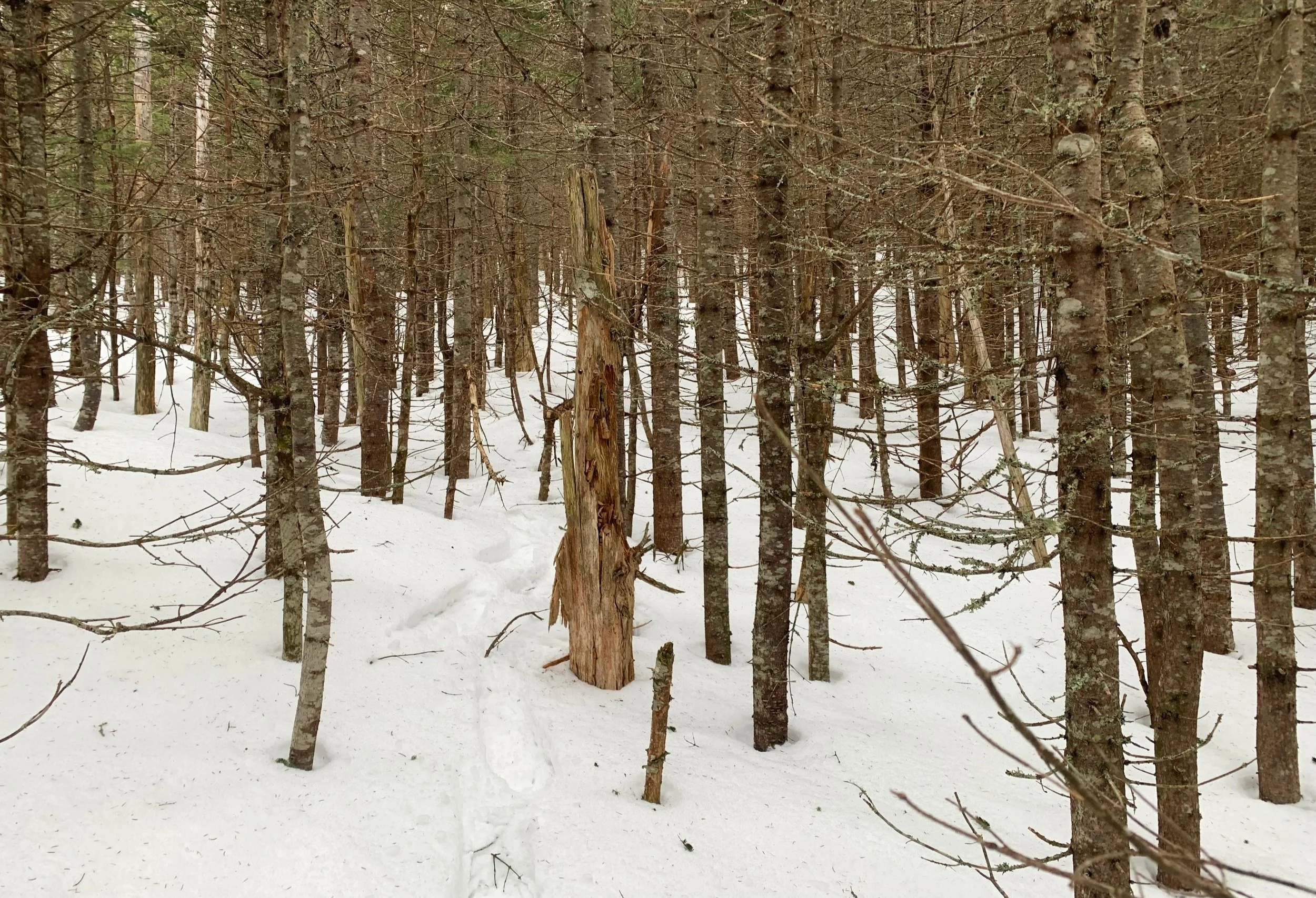
A bit thicker through the col
Descending to merely ~3,625’, I spotted decent woods to the south and with a shrug of the shoulders, departed the yellow blazed trail. Initially the bushwhacking was absolutely tolerable, for the moderate amount of spindly branches to contend with and swim through, the going was actually anything but atrocious - however, I knew the worst must be just up ahead.
I always remembered the beautiful, open conifer forest while trekking from Tom to Field, along the Willey Ridge Trail, that stretch always stuck out in my mind; a majority of my traverses along that high path have been in varying winter conditions, it always looked so enveloping and lovely to my eyes when a forest is cloaked in white. That sort of forestscape is exactly what the initial semi-dense ~0.1-mile opened up to.

Ascending West Field
While unsure of how long this easy-going, efficient forest travel would last, I could see young, bright green evergreen boughs just below me, at a lower elevation - I was determined to not drop into the thickness, at all costs.
Eventually, a view out to my objective opened up; the low dome of West Field seemed so far away; little did I know from what I was seeing, continuing on my ~3,500’ elevation trajectory would make this one of the finest, most satisfying bushwhacks of the winter season.
Honestly, I was expecting trash for snow; after yesterday’s trek up the East Peak of Scar Ridge proved to be 8” of slush by the end of the morning and with persistently warmer temperatures overnight. Sure, the snowpack had that granular, springtime quality to it since I had departed packed trail, but floatation here was top notch - it appeared that I sunk 4-6” with each step, not bad for a lingering 4-5’ snowpack in the backcountry!
Slide-streaked shoulder of Mt Field
Following a brief scramble up a hillside on the other side of a minor drainage off Mt Field, I continued to hook clockwise to meet the Field-West Field col at ~3,450’. The western end of this connecting depression contained a short patch of scrappy, pencil-thin forest but was never oppressively thick, all along I kept assuming the worst was yet to come.
Once through the col and back to ascending, all around appeared to be a birch and balsam meadow, perhaps this was the nasty, boggy section that robbed other hikers of their shoes - but today it was a base of drifted snow, quite solid now with well-spaced fir draped in lichen and mosses.
I trekked southwest toward the summit cone and after several mildly steep sections began with a more southerly direction while basically always following the direction of “up”. Just prior to reaching the high point of West Field I found several spruce traps which attempted to swallow me whole amidst a patch of young evergreen - I should have known they would be lingering out of sight, beneath my feet!

A feathered summit friend
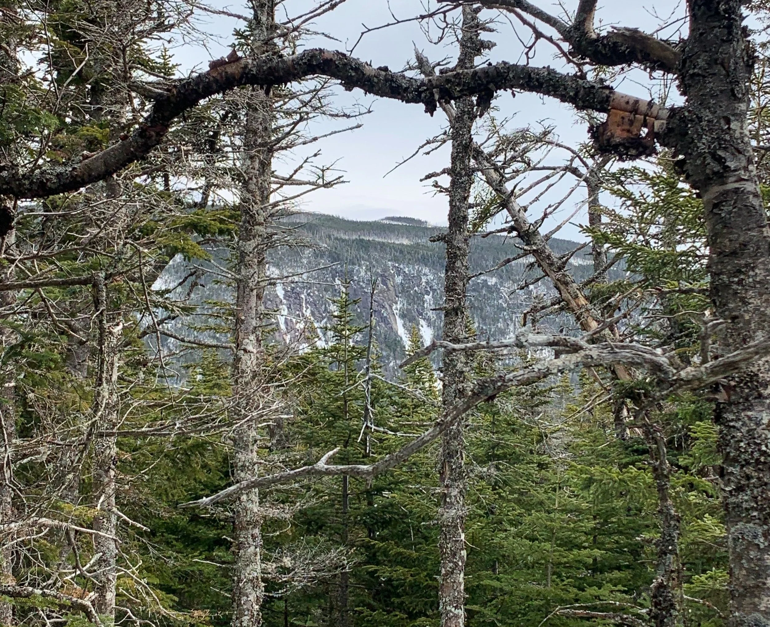
As a trade-off for becoming temporarily stuck in buried conifer branches I was rewarded with some fine views of neighboring Mt Field with several of its balding forest patches overlaying areas of mountainous ledges. Occasionally, views opened up toward Mt Hale and the Twins but with the cloud ceiling hovering right around 3,800’, I found nothing spectacular about the hazy vistas.
Reaching the recognized high point, I was joined by a plump Grey Jay while I signed into the newer summit register book. I jokingly offered my new summit pal some of my herbal tea, of which it probably would have sipped, flying to a lower branch for a better look - I don’t feed wildlife so unfortunately these woodland creatures will have to look elsewhere for a salty treat.
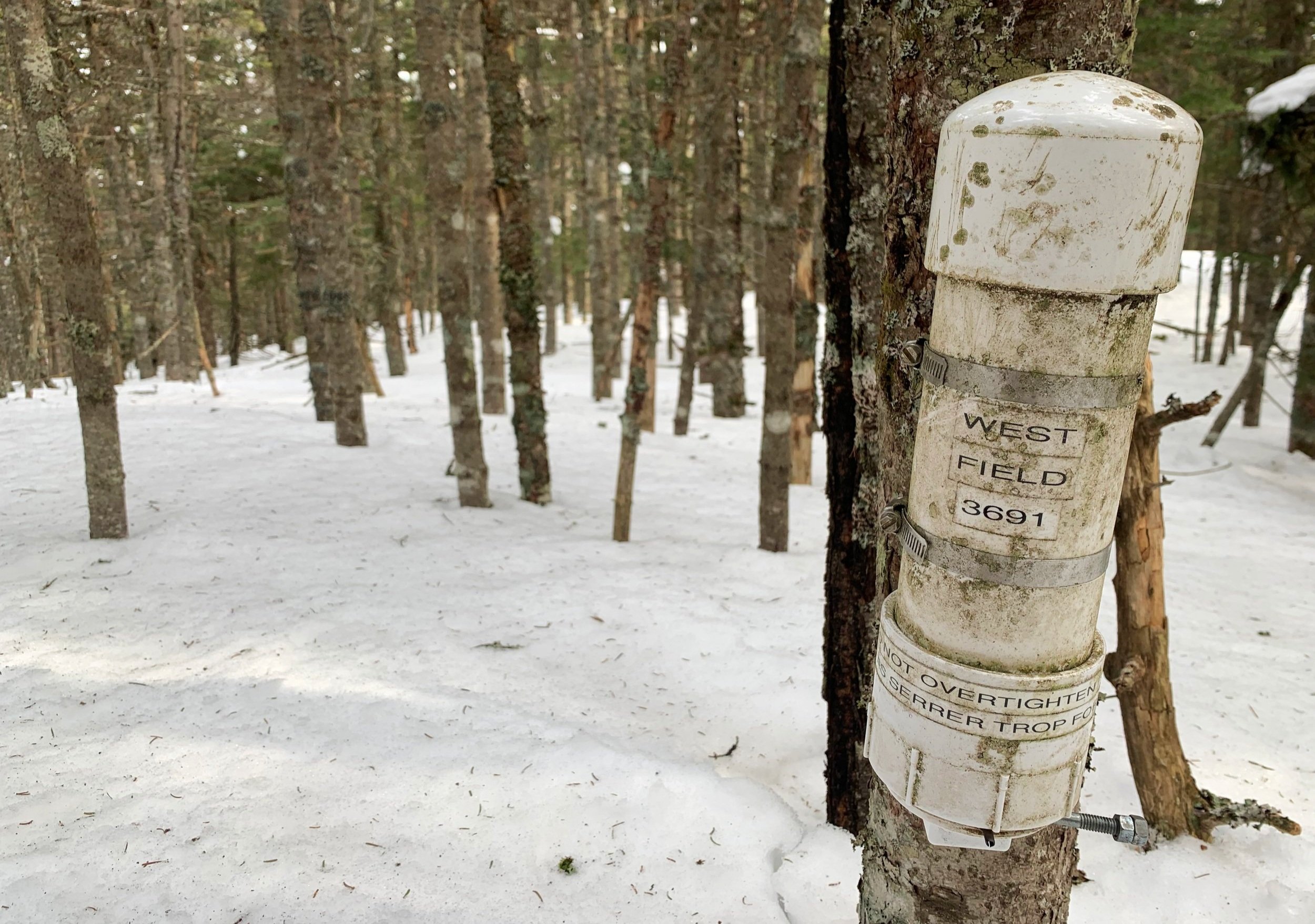
West Field summit
As I sealed the canister back up I had the realization - I had reached the summit of West Field and found none of the treacherous bushwhacking mentioned on others routes - it couldn’t be due to the snowpack alone, this route through the trailless forest was certainly a winner in my book.
Retracing my steps, I veered off here and there to look for hidden lookouts, the time was just past 9am and I had nowhere else to be but amidst this beautiful forest, taking in all the sights and sounds it had to offer. The remaining snow at 3,500’ took me back to the glorious snowshoeing of several weeks prior - when the deep powder was like riding a fluffy cushion down the mountainside - a true pleasure to cruise atop and I wanted to enjoy it as long as I could, for I know the real spring thaw is simply biding its time.
Overall stats for the day:
6.84-miles
3hr 24 minutes
3,002’ elevation gain
Mount Field - West Peak (West Field) - 3,691’