
Dorset Mountain
A cotton candy cloud layer blanketed Manchester and the surrounding low-laying towns while a stunning red-orange ball of sun crested over the distant mountains; early-morning birds awoke in the needled canopy of balsam fir and broke the otherwise silent morning air; frost and rime gently cascaded off evergreen boughs as the morning alpine glow began to warm another autumn day.
Finishing up a sunrise hike atop Equinox Mountain (3,840’) and its neighboring ridge, Lookout Rock (3,662’), I traipsed down through a blanket of fallen leaves amidst a glowing northern hardwood forest. With western Vermont mountainsides radiating such brilliant shades of gold, orange and deep reds, I could not let a minute of this glorious blue sky day go to waste.

Sunrise from neighboring Equinox Mtn
Just several miles to the north was another peak on the New England Hundred Highest list which I had been scouting out for quite some time, finally, today I found myself in the neighborhood with mountains on my mind. I had perused several brief reports before venturing to the Dorset Mountain trails, but with the true high point being a bushwhack with no views, there was minimal intel to gather from previous ascents.
Following a dirt road past several farms and residential homes, I parked in a small cul-de-sac area as the road faded into impassable disuse; I saw no hiker parking signs but was clearly parked out of any landowners way; beginning my hike at the end of Tower Road, just after crossing the Mettawee River.

Early along Tower Road enroute to Dorset Mountain
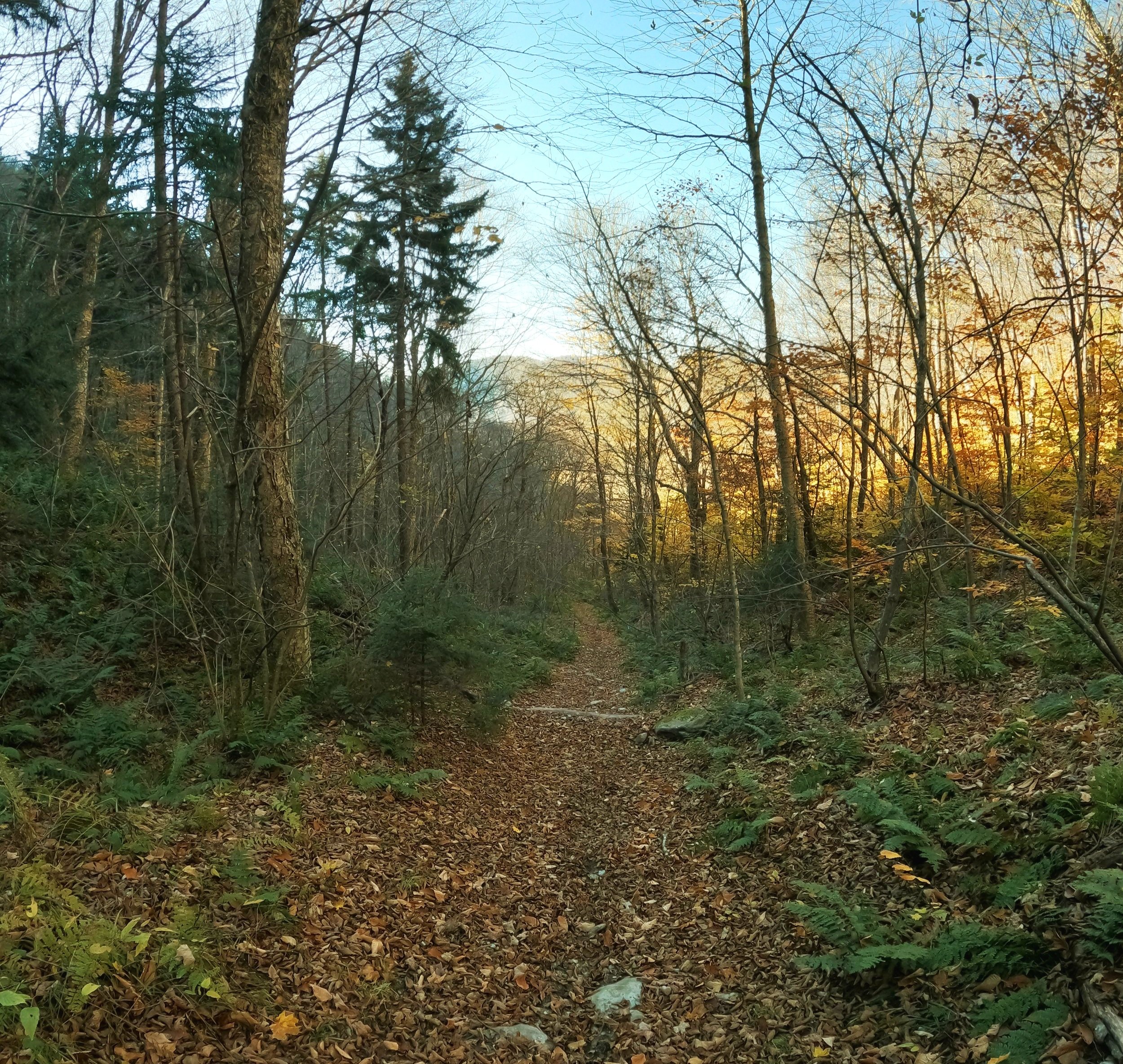
Continuing down Tower Road, now on foot, several shallow water crossings were made past various grown in logging roads and landing areas. Climbing ~400’ in the first mile, the old woods road passes through a beautiful birch grove, which was casting a warm yellow-orange glow onto the forest floor below.
Mixed hues of green began decorating the mountainside as lofty ferns took over the understory and lush evergreens draped over head and onto the surrounding hillsides. The path cuts up-slope with the trailless West Dorset Mountain (3,515’) to the east and today’s destination, the two peaks of Dorset Mountain toward the east.

Autumnal birch grove
Becoming more of a loose-footing single track path nearing the 2,950’ col, our trail veers off right while another old woods road continues to the north and eventually terminates on modern maps; I did not use this northerly stretch of trail so cannot report on its maintenance status - numerous areas where I had hiked contained small, localized areas of blowdown which were easy enough to duck under or climb over.
The trail which I continued on, at the right of the flat junction, still appeared to be an old forest road (access to the fire tower, perhaps), its width and footing being a clear give away. Knowing there would soon be a loop section of trail encountered, which I had intended to descend upon while returning from the more popular 3,730’ summit, which features an old fire tower, I stayed left at the first junction.
Gaining elevation along the old forest road
While remaining on the old forest road, the footway soon became overgrown, boggy and moss-covered in most places. Still, with clear evidence of prior foot traffic, I pressed on down the lonely old road.
Soon enough I noticed my path was obviously proceeding past my intended destination, the 3,770’ Dorset Peak, I was clearly not on the correct trajectory. Knowing this I veered off into a very mossy, mature conifer forest - which honestly looked very similar to what my pathway had been fading into as it continued northeasterly, diverging from my summit entirely.

Bushwhacking to Dorset Mountain summit
As I had trekked past the summit, I began hooking back in a southwesterly direction while continuing to ascend at a moderate grade while trying to step as light as possible on my beautifully springy moss and fern carpet. Occasional hints of herd path were clues in which direction I needed to ascend, obviously I had not been the first to summit by this off-beaten route.
Nearing the high point of the summit I ran into a plethora of meandering herd paths - either local moose had ventured in every direction or prior foot traffic had really left their mark upon the fragile summit area. Finding the canister which contained a summit register log, I signed in and paused to take in my surroundings, half expecting a moose to mosey out from behind the appearingly ancient fir trunks.

Pathway between peaks
Even though the path between the two Dorset peaks is not technically maintained or blazed, it does now appear on some maps. Clearly the pathway is another old woods road or ATV path; when I ventured through in October, it was very wet in areas, of which were crossed atop fallen logs or rocks. If not for the dirt bike and ATV tracks which have completely annihilated the old path, it would have been a very pleasurable stroll; underfoot was a fine bedding of decomposing evergreen needles and soft, rich soil.
At ~0.4-miles from the higher, more northern Dorset peak, the split for the southern, fire tower-bearing summit is reached. While some fine views can be had from a clear cut near the old fire tower base, I’d bet the 360° views were some of the best in the western Green Mountains.

Northwesterly views
I poked around in the woods briefly looking for any other lookouts or interesting forestry related relics but just found broken glass and trash from the summit being host to various parties over the years.
Continuing along the loop trail, which would meet back up with the old forest road I had ascended on, the footing was incredibly rough, appearing almost like the trail-work was incomplete - either I was off-trail or this section was as good as another bushwhack.

Camouflaged North Dorset signage
Back on my familiar forest road and heading west, toward the West Dorset-Dorset Mtn col, I considered extending my outing with a visit up to the trailless West Dorset summit which is featured on the Vermont 3,500’ peak list; proceeding back down my old forest road I decided to save that hike for another day, allowing a generous amount of time to bask in the autumnal birch and beech forest glow.
The dual-topped Dorset Mountain was a very nice trek in the remote woods; while time nearly became irrelevant, meandering along abandoned forest roads to moseying through higher elevation fir groves helped to forget about the bustling cities far below. Hopefully in short time these grand forests can also regrow and repair the hideous tire tracks tearing up the 3,700’ mountainside, as they are relentlessly reclaiming the old, retired fire tower access roads.
Overall stats for the day:
7.11-miles
2hr 16 minutes
2,559’ elevation gain
Dorset (North) Mountain - 3,770’
Dorset (South) Mountain fire tower - 3,730’
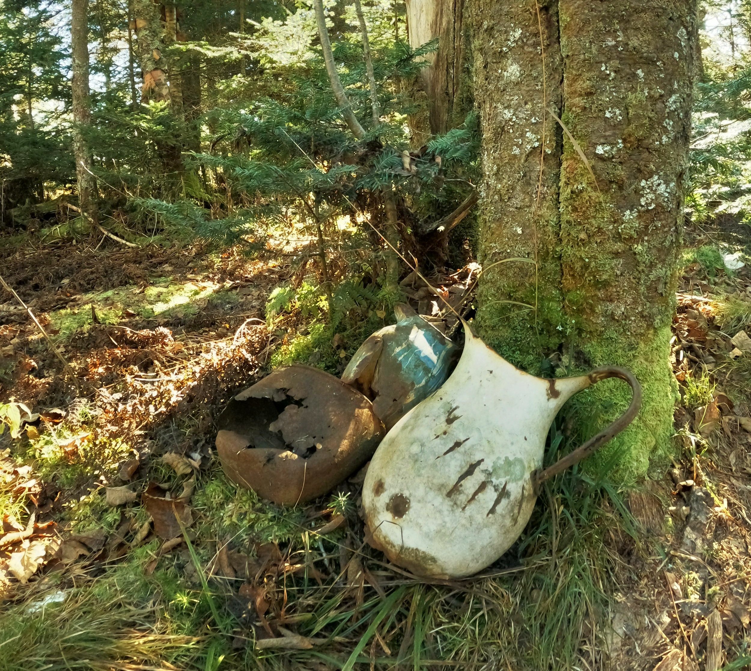
Summit relics