
Welch + Dickey Mtns
To feel the warming sunrays from atop an open summit; who knew this sensation would feel so much like home, perhaps until it becomes removed, replaced with wildfire smoke-induced atmospheric haze, which results in daily torrential rainstorms for weeks on end. This feeling was well received atop Welch and Dickey Mountains, while ascending their bare ledges and taking in the distant views - as gloomy clouds remained draped atop the western White Mountain peaks, blue skies had welcomed us for a most beautiful summit session atop the pair of rocky summits.

Setting off on the Welch-Dickey Loop Trail
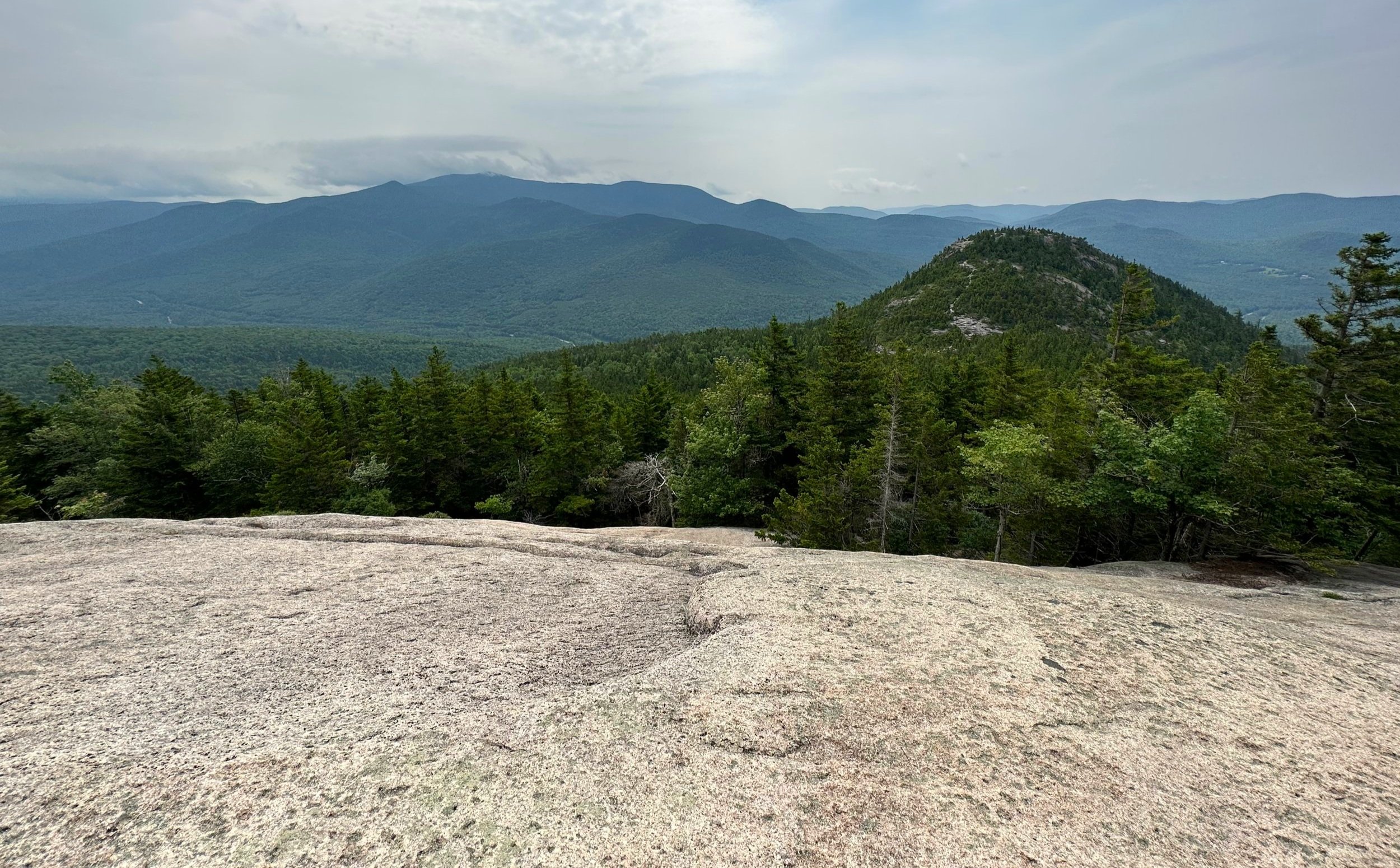
At 2,605’ and 2,734’, Welch and Dickey Mountains, respectively, are far from the loftiest of Waterville Valley, but - as with countless other lower summits - afford stunning glimpses of the Sandwich and Breadtray Ranges, the Tripyramids and (toward the south) Squam Lake peaks, making regular, everyday summits appear much more grandiose as they rise up nearby. Had Mount Moosilauke, the Franconia Range and those peaks found in the Pemigewasset wilderness been in clear skies as well, the sawteeth-like horizon would have continued well to the west from our mountainous vantage point.
Located down Orris Road, the USFS trailhead for the Welch-Dickey Loop Trail can be found by following traditional brown and white hiker signs which guide to Upper Mad River Road. From there, turning right on Orvis Road, the trailhead is located 0.6-miles northerly, on the right side of the road. Here, are located two vault toilets, a small information kiosk and an iron ranger, which happily accepts the $5 non-voluntary donation required to utilize the parking area; or simply carry and display a National Recreation Park Pass, which waives all parking fees of the White Mountain National Forest (excluding State Park fees).
Wide footway of the Welch-Dickey Loop Trail
Departing out of the northern tip of the paved trailhead lot, immediately the trail branches: a right turn here will guide counter-clockwise around the Welch-Dickey Loop Trail, while a left turn will soon meet up with the loop trail for a clockwise circumnavigation; venturing further northwestward, the trail soon becomes the Dickey Notch Trail, which leads by way of old logging roads with nice footing to a picturesque boggy area, from whence tributaries to the Mad River can be found beginning their downstream course.
While certainly possible to trek the Welch-Dickey Loop in either direction, it is preferred by most to ascend the bare ledges of Welch Mountain, rather than to descend the rock slabs, as they are quite steep and can be slick at times.
Along the Welch-Dickey Loop Trail
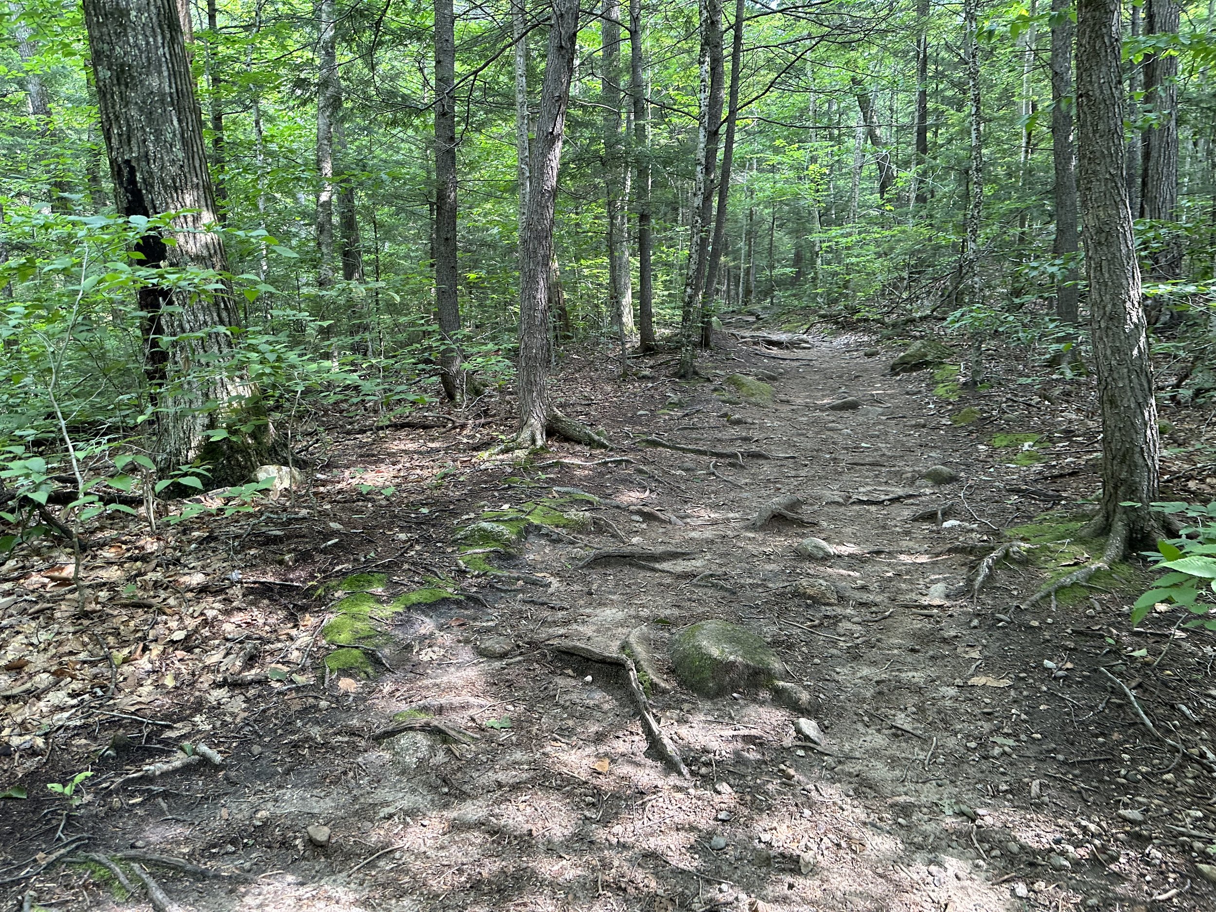
Beginning in a northeasterly direction, the Welch-Dickey Loop Trail (counter-clockwise) almost immediately crosses a tributary stream atop boulders and rocks - today, the water was quite high, requiring a staggeringly cautious crossing - necessitating intentionally placed steps, as most rock tops were found slightly underwater.
Beyond the crossing, the trail oscillated from dry stretches to ballooned-out, soggy patches of muddy path, widened from years of hikers trekking around the mud and not traipsing directly through; most areas of wet trail even had rocks placed which could be used to walk upon, remaining in the natural width of the path, avoiding widening the footway. Even sections which had rock walls placed to guide hikers down the path were unfortunately trampled beyond the edges of the recommended route, now becoming distinguished herd paths, devoid of vegetation.

Habitat Restoration signage nearing the ledges
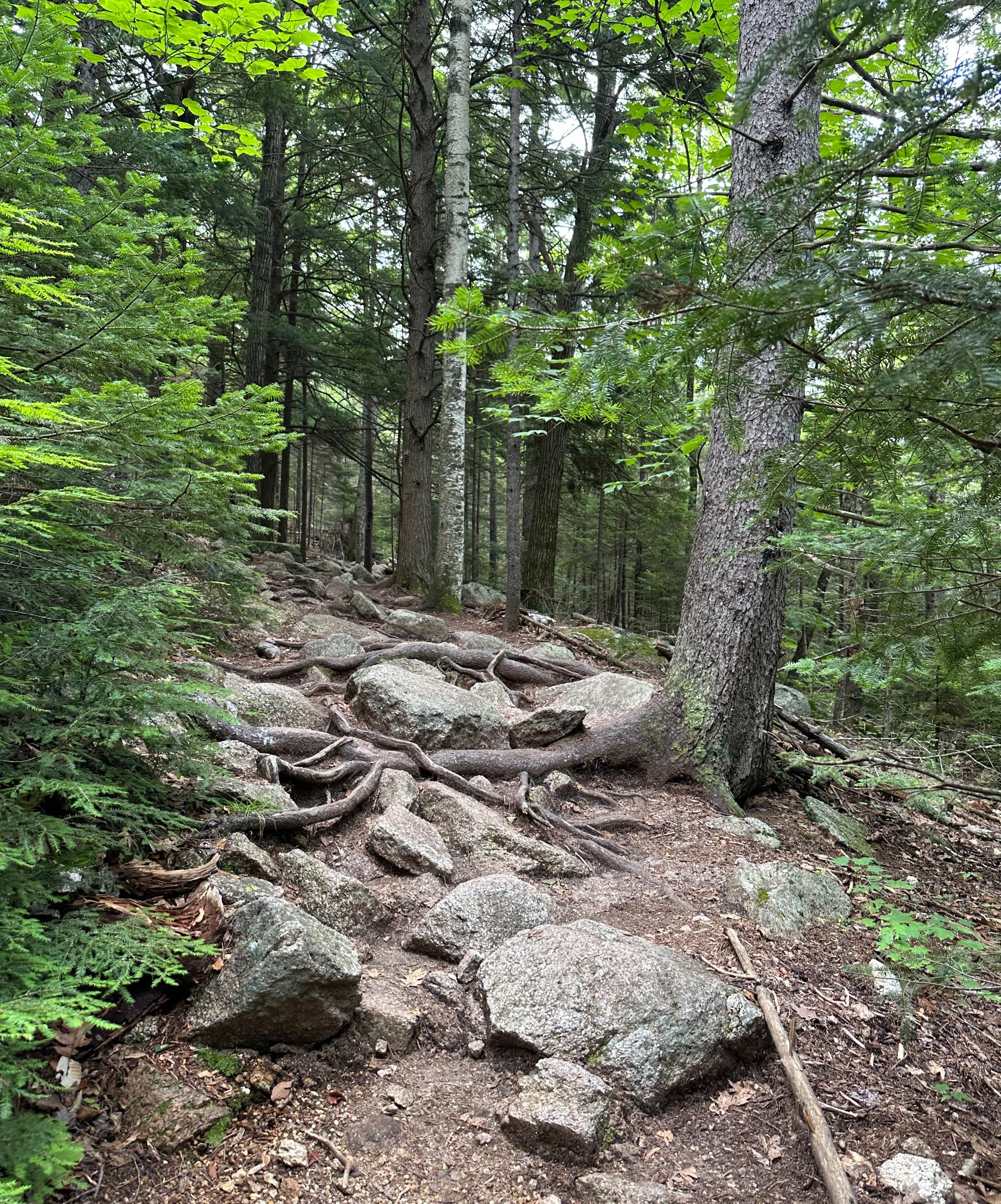
Roots and rocks emerged from both dry and saturated path as we continued to ascend, gradually for the first 1.4-miles, until reaching a pronounced southeastward swing in the route. Leading up to the switchback, several massive boulders are passed, which lay trailside, to be questioned inquisitively as to their origin and mode of downslope transportation.
The Welch-Dickey Loop Trail significantly begins to dry out once the swing is made; heading now southeastward, the trail is mostly atop bare soil with massive roots and boulders emerging from the treadway. Cutting along the mountainside, the path ascends a broad, wooded rock slab before leveling off and guiding toward the first set of lookout ledges; near here, the original trail from Upper Mad River Road would have entered (prior to the Orris Road Trailhead construction of 1983).

Ascending with Welch Mtn in the distance
Emerging onto the ledges, trailside kiosks advise hikers to remain on the trail to prevent further trampling the fragile, rare sub-alpine plant species. Through this section, dogs must also remain on leash to prevent fecal contamination, trampling vegetation or chasing and scaring wildlife - ironically enough, today, there were folks enjoying the views with their dog running wildly off-leash, only several feet away from the sign asking patrons to leash their canine friends.
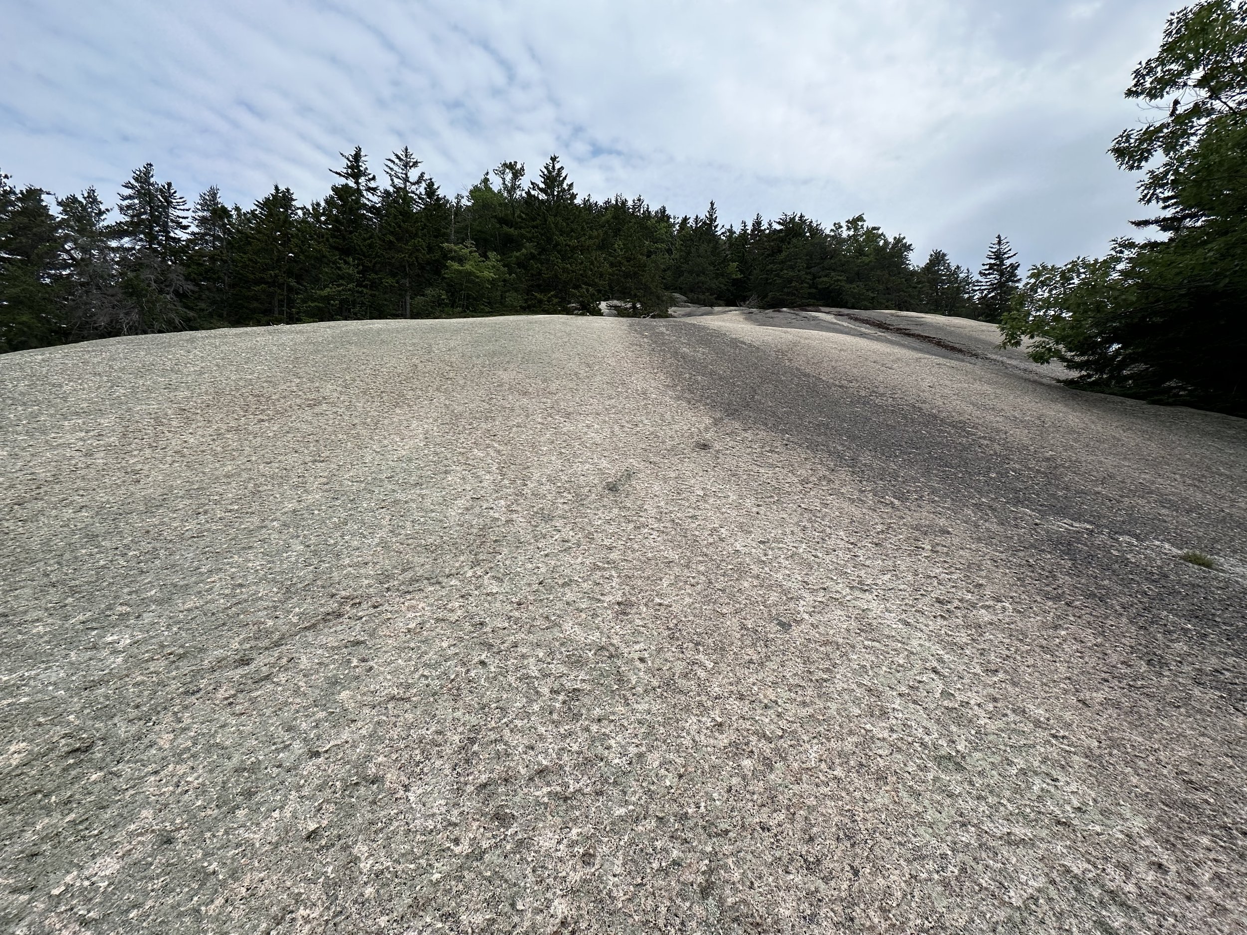
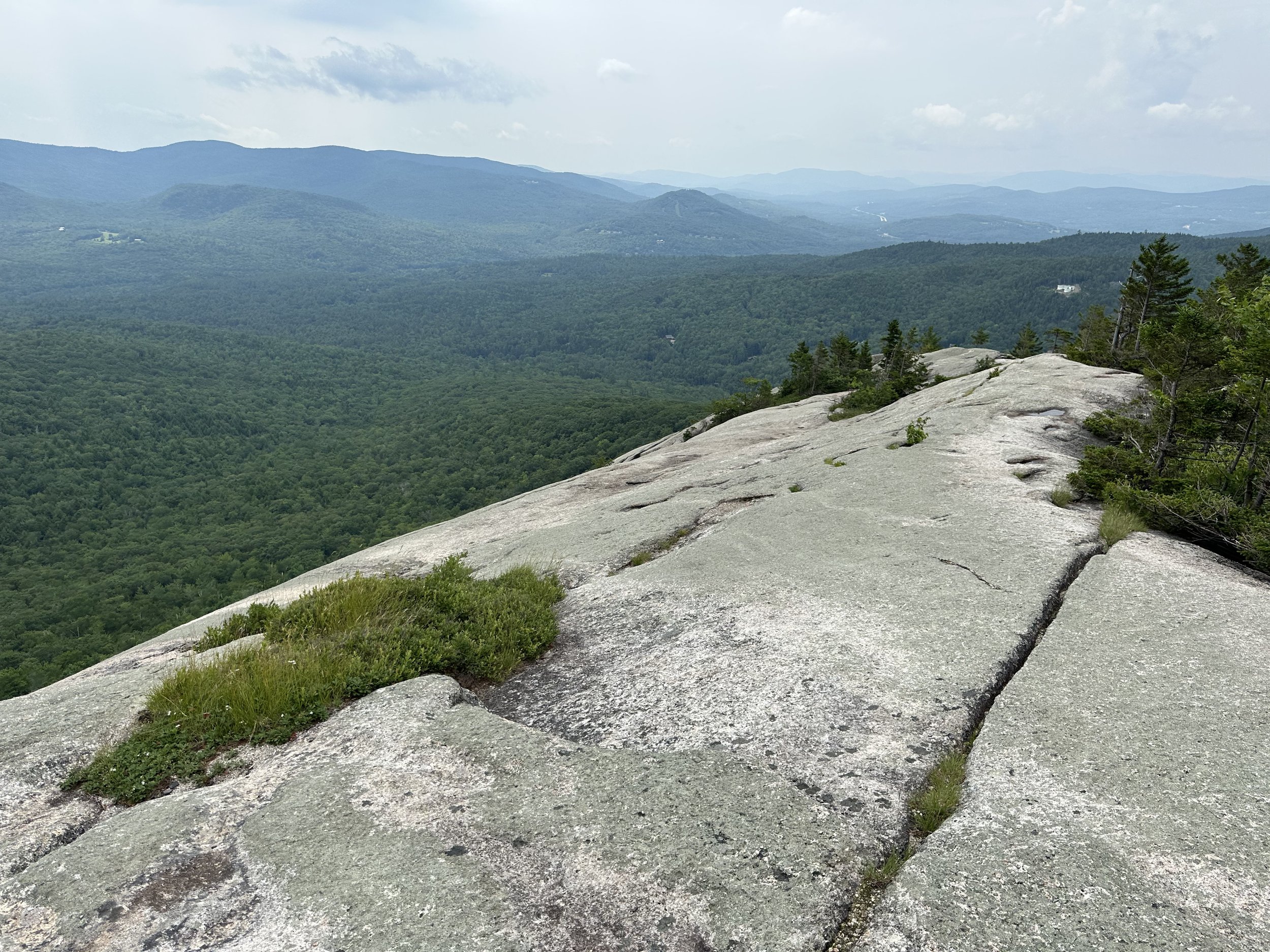
Massive, wide slabs of Welch Mountain
Lined with logs and rocks, the bare granite ledge trail swings northward to ascend the southern ridge of Welch Mountain proper. Passing patches of ripe blueberries and mountain laurel, small communities of dwarf birch, jack pines and spruce can be found in this unique and special area. Initially a mellow grade, the pathway soon becomes steeper as the ledges build up, culminating in several areas of long, wide slabs to clamber up; many of these wide, ledgy slabs offer no reprieve or safe, flat place to stand and take a break until reaching treeline far upslope.
As the Welch-Dickey Loop Trail makes several swings and switchbacks up the ridgeline, Tecumseh and the Waterville Valley ski resort area comes into view northeastward; while from behind, Noon, Jennings and Sandwich Dome peaks dominate the skyline, Bald Knob and Sachem Peak rise gently in the valley.

Tight squeeze along the Welch-Dickey Loop Trail
As one steps off the steep, bare granite ledge and into the forest reprieve momentarily, wooden USFS signs denote the path direction with arrows pointing toward the yellow blazes. Brief, steep scrambles work like steps up the mountain, gaining elevation one chunk at a time; at one interesting section, the pathway even cuts right through a massive, cracked boulder before scrambling along the backside, up smaller granite boulders.

Looking ahead to Dickey Mountain from Welch
Nearing the summit of Welch Mountain, the granite slabs show interesting erosion patterns as well as irregularly worn potholes in the substrate; jack pines and spruce grow increasingly short and scrubby as one follows yellow blazes up to the mountaintop along more open ledges. Topping out on the 2,605’ open peak of Mount Welch, the long, southwestern ridge of Dickey Mountain now comes into view, whose streaked and bare, cascading flows of granitic ledge will be descended upon later.

Sandwich Range
Departing the summit area, the trail descends 85’ over 0.15-mile atop layers of granite, acting as steps, the rock generally provides plentiful grip in dry weather to descend into the wooded notch. Reaching the low of the Welch-Dickey col, a truly massive rock cairn is passed, beyond which the Welch-Dickey Loop Trail dives back into treeline for a short traverse through a very open forest of spruce, dotted with white birch; roots and conifer needles comprise the footway, which was surprisingly dry for our passing, roots emerge from the compact, earthen trail like a network of reaching tendrils.

Wooded notch of the Welch-Dickey col
Once ascending Dickey Mountain, the pathway climbs steeply yet again, atop large granitic humps to reach the bare ledge; hands are once again employed for balance and aid up the mountainside, exposed roots are found in most opportune locations, which have evidently doubled as handholds for many previous climbers. Emerging atop the bare summit cone ledges, a glance over one’s shoulder reveals the interesting pathway used to descend Welch Mountain as well as its many steep sloped ledges and cliff faces adorning its shoulders.

Short, steep ascent of Dickey Mountain
With an ascent of 240’ from the col, the mountaintop crests, culminating at a moderate-sized rock cairn, likely denoting the summit of Dickey Mountain, while continuing slightly further westward around a corner, a slightly higher location can be found atop bare bedrock - perhaps this might be the true high point of Dickey Mountain, but is unsigned and unmarked as far as I could tell.
Looking back to Welch Mountain
While there once was an obscure trail leading from Dickey Mountain to Mount Tecumseh, traversing the ridge over Green Mountain, the trail can still be followed in most instances along the ridgeway. Descending in that general northeasterly direction for several rods will bring off-trail adventurists to remote ledges which offer a fine view into the notch and of surrounding mountainsides. Back tracking can be somewhat difficult, but just be aware of rock cairns and faint yellow blazes which signify the pathway.
Open ledges descending Dickey Mountain
Alternating from bare slabs to forested trail, the Welch-Dickey Loop Trail gradually descends with a beautiful westerly panorama most of the trek. Atop several massive slabs, the trail continues following rock cairns as the route swings around areas of slick moss and lichen.
Eventually emerging on the light green-hued, rolling waves of rock slab, the trail descends atop the ridgeline with stunning glimpses back toward the summit cone of Dickey Mountain as the slanted ledges of Welch Mountain are clearly visible, following around the cirque. With the Sandwich Range front and center, the trail descends, finally reentering the forest canopy for good.

Descending just to the right of a wet, moss and lichen-covered slanted wall of bedrock, the trail swings through the evergreens atop a very coarse substrate, which becomes increasingly fine and retains moisture as one descends further. With the aid of many stone steps and stair sets, the Welch-Dickey Loop Trail enters a hardwood canopy comprised of many oaks. In a southward direction, the path meanders downslope, eventually intersecting the Dickey Notch Trail. A left turn here will guide for 0.1-miles atop a very rugged old roadway back to the trailhead parking lot, thus completing the loop circuit around Welch and Dickey Mountains.
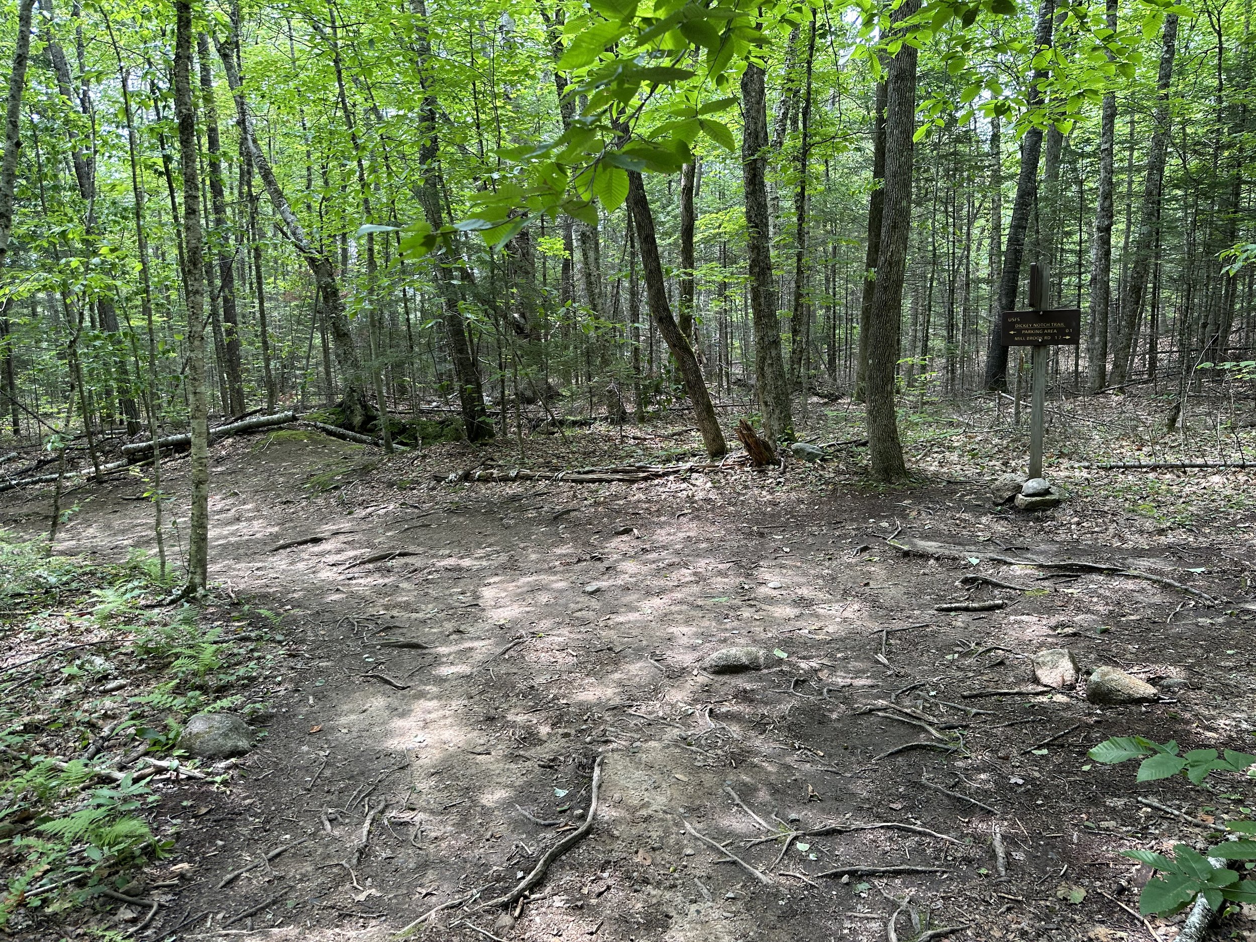
Dickey Notch Trail junction
Overall stats for the day:
4.17-miles
2hr 51 minutes (with summit breaks)
1,893’ elevation gain
Welch Mountain - 2,605’
Dickey Mountain - 2,734’

Mountain Laurel along the Welch-Dickey Loop Trail