
Mt Cardigan via West Ridge Trail
While sections of Vermont are under a state of emergency following torrential rain here in the northeast, a visit to an easy, scenic trail was in order - a recon of sorts to scope out the state of hiking trails in the White Mountains following the onslaught of rain. Since the West Ridge Trail features minimal water crossings to reach the 3,149’ bald summit of Mount Cardigan, this short and mellow trek might shed some light on how similar White Mountain trails faired, as far as drainage and erosion are concerned.

Beginning along the West Ridge Trail
Aptly named, and once known as the West Side Trail, the West Ridge Trail is perhaps the most direct route in which to summit the bald peak. The large parking lot is found in Mount Cardigan State Park, 4.0-miles east of Route 118 in Canaan, New Hampshire. Beginning initially along the paved Orange Road, the asphalt soon turns to rugged dirt and gravel as one begins ascending toward the trailhead area.
Proceeding on Cardigan Mountain Road, the winter lot (at the gate) is reached at 3.4-miles; the main lot, whose access road is unplowed in winter past this point, can be found 0.6-miles further. Offering bathrooms in summer months, there is also a picnic shelter near the parking area, beyond which the terminus of the orange-blazed West Ridge Trail can be found.

Beautiful stonework along the West Ridge Trail
Having only hiked in the Mount Cardigan State Park trails in winter while the gate is locked, I could not recall if there was a fee to enter and park at the lot; while I did see an iron ranger by the sheltered picnic area, I found no indication of a fee to utilize the hiking trails in summer months - however, I am sure the Cardigan Mountain State Forest (CMSF) and Appalachian Mountain Club (AMC) would greatly appreciate any donation for their arduous trail maintenance efforts!
Beginning northeast of the sheltered picnic area, signs denote the direction to the network of hiking trails. The West Ridge Trail begins up a series of log stairs held in place by small boulders - beautiful trail construction in place right from the start - working to help retain fragile soil amidst the heavy foot traffic. Rolling along the west ridge, the trail soon makes a soft switchback as it meanders through a beautifully, brightly lit hardwood canopy. Stepping up the hillside, atop multiple stone staircases, the West Ridge Trail climbs moderately at first, rising ~260’ over the first 0.4-miles in which to reach the western terminus of the South Ridge Trail.
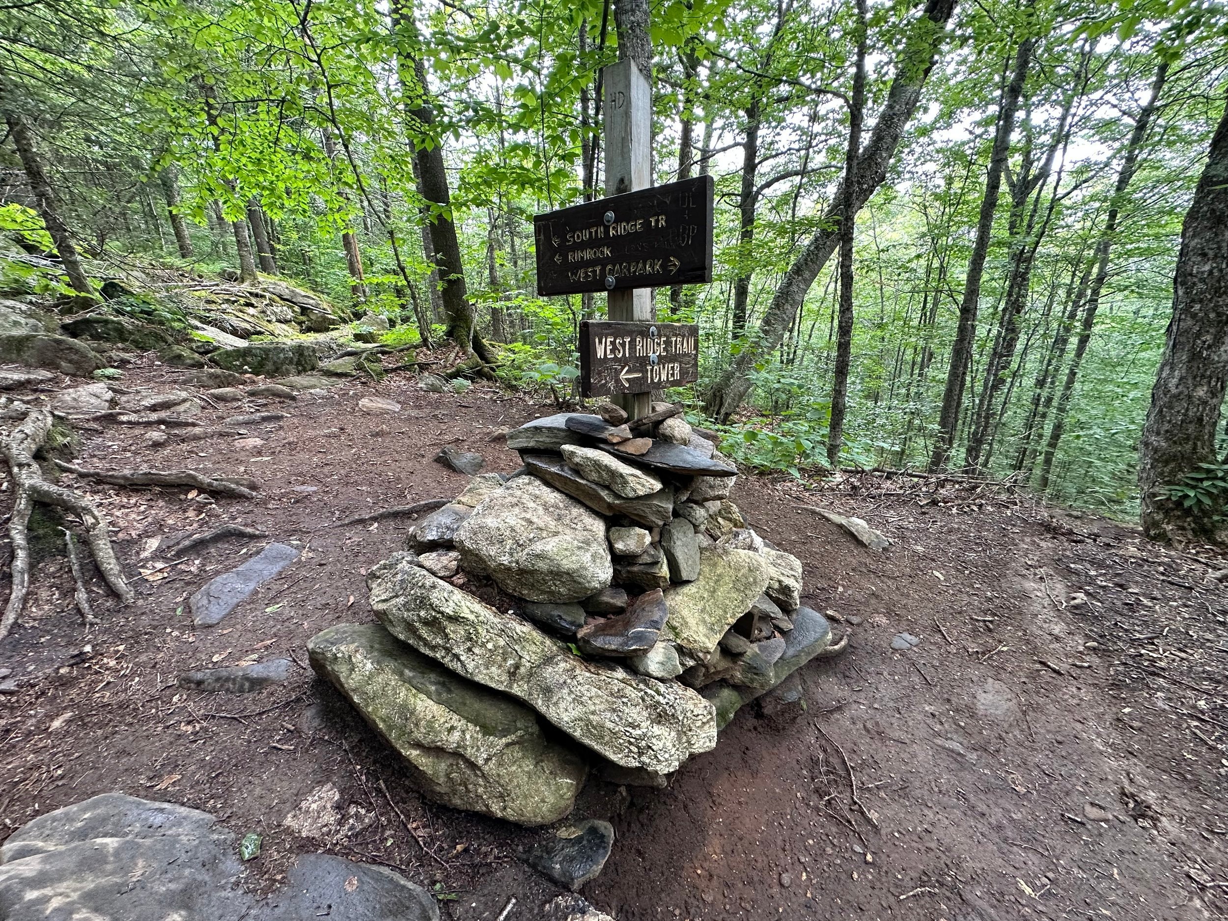
South Ridge Trail junction
Continuing left at the first junction, the West Ridge Trail soon joins sections of the original trail; nearby, blocked off sections of old, rerouted pathway can still be found all along the West Ridge Trail. The footway was overall surprisingly dry and well-packed, several small patches of mud remained but oftentimes could easily be avoided by stepping on rock tops which protruded from the blackened muck.
Becoming increasingly rocky underfoot, the trail passes over soggy spots atop boardwalk and a newer appearing, planked walkway. Several slabby ledges begin to appear as one ascends the West Ridge Trail, a glimpse of the stunning granitic bedrock to come - some of the steeper pitches of rock are very slick when wet or tracked with muddy boot prints.

Exposed bedrock along the West Ridge Trail
Nearing 1.0-mile, the Skyland Trail diverges south toward the Cardigan Rimrock. Just beyond the signed junction, Cliffs Bridge is crossed - even after days of rain the brook descending from the North-South peak col was but a mild trickle, albeit lovely atop a mossy, bouldery streambed.
Continuing to ascend, the West Ridge Trail begins to climb more steadily atop bare granite ledges as the coniferous forest tightens in around, becoming shorter and scrappier as one nears treeline. While not quite yet ripe, blueberries began to appear trailside along with bright, fuchsia-colored sheep laurel flowers (which look, to me, like upside-down umbrellas), both of which followed well us into the sub-alpine zone of Mount Cardigan.

Nearing the sub-alpine zone of Mount Cardigan
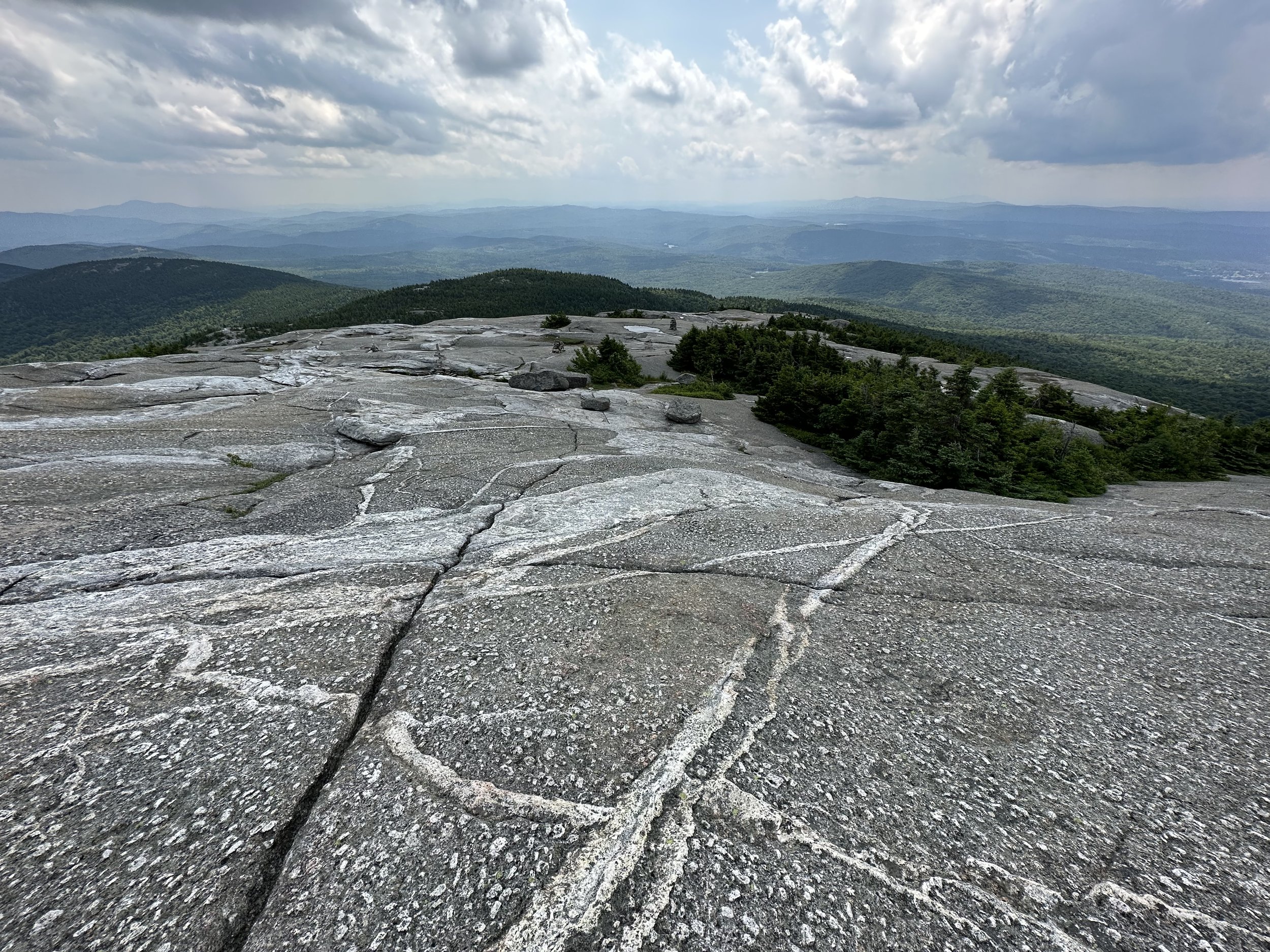
Following what appeared to be freshly painted orange blazes on the streaked bedrock, as the pitch steepened and trees grew shorter and less frequent; rock cairns began to appear, which were followed along the bare ledges toward the domed summit. Before long, large glacial erratics began to appear trailside - behemoth boulders strewn about the sub-alpine landscape, as if dropped by a passing giant.
Ascending the bare ledges, it is hard to imagine the chaotic scene of towering flames which barrel-rolled off the summit, denuding the highest crags of all soil and vegetation back on that frightful 1855 day. Now the summit area is viewed as a unique, special place as new environments of hardy trees and vegetation work to grow upon the windswept mountaintop. Over time, dust and fine sands have drifted onto the summit just as frost and ice slowly fracture existing rock to form a delicate substrate to which roots cling and soak up vital nutrients.
A glance back down the West Ridge Trail
As the 1924 fire tower comes into view, a final junction is encountered; the Clark Trail departs southward, from which several loops of varying lengths can be made - the most popular of which is via the South Ridge Trail. The tower remains in use for various weather station applications, powered by several solar panels mounted on the tower itself. Reportedly, the tower’s cab is slated for replacement from the end of July through August 2023 - which explains why there was a crew there during this hike removing solar panels and disconnecting electronics from the various antennae.
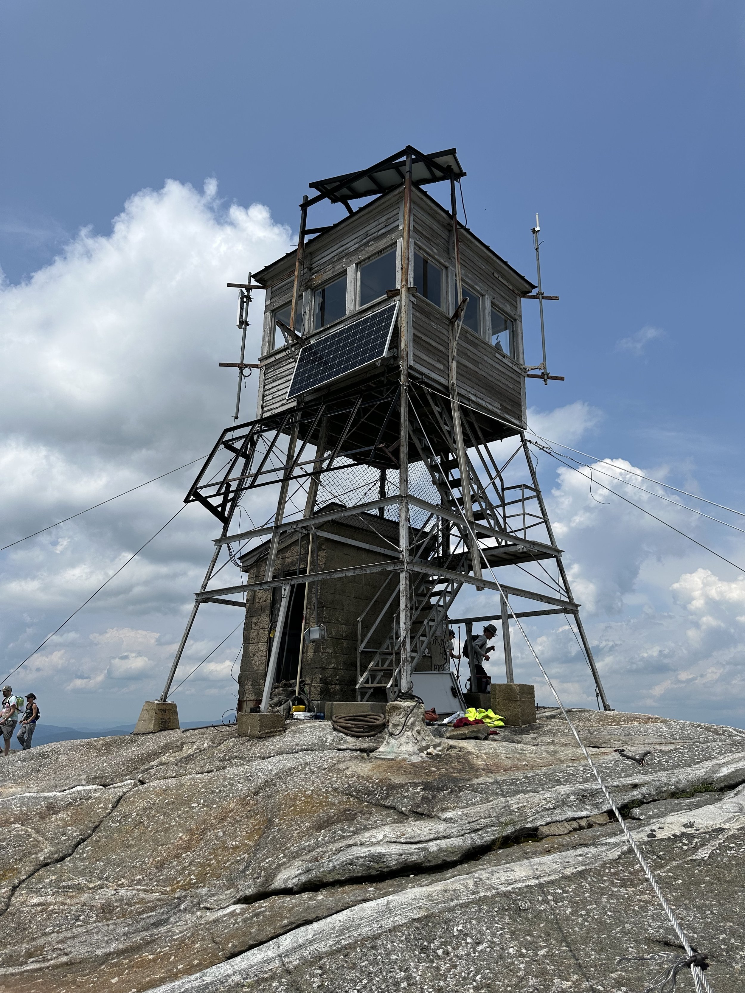
1924 fire tower atop Mt Cardigan
Glancing around the summit area, it is interesting to spot names and dates which have been chiseled into the bedrock, some of which have elegant serif lettering from a bygone era; unfortunately, we were also able to spot modern day graffiti just the same, tucked cowardly behind a summit alcove were names and whatnots sprayed in orange and blue rattle can paint - this type of colorful lettering every summit should do without.
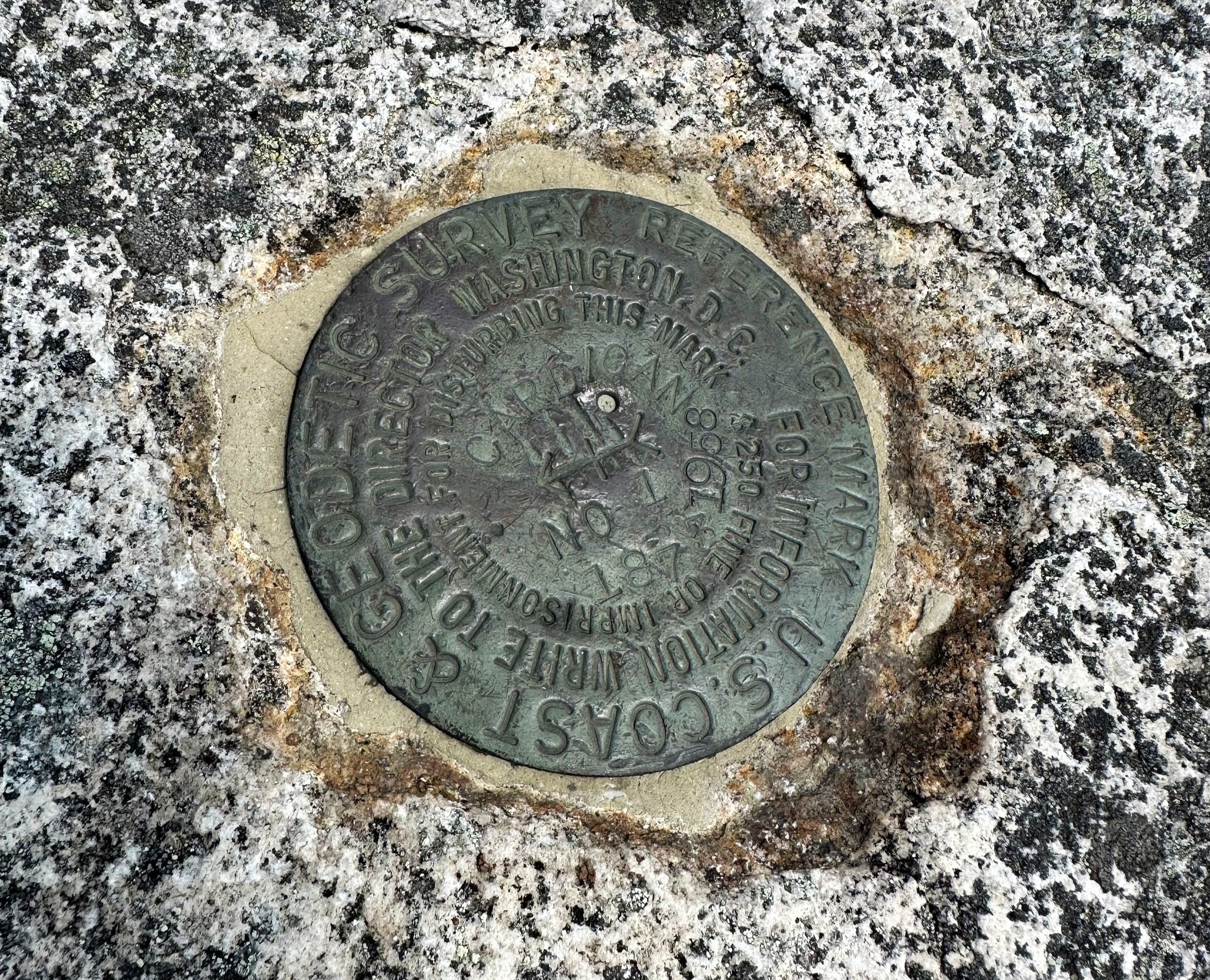
Swinging around the highpoint of Mount Cardigan, it is possible to spot a small, round US Coast & Geodetic Survey bench mark disc; the disc located today was placed in 1958, cemented to the bedrock slightly eastward from the fire tower framing.
Survey bench mark atop Mt Cardigan
Before departing the bare summit ledges of Mount Cardigan, it is recommended to take a pause to look not just upon the open ledges of Firescrew Mountain toward the north, but at the bedrock itself - bent and morphed while still in a plastic state, the granite is streaked with various shades of grey and white, evidently harder layers eroding at a slower pace than others.
Soaking in the view, it is possible to see in all directions: Smarts, Cube and Piermont mountains stick out northeasterly; Tenney Mountain was an obvious landmark nearby, with a sea of white windmills lining its ridge spine; Newfound Lake lay just beyond as the gaze continued swinging clockwise, now looking eastwardly; to the south, Ragged Mountain was visible, streaked with ski slopes - just beyond Mount Monadnock was hardly visible through the atmospheric haze of wildfire smoke.
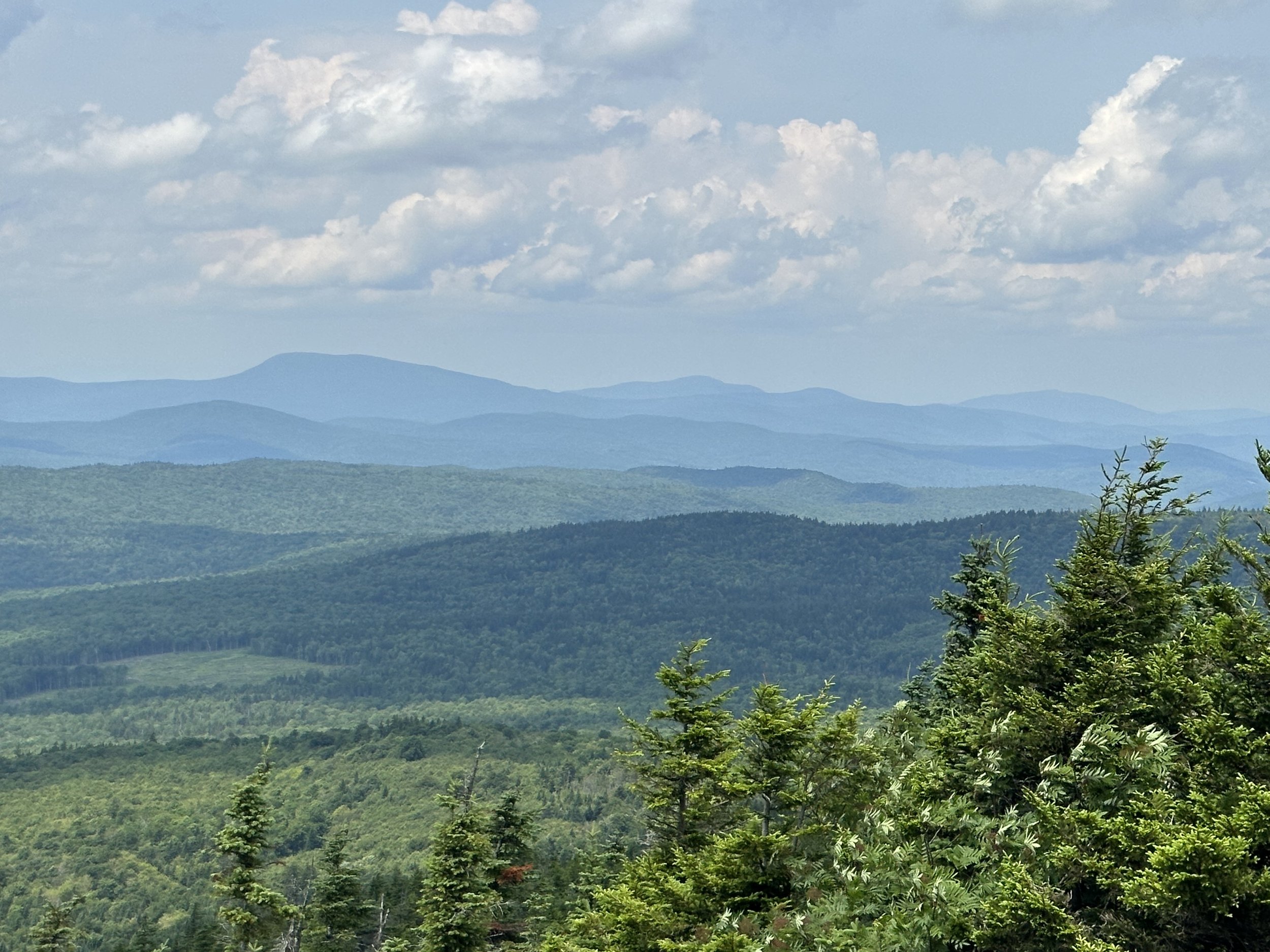
Northeasterly views from Mt Cardigan
This is one tough mountaintop to say goodbye to, but as others were making their trek up the mountain, we must allow them space as well and make our respective trek back downslope. The bare slabby slopes of Old Baldy will remain for long to come, long enough for us to make many more pilgrimages to visit its ledgy summit and beautiful sub-alpine vegetation - plus, we cannot wait to see the updated tower cab in the coming months.
Overall stats for the day:
3.18-miles
2hr 36 minutes (with a 20-minute summit rest)
1,549’ elevation gain
Mount Cardigan - 3,149’
AMC states 3,149’, CMSF signage reads 3,121’

Mountain Laurel along the West Ridge Trail