
North Weeks via Starr King Trail
“An extended route for backpackers interested in avoiding crowds of day-hikers”, advertised the AMC White Mountain Guide while they describe the current ridge path which now provides access to a trio of forested summits; The Weeks.
Originally known on maps as Round Mountain, this pack of peaks was renamed in the early 1960’s to honor John W. Weeks, who introduced the Weeks Act which was subsequently signed into law by President Taft, henceforth authorizing purchase and preservation of land for national forests.

Rocky footing of the Starr King Trail
Until the construction of the Kilkenny Ridge Trail in the late-1980s (which spans from the summit of Mt Waumbek in the south to the South Pond Recreation Area off NH Rt 110 in the north), there were no marked or maintained trails leading to the summit of any of the three Weeks mountains; therefore, bushwhacking, was the suggested mode of access to these remote, wooded peaks.
Early morning parking at the Starr King Trailhead off US Rt 2 was no issue; although a rough road provides access, the large, recently expanded dirt parking areas fit dozens of vehicles on a busy day, this being 8am on a weekday I had free-range of the lot.
Mount Starr King summit
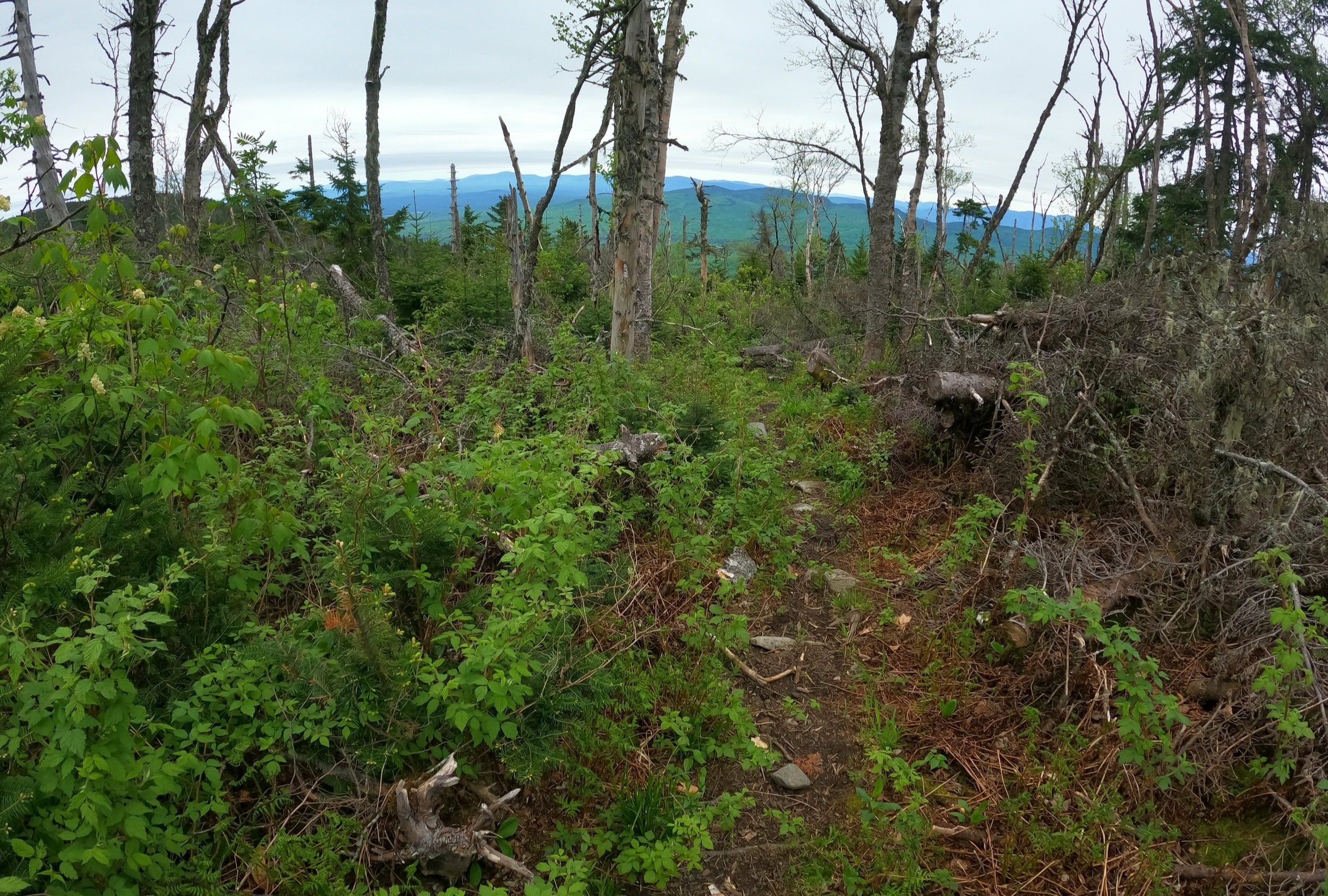
Making use of old logging roads, the Starr King Trail makes a steady ascent up the southwestern ridge of Starr King Mountain; initially paralleling a small tributary to the Israel River, the path begins a series of soft zig-zags through a beautifully open and wide hardwood ridge. During warmer months a sea of unfurling ferns, grasses and heart-shaped hobblebush leaves comprise the low understory; in winter, however, hikers can gaze a fair distance along the surrounding hillside.
Hiking beyond the 2,800’ elevation threshold, the trail becomes relatively darker as it abruptly passes into a dense evergreen canopy, the surrounding conifer boughs enveloping the hiker and provide a level of shade as the soft footing becomes increasingly rocky and angular. The path dips and weaves through the forest as it snakes its way up the western flank of the mountain.

Cloudy, southeasterly views
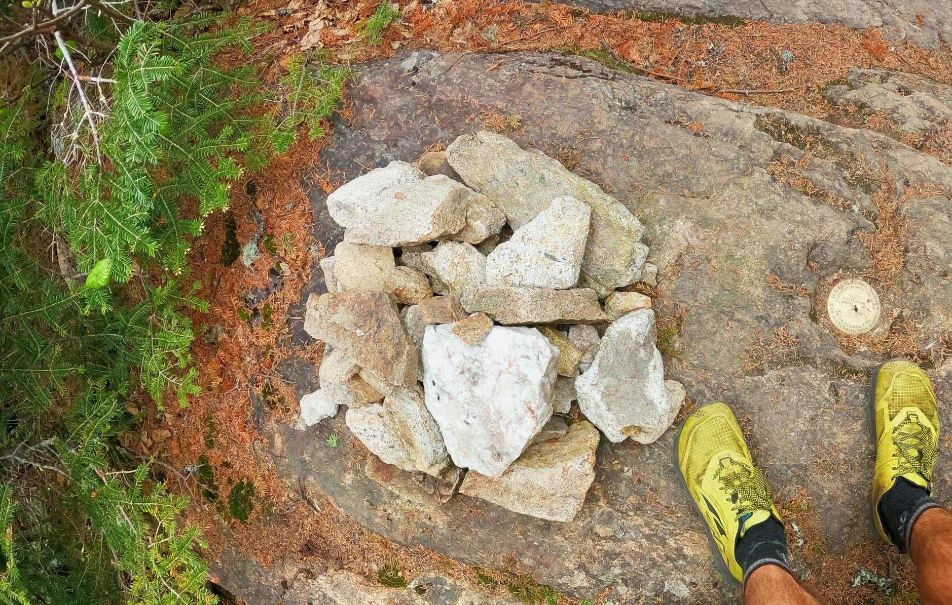
Soon tapering off, the trail makes several short scrambles as it passes a bare ledge on the right where a rock cairn and gold-colored US Geological Survey Bench Mark can be found; just beyond, the path descends slightly to emerge amongst the remains of an old shelter and a somewhat cleared southeasterly view toward the Presidential Range.
Swinging around the old fireplace, a small sign indicates the direction of the ridge path which continues over to Mount Waumbek; the once obscure trail was re-cleared in the late 1950’s and seemingly in perpetual use since. Descending off the open ledge of Mount Starr King, the trail makes several tight switchbacks in a lovely, mature conifer forest; lichen and moss drape from old balsam branches while moss carpets the surrounding forest floor - a proper home for both moose and gnomes.

Enroute to Mt Waumbek
The footing is rather soft, albeit with plenty of roots to step over as it descends ~180’ into the col; occasionally, suggestions of a view through the dense tree cover showcase the low mound from which one had descended, otherwise the ridge remains a fairly tight knit of mature fir. Footing becomes loose during the short ascent to the forested summit of Mt Waumbek at 4,006’. A wide, dilapidated cairn designates the mountain’s high point, oftentimes in winter this cairn becomes buried in even the shallowest of snowpacks.
Nearby, signs indicate the southern terminus of the Kilkenny Ridge Trail; several rods down this remote stretch of pathway a fine southerly view toward the Presidential’s can be obtained, thanks to a small patch of blowdown. The trail makes forward progress by a series of loose s-turns through the dense forest; fallen fir trees are avoided as young growth spills into the narrow corridor of trail, often needing to be pushed through to continue down the meandering pathway.
Descending East Waumbek
The forest gives a sense of entering an extremely remote section of the White Mountains, while trail maintenance is obvious, traffic through this stretch of Kilkenny Ridge Trail appears scarce, a perfect choice for hikers looking for a quieter experience in the wilderness.
Balsam fir of various ages and heights comprise the mountainside of East Waumbek, however, upon cresting over its high point the trail begins descending through patches of blowdown, thus affording restricted views to the coming climbs; South Weeks appears as the first bump following a series of short switchbacks down the hillside as the trail hooks, making a northeasterly swing toward the landmass of Mount Weeks.

Middle Weeks from the South peak
The surrounding forest becomes rather open upon reaching the South Weeks col; gazing into the depths of forest, dark-earthen, exposed roots from downed fir trees catch the eye amidst the otherwise green understory - my mind assumes these are all resting moose until the eye can focus upon each, thus proving the mind false.
Occasional rocks emerge from the footpath, while not a terribly muddy ridge trail, the flat rocks appear to have been placed with intention and in appropriate locations to help hikers avoid widening the lovely, narrow path.

Soft path of the southern Kilkenny Ridge Trail
As one traverses along the mountaintops of the beautifully forested Pliny Range, the pathway arcs around Willard Basin which was once the home of a proposed ski resort. With a suggested hotel and tramway atop Mount Starr King, the suggested 1960’s plan would have been to clear-cut the northern slope of Mount Waumbek for 2,000’, to resemble Tuckerman Ravine toward the south.
Thankfully, despite leasing agreements with the United States Forest Service, the project failed due to lack of funding and today, I, along with countless other mountain and forest enthusiasts, am able to bask in such a serene stretch of virgin conifer forest.

Ascending North Weeks
While the actual summits of South, Middle and North Weeks mountains do not offer views or lookouts (there are minor glimpses of surrounding hills along the trek), to fully enjoy the southern region of the Kilkenny Ridge Trail, immersion into a stunning forest setting and treading atop highly pleasurable, soft paths must be paramount on the hikers’ itinerary; stunning panoramic views can be found on Mounts Starr King and Waumbek earlier in the hike, but not the Weeks.
Between the low rise of the mountains, naturally some semblance of mud will be encountered in the low points of the cols, but nothing which becomes overly boggy and tricky to navigate; rocks, logs and other fallen debris has been utilized to aid in traversing wet patches. Several leaning trees remain, forcing taller trampers to duck beneath momentarily, however, maintenance along this seemingly remote stretch of path is superb - when I hiked through there was much evidence of both old and new fallen trees having been cleared from the ridge trail.

Ascending out of a col
As the Kilkenny Ridge Trail passes uneventfully up and over the high point of Middle Weeks, it begins its descent by way of switchbacks, navigating patches of blowdown before passing a localized wet area and almost immediately beginning a long ascent up North Weeks.
Mosses work to blanket trailside decaying tree trunks of old blowdown patches while ferns unfurl, adding vibrancy to the various shades of green which enliven the low understory as one begins to ascend out of the 3,275’ col. Massive lichen-draped fir stand proud and tall, towering into the dense canopy, while nearby, others have succumb to violent wind bursts, their up-turned, shallow roots exposing bedrock and boulders beneath, inevitably creating entirely new ecosystems for the smallest of plant life.
As the Kilkenny Ridge Trail reaches 3,500’, a branch of Stony Brook is passed atop rocks as the trail now makes a long s-turn before heading due north, toward the 3,901’ summit of North Weeks. Several minor lookouts along the path have been created by fallen timber, otherwise the view is more of the same - lush, beautiful boreal forest.

Kilkenny Ridge Trail
With essentially no roots or rocks to step over, the final ascent up to the high point of North Weeks is highly enjoyable atop a very soft footway of fallen conifer needles. The low dome of the mountain can be seen gradually falling away to either side of the trail. Upon reaching the crest of mountaintop, I found a suggestion of a cairn just off-trail to the east, while several herd paths lead in various easterly directions as well. I followed the routes briefly to see if higher elevation lay perhaps just through the forest, but turned around when the hillside began falling away.
Convinced I had stood atop the high point of North Weeks as well, I took a solitary meditative moment amidst the desolate forest before turning south, to follow my footsteps 8-miles back to my car. Several brief pauses were had on the trek out: exploring the side-spur path which led to a rock cairn atop the high point of South Weeks; climbing and standing atop several up-turned root clusters in attempts to gain better views; as well as a short chat with a gentleman who had begun a multi-day backpack from the Starr King Trailhead earlier that morning and would be traversing without urgency to the trails northern terminus.
It is incredible what can be found in a forest which offers minimal views when one stops expecting and just roams, with an open mind, accepting everything the forest and nature has to offer. The Kilkenny and Pliny mountain ranges reward in abundance to those seeking to avoid otherwise crowded places of the high hills.
Overall stats for the day:
16.01-miles
5hr 10 minutes
5,630’ elevation gain
Mount Starr King - 3,898’
Mount Waumbek - 4,006’
East Waumbek - 3,996’
South Weeks - 3,885’
Middle Weeks - 3,684’
North Weeks - 3,901’
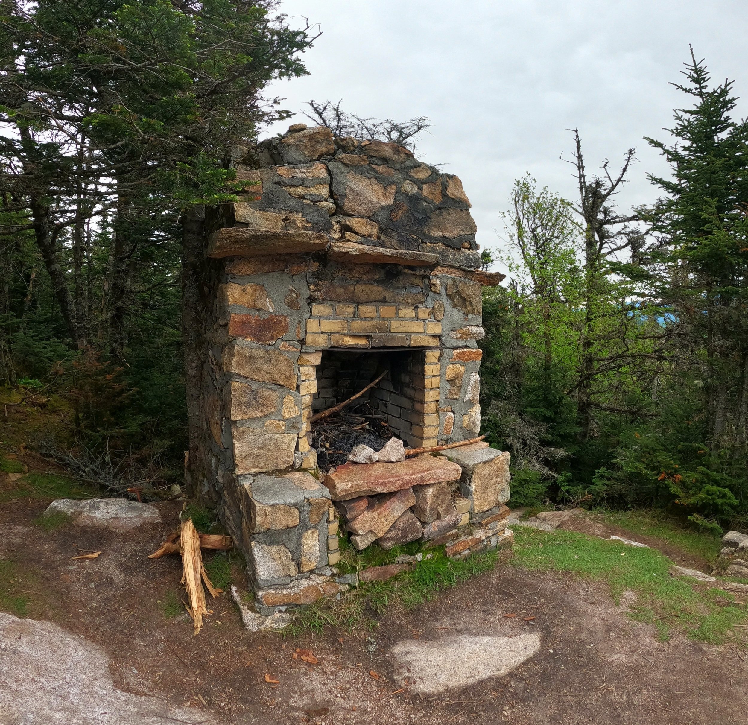
Old cabin remains atop Mt Starr King