
North + South Tripyramid Mtn Slides
Having ascended the North Slide in every season, it is safe to say the loop along the ridge by way of the North and South slides is my all-time favorite in which to climb the near-symmetrical trio, but as I write this, the slide route is hitherto the only path I have taken to visit the three Tripyramid peaks.
Both the Pine Bend Brook Trail and Sabbaday Brook Trails depart the Kancamagus Highway and lead up the northern and eastern ridges, respectively, but having taken the former only so a mile before departing trail, with bushwhacking the northeastern ridge of The Fool Killer in mind.
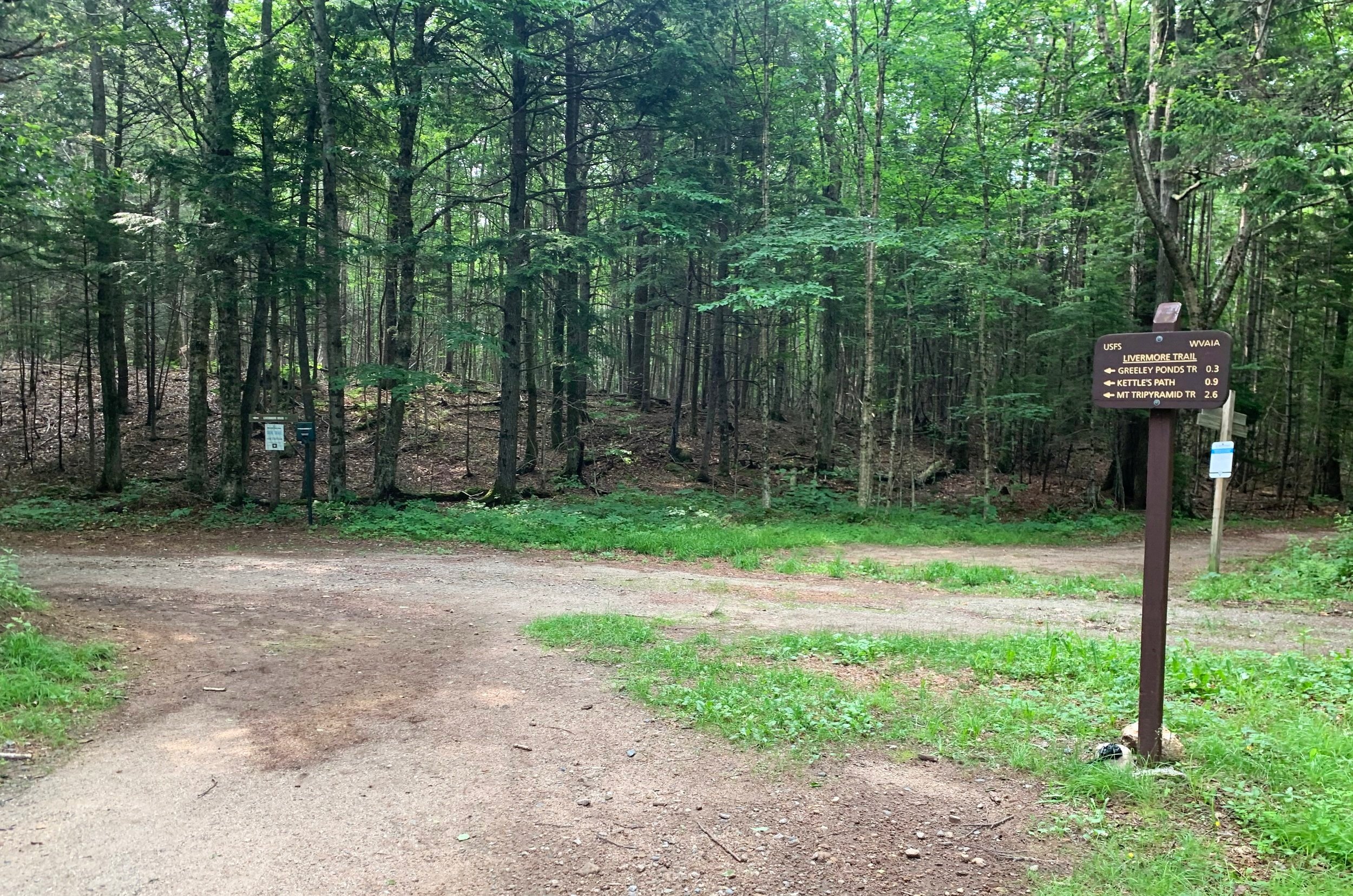
Departing the Livermore Trailhead
Trailhead parking for the Tripyramid loop is located just east of the Waterville Valley ski resort, prior to the gated section of Tripoli Road (closed in winter). Turning right onto West Branch Road, the West Branch of Mad River is immediately crossed on a rough surfaced bridge. A left turn just beyond will enter the large, rectangle-shaped trailhead parking lot. A year round $5 fee is charged to utilize the lot; a hangtag pass can be obtained from the iron ranger located at the southeastern corner of the lot; an annual recreation pass is also accepted here. Two vault toilet stalls are easily located at the northern corner of the parking area as well.
Departing from the Livermore Trailhead parking area, trails diverge in various directions - the paths to Greeley Ponds and Tripyramids are located beyond the information kiosk, also toward the southeast corner of the lot.

The old logging road which is the Livermore Trail
Brown painted, wooden USFS signs indicate mileage and direction for various locations along the Livermore Trail (FR 53); veering left (eastbound), the old logging road is also used for biking and cross-country skiing in winter months. Atop a wide, dirt and gravel roadbed the Livermore Trail swings north and soon back toward its easterly direction as it enters an open field which was once known as Depot Camp.
Passing through the junction for Deep Woods and Greeley Ponds Trails, the Livermore Trail crosses the Mad River atop a sturdy truck bridge; creosote fills the air as one nears the wooden structure. Beginning a slow, gradual ascent, the Livermore Trail (aka Livermore Road) enters a dense conifer canopy with ferns and hobblebush edging roadside.

Enroute to the North Slide
Several small, bridged tributaries are also passed as the old logging road swings its way further into remote wilderness; early in the season prior to a full verdant canopy, glimpses of the Tripyramid trio can be found enroute. After passing several signed spur paths, the south branch of the Mount Tripyramid Trail is encountered at 2.6-miles; regardless of season, I usually make it a habit to check out the status and depth of Avalanche Brook at this point, as it will be crossed not only on the trek out, but also shortly up ahead, while enroute to the North Slide.
Proceeding left at the junction to continue following the Livermore Trail, footing becomes increasingly rugged as the road ascends, following all the while just west of Avalanche Brook. At 0.5-miles (3.1-miles from the trailhead) beyond the South Tripyramid branch, a grassy field is encountered - the old site of Avalanche Camp from the bygone days of logging.

Steep pitch of the North Slide (ascent: 3/12/2022)
Just as the main trail makes a hairpin turn at 3.6-miles from the Livermore Trailhead, the route toward North Tripyramid diverges eastward (right), immediately descending a steep bank and crossing Avalanche Brook atop mid-stream boulders and rocks. Beyond the water’s edge, the trail once again climbs up the steep embankment and proceeds eastward on an old woods road. Narrowed by encroaching understory growth, the path undulates along the wooded mountainside for 0.5-miles before reaching the mossy tailings of the North Slide.
Once across Avalanche Brook the Sandwich Range Wilderness is entered (look for wooden trailside signage), an area of beautiful wilderness in which the entire Tripyramid massif is located. Reaching the base of the slide, here is a good place to sip water and take in a brief snack, once on the slide there are minimal resting areas until reaching the woods 0.5-miles upslope.
Ascending the lower North Slide
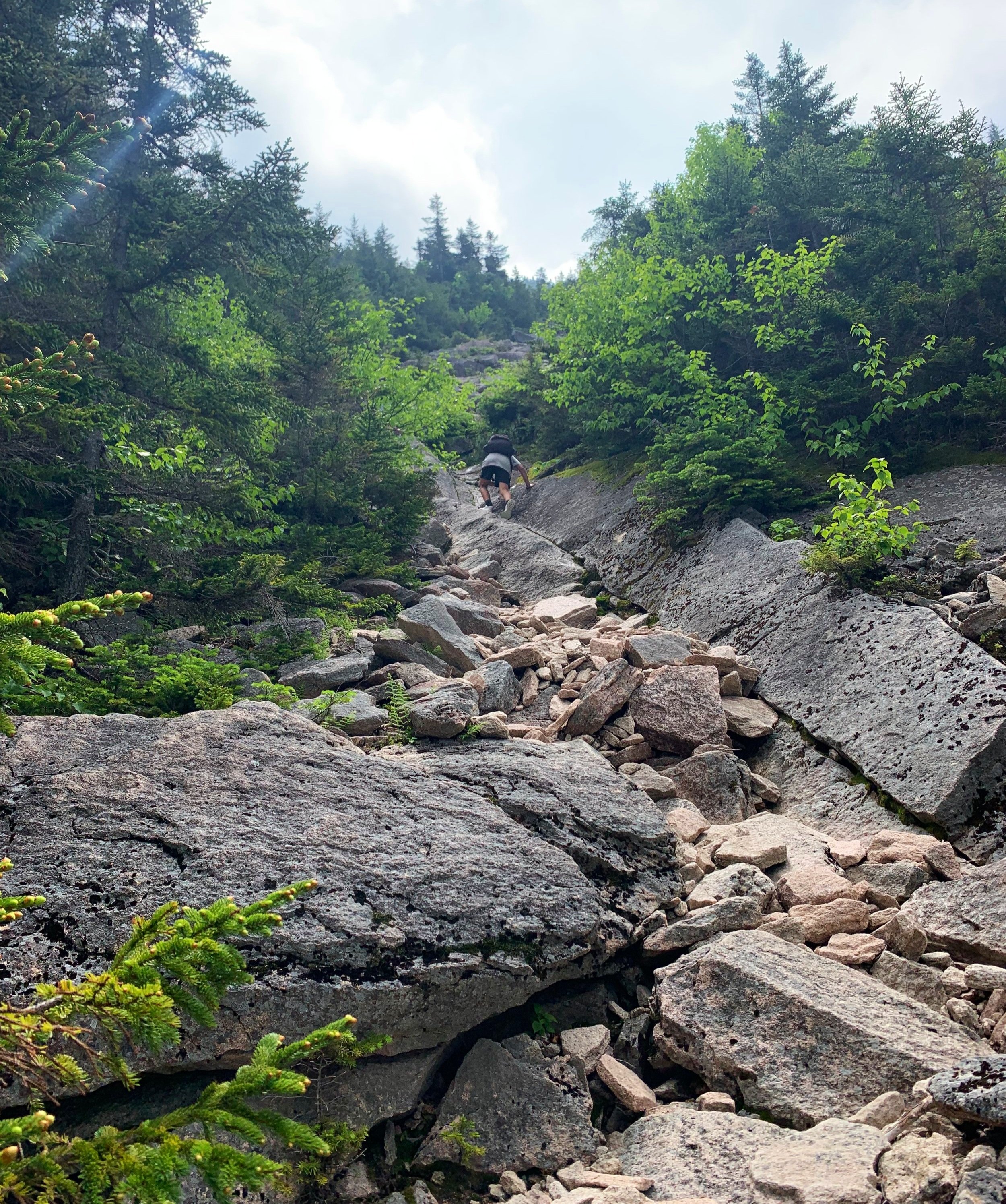
Beginning as a narrow V-cut in the northwestern face, the rock slabs and tumbled boulders are initially mossy and often wet at this angle on the wooded mountainside. In several locations the hiker’s route has been shifted off the slide toward the left (northeast) for brief stretches; albeit loose and rugged terrain, the wooded stretch is often dry with exposed roots which double as handholds. Tumbling rocks kicked loose are henceforth an extreme hazard while ascending any part of the slide - climbers should be fully aware and alert to parties climbing ahead or below.
Featuring Class Two and several Class Three maneuvers, the North Slide grows steep as the faintly yellow blazed climbers path coincides with the slide once again; ascending steep with several step-ups, the North Slide is a true game of “choose-your-own-path”, as one creeps up, utilizing cracks and precarious flat spots in which to place shoe tread.
In several areas along the middle of the North Slide, a well-worn path exists on the east (left) side of the actual slide, but before long, a wooded spur path guides climbers back onto the main slab. While staying low to the rock surface, as to retain traction, a section of long v-cut in the granitic bedrock is passed; the slide is a fun way to practice various pressure and crimping maneuvers; while the slide is certainly steep and a fall would have immense consequence, in fair weather the rock is quite tacky and its cracks often provide ample traction while ascending.
Nearing the top of the North Slide (ascent: 3/12/2022)
Nearing the upper section of North Slide, the path joins a series of switchbacks atop loose scree and jagged, broken boulders; great care should be taken, especially here, to ensure rocks are not kicked or knocked down on parties below - if a rock does end up careening downslope, it is good practice to yell out, “ROCK!”, to warn climbers below.
As one approaches the top of the North Slide a large rock cairn is encountered mid-path as the slide narrows toward its ultimate top. The path re-enters the woods just beyond the cairn for a steep, rugged ascent to the 4,160’ wooded summit; although, at this point a faint herd path enters the forest at the height of the slide, care should be taken to not miss the actual trail just above the cairn, diverging from the slide eastward.
Rocky descent toward the North-Middle col
Shortly into the wooded hillside, the rocky path swings southeasterly for about 0.1-miles. Following a steep, bouldery ascent, the Pine Bend Brook Trail merges from the north to coincide for the final ~30’ to the summit; a short spur path guides hikers to the mountains’ unmarked highpoint.
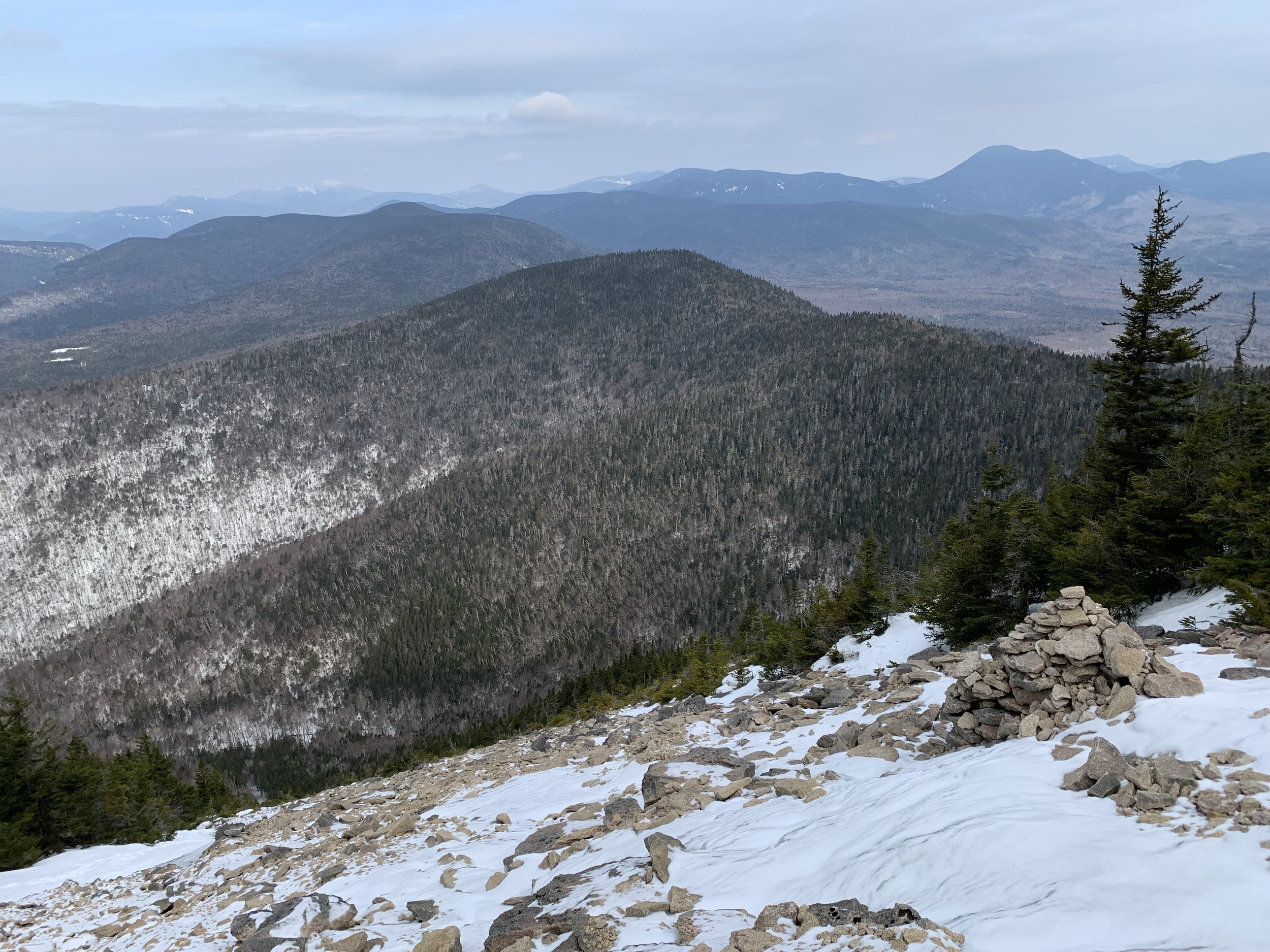
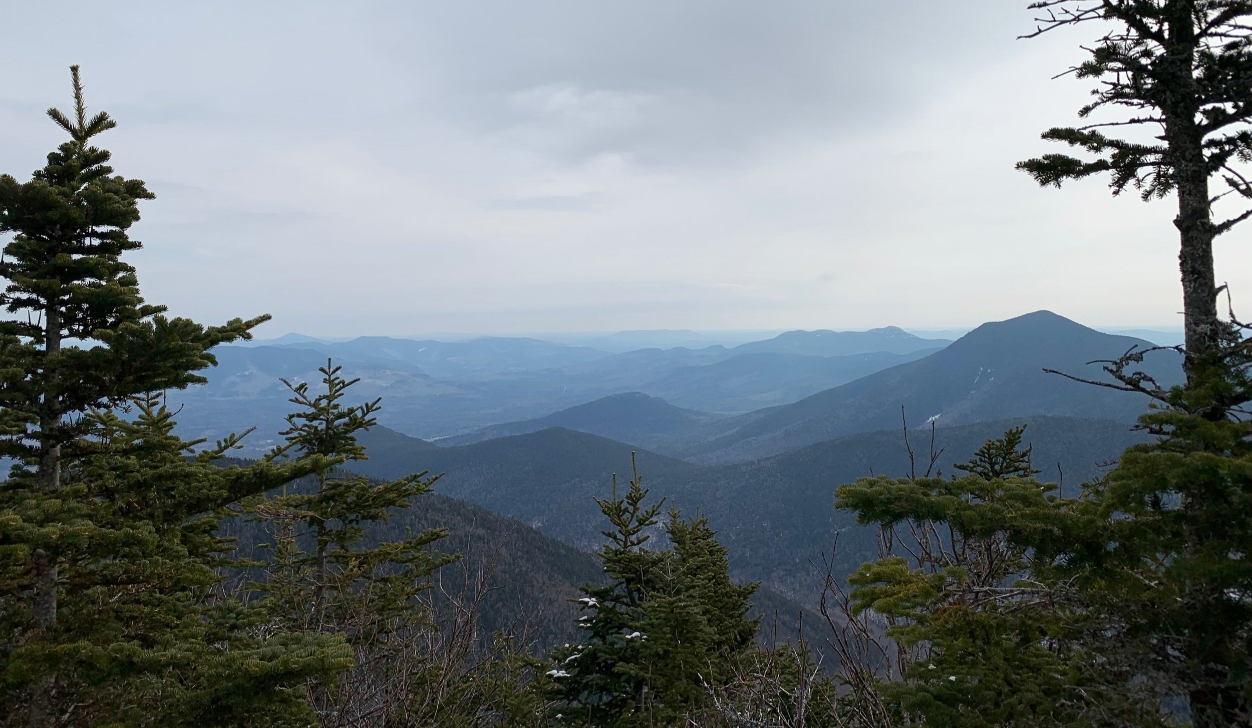
Back on the Mount Tripyramid Trail, the path descends steeply at first over rugged, rocky terrain. As the grade mellows out nearing the North-Middle col, the Sabbaday Brook Trail enters from the east. The trail ascending Middle Tripyramid appears more eroded each time I visit - a deep trench is often the pathway while ascending. However, nearing the crest, a restricted lookout westward, toward Tecumseh and the Osceola Mountains can be found.

Tecumseh from Middle Tripyramid (ascent: 7/13/2019)
Just beyond the lookout area, the summit of Middle Tripyramid can be found on the left, up a short, rocky step-up. The summit area levels off to accommodate several hikers; another restricted east-facing lookout can be found here with glimpses toward Passaconaway and Chocorua.
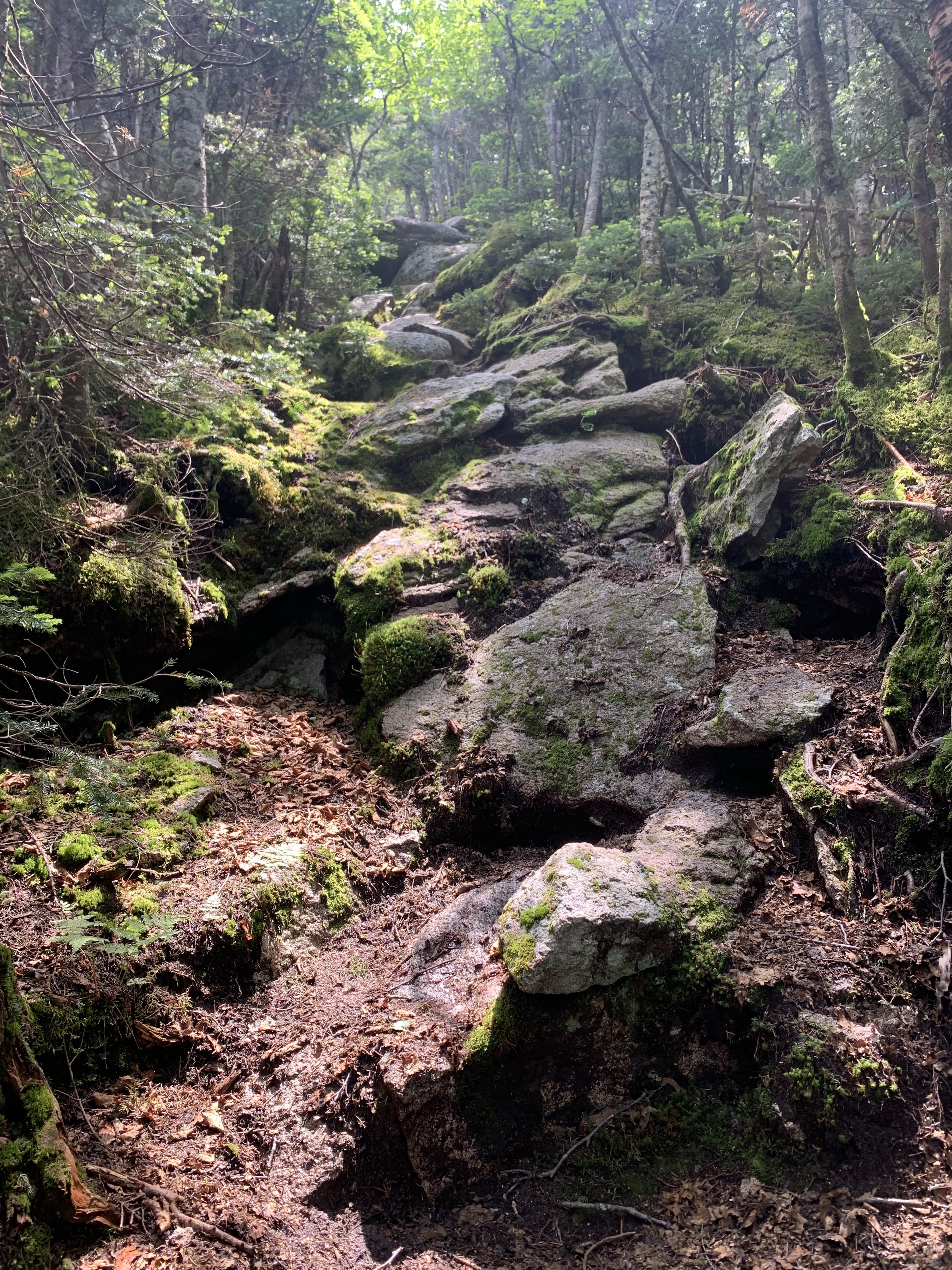
Descending Middle Tripyramid is initially steep and ledgy, mossy rock comprises the downclimb, on which hands are generally required to prevent a slip and slide downslope. Down several steep, rocky chutes and exposures the trail once again mellows in grade while traversing a domed coniferous fern glade; several patches of isolated blowdown have formed short herd paths atop the ridge crest.
Eastward views from Middle Tripyramid (Mt Passaconaway on right)
A quick, tight switchback leads the path along the South Peak summit ridge - the high point being just ahead, which was at one time marked with a low rock cairn, which has recently been broken down and stacked rocks scattered - the wide rock base can still be found resting in the soft, fallen conifer needle mountaintop. From here, at 4,080’, there are no views - any views will come shortly, from the South Slide.
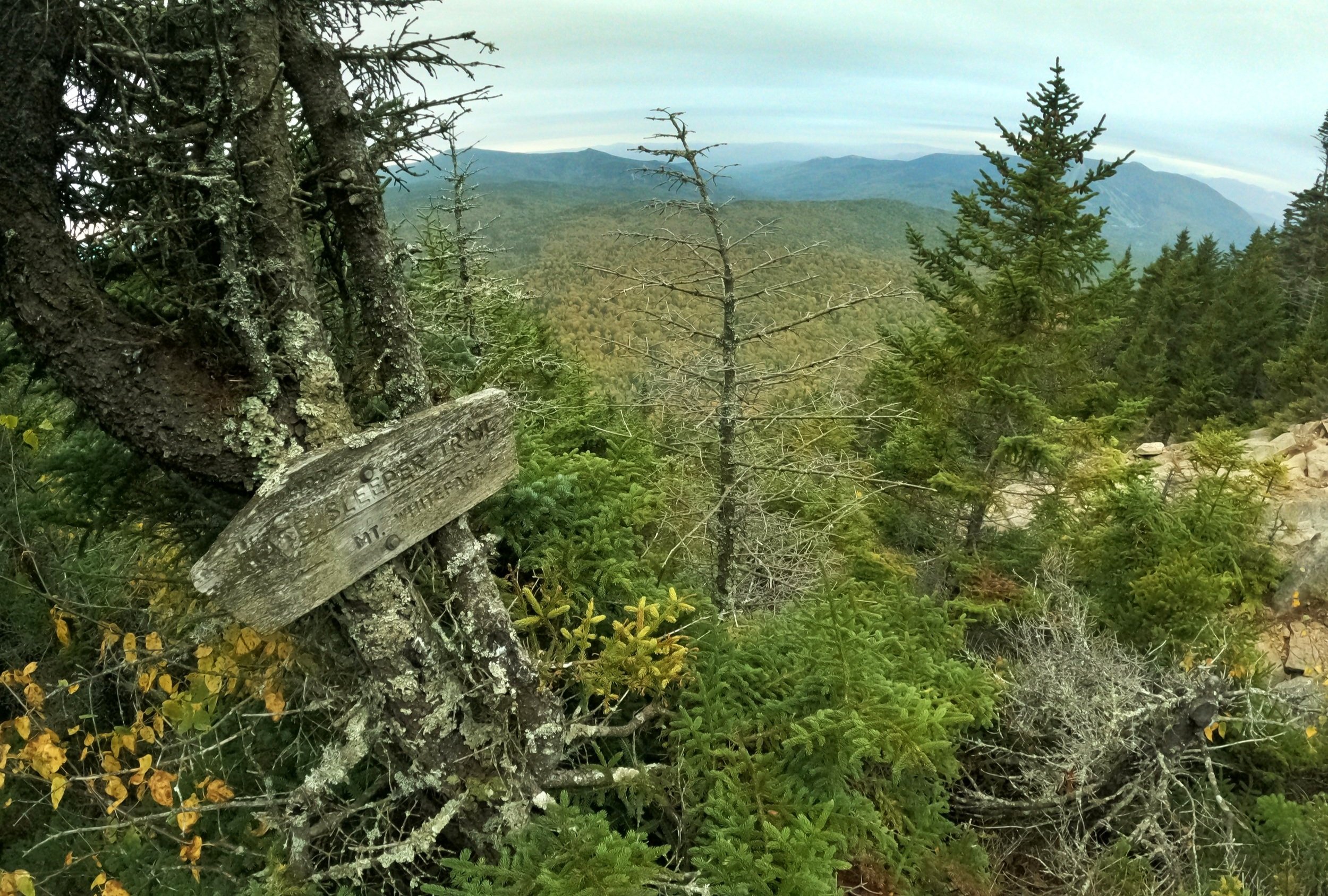
Initially atop a low-grade descent, the Mount Tripyramid Trail soon steepens to descend ledges and steep, exposed bedrock. Beginning onto the South Slide, footing is fairly solid higher up, but upon passing the signed cut-off for the Kate Sleeper Trail, the route becomes agonizingly loose. While the grade is overall not nearly as continuously steep as the North Slide, care should be taken here as well, loose boulders and scree constantly work to dislodge from beneath footsteps.
From the South Slide (ascent: 10/2/2021)
Several sections of loose gravel and broken boulders are interspersed with brief wooded stints before returning to the exposed rock slide. One mammoth boulder sits mid-route while descending, looking precarious as if a light breeze could set it back into motion. Before the route narrows onto more loose dirt and gravel, the slide edges over a short, brief drop - with the aid of rock and nearby trees, the descent can be somewhat easily managed with careful hand and foot placement.

From the South Slide (ascent: 9/17/2022)
Beyond the end of rock slide, the path returns to the forest, utilizing old woods roads for the remainder of the journey back to the Livermore Trail, which was ascended upon. A constant, low-angle descent guides hikers through a beautiful, densely mixed forest - which is surprisingly open and easy to bushwhack through in winter, when the snow is deep enough to cover any blowdown.

Descending back to the Livermore Trail
With Slide Brook in sight most of the final descent, just off to the hikers west (left descending), several small tributaries are crossed atop rocks and boulders. The crossings increase in size as the Black Cascades and Cold Brook are passed, culminating with a shallow yet wide crossing of Avalanche Brook. Occasionally shallow enough to rock-hop or cross atop bands of mid-stream sediment, during spring-thaw or following periods of heavy rain, this waterway can rise dramatically, making for somewhat tricky footing.
Beyond the final water crossing is Livermore Road (Trail), which will be followed westward for a gradual descent of the final 2.6-miles in which to reach the Livermore Trailhead.
Overall stats for the day:
10.5-miles
6hr 39 minutes
3,278’ elevation gain
North Tripyramid - 4,160’
Middle Tripyramid - 4,120’
South Tripyramid - 4,080’