
Mount Crosby + Bald Knob
Under partly cloudy skies, we departed home with anticipation of dramatic, moody cloud-filled vistas from the ledgy summits of both Mount Crosby and its lower neighbor, Bald Knob. Undeterred by a low cloud ceiling upon entering the town of Warren, we pressed on - thankful that at least the rain was holding off. I had been atop Bald Knob for sunrise several years prior and had desperately been craving a return to these beautiful, lower peaks whose trails varied from wide, old forest and logging roads to steep, ledgy, single track paths.

Entering the Cockermouth Forest
From atop the 2,232’ ledgy summit of Mount Crosby, generally, excellent easterly views - looking out toward Tenney Mountain (2,340’) and the White Mountains beyond - can be taken in, while from a similar yet slightly lower summit, a stunning, up-close view of the Mount Cardigan (3,123’) and Newfound Lake areas can be taken in from atop Bald Knob. Today, however, our sights were limited to the nearby moss and lichen edging the granitic footpath which caps each mountaintop.
Deciding to visit new (to us) trails, we parked just beyond the entrance to the Cockermouth Forest on North Groton Road. Owned and protected by the Society for the Protection of New Hampshire Forests (forestsociety.org), the 1,206’-acre tract of land was donated in 1991 by William B. Wadsworth, who faithfully acquired areas of forested land around Groton, in remembrance of his youthful days while attending the Cockermouth Boys Camp. Wadsworth managed the land for occasional timber harvesting and blazed many of the original paths along the mountainsides. In 1957, he blazed a path which is still sees heavy usage; the Bald Knob Trail guides hikers over rugged and rocky terrain to gain the summit of Bald Knob - atop which he had even mounted an antenna and hauled up a 12-volt television in which to watch the Wimbledon tennis match broadcasted from Boston television networks.

New bridge along the Romeey-Remick Road
Named for both the old town found where Groton, NH is now located, and the river which flows through it, the Cockermouth Forest features a network of old forest roads, alongside which, many old stone walls and foundations can still be found; the most notable historic structure being the old Remick Place property that was passed along the loop trail. Unfortunately, today, the old cellar hole was hidden by a dense blanket of ferns and viridescent understory vegetation.
Departing the paved North Groton Road onto a dirt and gravel Romeey-Remick Road, parking is located just prior to a gate found 300’ from the entranceway; however, several parking spots are also located just off the main road - just be sure to not block the gate or road access as we did see vehicles coming and going from the gated area, which remains locked at all times.

Trailside welcome kiosk
Beyond the gate, the hikers path coincides with the old forest road and passes a relatively newly constructed bridge over a cascading tributary to Punch Brook. Despite the wide vehicle track being easily discernable, trailside and mid-trail was beginning to grow brushy with grasses - I even picked two dog ticks off as they tried to scurry up my leg.
Briefly into the road trek, an information kiosk can be found on the right (east) side of the path; featuring a large, painted map of the trail network, there is also a PVC canister which may offer paper maps and brochures, but today, unfortunately, the plastic Ziplock bag contained within was completely empty.

Entering Old North Groton Road
Gaining just over 100’ during the initial 0.5-mile stretch since departing the main trailhead area, the road continues straight to meet the High Pasture Loop; here, we began hiking eastward along the Old North Groton Road. With an immediate shift in lighting, we traded the sky-lit Romeey-Remick Road for a very densely canopied Old North Groton Road, while other old forest roads could be distinguished diverging and meandering in various directions through the forest.
After a short descent which leads to a bridged brook crossing, the old road begins a long, gradual ascent; atop a well-drained roadbed of fine footing, we passed the very brushy southern terminus of Eliza Remick Road. Continuing eastward, occasionally the roadway grew narrow, enclosed by a grove of verdantly glowing ferns and young beech trees. With a hop atop well-placed rocks, we navigated over small waterways, several of which produced beautiful cascades upstream, just north of our footpath.
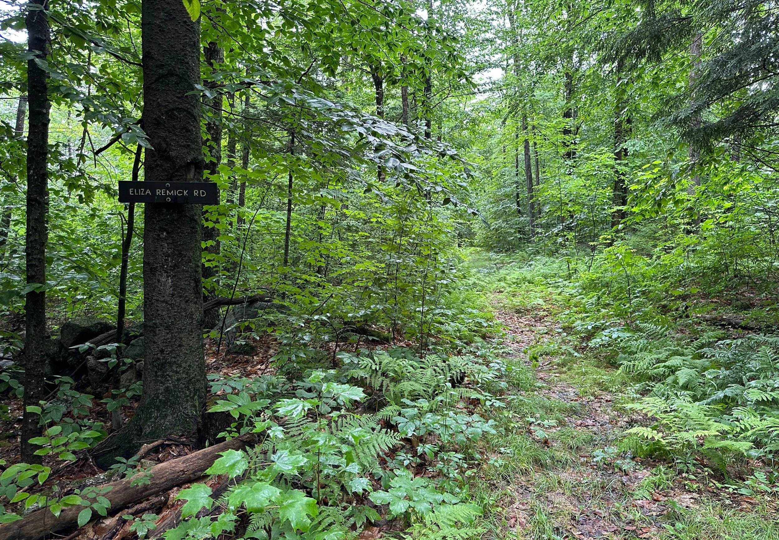
Southern junction with the Eliza Remick Road
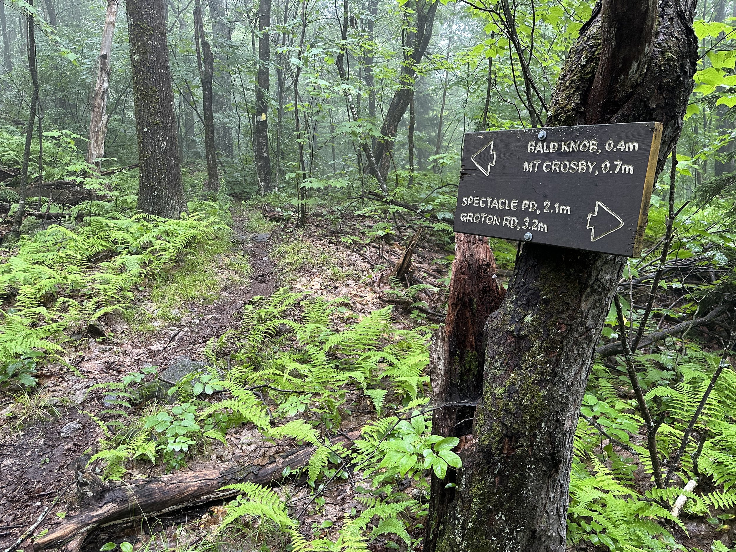
Through a mixed, hard and softwood forest with several brief reroutes avoiding soggy patches, the Old North Groton Road gains just over 600’ during its 0.6-miles in which to intersect the Bald Knob Trail. Becoming imperceptibly progressively steeper as the path veers nearly straight up the southern arm of Bald Knob. At 1,700’, the main trail to reach the 2,040’ Bald Knob proceeds left at a large, wooden sign, while a right turn here would lead southward, into the Hebron Town Forest trail system.
Enroute to Bald Knob
Becoming moderately rugged, the Bald Knob Trail now climbs northward, ascending Bald Knob proper; this is the original route blazed by Wadsworth in the late-1950’s. Weaving around boulders and passing large, old birch trees, the Bald Knob Trail begins to ascend atop bare ledges, most of which are alarmingly slick when wet - found shroud in a fine, slimy layer of moss and lichen, with both leaf and conifer needle duff to content with as well.
Comprised of nearly every shade of green imaginable, the forested trail was made soft and enjoyable by both the rich, loamy earth and a dense layer of fallen conifer needles. Cutting through a lush, mixed forest with a vast arsenal of understory vegetation: ferns, mosses, mountain blueberry bushes, evergreens, and young hardwood saplings all work to keep one’s attention on the immediate surroundings - the densely lingering fog blanket naturally kept ones attention on the nearby vegetation as well.

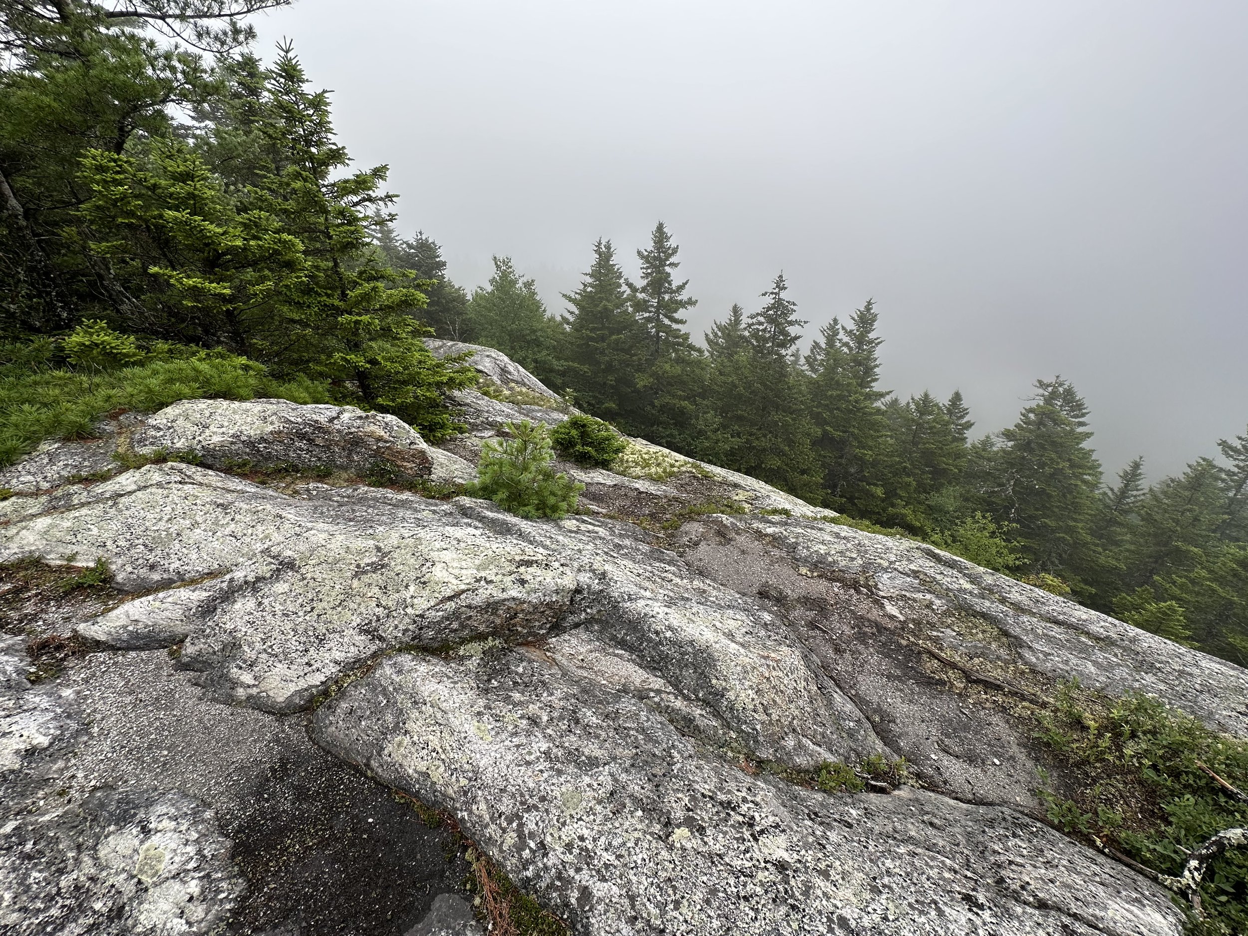
Foggy views of Bald Knob
Even when the pathway grows steep, it traverses either atop bare ledges or incredibly enjoyable, soft soils - how they remain in place and not eroding into a classic White Mountain trench is beyond all fathomability. Atop one of the finest networks of northeast trails, the passing trees grow short, stout and scrappy - proof of their adaptability and capability to handle the exposure of White Mountain winds.

Newfound Lake from Bald Knob (ascent: May 2nd, 2021)
Generally, when not socked in a low-hanging cloud, expansive views can be found from atop the Bald Knob - southwesterly toward the Mount Cardigan and Newfound Lake areas. Beyond the high point, the trail follows low rock cairns and occasional yellow blazes on the slabby trail surface. Northwardly, descending steeply through a short stretch, past nearly overhanging fern-covered rocks and boulders, the trail swings down an open chute to reach the Crosby-Bald Knob col.

Descending Bald Knob
Massive, old birches emerge from a layer of dense hobblebush in the col, a connecting spur trail diverges westward here, which cuts off the summit of Mount Crosby and connects to the High Pasture Loop trail. Continuing straight on the Bald Knob Trail will lead along the southeastern shoulder of Mount Crosby and eventually toward its ledgy summit as well. From the col, the Bald Knob Trail leads toward more interesting, jagged rock formations, guided by both yellow paint blazes and old, black-on-white wooden Camp Mowglis markers; said to be a stencilized wolf, the creature is certainly up to imaginative interpretation.

Camp Mowglis markers on the Bald Knob Trail
Ascending via exposed roots and bare rock, the pathway levels off several times to showcase a beautifully narrow, one-lane trail edged with mosses, lichens, and more alpine blueberry bushes. Passing thick sheets of up-turned bedrock, which has been fractured in interesting patterns over the years, the Bald Knob Trail passes over a soggy patch atop a fallen log before making the final climb toward the 2,232’ summit of Mount Crosby.

Nearing the summit of Mount Crosby
Appearing to receive minimal traffic, the trail is in delightful condition; atop several rods of bare ledgy rocks, the trail swings, finally proceeding northward to pass a small rock cairn with a birch branch sticking up - perhaps marking the high point? Just beyond, a small plaque commemorating Stanley Leroy Esty, by Mt Crosby State Park can be found on the west side of the trail (left while ascending).
Mount Crosby in a fog
Shortly beyond the plaque, the Bald Knob Trail terminates as the Beeline Trail begins. Turning abruptly to descend westward, the Beeline Trail is just that - it makes a steep, nearly straight “beeline” directly off the summit of Mount Crosby. With surprisingly good footing and continuously minimal erosion, the earthen path briefly resembles the lichen and moss-edged single track of higher up the mountain before pitching into dense forest of spruce and fir. Occasional boulders emerge from the footway, but otherwise soft, rich soil provides surprising traction for such a steep-angled descent.

Sunrise atop Mt Crosby (ascent: May 2nd, 2021)
In the 0.25-mile descent (or ascent, depending on direction), the Beeline Trail looses nearly 300’ of elevation before intersecting the High Pasture Loop; a left turn here will guide toward various southwardly destinations while proceeding right will head westward, toward the Romeey-Remick Road and our exit point trailhead. In early summer, when we trekked these trails, the ferns had begun encroaching on the narrow path; while still an obvious trail, a direct line of sight down toward the footing had begun to be covered by lofty ferns, requiring just an added bit of care and intention to place footsteps on favorably solid ground.

Leaving the summit to descend along the Beeline Trail
Passing a small waterway in the trail, we soon reached the northern terminus of the Eliza Remick Road; here, we discovered several wild strawberries to snack on, and found the pathway to coincide atop another wide, old forest road. Appearing recently unused and claustrophobically brushy, it was an easy decision to not take the Eliza Remick Road southward, we proceeded on the low, grassy forest road toward the Romeey-Remick Road, from whence we had begun our trek earlier in the morning.

Ferns along the High Pasture Loop
Passing the location of the old Remick Place, at the northern intersection, near the Little Pond Trail, we remarked how lovely the grove of ferns was, a break from the high forest canopy we had been trekking through. Also noticed along the trek was the lack of evidence and deforestation remaining from the 2010 timber harvest along the High Pasture Loop, perhaps this was masked by the incredibly dense understory we had found ourselves trekking through.

Departing the High Pasture Loop
As we began along the Romeey-Remick Road, evidence of vehicular traffic in the tire ruts kept grasses low. We began passing other hikers who trekked by, now beginning their adventure. Pausing to admire the trailside brooks and cascades, there are several newer constructed bridges along the access road.
As there are many more routes, loops and destinations to explore within the Cockermouth Forest, naturally, we will return soon again to catch sunrise from the remote summit ledges of Mount Crosby and Bald Knob; so often we find the better vantage points of the higher summits from the lower summits.
Overall stats for the day:
4.33-miles
1hr 54 minutes
1,434’ elevation gain
Bald Knob - 2,040’
Mount Crosby - 2,232’

Plaque atop Mt Crosby