
Trescott Trails (Hanover, NH)
Nestled between the Appalachian Trail to the southeast and the vast trail system of Storrs Pond - Oak Hill toward the west, the Trescott Water Supply Land Trails are a wealth of beautifully forested paths in Hanover, NH; at every bend in the Trescott Trails, rich history of the area may still be discovered. Nature works to reclaim old agricultural fields, cellar holes and old foundation remains often dot trailside, picturesque reservoirs create a scene of serenity as one strolls along the 1200-acre parcel of privately owned land.

Strolling along the Paige Hill Trail
Welcoming hikers, bikers, skiers, snowshoers and horseback riders, the Trescott Water Supply owned trail system opened for public use and enjoyment back in 2016 and have been well received by the community and all who visit these special lands. The network of wider paths follow old historic roads which were once important access points for travelers and local residents alike; other trails which can be found at Trescott are geared more toward the mountain biking community, with large, bermed corners and narrow wooden plank bridges to navigate which span several boggy areas. These bike paths are completely enjoyable to run or hike as well, knowing bikers have the right-of-way, of course.
While there are two main trailhead parking lots for the Trescott Trails - a smaller, roadside lot can be found on Trescott Road, with a larger parking area located on Dogford Road - both of which feature information kiosks with hunting (wildlife management) and logging information, trail maps, and other pertinent information to protect not only the users but lands as well.
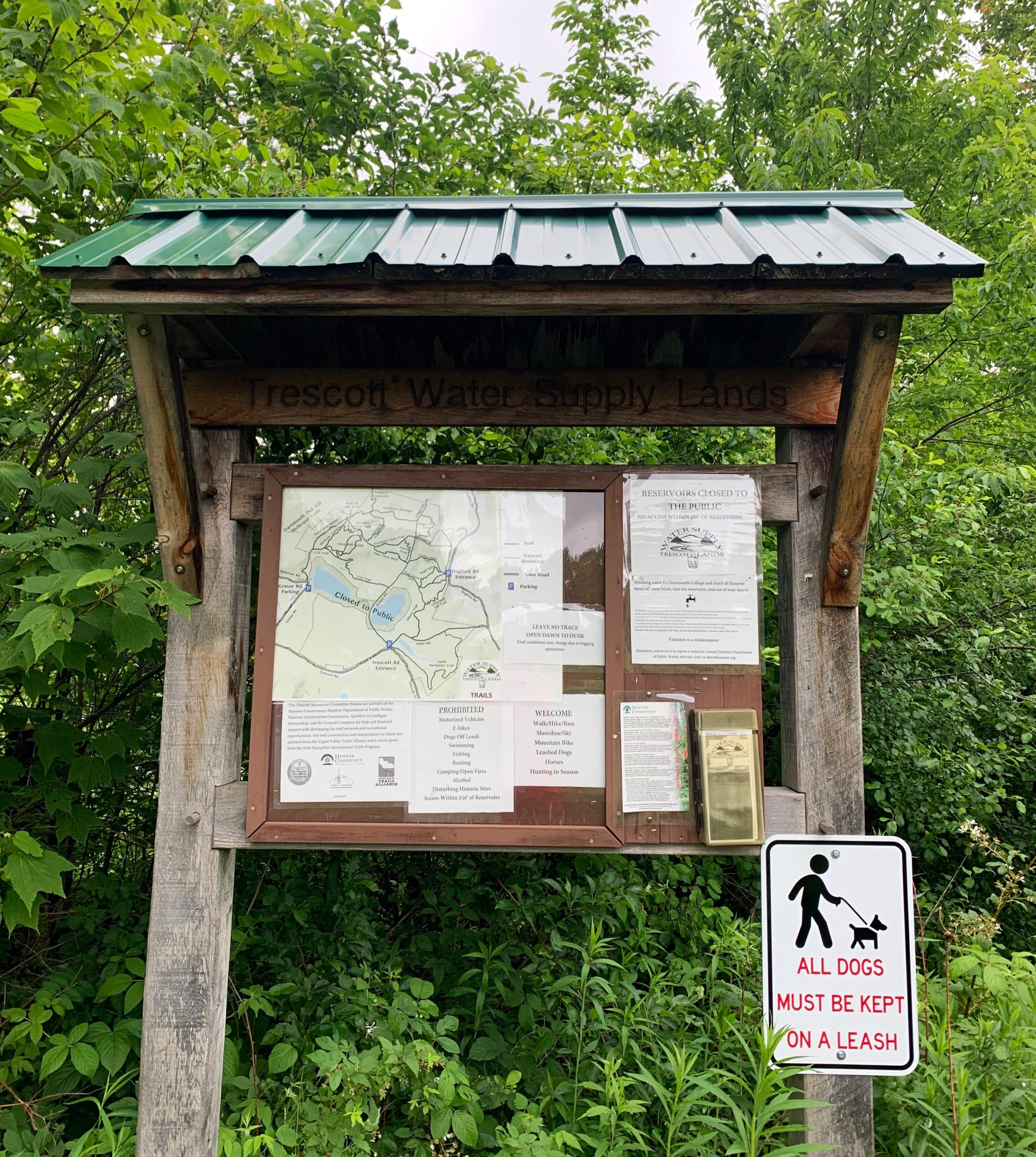
Trescott Trails parking lot information kiosk
With the decision made for a long day out on the Storrs Pond/Oak Hill/Trescott Trails, I opted to enter the Trescott trail system via the most northerly connection from Storrs Pond, to emerge onto the Northwest Passage trail. Instantly, upon entering the Trescott Trail system, hikers are greeted with solidly packed dirt footing with minimal (rock and root) obstructions on most of the trails; quality is some of the finest to be found in the Upper Connecticut River Valley area, creating a truly wonderful journey which gives a sensation of effortlessly rolling through gentle dips and rises in the hillscape.
Early along the Northwest Passage trail, a local hunter was encountered who was very respectful of the trails and its users, advising blaze orange (or any bright color) was a good choice any time of the year as to stand out amidst the dense forest canopy. Wishing each other a pleasant day in the woodlands, we continued our separate way, the hunter heading off-trail toward perhaps a favorite spot, away from recreationists which may startle his catch.

Paige Hill Trail
Several old, brushy logging and forest roads can be found diverging while the unmistakable main path nears Knapp Road. At 0.5-miles into the Northwest Passage of the Trescott trails, the T-junction of Knapp Road is reached. Veering northward (left) a short distance brings hikers to the northern terminus of the winding Paige Hill Trail. It’s high point can be found listed on some maps as Pinneo Hill; the Paige Hill Trail becomes somewhat rugged with spots of exposed bedrock with dark, rich soil all around. With moderate grades, the path remains a pleasant stroll, an easy ascent as it switchbacks its way up and down the 1,270’ bump in the landscape.

Porcupine Trail
At 0.3-miles into the Paige Hill Trail, the summit crest is reached, the unmarked, true high point of the dome lay just off-trail toward the west; like a slow roller coaster, the footpath begins a gradual descent downslope by way of switchbacks which taper larger with each turn. Several brushy areas now grown in with lush ferns force an inquisitive eye to how the mountainside had been sculpted by both loggers and farmers; the narrow path remains hard-packed soil with minimal rocks and roots as it passes a small, lovely patch of red pine nearing its bottom section.
Back at the southern base of the Paige Hill Trail, Knapp Road can be found several rods westwardly while the Porcupine Trail now heads eastward. Briefly down the Porcupine Trail a split is encountered; the Upper Porcupine Trail offers a restricted lookout, most of the year, toward the mightly Mount Ascutney (3,130’) as it switchbacks to merge with the Lower Porcupine Trail.

Southerly views from Upper Porcupine Trail
Following the 1,080’ elevation contour, the Porcupine Trail swings through localized areas of cleared blowdown; from a northeasterly direction to southeast as it passes behind several Hanover homes and grassy fields. Soft switchbacks guide the Porcupine Trail down a 50’ drop in elevation as it swings to parallel Dogford Road. While vehicular traffic can occasionally be heard, cars and trucks remain well out of sight thanks to the dense, leafy roadside understory.
A small, signed spur path is encountered which will guide hikers out to Dogford Road, 0.25-mile north of the main trailhead parking lot; here, however, there is no space for parking as the roadside is dominated by an old stone wall. Continuing southward on the Porcupine Trail, the pathway corridor narrows as it becomes enclosed by low, brushy white pine and various young hardwoods. As the landscape begins to open up once again, the main Dogford Road trailhead is encountered; from here, a multitude of paths diverge, creating many options for loops of nearly any length and duration.

Porcupine Trail nearing Dogford Road Trailhead (east)
Following the Poor Farm East Trail southward out of the Dogford Road trailhead parking area, in 0.15-miles the old Wolfeboro Road is soon reached. This old road was crossed over to begin along the Chipmunk Hill Trail. While this route demonstrates immaculate mountain bike trail construction, it is also a joy to trail run - cruising around the high-walled berms and venturing onto a different style of trail, cairns have been playfully built in some spots using extra rocks along the inside of several switchbacks. Being a designated bike path, the right-of-way should be given to mountain bikers, if possible. Descending the tight switchbacks of Chipmunk Hill Trail is periodically atop smooth slabs of bedrock with some moderately loose, gravelly and sandy footing, care should be taken while descending.

Along the switchbacks of Chipmunk Hill Trail
Reaching the end of the 0.4-mile Chipmunk Hill Trail, the path ends at a T-junction with the Mason Trail; a left here will guide hikers to Paine Road and henceforth the Trescott Road trailhead, while a right turn will venture deeper into the network of narrow trails and wide, old farm roads. As visiting the reservoirs was one of the main objectives of today’s Trescott Trails exploratory trail run, I took a right to follow the meandering Mason Trail back toward the Poor Farm East trail.

Ascending Knapp Road
Once again crossing the brushy Wolfeboro Road to continue following the Poor Farm East trail. Dropping down momentarily into a slight gully in the landscape, the rolling trail soon begins climbing through an old grown-in pasture. Scattered throughout these hills could once be found 10 farms and several residences. The old Wolfeboro Road which is has been encountered now several times along the route was originally drafted back in 1770 to connect Governor Wentworth’s residence in Wolfeboro with the Connecticut River Valley towns.
As the trail gently ascends out of the low gully, white pines rise out of a sea of ferns and other low growth; depending on the time of year, wildflowers also provide bursts of white, yellow, pink, blue and purple along the edges of the old farm road. A steady ascent of 60’ brings hikers to the junction with the old Knapp Road, another once bustling roadway through an old town; turning right here will guide toward trails found west of Knapp Road while a left turn here will provide a gentle descent down the brushy old road, toward Parker Reservoir.

One of several trailside kiosks of Trescott Trails
Trailside kiosks can be found alongside Knapp Road in several locations providing historical details about farms, residents, a school house, as well as logging and farm roads, which are now repurposed as our recreation trails. The first notable junction is once again with the old Wolfeboro Road as it bisects Knapp Road, this was at one time a major intersection known as Mason’s Four Corners and once a landing for logging.
Until 1903, the one room, District #4 school house could be found at the northwest corner of the junction, it now seems bizarre to imagine this old structure in what is now a reforested plot of land; across the 4-way junction, at the northeast corner, stood the residence of Lt. Knapp; nearby was the 160-acre Mason Farm which was home to an orchard of 100 apple trees, 200 sugaring trees, 11 dairy cows and 70 merino sheep until purchased in 1903 by the Water Company for $4000. What was once a bustling farm town was all but erased from the earth when every structure was finally removed in 1912, all that can be found today are remains of several cellar holes along the grassy roadside.
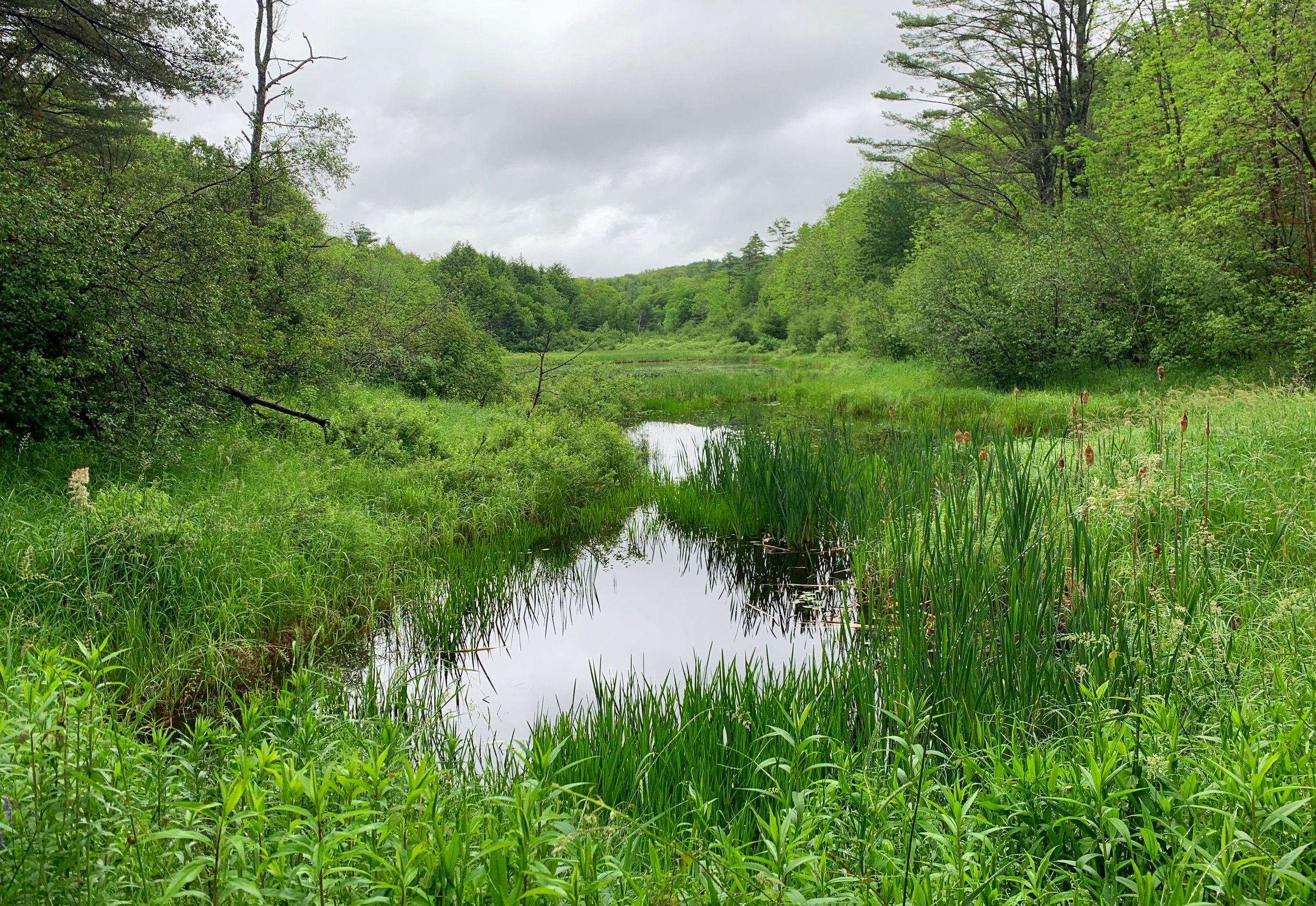
Paine Trail marsh land
As the trailside becomes boggy, the rugged old road becomes lined with pink clover as old tire tracks form two lanes of footpath. Listed as Grasse Road on modern maps, this old road provides access to Parker Reservoir (authorized vehicles only) and for logging trucks, which were actively logging just north of the Trescott Trailhead (south of Parker Reservoir) area. During visits in Autumn 2022, this area is now a field of slash and logging debris while a few low patches of greenery are trying to take over. Signs warn recreationists to not approach the reservoir and to maintain a 250’ buffer around the Hanover and Dartmouth College’s water supply.
Parker Reservoir is but one of three reservoirs for the town, the most westward, Fletcher Reservoir is the oldest, both Fletcher and Parker Reservoirs are a result of damming Camp Brook; while the Hanover Center Reservoir can be found furthest east, in the Mink Brook watershed area.

Wide-angle view of Parker Reservoir with Knapp Road
Past the earthen dam of Parker Reservoir, the wide road crosses over the outlet of Camp Brook and swings southeasterly around Parker Reservoir and briefly through tall stands of forest before emerging at the Trescott Trailhead. Turning left to re-enter the forest along Paine Road, a larger loop could be made by following the South Perimeter Trail, which parallels Trescott Road southeastward before swinging northerly toward Paine Road, further east.
As Paine Road was becoming grown-in and increasingly rugged for foot traffic, I veered left, back onto Mason Road for a gradual descent through open hardwood forest beside an old stone wall; lush green fern and grass understory contrasted strikingly with dark, rich soil of the springtime landscape. A bridge over a frequently soggy area brings the trail back to the western terminus of the Chipmunk Hill Trail, from earlier in the ramble.

Boggy water crossing along the Mason Trail
Continuing straight, through yet another encounter with the Wolfeboro Road, the path enters Toad Alley - another trail designed with mountain bikes in mind - is perhaps a personal favorite in the Trescott Trail system. Beneath a glowingly verdant canopy, Toad Alley climbs briefly and switchbacks often. The narrow path cuts around massive oaks, some of which have toppled and are now gathering moss. Passing an old stone wall and several deposited glacial erratics, recreationists have built small cairns trailside, which are a joy to find along the route.
Stone steps guide hikers and bikers over small drainages, some have developed a small wobble as one passes overtop, but overall footing remains very firm over this beautiful stretch of trail. Once reaching the end of the 0.5-mile Toad Alley, a right turn will guide adventurers back to the Dogwood Road trailhead, or veer left to make one’s way back to Storrs Pond by way of Child’s Farm Trail to Knapp Road.

Southeasterly views from Knapp Road
Heading north on Knapp Road once again, the Ascutney View Trail is soon reached which tracks west/southwesterly through a stunning grove of brushy conifer with a lovely lookout toward Velvet Rocks, which features a hilltop Appalachian Trail shelter, with Mount Ascutney towering beyond.
A diversion down the Stone Hill Loop should also not be missed; while it’s lower sections unfortunately features large patches of unsightly logging from several years ago, the western branch of the loop crests atop exposed bedrock and is a fantastic stroll with a very open hardwood forest. While the pathway does not offer much for vast, mountainous views, it is possible to glimpse far down the hillside to spot wildlife and beautiful native flora.
Encountering the 1772 Trail, this can be traversed to return to the Storrs Pond trail network, or followed northerly to diverge along any number of other trails to return to the Back Loop trail of Storrs Pond. The paths, while grassy, brushy and somewhat grown-in later in the season, are easy to navigate and patch together, creating loops and routes of any size and duration.
With that said, however, care should be taken to ensure one does not get lost or head in a wrong direction. While Storrs Pond trails often feature trailside maps depicting current location within the trail network, the Trescott Trails have yet to offer any of these navigational kiosks. Miles of exploration and fun can be had on the Trescott Trails, check out the map below or visit the Hanover Conservancy website to plan a trip of your own.
Overall stats for the day:
18-miles (including Oak Hill trails)
6hr 18 minutes
3,458’ elevation gain
Pinneo Hill - 1,270’
