
The Mount Flume Slide Itself
Since moving to New Hampshire state in 2018 and finding a passion for hiking in the White Mountains, I often wondered about the massive streak that shined bright from the 4328ft summit to nearly 1000ft into the Flume Brook ravine far below.
Before plummeting into the rabbit holes which have become the roughly 500+ landslides adorning the steeper slopes of the White Mountain peaks, I innocently assumed this was just how Mt Flume had always appeared since the glaciers retreated a long time ago.
Joined by the southwestern three-pronged slide (much of it revegetated now) of neighboring Mt Liberty as well as the numerous slides in Clear Brook ravine off Whaleback Mt to the south, the rainstorm June, 20th 1883 cleared a large patch of dirt, rock and forest from the western face of Mt Flume as well.

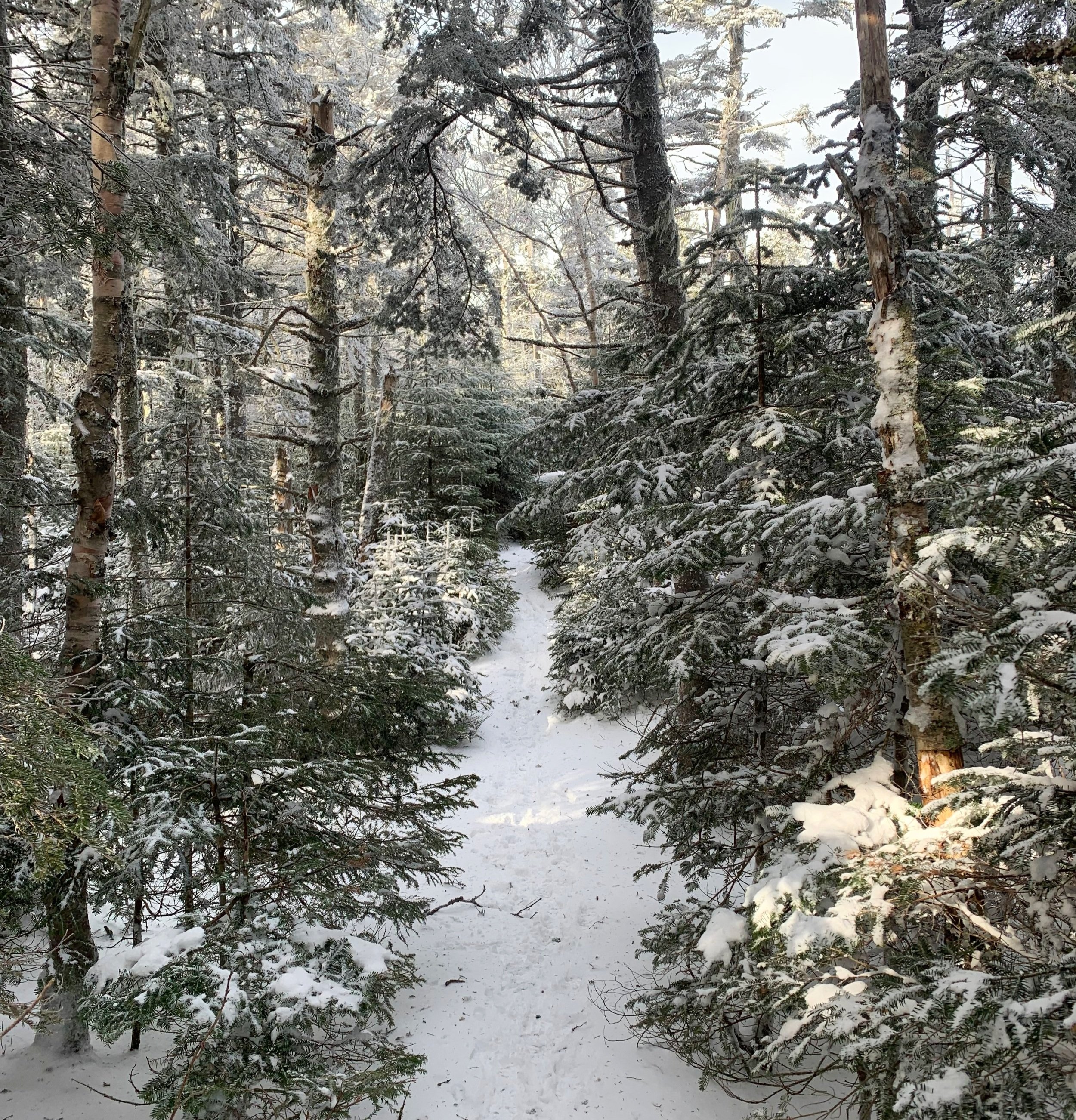
Sun rises on the Flume Slide Trail
For years, I could gaze at this slide from either its own summit peering down the massive drop into the ravine or from many high viewpoints laying to the west or even while driving along I-93 and think to myself “nobody climbs that, maybe with ropes and protection, but that’s just not a thing people do!”. It was only just recently that I found an old climbing report in which the climber noted that all loose rock had been ripped clean from the upper slopes of the Flume Slide face.
Several days prior, when ascending the southwest slide of Mt Liberty, I was able to look over to the gash adorning the western face and see that it shone a brilliant bright white, caked with snow and ice, perhaps conditions could be found just as favorable on that side of the ravine!

Several slides streaking Mt Liberty
Armed with a few days of high winds producing below-zero chills, I had high hopes that any remaining rain had frozen solid upon that open slope. We had received an inch of snow the previous night, this only compiling my hope for favorable climbing conditions as this was likely not enough powder to be concerned with avalanche threats. The forecast Tuesday and Wednesday called for high winds matched with low temperatures, Thursday for 20-30mph easterly winds with temperatures warming into the 20’s and then a winter storm creeping in Friday, rumors of it dumping more than a foot of snow in the high hills. I had my window and decided to jump on it!

Ascending the lower Mt Flume west-face slide
Back in the Basin parking lot I found myself lacing the yellow mountaineering boots once again, a regular occurrence these days, it seemed. My orange 28L pack was stuffed with all the typical necessary winter gear: Gore-Tex shell, extra gloves, spare (super warm) beanie, fleece buff all tucked neatly around a Nalgene bottle, close to my back in hopes that it would remain liquid. I stashed several extra date and quinoa bars into my pockets for the long trek in.
Finally, at 7:54am I stepped out of the Subaru, set my watch to record this endeavor while allowing me to view my location on the trail map in real time via a high contrast 1.4-inch screen. I had waved to a Massachusetts hiker while driving into the lot and was now following their shallow boot prints along the Franconia Notch Bike Path. Not far along the path, having similar ideas, we both cut off onto the well-known “bushwhack” up the hill to join the Liberty Springs Trail.

Looking up the main slide face
Before long I was closing in on this other early-morning hiker and upon passing we shared greetings and each other’s itineraries for the coming day; he was shocked that a climber would venture out alone but is something I have grown comfortable with over the years. Afterall, I never hold a grudge against myself if I get a bad feeling about a route and decide that day is just not the day to summit, mountains will always be there next time.
The fresh powder showed a multitude of hikers ascending and descending the Liberty Springs Trail over the past few days. While I was putting down the first set of boot prints along the Flume Slide Trail, I remarked jokingly to myself that once again I was following my own tracks from several days prior. The forested miles all looked familiar and crept by one mile alert on my watch at a time and before long I had made several of the small brook crossings, tributaries to the main Flume Brook just up ahead.

Very loose talus + boulder field along the face
Upon cresting the next and final ridge prior to following Flume Brook into the short bushwhack, I stood for a brief moment shocked, trying to determine whether what I was hearing up ahead was a flooded, raging Flume Brook or actually wind. In that moment it sounded more violent than either should sound, and much more so than my ears wanted to hear! Just then, I looked up into the trees which covered the southern shoulder of my destination – their avid swaying was a dead giveaway that what made up that sound was all wind, high up in the trees was the 30mph wind that I had read about, at trail-level there was barely a trace.
Continuing down the Flume Slide Trail, I was now leaning toward the “not summiting” side of my options, I could not imagine being on a 34° landslide in such a forceful wind and did not want to experience becoming a kite first hand today! One step at a time, one brook crossing at a time – I merely focused on putting on and taking off the Hillsounds as needed and before I knew it I stood at the base of one of the many slide drainage points staring up at a rock-filled gully which lay at least 15-20ft below the neighboring sides of my mini-ravine.

A glance back down the chute
Retreat or ascend? The time was now to decide what lay ahead for the coming minutes of my adventure. Knowing that I remained in a position where I could turn back if conditions worsened, I unclipped and dropped my pack, put on my helmet, switched Hillsounds for full-crampons, detached my two ice tools, switched glove liners for more insulated shells and added my Gore-Tex shell to keep a draft from flying through my wool/fleece mid-layer.
Up I went; high stepping up rocks and over boulders. I felt as if I were gaining all the mountains’ elevation climbing that lower slide while still in a conifer canopy. At one point along this early ascent, I came upon a small break in the trees – a marvelous view out to the Mt Liberty slides where I had just climbed three days prior, I had to sit and enjoy this moment even just briefly.

Looking back at the face of Mt Flume
Continuing up the slide even higher I could see the bright white of ice and snow glistening bright in the morning sun just beyond the thick bushwhack at the top of my narrow slide climb, now began the real climbing of my day and to my surprise, as I write this, the one thing I had completely forgotten about was the wind! Just as I hoped – being on the western face of this mountain, I must have been sheltered from the wind!
As soon as I got out onto the first ledgy rock face and swung my more aggressive ice axe into the clear ice I could tell this was not the same quality I had become used to on my other recent climbs. The contact sounded solid but when I looked down at where my ice pick struck the ice there was a radiating crack and at the slightest tug the entire ring of ice as far down as the pick had gone just sheared off in a layer, fracturing into four or five pizza-slice shapes and falling down past my boots. Not what I wanted to see today!

Panoramic views from the summit of Mt Flume
Trying to stay more toward re-frozen granular snow which held an ice pick much better than that crummy ice, I threw the axes and kicked my feet harder and harder into the snow and ice. Overall, as long as I kept at least three-points of contact in the winterized slope at all times, the ascent felt under control and so I took it slow and methodical.
Knowing that I wanted to stay toward the right (southern) most side of the slide to hit the chute, I checked my both my watch map and GPS location several times to ensure a proper trajectory up the slide, each time I consulted either, I was nailing the ascent direction, which was reassuring to see.
Once I had topped out on the fourth slick ledgy area I thought for sure I was making good progress and at that point when I checked the aerial map with my blinking blue GPS location I could see that I had just begun to scratch the surface and the climb was still young. I repeatedly used the 4,459’ highpoint of Mt Liberty just over my left shoulder as a guide, knowing that I was not climbing as high as that mound I could very crudely gauge my progress.
In the conifer tunnel from Flume to Liberty mountains
What transitioned from a slick ice and snow face of rock into sporadic boulder-step-and-climb-overs turned into a continuous pileup of various baseball and basketball sized, to microwave and small vehicle sized monstrosities. Most of this section had little to no ice and a very drifted 2-6-inches of fluffy snow that would not take an axe pick, resorting to picks shoved into rock cracks and crevasses I managed to crawl my way very carefully over this treacherous terrain.
But wait, there’s more!
At this point in the climb I could look up at a large stone tower looming about 300ft overhead, to the left I could see where the large slide section to my left connected up to the Franconia Ridge Trail, straight ahead was my chute to the right of the massive slide, the remainder of my climb was entirely insight and boy did it look like football fields of small, treacherous rocks on loose gravel and sand the entire slope. In my mind I knew I could be there in a matter of minutes if I could continue my agonizingly slow and extremely careful ascent using both ice axes to delicately distribute my weight as I inched one leg up at a time, occasionally sending a football sized rock careening down – and when they took off tumbling there was nothing to arrest their roll for hundreds of feet down the mountain face, I tried to keep that as awareness and not let the fear of sliding backwards rise up within.
Inching my way over to my left in hopes of finding more stable, solid terrain to ascend, I followed a line of conifers and low-laying shrubs, assuming their roots might lock the boulders into place. This narrow line also had slightly more snow than the directly exposed route of smaller rocks I had been following. Simply focusing on directing one limb at a time and ensuring forward progress was being made, I began seeing the large rocks nearing the ridge crest larger and larger, finding cracks and crevasses in these I began ascending like a giants’ staircase. I wanted to photograph this bizarre, unfamiliar terrain but more than anything I wanted to sink my 24 crampon points securely into the Franconia Ridge Trail and be able to peer back down from a safe perch.

The west-facing slide of Mt Flume
As I write this a full day later, I am still not completely certain if the reality of this climb has or will ever sink in. It was something I always wanted to do when I stood atop Mt Flume, or during the several times passing over as I neared the end of a long trek along the Pemi-loop, I never thought it could be actually climbed, especially not by some White Mountain transplant such as myself. As it turns out, I squashed that self-doubt somewhere back around 3900ft and completed a task that few others have even attempted. At the present, I am pretty darn satisfied; It feels as if a major chapter has been completed – the I’s have been dotted and the T’s all crossed.
It was as if one final reward was waiting for me atop that ridge – the inch of snow we received back home had grown exponentially into about 10-inches of thick powder on the path over to Liberty. With crampons still on the boots I blissfully hustled over while several other hikers acknowledged the helmet along with the two ice tools which remained in hand, obviously not your typical everyday hiking accessories.
As the elevation decreased and the parking lot grew near what had been a winter wonderland of snow turned into a sloppy mess of mashed potato snow mixing in with the thick layer of leave duff which lay below. What a great day it had been, satisfying climbing and making new friends on the trek out – now all I had to do was wait for this onslaught of snow to roll in and keep the snowshoes ready for their turn at the winter action.
Overall stats for the day:
7.86-miles
5hr 47minutes
4,551’ elevation gain
Mount Flume - 4,328’
Mount Liberty - 4,459’