
Mount Sunflower (Kansas HP)
With the west coast fast approaching, Alanna and I took the opportunity to pay a visit to another state high point; at 4,039’, one might assume this 4000-footer would offer some prime trails and hiking opportunities. However, this peak is merely the high point of a long plateau of dusty farmland. Welcome to the High Point of Kansas!

Real sunflowers add a splash of color to the arid landscape
As we approached Mount Sunflower from the southeast, both occupants of this Subaru searched far and wide for what we assumed to be a prominent mountain rising from the plateau. Actually, had we not done the research and consulted both topographic, and road maps for this region of Kansas, we may have been looking for a standard mountain cone shape as we grew near. One glance at an altimeter will display to state high point enthusiasts, the minimal elevation gain remaining from the highway to high point.
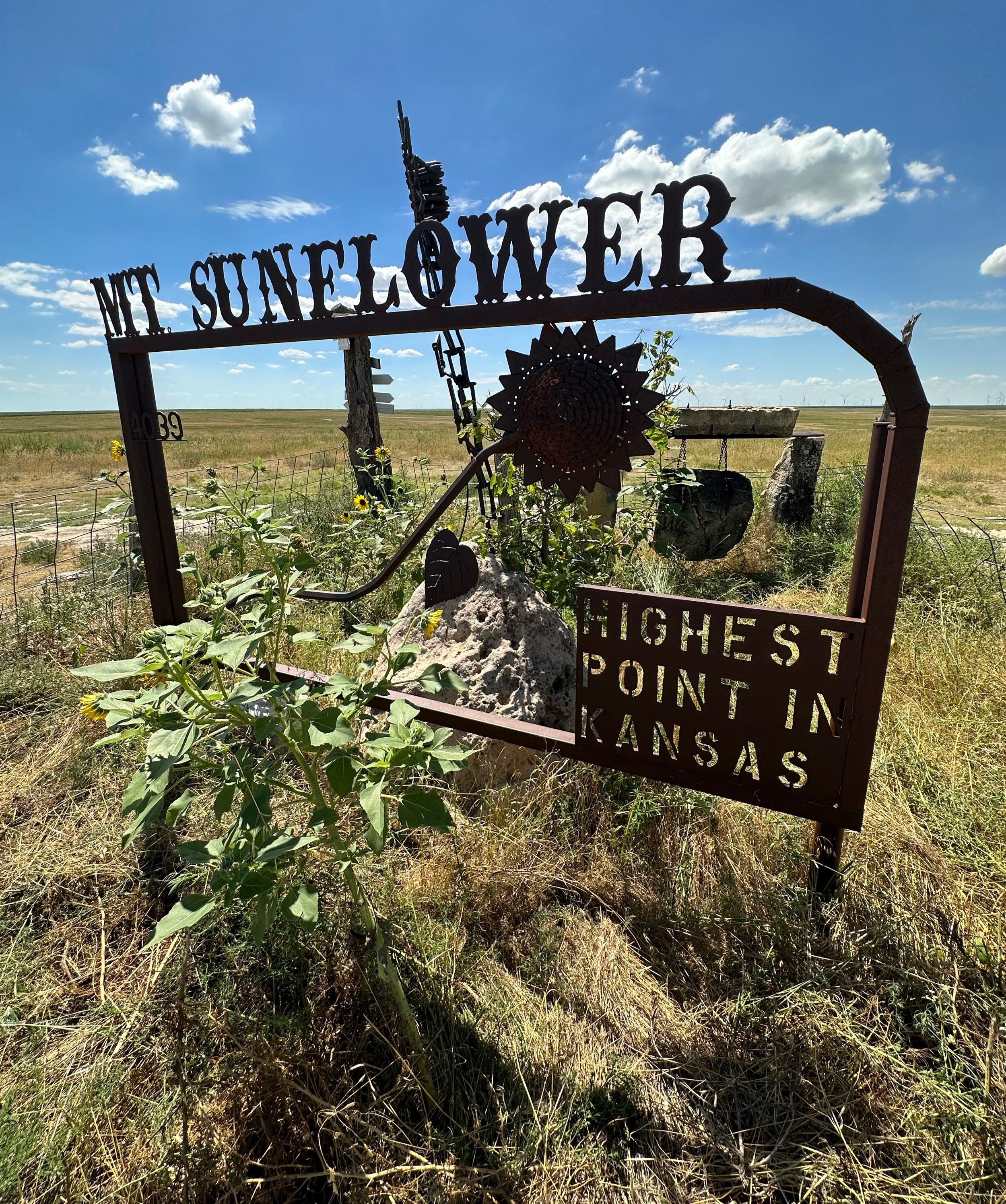
An offering of metal art atop Mount Sunflower
Following signs (and metal sunflower sculptures) for the state high point, we turned north off US Route 40, onto a strange assortment of dirt roads, which form a grid around square parcels of farmland. First, we navigated around brief sections of washboard road, passing several homesteads along the dusty path. At one minor sag in the landscape, the road veers into a patch of lush greenery before emerging on the northern side, into more dusty farmland.
Gaining 515’ in the 10.75-mile drive northward, from Route 40, the high point and all its mountaintop fanfare comes into view as signs indicate a westward turn (left) onto a dead-end road. During the course of 1.0-mile, more metal signs come into view, these indicating the final turn, and final ascent toward the high point of Kansas, and Mount Sunflower.

A little, free library atop the Kansas State High Point
According to some past trail reports, vehicles can be parked as to not block traffic, at the base of the final ascent, and then road walk the remaining 0.4-miles with about 30’ of elevation gain. As we could see no other vehicles or hikers atop Mount Sunflower, we opted to drive the remaining distance to the broad mountaintop, avoiding the heat of mid-day full sun.
The summit area is essentially a wide cul-de-sac style turn-around, with various points of interest on the western side of the summit; for as uneventful as this state high point is, the landowners have certainly gone above and beyond to make a visit worthwhile. Immediately, upon arriving at the mountaintop, we were greeted with a massive metal art display; formed with an old metal gate, several clusters of real sunflowers appropriately grew around the fence which barricades this high point metal art monument.
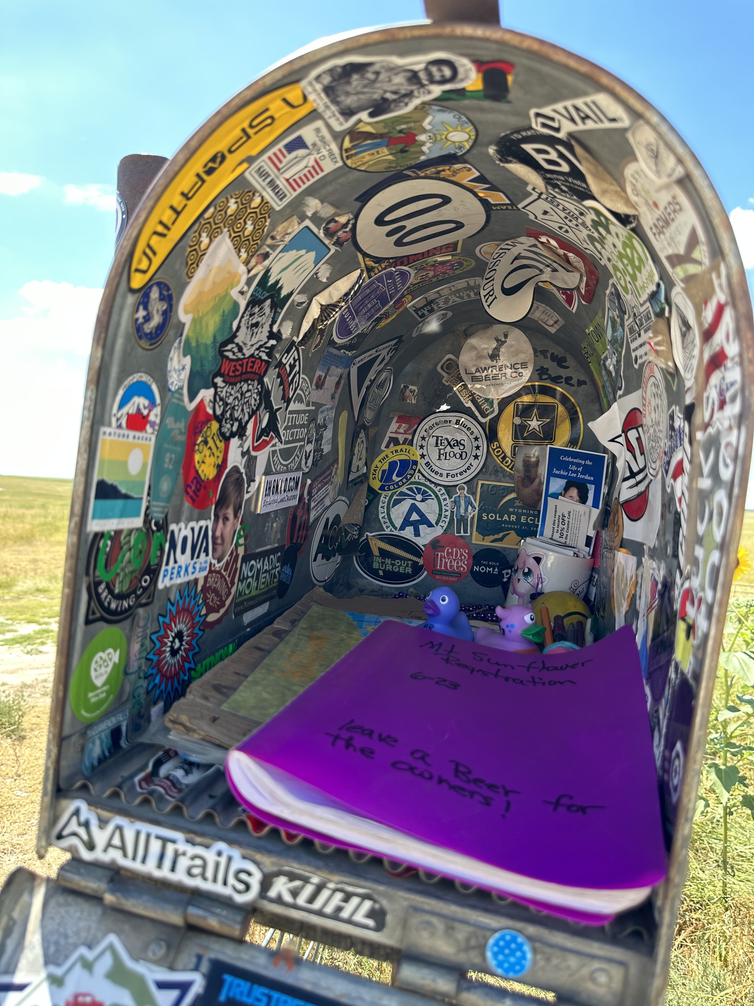
This mailbox may be held together with stickers
Until arriving at the summit of Mount Sunflower, it was unbeknownst to us that sunflowers are the state flower of Kansas, it certainly appears that they enjoy blooming atop their state highest. Revolving around the summit area, we also found a small, fenced in, and sheltered pavilion which featured an honor based library system, where visitors could take or leave used books - we have these readily back in New Hampshire, but we had yet to encounter a small library atop a mountain!

Directions + distances to other popular destinations
A lone, old stump from bygone days of forested farmlands stands beside the summit monument, various arrow-shaped wood planks display the distance and direction to other destinations. A sticker-clad mailbox stands to welcome visitors as well; this contains a notebook where visitors to the state high point can sign-in to the summit register notebook, thence documenting their ascent of both Mount Sunflower and the state high point of Kansas.

Our Subaru atop the 4,039’ high point of Kansas
One neat detail to keep in mind, if visiting Mount Sunflower - the eastern plateau of Colorado, whose elevation will soon begin piling up to form the mighty Rockies, can be found at the state border only 0.5-miles westward from the summit of Mount Sunflower.
After a brief stay at the high point of Mount Sunflower, we bade farewell to the mountaintop of black flies and deer flies, quickly got ourselves back in the car, followed our tracks southwardly to US Route 40, and paid a quick visit to the oft photographed Colorado state welcome sign, 1.4-miles westward.
Overall stats for the day:
0.06-miles
10 minutes spent signing-in and exploring mountain top
0’ elevation gain
Mount Sunflower - 4,039’
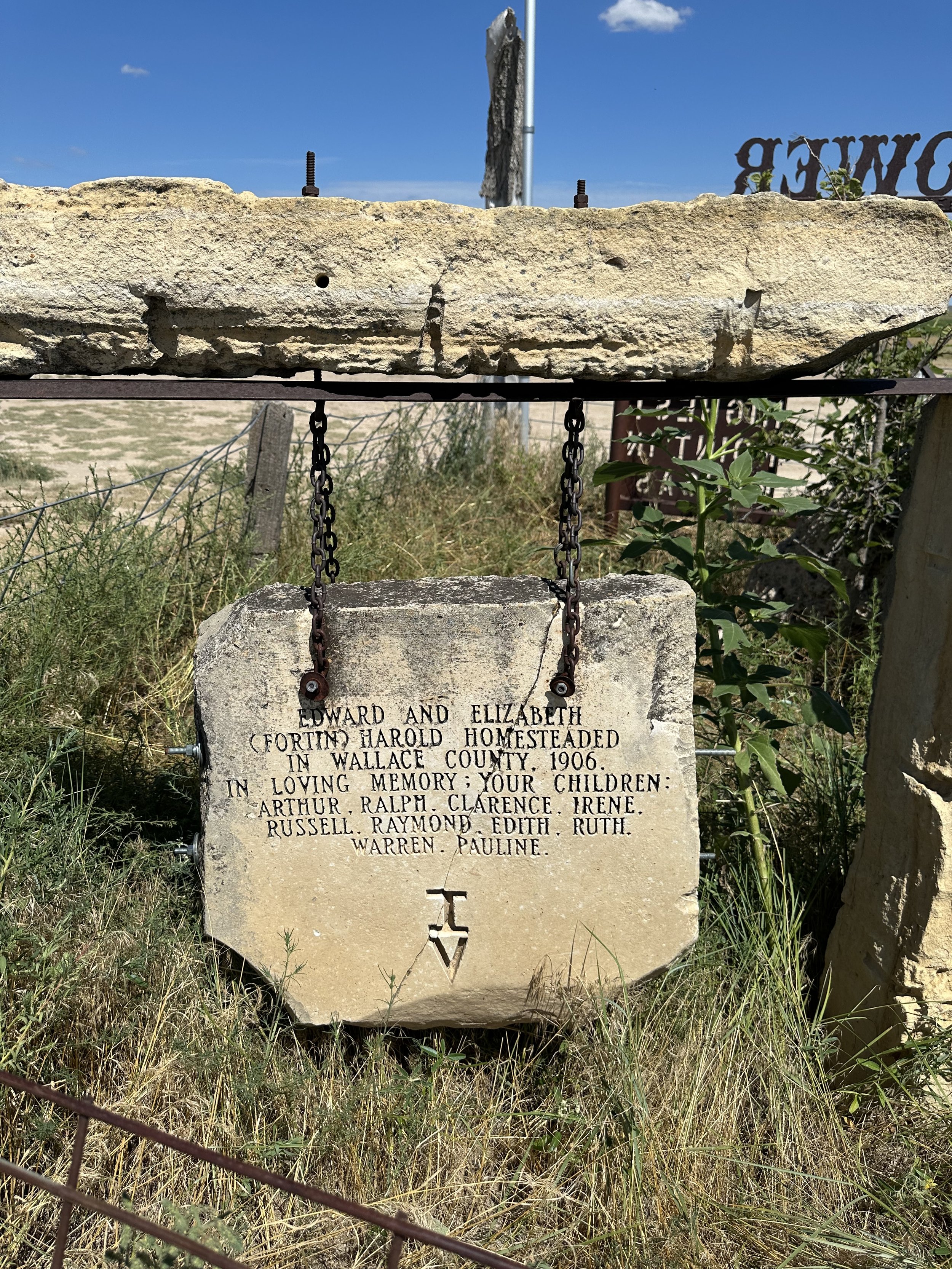
Memorial for a local homesteading family