
Black Mountain (Kentucky HP)
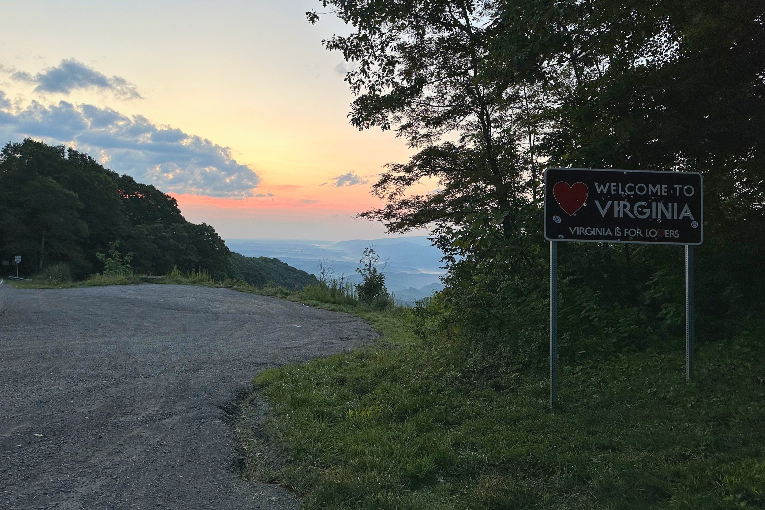
A million tiny lights comprised the town of Appalachia, mirroring the night sky as Alanna and I navigated a narrow, winding mountain road. Out of Virginia, we drove westwardly toward the Kentucky border, which would found as soon as we crested a mountain pass of the Tennessee Valley Divide.
Top of the Tennessee Valley Divide
Along the southern roadside we found adequate parking for several vehicles; a pull-off several rods beyond affords parking with a gorgeous lookout across the Appalachia’s - following this morning’s trek, we stopped at this location to boil water and have some morning coffee with a fine vista before carrying on, into Kentucky and subsequent points west.
At 6:23am, we departed the steep, winding road (US Route 160), and began a long approach toward Black Mountain (also referred to as Katahrin’s Mountain on some older maps). As our trailhead parking spot had been located at 3,705’ above sea level, only about 440’ of elevation gain remained to see us to the top of Black Mountain, the state high point of Kentucky.

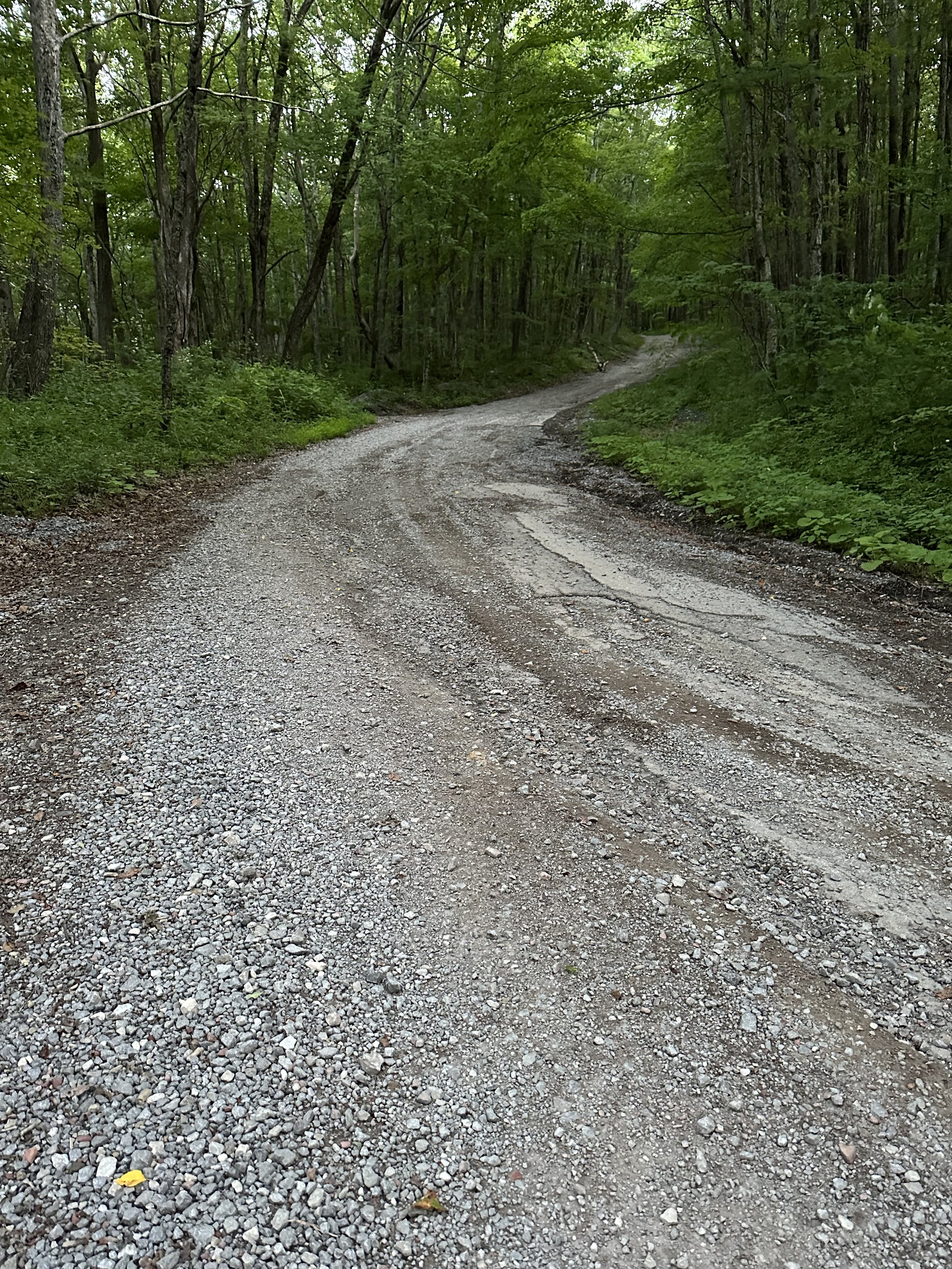
Beginning along the Black Mountain Ridge Road
Several warning signs are posted for anyone planning to traverse Black Mountain Ridge Road, as several radio and television towers exist along the eastern shoulder of Black Mountain, officials naturally would want to deter would be trespassers; foot traffic, however, seemed to be perfectly acceptable, as we passed by several power grid employees on the descent who offered a wave, and slowed their trucks down to let us roam past.
The route we chose (and would seem to be the widely accepted route in which to climb to this state high point) began along a wide, old forest access road - this roadway composed of much more clay and silty material than most woods roads back in New Hampshire. Several puddles stretched across the roadway here and there, any of these were easily avoided.

FAA radar dome partially up Black Mountain
Initially traversing the ridgecrest proper, the access road soon leaves the crest to side-hill around several bumps and ridges on the hillside. Occasionally, the surface becomes aggressively eroded, seemingly accommodating only the most rugged of off-road vehicles, alas, this is still a well-used thoroughfare for cherry pickers and other power grid, or FAA vehicles, in which to access their communication towers, and equipment.
Several old, rugged road corridors depart the Black Mountain Ridge Road, our path, however, is well-defined and unmistakable as it continues steep and rugged as it passes the fenced in site which houses a radar dome for the FAA (Federal Aviation Administration). This peculiar bubble on stilts could have doubled as a UFO in any corny SCIFI film. Signage warns would be trespassers of constant video surveillance about the immediate area.

Towers littering the Black Mountain summit
At 0.15-miles beyond the radar dome, a narrow, overgrown access road is found veering southwardly; reaching a tight turn around, where the rugged road (now more ATV trail) terminates, the skeletal remains of an old fire tower base can still be found - its cab having been long removed. Its grassy base reportedly home to a relatively newer US Geological Survey benchmark, given the tall grass and smashed glass surrounding, I was content only visiting the older survey benchmark; although it resides obviously below the recognized high point of Black Mountain, there was minimal broken glass or litter to contend with - apparently, the remoteness of this state high point makes it a popular party spot for locals.

Old, cab-less fire tower atop Black Mountain
The grassy summit area is also home to several fenced structures, this morning they hummed with the sound of surging high-voltage - even signs posted for summit visitors advised of excessively high radiation levels found around the summit equipment. Discovering this minor detail, we took photographs, explored briefly, and made a hasty trek back downslope.
One interesting plaque found amongst the grassy summit of Black Mountain explained the story of how this state high point became so accustomed to housing electronics and radio communication towers: a local resident, innovator, and WWII veteran is credited with building the first closed circuit television facility in Kentucky, therefore providing television access to the town below - now the sight of the big FAA dome does not seem so out of place.

Summit plaque
Beginning back down Black Mountain, several surrounding mountain ranges and ridges could be discerned through the northern hardwood canopy. With a gentle downgrade to the remaining 1.5-mile road trek, we opted to quicken the pace with a morning trail run, while the road surface was smooth enough, any rugged places saw a slower, more cautious pace.
As we enjoyed the silent, mountain air this morning, my heart jumped momentarily at the sight of headlights up ahead; the truck which they belonged was not moving, seemingly waiting for us to approach. With morning coffee on our minds, and knowing we did nothing illegal, we gave a welcoming wave to the driver, who returned the gesture and soon drove off toward the radar towers higher up the mountain ridge.
Descending along the Black Mountain Ridge Road
Once back at the roadside, I glanced around one final time, but found none of the posted signs indicating foot traffic from this approach was prohibited - with just about every other activity prohibited, it is reassuring to see foot traffic is still welcome.
To follow up, and reflect on our morning hike, Alanna and I boiled water at our perch atop the Tennessee Valley Divide. We watched cars cruise around the tight corner of mountain pass, their drivers often doing a double-take at the sight of two adventurers sipping coffee in the colorful, morning sunrays. Stretched out before us, however, demanded full attention - the beautiful, rolling hills of Appalachia splayed out before us.
Overall stats for the day:
3.41-miles
1hr 10 minutes
531’ elevation gain
Black Mountain - 4,139’
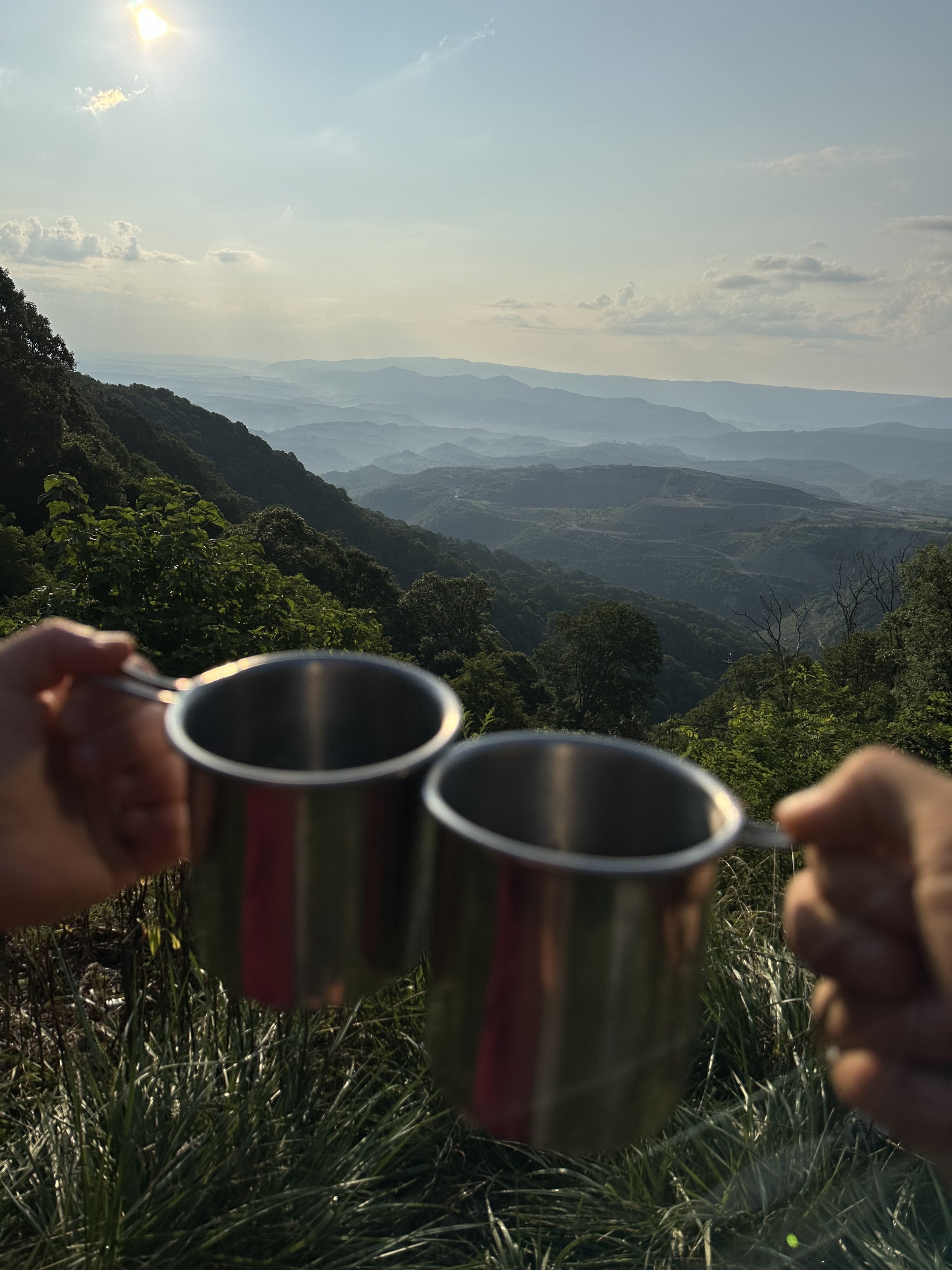
Morning coffee with a fine view!