
Sugarloaf + Hogsback Ridge
“To the west of Mts Moosilauke and Kinsman is the lower Benton Range extending N. and S. of which Black Mountain and Sugar Loaf are perhaps the most interesting, though possibly more adapted for those not looking for trails.” - 1917, Appalachian Mountain Club; Guide To Paths In The White Mountains And Adjacent Regions.
Precisely what was circling through my mind after snowshoe bushwhacking several days ago along Blueberry (2,662’) and Jeffers (2,994’) Mountains, south along the Benton Range of minor peaks. I could look over and see the open rock features adorning both - the southern ledges of Sugarloaf and western cliff face of The Hogsback shimmering bright while cloaked in its wintery white.

Sugarloaf through the trees
Most regions in the hills received near three times the snow that was forecasted, the large fluffy flakes flew sideways during nearly all daylight hours Thursday. Hoping Friday’s forecast of clear morning skies would pan out, I researched routes of how to re-visit these two places.
While the old trail along the western slope of Sugarloaf is trying to make a come-back, I wasn’t sure the cliffs would have been a terrific idea considering the ice layer from several weeks ago with now 12-18” of powder on top (in most wooded areas). This all looked promising for some enjoyable snowshoeing though!
While perusing Steve Smith’s old blog posts, I thumbed through his warm-weather bushwhack via The Chippewa Trail (which would typically guide hikers along the western slope Black Mountain) to ascend the northerly aspect of Sugarloaf. His post had confirmed just what I had been craving - open hardwood forest. I was in the mood for some more fast and light trekking ever since meandering through the open birch meadow atop Jeffers Mtn two days prior.
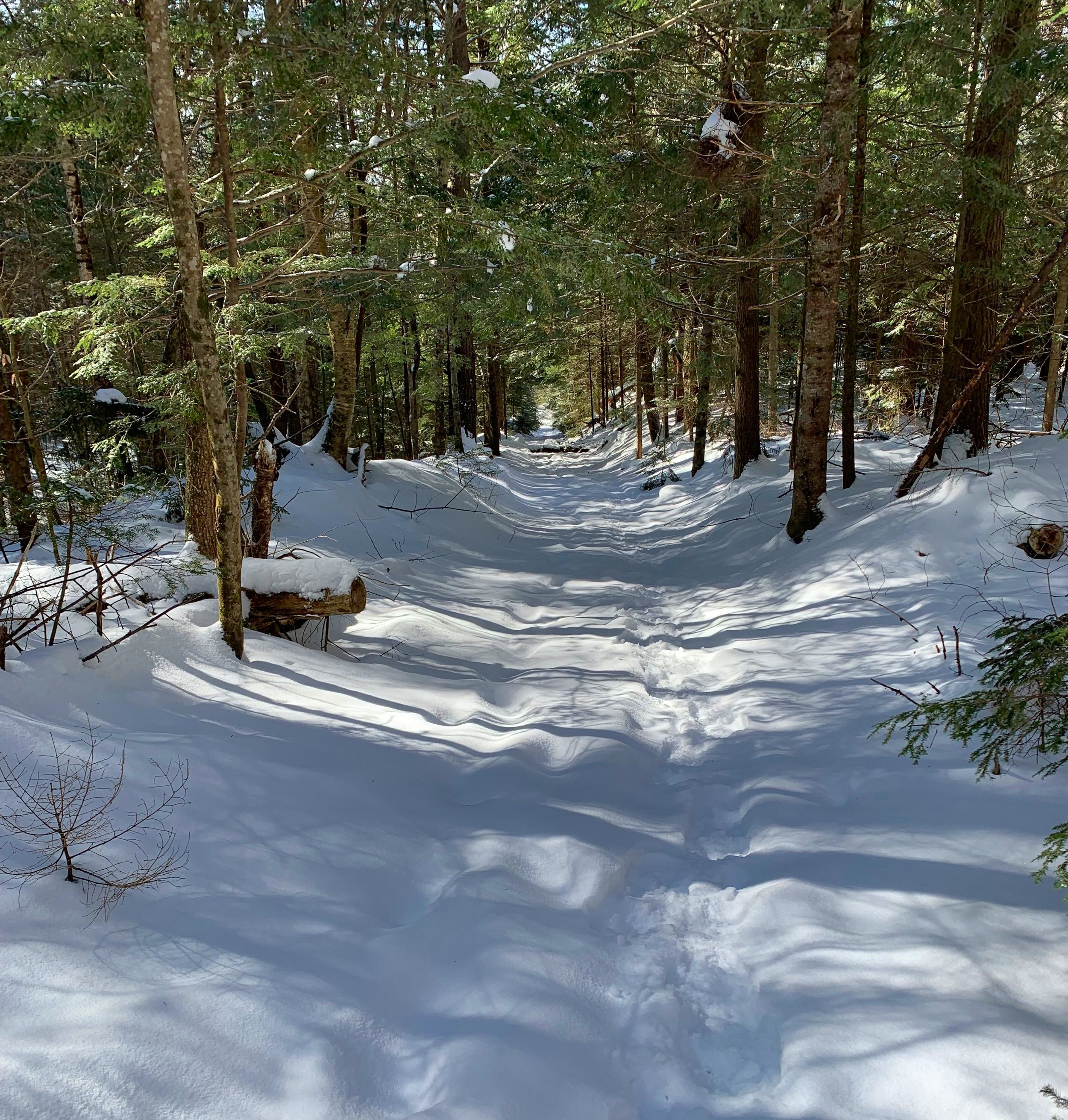
Old road grade of the lower Chippewa Trail
The sky was lit with pinks and oranges while commuting to the Chippewa Trailhead on Lime Kiln Road. A light pack of emergency essentials, a necessary flask of warm tea, snacks, ice axe + ice tool and full crampons all made the cut today - not knowing what I’d get into up in those hills, I’d bring a little bit of mixed gear.
To my surprise the lot was plowed enough to jam my Subaru in; the first and only car in the lot while I roamed about those woods. The air felt more arctic than the 27° that my car thermometer read; with snowshoes strapped to mountaineering boots I hit the gently packed trail at 7:06am.
Old cellar hole + overgrown pasture
All the usual wooden steps were cleanly covered over with a slope of snow down the initial, short descent, quickly reaching the minor water crossings which were easy to step over. Two stretches of wooden boardwalk span the larger crossings and with a quick ascent hikers are brought to a T-intersection; left goes out to visit the ancient lime kilns, right to follow the Chippewa Trail.
There are several old logging roads that branch off, first to the left is clearly blocked by a fallen tree, the Chippewa Trail breaks off at the second left and an old road follows straight (right). I was tempted to follow the latter option as it appeared to go in the direction of my objective; looking at old maps I wondered if this linked up with the Long Pond Trail, perhaps a journey for another day!
Westerly view while crossing a logging cut
Following the gradually ascending Chippewa Trail, I entered the 168-acre Kingsbury Timber Chippewa Trail plot of forest (Society For The Protection of New Hampshire Forests). My bushwhacking began near the old cellar hole and old overgrown high pasture, walking through this narrow corridor in warmer months is perhaps one of my favorite sections along the trail.
Almost immediately, my navigating brought me through relatively recent logging roads and various cuts, following south then swinging east with the contour of the land. Aside from a few thorned branches, travel was quick and efficient weaving through the new growth.

Travelling through the hemlock grove
Upon crossing a small brook I now entered a stand of giant hemlocks, what a sight as the sun shone through. Still navigating southeasterly toward my objective, I could see its summit cone off in the distance shining with the previous days snowfall.
Titus Brook was one main crossing followed by a smaller step over tributary, both of which were made relatively easy with the pillow-top rocks, ~6” of snow took the snowshoe crampons well but all the while I could hear the icy water just beneath.

Intersecting an old trail in the woods
Passing an intersecting trail, I thought, perhaps this was the long lost Long Pond Trail stretching from Chippewa to Long Pond. Either way it stills sees traffic, even if only by small woodland creatures.
As I ascended the slower slope of Sugarloaf, Black Mountain and its ledges began to appear just behind as a cloud stalled just atop its summit. I was entering a beautiful forest of birch - some of which must have been approaching multiple centuries of age.

Crossing Titus Brook
The forest remained considerably open while ascending over more of the pillow-topped snowy rocks, the white carpet was broken occasionally by trickles of running water, showing off the blanket of fallen hardwood leaves which provided even further soft footing.
Around 2,200’ I debated, swing left (east) to gain the summit at a more gradual grade or veer more to the right (southwest) and take it full on? Opting to continue my current trajectory I side-sloped slightly to my right and entered the spruce grove head on.
Even more gorgeous forest up here! It certainly became steep, but never so thick that I had to push nor fight my way through, always able to pick a route and meander further up-slope. The crust beneath 4-6” of powder provided plenty of traction to cut straight up the grade.

Ascending through the summit spruce cap
When I could look up and see what was likely a band of bare rock ahead, I knew it was time for additional traction; an ice axe to lean upon and use in case of self rescue, it didn’t make sense to carry tools and not use them.
I just love that feeling that comes over a hiker when they can look ahead, through the trees and see blue sky; no more land mass to ascend. Peering over my shoulder, now Black Mountain did not stand so tall; its 2,820’ summit being scraped by a grey, hazy cloud layer while my perch at 2,609’ remained cloud-free.

Black Mountain across the ravine
To my great surprise, from where I came up through the spruce, a blaze was freshly painted yellow, perhaps maintenance on the old westerly trail is beginning to resume after all; yet another adventure for another (warm-weather) day!
I followed yellow blazes slightly west to another vantage point with a restricted view toward Piermont, Cube and Smarts Mountains. I stood momentarily to let the sun warm my face as I looked down on Haverhill, the Connecticut River Valley and onward into Vermont - all looked so still and calm from where I stood.

Summit canister of Sugarloaf Mtn
I recalled signing into a summit register several years ago, back tracking toward yet another incredible lookout toward Black Mtn, the small canister was located, bolted to a tree - this time the cap came off!
Thumbing through the pages, I found the entry from October 25th, 2020 from when Chris and I had bushwhacked for sunrise from The Hogsback; in the next available open spot, I registered my ascent once again.

Open spruce forest along the summit top
Off the high spot, the open spruce forest seemed to stretch as far as I could see, truly a beautiful spot on that little pinnacle. Heading in the direction of bright blue sky, I found several rocky boulders and with the aid of crusty snow leapt from the lower to higher boulder; the views south/southeast to Hogsback and Jeffers were beginning to appear, but not to the glorious extent I recalled from years prior.
Back on solid ground and following more yellow blazes (out of curiosity of where they led), I found the view that I remembered - the spiney bare cliff ridge of the Hogsback with Jeffers broad arc just beyond. As it wasn’t even 9am yet, I figured I’d take a stroll over to see what the Hogsback looked like in winter.

The Hogsback Ridge with the low dome of Jeffers Mtn
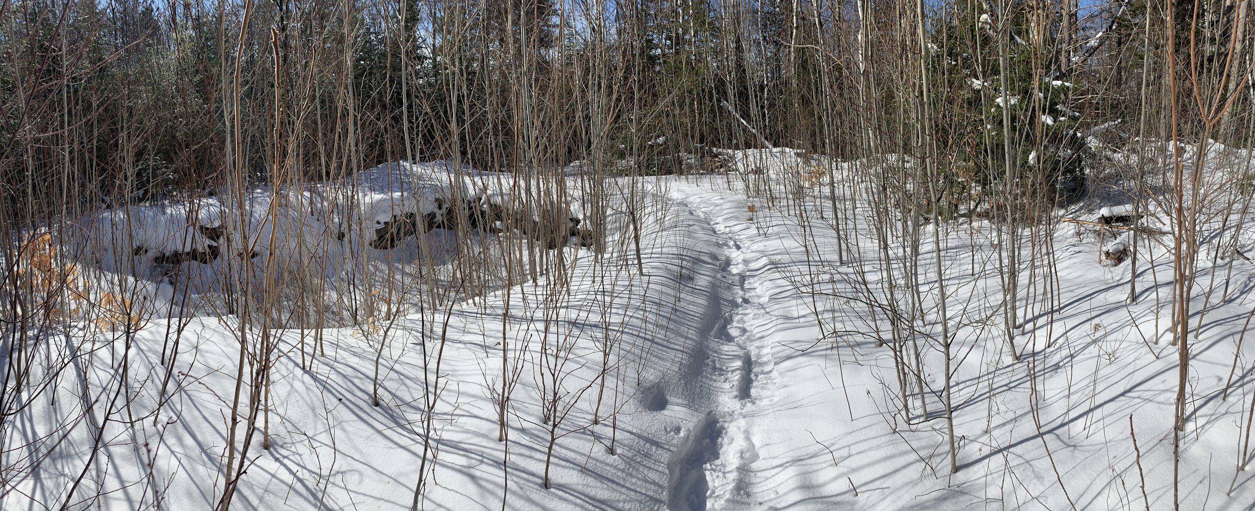
Leaving the summit cone of Sugarloaf I entered a glowing yellow birch forest sprinkled with dots of low evergreen - a continuation of the glorious forest atop Jeffers! While the snow in the col was my least favorite of the day, a newer crust sandwiched powder between an older crust, it was still a joy to snowshoe in and fairly quick going.
Each time I dodged south back into the conifer grove which topped the low ridge (the snow quality was better beneath the evergreens), I was greeted with blowdown and slow going, swinging back to the birch and young beech for several paces before trying it all over again.

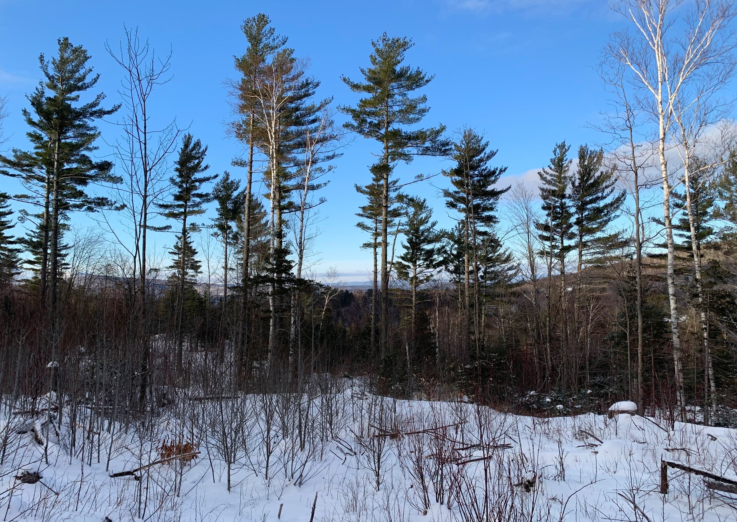
Open hardwood forest between destinations
A pair of moose prints meandered along the ridgecrest, in circles they went perhaps looking for a bedding spot or breakfast before dropping off the ridge for water from Long Pond. Old tracks were snowed over but there were clearly prints placed since it snowed just yesterday - the pair whom I ran into two days ago on Jeffers were up here somewhere listening to me romp through their territory!
Staying on high-alert for any gigantic moose bodies hiding in conifers along the ridge, I found the first set of ledges and paused for a break; I could see a better vantage point just up ahead, so off I went in search of higher ground.
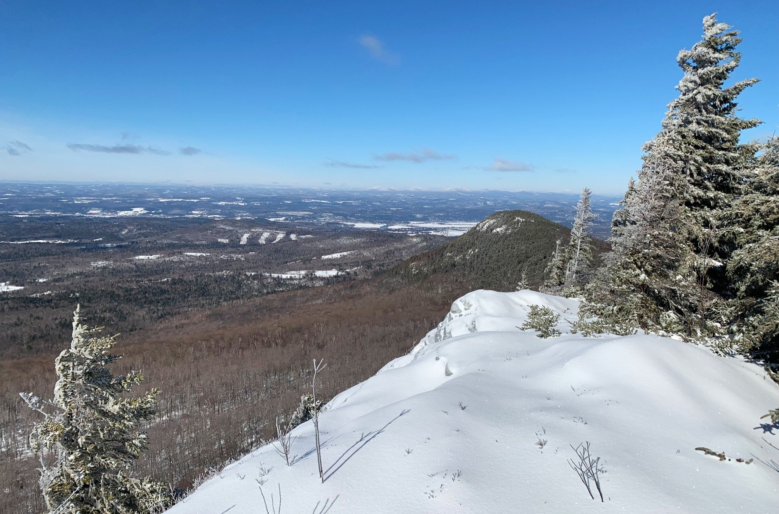
Looking back at Sugarloaf from The Hogsback
Gaining the open cliff-top involved a snowy scramble onto the crest, I remained thankful for bringing a technical ice axe along today. All around the ice-covered thin branches snapped and crackled, warming in the morning sun, wind was zero on this western aspect; I had found my happy place.
After a long stay in the morning sun I simply followed my snowshoe tracks back along the ridge, remaining in the open hardwood to avoid any blowdown patches from my initial trek out. Reaching 2,430’ I began traversing the side of Sugarloaf, opting to not completely ascend back into spruce, I’d intersect my tracks on the northern side.

Jeffers Mtn from The Hogsback
The snow along this route was some of the best, 8-12” of pure powder bliss as I could take a step and ride the snowshoe tails, glissading and coasting several feet with each step. Eventually intersecting my ascending snowshoe tracks it was an easy trek out now just following old prints back to the Chippewa Trail.
With surprise I looked to see no tracks ascending the trail toward Black Mountain on this blue bird morning, perhaps later in the day it would see traffic. The time was nearing 10am and I recall noticing the snow beginning to turn into that classic springtime mashed potato snow as I continue to descend - for this very reason is why I prefer an alpine start!

Descending open hardwood forest
Returning to my car I paused from sipping some warm tea, thinking of all the backcountry hidden locations I’ve been able to find through my journeys, the friendships I’ve made while doing what I enjoy.
I look forward to seeing Sugarloaf Mountain in many more seasons and returning often to its bare ledges; as it was stated in the 1876 Osgood’s White Mountains, “it will probably be a favorite point of attack when alpine exercise becomes popular in New England, on account of the fascination of its defiant cliffs, the exciting perils of the ascent, and the beautiful view from the summit.”; I have found all of this to be true and have become extremely attracted to the little glacial horn.
Overall stats for the day:
5.83-miles
3hr 54minutes
2,369’ elevation gain
Sugarloaf Mountain - 2,609’
The Hogsback Ridge - 2,810’