Vose Spur to Mt Carrigain: A bushwhack
An adventure “across the mostly pathless scrubby ridge from the summit of Carrigain is one of the most challenging bushwhack ascents in the White Mountains.”
I’d say the 2007 AMC White Mountain Guide writers nailed it on that description. Although, Alanna and I went Vose Spur to Carrigain, we most certainly ran into the same “pathless scrubby ridge”, only in reverse order.
I had been eyeing the final peaks on the New England Hundred Highest list for some time, a list that was slowly becoming checked off as I ticked off the New England 4000-footers. Before I knew it I was at 90 out of 100 of those high places; Alanna was on board to help me track down the rest as I had joined her ascending the New Hampshire 4000-footers.
Vose Spur was one of those peaks that remained on my to-do list for several years; I looked at GPS tracks, maps (old and new), even studying and planning the route utilizing photographs from other folks - I figured when the time was right, I’d give it a ‘whack.
Signal Ridge Trailhead; ascent: Nov. 9th, 2019
The weather was on our side for that summer weekday - blue skies, with low wind, perhaps a chance of late-afternoon rain rolling through, figuring we would be well on our way home by that point. I’d summit my Vose Spur and Alanna would get to see some incredible views from atop the tower on Mt Carrigain.
The sun was just beginning to light up the sky as we turned off US 302 and onto the dirt/gravel forest road (Sawyer River Road), which would take us past the site of the abandoned logging town of Livermore and to our trailhead parking lot.
At 6:17am we geared up and departed the Signal Ridge Trailhead enroute to Carrigain Notch. Immediately on trail, the reroutes of 2012 kept our feet dry and through beautiful mature white pine forest, south of Whiteface Brook. While keeping the sight and sound of flowing water nearby it is possible to spot several other brushed in reroutes along the path.
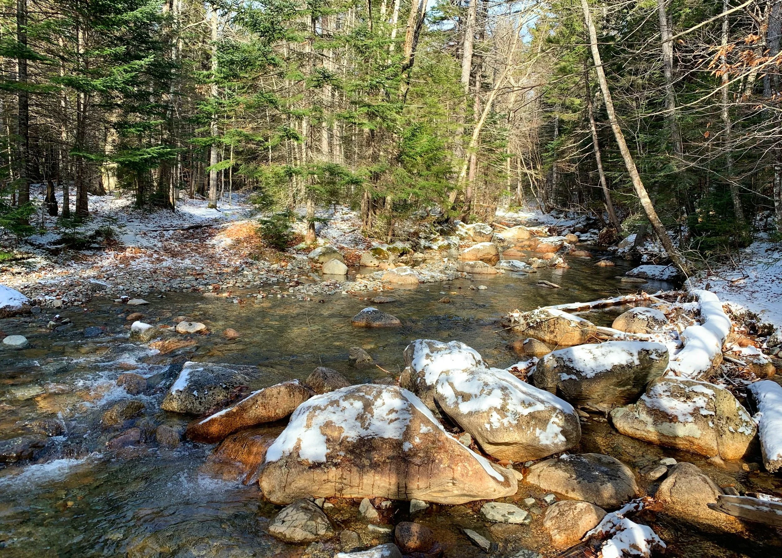
The Signal Ridge Trail doesn’t try to hide its past as an old logging road, several date from the early 1960’s while most road and rail beds are considerably older. A sea of ferns made up the understory carpet along the trail before we crossed a remarkably low Carrigain Brook for the first time of the day.
Crossing Carrigain Brook; ascent: Nov. 9th, 2019
Following a brief reroute to the east around newer beaver activity, we paused at the intersection of Signal Ridge and Carrigain Notch Trail, debating our fate for the coming hours. With the words: “well, since we are here…”, we began trekking down a very nicely graded Carrigain Notch Trail; formerly the North Fork Trail which was opened by the AMC in 1906 along with about 20-miles of other trails in the area.
It was a lovely walk through the woods, not a sound could be heard except for a pair of birds chirping, probably alerting the rest of the forest a few smelly hikers were romping through. We could see the bed of what would have been Carrigain Brook but perhaps it went below ground or relocated elsewhere - to our surprise all the river boulders were bone dry.
Nearing 3.4-miles into our trek, I located the massive boulder mid-trail (very hard to miss) and shortly after spotted a well-travelled herd path which would guide us in a near-straight shot northwesterly up the trailless slope.
What began as a steep ascent through a v-cut of thick forest duff quickly became a light scramble over bouldery ledges - our favorite kind of hiking involves getting the arms involved. Using roots and tree trunks we gently hoisted ourselves along the eastern face of the Vose Spur nub.
Alanna ascending the boulder field
Reaching the first talus field of the day around 3,440’, we were very pleasantly surprised to find solid footing with the rocks well-locked in place and the jagged boulders easy to ascend; the exit back into forest was marked by a cairn high up to which we simply aimed for.
Back in the thick forest, walking was a bit more up-right and easy going - but not without the gift of many blown over and up-rooted fir and birch. Excitement grew as we reached a junction - it looked like we would have a herd path leading to Carrigain after all; we followed the lightly worn path north toward the true summit of Vose Spur.
There was once a chair and some other relics sitting atop this trailless peak, I had read past reports claiming hikers selfishly stole the summit sign and register to keep as souvenirs (unless they were actually carried away by USFS rangers for illegally posted signs and debris in the forest, on a trailless peak).
Found the forested summit at 3,862’
Today, we were overjoyed to be rewarded with not only a summit sign but also a summit canister/register into which we both signed, documenting our bushwhack ascent.
With the sight of the next herd path still fresh in our minds we bounded over fallen trees, back to the junction from whence we came. A very short-lived excitement as we watched our herd path fade into a wall of thick spruce and fir, the only way out was forward.
While bushwhacking terrain like this, progress is measured in the tens of feet; an object was sighted nearby and we did all we could to push through tree limbs to get to it, then we picked a new point and pushed forward. Again and again we did this simple task until the entanglement of branches gave way and we could see our next objective: the second chossy talus field.
All the while Mount Carrigain loomed high over head, seemingly far in the distance. It seemed so simple - if we could just find that open evergreen forest, enabling a swift traverse.
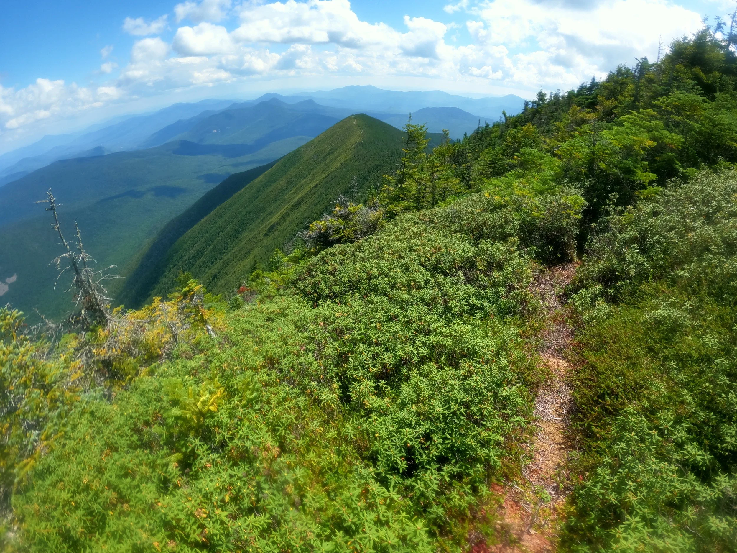
A cloud hovers overhead as we look back down Carrigain’s NE ridge
Not so quick though, if we could just climb this talus field as efficiently as the previous field ascending Vose Spur, the open air of the slide might prove valuable; but this rock damn-near disintegrated underfoot - one step onto the jagged grey boulders sent the foot sliding half a step back - the whole hillside seemed to slide with each step.
I went first and tried to keep Alanna out from under my path should a boulder take a tumble - I got a very unsettled feeling anytime I crested a corner and could not see or hear her.
There was no rock cairn directing the way this time, nothing suggestive of past climbers ever having been here nor any indication of where they may have re-entered the forest, it was all us navigating our way alone out here. While consulting the topographic maps displayed on my GPS watch, I picked a spot which led directly up to the next sub-peak of Carrigain’s northeast ridge and we went straight for it.
Steep, wet, mossy; those three words combined fail to adequately describe how treacherous the ascent was to gain that little knob, occasionally I could see boot prints in the moss from others - surely a reassuring find.
A good bushwhack isn’t complete without a mini-meltdown, right? We stood together on a boulder, to the left the ground disappeared off a ledge into unknown thicknesses of moss and old rotting forest tangles; to the right was a sea of young, waist-deep spruce and fir growth through which the sight of feet simply vanished; overhead, dark grey storm clouds began to roll over the summit of Carrigain. Panic crept in.
Thankfully, Alanna was able to reel me back into reality and recognize we were the only ones to get ourselves out of this situation, one step at a time. So that’s what we did, creeping through the conifers, ensuring our steps were meaningful and on solid ground.
Herd path along the shoulder of Carrigain
Eventually we began to see evidence of an old herd path running right along the spine of the ridge, we meandered along this route trying to laugh and keep spirits light over the sights of fairy tale mushrooms and lovely dangles of lichen.
The moment voices from the observation tower rang through the air, our speed and determination picked up; still following the mildly worn herd path, we were rewarded with a most incredible view along Carrigain’s shoulder and down the spine of Signal Ridge.
Reaching the tower, we climbed the stairs, staked our claim at a piece of observation tower floor onto which we dropped packs, snacked, rehydrated and kicked off running shoes for much welcome respite. We did not want to move any further, that was a full enough day.
USGS Bench mark disc below the tower
Prior to this observation tower being placed in 1980, there briefly stood a wooden tower, later replaced in the 1940’s with steel construction which was maintained as a hiker shelter (sleeping 8) until being dismantled in 1978. The current tower reusing the old metal base.
After a good rest in the sunshine, we descended via the scenic Signal Ridge Trail; prior to the AMC opening trails up the mountains slopes, it was said in the 1876 Osgood’s White Mountains that “the early climbers first ascended the west fork of the Carrigain Brook, over successive steps of granite where every muscle was called into play”, sounds a bit like our bushwhack from Vose Spur -> Carrigain to me!
Winding southeasterly off and around the summit cone, we dashed over the rocky footing and past the old water well just off in the woods which was near the former State Fire Warden’s cabin and was dug by a warden long ago.
Slide-streaked Mt Lowell across Carrigain Notch
Passing over the cleared area of Signal Ridge, I will never grow tired of these views - gazing down to the slide-streaked Mt Lowell (3,720’), which forms the far side of Carrigain Notch with Vose Spur.
The trail zig zags off the ridge through a beautiful grove of spruce and fir, damage from the December 1980 windstorm can still be seen in forest. Footing remains loose and rocky while quickly loosing elevation by way of old logging roads before meeting back up with the Carrigain Notch Trail.
With tired feet and exhausted bodies, we trekked out over familiar terrain as if on auto-pilot. To mock our energy depletion even further, the scent of campers cooking dinner over a campfire wafted directly to our noses for the final mile speed walk.
Well deserved post-bushwhack dip in the brook
Once reaching the trailhead we continued straight down below the bridge to dip ourselves into Whiteface Brook, the cold water stinging open cuts but felt so good on sunburnt, sweaty skin. We glanced at each other with sleepy eyes and commented that we wanted anything but the salad that awaited us back at my car.
The folks over at the Appalachian Mountain Club were certainly not wrong, that was (until snow and spruce traps are added in) one of the most challenging bushwhack ascents in the White Mountains. When folks learn that we bushwhacked this treacherous route together at my recommendation, they glance at Alanna with the inquisitive, “…and you’re still with him?!”.
For the love of the mountains, we will always climb.
Overall stats for the day:
10.36-miles
11hr 51 minutes
4,183’ elevation gain
Vose Spur - 3,862’
Mount Carrigain - 4,680’
Sunrise viewed from the Mt Carrigain tower; ascent: Sept. 11th, 2021


