
Stonehouse Mountain
Standing atop Stonehouse Mountain, I wondered as to the origin of the faint herd paths which traced up and over the summit of the low, 1,986’ mountaintop. Nearing the final climb of my morning, I had set out from the off-grid cabin where I then resided, to catch the hidden southern terminus of Smith Mountain Road for a bushwhack ascent of Smith Mountain (2,213’) on the eastside of the old woods road, then back across Smith Mountain Road for a steep bushwhack of Mousley Mountain (2,140’), then continue up and over to Stonehouse Mountain.

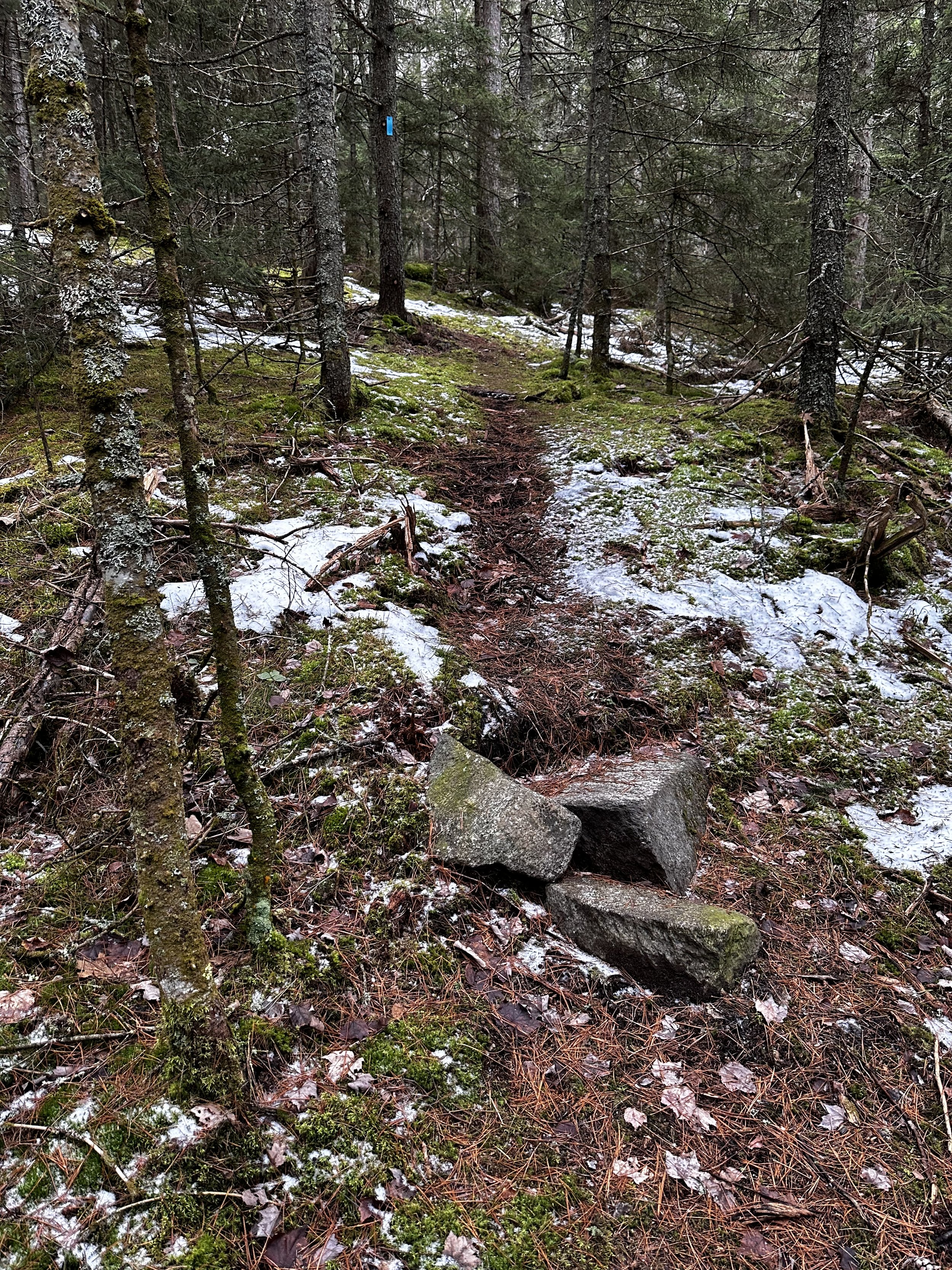
Early along the Stonehouse Mountain trail
It was a long morning of checking off several peaks on the New Hampshire 500-highest list. This was where I grew a passion for bushwhacking the lesser peaks of the Connecticut River Valley; the forests, even when coniferous in nature, are generally open enough, and easy to cruise through the miles thanks to minimal blowdown and a relatively tidy forest floor throughout.
Fast-forward three years and I no longer live in Lyme, but still make return visits to some favorite paths and peaks. Naturally, I was intrigued upon receiving an article from the UVLT (Upper Valley Land Trust), announcing the opening of a trail to the signed summit of Stonehouse Mountain; a project I had heard ruminations of leading up to its grand inauguration.

First fork in the road, all well signed
Being several months late to the commencement ceremony, I was still excited to check out the new, gravel trailhead parking lot, and (of course) the new trail, whether simply repurposed woods roads or a freshly cut and blazed footpath.
While mid-December might not be the most rewarding season to hike Stonehouse Mountain, the lack of snowy ground cover in the Connecticut River Valley enticed me to ditch the Tubbs snowshoes for these miles - to step back onto exposed earth once again before winter tightens its grip for the coming several months.

Beautifully crafted stone staircase
The town of Lyme, NH offers a fine network of dirt, generally plowed but overall unmaintained for winter travel. I was abruptly reminded of this fact when Google Maps requested I make a “slight right turn” onto Lower Stonehouse Road. Unfortunately, the portion of dirt road which would allow me to connect to the Stonehouse Mountain Road trailhead was an unmaintained OHV roadway, not indicated in any way, shape or form, from what I could gather. One minor set back - just one of the reasons why I prefer to start hiking early in the morning.
The new gravel UVLT trailhead affords parking for 3-4 vehicles comfortably, however, the landowners ask that cars do not line the road for this trek; if the lot is full, just come back another time - after all, these hills are chock full of pleasant routes and scenic mountaintops!

Through a short stretch of logged land
Departing the trailhead parking lot, the blue blazed path immediately joins a wide, old woods road. Early into the hike up Stonehouse Mountain, several other rough old paths and roads diverge, all are appropriately marked and signed whether they are private paths or otherwise.
Trekking in an overall eastwardly direction, the route soon climbs atop nicely placed rock slab steps, up a shallow embankment to join another old woods road. Following this roadbed for several rods, the Stonehouse Mountain trail soon leaves the wide footway for a single lane of trail travel.
Soft footing nearing the summit plateau
Beginning to climb, the path slices through a logged area, which works to fill in with oak (and various hardwoods) around the older white birch. Before long the trail enters a fine blend of forest: spruce appears more and more frequently, one stately old specimen even playfully winks at uphill traffic with one plastic eye and nose.
Despite appearing as an old trail corridor (new, blue markers cover yellow blazes, faint red swatches can also be discerned on some trailside trunks), the footing is incredibly soft as the trail swings, often side-hilling around corners and bends in the trail. Understandably, it is mid-December, and the ground is not as frozen as it traditionally would be for this time of the year. My concern at present is the lack of durability found in the footway of this new trail - there is much, much work to be undertaken to allow volumes of traffic to traipse these trails without causing great erosional harm to the hillside.

A mossy stroll to the summit
From all the precipitation accumulated this winter, the forest retained about one-inch of spotty, crunchy snow, which, while on trail, provided decent traction for ascending and descending.
The trail becomes moderately rugged underfoot as it nears the summit plateau. The fallen oak leaves transition into a blanket of fine verdure. Mossy boulders, mossy stumps and fallen logs all covered - moss even worked to affix itself to the base of several living spruce, what a delectable sight! In a mere several paces the forest seemingly encloses in, becoming a few shades closer to nighttime as the canopy switches from hardwoods to lush conifer boughs of the softwoods.

Old herd path (left), Stonehouse Mtn trail (right)
One detail of Stonehouse Mountain which has always caught my attention was the narrow, moss-lined foot path which meanders atop the summit plateau of the mountain. I had found this herd path back in 2020, while bushwhacking to the peak and traced it lightly, until feeling as I had ventured far enough. I did the same today, cruising right by the recognized high point, my vision was locked on frozen pockets of standing water - it seemed appropriate to find a moose, although in these woods, hikers are more likely to encounter black bear first.
With the sound of the wind high overhead, I scrambled up the final 3’ pitch to truly stand atop the 1,986’ mountaintop, once again. Thankfully, the old Stonehouse Mountain sign was still present, its base now formed by a ring of stacked rocks. A newer, wooden summit register has been installed also at the high point - unfortunately on this day, the internal spring was dislodged from the door which allowed a critter (with a decent sized mouth, judging by the bite marks left!) to pry open the wooden box and retrieve the waterproof register notebook.

Wooden summit register box
I spied the remains of the register notebook, it lay strewn about, each piece of torn paper displaying a different handwriting style, all remnants and bits from the previous couple months of entries. For several moments, I weighed options while picking up the half-frozen pieces of paper (do not forget: Leave No Trace in the backcountry, or “leave it better than you found it”), which I would later dry out and piece back together for the archivist.

Old summit register log book, chewed by wildlife
I had concluded that - since the door to the register box did not close properly nor latch, that I would not leave my extra summit register notebook (pencil was okay, still contained in the box). I devised that I would go home, dry out the old notebook, advise the UVLT that I had the notebook (although I have a nagging suspicion this was left privately, not coordinated by the Upper Valley Land Trust committee), and that the object had been damaged by wildlife.
What I would really like to recommend is that eating a PB&J sandwich and signing into a summit register take place at SEPARATE times - not two activities which should be undertaken simultaneously.

Old trail continues eastward
After much time spent roaming the broad summit area and recalling the sights which I had found several years prior, before marked and maintained paths led to these peaks. Perhaps next time I venture to the summit of Stonehouse Mountain, I’ll be able to continue trekking right past its summit, right on toward Smarts Mountain, which is rumored to be the next goal for the old, rough path.
While it is a glorious endeavor, to bring new folks into the mountains, I hope by doing just this, the mountains might retain some of their rugged, trailless fervor. With such fragile mosses atop this mountain, I sure hope trampling does not become an issue. However, understandably, all I can do is encourage others to remain on trail and not widen this beautifully mossy thoroughfare.
Respect Trails.
Overall stats for the day:
2.26-miles
58 minutes
922’ elevation gain
Stonehouse Mountain - 1,986’

Stonehouse Mountain summit