
Savage Mountain
While plains of the northeast slowly shed their flood water, I perused the rolodex of hikes in my mind for a particular route that might not be overly saturated; a path without any major water crossings would be nice, as well. One glance at the overnight cold snap brought a bit of excitement to the abysmal hiking conditions we currently face in the northeast.
A bushwhack might afford more favorable conditions, perhaps a route which might soon become inaccessible upon receiving an additional helping of powder. All focus was placed on the logistical nightmare which is: Savage Mountain.

Beginning along Lamms Trail
Savage Mountain is a trailless peak of the northern White Mountains; in a distant land where most roads were designed to haul timber from the surrounding hills, where asphalt crumbles to gravel, eventually becoming the vast network of old logging roads, most of which still see some activity. To the untrained eye, it could be easy to assume any of these routes would guide right up the 3,500’ mountaintop.
While this was precisely my plan, pulling of a bushwhack such as this had much more red tape and “what ifs” than most regular trailed hikes in the Whites. Would the road I spied on Google Maps be gated or blocked with No Trespassing signs upon arrival? Are logging operations active in the area? For an ascent of Savage Mountain, the question of how much blowdown would I encounter rang through my mind - needless to say, I had a long drive with serious doubts about whether I could pull off this ascent on the day before the official start of winter.

Through the gate awaits great climbs!
Pulling onto Lamms Trail in Stratford, NH, I was pleasantly shocked to see the road not Posted and not gated (there is no gate for Lamms Trail until reaching the cabins ~0.7-mile in). Driving slowly away from US Rt 3, I weaved around exposed rocks in the rough road. Nearing the woodline, I could tell turning the Subaru around might pose issues once further along the narrow, wooded road. Thankfully, the massive grassy lot (helicopter landing area?) was trimmed and frozen enough to fully support the weight of my sedan.
Anybody watching me ready my pack and gear must have thought this bushwhacker had lost his mind, with not a single flake of snow to be found at my 1,075’, “unofficial” trailhead. Knowing I might want them on my feet later in the climb, the Tubbs were strapped to my pack; with bare mountaineering boots, I began trekking eastward along Lamms Trail (Bissell Road on some maps).

Savage Mountain from a logging corridor
Shortly into the gravel road walk, I passed the first log landing/processing site, which had all the workings of a typical lumber mill. However, without a logger to be found, all was silent - the old GMC L9000 creaked and popped as the morning sun warmed its steel body panels. Patches of crunchy snow began to appear on the roadbed, any ice was easily navigated around by trekking in the grippy, roadside snow.
Passing an area of interesting, exposed bedrock slabs, the rough road gently climbs, swinging through a small compound of seasonal cabins - talk about feeling like being watched through the closed blinds! All was quiet as the road swung back to its regular eastbound direction, passing through an old iron fence. Here, the gravel became consistently covered by a thin, yet crusty snowpack which provided more than adequate traction for bare boots on its subtle grade.

A “hidden” road, not seen on satellite imagery
Walking obliviously right past a small cairn marking a northward diversion, the faint road crossed Bissell Brook (unbridged) at an icy spot which I wanted nothing to do with anyway. With no idea I was passing my intended route, I pressed on, following the wide old road until reaching a brushy clearing with lots of old snowmobile traffic. On map, this grassy landing is where my current road corridor should have ended, thus beginning a short yet steep bushwhack to locate a more level road which appeared to contour Savage Mountain at 2,400-2,500’ - around the odd-shaped southwestern fin/ridge.
To my great surprise, another brushy old road continued straight in the direction I had intended to set out bushwhacking - jackpot! Likely, this old corridor was so overgrown that its canopy in full foliage completely camouflaged it from being picked up by any satellite view.

Approaching the end of the road
Over my shoulder, the mountains began stacking up on the distant horizon as elevation continued to be gained at nearly each step. This bonus logging road consisted of a bed of fallen leaves which crunched with each step - frozen. If temperatures were any higher than the ambient 22°, no doubt I would be in some deep muck! Slim tributaries to Bissell Brook ran alongside the old road, eventually veering southeastwardly, toward East Spruce Mountain (North Spruce, alternatively).
Beyond the small brook crossing, all evidence of road corridor quickly dissipated into a sea of hobblebush with moss-covered boulders and rocks underfoot. Luckily, any mud which flowed due to the recent rainfall had dried since or was frozen solid, any crossings were all fairly easy to pick a route. In the gully, I began following deep moose tracks which were likely at least 24-hours old, given their glassy, freeze-thaw appearance.

Contouring Savage on an overgrown corridor
With snowshoes finally on my feet (turns out they were not needed until reaching the next old roadway at ~2,400’), I began up the steep embankment, working around obviously dense patches of young evergreen; however, the steep climb was primarily through decent spruce, which was fairly easy to navigate thanks to all the moose who had plowed through prior.
From the dense canopy, I popped out into what appeared to be an old railroad siding, the main trail located within an impenetrable wall of balsam boughs. Tracking alongside the old corridor, I veered onto the roadbed proper at the first opportunity, more moose tracks guiding the way through the dense wall of vegetation.

Finding much better conditions than anticipated
This section of old road is likely not suitable for snowmobiles as fir of various ages and sizes stretch from side to side, and most oftentimes underfoot! Luckily, the frozen snowpack was still bearing my weight well, snowshoe crampons barely sunk into the surface - which meant I could walk nearly on top of the foot-tall fir shrubs without damaging - what epic bushwhacking conditions for early in the season - it sure felt like a dream to finally have the bulk of Savage Mountain directly in front. The face which I intended to climb was now visible through a frame of conifer boughs.
Following fresh coyote tracks, I made my way toward the wide landing at 2,530’. With a quick glance around for any wildlife or interesting mountain features, I crossed a small branch of Bissell Brook, and took off into the woods.
Small blowdown patch through the trees
Trying to actively work my route off the ridgecrest, I kept correcting my course by trekking to my left (westerly), especially upon seeing any dense young growth, I worked around patches of scrappy forest as if it were my job. At about 3,200’, I encountered the first band of cliffs which stood before me, about 15’ tall. I saw one location which could support a steep ascent directly up and over but opted to trace the base of the cliffs eastward. Working up and around this way was much safer and easier, in my opinion.

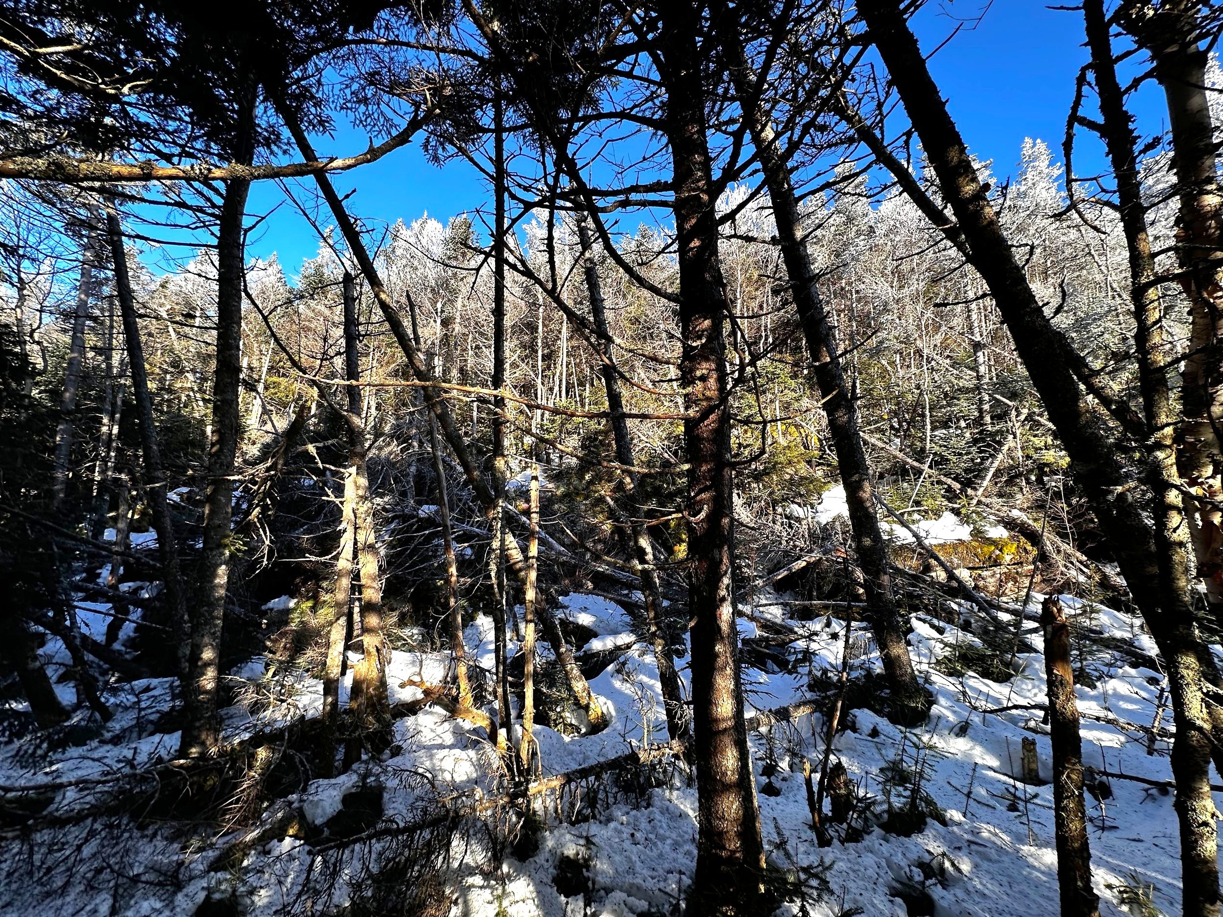
Toppled trees open the canopy affording sporadic views
Sensing that I had pushed too far east while avoiding these cliff bands, I continued to veer (slightly) westward, to avoid subsequent oppressive fir patches - even reviewing my ascent route on satellite map, it is obvious to see when I would hit a blowdown or fir-wave patch, as if bouncing off, my track immediately worked to redirect around the tangles.
No fewer than two decent blowdown patches were encountered during this ascent, none of which were abundantly treacherous, just requiring enough balance to stand atop in snowshoes and pick one’s way over, under, or through the toppled timber. While not the most enjoyable to navigate through, these blowdown patches did offer the only glimpse of scenic vista, aside from restricted windows from the logging roads.

Final blowdown patch nearing the summit ridge
The final blowdown patch (at about 3,440’), which could have doubled as an emergency Helipad site, was very flat with its rock-solid snow base. Several rods beyond this opening in the canopy, I encountered the most blissful moment of the hike - the scene could have been borrowed from Whaleback, Kancamagus, East Huntington, South Hale - all mountains where I had found significantly beautiful stretches of hidden forest.
Approaching the summit plateau from the west, it was nothing but a pleasure to find myself traipsing through a welcoming sea of spruce. Narrow corridors presented themselves all throughout the summit ramble as a series of mazes; by continuing upslope, and sticking to the more friendly forest, it was not hard to end up at my objective.

Savage Mountain summit
Standing at the summit sign and canister, I absorbed the sight for several minutes as the morning sun rays filtered through the rime ice-covered boughs overhead, sending a tsunami of sparkles through the alpine air at the gentlest breeze. While unable to open the PVC canister, I recalled the comments of folks using industrial tools or hand warmers to pry the containers open, to access the register within - today, I was just happy to have picked such an outstanding and enjoyable route up this trailless peak, no desire to jot my name on a piece of paper to prove I stood there.
Once enough time was spent perusing the summit area, I worked to follow my ascending steps back downslope, but since the snow was so hard, my crampons hardly left a dent in the snowpack! With the general idea of direction in my mind, I retreated back down the summit plateau simply by feel.

Descending the summit ridge
Locating my ascending steps in the snow here and there, I’d follow them until getting off my own track, but with a forest as open and navigable as this, I just let gravity whisk me back downslope to Bissel Brook. At several instances on the descent, I did get a little hung up, once was trying to navigate back through a blowdown patch, I kept getting walled off and I simply wanted more nice forest to roam. The second (hardly a surprise) was back at the cliff band around 3,200’. I found myself standing on top of the sheer rockface, not wanting to walk further and get myself into trouble, I performed several “side to side” maneuvers before locating the thickest patch of spruce-fir of the day, through which I committed to simply getting through while doing the least damage to the spindly spruce twigs.

Gazing back up my descent route
It was noticed more on the descent than ascent of Savage Mountain, the snowpack covered the mountainside in such a way as to leave voids and deep crevasses between boulders on the slope. My mind conjured up the possibility of a bear den in the area, and for the remainder of my time spent on the face, could not shake the incessant sensation; no bears (or even tracks) were encountered anywhere along this trek, Savage Mountain just seems like a perfect environment for them to over-winter.
Once the mountainside began to mellow out, I could hear Bissell Brook (or a tributary to) at the base of the climb. Through more open birch I meandered, still completely enjoying how supportive the snowpack had been, but in the 10am morning sun, I could sense the shift in surface conditions, I was happy to be making my escape from what would likely become sticky, soft snow in the afternoon sun.

A branch of Bissell Brook
On the trek out, I could now see either bare bedrock from a landslide or just more cliff bands adorning the odd, downturned southwest ridge of Savage Mountain. Briefly, I thought of venturing to the slabs but also wanted to get off the snow before spruce traps were given the opportunity to start trapping. A trek for another day - it will be filed accordingly into the rolodex of hikes, which occupies most of the space between my ears.
Snowshoes actually made the remaining log road trek out very enjoyable, their wider footprint providing adequate loft while crampon spikes helped with any hidden ice. As I passed the two logging zones for the final occurrence, I was surprised at the inactivity of the site - perhaps due to the fast-approaching Holiday season.

Westward views from a logged clearing
While there may be as many routes up this trailless peak as individual peak baggers who have stood atop its wooded summit, I have to give credit to Liam Cooney and his impeccable trail reports, and for the heads up on how to stay out of the worst that Savage Mountain has to offer.
Now I wait, eager to get back out into the trailless forest to visit more high places while such outstanding bushwhacking conditions present themselves. Will this be another winter of a seven-foot snowpack, or will we be scraping by on shards of fallen rime ice all season?
One climb at a time...
Overall stats for the day:
6.30-miles
3hr 30 minutes
2,785’ elevation gain
Savage Mountain - 3,500’