
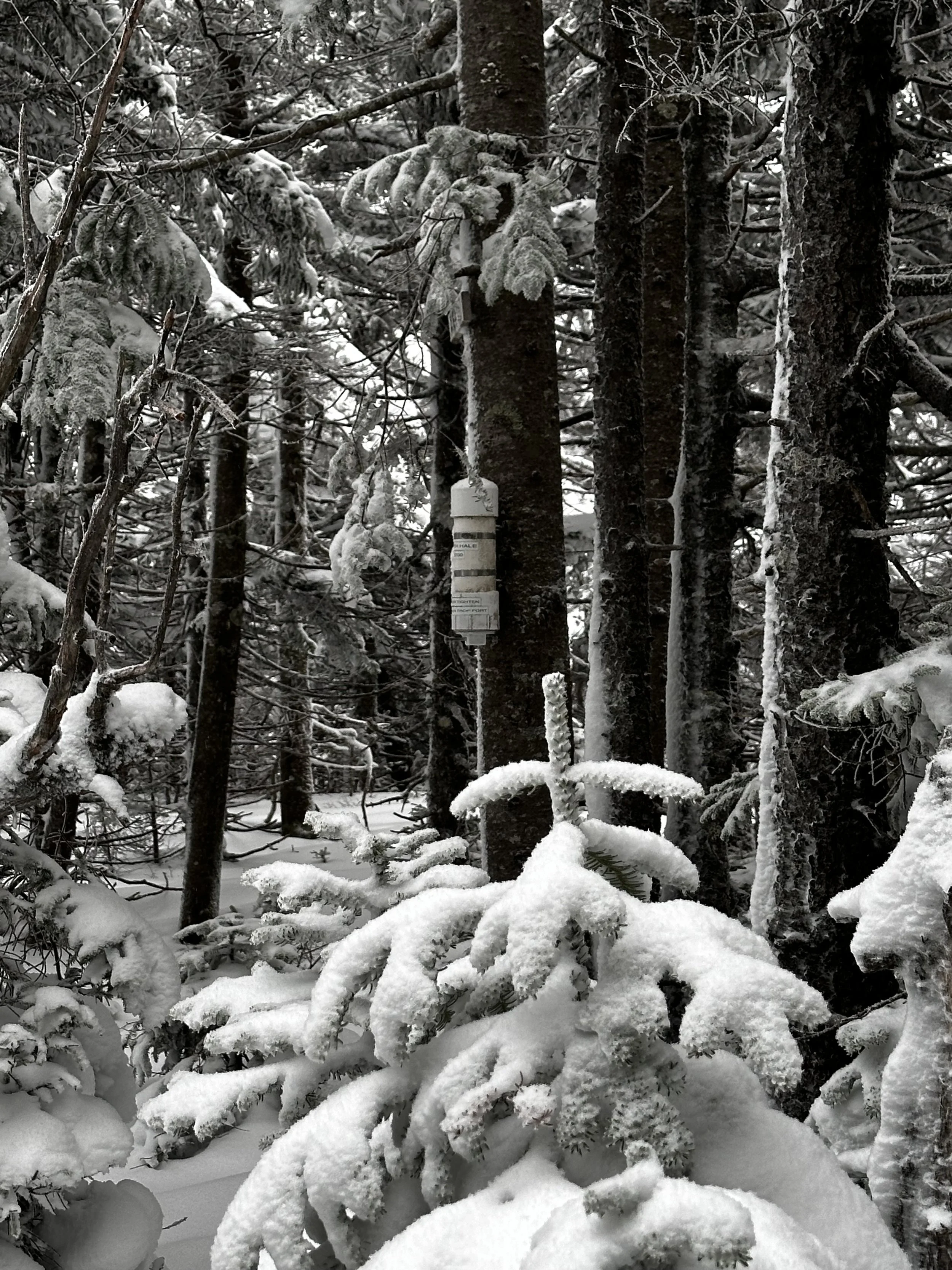
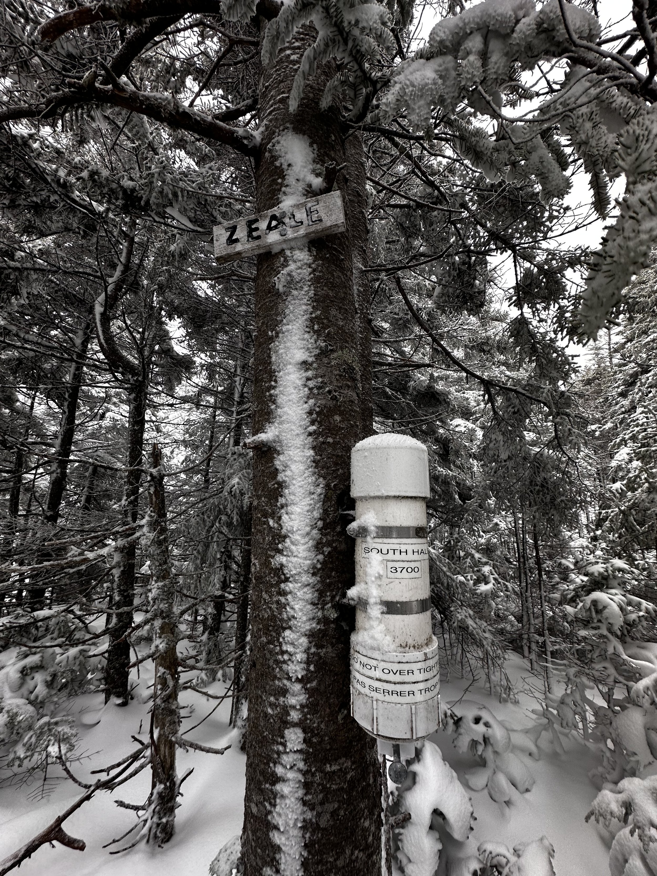
South Hale
Typically, a first snowshoe hike of the season will take place on the “bunny hill”, just enough terrain to ensure we recall the technique of not stepping on our tails, or how to walk uphill or downhill with a larger footprint. I think, perhaps next time I will have reservations when my mind gets excited over taking the Tubbs back out for a joyride - longer than a half marathon, with over 4,000-ft of climbing and a three mile bushwhack stuffed mid-route. Although, it was just the snowy ramble this ‘whacker was craving, to kick off the winter “condition” season.

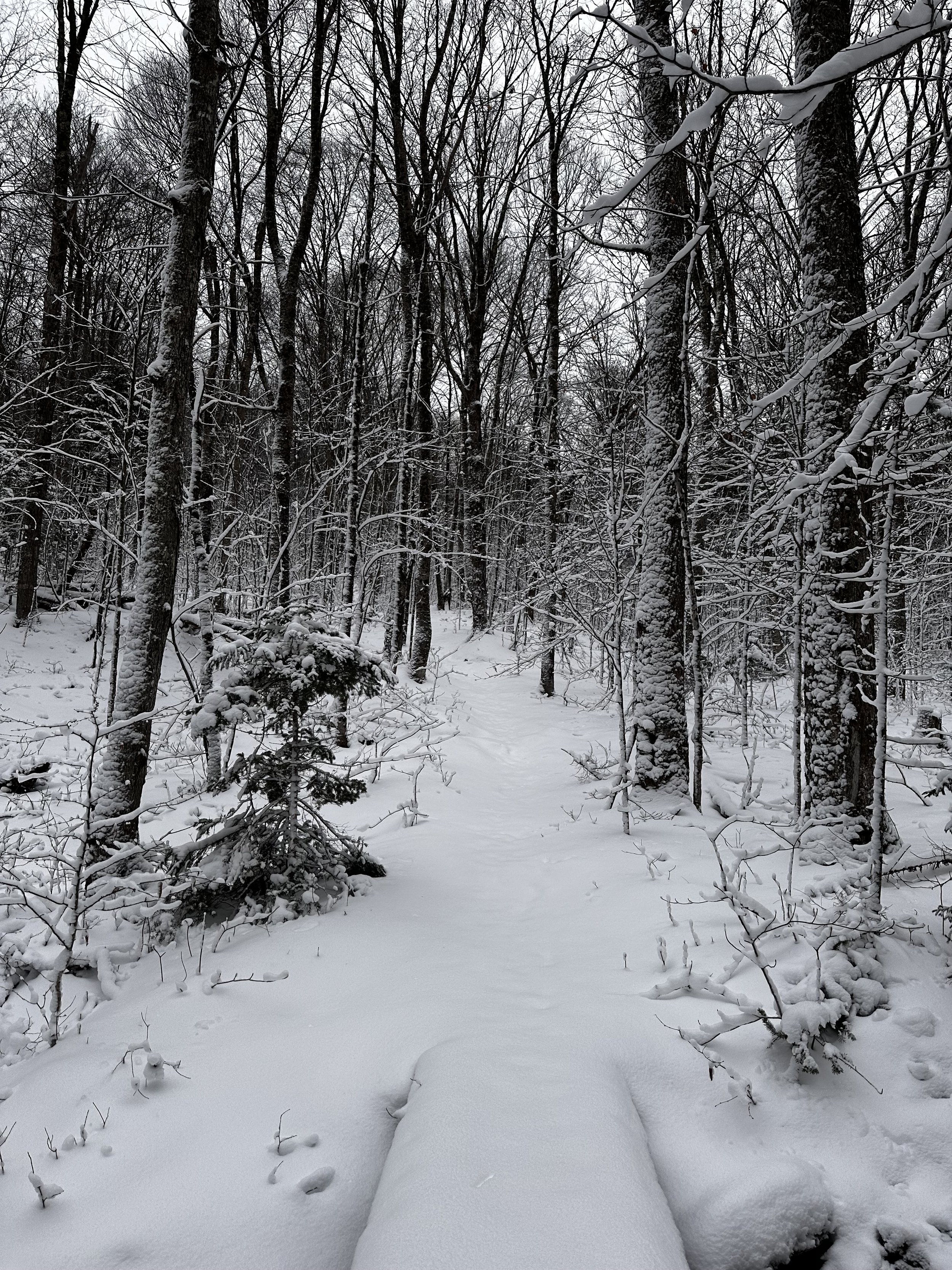
A snowy road walk down Zealand Road
South Hale is one of those peaks I stared at most warmer months yet always settled on adventures elsewhere, away from likely crowds of the Hale Brook Trail. While I am about a week late to the Forest Road closing party, I was hoping the early season conditions might afford some easy road walking for the 2.5-mile (each way) trek along Zealand Road.
Unsure of how much snow I would encounter, I took a little bit of everything from the gear closet, the 75-liter pack and snowshoes coming back out to roam and explore for another season. Water reservoirs were swapped for a hot thermos of tea, and when I thought I had packed enough warm weather gear, I stashed another insulated jacket in the bag, just to be safe and warm while in the backcountry.
Beginning along the Hale Brook Trail
Of course, I had planned to venture out to South Hale while Forest Road 16 (Zealand Road) was open for vehicular traffic, but more remote jaunts always called me. Seems silly to now be trekking up and over Mount Hale following the first snowstorm, but I also wanted to see how the backcountry had faired regarding snowfall totals, a recon mission of sorts.
Arriving at the winter parking lot for hikers wanting to access hikes along FR 16, I parked next to one other snowy vehicle, tires groaned as they pushed through four-inches of soggy slush. Listed on maps as Lower Falls Road, I simply knew this parking area as a place for winter hikers wishing to do just what I had come for, as well as snowmobilers looking to gain access into Jefferson Notch, perhaps.

First tracks in the powder
With snowshoes strapped to my back I instantly missed toting a light weight summer pack but was content knowing I had supplies to survive an apocalypse stashed on my shoulders. A fresh sea of fluffy, white snow blanketed Zealand Road, completely unbroken by anything other than a few sets of deer hooves and several small birds in search of breakfast seeds.
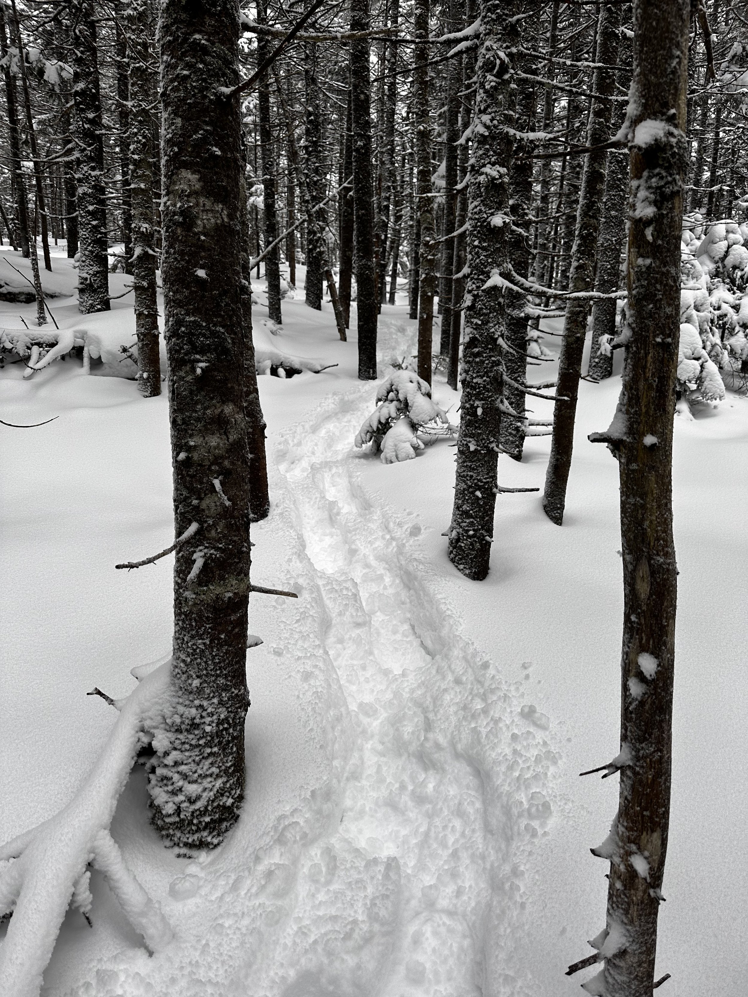
Four-inches slowly became five, which turned into six-inches of powder by the time I had reached the Hale Brook Trailhead. Trekking several feet to get out of the gusting wind, snowshoes were added to boots as layers were replaced or adjusted to accommodate the approaching climb.
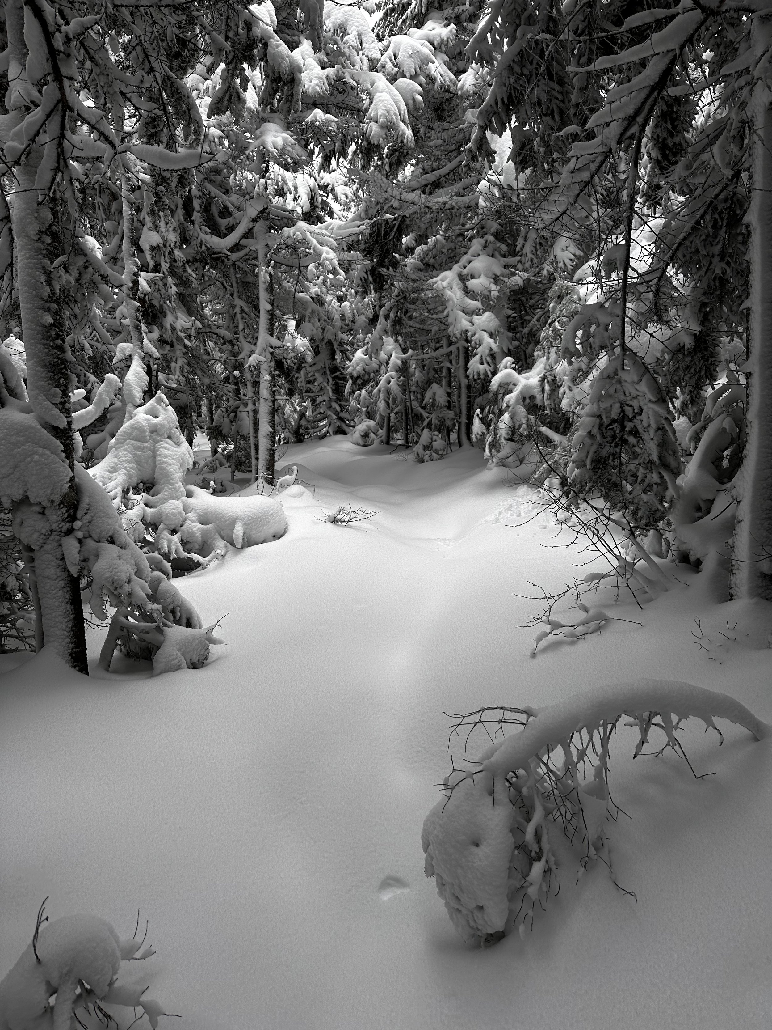
Descending the Lend-A-Hand trail
Several inches of powder topped the rocky pathway down low. All around, plumes of white powder cascaded through the canopy as heavy branches let loose their lofty loads. Aside from the southwesterly winds, hardly a sound rang through the mountainside, soft trickles could be heard from shallow brooks underfoot, as they ran downstream beneath snow laden boards and planks. Tufts of beech leaves clung tight to their frozen branches as they rustled in the morning breeze.
The higher I climbed along the northeastern aspect of Mount Hale, the more wind scoured and drifted the footpath became. At several instances, a snowshoe would be placed as it would careen through the snowy surface, not hitting solid ground for a foot or two - knee deep powder already in the hills!

Approaching the eastern shoulder of South Hale
The remaining switchbacks and haul up to the summit of Mount Hale was just a game of placing several steps, then resting for a breath or two, repeating until the notorious pile of rocks was in sight. Today, it was hardly recognizable, simply a low-domed mound of rocks, and if my memory did not fail, I’d swear that summit cairn is getting shorter by the season.
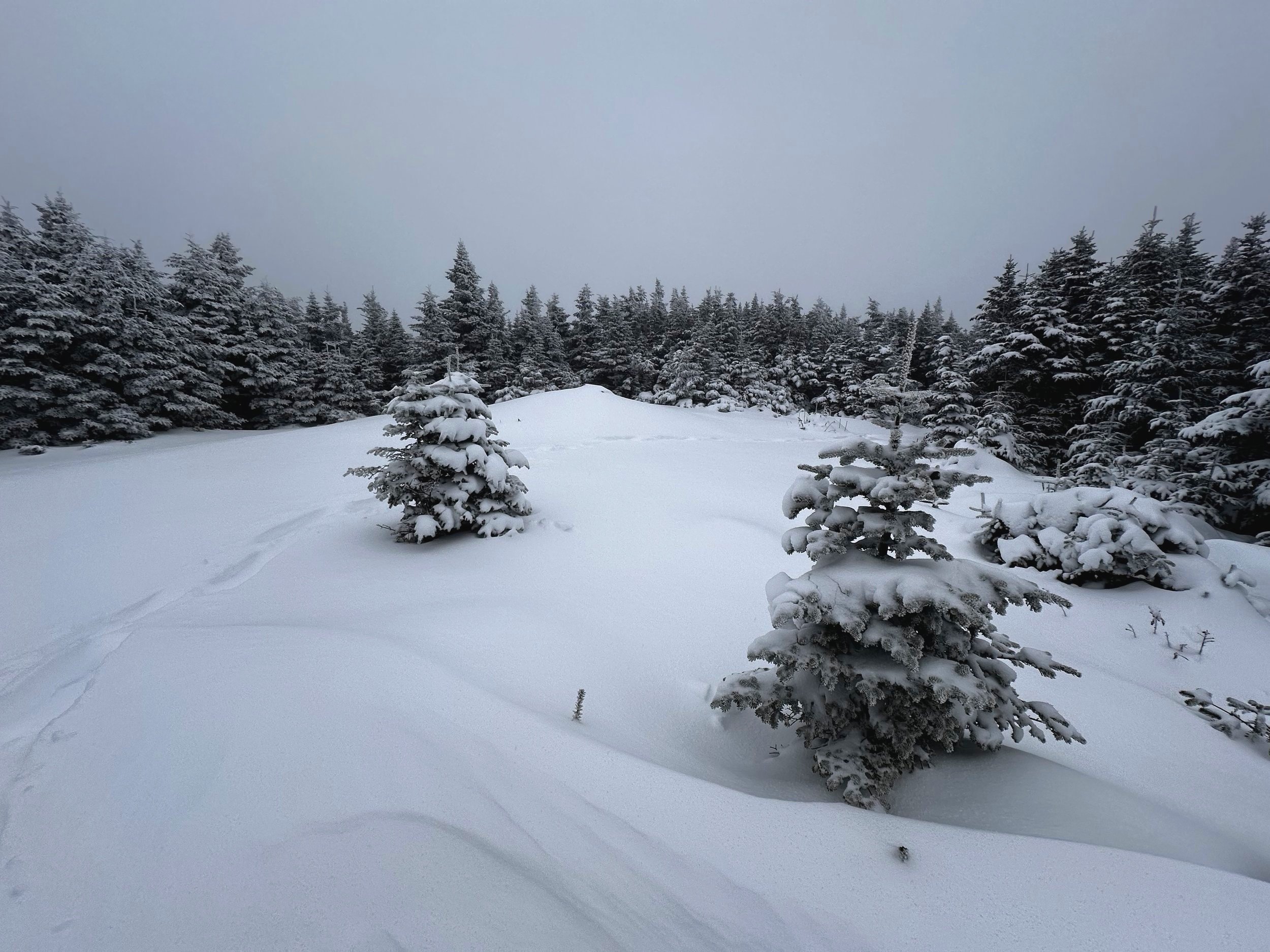
I work with a fellow who can still recall the summit of Mount Hale when it had “the finest views of all the Whites”; those views, unfortunately, are still gone, long since replaced by a wall of conifers, and to me, it’s still a lovely sight!

Lovely, open conifers along the summit ridge
Still breaking trail with each step, the initial few rods along the Lend-A-Hand trail were hardly snowy, sheltered by the impenetrably dense canopy, the trail appearing as if it had been drilled and bore into the forest wall. Descending the Lend-A-Hand trail off Mount Hale was pure exhilaration; such a pleasure to finally romp through a hefty depth of powder. Nearly jump-sliding down the trail, finally I could cover distance somewhat efficiently in this winter wonderland.
I had trekked this trail in many conditions over the years, while winter does little to enhance the already stunning, lichen draped sub-boreal forestscape, there was a certain aspect of peace and stillness found while passing small, trailside blowdown patches and finally approaching a boggy tarn area, where I would diverge from marked trail, although the trekking would be very similar.
Looking at a topographic map of the route, I descended Mount Hale and traversed its long south-facing, flat ridgeway, then descended once more, off the southern tip of that ridge, thinking all the while about how I would need to ascend every foot of this lost elevation just to get back up to Mount Hale, to return home. As I grew closer to beginning the bushwhack up South Hale, I began to weigh options of simply following the Lend-A-Hand trail past the Zealand Falls Hut for a very roundabout exit strategy, followed by a five-mile road walk - no thank you.
Approaching 3,430’ on the Lend-A-Hand trail, I veered south-southwesterly toward the mass of South Hale. Delicate steps were placed while crossing this near level area, even with waterproof boots, a plunge into water at this point in my day would have sent me in varying directions of panic.
As the land began to rise up before me, I let out a sigh of relief to be back on solid, snowy ground. Trekking counterclockwise around the elevation contour, I began hitting a wall of young fir and blowdown (fir likely allowed to sprout and grow due to increased sunshine as a result of the downed trees opening up the canopy - its a vicious cycle for us bushwhackers).
South Hale summit
Thankfully, this blowdown and new growth patch did not persist long and once through to the decent woods, it was smooth sailing, for a bit. Narrow, pencil-like spruce lined the crest of the summit ridge, as I topped out on the more northeasterly shoulder of the triangle-shaped peak. Knowing I did not want to drop much in elevation, I hooked around the summit plateau toward the westside of South Hale, where I was hoping to locate the high point of the mountain.
Beautifully open, mature conifer woods guided my way past several massive glacial erratics, boulders which appeared dropped haphazardly about the the high mountaintop; given the marshy area where I had begun the bushwhack, I had anticipated encountering moose tracks but had never encountered a single print in the snow, out in this remote wilderness.
Navigating across the summit plateau was slowed to a near-halt upon reaching the final short, yet steep climb up the summit knob. It could be very easy to misinterpret the high point of this little peak, if someone did not know to look around for this additional bump in the landscape. Guarding the high point of South Hale was another wall of young balsam fir, although, excitement ran high when I realized the “trap” aspect of these backwoods spruce traps had yet to materialize, the forest floor (with 8-inches of snow) was supportive and pace hardly diminished as I performed my patented “fir-swim” bushwhack maneuver, where the arms guide one’s body through tangles of low evergreen boughs.
Following ascending tracks back downslope
While normally not an issue to simply push through lofty boughs as this in warmer months, the problem with bushwhacking following a snowstorm is that the conifer boughs like to collect every inch of snow just to release the mass onto the heads of unsuspecting bushwhackers, this is where Gore Tex layers and a hood come in very handy, but run very hot in shoulder conditions and temperatures as this.
Through the wall of hearty, young fir, a small arc around the presumed summit area found the summit canister awaiting patiently on the highest tree. Despite a fine, near-level summit landing, I still managed to step on the tail of my own snowshoe while trying to open the summit register - it is bound to happen to every snowshoer at some point each season!

Looking back toward South Hale
Reading through some of the older 1991 entries, I logged my ascend into the newer of the two register notebooks, tucked it all back safely into the double Ziplock encasement and all it went, back into the canister for the next wacky hiker to find.
One of the best parts of winter bushwhacking, aside from the softer footsteps in deep snow, is being able to simply follow one’s ascending tracks back out of the forest. While nothing is impossible, I would like to think it might prove tricky to lose one’s own snowshoe tracks, especially if the risk of wind drifted tracks is minimal.

Looking back down the Lend-A-Hand trail
Making quick work of the bushwhack portion, following a few sips of warm tea and a snack for the road, I began puffing my way back up the terraced climb to Mount Hale like a steam engine train. Slow, deep, methodical breaths bookended by rest steps to slowly meander my way back up what was once so fun to romp down.
The open-air summit of Mount Hale was socked in a cloud for my second passing as big snow flakes took cyclonic flights before coming to a rest at their new, 4054’ home. Stopping only long enough to acknowledge there were no subsequent footsteps, no other hikers had ventured out to Mount Hale on this beautiful day, I blew past the summit cairn and began following my snowshoe tracks along the Hale Brook Trail.
Mount Hale summit
Descending the Hale Brook Trail afforded brief opportunities to ramble off-trail as the boot-packed trail was too narrow and rocky for my taste; its narrow footprint did minimal to accommodate standard snowshoe travel without lunging one snowshoe single-file, one in front of the next.
During my trek up to South Hale, it appeared that the forest had received another inch or two of powder, as my ascending tracks had begun to fill and branches were weighed heavy yet again, all around was blindingly white.
The two and a half mile road walk out was made somewhat more expedient by following in the tire track from a USFS truck who had evidently ventured down to the Zealand trailhead and back. Constantly, I was straining my vision to check far into the distance, working to spot anything familiar - a sign for the Sugarloaf campground let me know progress was still being made.
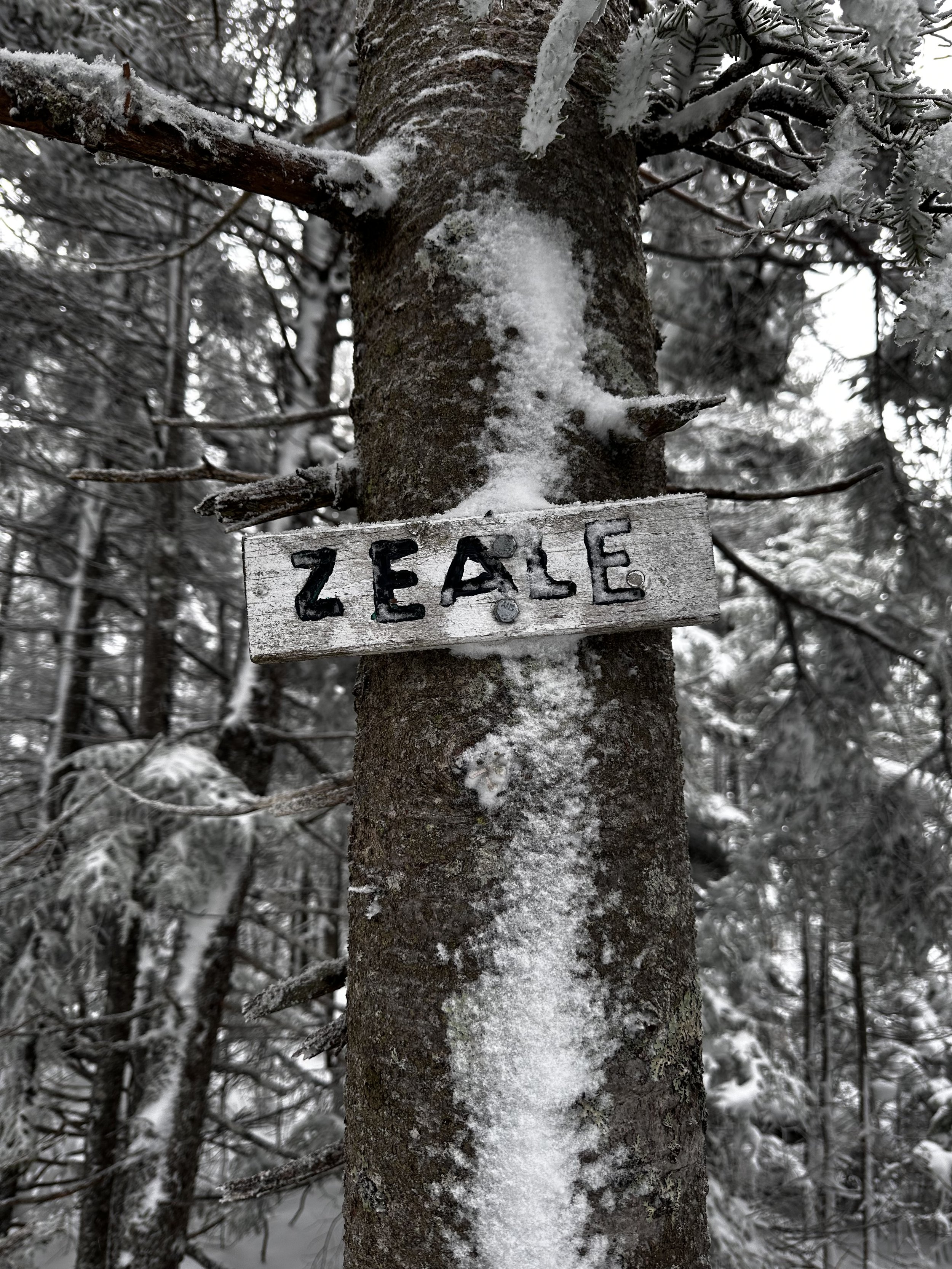
Zealand + Hale = Zeale?
I do not think a single vehicle which sped by on that short road walk of US Rt 302, back to the winter Zealand lot, could have imagined the depths of powder encountered and great satisfaction contained within, knowing I had safely hauled myself and gear to the South Peak of Mount Hale and back, without encountering a soul all day.
Now I find myself faced with the question for which I currently have no answer: Zeale; a word salad combination of Zealand + Hale, perhaps?
Overall stats for the day:
13.68-miles
6hr 51 minutes
4,239’ elevation gain
Mount Hale - 4,054’
South Hale - 3,680’