
Snow Mountain - Chain of Ponds
Onto the second Snow Mountain of the Maine 6-pack of peaks. This 3,960’ mountain is located in the Chain of Ponds region - an area of reserved land featuring several ponds which are connected by short thoroughfares and offering various recreation (hiking, boating, camping, fishing, etc.) activities.
In darkness the previous evening, I found a car camp spot which seemed suitable for a brief shut-eye session, 5-miles along North Road which soon becomes Round Mt Pond Road, prior to it being listed on most maps as Snow Mountain Road. Call the road any name you prefer - to me, it was a quiet stretch of forest access road, a beautiful place to catch 8.5hr of rest and still be on trail before sunrise the following day. As I settled into my backseat berth for the evening, I could hear winds rustling the leaves high overhead along with a softly falling cascade emanating from Little Alder Stream just through the woods, to the west.
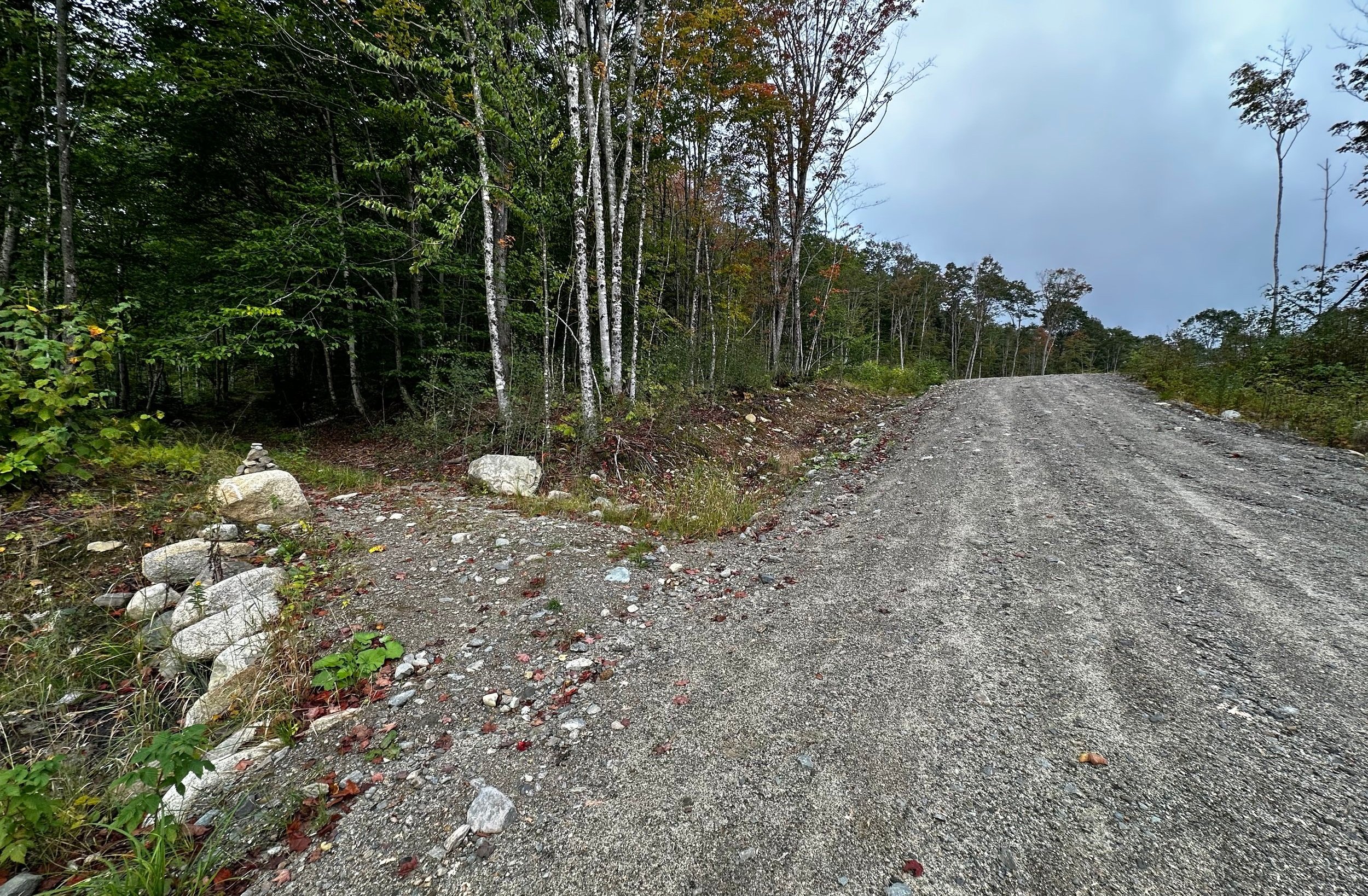
Departing logging roads to begin along ATV trails
While most vehicles could make the additional 0.6-mile trek to a larger parking area adjacent to the path further along, I preferred my parking spot once I spotted some of the larger rocks emerging from the roadway of further up. The hiking began with a quick pace to start, however, trekking along the easy grade of old logging roadway.
At 0.6-miles into the road walk, two moderate sized cairns can be found on the left, marking the entrance to a network of ATV trails, more old logging roads surrounded by a fine forest canopy. The trail proceeded, climbing gently as it crossed several bridged waterways. For the most part, the trail which leads up to the summit of Snow Mountain consists of old roads down low, followed by a beautiful path, (which served for many years as the fire warden trail) once on the actual mountainside.

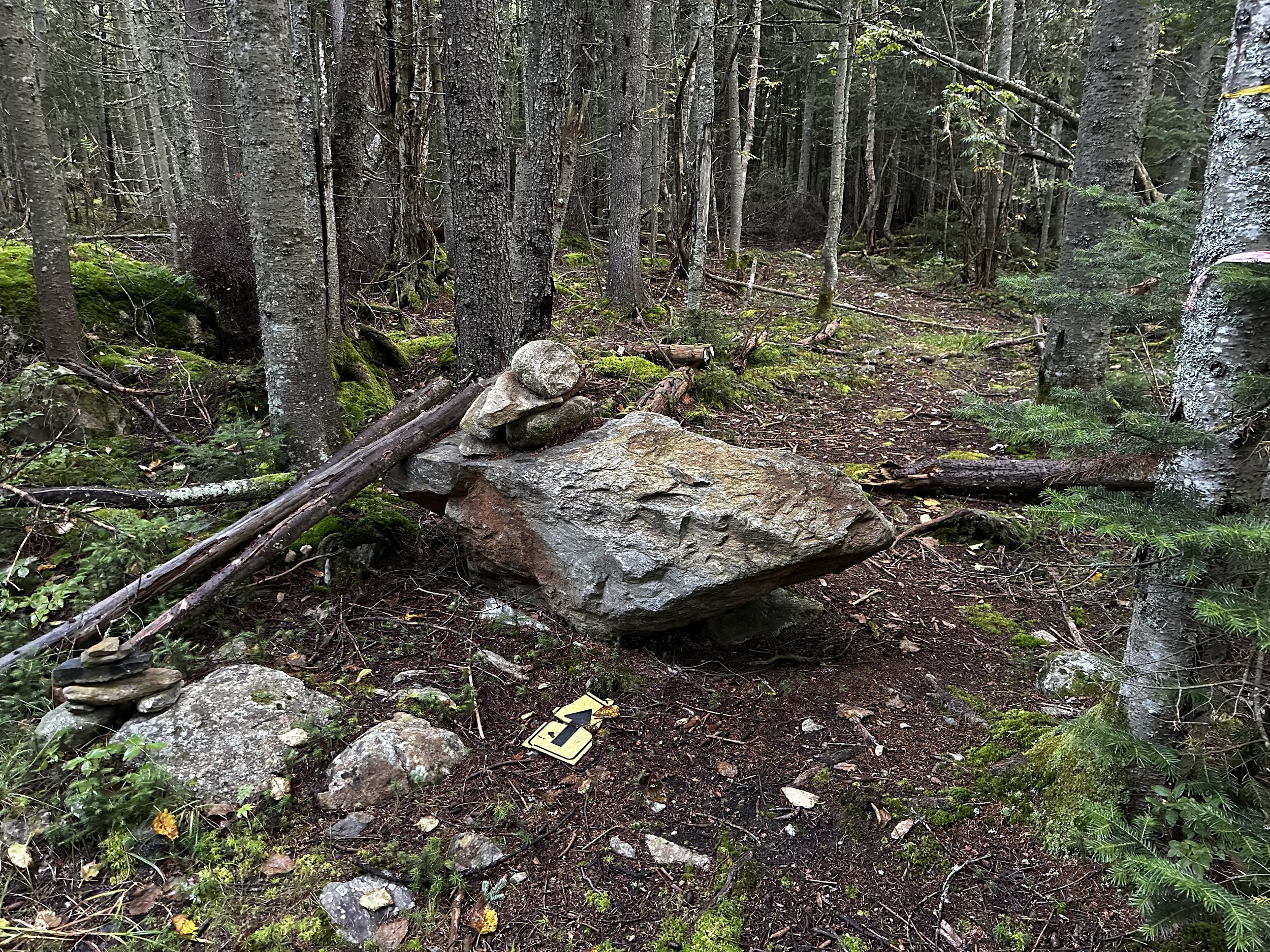
Herd path alongside the old drainage
At 1.1-miles along the ATV trail, the obvious road continues southeast (left) while a small rock cairn denotes the herd path which can be found up and over a low embankment. The footpath now resides in a shallow drainage; becoming increasingly dry and easier to traverse as one traverses along the rocky streambed. Eventually, the route evolves back into a highly enjoyable, earthen footpath as it rejoins the brushy old road just beyond another embankment marked with more rock cairns.
While most logging roads can be found linking up one way or another in these backwoods, there is an obviously well-worn footpath which can be followed, this aids drastically when trying to negotiate the brushy, soggy, old roads. The pathway swings to head in a northwesterly direction as it continues to ascend, gradually at first, but soon its pitch picks up and the footway consists of exposed bedrock and other bare, eroded rock.
Beginning along the old fire ranger path
As the herd path swings toward a westwardly direction, several more rock cairns and a large boulder can be found on the climbers right, today I even found a yellow plastic arrow to indicate this was indeed the direction I should be trekking. Beyond the barrage of navigational gadgets, the herd path (old fire warden trail) was found extremely tidy and a pleasure to roam. Mossy boulders protruded occasionally from the soft footway; dark soil made lavishly rich by copious fallen conifer needles, which seemingly decomposed swiftly in such an anaerobic environment.
Occasional surveyor tape could be spotted, its bright yellow, orange, pink or blue colors dotting the otherwise verdant hillside. Perhaps remaining from winter excursions to the New England Hundred Highest peak, for, in warmer months, such a beautiful, warm-hued, narrow path can be found meandering directly through a lofty carpet of moss.
Getting steep along the old path
At one point during the ascent to the 3,960’ summit, the old fire warden trail climbs a steep, rocky section akin to a chimney of sorts. Good handholds and adequate foot placement can be found during the abrupt climb, however, it seems as if various other routes are beginning to show wear and favorability around the steep areas despite being blocked off by downed logs and sticks.
Beyond the short yet steep scramble, the path proceeds in a more-or-less northerly direction at a low-angle but constant grade. At one point, another fine woods path can be found merging with ours, likely this is the old trail (now rumored to have been abandoned) which led from Big Island Pond in the west - care should be taken to not follow this path down while descending, stay left at this unsigned junction.

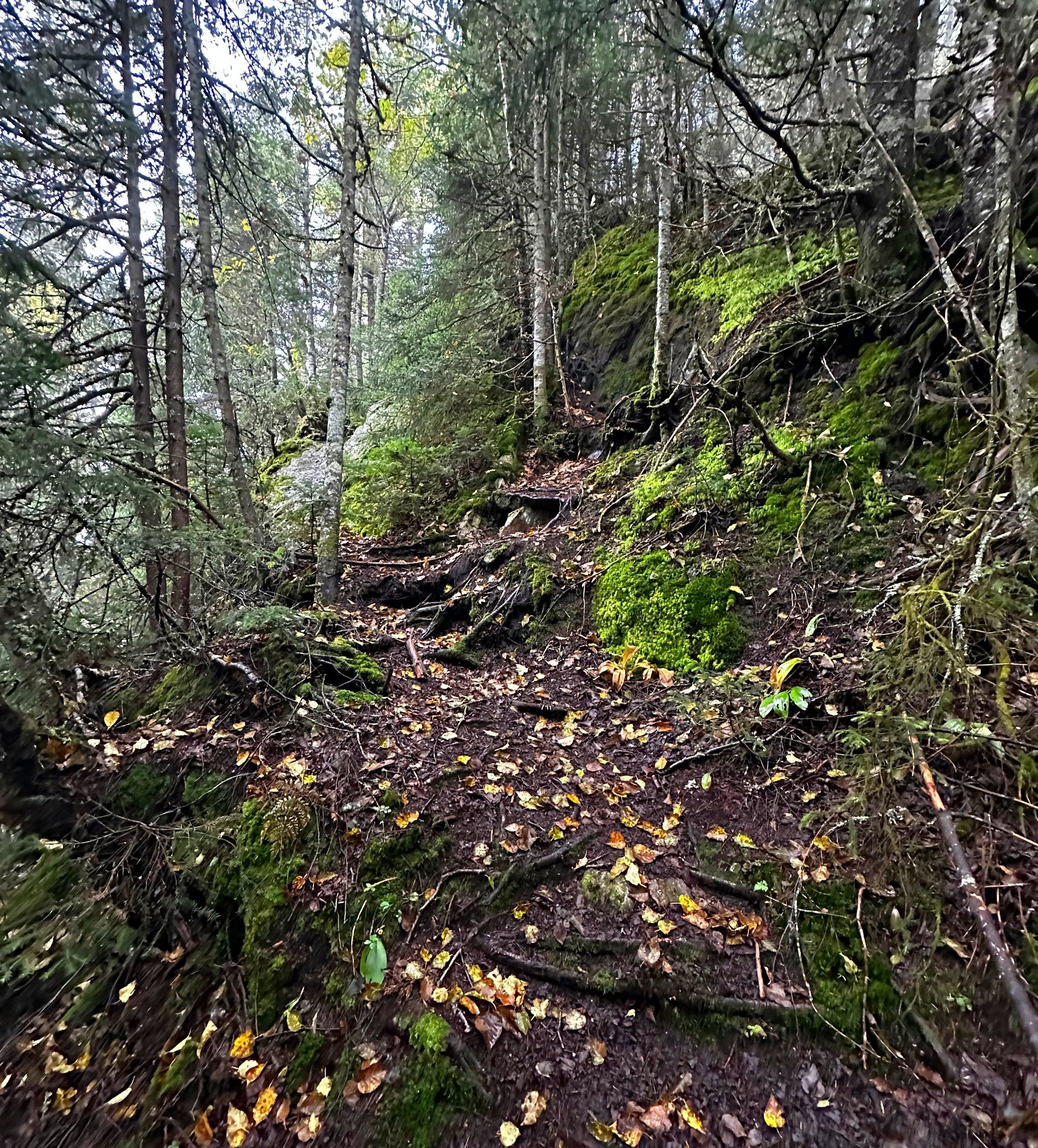
A stunning moss-lined path in the old forest
Passing an old blowdown patch, the path re-enters the forest canopy briefly before reaching a bare rock ledge which offers up (reportedly) a fine eastward lookout. Today, I had entered a low-hanging cloud at 3,200’ and therefore would share none of the presumed views from this perch, nor the old fire tower structure at the summit.
From the lookout rock, the summit is just a short distance beyond. First, one comes upon the old, toppled remnants of the previous ranger cabin, swinging around, one then turns directly into not a traditional PVC canister, but one of the wooden variety. A bird or bat box perhaps, has been hung and is protecting the summit register log books.

Old fire tower frame atop Snow Mountain
Several paces to the north, the high point of Snow Mountain awaits. All that remains of the old fire tower now is the steel frame, the cabin and roof components can be found resting in the woods slightly further north. Having been taken out of use in the early 1970’s, old gas cylinders, batteries and shards of window pane glass can still be found littering the summit area.

Old ranger cabin atop Snow Mountain
With not much to see due to the low-hanging morning cloud cap on the summit of Snow Mountain, and the accompanying barrage of wind, I noted the full summit register log and returned all to the bat box and methodically made my trek back downslope. With such beautiful and sturdy footing, the descent seemed to whiz by; one turn after another until I could feel the whisp of overgrown logging roads on bare skin.
What a great jaunt to begin the second day of climbing Maine peaks; a marvelous old trail in the upper section complementing well with the speedy cruising of old logging roads and ATV trails - leaves are beginning to turn and the forest smells of cinnamon, coconut and allspice. All is well.
Next up: East Kennebago
Overall stats for the day:
6.88-miles
2hr 33 minutes
2,254’ elevation gain
Snow Mountain (Chain of Ponds) - 3,960’

Summit canister bird box