
East Kennebago
With five out of six clustered peaks complete, enthusiasm was brimming as I knew a vast majority of the grossly rugged (for a Subaru) forest roads were literally and figuratively in the rearview mirror. Once all four tires were back on a proper asphalt surface and heading southbound, away from Snow Mountain (in the Chain of Ponds region), attention was put into refueling and rehydrating before arriving at the final climb of this Maine session.
With a 6” drop off freshly laid asphalt, I reluctantly veered off a smooth Route 16 onto more gravel logging roads. Denoted on most maps as Oody’s Road, I had found mixed reviews about how far along the rough stretch other hikers had entrusted their vehicles to take them. Passing the first, “could be” parking spot, I was quietly happy to be mentally ticking off mileage that I would otherwise need to trek both on the ascent and descent.
By the 1.5-mile mark, Oody’s road had become the Rangeley-Eustis Snowmobile Connector trail; I halted at a patch of mud bisecting the main logging road which rose higher than my front bumper and appeared darker and stickier than molasses. “I might not be tackling this one”, I thought to myself, remembering the day prior when I more than bottomed out and kept going through the deep skidder mud of the Cupsuptic Tote Road.
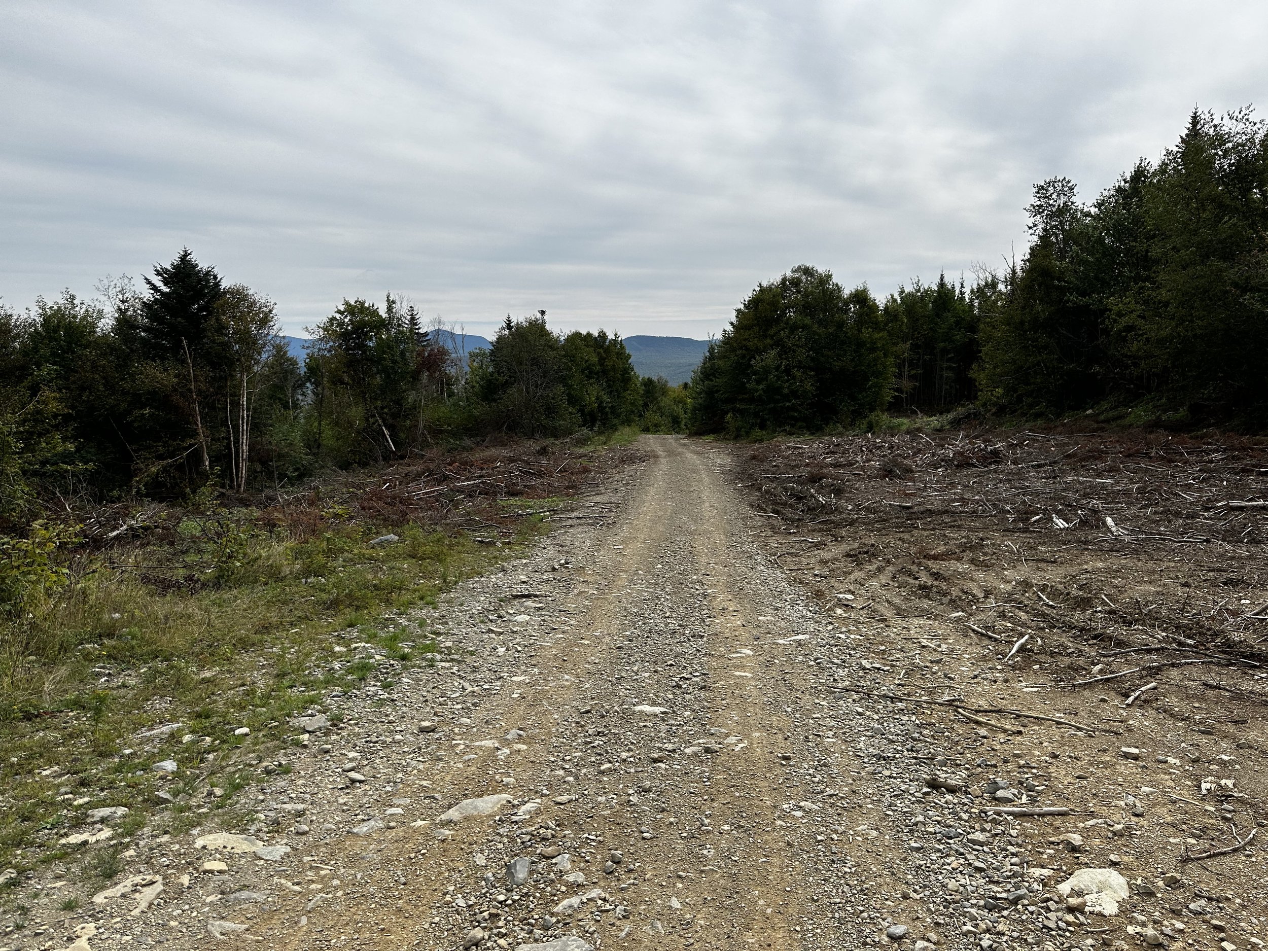
Along the old logging roads
Turning back, I recalled a spot in which to stash the Subaru about a quarter mile back. Tucked into an inactive logging landing, at least there I hoped I would be out of the way for the next several hours. Thankfully, the ground was solid enough to park on and get out of the way of any heavy equipment.
The midday sun was bright but became nullified by the incoming wind; Hurricane Lee was due to make landfall later in the day, which afforded plenty of time to scale this peak and commute home, far from the path of hurricane. As the logging road climbed steadily atop the increasingly rocky surface, wind worked to dry any sweat the instant it formed. I recalled thinking about how thrilled I was to have obtained that parking spot, for, I would not have wanted to bring my sedan much higher along the rugged forest road anyhow.

Trail ends; bushwhack begins
Many side trails diverge as one gradually ascends along the initial road trek in; most are labelled for ATV and snowmobile use. Upon reaching 2,500’, the road terminates at a wide log landing; while several signs state that the “Trail Ends!”, another simply requests no ATVs be used on the old route.
An obvious pathway continues, albeit highly overgrown to start, along the hillside and over a minor drainage before entering the shaded, coniferous forest. As if a light switch had been flipped, the brushy pathway soon cleared to a tidy, 5’-wide swath bore into the woods. Admiring my new surroundings, this lovely, open forestscape would thankfully remain until reaching the summit and returning back to this spot.

Start of the herd path
Mileage was sailing by effortlessly as I suddenly noticed a pair of sticks strewn on the otherwise neat footpath; the sticks formed an arrow which directed attention up a short embankment where hikers could begin along the herd path. Nearby the entrance to the footpath was also a yellow property boundary marker post, whose yellow paint matched the yellow paint swatches in the trees - just then I recalled prior trail reports commenting on how nicely blazed the lower trail was. I often thought this to be odd as this peak has no marked or maintained trail (to my knowledge) - perhaps they saw the property blazes and thought it marked the herd path.
Initially, the faint path is a bit rugged, as if the trail had been recently relocated or brushed out; before long the herd path became much like what I had expected, more gorgeous Maine footing with a stunning moss-lined pathway. Occasional downed trees broke up the tidiness of the herd path, with a quick step over, the obstacles were hardly a hindrance.
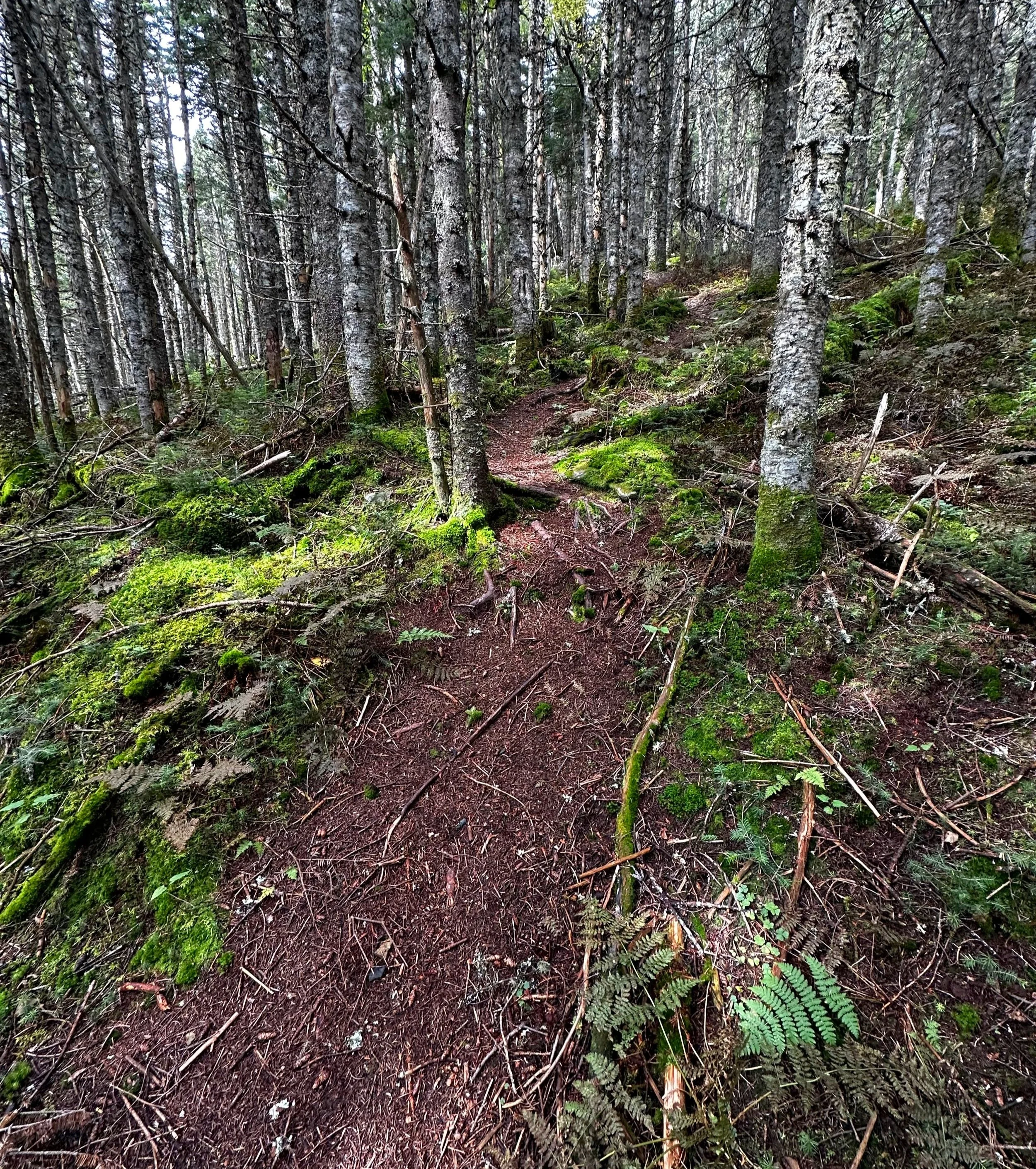
A neat herd path leading up East Kennebago
Despite the steep grade, climbing remained easy with solid footing atop the rich soil. Another trail review noted how this was a favorite Maine peak among bushwhacks, and I can now share their sentiment, I imagine many New Hampshire trails were at one time so enjoyable, but with time and much foot traffic, have since fallen to the forces of erosion and dilapidation.
The lush pathway swings hither and thither, around both standing and fallen trees, while overall ascending northwesterly toward the 3,791’ summit. Arriving along the summit ridge slightly toward the east, the path makes a noticeable switch in direction, swings clockwise toward the summit cairn along several rods of near-flat terrain. If standing at the low rock cairn, if one turns to face southward, the summit canister will be spotted, with a moose skull hung adjacent.

Summit of East Kennebago
After a moment to flip through entries in the summit log book and pick out several familiar names I had been noticing during the previous few climbs, my own ascent was logged with a kind note for the next bushwhackers, all sealed back up in Ziplock bags and returned to the canister. Before departing the summit area did I notice at least two other herd paths diverging from the forested summit area, luckily I had never lost track of which direction I had ascended.

A fine corridor through the conifers
The trek back was nearly a jog atop the soft footbed, even more so once I had departed the herd path proper and regained my beautiful corridor cut through the forest. A most remarkable scent filled the air upon exiting the narrow path and emerging into a more open landscape. Perhaps as morning temperatures rose, the grasses and rainbow of wildflowers warmed as they soaked up the sunrays - every inhale was enhanced by the sweet scent of autumn farm stand, apple pie spices and coconut flakes.
Around every corner, it seems, a surprise awaits hikers of these trailless Maine peaks. While I had succumb to the notion that the inconveniencing of the remote drive would only make for a preconceived dull adventure, nothing but the opposite was to be found in this six-pack of stunning summits.

Southwardly views from “The Lookout”
Sure, most of these peaks offer little to no views and perhaps all are scarred by a little logging here and there, but what they do offer to those who roam their slopes is the unrefined beauty of nature; wilderness on its own agenda, with its own set of rules and game plan, kind enough to let us sneak in for a peek and a peak, but needing no influence by human hand. Nature has it all under control in the back hills of Maine and I cannot wait to see autumn foliage as (hopefully) this New England Hundred Highest journey comes to a finish. Two peaks remain.
Overall stats for the day:
9-miles
2hr 39 minutes
2,448’ elevation gain
East Kennebago Mountain - 3,791’