
Shelburne Moriah Mountain
Being the last peak on my list of New Hampshire 3000-footers with a marked and maintained trail, I had been secretly saving this climb for when I could drag Alanna along for the adventure. Prior to hiking the Rattle River Trail, we joked about, and scoffed at the reviews which suggested that this trail was a “one-and-done” hike; as we returned to the Subaru with a few new scrapes and very extra clumps of stuck-on bog mud, we understood where this reviewers sentiment had originated.
Many times I had driven past the large trail head located several miles east of Gorham, New Hampshire; just outside of town, the Rattle River Trailhead can be found (several rods beyond a bridge spanning the Rattle River), on the southern side of US Route 2. Accommodating perhaps 12-16 vehicles, the parking lot had only two other cars when we arrived for a 6:30am embarkation on the Rattle River Trail.

Beginning along the Rattle River Trail
The Shelburne Moriah ridge technically has two peaks - Shelburne Moriah Mountain, at 3,735’, toward the east, and with 3,755’ Middle Moriah Mountain comprising the western knob of the ridge; today, we planned a visit to the mostly bare summit of Shelburne Moriah Mountain. This peak is listed as the fifth-highest mountain on the New Hampshire 52 With A View list. With forecasts indicating clear skies in the Carter range, we were hopeful for fine views but incredulous to believe the low-laying clouds of the Northern Presidential mountains would not drift our way.
It was obvious that we were trekking through a slightly “past-prime” fall foliage forest, with many of the burnt-colored leaves already resting on the path itself. Leaves hid the medium-sized rocks and boulders underfoot, but overall the treadway was much more dry than we had hitherto expected, or at least what recent trail reviews had led us to believe. The dull cascading of the Rattle River filled the airwaves as we strolled a very casual grade; occasional drainages ran appropriately across the trail, well-crafted waterbars working just as the trail builders had intended.
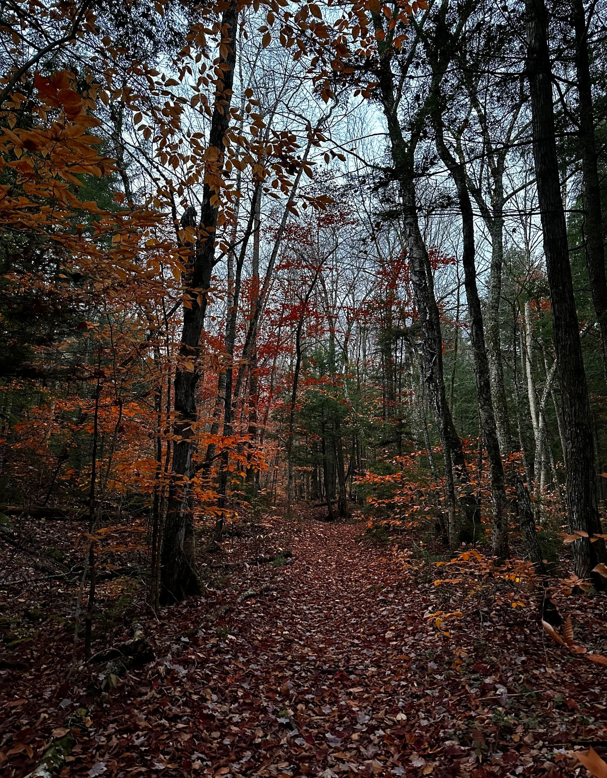
Autumnal vibes on the Rattle River Trail
Early along on the Rattle River Trail, with one glance it is plain to see the old logging road corridor slicing through the forest, oftentimes as straight as an arrow, reaching far into the distance. At 0.4-miles, a brushy snowmobile trail intersects and continues upslope, southeastwardly out of the Rattle River Ravine.
Reaching the first water crossing at 0.8-miles, we found standard, white AT blazes and rock cairns marking the suggested route across the branch. However, as water levels rise following significant precipitation or spring thaw, these crossings would likely become hazardly treacherous - before long into our ascent of Shelburne Moriah Mountain, we both had soggy toes and wet shoes. Needless to say, subsequent mud or water was simply trudged right through, with all efforts and attempts switched from staying dry to merely not slipping on slick, damp rocks and roots.

Rattle River Shelter
A very mellow grade of old forest road persists as the trail begins to side-hill and meander along the eastside of the gully. At 1.6-miles we reached the Rattle River Shelter; built mid-1960’s, this camping area on the Appalachian Trail offers a lean-to basically directly on the trail with a nice fire pit; tent-sites and restroom are located eastwardly, a short distance from the main trail; water can be gathered from the nearby stream which likely flows indefinitely.
Departing the shelter area, I noticed a tidy row of young white pine which had grown trailside. We could have spent all day just roaming the woods, spotting wild edibles and fine examples of mushrooms along with various tree, fern and shrub species. Despite a majority of the leaves having already been shed from tree branches, the forest had a welcoming, warming glow throughout, as the morning sun began to rise up from behind other nearby high places.
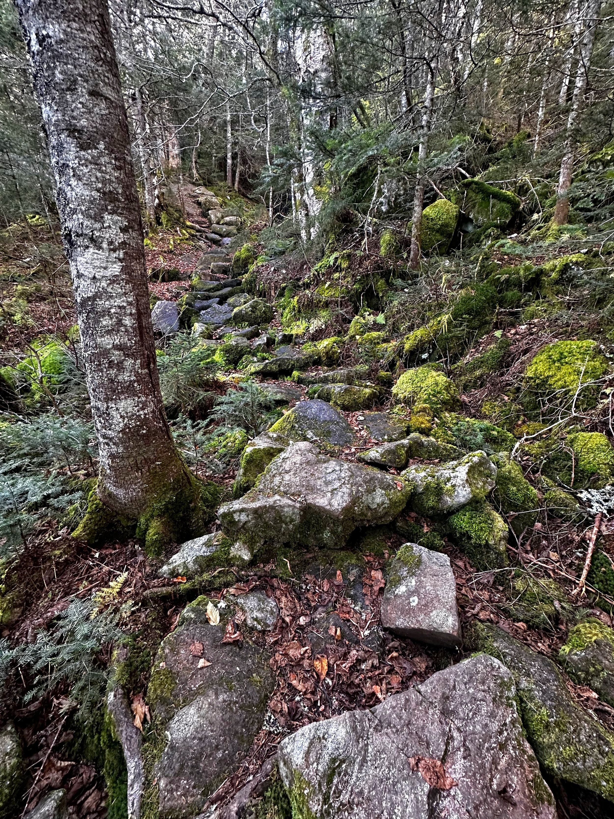
Getting steep on the Rattle River Trail
As the Rattle River Trail begins to gain elevation in earnest, we briefly drop several rods to cross the Rattle River and begin tracing the western bank before once again crossing a tributary and continuing toward the ridgecrest. Our rugged, old logging road soon transitioned to sections of beautifully constructed stone staircases - each hand-placed boulder encapsulated by a sea of lush viridescence.
With each step progressively further upslope, hobblebush and hardwoods grew sparce as mighty spruce, birch and fir work to fill the forest landscape; peering back over our shoulders, neighboring hills of the north now came into view. Entering into a predominately sub-alpine boreal forest, the pathway begins to taper off as it continues toward the Kenduskeag Trail atop the high ridge; lengths of old, wooden boardwalk spanned many boggy sections as we trekked on.
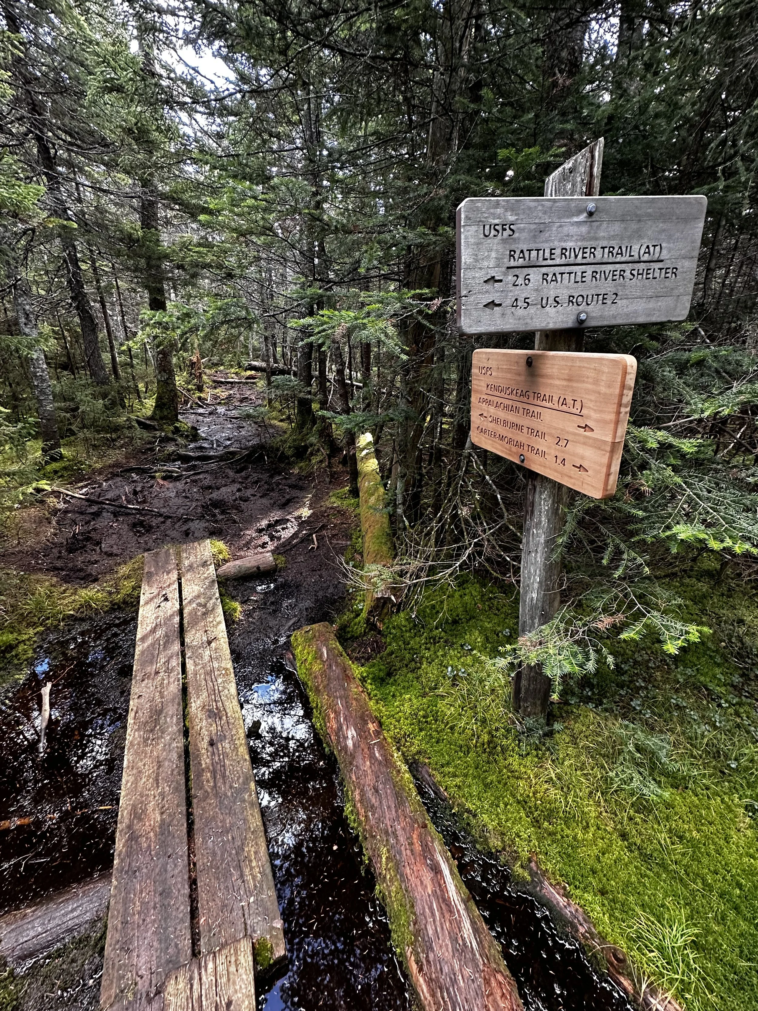
Joining the Kenduskeag Trail for a non-voluntary mud bath
As we reached signage at the Kenduskeag Trail junction, the well-travelled Appalachian Trail diverged westwardly (climbers right) while we continued eastwardly, down an increasingly boggy pathway toward Shelburne Moriah Mountain. At several instances along the Kenduskeag trek, Alanna and I made several remarks and observations that perhaps, “all the boards appear to be in the wrong area - not even bridging the mud pits!”.
While navigating the soggy saddle at 3,300’, Alanna called me to attention; with a gasp, laugh, hoot and perhaps a drop of a single tear, what I witnessed appeared to be Alanna sitting on the trail, but in actuality was her left leg plunged thigh-deep in pungent, blackened muck, while her right leg came to a halt merely knee-deep. For as long as I am able to traverse these trails, I do not believe I’ll be able to disremember the sound of that sticky mud working to dislodge trail runners from feet.

Final ridge climb of Shelburne Moriah Mountain
After several undulations through the scrappy, coniferous treescape, we finally emerged for a stunning glimpse of our ultimate objective - the final ridge of Shelburne Moriah Mountain rose up like a sleeping giant’s spine; seemingly still miles distant, we were across a minor, rocky plateau and ascending toward the final ridge in no time at all. This concluding ascent toward the true summit brought my mind right back to navigating some of the “trailless” peaks of the AMC Hundred Highest list, where, it would be correct to say there is no “marked and maintained trail”, but that there is a definite “herd path” of sorts - one can certainly appreciate the direction and pick their way across the mountain ridge - I fully enjoyed the tight ramble, but could understand being rubbed by countless spruce and fir boughs may not be ever hikers’ cup-o-tea.

Shelburne Moriah summit
The mid-trail mud bogs continued as we neared the pile of rocks adorning the high point; the worst of which was actually found at the base of the final ascent - a mud pit guarded the final rocky scramble. It is, of course, worth noting that, we hiked the Rattle River and Kenduskeag Trails in a period of dry weather; perhaps these bogs are residual from the persistent rain storms which plagued the summer of 2023, or perhaps these trails are just not highest on the to-do list of AMC trail maintenance (or trail adopters), whatever the reasoning behind a trail in such a decrepit state - it is in dyer need of many more boardwalk planks or several short reroutes - otherwise hikers will end up making their own paths, inadvertently trampling a fragile network of beautiful sub-alpine plantlife.

Sub-alpine boggy marshland
Upon reaching the summit, we were thankful for moderate winds as neighboring Mount Washington logged gusts in the 90’s this morning. While all of the Presidential’s (from our viewpoint) remained socked in a cotton candy cloud, we gave many thanks for the vistas which we could enjoy - the Carters, the Baldfaces, and furthermore on into western Maine. Northerly views were somewhat blocked by mountaintop fir, but we were able to enjoy a fine vantage overlooking the town of Gorham.
A brief spur path leads southwardly, toward a series of open ledges affording even more southerly views; here, it is possible to already find sub-alpine vegetation trampled from others attempting to avoid these muddy sections.

Southerly views approaching summit
After our short, windy stay atop Shelburne Moriah Mountain, we proceeded back down the ridgecrest by literally following our footsteps as the imprints in the mud lingered, as if stamped in wax. Exchanging greetings with the first hiker and pup we encountered thus far, the tramper advised that he had ascended via the Shelburne Trail and ventured to Mount Moriah and back. His description of a lovely Shelburne Trail had us wishing we had chosen his route instead - next time, perhaps.
The descent back to the Rattle River Trail and henceforth trailhead was relatively uneventful, we were privy to the deepest mud pit locations, tramped directly through remaining water crossings, yet lingered at the final brook just long enough to rest atop a fallen log to observe the peaceful cascading of the waterway.

Trailside cascades beckoned us for a respite
As we made fast work navigating the leaves which blanketed the rocky, old logging road, droplets began periodically falling through the bare tree canopy; with perfect timing we reached the relative safety of our Subaru, the rain now fell with a supposed purpose as we changed into dry clothes and out of wet, muddy gear. Ironically, we could not get much more wet following a trek along the Rattle River and Kenduskeag Trails.
While we are very pleased to have be able to experience both of these trails at the time we did, however, we now anticipate the joys of winter hiking once again - a joyous hiking season where rocks, mud, leaves, and roots are all neatly tucked under a fluffy blanket of white powder for several months.
Overall stats for the day:
10.8-miles
6hr 14 minutes
3,730’ elevation gain
Shelburne-Moriah Mountain - 3,735’

Rattle River + Kenduskeag aftermath