
Unknown Pond Peak + Northern Pilot Ridge
With snow beginning to settle in the higher hills of the White Mountains, I thought a mid-week adventure to a trailless tract of wilderness was in order - for soon, gate closures would begin to limit trailhead accessibility for several wintery months. More and more lately, it seems, I’ve listened quietly to others remark on how picturesque and dreamy the Kilkenny forest is; with acres of lichen-draped spruce and fir, it is truly a remarkable sight and incredible place on earth in which to find oneself.

Embarking along the Unknown Pond Trail
Trekking primarily off-trail for this ramble, I saw no other hikers; just bear, bobcat, deer, moose, and plenty of other, tiny tracks left by critters probably stashing the last of their winter nuts and seeds. A visit to the northern Pilot Ridge had been on my “to-visit” list for several years now - and while finding myself with minimal time restraints today, why not throw in a personal first ascent of the neighboring Unknown Pond Peak.
Sometimes everything just seems to come together while in the high hills - weather, trail conditions, an exciting route into the unknown - I had the notion that today would not be just an ordinary day of romping through the backwoods when rewarded with a stunningly pastel-hued sunrise while driving through downtown Littleton. Noticing trace amounts of frost lingering in the conifer boughs atop the forested summits, I made the drive down Forest Road 11 (Mill Brook Road), glad to see the old path was mostly devoid of snow and ice, making for a efficient commute to the Unknown Pond Trailhead, several miles into the forest from Stark, New Hampshire.

Morning sunshine, approaching Unknown Pond
The trailhead, at the terminus of Mill Brook Road, accommodates perhaps 5 or 6 vehicles; I became the sole vehicle in the lot. Using the 0.1-mile backtrack along FR 11 as a warmup, I soon joined the Unknown Pond Trail on the eastward-side of the bridged Mill Brook. The path follows an easy grade for the initial mile; along the east side of the brook, several minor waterways and drainages are crossed atop placed rocks. Several other hikers had come before me in recent days, packing down the trace amount of fallen snow, creating a beautifully coarse and grippy wintery trail surface - Hillsound spikes were ready to be donned, yet went for a ride during the entire trek.
As the grade increases, it became possible to see through the baren hardwoods, to my objective far ahead: the Pilot Ridge; a massive expanse of unspoiled, trailless forest. The morning sun cast a low, warming glow across the undulating ridgecrest; despite the “balmy” 28° morning air, the sunshine was intoxicatingly inviting on the high ridge ahead.

Unknown Pond, in winter-mode
The ravine which I had been ascending began to taper as the morning glow now crept through the immediate trees as well. It was not hard to ascertain that the large, open area just ahead was that of the Unknown Pond, but to my surprise, this early in the season, the pond had completely frozen over! Tracks of various sizes meandered across the snow-dusted, icy surface. Briefly, I let my mind wander, daydreaming of being their size - where would I venture if I came upon a frozen pond such as this?
Circumnavigating the water’s edge for several hundred feet, I proceeded away from the pond to continue following the Kilkenny Ridge Trail, this would allow access to Unknown Pond Peak. If it was not apparent - today’s bushwhack adventure was a quest to visit several new-to-me New Hampshire Hundred Highest peaks, a variation of the AMC New England Hundred Highest, these being all in my home state of New Hampshire. One thing I do appreciate about following lists are the opportunities to seek out and visit tremendously remote tracts of wilderness, most without the aid of trails - there is a sense of peace (aside from constantly watching for moose, bear, hunters, etc.) which takes over when I find myself in remote stretches, I find the moseying some of the most satisfying.

Ascending nice, open woods of Unknown Pond Peak
Reaching the height-of-land, about 0.4-miles northeast from Unknown Pond, I dashed off, away from familiar footprints and off to break my own trail. The forest along the low, west-facing ridge of Unknown Pond Peak was delightfully open and easy to traverse - prior reports may indicate a followable herd path in which to reach the 3,500’ summit, I found nothing of the sort today, just highly pleasant woods to roam, all culminating at a stylish, black PVC canister located near the center of a glorious, mountaintop birch glade - I could have stayed here all day and likely been completely content with that decision.
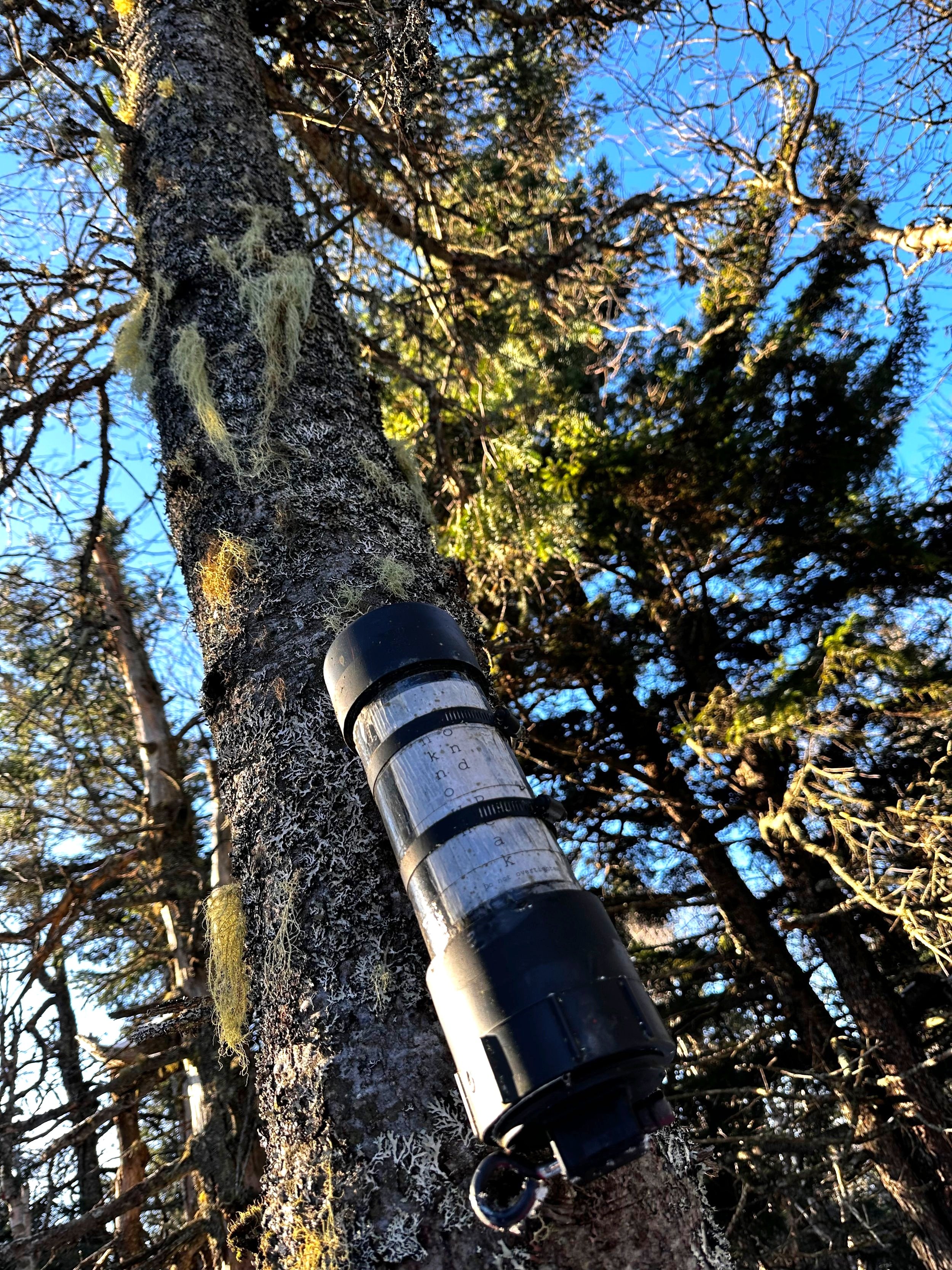
Summit of Unknown Pond Peak
After signing into the summit register and returning all of the contents, I took one final gander about the glade and began back, following my fresh tracks in the snow. Within minutes, I had rejoined the Kilkenny Ridge Trail; any fallen snow had worked its way into cracks and crevasses between rocks on the trail, creating a soft path which was easily runnable downhill, back to the pond.
Being already far ahead of my time cut-offs, I proceeded in a counterclockwise fashion around Unknown Pond, on the Kilkenny Ridge Trail. While planning and plotting out possible routes in which to gain the Pilot Ridge and subsequent peaks, I weighed the option of descending the Unknown Pond Trail, to simply bushwhack one of the ridges up to the Southeast Peak (also referred to as, “Mount Mary”). Not wanting to give up precious elevation which had already been climbed this morning, I opted to follow the KRT toward the spur path for The Horn and hook along the elevation contour (avoiding summiting The Bulge as I recalled thick woods trailside, in prior trips), to gain the Pilot Ridge.
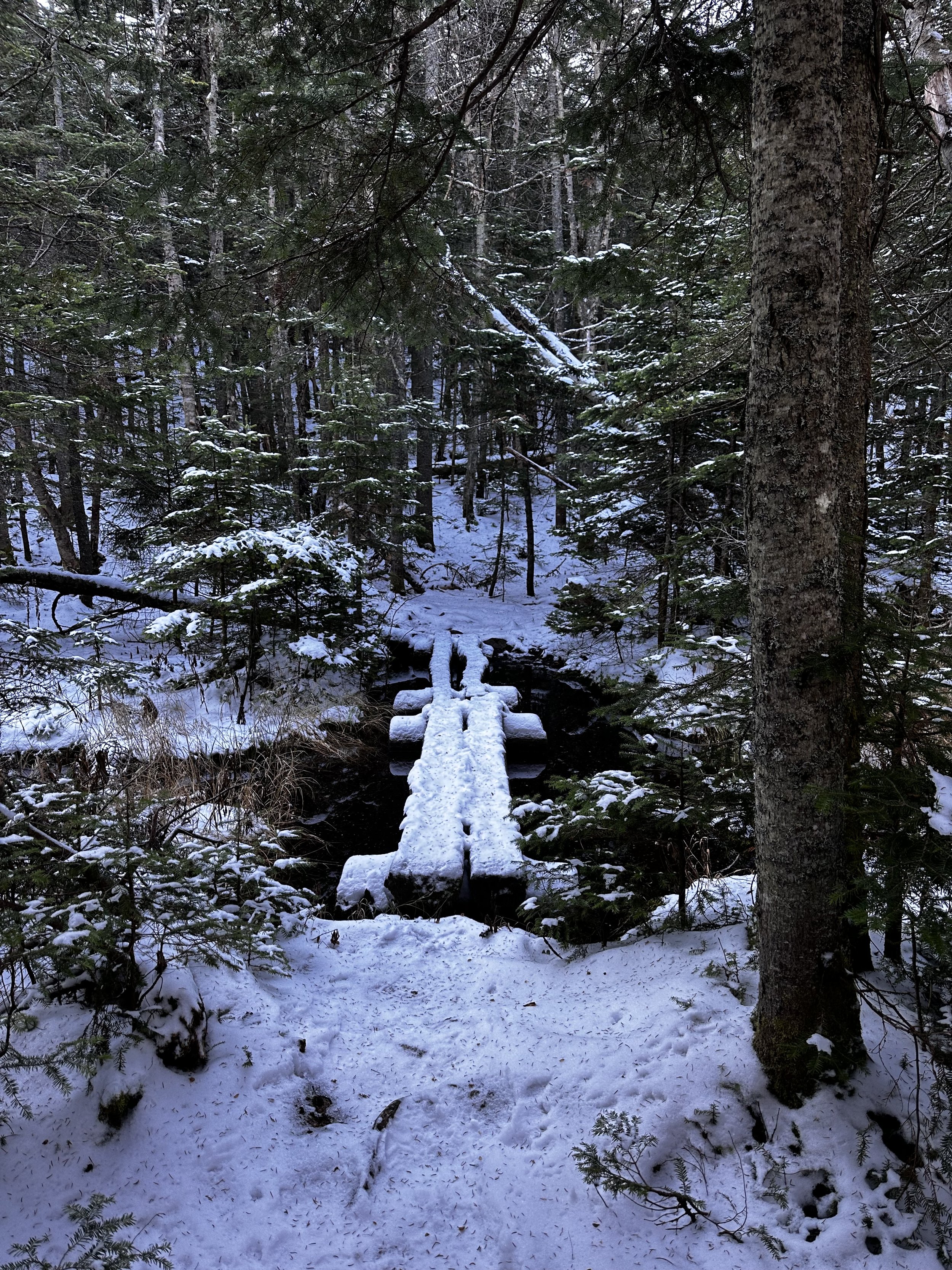
A snowy Kilkenny Ridge Trail
Still following unmistakable Altra Lone Peak sneaker prints in the snow, the trail was packed, making for quick and efficient travel. The woods this morning were some of the finest I could recall - the forest I had come to adore, now freshly caked in several inches of wet snow - powder has yet to exist in these hills.
Confirming my suspicions, the observable forest from the shoulder of The Bulge appeared oppressively thick and perhaps younger growth (fir boughs constantly shedding snow) than I wanted to traipse through; back down toward The Horn junction I went, in search of more inviting woods!

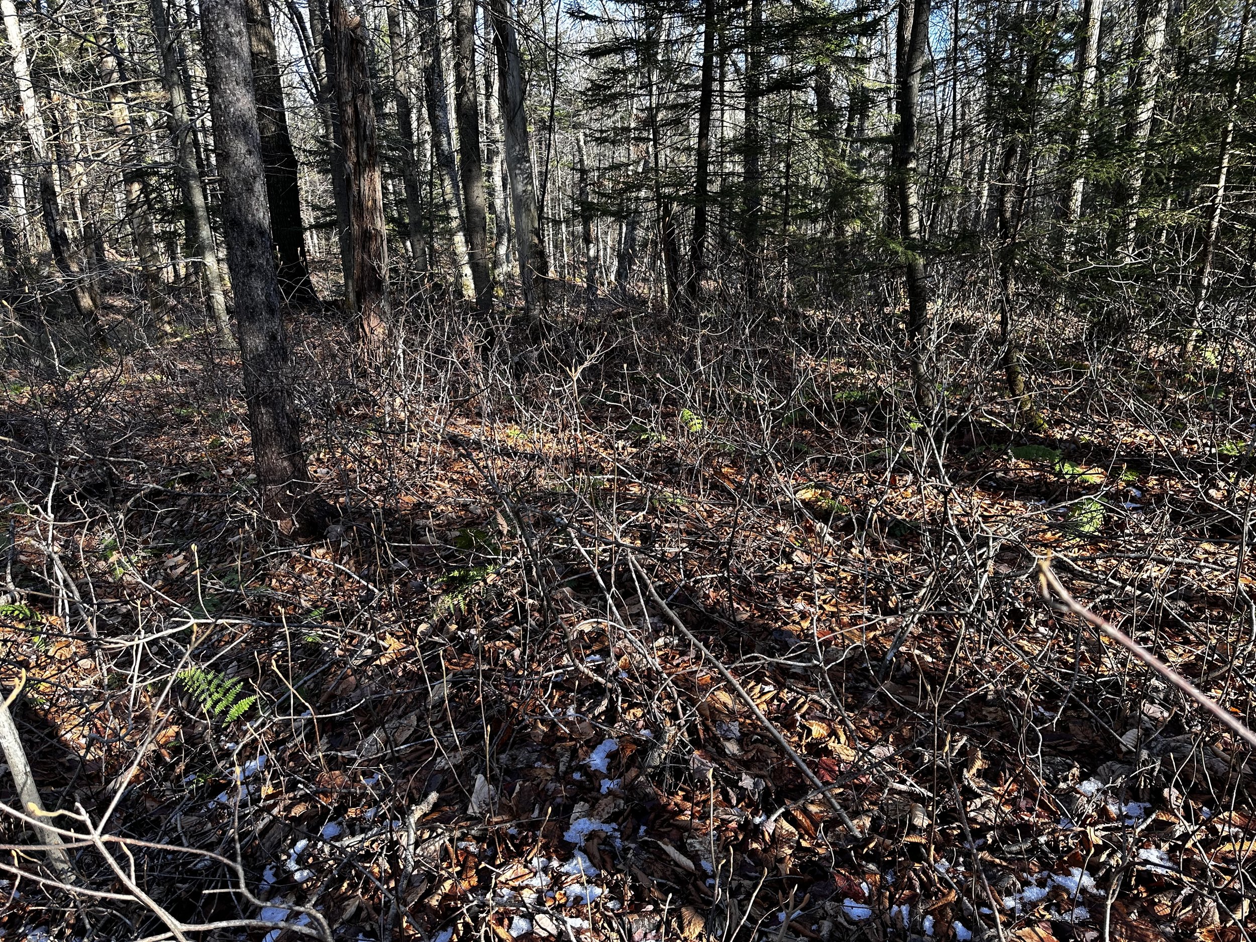
Bushwhacking along the Pilot Ridge
Into the forest I began, working to follow the 3,670’ elevation contour which would allow me to avoid scrappier, younger growth of higher elevation. This plan worked great, the forest remained agreeable - open and very pleasant; nearing the ridgecrest, I found plenty of old, downed logs to step over (but no true blowdown patches here), lots of wildlife activity - even bears had roamed since the snowfall several days prior.

Northerly views from a bump off The Bulge
Just for kicks, I decided to summit and stand atop a 3,525’ unnamed knob which lay in my path, about 0.4-miles due northwest from The Bulge. Here, I found suggestions of a northern view but was limited to the low taper of a neighboring ridge, originating off The Horn. The climbs up or down were always in favorable woods, never slick nor steep enough that I wanted to add spikes to my trail runners.
Several instances along the Pilot Ridge, I was met with localized patches of dense blowdown - as in, every standing tree had been leveled, stacked in a haphazardly manor, creating a tight network of woven tree debris. Each of these instances were avoidable by bushwhacking either north or south of any tangled mess; only once I recognized cutting straight through a patch of blowdown to be of any logistical value - luckily this patch was easily navigated by meandering alongside the fallen trees as if they became barricades, instead of incessantly hoisting oneself up and over constant obstacles.
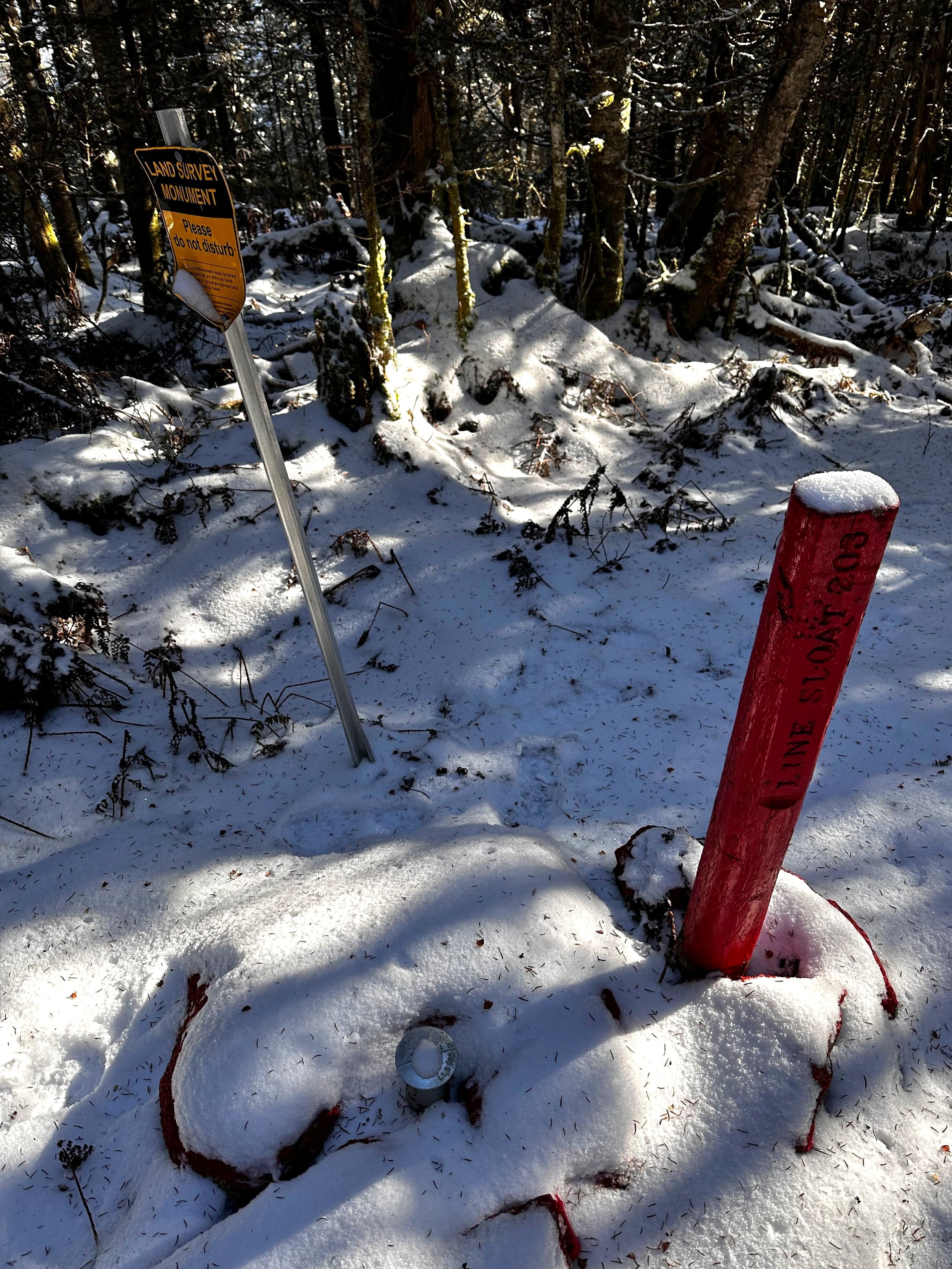
USFS Survey Monument atop Mt Mary
Ascending the Southeast Peak of the Pilot Ridge was straightforward; open and mature forest persisted along the ridge. Climbing was undebatably much more straight forward, as there was simply one direction to travel - up, until each mountaintop is reached. Descending, however, is where great care comes into play, as to not drop off the wrong ridge, into an incorrect gully. Several rods southeasterly from the true summit of Mount Mary, a red, USFS Land Survey Monument can be found, as well as a nearby bearing tree, signifying the edge of National Forest land.

Summit register box atop Mt Mary
To my surprise, the summit register atop Mt Mary is one of the finest! A lovely, wooden box beckons whacky bushwhackers to “Please Register”. Inside the box was an old notebook and several short pencils; perhaps a hiker had peanut butter on their hands while logging their ascent, as the notebook and Ziplock bag had been nearly devoured by the hungry little rodent.

A path among the pathless woods
Beyond the summit register box lays a surprise in the form of herd path cut generously into the ridgecrest. Expedient travel across the Pilot Ridge was rendered even more efficient while descending, half-glissading downslope as I hit the seven mile-mark of my day. From reading prior reports, I had recalled there being an old cabin somewhere in the col, but was unsure of exactly where it was located. As luck would have it, the herd path which I had been following led directly to its front steps. The door was unfortunately locked as the building still contained all the implements for several folks to survive comfortably in its constraints - even a miniature fuel canister remained hooked up to the gas line.

A cabin in the col
Continuing to follow the path into the woods, I soon noticed it leading to the far edge of property boundary; met with yet another red, WMNF National Forest Survey Monument. As the path I had been following clearly began to avoid my next objective, the 3,615’ summit of Pilot Ridge (Middle Pilot), I backtracked slightly to locate favorable woods to ascend. What I found was a sea of old, brown ferns coated with a layer of wet, slippery slush. Snow, which had now begun to melt in the 10am sunshine - both underfoot and overhead, dripping constantly from the forest canopy.

Summit of Pilot Ridge (Middle Pilot)
Reaching the recognized high point of Middle Pilot Peak, I located its summit register (up, way high in a tree! Must have had a hefty snowpack when that canister was hung!) with an old, wooden sign on an adjacent tree. Logging my ascent into the notebook, it was also time for a tea break before moseying along to my last several summits. Paying a visit to the Northwest Peak; this was found by following a moderately worn herd path southwestwardly for several rods. Here, I found a glass canister register strung from the highest tree, I soon followed my tracks to rejoin a crude herd path which seemed to beeline directly toward Hutchins Mountain in the north.

Summit of NW Peak
This path inevitably dissipated quickly into seemingly undisturbed forest. Picking the “path-of-least-resistance”, I nearly dropped too far east once in the col, but soon caught, and corrected the error, meandering around fallen timber and low, snow laden conifer boughs. The only real steep climb along the ridge came just below the summit of Hutchins Mountain. While scrambling the final steep section, several questionable herd paths apparently zigzag between trees and around exposed rocks. All the while, dense moss afforded a delightfully cushioned route as the crux was scaled and the mountaintop was gained.

Ascending the steep summit cone of Hutchins Mtn
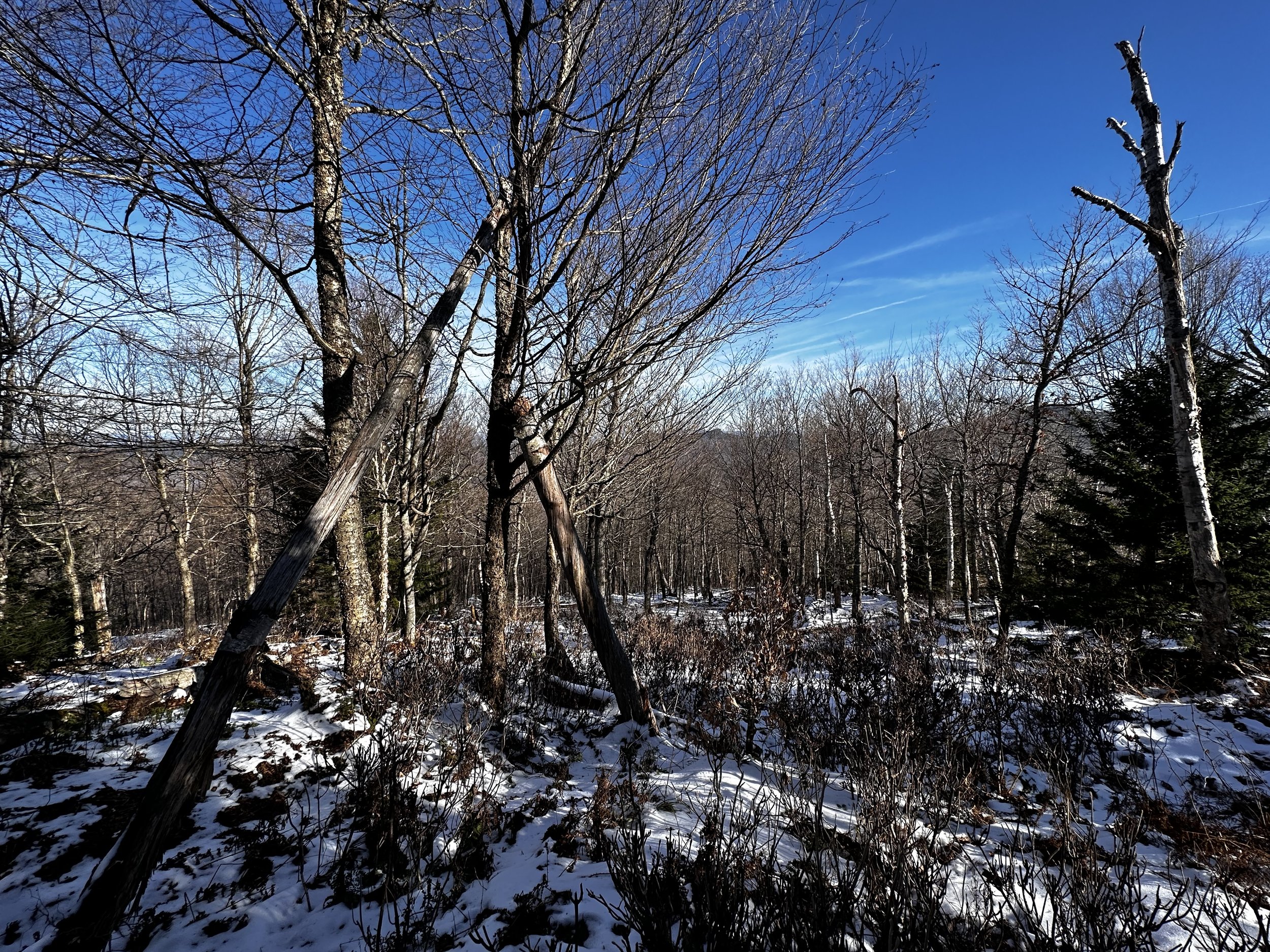
Suggestions of possible vistas could be found in various directions atop the summit area. I trekked in various directions before departing, in an attempt to locate a glimpse from any of the open patches - here, I found indisputably the best views of the day. The Percy Peaks were plain to see several steps from the high point; otherwise, a fine southwesterly view toward the Presidential Range could be had if one wanted to pick their way through leaning, windswept conifers, near the edge of the high summit area - which I did.

Summit of Hutchins Mountain
After signing the register and reading through some recent entries, I could now make my way back to the awaiting Subaru - all I had to do was navigate roughly two-miles of east-facing ridge from Hutchins Mountain - which was rumored to contain some fine hardwood forest on its lower slopes - just what I needed to round out a glorious day in the Kilkenny Mountains.

Summit views; Percy Peaks center
Backtracking about 0.3-miles by following my ascending footprints, I located the ridge in question, which I would follow downslope, eastwardly. For a majority of the downclimb, I followed tracks placed by a relatively large moose, with each heavy step, excavating rich soil, as well as snow. Since these tracks were likely placed this morning, I remained on high alert for their creator, who might still be lingering in nearby bushes. It is remarkable how the mind can turn a large root ball in the forest into a crouched moose, until the eyes can focus, thus proving it otherwise.
Hardwoods along the east-facing ridge
Nearing 2,950’, the surrounding forest transitioned from beautifully open softwoods to hard. I stopped briefly to take in my surroundings at more than one occasion: the first instance being at the entrance to a birch and hardwood glade, being highly reminiscent of bushwhacking along Jeffers Ridge back home in the Benton Range, what fun.
While the rocky hillside remained dauntingly steep atop droopy, late-season ferns, leaves and some snow lingering, I took the opportunity to perform my first (entirely voluntary) butt-slide of the season. Once the grade began to level out, the ground underfoot became somewhat soggy, with minor, narrow drainages twisting their way through the mountainside. Delicate, white moths joined me on the descent as they lofted low along the exposed leaf duff, as if searching for Spring already.

Glancing back up the ridge
Knowing my awaiting car was just up ahead, I hit a patch of cripplingly thick hobblebush, followed by an entanglement of red-hued thickets - logging activity. Backtracking slightly, to pick a route around the boggy, spike-riddled area, I popped out directly at my car, still the lone vehicle in the lot, and could now answer the question I had humbly inquired for years: “I wonder where that goes.”
Overall stats for the day:
11.87-miles
5hr 52 minutes
4,094’ elevation gain
Unknown Pond Peak - 3,500’
Pilot Ridge SE Peak (Mt Mary) - 3,560’
Pilot Ridge - 3,615’
Pilot Ridge NW Peak - 3,520’
Hutchins Mountain - 3,730’
Hobblebush entanglement on the descent