
Blue (Bunnell) Mountain
A ramble to the highest peak in New Hampshire to reside outside of the vast White Mountain National Forest; that was how I planned to enjoy the last bit of dwindling snowpack in the backcountry - before any pleasant bushwhacking likely turned into a springtime slog following the rain deluge scheduled for Wednesday.
Originally named Blue Mountain, up until the early 2000’s, this trailless peak was renamed to Bunnell Mountain to celebrate the life of a local attorney who lost her life over a landowner dispute. Even with such local notoriety in the past few decades, aside from several crude, old woods roads which have been repurposed as rugged ATV trails, no hiking paths currently lead up to its 3,724’ summit.

Brown Road as it splits: Vickie Bunnell Preserve to the left
Upon studying satellite images of the area, and tracing the vast network of trail corridors which can still be seen slicing through the valley and up the mountainside, I pondered an ascent from the west - from Meriden Hill to Brown Road - a fairly common route in which to approach this and several other nearby New Hampshire Hundred Highest peaks.
Following a long commute to the North Country, I had just begun to escape the low, ground covering cloud layer which blanketed the entire Middle Connecticut Valley region this morning, as I pulled onto a paved Meriden Hill Road. Passing several new construction projects as I drove, I parked momentarily at a gated snowmobile road, assuming these were near the old corridors which would lead into the woods. A quick glance at Google Maps showed I was near Brown Road - not on Brown Road - which leads directly toward several trailless mountains.

One final gate before entering moose territory
At the first opportunity, I pulled off Browns Road onto a snow-free snowmobile trail, assuming traffic on the bare trails would be minimal today. Further along Browns Road, the surface becomes increasingly rugged and rocky (eroded and tore up some from the recent rainstorm), although it did appear that one of the last residents of the dirt road may have plowed the road up to their driveway.
With snowshoes on my back, I was making good timing despite heavy mountaineering boots on the feet; while I had wanted to simply travel fast and light without snowshoes and with trail runners, I had nagging suspicions that I would be happy to be lugging a few extra pounds while surpassing 2,500’.
The Grand Central of moose traffic
Generally, in warmer months, Browns Road can be driven several miles into the trail network, although I would not attempt to traverse the rugged old roadway without high clearance and all-wheel (or four-wheel) drive. The dirt and gravel road was relatively snow-free past the last residential driveway, but increased nearing the first junction - turning right here allows for a trailed approach to West Castle (NH Hundred Highest) or Teapot Mountain (NH 3000-footers), my objectives for the day would be found by veering left here.

Snowshoe bushwhacking made easy
As the road swings north, a tributary to the Gore Branch of Lyman Brook becomes audible, luckily bridges span all water crossings while the road is found in such robust condition, further into the wilderness this road becomes rather water logged and impacted by beaver activity, but overall the roadbed is unmistakable. Passing a gate (likely the furthest vehicles can be driven in the best circumstances) with trailside Nature Conservancy signage listing rules and regulations regarding the timberland property.
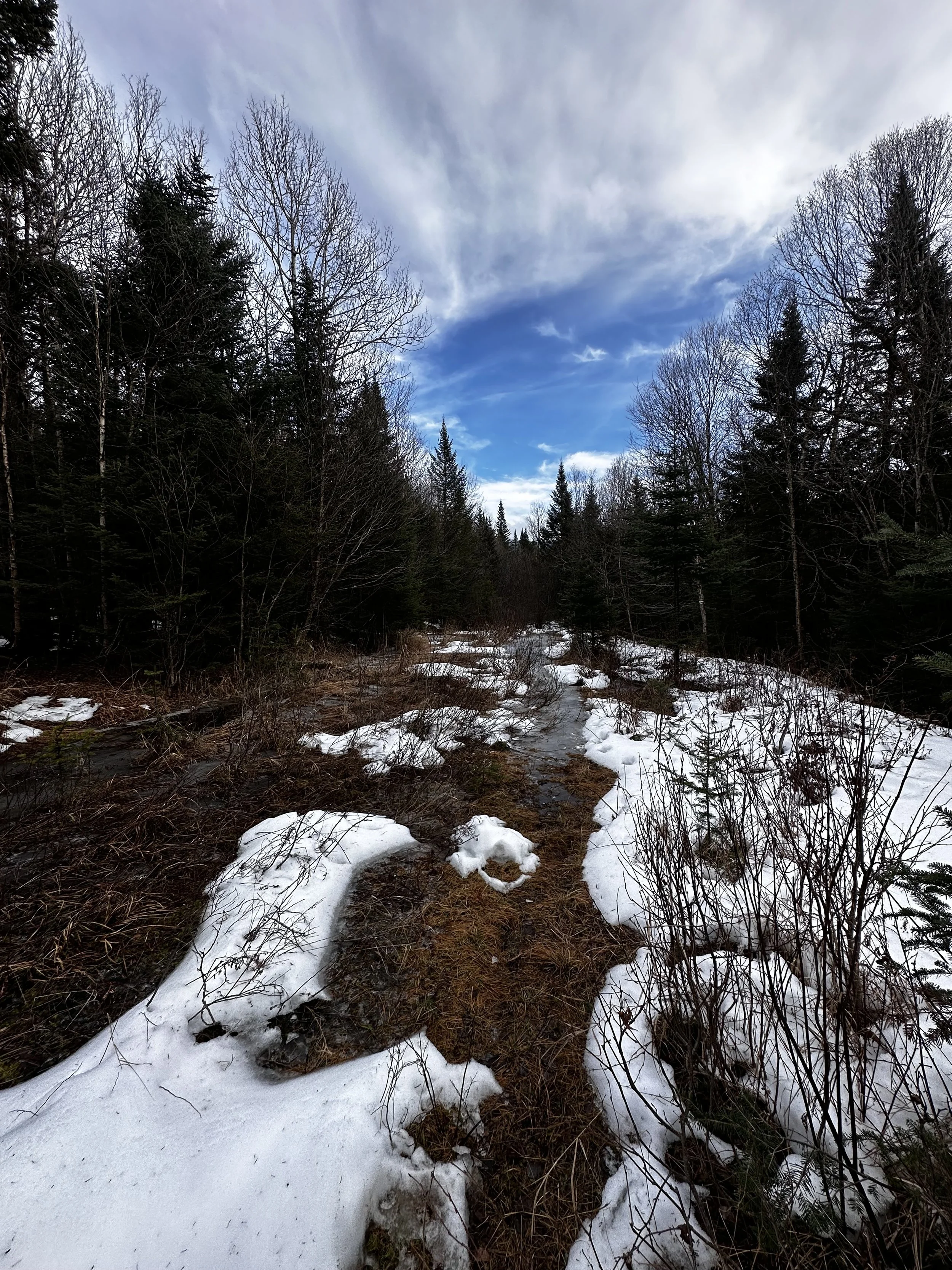
The road continues to climb gently through a stunning hardwood mountainscape, the trailless ascent to Mount Pleasant, directly north, appeared completely unbroken, as if a hiker could strike a bearing toward its 2,900’ summit and hardly hit a tree or other debris during the climb. The footway even grew soft underfoot as the gravel surface was swapped for last year’s fallen foliage.

I spy an old trail corridor!
Becoming increasingly narrow, the old roadway can be found clogged with young fir at several instances; often finding travel overall easier just adjacent to the road, in the open woods. The snow was soft, but with only several inches to contend with, the snowshoes remained affixed to my pack until reaching the first large clearing, which appeared to be repurposed from a log staging area to a more commonly used moose bedding site. Hooves and hair were strewn all over this area - needless to say, I worked twice as fast while putting on gaiters and snowshoes before embarking on my next path.

Hints of a view from the western col
Originally, I planned on ascending Bunnell Mountain first and then following clockwise along the southeastern ridge of the mountain, which would lead me through Gore Notch, to Gore Mountain itself before dropping back into the cirque to meet up with the woods roads where I currently found myself. Throughout the mindless trek in along forest road, I weighed options, shifting plans to accommodate the conditions I was presented with.
Opting to climb Bunnell Mountain first, I headed along this old road corridor as it appeared to veer toward my first destination. If the climb went remarkably smooth, then I would consider adding on a subsequent peak, but this likelihood diminished with each uphill step. The snow was supportive, thanks to a lingering ten-inch snowpack, but the top inch had melted during the previous few sunny afternoons, turning into ball bearing-like pellets, which retained an enormous amount of liquid water within its snowy slurry.
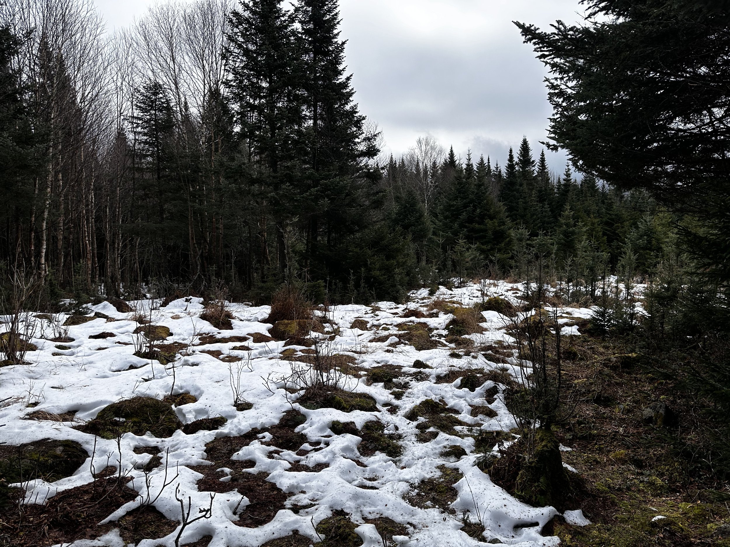
Nearing the summit of Bunnell Mountain
Following 1-2 day old moose prints, I began north, soon switching to a northeastwardly approach, but soon began running into Bunnell Mountain’s western sub-peak; whether on an old woods corridor or in trailless woods, the travel was overall very enjoyable, minimal blowdown - which could always be easily navigated around - very reminiscent of a birch glade before the canopy grew tighter, but never oppressively tight, it was always easy to look ahead and pick a route of least resistance upslope.
As I began hooking counterclockwise around the western peak, working myself toward the col, I was whisked away to the Hubbard Brook Experimental Forest, where I performed a similar task through nearly identical mossy, spruce woods as the day when I side-hilled around Mount Cushman enroute to Green Mountain. Occasionally stepping over fallen, rotten logs brought me to a pattern which I recognized to be two sets of tracks - I had meandered onto another ancient woods road, this one was hardly discernable, but nonetheless, still a clear corridor slicing through the mountainside.

High moose activity about the summit area
Upon reaching the col, I found myself in a beautiful open meadow of birch and fir, if not for being stuck in a low-hanging cloud, there may have been stunning views from this vantage. As the moose tracks continued zig zagging all over the hillside, I picked what appeared to be a slim corridor and followed it upslope, however, travel would have been just as pleasant without a herd path of any sort.
Continuing toward the high point, what I had been following soon grew narrow, more moose herd paths - these fellas must cover every square-foot of this mountain during the course of their day. Up to this point I had been following animal tracks which had clearly been through several freeze-thaw cycles, however, the prints I now found underfoot were clearly made only this morning; a large set of hooves roamed aside a tiny set of prints - whose creator was so small they struggled to push through the melting snow!
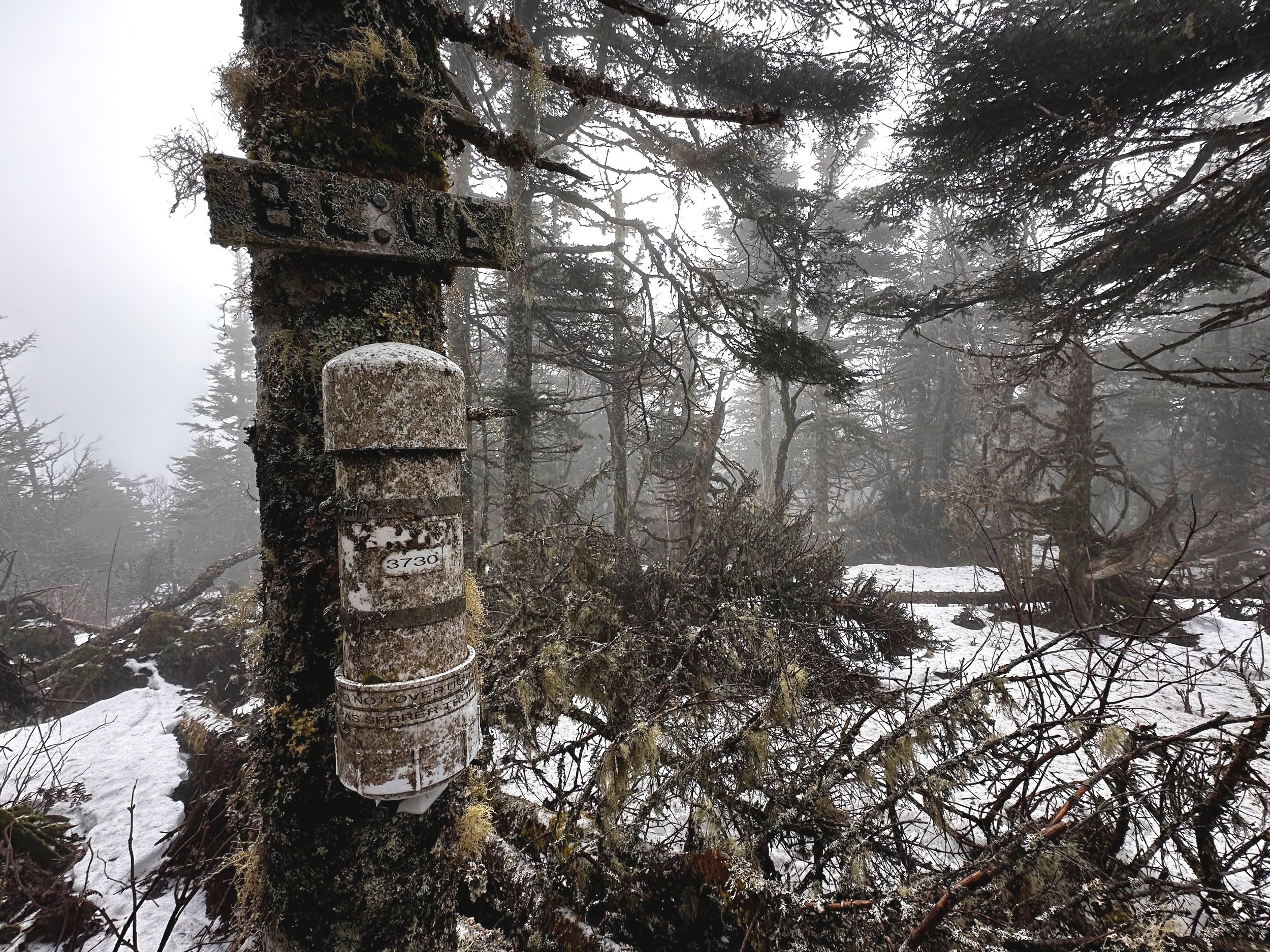
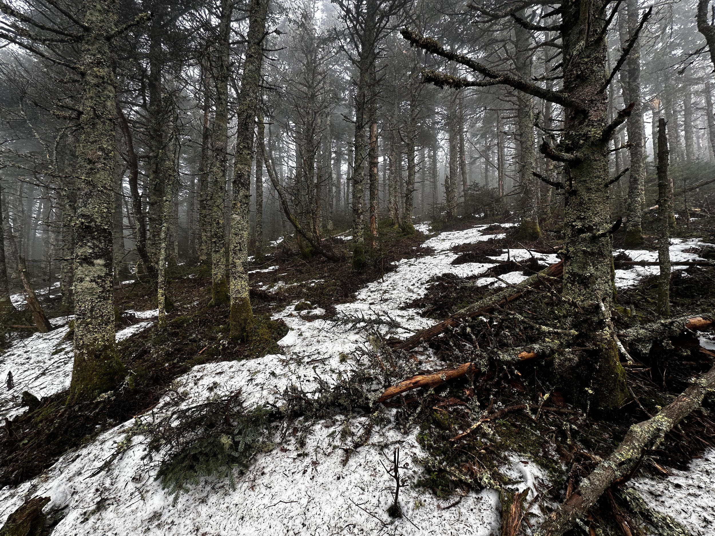
Bunnell Mountain summit
Now on ultra-high alert, I knew a jingling bear bell would only bring awareness to wildlife, it would definitely not deter them from approaching this smelly hiker. Knowing the recognized high point was just up through a few sets of scrappy conifers, I pushed uphill harder as cold water droplets fell from boughs and onto my base layer. Knowing I had a full change of clothes tucked in my pack, I had the open summit area in mind next, where I could switch into more appropriate clothing for the downslope push, back through the softwood boughs.
Once standing at the high point of Bunnell Mountain, I signed into the summit register notebook, laughing suspiciously to myself at the sight of moose hooves directly under the summit canister!
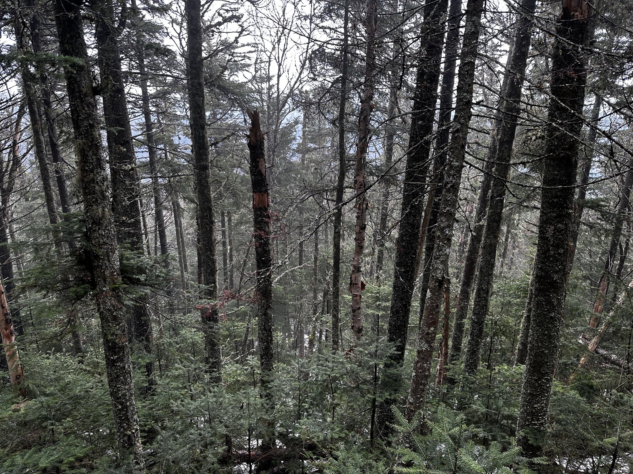
Dense fir to begin the descent
Over several sips of warm tea, I pondered my next steps; with daytime temperatures lingering around 41°, I had concluded that the snowpack had become too soggy and soft for my preference. Content on having visited the highest point in New Hampshire to be found outside of the White Mountains, I spied a new route - I was in the market for quick and efficient, and my ascending route was anything but that!
With Gore Tex shell to shed falling water droplets, I pushed, twirled and swam my way through a brief patch of dense spruce twigs. Eventually, this technique brought me steeply downslope, to a patch of pencil-straight spruce. Devoid of lower branches, I could bob and weave a path through the tidy maze of tree trunks. The snowpack dwindled to six-inches; while I was still happy to have the wider foot print of snowshoes on my boots, I neared the beaver activity along the old woods road, small twigs and sticks snagged on snowshoes, making for one wacky, off-kilter dance - the likes of which this forest yet to witness.

Stunning spruce-fir blend
Once back on the woods road, I played out in my mind what my day might look like had I ventured onward, toward Gore Mountain. With more than a mile of bushwhacking through Gore Notch, and on toward the high point, I suspected for an extra two hours of off-trail roaming, I could have included this additional peak. Although, when I come back to visit Gore Mountain, I can simply follow miles of logging roads directly into Gore Notch - or by viewing satellite imagery, old switch-backing corridors begin to present themselves as streaks of illumination in the otherwise dark green evergreen boughs - one of which meanders nearly directly to the high point of Gore Mountain.
Waterlogged old roadway
As I trail ran several final miles of old logging road in mountaineering boots, I watched a wall of blue-grey clouds blow in from the west; any glimpse of former blue sky had come to a close as the atmosphere prepares to unleash several more inches of rain, further destroying any semblance of winter in the northeast.
Overall stats for the day:
10.09-miles
4hr 12 minutes
2,569’ elevation gain
Bunnell (Blue) Mountain - 3,724’
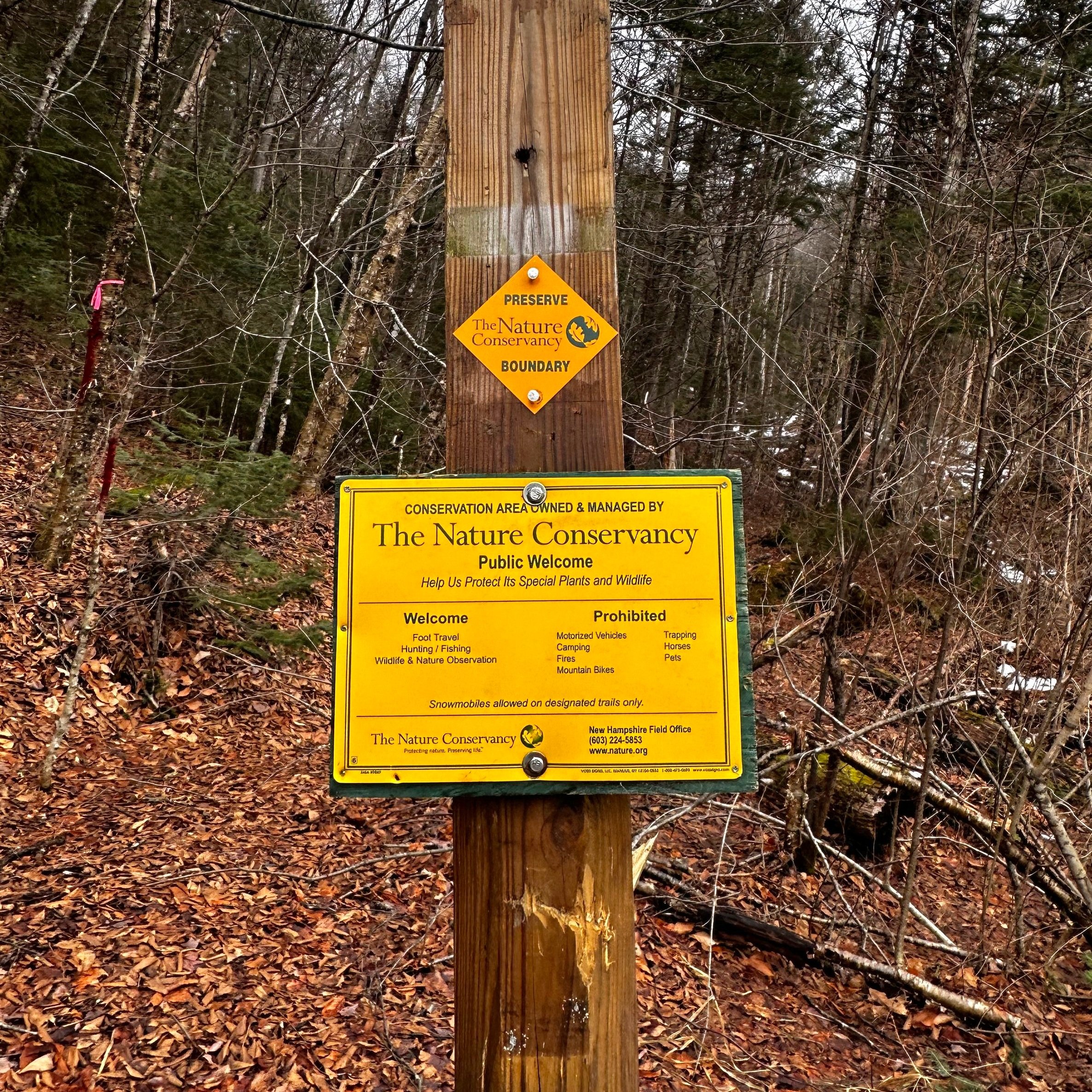
Entering Nature Conservancy preserve land