
Piermont Mtn (north ridge whack)
As the night temperatures dropped, also does the hardwood canopy from the ridgecrest beyond Lake Katherine; day after day, as I would drive that section of US Route 25C, I would gaze secretively into the low-angle mountainside as it rolled along, eventually meeting exposed blocks of bedrock, which adorn the highest reaches of Piermont Mountain.

Piermont Mtn’s northern ridge over Lake Katherine
Fast-forward several months; Lakes Tarleton, Armington, and Katherine are all frozen over; a bit of snow was dropped on the Middle Connecticut River mountains (and the entire northeast) yesterday, and though this ceremonious trek would be a perfect opportunity to snowshoe bushwhack that northern ridge that I had spied for so long. Today, a welcoming blanket of white smoothed any irregularities in the forest floor, as a dense coating of fondant covers cake. Even with a cloud ceiling hovering around 2,500’, there would be plenty of unobstructed hiking to be had along this ridgeline.

Following old logging roads early into the bushwhack
Knowing that I wanted to park neither at the Walt Whitman nor Kingswood Camp areas (both camps have trails to Piermont’s summit: Walt Whitman has the marked and maintained Private Ritchie Green Trail which departs their campus; while a flagged, yet unofficial trail departs Kingswood’s ball fields, roadside southward), I brainstormed my remaining options: occupy one of several roadside pull-offs (likely not yet plowed), or pull into the Lake Tarleton State Park public beach lot, which is generally plowed in winter for the two horses which are stabled here.
With a snow shovel in my backseat, I was ready to dig out both an entranceway and a parking spot, if need be. Once backed into a spot I deemed out of anyone’s way, I stepped into snowshoes (still the broken pair for the time being), and immediately hit knee-deep powder alongside US Rt 25C.

Dark grey clouds churned overhead, a bewildering amount of wind was tearing through scrappy birch and pine, opportunists working to take back over the old Tarleton Club grounds. Studying the looming mountainside as I circumnavigated Lake Katherine for 0.4-miles, reaching the unfrozen, wide, grassy drainage area, I was thankful that any high water had drained, and a snowpack of 12-14” here covered any pesky wetlands. The first waterway was narrow, a simple step-over; about a rod beyond, a second crossing about 4’-wide was crossed with the aid of a stone emerging from the murky drainage - once on the ridgeway proper, I saw no other significant water crossings.

Open hardwoods along the northern ridge
Attempting to bushwhack directly up the ridgeline, I was ready to navigate around any obstacles, such as blowdown, yet I only encountered a handful of downed trees on my route: a stiffened spruce frozen in time, a toppled yellow birch whose upper canopy splayed out like a leaning tear drop, one felled fir here or there - overall, any obstacles or debris on the forest floor could be easily meandered around. The northern ridgeway of Piermont Mountain was just what I had hoped for - pleasant, easy strolling through regrowth hardwood.
As this area had been subject to enormous swaths of timber cutting, it is not hard to observe old logging corridors in these woods, some more overgrown, and filled with blowdown than others. As I am always on the prowl for old trails, primarily those originating from the Lake Tarleton Club, given the extensive logging in this area, the old corridors may have been completely annihilated - but also, possibly not - the search continues.
Flagging for the unofficial trail
Passing directly over a low mound, marked 1,588’, I continued directly onto the ridgecrest proper as the terrain now pitched in elevation. Leaning into the snowshoe crampons, I could feel them find purchase on occasional ice flumes which remained well-hidden beneath the deep snowpack.
Before setting out on a bushwhack of the northern ridgeway, I studied topographic maps of all ages. For this trek, however, the most important map analyzed was a good source of global imagery. For this, I consult multiple sources, oftentimes differing details or certain aspects will be visible on one set and not another. Shaded Relief style maps are inherently important as well, these tend to erase any vegetation, only displaying bedrock and similar semi-permanent features.

Tarleton and Armington Lakes from an overgrown lookout
As one continues climbing the northern ridgeline (similar to the southern ridgeline), angled masses of bedrock jut out from nearby flatter stretches - almost appearing to be an old trail corridor, whether foot or vehicular traffic. Many massive, old birch examples can be found higher along the ridgecrest; several areas have patches of uniform trunks, a pencil-like kind of forest, these somewhat denser areas of forest are spread around, and do not tend to last long. Several stately firs can be found higher along Piermont Mountain as well.
It was obvious to discern the hobblebush stems protruding from the snowy hillside; what did not emerge from the snowpack, and I recall the understory being clogged with, in summer months, are hip-height fronds of ferns; several warmer bushwhacks have been plagued with mounds of ferns. Today, however, the traipsing was more-or-less smooth sailing when the hobblebush proved tame.

Passing a smaller row of rocky outcroppings
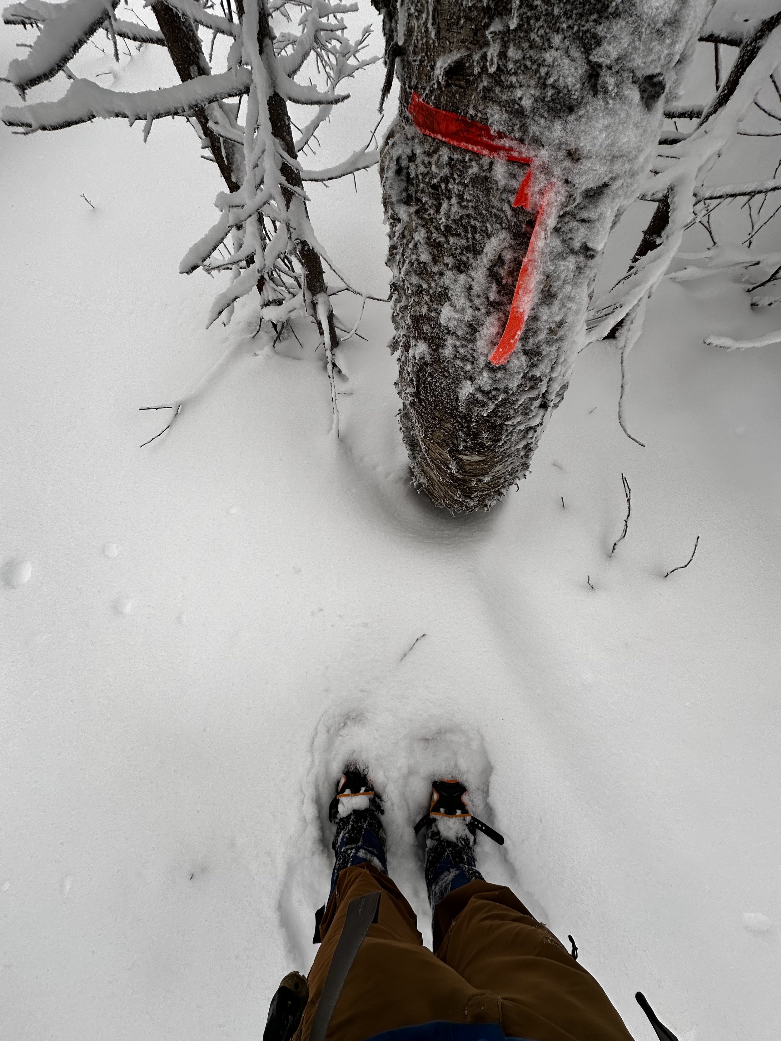
Tracking alongside a long, slanted section of exposed bedrock, I noted one area where a block of rock had fractured off, resulting in a rather deep cave set into the craggy mountainside. As the trailless ridge grew even steeper still, I picked a route between two angled boulders and hoisted myself toward a flat landing - just ahead was a pink ribbon. Knowing that the White Mountain National Forest had used orange for their recent re-blaze and re-cut of their boundary swath, I knew this to be the unofficial Kingswood trail.
Following pink ribbons for several rods, I quickly grew frustrated at how badly the flagging did not seem to correspond to the terrain I was now traversing. As quickly as I had found the unofficial trail corridor, I said goodbye, opting to simply head in the direction I knew the summit to be. Sometimes our own natural instinct makes more sense than routes we try to follow; perhaps winter is not the best season to attempt this flagged route, it has been found to be pleasant (albeit steep and rugged in its mid-section) in warmer months.

Hanging around in the 2,700’ cloud ceiling atop Piermont Mtn
Reading the mountainside brought such great enjoyment to this bushwhack, perhaps due to such an airy forestscape, one can see far up the hillside, affording much time to determine a proposed route up each next pitch. Noticing the irregular hillside and how flat the area had become, I knew I had drifted too far west while bobbing and weaving around medium-sized fir. With a quick push southeastwardly, I discovered faded yellow flagging in an old fir, more blazing from the unofficial trail.
With the open air of the summit visible not far up ahead, I simply stepped on top of, or over any downed timber; six-inches of snow now covered the bare rock slab which leads up the back of the summit area, the sound of metal on bare rock was enough to know the summit top was free of ice. Having been atop this summit in all seasons and nearly all times of the day (or night), I stood long enough to watch the dark grey, tumultuous clouds roll over the northern shoulder of Piermont Mountain, effectively blocking out much of Lake Tarleton, and the mighty mountains beyond.
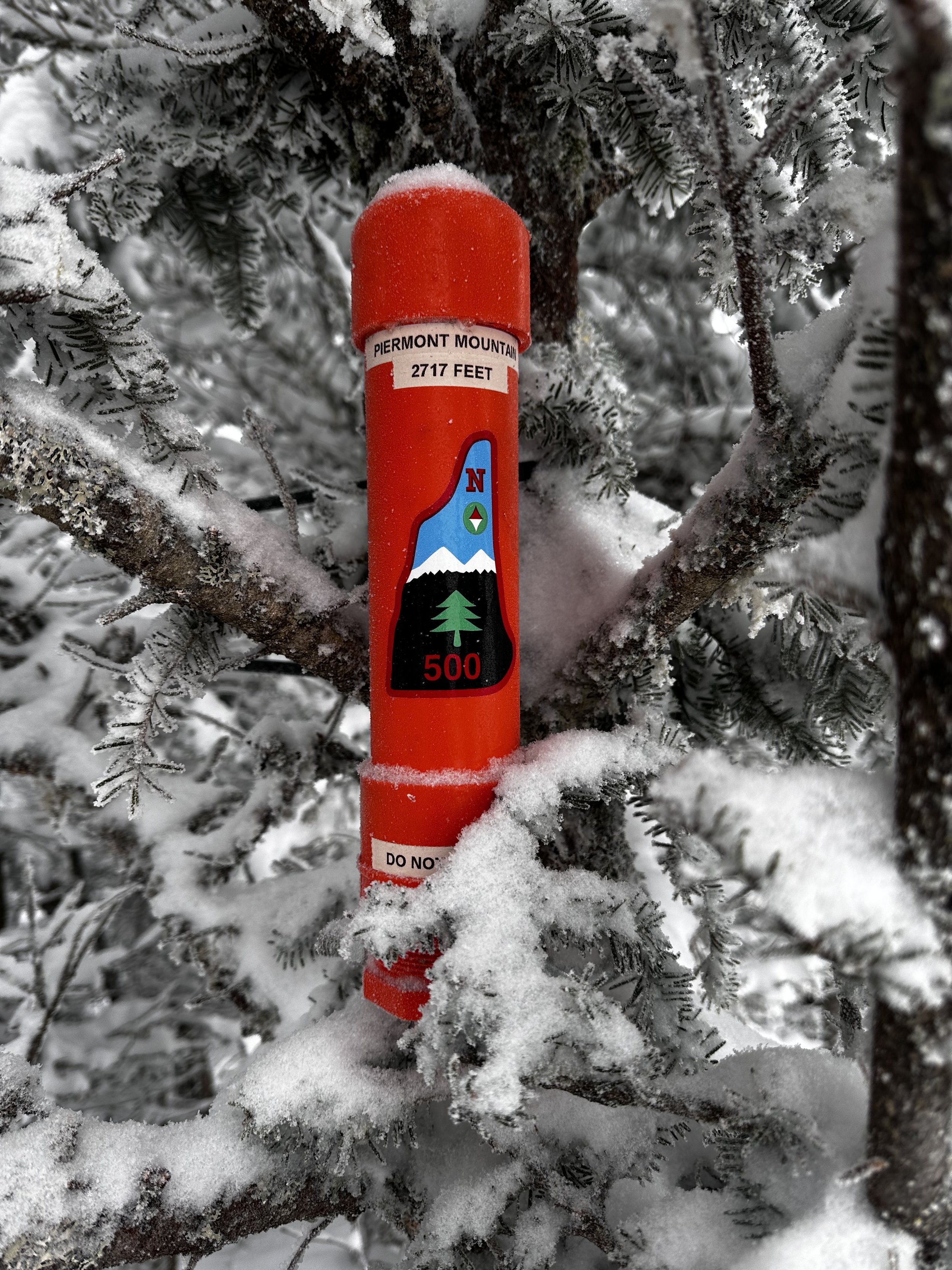
Piermont Mountain summit
Turning from the vast panorama, the bright orange summit register was plain to see - unfortunately, not even in the cluster of trees which are likely the highest of the mountain. Although the cap was free to rotate (most had been frozen onto the main PVC piece lately due to driving rain and gusting winds), I opted to save the sign-in for another day, as Piermont Mountain is a favorite place to explore both on-trail or off.
Overall stats for the day:
5.90-miles
3hr 30 minutes
1,703’ elevation gain
Piermont Mountain - 2,717’