
Currier Hill + Ames Mountain
For well over three years, I had been trying to locate myself on the summit of these two New Hampshire 500-Highest neighboring peaks; without any real attempts on the mountains, my lackadaisical efforts were confined to simply consulting various maps, hoping that, perhaps their concentric contour lines held the answer. Alas, each time I drove Route 25C along their bases, I wished I could look at those mounds of low mountains and have a date for our timely meeting.

Departing the Carr Mountain Trailhead
Having just bushwhacked the northern ridgecrest of Piermont Mountain only yesterday, I could feel tired legs grow heavy when asked if I would care to join for a sunrise snowshoe bushwhack of the pair of peaks. Heck yeah, this was just the opportunity I had unintentionally been waiting for! Generally, when I join Mr. Gothberg for a morning mountain run, it is with grippy trail running shoes and a pack - stuffed as light as possible, while still containing all the bushwhacking essentials.
Knowing that we have an unconsolidated 10-14” in the backcountry, we would certainly be wearing waterproof gear. Arriving first to the western terminus of the Carr Mountain trailhead, I slipped back into mountaineering boots for maximum warmth and protection from any soggy water crossings. All prior research had been spent staring at the old ATV trail which runs east, from Eastside Road - how nice it felt to be parked at an official WMNF trailhead, and not have to worry throughout the trek whether my car was safe from being towed.

Chris climbing steep before sunrise
Arriving merely seconds after I backed in, we carried snowshoes for the final 0.2-mile snowy road walk; the WMNF trailhead was freshly plowed since the dumping of snow two days ago, but I had brought along a shovel in case we needed to clear out several parking spots.
A private residence is located at the end of Clifford Brook Road, parking can be found 0.2-miles back, at the signed White Mountain National Forest trailhead. A small hiker sign directs foot traffic up and over a snowbank, which spills into a wide open, snow-covered field area. Old logging roads begin upslope as we passed several piles of logs and various organic matter. As the Carr Mountain Trail proceeds straight ahead, into the woods, we turned right, to slab up the Clifford Hill (1,392’) ridge which spills out of Carr Mountain (3,453’).

Currier Hill from near Clifford Hill
As any suggestion of daylight had yet to illuminate the mountainous horizon line, we pushed on toward our main objective, with sunrise heavy on our minds. Dropping off from Clifford Hill, we could spot various old trail corridors, which could have passed as simply overgrown logging roads out here in the trailless woods. The woods began tightening around with encroaching young beech saplings as we descended into the ravine/drainage feature between Clifford Hill and Currier Hill. Several narrow streams (tributaries to Martins Brook) were stepped over while navigating nearly due south.
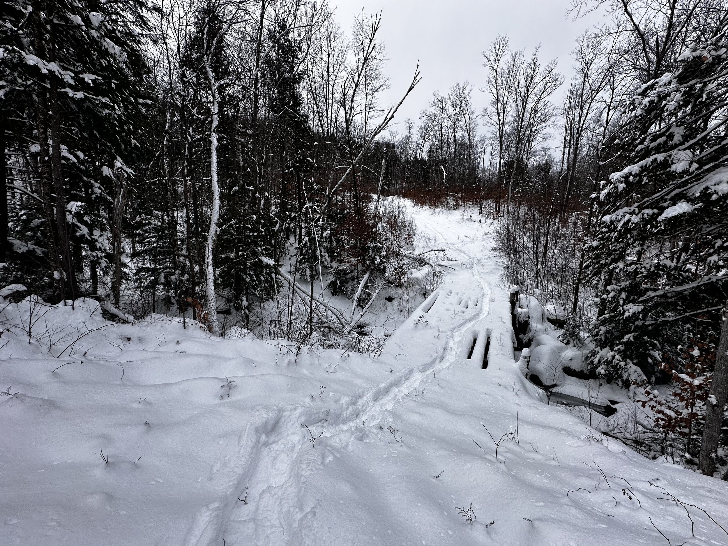
Bridged crossing of Martins Brook
Hanging onto the 1,150’ elevation contour, we soon entered a relatively recent logged patch, which was regrowing into a sea of pink stalks - berry thickets! Trying to protect clothing and eyes, we worked to “swim” through the fine mess of pokey vegetation; until, in the dim morning light, we could both recognize a bright white swath of something through the forest - a logging road, as Chris recalled. We veered straight at it to escape the brambles and thickets of recent logging regrowth.
An old log bridge spanned a water crossing; in spite of the log bridge being covered with 10” of powder, we surmised a snowshoe could fit between the oddly spaced logs, had one of us stepped haphazardly. Glancing up at the harrowingly steep skidder road, I kicked snowshoe steps into the snowy roadway with Chris following not far behind. A 960’ ascent stood between the summit canister salsa jar and our current location. A frosty Moosilauke rose up behind our shoulders, such an interesting vantage from where we climbed.

Wooded summit of Currier Hill
Switching for woods travel when we noticed the wide logging road veer more eastwardly than desired, we encountered a beautiful conifer cap for the remaining ascent, even the grade tapered to sections of moderately steep, bookended with gentle strolls through lovely boreal forest. Some large trunks lay toppled beneath the blanket of deep snow, necessitating either a brief reroute around, or a step over. As the mountainside mellowed, we encountered the domed summit area of Currier Hill; with several spins around what we deemed the high point, a bright band of neon orange duct tape was spotted.

Chris eyeing Fletcher + Tenney Mountains through the notch
Satisfied with having stood atop Currier Hill, and without signing into the register, we pressed on toward our furthest, and final destination of the morning. Working to avoid any steep cliff bands, we first swung eastward briefly before swinging more southwardly. Through a small, stunning grove of red pine we trekked, Chris taking several opportunities to capture a slim window of a restricted view toward Tenney Mountain - from here, it was even possible to watch the windmill turbines spin.
Down a rather steep, ledgy area, we scrambled over, or around snowy, broken boulders and ledges. All the while we could look ahead and spot our next destination, another low dome of mountain, this one called Ames.

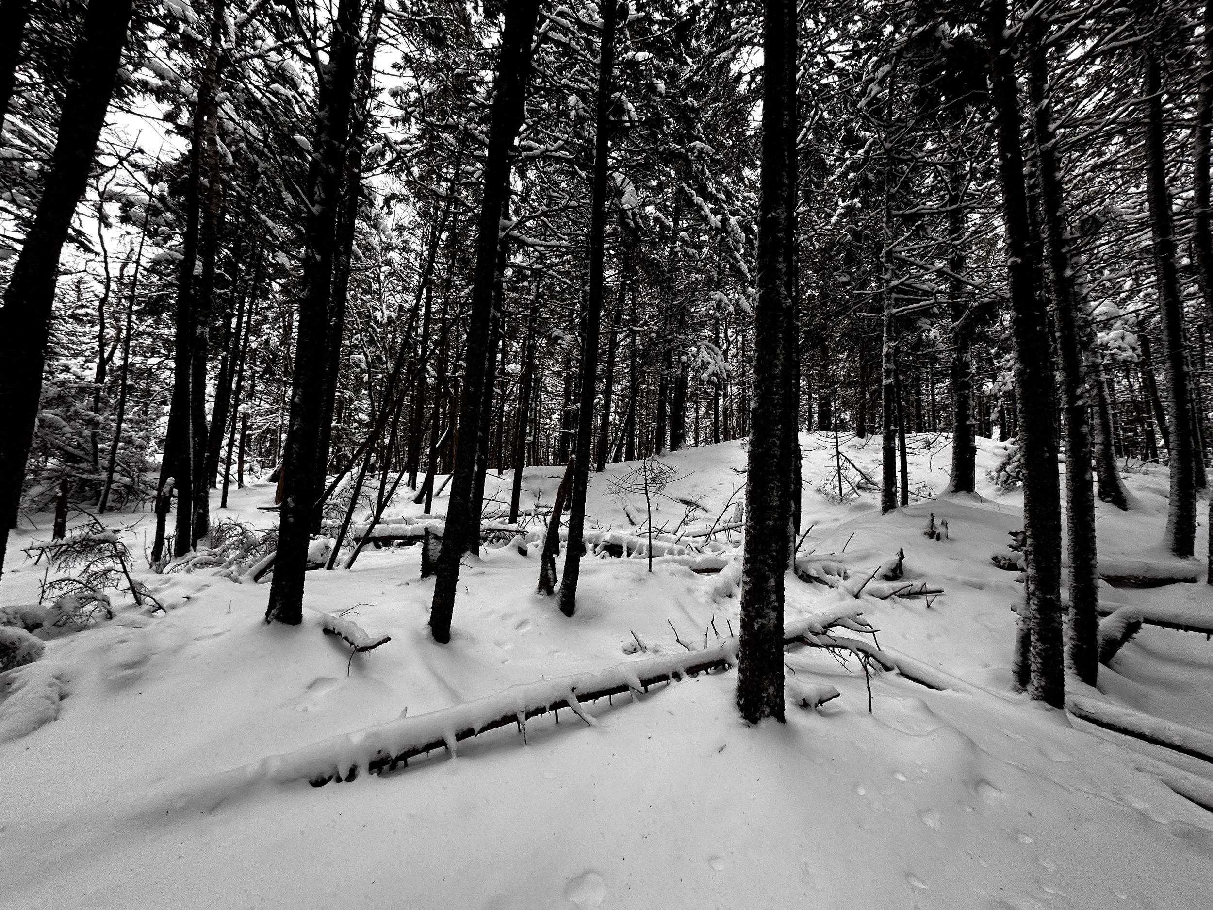
Traversing the high bog
Reaching the base of Currier Hill, we were astonished at what we presumed to be a wetland area; bog myrtle with acres of mosses formed the understory while we traipsed through a fine spruce-fir canopy. Commending ourselves for trekking through the bogland at just the appropriate time, it did not take long for the snow beneath a footstep to become visually waterlogged - thankfully, we never encountered standing water or any adverse conditions through here, just a picturesque forest to roam.
At the southern end of the boggy wetland area, we began ascending, however, with not nearly the pitch of Currier Hill’s northern aspect. Following the chute of a fisher cat as it slid along the mountainscape, I remarked how the little creatures are great wayfinders, often employing the path of least resistance, as I similarly tend to do off-trail.
Open spruce of Ames Mountain
Finding ourselves in a stunning summit cap of spruce, we stepped onto the diagonal-running summit ridge. Cresting up and over, we began side-hilling the precipitously steep southeast face of Ames Mountain, Chris on the prowl for ledges he had spotted during recon, and hoping they might offer unique vistas and perspectives. Dropping down to ~1,860’, we found what we came for, or at least Chris may have, I’d track down my summit soon enough. Some residual pink continued to illuminate cloud bottoms, a meager taste of the brilliant sunrise color that was missed while ascending through dense softwoods of Currier Hill.

Chris, living the ledge-life, always looking for secret vistas
Once the furthest location of the trek was reached, I worked my way back toward the summit ridge while checking for western lookouts. A much easier ascent greeted us onto the summit ridgeway, deciding if we simply walk the peak of the ridgecrest, we would no doubt stand atop this mountain after all. Before heading toward what we deemed to be “higher” land, an old road corridor was crossed, which appeared to terminate at a south-facing lookout, similar to what can be found atop Stinson Mountain as well.
Swinging around the second or third possible high point, I could see spruce branches lobbed off before even turning the corner - this trimmed tree with upper boughs still intact protected the Tostitos salsa summit canister. In a similar fashion to how we summited Currier Hill, we said thanks to whomever had strung up these old jars, and promptly moved on.

Ames Mountain summit
From the recognized high point of Ames Mountain, it was not hard to locate our ascending snowshoe tracks, actually laughable at how near to the true summit we had been while heading to find ledges and vistas. Both Currier Hill and Ames appear to be fine examples of past glacial activity in this area; both peaks feature glacially plucked boulders and minute boulderfields adorning their southern slopes. For as much as the other, taller, more mighty mountains tower above these two bumps on the landscape, both mountains are similar, yet unique in forest composition and certain mountainous features - another great climb!

Carr Mountain to our west
Once back on ascending snowshoe tracks, we cut off any wasted steps and bee-lined back through the boggy col between Currier Hill and Ames Mountain. A steep, rocky scramble brought us back to the summit ridge of Currier Hill, where we found red blazes of the White Mountain National Forest boundary swath. With no need to re-visit this summit, we followed a lesser elevation contour counterclockwise, until converging with our older track.

Moosilauke from a unique vantage
Emerging back onto the old logging road corridor, this steepest section surprisingly afforded adequate traction to safely descend to the old log bridge. Testing out a new route, we tried to avoid the beech saplings and berry thickets on the reverse, this worked somewhat - at least it seems I returned home with no additional tatters in hiking clothing. While Chris and I enjoyed a varied route, with a longer approach than perhaps other ascensionists may have attempted, we enjoyed roaming and visiting stunted and scrappy oaks, high elevation red pine patches, and lofty spruce-fir forests of the Carr Mountain area.
Overall stats for the day:
6.82-miles
4hr 51 minutes
2,756’ elevation gain
Currier Hill - 1,958’
Ames Mountain - 2,060’