
Owl’s Head
With no fewer than four Owl’s Head mountains within the state of New Hampshire, most who hike the New Hampshire 4000-footers have come to know and (often times dislike) this peak as the dreaded longest hike of the 48 high peaks.
With no officially maintained trail to its 4,025’ summit, Owl’s Head has seen its share of approaches from all directions; up until the early 1970’s, Owl’s Head is said to have been summited in a single day by “strong trampers”. Upon departing the Green Leaf Hut, climbers would descend to the east, down the steep Lincoln Slide, losing approximately 1,800’ to cross Lincoln Brook and then ascend the trailless peak by bushwhacking - heading directly for a stand of virgin timber near the summit of Owl’s Head - the AMC suggested 9-hours for the round trip.
Several alternate ascent options were listed in the 1940 AMC Mountain Guidebook, by way of the new Franconia Brook Trail to the east, or Lincoln Brook Trail on the west of the mountain.
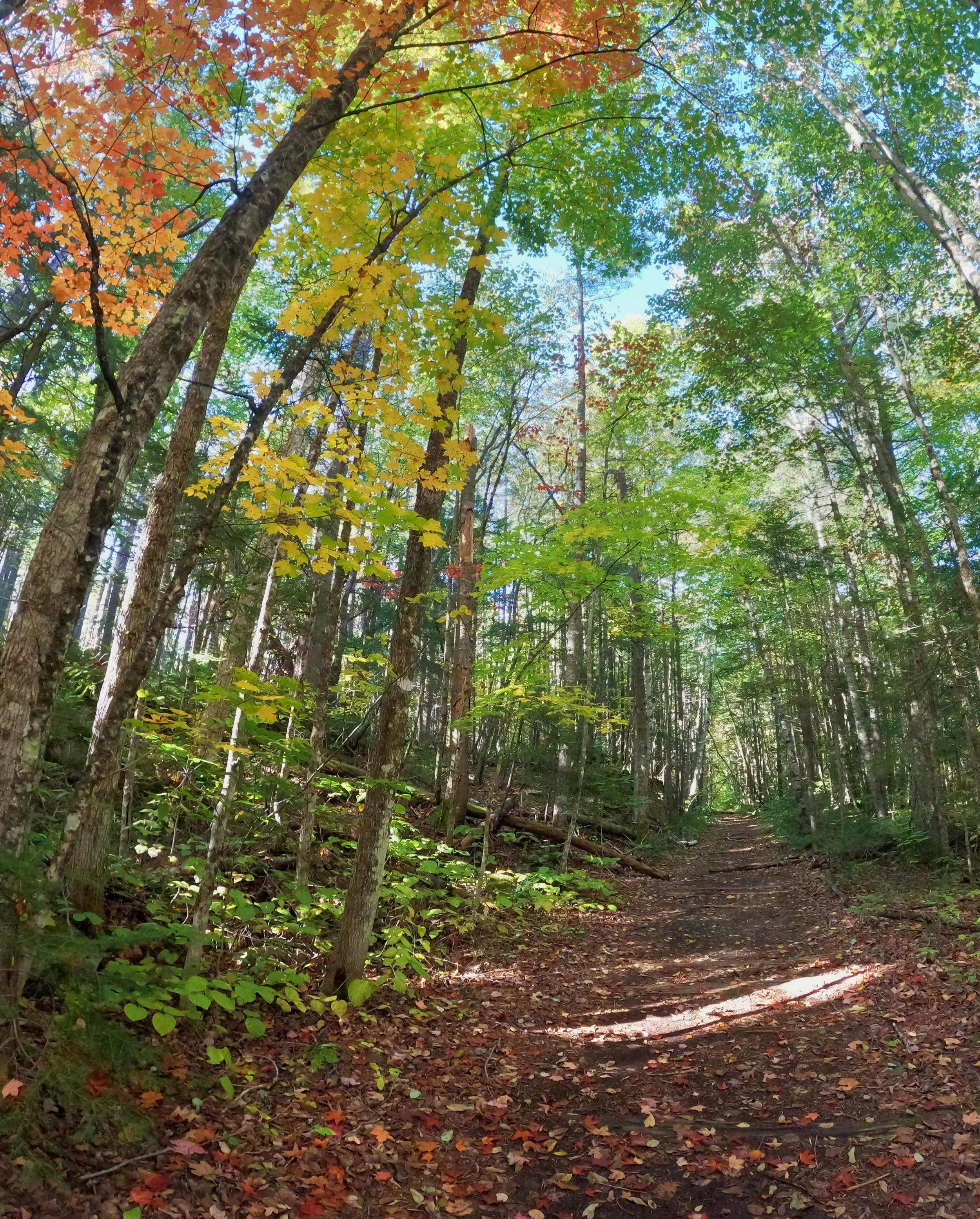
Lincoln Woods Trail in Autumn
Both of these newer routes departed the Wilderness Trail (later renamed our familiar Lincoln Woods Trail in 1992 by the USFS), which made use of abandoned Parker-Young logging railroad beds. For several years these two trails encircled Owl’s Head but plans were soon in place to extend the Franconia Brook Trail the extra 2-miles from Thirteen Falls to join with the Garfield Ridge Trail to the north.
These trails both utilized retired logging railroad and gentle woods road grades, the AMC oftentimes set up shelters and designated camping areas at the old logging camps.
Eventually, in the early 1980’s a small parking lot with an information booth could be found at the old logging Camp 4 site, the present day Lincoln Woods Trailhead and Forest Service Visitor Center now occupies this land.
While hikers trek all sorts of routes to gain the Owl’s Head summit ridge - such as descending the Garfield Ridge Trail (northeast) or Twin Brook Trail (northwest) - I greatly enjoy a “standard route” through Lincoln Woods and find myself making repeat adventures along the same approach to the wooded wilderness mountain.

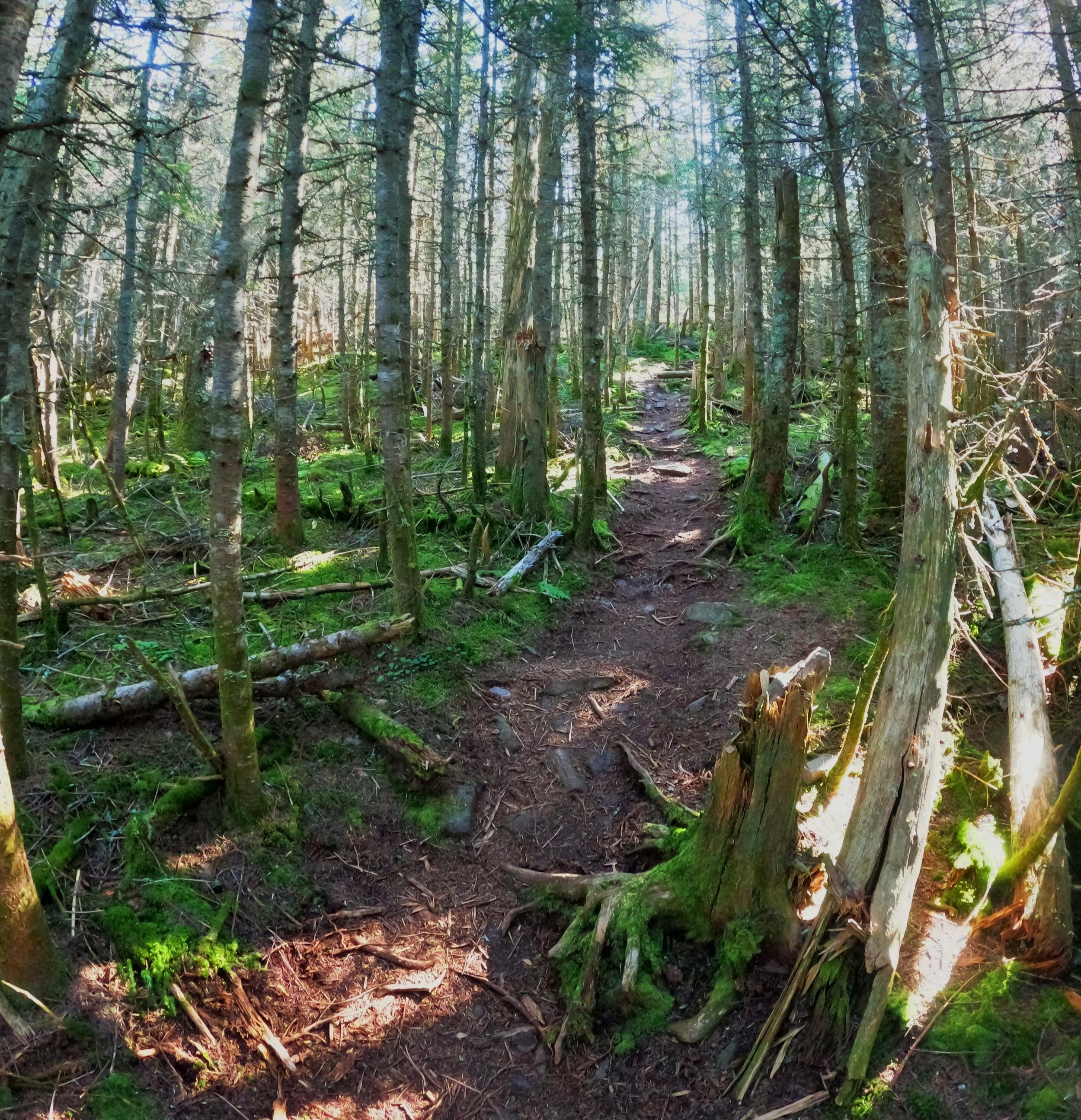
Soft paths along Lincoln Brook Trail
Almost immediately upon departing the 170-car capacity Lincoln Woods Trailhead (which conveniently has 24-hour restrooms in most seasons), a 160’ suspension bridge guides hikers across the East Branch Pemigewasset River to follow the path northerly along the west side of the river.
At 1.4-miles into the approach, the 1983 Osseo Trail reroute departs on the left to bring hikers up to Mount Flume (4,328’) and other points along the Franconia Ridge Trail.
Reaching 2.6-miles along the old East Branch and Lincoln railroad grade, the Black Pond Trail also diverges left. This old railroad siding terminates at Black Pond, which has a great view toward the Owl’s Head Cliffs from the pond’s outlet and up to the Bonds, once standing pond-side. In 1978, three “temporary research” tent sites were marked on a hillside southwest of the pond, but by 1983 these had been removed and camping no longer permitted at the pond.
Interestingly, the AMC Mountain Guide, after recommending in 1979, bushwhacking by way of old logging roads and angler paths along the western shore, avoiding three crossings of Franconia Brook in times of high water; they later advertised in 1987, bushwhacking from the northern terminus of the Black Pond Trail on a northerly trajectory until meeting up with the Lincoln Brook Trail.

Cairns marking the start of the slide path
While not a marked or maintained trail, this bushwhack has become synonymous with hiking Owl’s Head mountain in winter. Having taken the Black Pond bushwhack several times, it has shown to be a rather easy trail to navigate, occasionally narrow herd paths diverge but overall its pretty straight forward of a northerly path.
In times of warm weather, however, I do enjoy taking the standard route out to the Franconia Brook Trail, which departs the Lincoln Woods Trail at 2.9-miles and proceeds on a beautiful corridor through the forest, more gentle grades of old logging roads continuing onto the Lincoln Brook Trail. Plus, nothing beats the sights and sounds of rushing water underfoot while crossing Franconia Brook!
Prior to beginning the northwesterly swing around Owl’s Head, the Lincoln Brook Trail crosses Lincoln Brook and meets up with the bushwhack terminus near a stealth campsite, I haven’t found this listed as an “official” camping location but have found hammocks hung and tents set up on multiple occasions.
The path continues through a lovely hardwood forest (still with a view up to Owl’s Head Cliffs on the hikers right), along a gentle grade as it traces along the western edge of Lincoln Brook, crossing Liberty Brook and several other minor tributaries and waterways enroute to the final Lincoln Brook crossing at 7.4-miles from the trailhead.

Ascending the slide route
Here, the Lincoln Brook Trail traces the brook this time on the eastern side, with the slopes of Owl’s Head closing in on the right. Shortly after crossing, what looks like an old logging road or herd path is actually the Brutus bushwhack, a winter or wet-weather alternative to the traditional western-facing slide climb up the mountain, both of which can be found on most maps these days.
The slide trail was marked with paint and cairns in the early 1960’s, the latter of which can still be found marking the path. Anytime I had ascended via the slide I have found the base of the path clearly marked by two moderate-sized rock cairns (path down the center and quickly joining the slide), but the AMC Mountain Guide does advise that, since this is technically an “unmaintained trail”, these are illegal rock cairns and not too be relied on.
The slide itself is an exciting climb - employing all limbs - in dry weather, with excellent views out to a lesser-seen side of Franconia Ridge and the massive slide scarring the eastern side of Mount’s Lincoln and Truman, the climb switchbacks several times ascending angular ledgy areas before climbing steeply through a section which nature is working to reclaim.
Enroute to the 4,025’ summit
At about 0.3-miles into the slide climb, the Brutus bushwhack path emerges from the contour on the right and both trails ascend the final 0.6-miles through lush, moss-carpeted fir and spruce forest to the proper Owl’s Head summit at 4,025’.
In 1987 (prior to the establishment of the Brutus bushwhack to the south), the AMC suggested that hikers who find climbing the “slide unappealing may be able to bushwhack up or down the steep slope to the north, parallel to the slide, through mostly open woods.”, although I have never heard of this route being taken on in recent times, it does sound intriguing.
Nearing the high point of the north-south ridge, the trail rolls along, passing the once accepted high point, until an even higher place was located and recognized in 2016, slightly further to the north; the trail now continues on to this location which is marked by a rock cairn after the mountain spent much of its life having any proper signage stolen.

Cairn atop Owls Head; 4,025’
This summit area makes for a good snack or lunch spot before beginning the reverse trek back down and through the Pemigewasset Wilderness, occasionally decent easterly views can be obtained - on one occasion I was greeted with a lovely and unexpected sunrise over the nearby Bonds.
Knowing this is a long trek through the forest I just try to remain present and enjoy the numerous forest styles one hikes through, checking off progress one stream crossing at a time - if needed. It is truly a beautiful land out here and a good break from the sights and sounds of modern day society, a trek into by-gone days when time slows down and life becomes simpler, merely walking with the old forest and absorbing the never-ending trickle of water flowing all around the valleys.
Happy Climbing!
Overall stats for the day:
15.73-miles (w/ winter bushwhacks)
7hr 38minutes
3,802’ elevation gain
Owl’s Head - 4,025’