
Kearsarge North (Trail)
With an early start and fingers crossed trail conditions would be as favorable as the day prior on Mount Cube, gear was packed and before long we were off for a morning jaunt up Kearsarge North, near North Conway, NH. Cringing all the while, Alanna and I shot nervous glances back and forth as we watched the sun rise and temperature creep up to a balmy 57° at the trailhead - not your typical February hiking!
To our surprise, the trails remained solid throughout the hike, finding Hillsound spikes completely satisfactory and happy for the extra traction on the steep descent as the trail swings off the summit cone. Trails were well packed from snowshoers since the last snowfall - this is a very popular and easily accessible trail, after all.

Departing the trailhead
Not to be confused with the other Kearsarge a bit southwesterly in the state of New Hampshire, located in Winslow and Rollins State Parks. Both summits feature fire towers atop, while both hikes are equally lovely places to explore for several hours, today we went trekking a familiar route up to the 3,268’ summit of Kearsarge North.
As early as 1784, this mountain appeared as “Kearsarge” on maps but was simultaneously known as “Pequawket”; which was, “the name of a famous tribe of Indian who once inhabited the intervales of Conway and Fryeburg.”, according to the 1960 AMC Mountain Guide.
They also explained in the Mountain Guides, “in 1915 the US Board of Geographical Names adopted the name Pequawket for this mountain and Kearsarge for the one in Merrimack County. In 1957, however, the Board reversed this decision and the mountain is now officially named Kearsarge North.”
Kearsarge North Trail
The Kearsarge Trail took a break from this name in the guide book and briefly, from the 1946 until 1972 edition was known as the Pequawket Trail; prior to this brief switch, the trail was listed as the Kearsarge Trail, while following ‘72, it became the Kearsarge North Trail.
The trailhead begins along the northern side of Hurricane Mountain Road, about 1.5-miles east of NH 302 in Intervale. The parking lot fits about 6-8 cars, and while it was tremendously icy, the lot was plowed. Upon returning from our hike around noon, cars had begun lining the northern side of the road.
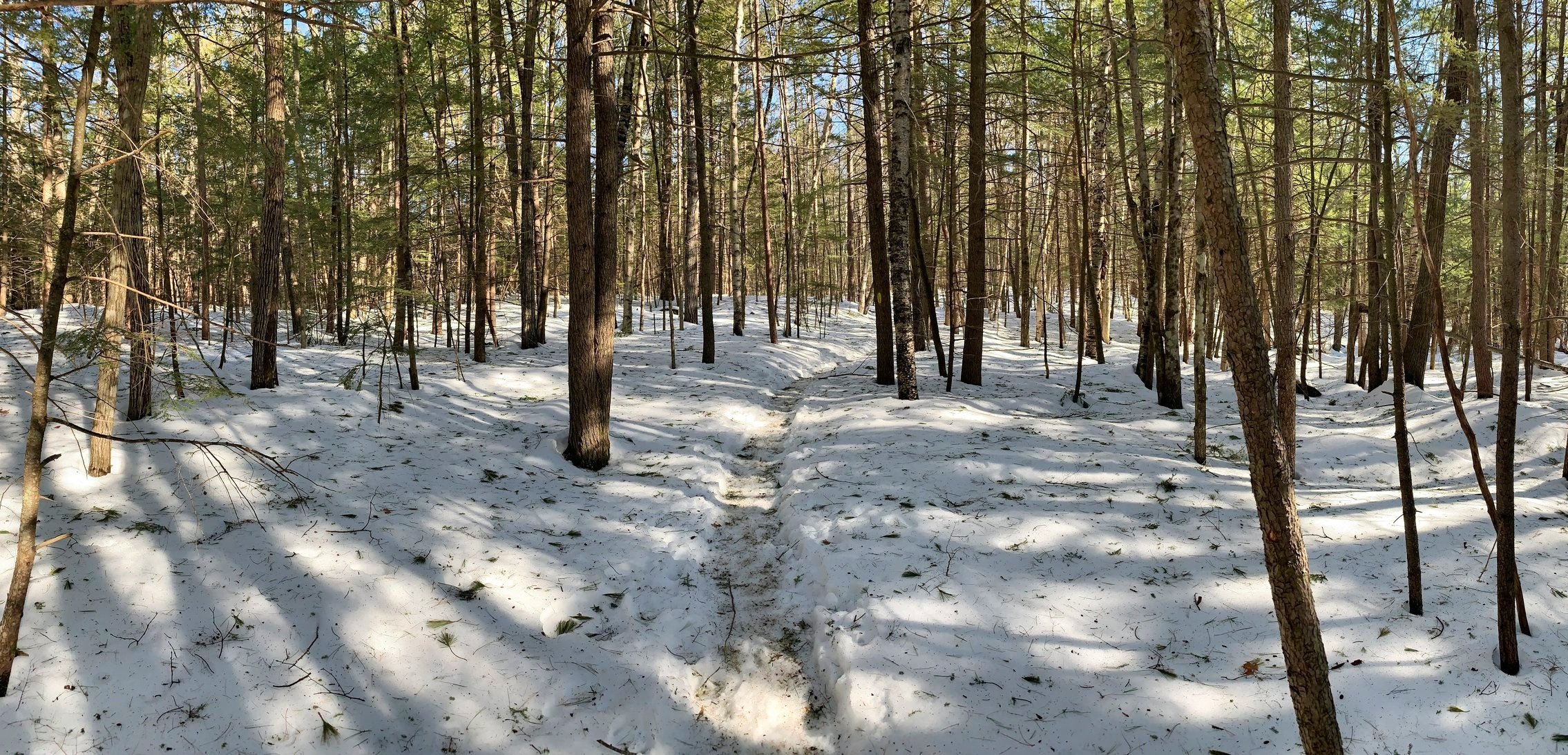
Following an old woods road, the path is very mellow to start while passing several camps and homes, massive white pines tower just off trail. At about 0.7-miles into the hike the trail begins to climb as footing grows rocky, meandering through a gorgeous mix of hemlock, red and white pine with plenty of spruce as well.

Looking back at the views as we climb
While hardly coming into view, Kearsarge Brook just off to the west drains from the col between Kearsarge and Bartlett mountains, the soundtrack of trickling brook with birds chattering a springtime tune made me want to hop onto any of the massive, moss-covered trail-side boulders and shut my eyes for a bit amidst the morning sun.
Following along one of the southern ridges of Kearsarge, the trail climbs northeasterly, away from the brook and onto the nose of the ridge, briefly traversing through a wet and weathered patch of hardwood.
Slowly the forest transitions and conifers are the majority again as the trail breaks onto open ledges, very reminiscent of Blueberry Mountain in Glencliff, NH or Mount Cardigan, as one begins to break out of treeline.

Ascending through a spruce cone
Today, there were several open spots, giving glimpses down to the ledgy rock face which had a steady stream of water running beneath the snow, evidence of the warming sun overhead. Glancing back over the shoulder, the views begin to creep through the trees.
At 2.5-miles, the trail swings right to follow the western shoulder to the summit, a detour to the left would bring hikers to 2,579’ Bartlett Mountain, 0.5-miles southwest. We opted to proceed to the right, continuing on the Kearsarge North Trail and entered a canopy of spruce with fir beginning to show up a bit.
The trail overall traverses rather steeply to the northeast for about 0.5-miles with several quick dips and gains in elevation, reaching a switchback in the trail, hikers now traverse counter-clockwise around the summit cone, getting ever closer to the open slabby final ascent. Here, the views remain restricted but offer a glimpse to the white-capped jagged peaks to follow.

Presidential Range from the 1951 Fire Tower Lookout
Excitement grows as the 1951 fire tower comes into view, I think in a former life I would have favored a career atop one of these perches - or perhaps just a quiet mountaintop to read a book and enjoy a cup of warm tea.
The cabin unfortunately had lost a pane of glass but had received some TLC to cover the leaky window; with the sun shining bright outside the cabin was a very welcome break from the 30mph winds atop the open summit, chilly fingers got warm and jackets were donned before going back out into the elements. We even took a minute to look through and sign the summit register.

Briefly, with the tower to ourselves, we tried our hand at naming the surrounding peaks and noting which we had scaled. Perhaps we will come back and stay in the tower to watch the sun set and rise - we had tried on a weekday last year but upon entering the tower found it already occupied to the max and opted for a headlamp descent with full packs instead. Surprisingly, the USFS doesn’t have an overnight reservation process in place as with several of the similarly retired towers out west.
With a firm snowpack and Hillsounds on our feet, we made quick work of the descent, stopping to forage several bunches of white pine needles for a tea later in the day.
Plus, what trip isn’t complete without a post-hike trip for plant-based subs from The Valley Vegan back in North Conway - a vegan sub shop that also sells gem stones? Perfect way to end a great hike up a White Mountain classic.
Overall stats for the day:
5.97-miles
3hr 19minutes
2,841’ elevation gain
Mount Kearsarge North - 3,268’
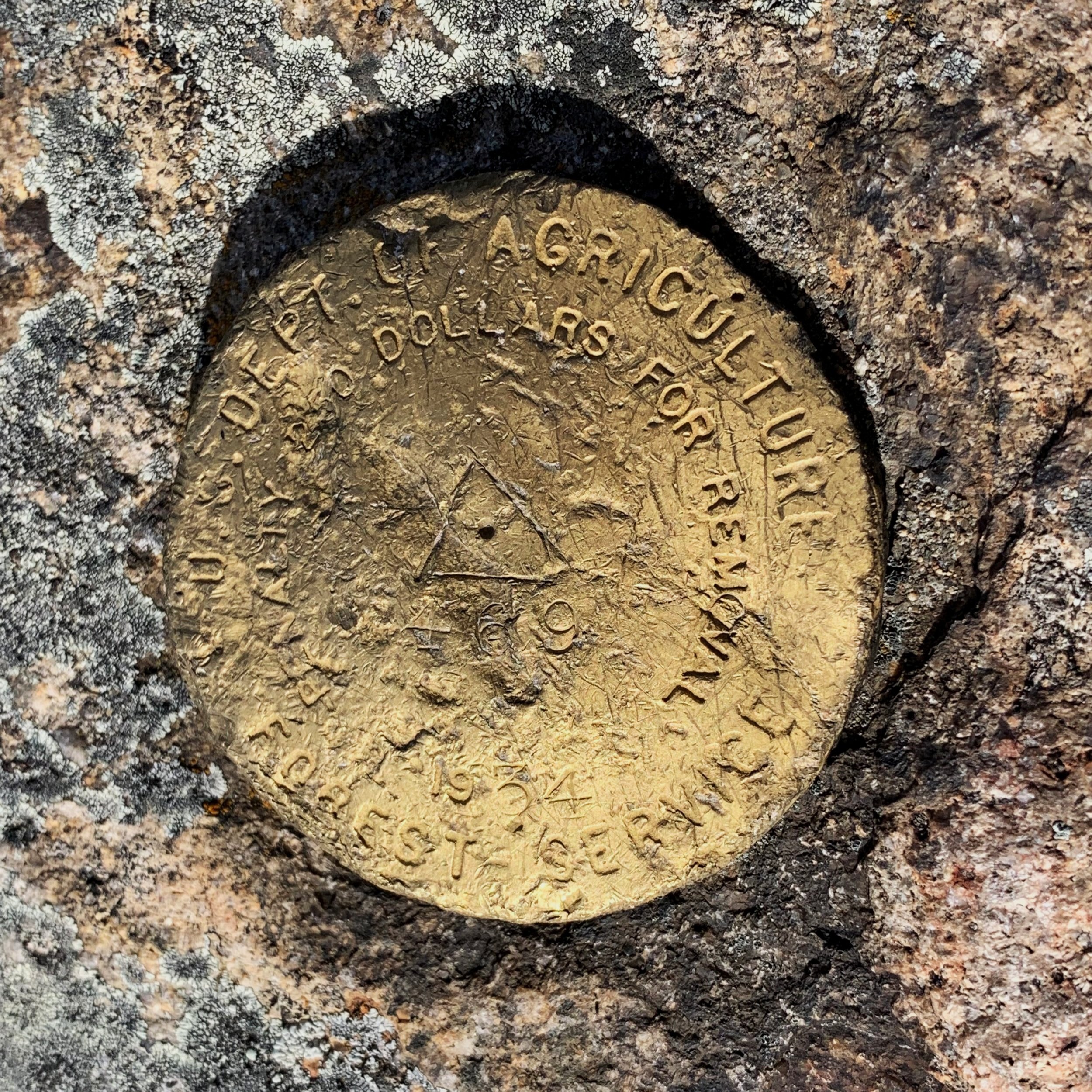
1934 Forest Service “survey” disc