
Mt Wonalancet + Mt Paugus
Every trek into the wilderness is a step into the unknown; especially this time of the year - springtime - when trails might be dry, soggy, riddled with residual postholes or made slick from last autumns buried leaf litter.
While I had been sticking to ascents of peaks which lay below 3,000’, I thought a trek to the southern region of the White Mountains might provide a bit less snow cover and better climbing than its northern peaks. The loop, departing the Ferncroft parking lot, consisted of Mt Wonalancet (2,760’), Mt Hibbard (2,920’), the Hedgehog of Mt Wonalancet (3,120’), with an out-and-back to the southern knob of Mt Paugus (3,080’) and finally a bushwhack off-trail to the real Mt Paugus (3,198’) - if conditions proved feasible.

Joining the Wonalancet Ridge Trail
Arriving to an empty parking lot at the Ferncroft trailhead I readied the typical 28-liter pack with the usual; spare clothes, food, tea, emergency gear all got stuffed in the bag all the while skies seemingly toiled with the idea of letting the morning sun shine though. I began at 7:15am down FR 337. Almost immediately diverging to the left, I followed the Old Mast Road briefly - which has a very interesting history involving the old road having been used to haul out the tallest timbers which would then be transported further, thus becoming masts for the British navy.
Prior to the bridged crossing of Spring Brook, I veered left onto the Wonalancet Ridge Trail - an area I had wanted to explore for years but hitherto had spent all of my time on the higher peaks to the northeast. The brook was roaring through the mountainside as the Ridge Trail immediately begins climbing up the southeastern ridge of Mt Wonalancet.

Ascending Mt Wonalancet
Steep ascents were highlighted with glorious sections of well-maintained trail; what a joy to run in the morning as low-cloud lingered along the mountainside - early on, not even a single root stuck through the soft, leaf duff and fallen conifer needle footbed.
Upon entering the Sandwich Range Wilderness the trail climbed once again, this time exposed roots created steps up the slope; rocks of all sizes poked up through the fallen leaves, starting small and gradually becoming large enough to walk around. At ~2,260’, the Short Cut path is reached which avoids the steep ledges and scrambles enroute to the high point of the mountain.
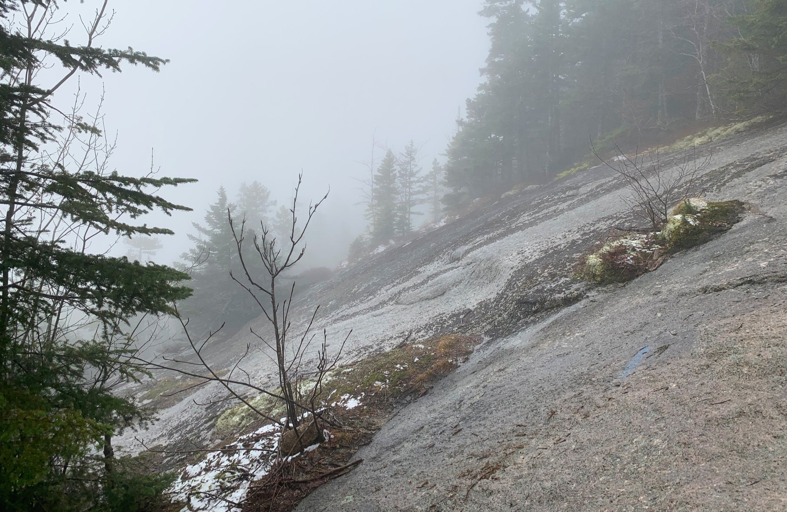
A fine spot for a view if not in a cloud
As I was only hitting a slight dusting of soggy snow, which likely fell overnight I chose to proceed up the steep path to the left, using rocks as handholds to hoist myself up several precipitous sections. I’ll certainly need to make a return trek to these hills when the clouds part - I’m sure the views must have been stunning; reaching an open ledge, I ascended with aid from a crack in the rock and dove back into evergreen forest.
Making a sharp turn north, the Ridge Trail passes nearly over the true high point of Mount Wonalancet, I took a short trek ~100’ to the east, locating the true summit before continuing along. Occasionally, now there were several inches of snow which was frozen solid in the cool morning air - when required I could use other hikers footsteps which ranged from 2-6” deep, the knee-deep postholes I avoided altogether.

Mount Hibbard summit
Travel was actually quick and efficient, mostly on bare trail with some patches of hardpacked snow; Hillsound spikes were in my bag and ready to be used but went along for the ride today as I never found any overly-slick patches. Ascending the southern ridge of Mt Hibbard was simply marvelous; conditions were very enjoyable as the low sun shone through the conifer boughs, casting crepuscular rays through the lingering haze.
Once again, the would-be views atop Mt Hibbard were guarded by a dense layer of cloud, forcing me to enjoy my immediate surroundings; brilliant green conifers, their dark, damp trunks dotted with lime-colored lichen and moss; overhead, chunks of soggy snow rained down constantly while being warmed in the morning air.

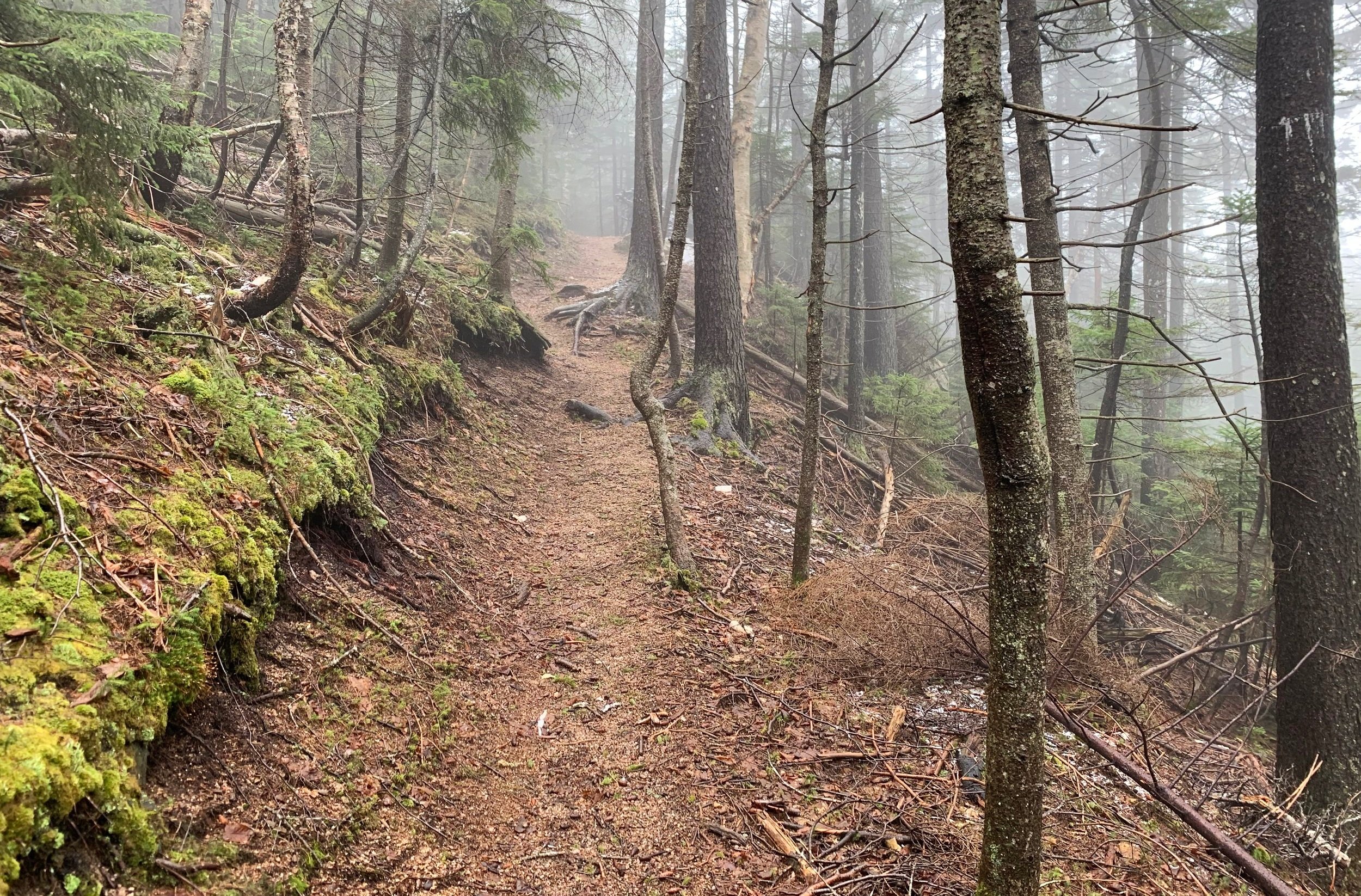
Morning along the Walden Trail
Eventually, the Walden Trail merged from the north; although, visually it appeared identical to the trail I had already been roaming, I’d follow this up and over Wonalancet Hedgehog and down to the next four-way intersection. Hitting the crest of the trail I took the short spur to the southern lookout - I imagine these views are breathtaking but from atop this ledge all I could see was a wall of white cloud, the slick rock slab seemed to drop abruptly just ahead.
Back on the Walden Trail, elevation was lost very rapidly by shimmying down rock scrambles and eventually descending atop sections of stone staircases further down. As the mountainside mellowed out, the upper portion of the Old Mast Trail is reached; a bail-out option, if needed; as my intended descent route at the next intersection lay a mere 0.3-miles further, I continued on.

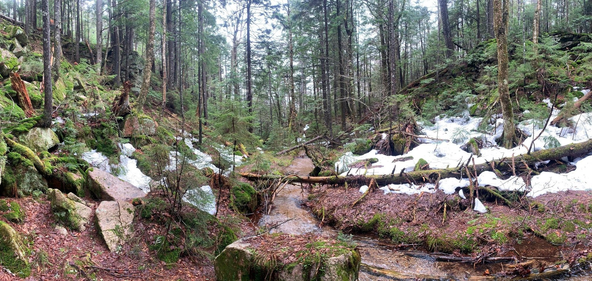
Descending Wonalancet Hedgehog
Despite the grim appearance of the Kelley/Oliverian Brook intersection with a modest pond of snow and standing water surrounding the trail intersection signpost, I continued on simply to say I had gone on to see how the trail was up ahead. And am I ever glad I did give the next stretch of the Lawrence Trail a shot - after the first 15’ section of frozen footsteps the snow gave way to a beautiful earthen trail.
There were a few patches of refrozen snow but once I had cleared the shadow of the low bump which lay just west of the Cabin Trail I was in the clear; snow-free for as far as I could see, a bed of soft dirt and fallen leaves made up the initial stretch of enjoyable pathway.

Wooded cliffs along the Lawrence Trail
To my right lay massive fallen boulders, to my left was the sheer rock face from which they had tumbled. Behind, in the distance, a jet was making practice maneuvers and cruising around the sound barrier; with the sight of fallen rock and knowing how saturated the mountainside had become during the past several days, the sound of that aircraft rumble brought the notion of rock and landslides to my mind, sending chills right up my spine.
Once above the switchbacks that lead up and eventually over Whitin Brook, the trailbed became coarse tan/brown gravel; larger than sand yet finer than pebble. Traction while ascending this surface was surprisingly no problem albeit the sight of such a loose surface instilled more thought of possible landslides - around the switchbacks I trekked smoothly and lightly, nearly tip-toeing as to not set any earth in motion downslope.
Switchbacks enroute to Mt Paugus
After several more zig-zags and switchbacks in the Lawrence Trail I came out to the viewless yet bald, southern peak of Mt Paugus at 3,080’. The mountaintop sign pointed to a spur path from which a view could be obtained - as there was no mistaking the low cloud which lingered all around, I turned back with my attention now on the 3,198’, trailless summit of Mt Paugus.
Finding what I thought was a fine spot to depart blazed trail, travel was initially quick and easy for a brief stretch, until navigating directly into a 30’ patch of blowdown. “Go through or around?”, I thought to myself; before I could weigh the options I found myself swimming toward the sight of open forest on the far side of tumbled tree trunks.

Mt Paugus South Peak summit signs
While that span was not all that bad, just a minor obstacle on the hillside, I next ventured through extremely tight pencil-thin spruce, a wall of mind-numbingly thick evergreen boughs, a few short but steep moss-covered rocky scrambles - and once I had found myself nearing the high point of Mount Paugus, I landed right on a mid-forest herd path. I could not believe what I was witnessing; perhaps it was simply the result of broken branches over the years but this appeared to be an intentional corridor in the otherwise oppressively tight spruce. The hobbit paths seemed to radiate in every direction from the high point but what I was looking for was not hard to locate.

Bushwhacking to the high point of Mt Paugus
Actually, to my bewildering surprise, there was a small, white PVC canister bolted to a spruce tree; I had heard semi-recent reports of the canister having been removed or stolen for whatever reason so this was an exciting find for someone who likes to find plumbing in the middle of the trailless woods.
Unlike myself at this point (from the wet snow falling off the conifer boughs), the contents were dry and once I had signed into the summit register, logging my ascent and giving good tidings I returned everything as I had found it and began toward home.

Mt Paugus summit
Initially, I attempted to follow my footprints in the thin snow layer but quickly abandoned this technique, simply following a bearing to the south, knowing I would eventually bisect the trail. This route was much easier than my ascending track - gone were the steep scrambles and patches of downed trees, I never even ran into any obscenely thick evergreen; however, I did end up paralleling the trail briefly until turning directly at it, who would have known it lay only 10’ through the thick forest.
While glad to have regained the marked trail, I was now able to cruise back down the packed dirt path until reaching the point I grew too warm in Gore-Tex layers. With a quick sip of dandelion tea and a fresh, dry shirt, I passed the Cabin Trail - next stop, my exit: the Kelley Trail.
Descending into the ravine along the Kelley Trail
Carved from torrents of glacial water exiting Lake Albany, this box ravine was created a long time ago. While not quite the flow it may have had back then, I followed alongside Kelley Brook and occasionally atop the waterway itself - nerves kicked in when the snow which spanned the brook began collapsing. Luckily, this did not last more than 15-20’ pathway before I was back on solid, rocky ground, on the eastern side of the brook.
Occasionally, the trail crossed from one side of the brook to the next; around the time I had to pause to take in the finely crafted stone bridge I ran into the trail’s adopter, a member of the Wonalancet Out Door Club (WODC). We had a good chat about trail conditions higher up the mountain and the clubs’ future trail-work meet-ups of early Summer. Mike was out on his trails raking and cleaning out waterbars and various drainages to aid with the spring thaw.

Easy grades of lower Kelley Trail
Leaving my new friend to his trail maintenance, the path now tracked along the western edge of the ravine where it sounded like the brook became massive cascades, but elusively remained just out of sight. Appearing as if to be an old forest or logging road, the path sidehills downslope until meeting up with FR 337.
Following signs to continue along the Kelley Trail, which momentarily coincided with the forest road before abruptly turning toward the south, it was obvious that this wide path was once utilized as a road as well. All along its length I could admire the recent handy work of the trail adopters: well-placed stones to step atop with freshly exposed dark soil along cleaned out waterbars and drainage sites - they certainly take good care of these trails.

Old logging road through the forest
Before long I had rejoined the Old Mast Trail and could now bask in all the springtime scents, sights and sounds found in this lovely stretch of forest; sometimes it is a blessing to be stuck in a cloud all day - the opportunity to gaze not out, but around and down at what lay at ground level; to gaze at the miniscule ferns, mushrooms and bedrock striations and not always searching for the colossal views from one mountaintop to the next is but one of the many reasons I keep coming back to the wilderness.
Overall stats for the day:
10.36-miles
4hr 55 minutes
4,442’ elevation gain