
Cooley + Cole Hills
For years I have driven past the gated logging road on the western side of US Rt 116, just south of Easton, NH; cars and trucks would often be parked there, I assumed hunting was going on - but in wintertime? The other day I was just tracing trails, peaks and ridges while daydreaming and drooling over maps as I do in any spare time and saw the Jericho Road Trail, which could be followed up to several summits and onward, connecting to the Cooley-Jericho Community Forest trails.
Hoping that the overnight rain in addition to the springtime thaw would keep logging traffic to a minimum, I parked as far off to the side as my Subaru could handle and began lighter than usual down the old horse trail (FR 480) at 6:59am.
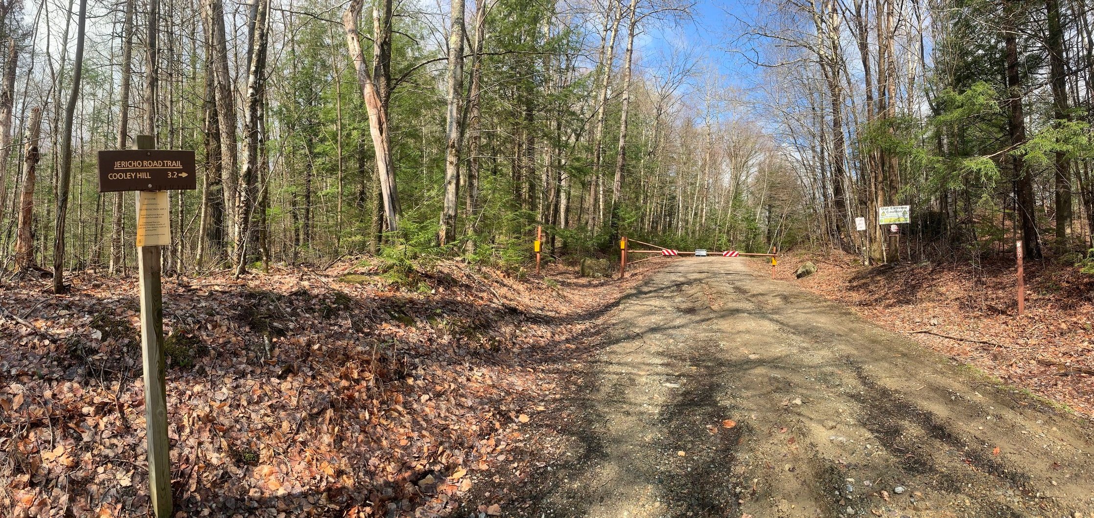
Jericho Road Trail
An 8-liter pack with cold weather essentials as well as some snacks and water filter took the place of the typical 28-liter, longer excursion pack. Old, muddy trail runners were the choice of footwear for the day - they still squished going down the wide logging road but could certainly cover ground much faster than the winter mountaineering boots.
To contrast the image of logging right from the start, the trail ventures through beautiful stretches of mixed forest with birch and evergreen trunks leaning in from the roadside. All was quiet as I passed a recent logging cut and staging area on the southwestern side of the trail and at 0.3-miles from the trailhead the Jericho Road Trail veers left while a newer logging branch diverges right.

Down the old logging roads
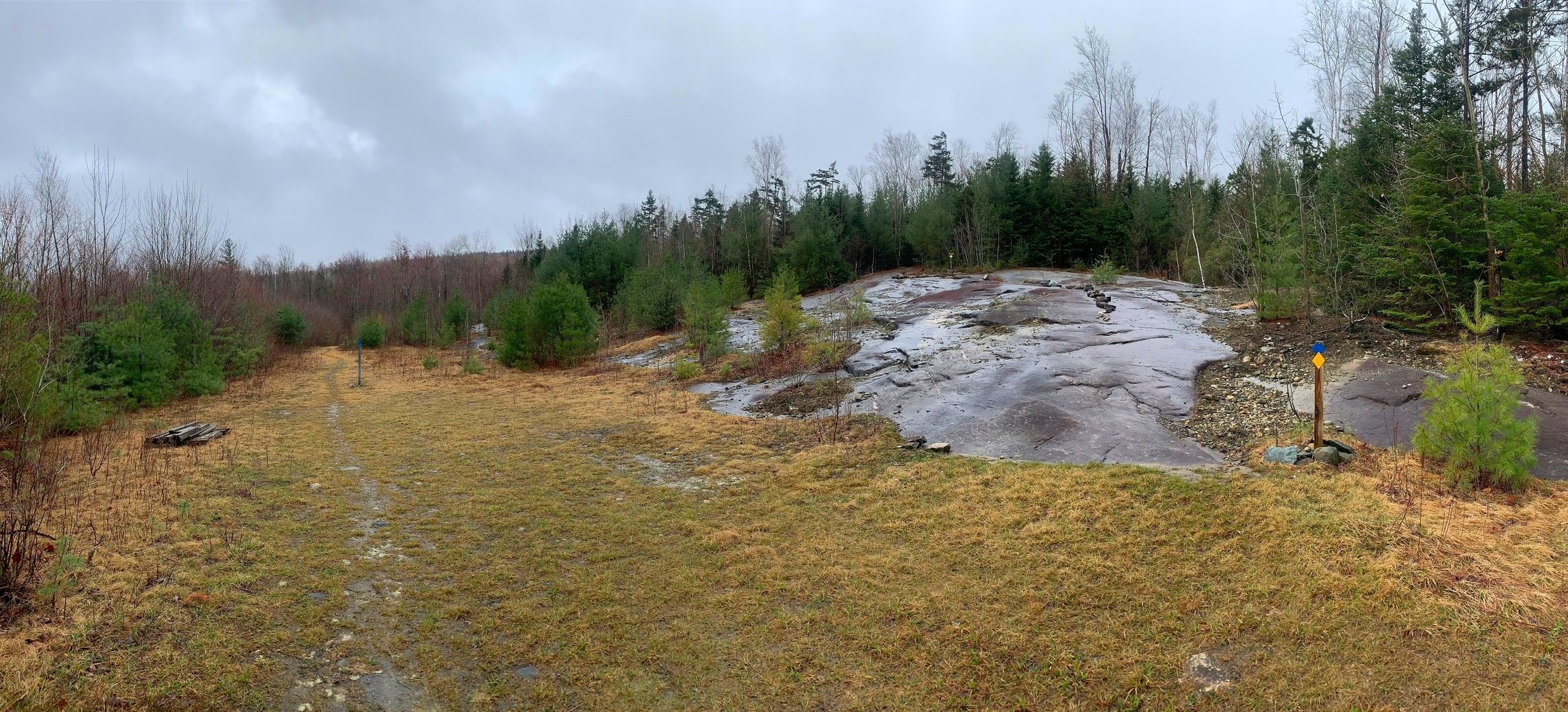
Until the next large clearing at 1.0-miles, the trail is well-worn but soft underfoot and unmistakably easy to follow. Beyond this landing, whose surface is constructed of essentially large wood chips, the trail begins to narrow as nature attempts to reclaim the old road; I had two paths to choose from (old tire ruts): soggy mud on one side or dry footing with thickets on the other.
All along the trail were numerous downed trees, most of which were easily ducked under or stepped over but one spruce tree was thick enough to walk around. Many large water bars appear to help with drainage as the trail rolls up and over the 2-3’ earthen mounds.

Through logging cuts to Cooley Hill
At 1.7-miles the Jericho Road Trail begins tracking along the side of sapling-filled logging clear-cuts, the first of which traverses along a plateau and the second, to the west, as the path begins to descend toward Cooley Hill at 2,485’. While peering over the low growth of the logging cut, it would appear that the Kinsman mountains and perhaps even Cannon Mountain would be very picturesque, but unfortunately the morning clouds had yet to rise out of the surrounding valley for me.
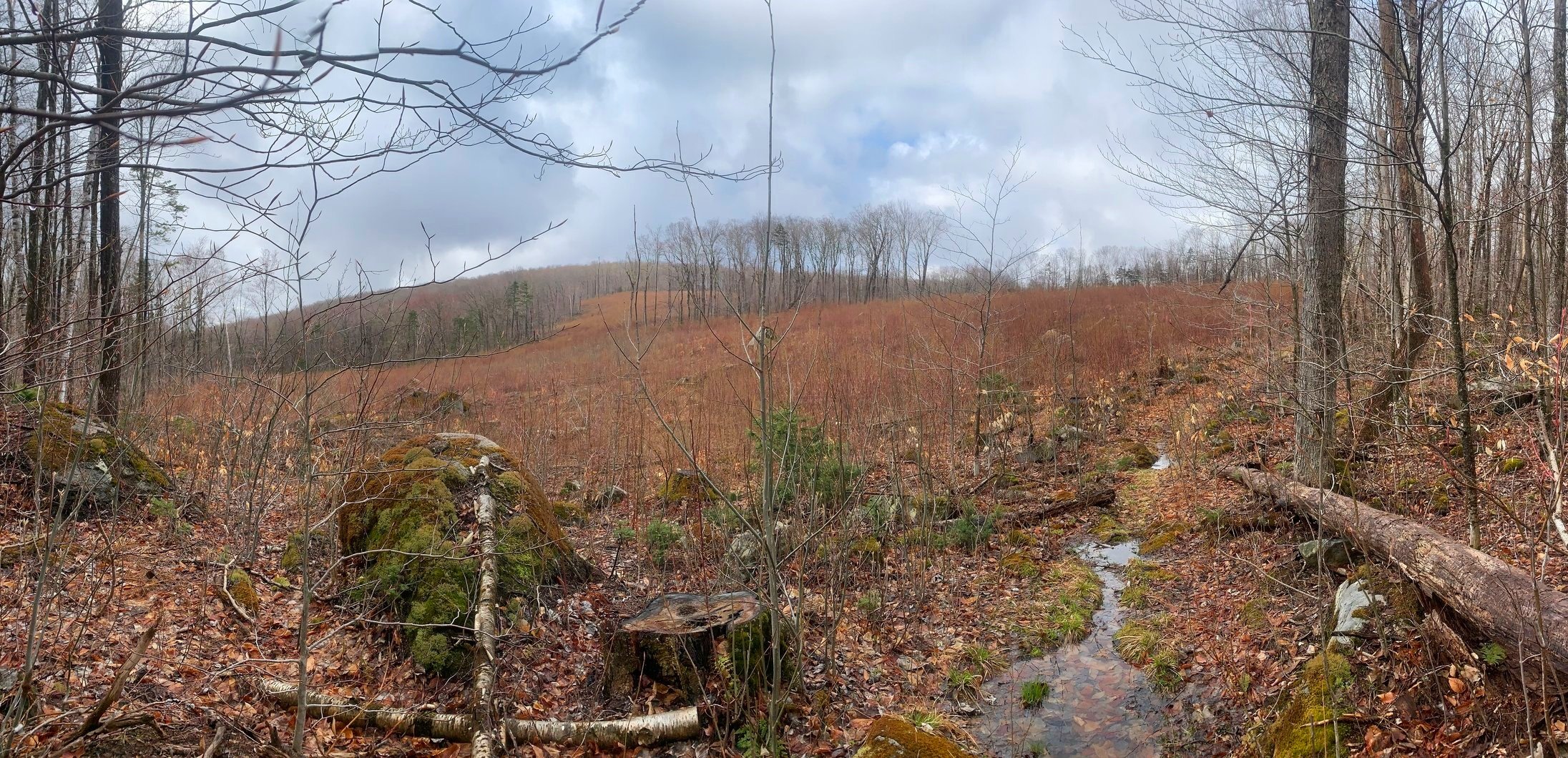
While glancing straight ahead, down the Jericho Road Trail, I did have a fine view of Cooley Hill and an old logging cut with a little tuft of birch growth left growing in the clearing. The pathway, while ascending northerly toward the summit, felt like a continuation of an old road - I thought perhaps a ranger jeep road which could have been used to access the old fire tower.

Old fire tower foundation
Passing several more patches of blowdown, some of which appeared to have been cleared recently, the base of the old fire tower soon comes into view; its four concrete abutments rise out of the mossy mountaintop while the old wooden frame lays decaying alongside.
With an uneventful side trip to the high point of Cooley Hill (just off-trail to the west) I continued on the yellow-blazed path, which now bore signage for both the Ammonoosuc Conservation Trust as well as the Cooley-Jericho Community Forest.

Enroute to Cole Hill
The narrow path rolls along the northern slope of Cooley Mountain and through a lovely marshland with some evidence of moose passing through recently. At 0.3-mile past the summit, the trail swings to the east momentarily, beginning its descent toward the col while clinging to the ridgeline. Suddenly, the trail departs the open ridgetop and plunges into a sweet-scented boreal forest; the sight ahead is a narrow single-track path, topped with dry conifer needles, the air lingers thick with evergreen resin - even an aroma of cedar as one passes through.

Descending the Blue Trail
Once the Yellow Trail (bike path) veers right and the Red Trail is joined, the climbing begins once again; this time through massive sections of downed balsam fir, which, thankfully had been cleared by the trail crew. The pathway remains constantly soft and dry underfoot, despite a fair amount of roots which never seemed to trip me up as some more eroded trails do.
Just prior to reaching the high point of Cole Hill, a side spur for the Vista is reached; I didn’t bother taking this short path as I could see the trail heading straight into the low cloud. Views would have to wait until another day.
Departing the Trumpet Round Road Trailhead
Part of the reason for heading up to Cole Hill was to explore and experience a bit of the 840-acre Cooley-Jericho Community Forest. The tract of conservation land offers trails for various uses; a separate Glades map can be found at the welcome kiosk just for winter skiers, while the yellow trails are primarily denoted for mountain biking. Today, I would make a loop of the Blue Trail and see what I could find.
After trekking a clockwise loop of the Blue Trail, I can certainly say that the western side of the loop appears to be the wetter side; descending over old, grassy logging roads and slick bedrock slabs (watch the red slime), much more erosion can be found on this side as well. During much of the descent I watched the clouds lingering to the north, occasionally exposing hints of the low-laying villages as if tempting me with what lay beneath.

Woodwork and trailwork over Salmon Hole Brook
However, with my attention on the trail and my surroundings, once the Blue Trail meanders off the old logging road and begins switch-backing down Cole Hill’s northwestern peak, the stone rockwork through wet sections are much appreciated and highly enjoyable - hopefully a glimpse into the immaculate trail work which might someday alleviate some of the poor drainage of higher up the mountainside.
Descending to the Trumpet Round Road trailhead parking lot, the Blue Trail departs at a right-angle and crosses a soggy section on boardwalk - which are incredibly slick when wet. Passing over Salmon Hole Brook was made easier with several new bridges and walkways - lots of quality trail work is being done to further improve these trails.

Ascending the Blue Trail (eastern side)
Ascending the eastern portion of the Blue Loop was extremely pleasant; through young birch and into patches of coniferous corridors, several ledgy outlooks are passed - one which even brings hikers to a fairy garden, that also will wait for a return visit on a clear-sky day.
Although, I was half-startled out of my running shorts when I came around a corner to the first (of several) carved gnomes which sit patiently in the forest, eerily smiling in my direction. For a short stretch the Blue and Yellow trails coincide as one before I diverged to the right, in which to meet back up with my descending tracks - to complete the Blue Loop.

Cole Hill summit
The real reason I wanted to trek back over the summit of Cole Hill was to locate the high point and track down the red-painted sign which hangs above the glass canister. After a moment of searching I found it tucked behind some conifers with a slightly worn herd path heading to it. The register notebook was a ball of goo, appearing as if the glass jar had leaked - perhaps a replacement will be my gift to the summit when I make my return trek for all the views.
Retracing my steps now for the 4.4-mile trek back to the trailhead, I could now really enjoy the technical descent along the wooded single-track; mature fir and spruce trees draped in lichen are reminiscent of the old forests along upper slopes of the neighboring Kinsman’s - I could not believe such beautiful trails existed so close to home.
South from Cooley Hill
The Cooley-Jericho Community Forest crew is really putting in some serious effort to improve their already lovely trails; it is simply marvelous to find oneself in spruce and fir one moment, while the next amidst a bright and open birch glade with extensive views - I cannot wait to explore these old logging roads and drop my pack at any of the ledgy outlooks to bask in the morning sun and take in whatever views come my way.
Overall stats for the day:
12.22-miles
3hr 1 minute
3,068’ elevation gain
Cooley Hill - 2,485’
Cole Hill - 2,645’

Forest carvings, trailside