
Mount Tremont
This north-south ridge rises sharp like a resting dinosaurs’ spine; it had been on my radar as a very conspicuous landmark I could pick out from surrounding mountain tops. This ridge actually consists of 4 bumps; third from the north being Mount Tremont and terminating at Owls Cliff (2,920’) to the south, about three-quarters of a mile away.
Mount Tremont is recognized as the 17th tallest peak on the 52 With A View list; peaks around the White Mountains with must-see views, places that might otherwise go unnoticed with the more sought after 4000-footers scattered throughout the area. While I do love a good view, it was more the shape that drew my attention - appearing to have been carved and scraped by glacial ice sliding past on either side, needless to say, I’ve wanted to visit this peak for quite some time.
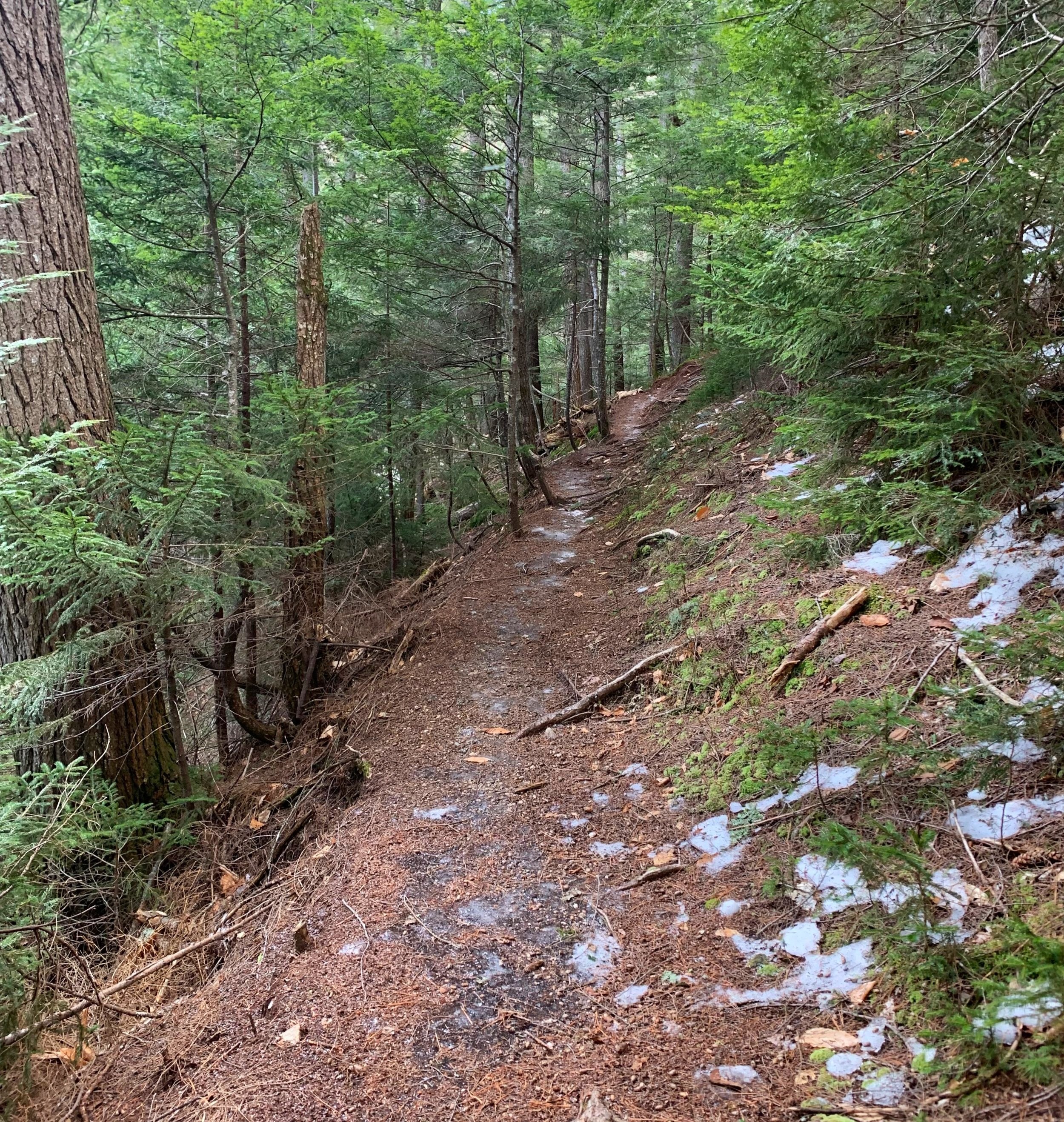
Mount Tremont Trail; soft paths
For many years the only official trail approached from the south; planned and blazed by Dr Roger F Brunel, the aptly named Brunel Trail ascended the ridge by way of Sawyer Pond and Owls Head. Early guidebooks made note of an old path consisting of logging roads departing Livermore (west) which was soon found to be overgrown and difficult to follow.
It was noted that early descents were made by striking straight down to the southwest “without trail” to Sawyer Pond, a similar trailless route was known to descend southeast off Mt Tremont, “soon finding and following a branch of Douglas Brook to Bartlett-Passaconaway Road”. Interestingly, there can now be found a network of trails between Mt Tremont and Bartlett-Haystack, to the east, which link up with the old road, now Bear Notch Road.
Departing the southern side of US 302 just west of Bartlett, we hopped on the Mount Tremont Trail for a 2.25-mile hike up to the 3,371’ summit. While this is the most direct and more popular approach, the parking is simply on the side of US 302 with no amenities. Snow was minimal at this elevation so we weren’t concerned with the pull-off being plowed, but did keep an eye out for any recent trail reports.
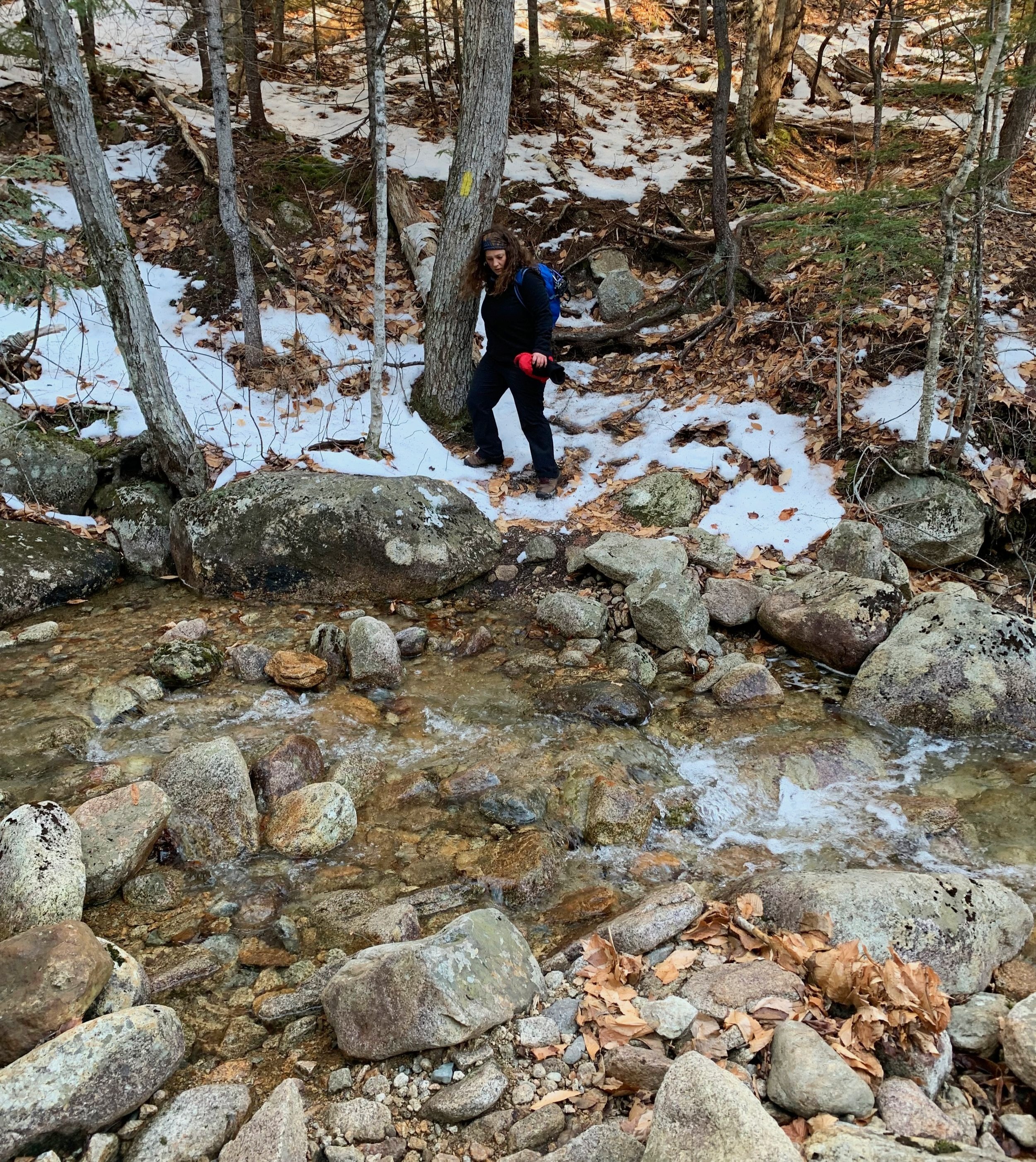
Crossing Stony Brook
Crossing US 302 and getting onto the trail was easy going, occasionally we hopped standing water through dense leaf coverage on the trail. All the while Stony Brook runs just off to the left (east) and quickly drowned out the rumble of auto’s speeding by on the nearby highway.
Easily stepping over or hopping several small tributaries, the path was wet but our feet remained dry as the sun rose over the surrounding hills. While walking a very well-graded path through a gorgeous canopy of hemlocks the brook offers several cascades and small waterfalls that begs the hiker to pause, if even momentarily.
An old logging road labelled (Forest Road) FR 513 is crossed and is gradually being reclaimed by nature at the 1.0-mile mark along the path as the hiker next passes through a brief soggy section of old blowdown. Most has been cleared from the path but this damage remains from the December 1980 windstorm.

Final steep ascent up to the summit
At about 1.5-miles from the trailhead Stony Brook is easily crossed by way of rock tops but I could see this being tough in high-water or with springtime melt.
From here the trail climbs steeply up the northern face of the ridge aided by a series of 19 switchbacks over the last 0.7-miles for a climb of nearly 1,200’.
Beginning the final ascent the forest makes an abrupt transition from primarily one of birch to “virgin conifers” as the AMC Mountain Guide book beautifully paints the picture. Footing is rough over loose rocks initially before making use of exposed roots for foot and handholds on several of the steeper pitches.
It is interesting to venture back in time through the eyes of the AMC Mountain Guide writers and witness the early hiking reports; prior to 1987 the views were noted as, “excellent in all directions”, however, in that year the guidebook then stated, “the main summit of Mt Tremont has spectacular views to the south, west and north”, perhaps demonstrating a forest taking back over?

Soaking in the views from 3,371’
They certainly are not wrong about their description - wide panoramic views were soaked in as the sun warmed us back up - Passaconaway, Potash, Tripyramids and more were all in sight, although a distant snow squall tried in earnest to engulf the peaks in a white mist, the views from Mount Tremont were simply breathtaking.
The open slab of summit rock is large enough for many groups of hikers to rest while not getting in each others way, even a USGS survey benchmark disc from 1943 can be found near the apex.
Making careful steps for the icy descent, we nearly jogged going down the switchbacks, thankful in part to Hillsound spikes which we had strapped to our boots for the ascent, after crossing Stony Brook.

Stony Brook cascades
This was one gorgeous trail that featured all we desired: stunning waterfalls, quiet trails tracking through a variety of beautiful northeastern forests, a wicked ascent for the final third of the climb necessitating careful hand and foot placement, all culminating at the 3,371’ bare-rock summit affording us brilliant views of distant hills and nearby Sawyer Pond where I daydreamed of spotting moose and blue heron at the waters edge.
Truly lovely section of the White Mountain National Forest with such history and natural beauty all around, we are so lucky to have this treasure!
Overall stats for the day:
5.58-miles
4hr 6minutes
2,989’ elevation gain
Mount Tremont - 3,371’