
Mts Crawford + Stairs
After a night of sleeping in the backseat of my Subaru at the Mount Crescent trailhead in Randolph, NH, I awoke to a starry October sky at 4:27am. I had plans to hike in the eastern White Mountains but when met with flashing orange barricades which blocked my route into Evan’s Notch, I returned to rethink my plans for the day.
Recalling a great trail report from my running buddy of the Davis Path during one of the sunrise trail runs I was unable to join for, the photos had me kicking myself for missing such an amazing stretch of trail. Perhaps today was my day to visit Davis.
Beginning in a location formerly known as “Bemis”, the town now goes by Notchland and is several miles south of Crawford Notch, near the site of the historic Crawford House.
Originally constructed by Nathaniel P.T. Davis in 1844, the Davis Path was the third bridal path which meandered its way up to the 6,288’ summit of Mount Washington. The path soon fell into disrepair becoming “impassible” by 1854, thankfully though the trail was reopened to foot traffic in 1910.

Bemis Bridge spanning the Saco River
Departing the Crawford Notch Highway, which is now better known as US 302, from a large parking lot, which was build 1978-79, the Davis Path begins down a short walk of Crawford Valley Way, soon reaching resident parking and swings east to cross the Saco River.
The original Bemis Bridge was a 108’ suspension bridge built by Samuel Bemis in 1931, later rebuilt in 1999 by the town after receiving a grant from the National Scenic Byways, the newer bridge at this location now spans 168’ and is a joy to watch residents cart groceries across to their private residences on the east side of the Saco.
The path is near-flat to begin, winding through an old field that nature works to reclaim, crosses a small brook by way of a wide log. Such a quiet stretch of land recalling the heavy tourist destination only several miles north, up in the ‘Notch.

Soft footing of the low Davis Path
Crossing a Saco River tributary the path begins climbing steeply, utilizing switchbacks and a rock staircase for both footing and erosion control. The trail ascends between Mt Hope to the south and Mt Crawford, then climbs once again gaining elevation up the open slabs, here is the first taste of delicious views, to the south and west.
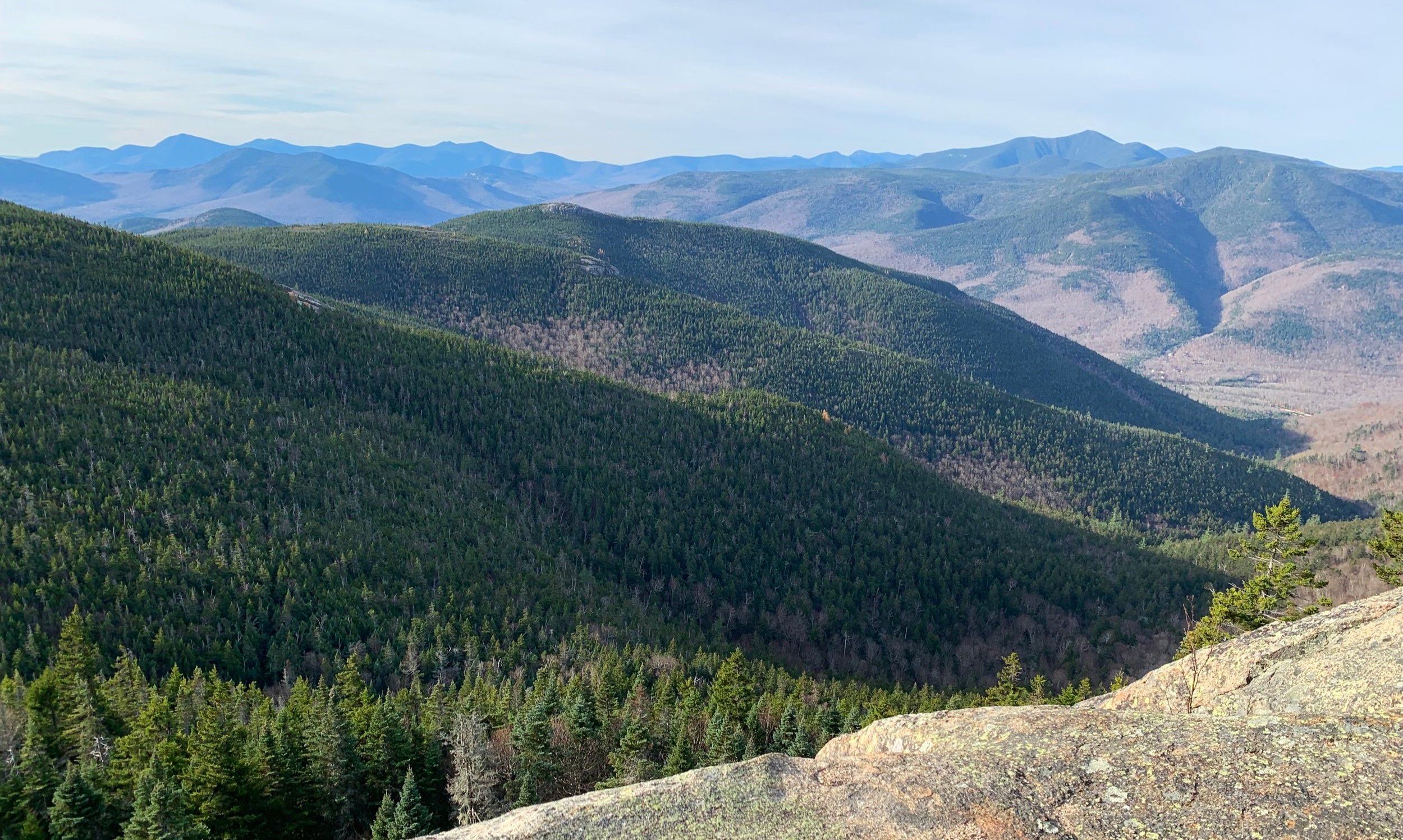
Shortly up ahead, the first junction is reached guiding hikers to the peak via the Mt Crawford Spur trail, reaching the 3,119’ near-open summit in about 0.2-miles by way of more rock slabs. If time allows, this additional trek should not be missed on a good-weather day, for Mount Crawford is known to have some of the best views in all of the White Mountains!

Mt Carrigain from Mt Crawford
I could have poked around this summit and moseyed across the bare rocks all day and been content with my surroundings, picking out my familiar mountains - while I do not recall any one place where 360° views can be obtained, paths encircle the summit affording stunning views in all directions, and hints of privacy on busier days.
Back at the intersection, continuing along the Davis Path I had to marvel at the craftsmanship of the route, grading such a path in this remote land suitable for horse travel, what a feat! The trail continues briefly through a spruce and fir tunnel with soft footing until reaching the shoulder of Crawford Dome (3,088’) and travelling through scrubby growth over bare rock slab corridors.

Soft footing along the Davis Path
I was in another world of bliss traversing the Crawford-Resolution Col, the well-graded trail amidst such a steep slope is something straight out of the west coast; I had never enjoyed such a scene here in the White Mountains, I think I laughed all the way to the junction at how beautifully out of place such a smooth trail felt underfoot!
At about 3.8-miles into the hike a junction is reached, on the right is the Mount Parker Trail which brings hikers up to Mount Resolution (3,415’) or further to Mount Parker (3,004’). On the left is the old spur trail which would have taken hikers to the old AMC Resolution Shelter at 2,940’, this shelter was closed in 2009 and torn down shortly after, however, water can still be obtained most of the year on the nearby branch of the Sleeper Brook.
Entering the southern end of the Montalban Ridge, the Giant Stairs of Stairs Mountain comes into view, known as the most “wild and picturesque feature of the area”, the ledgy cliffs of the two steps are visible at 420’ above.

Giant Stairs from atop Mt Crawford
At this junction the Stairs Col Trail enters from the east, Davis Path continues northwest ascending steeply and utilizing several rocky switchbacks before reaching a near flat stroll across the top of Stairs Mountain. The actual summit is a wooded spot in the woods just off trail but upon following the Stairs Mountain Spur for 0.2-miles an incredible down-look is obtained from atop the stairs at about 3,450’.
Just back slightly from the edge of the Giant Stair ledge are several primitive campsites, while this area does not have an easterly view for a proper sunrise, I would imagine the sunsets from atop these cliffs are jaw-dropping.
Mt Crawford from Stairs Mtn
From here I simply retraced my steps, considered adding Mount Resolution into my day as it was still early but the first set of ledges had yet to catch any warming sun and were glazed in a sheet of ice. Knowing I would be back out to Mount Parker in the near future, I might consider adding Mt Resolution into that hike.
Seeing the trail in reverse during the trek out I could really get a better look at the craftsmanship of early trail building and truly appreciate the special place I currently found myself. The Davis Path had it all - stunning views, great climbs with rocks to scramble, immaculate trail work, spruce and fir tunnels - certainly a place I’ll be returning to in different seasons.
Overall stats for the day:
9.56-miles
4hr 26minutes
3,609’ elevation gain
Mount Crawford - 3,119’
Stairs Mountain - 3,468’

Benchmark survey marker from atop Stairs Mtn