
Mount Pierce
As I trek the old bridal path, I let my mind create images of scenes which may have taken place many years ago. A carriage driver working tirelessly as they try to navigate their stage up and over rocky precipices by candlelight, perhaps the driver indelibly fears that gust of wind which may extinguish their dwindling, guiding light - for, if forward progress cannot be made along the Crawford Path, a deep chill may instill their bones, until searching parties can discover their whereabouts.

Welcome to the Crawford Path
Countless tales recount worries of and from hikers as they departed the Crawford Notch trailhead during the past two-hundred years, as they began their journey along perhaps the oldest established, and maintained trail in all the White Mountains. There are fantastic non-fiction writings recounting the narrow-escapes and lives lost on or near the Crawford Path, as it was the singular trail for many years which guided trampers to the highest boulders topping Mount Washington.
Today, we had no need to trek the Crawford Path until its penultimate destination, Alanna and I simply used the roughly 3-mile out-and-back to experience some cleansing arctic air and get back into the mindset of layering properly and carrying functional winter gear.
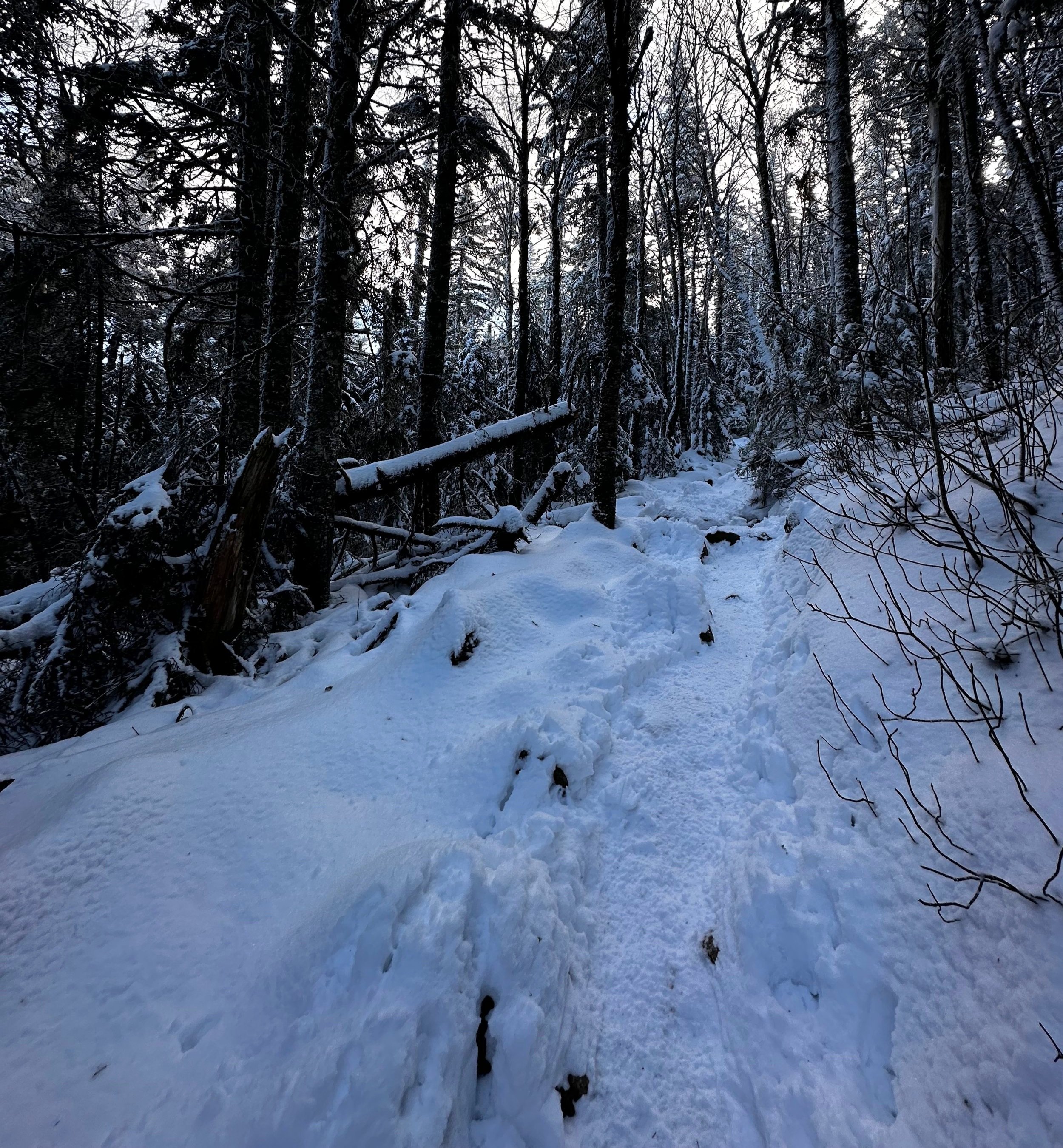
The start of a snowy path
At 7:05am, we departed the warmth and safety of proper Subaru heat and stepped onto an icy parking lot. Simultaneously, we glanced at each other, noticing the orange barricades which were conveniently blocking a sink-hole of sorts, which we witnessed last winter attempting to swallow up sub-compact vehicles, one of which I had tried to aid in pushing out of the puddle and ended the endeavor in a pre-hike ice water bath. Hopefully no repeats this winter.
Parking across from the shoreline of the now frozen Saco Lake, we invariably had to retrace our direction from the quaint railroad depot, to catch the southern terminus of the Crawford Path, which begins just across US Rt 302, from where the old Crawford House once stood. It is recommended that anyone looking for interesting, historical details about the AMC Highland Center property (which now occupies the Crawford House property), to pay a visit to the Highland Center, and look over the old maps and diagrams which explain and show how the old Crawford family estate would have looked prior to its repurposing.

Ascending toward the Mizpah Hut Cutoff
Immediately, on the Crawford Path, hikers are welcomed with a kiosk explaining the 10-essentials for safe and responsible trekking, as well as a large signboard offering up swaths of historical facts regarding the old path. While not enough snow had fallen to warrant snowshoes, the time is swiftly approaching - just one burst of powder overnight and it will be snowshoe season once again. Year by year, I still find myself curious as to when the WMNF will implement similar rules and regulations as the Department of Conservation had done years ago, in the Adirondacks of New York: if there are 8-inches or more of snow, snowshoes must be worn. The agency appropriately gives fines for those who neglect the rule - that’s one way to get snowshoes on the feet of potential postholers!
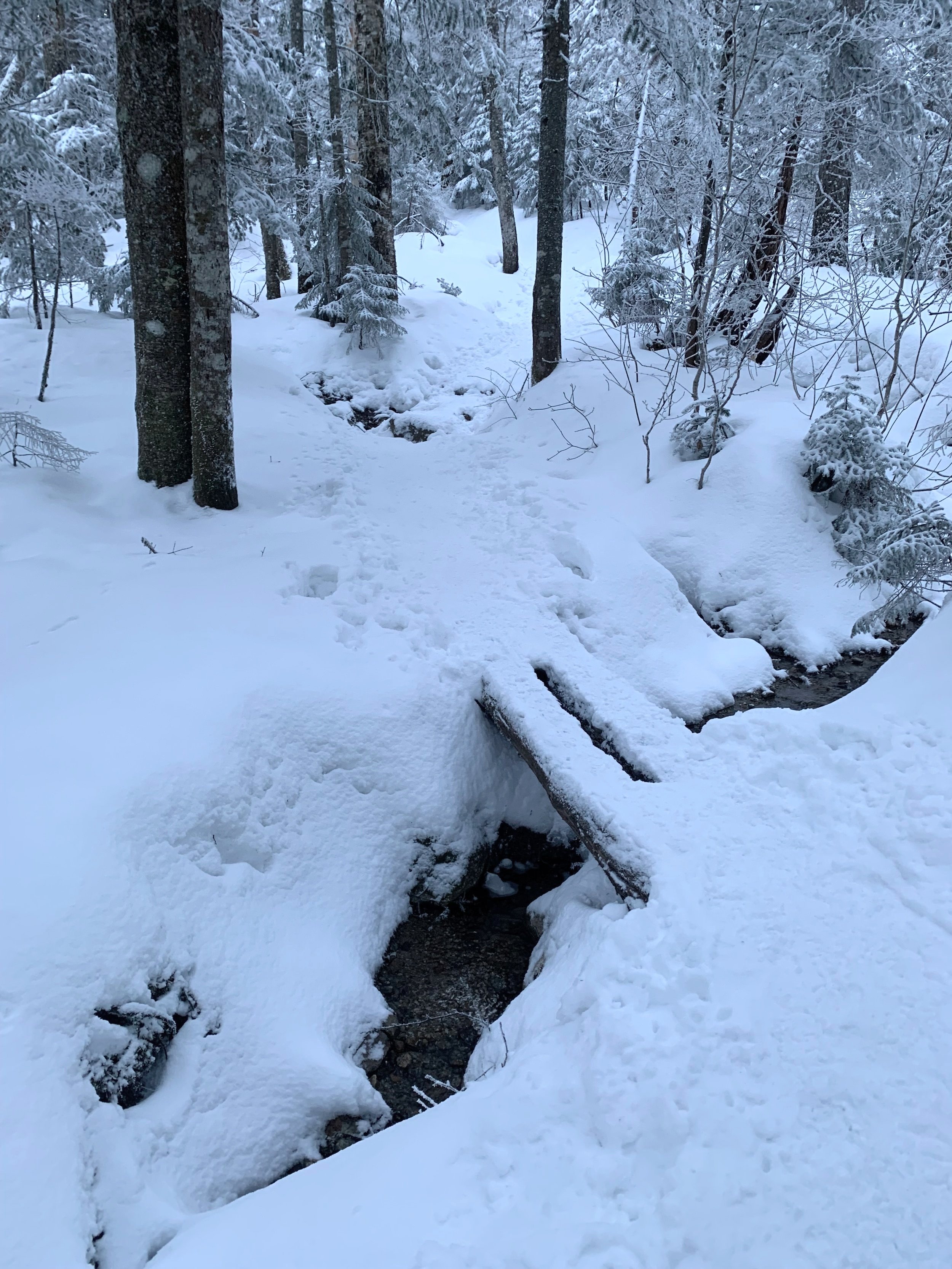
Drainage crossing along the Crawford Path
Beyond the first 0.5-mile, we began finding increasing amounts of ice and snow crusted around the exposed rocks. Just to be safe and a bit more sturdy on the feet, Alanna and I put on our old Hillsound spikes, where they would remain until departing the forest several hours later.
We recalled the state of trail which we descended last year, following a Presidential Traverse in autumn, the pathway was entirely comprised of slick, leaf-covered boulders, our pathway was a river of drainage. Today, we found dry conditions in the form of ice and snow - but, how lovely is the boreal forest in winter? Boughs draped low, weighed heavy by a coating of thick wintery icing.

Winterized conifer canopy
Passing the spur trail for Gibbs Falls at 0.4-miles, we were both surprised to see the fresh powder with as many boot tracks as it had. Saving the additional trek for the hike down, we pressed on, weaving our way eastwardly as the Gibbs Brook flowed opposite, out of sight but its trickles rang through the muted hillside.
As we crested a short section of rock staircase, a blur of movement caught my eye, before long, Alanna was also locked in on the interesting, little creature - an American ermine, which had yet to transition fully into its winter coat, bounded from limb to branch and from tree top to snowy forest floor until it took one last look back to us and bounded as a hungry fox would, through the snow before finally jumping up and high-diving into a ground hole in the snow.

A popular break spot along the Crawford Path
The current trail diverges at 1.6-miles, as the ascending Crawford Path continues left and a 0.6-mile connector path veers off to the right and proceeds due east. While this mileage addition makes for a highly enjoyable loop, for those who may not want to participate in a larger undertaking, such as linking up Mount Jackson or further still - toward Mount Webster - which have both become popular additions to a simple ascent of Mount Pierce, we had planned on a quick out-and-back, a irrefutable decision once we reached exposure and wind during the final ascent of the 4,310’ summit.

A narrow corridor of Crawford’s Path
Beyond the junction for the Mizpah Cut-off, which would escort hikers toward the AMC Mizpah Springs Hut (signage alerts hikers back at the Crawford Path trailhead to it being closed for the winter season), the Crawford Path seemingly skirts a narrow Gibbs Brook ravine. The pathway alternates from sections of conifer boughs tightly enveloping the trail to a vast expanse of mature conifers filling the mountainside, as far up toward its summit as one can see.
As the pitch begins to taper, breaks in the forest allow panoramic glimpses which swing from the Dartmouth Range to nearby Mount Eisenhower with its long south-running ridgeway, bald on its crest with frosted trees blanketing its long, sloping ravines. Beyond the closest peaks, a small wedge of Mount Monroe rises up, although, with its wintery façade, it becomes nearly lost, blending into the expansive bulk of Mount Washington - which is easily noticeable from anywhere, thanks to its crown of antennae and towers.

A pack of Presidentials
In a mere couple of rods a junction sign comes into view, directing hikers to destinations either northward, along the Crawford Path or southward, toward our main objective and points further south, along the Webster Cliff Trail.
From the trail junction sign, the path is short yet ascends in steep pitches up sets of rock stairs. Rime ice covered rocks edge the path leading up to the high point of Mount Pierce, all the while one can gaze back over the shoulder to a breathtaking glimpse of the Presidential mountains - Mount Jefferson even makes an welcome appearance to the left of Mounts Eisenhower and Clay.

Mount Pierce summit
As the terrain underfoot begins to level somewhat, the path toward the summit of Mount Pierce reminds us that we just trekked through an open area with amazing views, yet we remain beneath treeline, which offers up an area for some shelter if conditions deteriorate while atop the 4,310’ peak.
A large rock cairn adorns the summit area of Mount Pierce as the Webster Cliff Trail diverges into a narrow corridor of thick, scrappy fir, while other bootleg herd paths meander in various directions, perhaps searching for summit views from various angles.

SE views from Mount Pierce
After swapping photographs with another couple atop Mount Pierce, we turned to bid a fond farewell to one of our favorite mountaintops and happily let gravity do the work as we simply put one boot in front of the next, trying to not slip on exposed ice, overall the early winter footpath was smooth sailing with Hillsound spikes for traction. After countless greetings and wishing dozens of hikers trekking the opposite direction a nice day, we changed wet layers back at the Subaru and tried to decide what food would be devoured first.
*several photos were borrowed from a Jan. 2023 trek with similar conditions
Overall stats for the day:
6.15-miles
3hr 33 minutes
2,690’ elevation gain
Mount Pierce - 4,310’