
Mount Frissell - South Slope
Every road trip needs a break to stretch the legs, what could be better than a visit to a state high point for this driving reprieve? While most of our home, the central White Mountains, remain under many feet of deep springtime snow in the backcountry, we were pleased to find no need for snowshoes in the hills of southern Massachusetts.
While the 2,452’ summit of Mount Frissell resides in Massachusetts, a short trek beyond will take hikers to the highest point to be found in the state of Connecticut: the 2,382’ Mount Frissell South Slope. Located in the low, rolling hills of Mount Washington State Forest, this 4,169-acre, 30-mile network of trails is a local favorite, being host to a variety of outdoor activities - even home to the nearby South Taconic Trail which features even more breathtaking views along its climb.
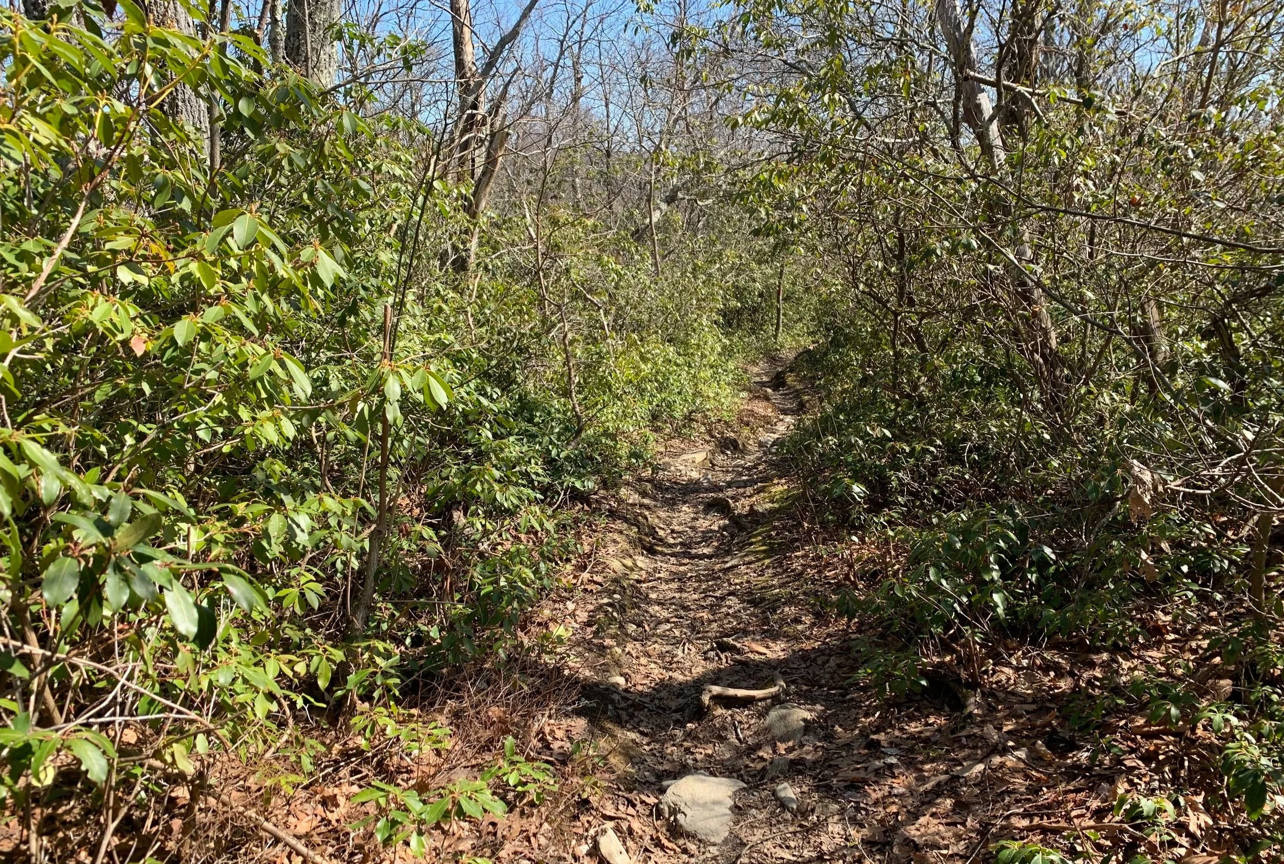
Hiking through a corridor of laurel
Thankfully we had a GPS to get us to the trailhead, while it wouldn’t be terribly difficult without, as there are minimal turns, there is no cell phone service in the area and the trailhead is located at the end of a rather rough road, East Street, just prior to a winter gate which lay just beyond the Massachussett’s state line.
Passing many beautiful residential homes along the way, the road was recently treated to a fresh layer of gravel which caused me to cringe each time we drove over patches of the sharply pointed daggers. Luckily, we made it to the small parking lot trailhead along with several other cars, all arriving without incident, for a late morning start; we found a spot to park in the main trailhead but across the dirt road is space for several additional cars with another overflow lot to be found further down the road.

Beginning the Round Mountain ascent
There is no mistaking the trailhead with its huge Mount Frissell Trailhead hanging from a grass-green colored post at the roadside; leading to the actual hiking trail is another sign displaying mileages to several popular destinations along the Mt Frissell Trail.
Upon leaving the parking lot area, the trail (in springtime) travels briefly through a boggy area - water ran down the narrow path for the first ~500’ until making a southwesterly swing (left) onto a newer stretch of trail which had much drier footing over packed dirt and rock.
Mount Frissell from Round Mountain
Skirting northerly past a small patch of mature hemlock, the trail guides hikers through a narrow corridor of mountain laurel bushes, over more solid, rocky footing - providing a taste of the short but steep climbing just ahead.
Reaching 0.5-miles, the trail abruptly begins ascending the low dome of Round Mountain over more rocky slabs; nearing the open summit a short spur trail is reached guiding hikers to a beautiful lookout atop open rocks with views toward neighboring Bear and Gridley Mountains - among many more low summits in its grand easterly panorama.

Easterly views from Round Mountain
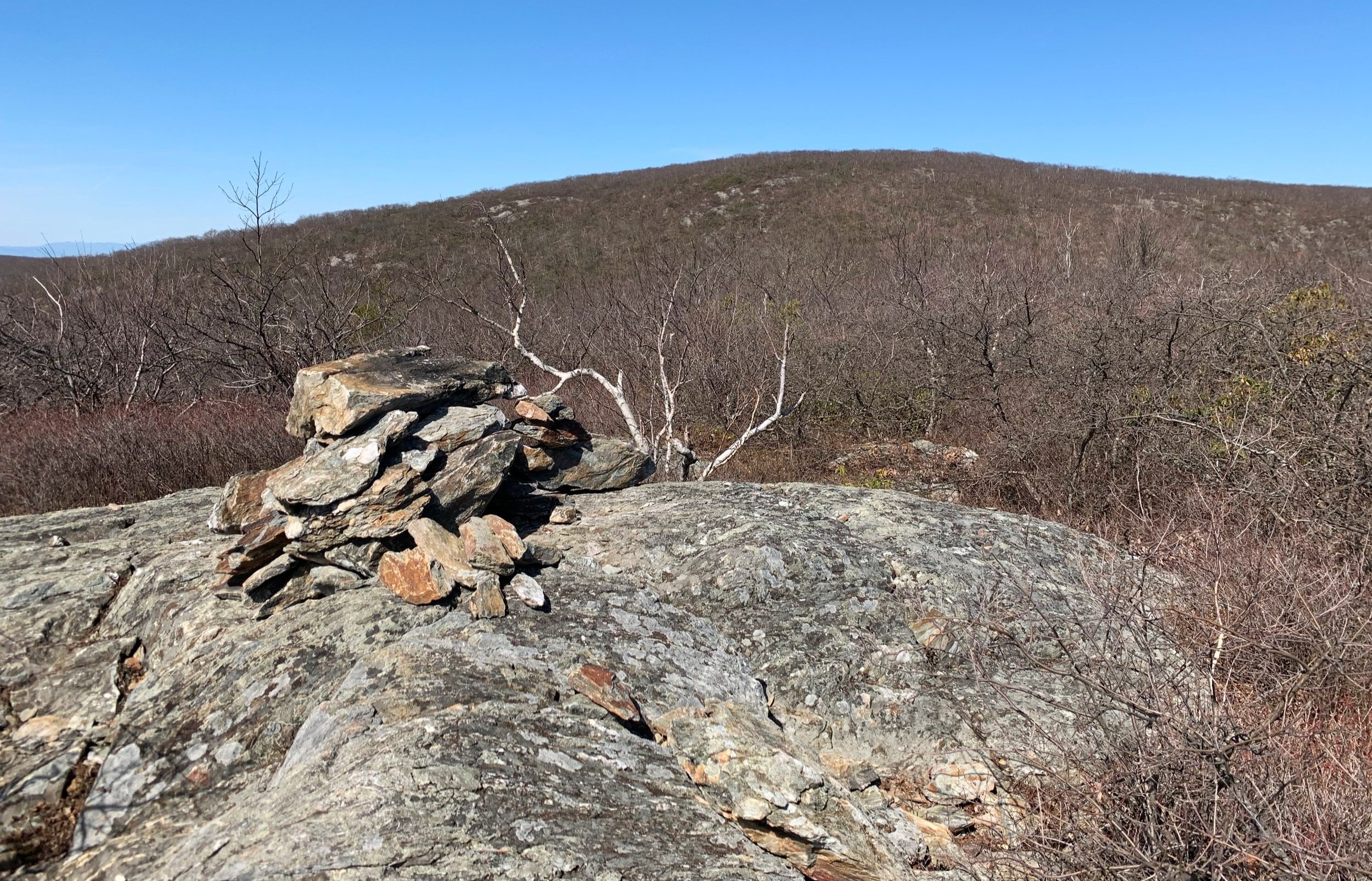
While many herd paths lead to various rocky outcroppings along the low domed summit of 2,292’ Round Mountain, the high point is marked with a large rock cairn, which affords stunning views in nearly all directions - the most interesting in particular to us was the westerly view toward our next destination, which appeared much further than the 0.5-mile trek that maps indicate.
Beginning the northerly descent down from Round Mountain we began to hear a cacophony of chirps from springtime peepers occupying the mountainside pond at ~2,120’, just to the north of the trail as it winds through the col.

Riga Lake + South Pond while enroute to the South Slope
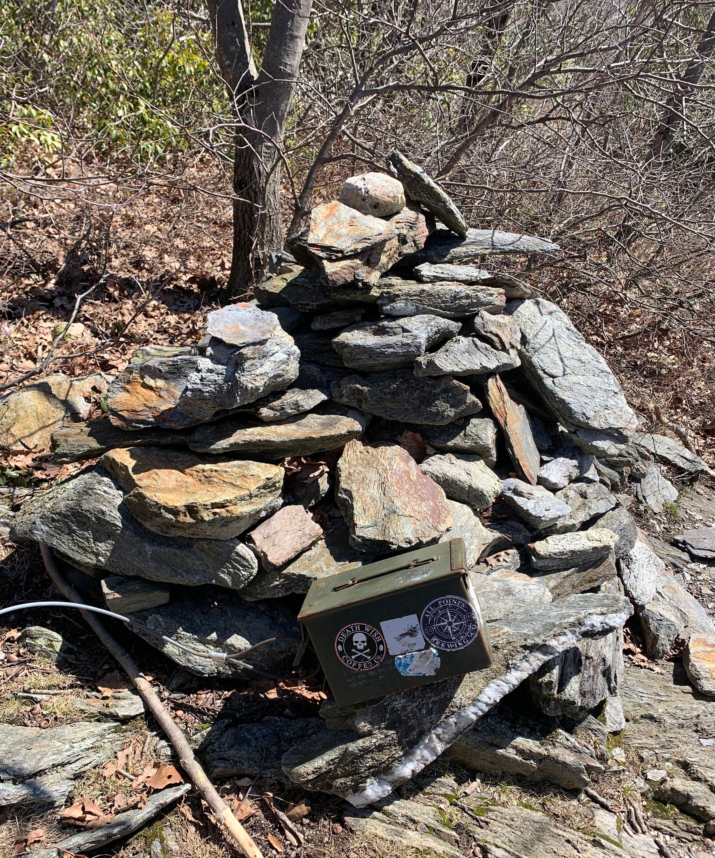
Atop mostly bare rock slabs, the trail climbs quickly and steeply to gain the summit of Mount Frissell, here we found another large rock cairn and an old metal ammunition box; acting somewhat as a geocache, it contained a summit register notebook, stickers and other small items left by previous hikers.
After logging our ascent into the nearly full summit register book and finding a small log shelter more north of the summit area, we continued for the brief 0.1-mile trek toward our penultimate destination – the south slope of the mountain and high point of Connecticut state.
High point of Connecticut state
The Mount Frissell Trail now treks in a southerly direction while hosting stunning easterly views into the valley and of low rolling mountains far into the distance. Before long we came upon our final rock cairn of the day, the state high point of Connecticut with another old metal ammo box turned summit register box, this time we could not get the canister open but just enjoyed the vast views before retracing our steps.
Greeting many early afternoon hikers along our descent back toward Round Mountain, we remarked and were thankful to have such a pleasant, remote hike amidst a multi-state commute. While we may not have spotted the red oak growths that the Mount Washington State Forest has become known for, the laurel groves took me right back to trekking along the southern Appalachian Trail; what a simply stunning landscape to find oneself.
Overall stats for the day:
2.47-miles
1hr 56 minutes
1,204’ elevation gain
Round Mountain - 2,292’
Mt Frissell - 2,452’
Mt Frissell, south slope (CT high point) - 2,382’

State border marker - CT/MA