
Eagle Cliff
While trekking through Eagle Pass several years ago enroute to a wintery ascent of Mount Lafayette (5,240’), I nearly lost my footing and tripped over my own snowshoes after becoming mesmerized - staring up at the bare rock slabs which comprise the western face of Eagle Cliff and continues along much of the north-south ridge.
As today’s cold, windy forecast is a temporary reprieve from the springtime warming thaw; for days, temperatures above freezing have been reeking havoc on our once supportive snowpack, turning it into re-frozen slush, now containing more air pockets than snowy material.

Eagle Cliff (toward the right) from Cannon Tramway lot
Eagle Cliff is the high point of the spur-ridge which originates from the northwestern shoulder of Mt Lafayette, separated by a “tangled ravine”. As noted in Osgood’s White Mountains of 1876, this ledgy destination was named in the early 1840’s after an eagles nest was found “high up on these beetling crags; but the eagles have long since departed.”
With the remaining snow and ice mostly melted from the precipitous western face of Eagle Cliff, there was no way I was putting my faith into any of those rocks; with this being prime time for some freeze-thaw rock-fracturing action, of which I observed a remarkable amount of fallen rock atop the snowpack while snowshoeing through Eagle Pass just this morning - evidence of some pretty unstable rock as temperatures rise and fall; I’d be taking the safer route, around the backside of the mountain.

Greenleaf Trail with sunrise on Cannon Mountain
As the hiker lot for the Kinsman Ridge Trail remains unplowed, I became the first car of the morning to take a parking spot at the Cannon Tramway; I confirmed with a friendly Cannon employee that this was acceptable, after we talked trails and snow conditions for nearly ten minutes.
I would be ascending by way of the Greenleaf Trail, which was formerly the Profile House Path until the famous White Mountain hotel burned in 1923. At 6:53am I crossed under I-93 and began into the woods; immediately, even with snowshoes on my feet, the well-traveled path was full of refrozen springtime snow, incredibly unsupportive in most places.
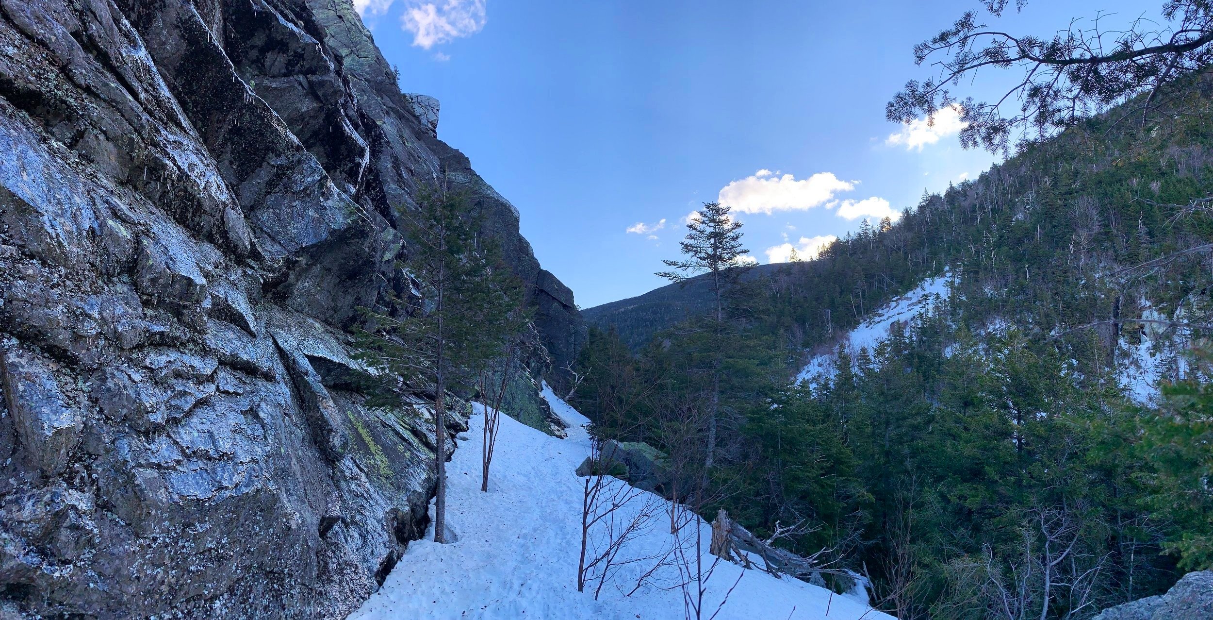
Eagle Pass at ~2,980’
A majority of the rocks along the pathway remained blanketed under the snowpack but several shone through; despite waterways sounding like swollen rivers, they remained bridged for now, however, I made sure to step extra-wide over their hollow cavities, from which melt water rushed.
Gaining minimal elevation, the Greenleaf Trail tracks in a northeasterly direction through open, boulder-strewn hardwoods, paralleling the interstate below for the first 0.5-miles. After beginning the first set of switchbacks which leads into more of a coniferous corridor, the sound of traffic begins to fade and one is plunged back into the forest element; today, I could hear screeches and wails high atop the rocky crags along the Eagle Cliff face, perhaps a young predatory bird calling for its breakfast.

The snowpack continued to grow more solid as elevation was gained, by the time I had entered Eagle Pass at ~2,980’ I had ascended about 1,030’ over the 1.2-mile trailed section.
I had read reports of previous hikers trekking for a distance, then hooking counterclockwise (northwesterly) to contour the northeastern face of the mountain before beginning to climb toward the summit; this did not interest me, as soon as I departed the blue-blazed trail I began climbing. The forest was incredibly welcoming; sure, there were the occasional dense patch of thin spruce branches, nothing completely overwhelming, however.

Ascending Eagle Cliff
Knowing that I did not want to hit the sheer southern ledges, I constantly veered to my right through the woods, ascending around boulders and bare rock - always spotting an area of affable woods ahead. While I could see thin branches had been snapped here and there, I found nothing initially which appeared to be an obvious herd path, despite reports of these woods being riddled with such paths, I found a very pleasant bushwhack.
Eventually, as trees grew shorter, the views over my shoulder began to open up, putting the Lafayette Brook ravine on full display as the sun rose above the summit rocks. Before long my sidehill meandering opened up to what appeared to be a full-on 5’ wide corridor through the fir canopy.

Lafayette Brook ravine
Following this path, I had to crouch and crawl under and through the scrubby conifer growth as the snowpack remained at the several foot depth at these elevations. I had heard reports of an abandoned trail along the top of the Eagle Cliff ridge but have yet to find any mention of such in any of the AMC White Mountain Guidebooks; perhaps this is just an unofficially cut section of pathway - either way, its easy travel was appreciated instead of pushing through the stiff, scrappy krummholz in which to gain the summit.
As I ascended from the east and eventually began more of a northwesterly trajectory, I came upon a beautifully open ledge area with a fine view of Cannon Mountain - thankfully more cliff-face than skiway - just how I like my mountains.

Cannon Mtn from Eagle Cliff
Proceeding ~20-30’ further northwest along the summit ridge I did find the recognized high point of the mountain; unfortunately the canister had no handle to remove the bottom screw plug allowing access the summit registry notebook inside; after several moments of fiddling with the container I left it as is and carried on, back to soak in the early morning sun from atop my ledgy, southwesterly-facing perch.
Reports were calling for ~50mph winds atop the neighboring Mt Lafayette; while I had nowhere near that range at 3,420’, the constant breeze was enough to help me continue along after several meditative minutes.

Eagle Cliff summit
Following my snowshoe tracks back into the woods, I veered off several times to visit a few bright, sun-lit patches toward the southern terminus of the cliffs, hoping for more interesting views and to simply see what the snowy hillside had to offer.
Back at my car I was happy to be off the hardpacked snow layer; certainly, I’ll be missing my softer, more forgiving, joint-friendly snow from mid-winter, which was like cruising atop a backcountry marshmallow. With the scent of thawing soil and seemingly more wildlife springing back to life every day, I’m just about ready for some solid earth underfoot. Now, if we can just fast-forward past mud and black fly season.
Overall stats for the day:
3.61-miles
2hr 24 minutes
2,005’ elevation gain