
High Point, New Jersey
What week-long excursion to a new (to me) state is not complete without a ramble up to its high point? While 1,803’ is far from the tallest state high point we have been to, the 360° views and highly enjoyable hiking trails it has to offer rank it amongst the finest.
While there are multiple routes and directions to approach the highest peak of the Kittatinny Mountains, we chose to approach via the eastern New Jersey section of Appalachian Trail.

Along the blue-blazed spur path enroute to the AT south
Finding parking accommodations for several vehicles along the western roadside of Greenville Road (Rt 519), we were quick to get on trail as the gnats were beginning to swarm with the rising morning heat.
Generally, along the Appalachian Trail, spur/connecting paths are now blazed blue; we followed a short blue-blazed side trail from the parking lot for about 200’ until it merged with the white-blazed Appalachian Trail.

Peaceful springtime Appalachian Trail
Once on the AT south, we followed the typical sight of a moderately worn pathway; a trench just wide enough for two boots to trek - evidence of foot-traffic over many years as thru-hikers meander north or south toward their ultimate destination; over these rocks, making small curves around trees and gradually forming a weathered walkway around any obstacles which would impede travel.
At ~0.2-miles into the hike, we began ascending by way of gradual switchbacks, making turns to lessen the grade as we made the 200’ climb onto a shelf of land - this, no doubt, would be much more difficult to navigate with full backpacks weighing us down.

Rock piles along the AT
We remained at ~1,350’ for the next mile of hiking as the landscape displayed the “step” in the mountainside: the valley lowlands and farm country fell away to our east as the shelf-like sedimentary bedrock of mountainside poked from the grassy understory on our west; the low, northerly tapered ridge emanating from today’s destination.
Passing several old, mostly grown in forest and farm roads, evidence of past farming was all around; massive rock piles dotted the early-spring open forest understory, I thought initially these were old foundations but upon finding the mountainside dotted with dozens of ~4’-tall cairn-like rock piles, assumed them to be remnants of animal grazing fields, as the land remained far too rocky for efficient agricultural farming.

High Point Shelter
At 1.2-miles we reached a spur trail which would guide thru-hikers and campers to the High Point shelter. This was a beautifully constructed and historic stone structure which, evidenced in the AT hiker log books, had undergone restoration several years ago with new wooden beams and shiny tin roof.
Nearby, several small mossy clearings for tent campers can be found on either side of the small brook which flows through the compound; near the main AT intersection a large privy can be found, for sure one of the finer resting areas we have found along the Appalachian Trail.

Getting rocky ~1,600’
Back on the white-blazed trail, the path continues for 0.2-miles before turning to a more northwesterly direction to ascend another round of 200’, albeit over a more rocky footing this time; bringing us to a col from whence we would temporarily depart the AT and begin along the Monument Trail to climb the remaining elevation.
The path underfoot was very reminiscent of the rocky Pennsylvania trails as we trekked beyond 1,600’. In a short distance we passed over Park Road, the paved motor vehicle road for those who would like to drive nearly to the summit of High Point and to the base of the 1929-built mountaintop monument.
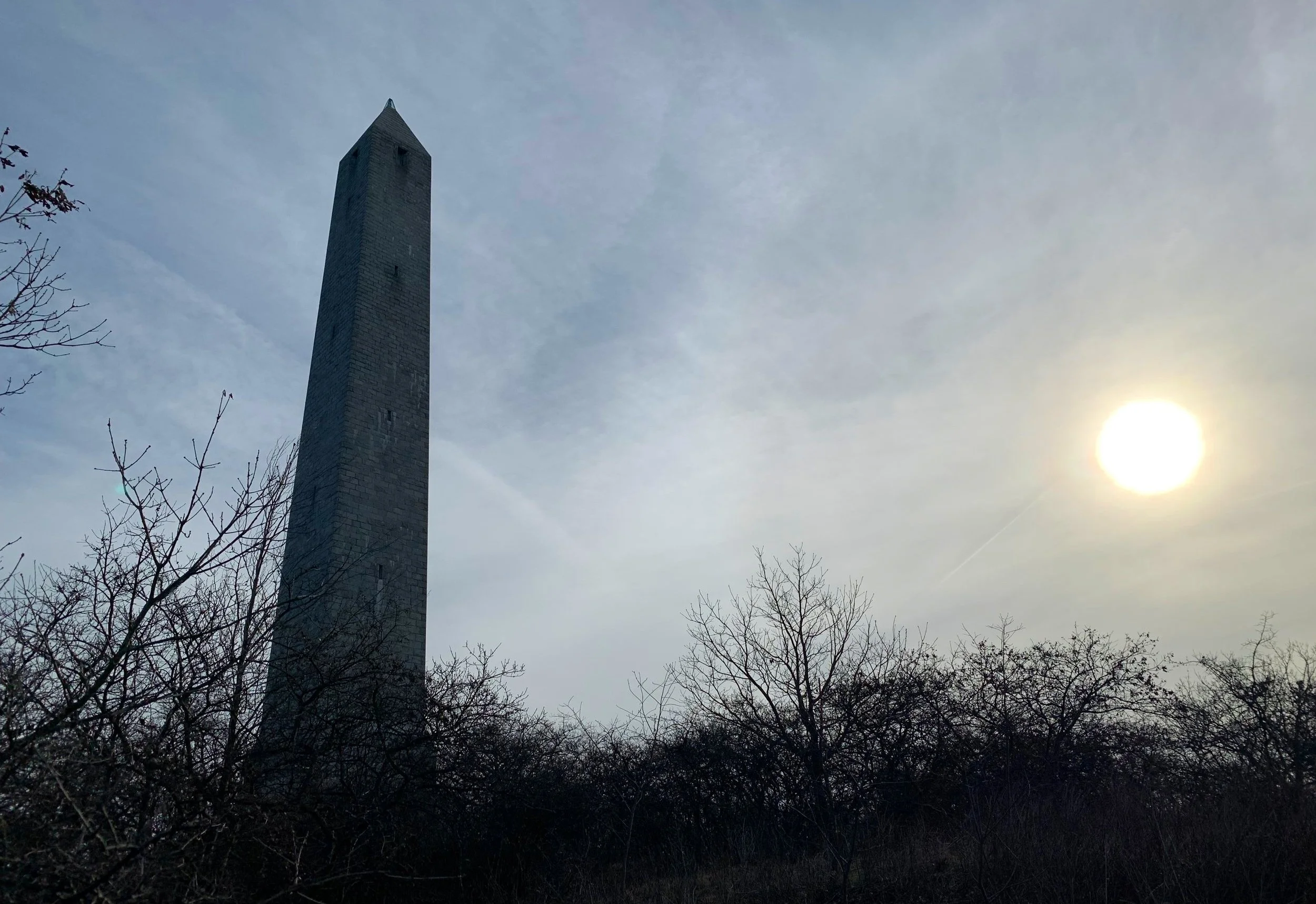
Approaching the High Point summit
Over paths which appeared to be old access roads and with the multifaceted monument in sight all the while, we began the final climb to the highest location in New Jersey, stopping to snap several photos of the monument, finding it now beautifully framed by nearby wind-bent scrub.
From the base of the 220’ memorial tower we had incredible views in every direction; placed on the four cardinal directions at the base are placards indicating which landmarks and natural features could be found in the nearby distance. From 1,803’, the adequate breeze of open mountaintop brushed away any hovering insects while cooling us sweaty hikers off amidst the low, morning sun.

Southerly views along the Kittatinny Mountain ridgeline
US Coast & Geodetic Survey marker discs were spotted to the north and south of the tower structure, both embedded in exposed bedrock. From the summit we retraced our steps back to the col to meet up with the Appalachian Trail south.
Over a short, rocky ascent through scrappy red pines, we found the wooden AT Observation Platform, which was denoted on our maps. Here, similar views were found, while southerly views could not be had over the surrounding forest treetops, we found a fine look back to the low dome of the High Point summit with the spiked monument atop.
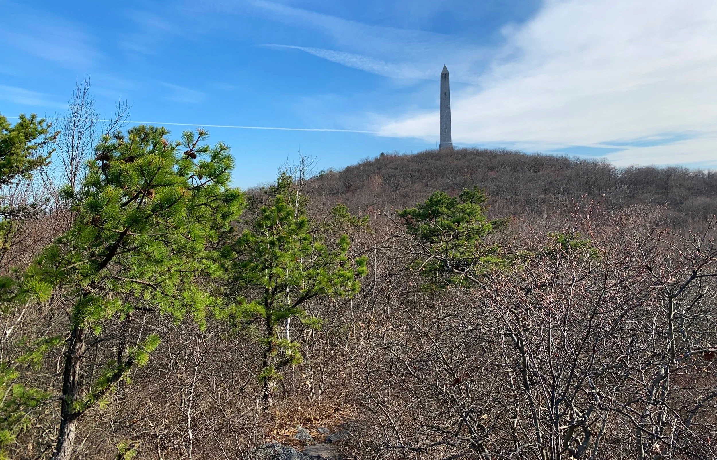
High Point from the AT Observation Platform
While a visit to nearby Lake Marcia or Steeny Kill Lake would be a nice, historical addition to the outing, we opted to simply retrace our steps back down the Appalachian Trail, northerly this time and back to our car.
Although this hike was early morning on a weekday, we were surprised to never pass any other hikers; while it is still early for 2023 thru-hikers to be passing through New Jersey in either direction, we have talked with section hikers along other NJ stretches of AT, several folks had driven to the summit to enjoy the views and monument on this day.
Overall stats for the day:
4.72-miles
2hr 27 minutes
1,332’ elevation gain

Mountaintop survey marker