
North Loon + Black Mountains
Only several hours ago, Loon Mountain Ski Resort had closed for the season and I was now on the prowl to find decent - or at least tolerable - snowshoeing amongst their 33-open ski trails on the 3,065’ mountain.
Several years ago, when I had bushwhacked along the ridgeline out to Scar Ridge the northern summit of Loon Mountain was not even on my radar; times have changed and now it was on my mind. I thought I’d attempt a loop: ascend via ski trails and enter the forest near the top of the North Peak Express Quad to the summit of North Loon Mountain, then follow the ridge counterclockwise, in a northerly direction to the 2,937’ summit of Black Mountain. A bushwhack descent to the west would be figured out on the spot to find my way back to the parking lot from whence I began.

Ascending past Camp III Lodge
Thanks to earlier sunrises each morning, I departed the Ski Resort parking area at 6:22am, hoping to avoid confrontation from any residual park staff - thankfully I never ran into anyone during the entire outing. Utilizing my route from several years prior, I traipsed through the ghost town ski resort to catch the Brookway Trail which follows alongside Boyle Brook while enroute to the Camp III Lodge.
Gaining only 550’ in the first mile, initially the pathway was easy going atop refrozen springtime snow with minimal ice. Nearing the Lodge I was met with a solid flume of ice necessitating the burly crampons and traction of Tubbs snowshoes, which remained on my feet until much later in the morning.

Ascending the Upper Flume Trail
Departing the Lodge area, this time I decided to shoot straight for the North Peak, following beneath the quad ski lift along the western edge of the degrading trail. In the final 0.9-mile ascent from the Lodge, the trail steepened greatly, now climbing 1,565’ before topping out on the Northeast Peak.
While kicking steps into the part-slush, part-ice along my route, I entered the low cloud ceiling at ~2,600’, any hint of wind gust blew the airborne water droplets horizontally, adhering to anything in their path. Knowing one particular weather forecast called for light rain at 9am and another predicted no precipitation until later in the afternoon, I decided to press on, up the icy slope.

Toward Loon Pond from NE Loon Mtn
Wasting no time, I was relieved to relax my calves on the flatter path and meandered briefly down the Sunset Trail. Along the western/northwestern side of the mountain, views toward other bumps of the mountain range began to appear with a cool grey cotton ball cloud lingering along the lower sections of the ski resort.
Finding an appealing spot to depart ski trail and enter the sweet-scented conifer forest, into which I could snowshoe toward the North Peak; almost immediately I found evidence of prior tracks through a very clear herd path/bootleg ski trail which led in the direction of the mountains high point.

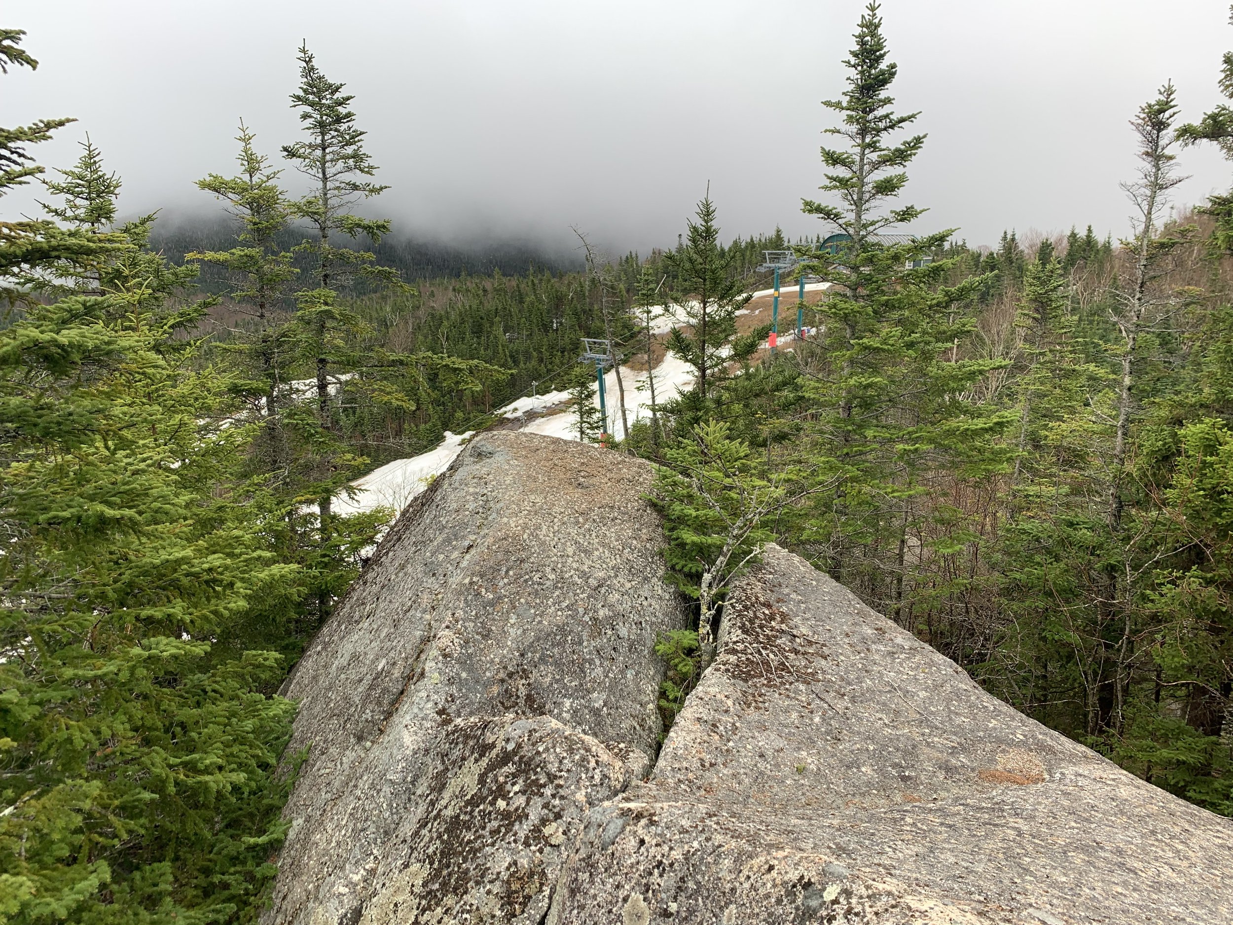
Boulders on North Loon Mountain
The simply cut path seemed to fade out altogether upon reaching a massive boulder; skirting around the eastern side of the house-sized rock I regained a northerly trajectory on the far side, heading straight for the summit area.
Upon reaching the 3,065’ summit of North Loon Mountain, I found a relaxing and open slabby-rock area; atop which I could gaze back toward the northeast peak and unloading area of the quad ski lift, below which I had just ascended. After several minutes atop the summit boulder and a brief exploration around the high forest I retraced my steps back to the groomed Sunset Trail.
Views from atop North Loon Mountain
By now, the low cloud ceiling had actually lifted slightly, exposing the forested slopes of the neighboring Whaleback and Big Coolidge mountains along with Potash Knob; all rising up from the northern side of the Kancamagus Highway far below.
Shortly beyond the quad lift, several signs can be found warning skiers of hazards and repercussions for knowingly departing the ski resort trails; here, over a small embankment I entered the forest and began toward a familiar cut/herd path which would typically guide hikers to Scar Ridge. Unbeknownst to me at the time was how much traffic the northerly ridge toward Black Mountain actually sees - and the utter devastation which had taken place along that beautiful ridgeline.

Remaining snowpack along the herd path
All the while, traipsing through a narrow path in the forest I stayed mostly atop a hardpacked track from several previous snowshoers and skiers; I could recall and envision the same patches of trail without a snowy blanket from the autumnal hike several years ago. Occasionally, moose tracks bisected my narrow herd path but appeared much older in the now melting snow.
Passing a single spot of blazing and orange spray paint on a lone tree, I thought perhaps that may have been the area where Scar Ridge hikers would diverge; I continued on the northern slope of the ridgeline and began gently descending over soft, collapsing snow. Before long I trekked atop roots and fallen debris, between which an exposed bed of soft, decomposing conifer needles and birch leaves could be found.

Burned moss + rock along the ridge
While descending still further north, I grew increasingly appalled with each step - initially I came upon a living birch tree which had been burned and scarred; then, dozens of small campfires littered the forested area, rocks had been scorched black, fires lit atop beds of conifer boughs, large and small trees alike had all been broken, bent and burnt. Truly a horrific sight in the White Mountains which I did not expect to discover today.
The sight of such wasteful destruction left me in shock as I passed through; sure, the prior campers had cut a nice view out toward Scar Ridge, but how they had not recklessly burned the entire mountainside with their blazes remains a mystery to me. A very sad and gross use of this beautiful forest land which I have grown to love.
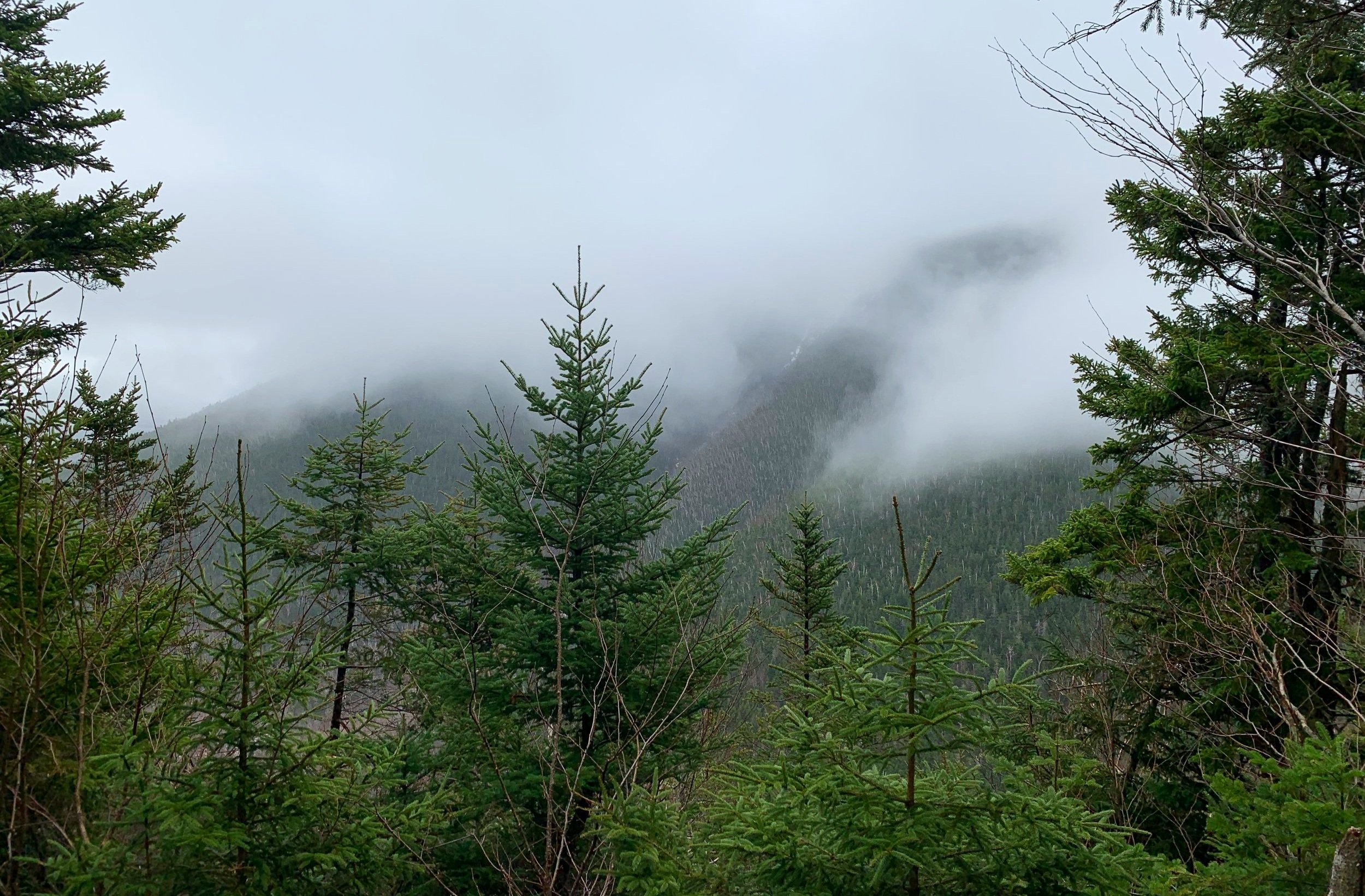
Cloud-cover along Scar Ridge
It appeared that nearly all traffic along the ridgetop terminated at the over-used campfire area. Beginning up the base of Black Mountain was back to more pleasant bushwhacking; no evidence of prior traffic nor herd path, no litter to be found - but what I did find, and had been observing in areas where the snowpack had melted away, was a residual layer which appeared almost like a massive cob web atop the forest floor. Evidently this is known as “snow mold”, I had never encountered such a phenomenon before, especially not in the backcountry between 2,600-3,000’.
Over fallen trees, most of which were well rotten, and between others which appeared to want to topple, I climbed the steep southern slope of the Black Mountain summit cone as wind howled all around. Luckily, the temperature was somewhere around 55° and I found comfort in hiking in just a base layer, saving waterproof layers for “just incase”.

Black Mountain summit
The summit area of Black Mountain is rather pronounced, with a bald patch of blowdown directly on the top; the high point and summit register were located (actually spotted from a distance while climbing over fallen trees), noticing someone had signed in back in January 2023, I registered my ascent, signed the notebook and returned everything to how I had found it.
Originally I had toyed with the idea of backtracking to Loon Mountain and descending via ski trails if the backcountry snowpack was very favorable, otherwise I could shimmy off toward the west to meet back up with my ascending tracks.

Black Mountain summit
I opted to follow my ascending tracks briefly south, off the summit cone, as this was easier and through a slightly more open forest of spruce and fir. Before long, however, I could spot a decent-appearing forest and meandered off my track now in a southwesterly direction. Here, I encountered some spindly, poking spruce, but even the thicker evergreen boughs did not bother me much - finding any grade of forest easy to push through and navigate today.
Reaching ~2,500’ along the mountainside I switched to a more due west track as I could now hear rushing water; once it came into view I could clearly recognize the sound of flooded river was merely a 2-3’ wide brook, knowing I could likely hop over it at any time, I followed the westerly ridge as it guided me into a tremendously pleasant, open beech forest.

Descending through hardwood back to Loon Ski Resort
Assuming this ridge was proper backcountry skiing during the past several months, I could spot numerous small diameter trees which had been hacked down for better skiing. Eventually, the ridgeline I had been trekking atop sandwiched me between two forks of Boyle Brook, beyond which I could see a wooden bridge spanning the main section of waterway.
Upon crossing the bridge, I found the Whaleback XC path which would take me on a brief tour of mountain bike paths and finally back to the familiar Brookway Trail, which I had used to ascend Loon Mountain earlier in the morning.

Springtime Boyle Brook
The 0.6-mile trek back to the ski resort went by uneventfully, several park employees said good morning with rather inquisitive looks upon their faces. Skiers readied their gear in the parking lot as I made the final trek out; several asked about conditions and whether there was “gnar to shred” - I assured them, they could indeed find some pow to rip.
Overall stats for the day:
5.76-miles
3hr 27 minutes
2,776’ elevation gain
Loon Mountain North Peak - 3,065’
Black Mountain - 2,937’